Showing 3053 items
matching highway
-
 Ringwood and District Historical Society
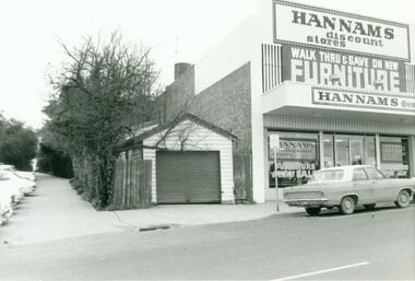
Photograph, Garage at rear of chemist shop, 173 Maroondah Highway, Ringwood. 1973
Written on back of photograph, "Garage at rear of chemist shop, 173 Maroondah Highway. 11/7/73". -
 Ringwood and District Historical Society
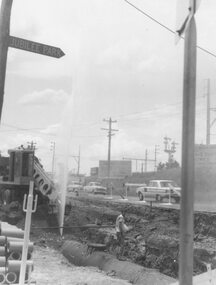
Photograph, Maroondah Highway East, Ringwood- 1964. Water main repair work on the north-east corner of Maroondah Hwy and Warrandyte Road
Black and white photographWritten on back of photograph: "Corner Maroondah Highway and Warrandyte Rd. Water main repair work,1964". -
 Ringwood and District Historical Society
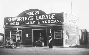
Photograph, Kenworthy's Garage, Maroondah Highway near Wantirna Road, Ringwood - c.1925
Black and white photograph (2 copies)Typed below photograph, "Kenworthy's Garage, Maroondah Highway, South side near Wantirna Rd - 1924.." -
 Ringwood and District Historical Society
Photograph, Maroondah Highway West, Ringwood- 1969. Looking east from Heatherdale Road
Black and white photographWritten on back of photograph: "May 1969. Eastern view from corner of Maroondah Highway and Heatherdale Road." -
 Ringwood and District Historical Society
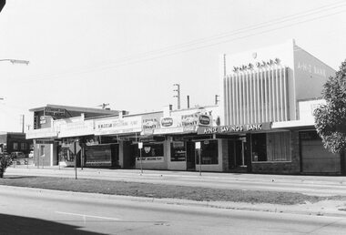
Photograph, Maroondah Highway Central, Ringwood. Shops opposite old Town Hall site and Midway Arcade, 1969
Black and white photographShops include CBC Bank on corner of Railway Station entrance, and A.N.Z Bank at 116 Maroondah Highway. -
 Ringwood and District Historical Society
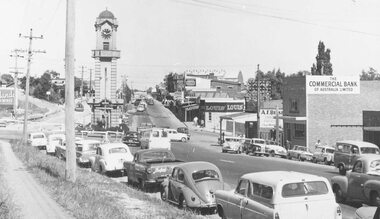
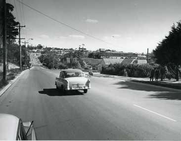
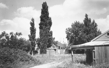
Photograph, Maroondah Highway Central, Ringwood. Looking west from Warrandyte Road, 1960
Black and white photograph (2 copies)Written on back of photograph: "Maroondah Highway looking west near Pratt Street. Warrandyte Road on right. -
 Stawell Historical Society Inc
Photograph, Wehl Family home "Carlsruhe" on the Western Highway
Front of Private Home "Carlsruhe" Western Highway (Wehl) Family Demolished 1993stawell -
 Stawell Historical Society Inc
Photograph, Wehl Family home "Carlsruhe" on the Western Highway
Rear of Private Home "Carlsruhe" Western Highway (Wehl) Family Demolished 1993stawell -
 Linton and District Historical Society Inc
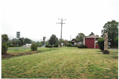
Photograph, View to south-east, Glenelg Highway, Linton, 2014
Colour photograph which shows the memorial to firefighters who died near Linton in 1998, the rotunda near the Linton takeaway shop, and a house further along on the east side of the Glenelg Highway.linton rotunda, memorials, monuments, firefighters -
 Lakes Entrance Historical Society
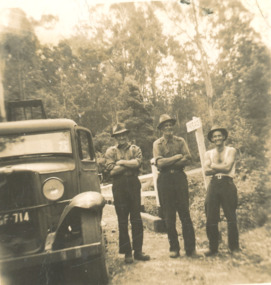
Photograph - Vic Fish, CRB road crew, possibly Bonang Highway, 1945 1950 c
Black and white photograph of Vic Fish and two mates working for CRB possibly Bonang Highway between Bonang and Orbost Victoria. Also a very damaged photograph of Vic Fish and a mate road construction and maintenance, engineering -
 Stawell Historical Society Inc
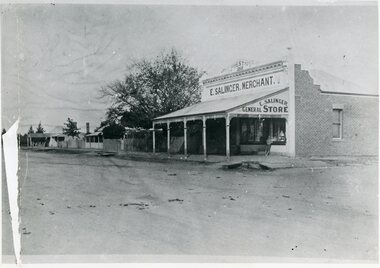
Photograph, E. Salinger -- Merchant's General Store in Great Western on Western Highway 1868
E. Salinger. Merchant. General Store. Great Western (shop) 1868 on Western Highwaystawell -
 Ringwood and District Historical Society
Photograph, Warrandyte Rd. looking towards Maroondah Highway, Ringwood - 1967
Typed below photograph, "Warrandyte Rd. looking towards Maroondah Highway - 1967". Written on backing sheet, "Warrandyte Rd. 1967. alongside Woodside Ave. looking towards Maroondah Highway. (Taken from same spot as 1902 photo with 2 children on road)". -
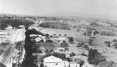
![Photograph, Setting columns for first floor [Target Square], Maroondah Highway 1981](/media/collectors/4f729f6497f83e03086016dd/items/5c1835786b785e0ebc9c75e5/item-media/5c1835786b785e0ebc9c75e6/item-fit-380x285.jpg) Ringwood and District Historical Society
Ringwood and District Historical SocietyPhotograph, Setting columns for first floor [Target Square], Maroondah Highway 1981
Written on back of photograph, "6/6/81. Setting columns for first floor [Target Square], Maroondah Highway." -
 Ringwood and District Historical Society
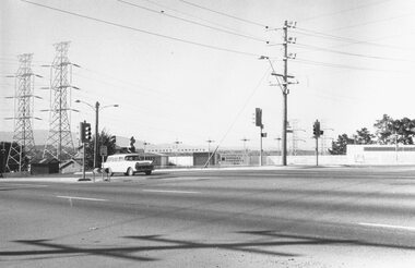
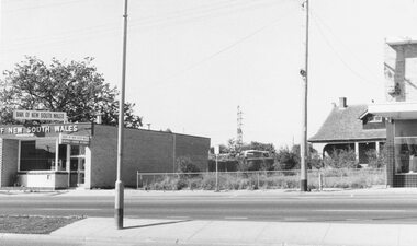
Photograph, Maroondah Highway West, Ringwood- 1969. Looking east from near Wantirna Road
Black and white photographWritten on back of photograph: "May 1969". Image shows 'Bank of New South Wales' on south side of highway. -
 Ringwood and District Historical Society
Photograph, Heatherdale Road railway crossing looking south from Maroondah Highway c.1949
2 black and white photographs - similar sizesTyped below photograph, "Heatherdale Road railway crossing. Looking south from Maroondah Highway c.1949. -
 Mt Dandenong & District Historical Society Inc.
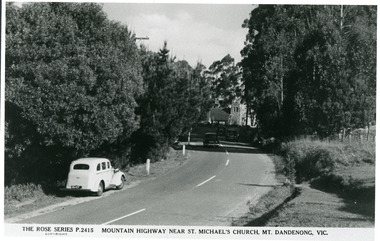
Photograph, Mountain Highway Near St. Michael's Church, Mt. Dandenong, Vic, c1950
Rose Series Postcard number 2415Copy of Rose Series post card taken c1950. St. Michael's Foundation Stone laid in 1940. Name 'Mountain Highway" is incorrect as the Mountain Highway was the Sassafras - Basin Road though it may not have received that name by 1950. The correct name is the Mount Dandenong Tourist Road at Mt. Dandenong / Kalorama as Falls Road is the boundary. Note: Heavy roadside vegetation, no white lines at side of road. White car probably pre war Vauxhall.kalorama, mount dandenong, rose series, st. michael's church, mt. dandenong tourist road -
 Greensborough Historical Society
Photograph - Digital Image, Chapel corner Yallambie Road and Greensborough Highway 1950s, 1950s
Black and white photograph of an old chapel that stood on the corner of Yallambie Road and Greensborough Highway in the 1950sThis chapel has been demolished.Digital copy of black and white photographyallambie road watsonia, greensborough road watsonia -
 Stawell Historical Society Inc
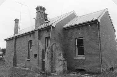
Photograph, Small Brick Cottage at the rear of the Wehl Family home "Carlsruhe" on the Western Highway
Small cottage at rear of Private Home "Carlsruhe" Western Highway (Wehl) Family Demolished 1993stawell -
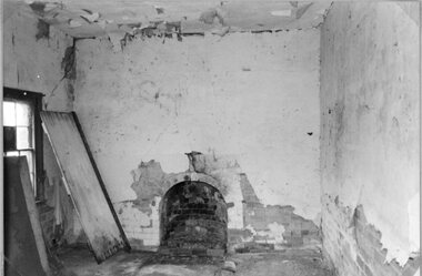
 Stawell Historical Society Inc
Photograph, Small Brick Cottage at the rear of the Wehl Family home "Carlsruhe" on the Western Highway
Small cottage at rear of Private Home "Carlsruhe" Western Highway (Wehl) Family Demolished 1993stawell -
 Stawell Historical Society Inc
Photograph, Small Brick Cottage at the rear of the Wehl Family home "Carlsruhe" on the Western Highway
Small cottage at rear of Private Home "Carlsruhe" Western Highway (Wehl) Family Demolished 1993stawell -
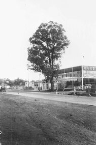 Ringwood and District Historical Society
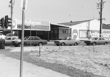
Photograph, Maroondah Highway West, Ringwood- The last remaining naturally grown gum tree on the Maroondah Highway between Ringwood and the city, cut down 1959. before it was cut down from out the front of Bill Patterson Motors in 1959 - a yellow box tree 60 feet high and 75 years old
Black and white photograph (2 copies)Typed below one photograph: "The last remaining naturally grown gum tree on the Maroondah Highway between Ringwood and the city before it was cut down from out the front of Bill Patterson Motors in 1959. Was a yellow box tree 60 feet high and 75 years old." -
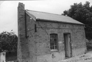
 Stawell Historical Society Inc
Photograph, Wehl Family home "Carlsruhe" on the Western Highway
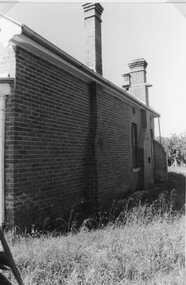
Private Home "Carlsruhe" Western Highway (Wehl) Family Demolished 1993. Exterior side of Brick Section.stawell -
 Stawell Historical Society Inc
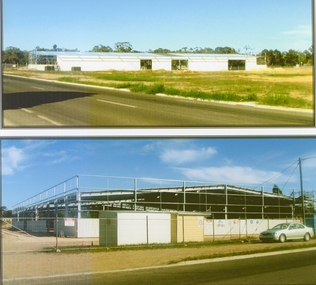
Photograph, Mitre 10 Building Under Construction at Playford Street Western Highway 2006 -- 2 Photos -- Coloured
Two Colour photos of Mitre 10 Building Under Construction at Playford Street Western Highway 2006stawell -
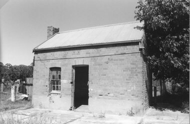
 Stawell Historical Society Inc
Photograph, Wehl Family home "Carlsruhe" on the Western Highway
Private Home "Carlsruhe" Western Highway (Wehl) Family Demolished 1993. Exterior side of Brick Section.stawell -
 Buninyong & District Historical Society
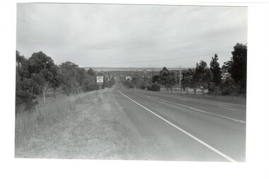
Photograph - B/W photograph, Mr. Clive J. Brooks, Eastern approach to Buninyong Midland Highway 1994, April 1994
Approach to township of Buninyong prior to amalgamation with Ballarat City Council. Buninyong shire town sign visible in foreground.Record of Buninyong Shire prior to amalgamationBlack and white photograph of the Eastern approach to Buninyong from the Midland Highway taken from opposite Ballantrae looking West. In left foreground is an example of Buninyong shire town sign before amalgamation 1994.buninyong shire, midland highway, street scene -
 Ringwood and District Historical Society
Photograph, Maroondah Highway Central, Ringwood. Rear of shops in Maroondah Hwy east of Adelaide Street- 1963
Black and white photograph (3 copies- 2 large, 1 small)Typed below large photograph: "Rear of shops in Maroondah Highway. Taken from Adelaide St. near Warrandyte Rd. 1963". Written on back of another copy: "Rear of shops in Maroondah Highway east of Adelaide Street. Shed on right is in Adelaide St opposite 'Mail' office." -
 Ringwood and District Historical Society
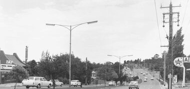
Photograph, Maroondah Highway East, Ringwood- 1971. Looking east towards Mt Dandenong Road
Black and white photographWritten on back of photograph: "Maroondah Highway, looking east towards Mt Dandenong Road turnoff past lake. 1971." -
 Ringwood and District Historical Society
Photograph, New market - Where Ringwood Timber used to be. The corner of New Street and the Highway. 1982
Written on back of photograph, "E655. 18/1/82. Where Ringwood Timber used to be. The corner of New Street and the Highway." -
 Ringwood and District Historical Society
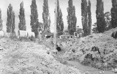
Photograph, Maroondah Highway East, Ringwood- 1963. Excavations for Ringwood Lake overflow
Black and white photograph (2 copies- 1 large, 1 smaller)Typed on rear of backing sheet of large photograph: "Ringwood lake overflow pipe. (Passing under Maroondah Highway). 1963. -
 Ringwood and District Historical Society
Photograph, Maroondah Highway West, Ringwood- 1939. Looking east from Heatherdale Rd
Black and white photograph (2 copies)Typed below one photograph: "Maroondah Highway looking East from SEC pylon at substation in Heatherdale Road, 1939.