Showing 1290 items
matching lands
-
 Tatura Irrigation & Wartime Camps Museum
Book, Register of Lands 1985-86, 1986
Lists of water users in Rodney Irrigation area 1985-86 seasonRed cover, black writing,. black spine. Extra loose leaf attached inside back cover.irrigation, farming, books, rural, industry -
Tatura Irrigation & Wartime Camps Museum
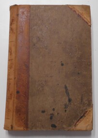
Book, Register of lands 51-52, 1952
Extra wagter applications and recmmendations for irrigation users 1951-52.Back cover missing, beige front cover, black writing. Cloth spine damaged. Irrigation season 1951-1952irrigation, farming, books, rural, industry -
Tatura Irrigation & Wartime Camps Museum
Book, Register of lands 1978-79, 1979
Contains lists of names of farmers and their Water Rights for 1978-79 seasonBlack back cover, beige front cover, navy blue writing, gold cloth spine. Hand printed list inside front coverirrigation, farming, books, rural, industry -
Tatura Irrigation & Wartime Camps Museum
Book, Register of Lands 1984-85, 1985
Lists of Water users in Rodney Irrigation District 1984-85 seasonPale green cover, black writing, black spine stamped with " S.R. & W.S.C Tatura District" logoirrigation, farming, books, rural, industry -
Tatura Irrigation & Wartime Camps Museum
Book, Register of Lands, 1980
Register of annual water rights for farmers in Tatura District 1980-1981Grey back cover, beige front cover, red cloth spine. Black lettering - S.R & W.S.C. Rodney irrigaton area, G.M.I. district. 1980-81 Irrigation seasonfarming, irrigation, books, rural, industry -
Tatura Irrigation & Wartime Camps Museum
Book, Register of lands 1972-73, 1972
District accounting officer, Tatura, Rating Divisions for Water Rights 1972-73Black back cover, green front cover. Black writing. plastic binding mended with tapeirrigation, farming, books, rural, industry -
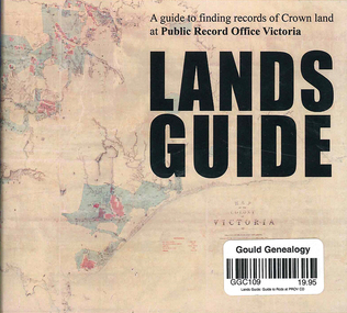 Victorian Aboriginal Corporation for Languages
CD-ROM, Public Record Office Victoria, Lands guide : a guide to finding records of Crown land at Public Record Office Victoria, 2009
A Guide to finding records of Crown land at Public Records Office Victoria.CD-ROM -
University of Melbourne, Burnley Campus Archives
Document - Circular, Department of Crown Lands and Survey. Complete list of weeds declared noxious in the State of Victoria, 1964-1972
Chart prepared by Vermin and Noxious Weeds branch. Plants proclaimed under the Noxious Weeds Act 1928 (No 3799) for the State of Victoria.. Plants proclaimed within certain Municipalities of Victoria. Includes tables of Chemical Treatment and other remarks.Large circular - Complete list of weeds proclaimed noxious within the State of Victoria and for certain Municipalities and table of quantities for chemical treatment together with brief instructions for treatment of Noxious Weeds (Vermin and Noxious Weeds Act 1928)weeds, vermin and noxious weeds act 1928, chemical treatment of weeds -
University of Melbourne, Burnley Campus Archives
Document, Clearing of timber from farm lands, 1957
Reprint of article by K.V.M. Ferguson & F.R. Drake from Journal of Dept. of Agriculture, March 1957 timber clearing, fam lands, k.v.m. ferguson, f.r. drake -
University of Melbourne, Burnley Campus Archives
Document, Report by the Working Party on the Use and Administration of College Lands, 1975
Department of Agriculture, Victoria, 51 pp.working party, college lands, agriculture, victoria -
Whitehorse Historical Society Inc.
Article, Time to tell tales from other lands, 2006
Whitehorse Historical Society is collecting stories of post-war immigrants living in Whitehorse (photo)Whitehorse Historical Society is collecting stories of post-war immigrants living in Whitehorse (photo)Whitehorse Historical Society is collecting stories of post-war immigrants living in Whitehorse (photo)whitehorse historical society inc., arrowsmith, valda, simmenauer, peter, migrants -
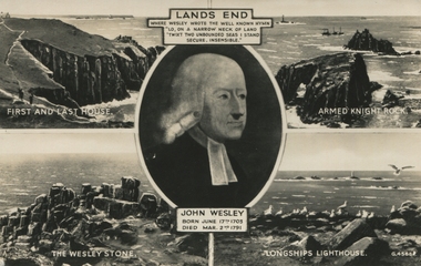 Ballarat Heritage Services
Postcard, Lands End with picture of John Wesley
-
![Publication, Keeping bees on forested lands: a code of practice. (Benecke, F. S.). [np], [nd], [nd]](/media/collectors/51d110e42162ef12e06aa06b/items/535efd552162ef07189079c8/item-media/53717c952162ef165899cc5b/item-fit-380x285.jpg) Beechworth Honey Archive
Beechworth Honey ArchivePublication, Keeping bees on forested lands: a code of practice. (Benecke, F. S.). [np], [nd], [nd]
9 pages. -
![Publication, Keeping bees on forested lands: a code of practice. (Benecke, F. S.). [np], [nd], [nd]](/media/collectors/51d110e42162ef12e06aa06b/items/535efded2162ef071890886a/item-media/53717cae2162ef165899cef7/item-fit-380x285.jpg) Beechworth Honey Archive
Beechworth Honey ArchivePublication, Keeping bees on forested lands: a code of practice. (Benecke, F. S.). [np], [nd], [nd]
9 pages. -
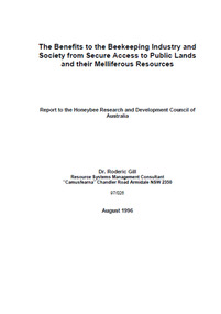 Beechworth Honey Archive
Publication, The benefits to the beekeeping industry and society from secure access to public lands and the melliferous resources. (Gill, Roderic). Canberra, 1996, 1996
53 pages, illustrated. -
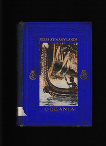 Mrs Aeneas Gunn Memorial Library
Book, Frank Fox, Peeps at many lands : Oceania, 1912
Includes general statements on Aboriginal origins; population numbers; description; warfare; their futureIll, maps, p.203.non-fictionIncludes general statements on Aboriginal origins; population numbers; description; warfare; their future oceania - description and travel, australia - description and travel -
 Mrs Aeneas Gunn Memorial Library
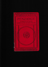
Book, Ward, Lock and Company, A pictorial and descriptive guide to Penzance and west Cornwall including Lands End and the Isles of Scilly, 192?
A pictorial and descriptive guide to Penzance and west Cornwall including Lands End and the Isles of ScillyIll, maps, p.176.non-fictionA pictorial and descriptive guide to Penzance and west Cornwall including Lands End and the Isles of Scillyengland - guidebooks, penzance - guidebooks -
 Mont De Lancey
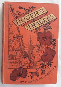
Book, E.Payson Hammond, M.A et al, Roger's Travels; or Scenes and Incidents with the Journey of two boys in foreign lands, and how they were led to start for the better country, 1886
The journey of two boys in overseas countries and their adventures with strong religious themes.Orange hardcover children's fiction book, Roger's Travels by E. Payson Hammond. M.A with the title surrounded by gold boxes and an illustration of a Dutch windmill and boat in the countryside. Brown flowers decorate the right side with the author's name E. Payson Hammond M.A underneath. The spine has the title author flowers and initials of the publisher SSU at the bottom. Black and white illustrations and full page plates are throughout. At the end are 15 pages of recommended books for young children by the Sunday School Union. 155p.fictionThe journey of two boys in overseas countries and their adventures with strong religious themes.religious fiction, adventure stories, children's books, morals fiction -
Port Melbourne Historical & Preservation Society
Document - Exhibition Catalogue, Joan Winter, Dredging, Draining, Dipping & Shipping: A History of the Foreshore & Low-lying Lands of the City of Port Phillip, Apr 1996
First major exhibition from the Council of Port Phillip was held in 1995. The catalogue material on Port Melbourne was written by PMH&PS members. It toured the city and then a reduced version was sent to sister city, Devonport. Black text and picture of Sandridge from the Esplanade, St Kilda on cover. sandridge lagoon, engineering - canals and drainage, melbourne harbor trust - port of melbourne authority, piers and wharves, piers and wharves - waterside workers, arts and entertainment, transport - shipping, centenary bridge, beacons, fishermans bend, transport - aviation and aerodrome, sport - swimming, flood, local government - city of port phillip, kulin nation, caroline frederica liardet, swallow & ariell ltd, mission to seafarers, emerald hill, st kilda -
 Greensborough Historical Society
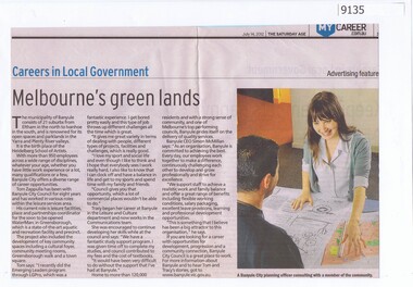
Article - Newspaper Clipping, The Age, Careers in Local Government - Melbourne's green lands, 14/07/2012
Discusses employment at Banyule City Council in particular the planning departmentNewspaper text and colour imagebanyule city council, town planning, careers -
 Federation University Historical Collection
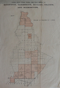
Plan, Lands held under leases for gold mining at Biddington, Carisbrook, Moolort, Craigie and Rodborough, not dated
Printed paper map with red shadingbiddington, carisbrook, moolort, craigie, rodborough, mining lease, d. fitzpatrick, m. mullins, d. fern, kong meng, p. mitchell, curtain and co, a. robertson, j. fay, chalk's extended, tullaroop creek, mining, gold mines, bucknall's estate, chalk's estate -
 Federation University Historical Collection
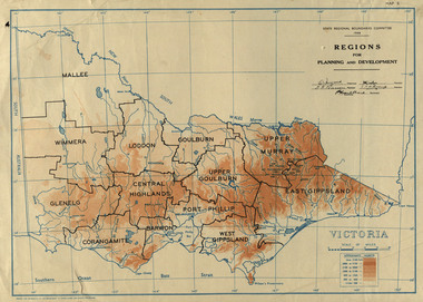
Map, Victoria: Regions for Planning and Development, 1944, 1944
This map was produced for the State Regional Boundaries Committee Two colour map of Victoria showing the regions for planning and development. The regions are Central Highlands, Mallee, Wimmera, Glenelg, Corangamite, Barwon, Loddon, Goulburn, Upper Goulburn, Upper Murray, East Gippsland, West Gippsland, Port Phillip.central highlands, mallee, wimmera, glenelg, corangamite, barwon, loddon, goulburn, upper goulburn, upper murray, east gippsland, west gippsland, port phillip, victoria, m4486 -
 Federation University Historical Collection
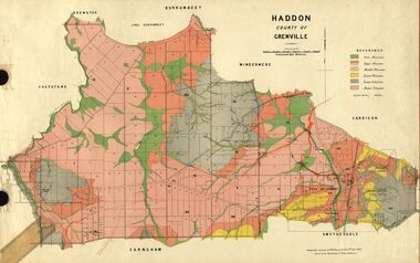
Plan, Haddon, County of Grenville, 1887, 1889
Ferdinand Krause taught at the Ballarat School of MinesGeological Map of Haddon in the County of Grenville surveyed by Ferdinand Krause. haddon, grenville, krause, ferdinand krause, cgt, lake burrumbeet, windermere, chepstowe, bailies creek, snake valley lead, nentingbool preemptice right, cardigan state forest, haddon state forest -
 Federation University Historical Collection
Plan, Burrumbeep, 1884, 16/10/1884
Auctions of Crown land were introduced in the Colony of Victoria from 1851 to encourage settlers to occupy and work the land. Many squatters purchased land at auction at the upset (minimum) price of £1 per acre. In some areas where demand was high, such as the goldfields, the price realised at auction was much more. Land was put up for sale in the study area on the Burrumbeep run in May 1855, on the Lexington run in 1857, and on the Gorrinn run in 1858. (http://www.ararat.vic.gov.au/library/document/thermatics.pdf, accessed 27 January 2015) For 70 years or more, Yalla-y-Poora, Burrumbeep, Edgarley, Mount William and Narrapumelap ranked in the leading wool producers in Victoria. 1 Stud owners at Yalla-y-Poora, Eurambeen, Burrumbeep and Challicum crossed merino sheep with sheep descended from John Macarthur's Camden Park in New South Wales. (http://www.ararat.vic.gov.au/library/document/thermatics.pdf, accessed 27 January 2015) In what was to become the Ararat Mining Division, gold was discovered in May 1854 on the Burrumbeep run at a place that became known as Pinky Point on the Mount William goldfield. By 21 June 1854, between 600 and 1,000 people had arrived. (http://www.ararat.vic.gov.au/library/document/thermatics.pdf, accessed 27 January 2015)\ Town allotment plan for Burrumbeep. Merrymbuela, Borung, Lexington and Langi Logan are neighbouring areas. The plan includes the Burrumbeep Pre-Emptive Right (Roger and Wright); licensed land holders including Stephen Young, John Carroll, William Walsh, Thomas Purcell, Martha M. Bond, Colin Johnson, John Charles Webb, Henry Withycombe, William Henry Barbridge, John Wall, Thomas Flatelly, William Jenkinson, Elisia Radford, V. Radford, Denis Byrne, George Cook. Land holders included Andrew Maloney, Richard Wingfield Harrocks, W. Sporton, Terence Lynch, F. S. Falkiner, A. Millman, H. Morris, George Upham, J. McCLure, S. Fletcher, W. Parker, Thomas Myers, William wright, W.C. Winter, C. Wordman, Oliver A. Winter This plan is associated with former Ballarat School of Mines student Richard Squire (1875-6) Gift of the Squire FamilyVerso written in pencil - Plan of Burrembeep Ararat Burrembeep Araratburrumbeep, corrinn, langi logan, merrymbuela, lexington, ararat, roger & wright, cook, rogers, upham, george upham, ross, parsans, morris, johnson, withycoombe, colin johnson, falkiner, dsporton, john carroll, donald gordon, denis bryne, maurice dooley, martha bond, william harricks, \william wingfield harricks, william l.c. harricks, michael houlihan, thomas purcell, martin ryan, michael cody, fletcher, mccaw, w. parker, j.m. clow, elisia radford, thomas radford, thomas myers, barbridge, e. wilde, j. wall, flatelly, g. wardman, w.c. winter, david ball, jenkinson, ballarat school of mines, richard squire, squire -
 Federation University Historical Collection
Plan, Smythesdale, County of Grenville, 01/12/1892
This plan is associated with former Ballarat School of Mines Student Richard Squire (1875-1876). Gift of the Squire FamilyA plan showing the Borough of Smythesdale, Smythesdale, Browns and Scarsdale, allotments, water reserve, Timber reserve, Nintingbool Pre-emptive Right, Reserve for public gardens, Reserve for Cricket Ground, Reserve for Reservoirsmythesdale, scarsdale, browns, yarrowee, carngham, samuel barlett, sheridan, wrigley, p. land, r. simpson, d. davis, nintingbool, mclachlan, a. mclachlan, c. taylor, w. c. smith, d. davies, w. williams, m. jones, t. mcgurk, r. selkirk, a. mooney -
Port Melbourne Historical & Preservation Society
Map - Footscray, Public Lands Office, 19 Oct 1857
Map of Footscray, west of Saltwater Creek; south of Hopkins Street, east of Railway and north southern boundary of Botanical Garden reserve.The Township of Footscray, Parish of Cut-Paw-Pawfootscray -
 Bendigo Historical Society Inc.
Document - LANDS OFFICE - CROWN LANDS SURVEYED AND SOLD SANDHURST, 1860 onwards
Journal: LANDS OFFICE - CROWN LANDS SURVEYED AND SOLD SANDHURST green hard cover journal with buff spine and corners. Contains details of crown land surveyed and sold in the district of Sandhurst. Indexed in front by parish, alphabetical double pages not numbered. On LH page, parish, town, suburban, country, date of survey. On RH page, date of sale, auction, selection, price, total amount, purchaser. On spine ' index book' 'F' and '09'. Dated from 1860 onwardsLands Officeland sales, bendigo -
 Bendigo Historical Society Inc.
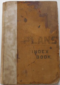
Document - LANDS OFFICE, - INDEX TO CROWN LANDS SURVEYED AND SOLD IN THE DISTRICT OF SANDHURST
Document: Buff hard cover book, with fawn coloured binding on spine (later addition to mend spine?) On front cover drawn in black pen ' PLANS' and 'Index Book' On spine written in black ink ' plans index book'. Contains index of parishes in front of journal with 470 pages indexed to parishes. Double page entries: LH side page: town, suburban or country lands, total lands surveyed. Date of survey. RH page: allotment, section, particulars, no. page. Entries are not dated.Lands Officeland sales, lands office, land surveyed , land sold, bendigo, sandhurst -
 Bendigo Historical Society Inc.
Document - LANDS OFFICE: AGRICULTURAL LAND LEASE REGISTER AMENDING LAND ACT 1865, 13.9.21 to 26.6.24
Document: buff leather covered journal containing rules pages with handwritten entries. Book is indexed A - Z. Across top: Register of agricultural lands leased under ' The Amending Land Act 1865' LH page: date of lease, name of lessee, county, parish, number of, extent, no. of report. Rh page: no. of report, remarks.Lands Officecottage, miners, lands act, lands office, agricultural land. amending land act 1865. -
 Bendigo Historical Society Inc.
Document - LANDS OFFICE - PLANS FORWARDED TO CROWN LANDS OFFICE, 1.9.1871 to 5.4.1880
Document: hard cover journal, brown cover with darker tan spine. 239 pages. Contains index at front of journal. Listings of plans forwarded to Melbourne Crown Lands Office by Bendigo Office. Alphabetical listing in front followed by numbered pages with individual details. Parish, county, allotment, section, surveyor, date remarks.Lands Officelands office, sandhurst, bendigo, land sales, land surveyed, plans