Showing 5786 items matching "location"
-
 Bendigo Historical Society Inc.
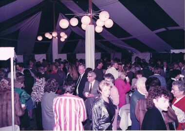
Photograph - CASTLEMAINE GAS COMPANY COLLECTION: PHOTO PEOPLE
Gas and Fuel Fashion,food,Fitness. Large gathering of people inside a tent. Possibly some official function most men in suits ladies in dresses and coats. Date and location unknown.event, social, gas & fuel fashion, food, fitness -
 Bendigo Historical Society Inc.
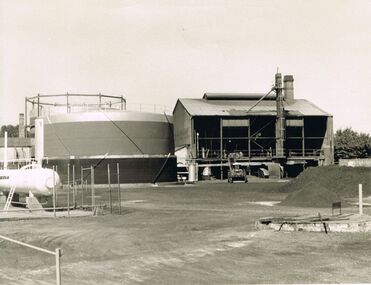
Photograph - CASTLEMAINE GAS COMPANY COLLECTION: PHOTO WORK AREA
Photo of a plant date and location unknown - Left side a gas tank in the centre a round silos and a large open shed with chimney and tractor or excavator at front. At left of photo a Pile of dirty.organisation, industry, gas and fuel -
 Bendigo Historical Society Inc.
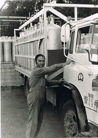
Photograph - CASTLEMAINE GAS COMPANY COLLECTION: PHOTO MALE
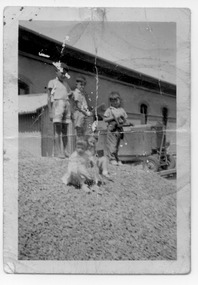
Angelo Pontell about to depart into country with a day delivery Heatane gas bottles. Angelo is President Social Club. Photography by Gas & Fuel Corporation Printing Section. Date and Location Unknownperson, individual, worker -
 Bendigo Historical Society Inc.
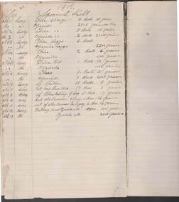
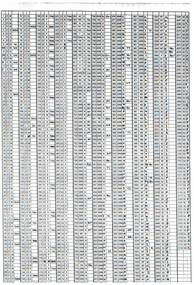
Document - JOHN EVANS COLLECTION: SEBASTIAN CYANIDE WORKS ASSAY BOOK: MAY 1910 TO MAY 1911
Sebastian Cyanide Works Assay book - May 1910 to May 1911 (entered into book in reverse) J Evans Collection. Pencilled entries re description/location of sample with assay results.bendigo, industry, sebastian cyanide works, sebastian cyandie works -
 Port Melbourne Historical & Preservation Society
Postcard - Railway Pier, Port Melbourne, 1880 - 1952
Collected by Alison KELLY when she was caretaking the Missions to Seamen Building 1987-90.One of four postcards of various locations in Port Melbourne. Hand coloured postcard - Railway Pier, Port Melbourne held in an oval frame by a kangaroo on left and a kookaburra at lower right C1914.piers and wharves - railway pier, piers and wharves - princes pier, parks and gardens -
 Port Melbourne Historical & Preservation Society
Photograph - Thomas family members, Esplanade West, Port Melbourne, 1990s
One of three sheets of photos copied from originals held by the Thomas family of Esplanade West: A: five B&W photos of Thomas family members in various locations in Esplanade Westbuilt environment, families, pat thomas, esplanade west -
 Bendigo Historical Society Inc.
Postcard - ACC LOCK COLLECTION: SEPIA PHOTO OF BATTLEFIELD, POSTCARD, 1914-1918
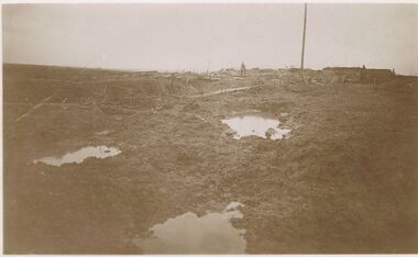
Postcard, WW1, Sepia image of a desolate battlefield, location unknown. Boggy ground with 3 holes filled with water. Two figures standing in background. G27 and GS handwritten in pencil on the back.postcard, postcard, ww1, france, battlefield -
 Bendigo Historical Society Inc.
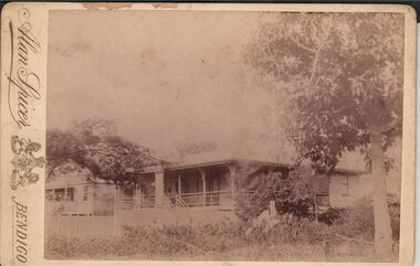
Photograph - ELMA WINSLADE WELLS COLLECTION: PHOTOGRAPH OF TWO HOUSES
Black and white photograph of two houses, a large tree on the right and branches of another one on the left. Date and location unknown. On the left hand side printed the name: Alan Spicer, Bendigo.Alan Spicer, Bendigobuildings, house, unkown -
NMIT (Northern Melbourne Institute of TAFE)
Report: Campuses, buildings and rooms - Layouts and listings July 1994 NMCOT
Spiral bound report of 284 pages, A4 size. Consists mainly of campus location maps and room layout plans by building. Prepared by Neville Lester for Northern Metropolitan College of TAFE.northern metropolitan college of tafe, buildings, reports, nmit -
Bendigo Historical Society Inc.
Map - PLAN OF THE BENDIGO RAILWAY YARD, Circa 1960
Map: Plan of the Bendigo Railway Yards, Scale: 80 feet to 1 inch. 1960's. (number 319 in map cupboard 1) Location unknown. Image in Mosaic images overflow.map, bendigo, railway yard, railways, rail yards, station layout -
 Bendigo Historical Society Inc.
Document - FOR NEWSLETTER - ACTIVITIES DURING OCTOBER
handwritten account of activities during October. Mentions taking bus groups to various locations and a visit to the Kangaroo Flat Technical School where the students had made a model of a mine and workings.document, for newsletter - activities during october, mr a llewellyn, south australian rural youth group, east meadows primary school, victoria hill, the central deborah mine, council of adult education geology group, mr wyn williams, bendigo institute of technology, kangaroo flat technical school, a richardson -
 National Vietnam Veterans Museum (NVVM)
Poster - Poster, Information Board, Australian Army Training Team Vietnam - The Team
Yellow metal with white, black & red letterings & numbers. Some of the locations where AATTV members served. Also a map of Vietnam showing Admin Divisions & military regions, June 1967.aattv, vietnam map -
 Ballarat Tramway Museum
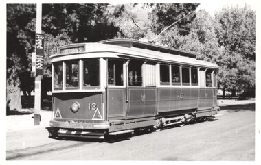
Photograph - Black & White -Tram 13 at Gardens Loop, Keith Kings, 12/4/1958
Photo shows the tram prior to fitting of hazard lights and striping.Yields information about Ballarat tram No. 13 and the locationBlack and White photograph of SEC Ballarat tram No. 13 at Gardens Loop, Wendouree Parade 12/4/1958. Photo shows the timetable boards located at this location. Photo by Keith KingsOn rear has the photographers file number A(h)(12)ballarat, wendouree parade, gardens loop, tram 13, trams, tramways -
 Kew Historical Society Inc
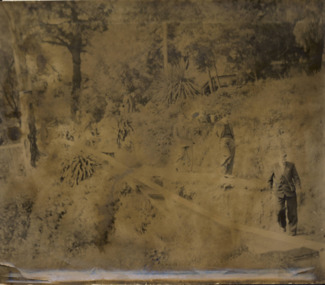
Photograph - Men on the bank of the Yarra River, circa 1953
This is one of a series of 17 black and white undated photographic proofs donated to the Kew Historical Society in 2013 by the Queenscliffe Historical Museum. The series includes images of individuals, tea rooms, ferries, motor launches, ocean liners and tugs. The subject of the photograph is a Hicks Bros ferry, which from circa 1921 operated a ferry service from Princess Walk (Melbourne) to Studley Park.Very faded and degraded photograph of a group of men walking down pathways on the bank of a river in Melbourne. The location may be the Hawthorn Tea Rooms. The undated photographic positive was probably taken in the 1950s.melbourne, tourism -
 Kew Historical Society Inc
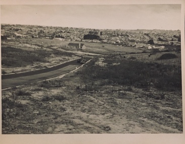
Photograph - Urban landscape, 1860
An item from an outstanding and diverse photographic collection, assembled by members of the Christian and Washfold families of Kew.Black and white photograph looking across a valley to buildings in the distance. Similar locations in nos.41, 42, 43, 44. Road-making in foreground. Identical but sharper photo than no.44.christian-washfold collection, landscape photography, subdivisions -- kew (vic.) -
 Kew Historical Society Inc
Photograph - Urban landscape, 1860
An item from an outstanding and diverse photographic collection, assembled by members of the Christian and Washfold families of Kew.Black and white photograph looking across a valley to buildings in the distance. Similar locations in nos.41, 42, 43, 44. Road-making in foreground. Identical but paler photo than no.43.christian-washfold collection, landscape photography, subdivisions -- kew (vic.) -
Canterbury History Group
Document - The stained glass windows by Christain Waller at St Paul's Anglican Church, Canterbury, National Trust of Australia (Victoria), 2005
Classification Report on the Christian Waller windows. Lists assessment criteria, plan of the interior of the church, photocopies of the design of the windows and exterior of the church, and a list of some of Christain Waller's windows together with their location.canterbury, margaret street, church street, st paul's anglican church, boroondara city council, national trust of australia (victoria), waller> christian, stained glass, windows, redman family, churches -
Bendigo Historical Society Inc.
Photograph - LANSELL'S HOME IN ENGLAND
BHS CollectionPhotograph of a substantial home with tower, surrounded by lawns and parkland. Pencil annotation on back identifies Lansell's home in England but puts a question mark by its location -further research needed to identify.buildings, house, homes (u.k.) -
 Melbourne Tram Museum
Administrative record - Depot List, Public Transport Corporation (PTC), c1998
A4 photocopied sheet providing the location of tramcars at the various depots, includes Z and B class trams, Sydney R, Scrubbers, including Heritage cars stored at Hawthorn. Undated - 1998ctrams, tramways, tramcars, depot allocation, lists, depots -
 Phillip Island and District Historical Society Inc.
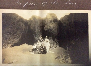
Photograph, In front of the Caves, 1925-1926
Location is possibly Forrest Caves.Sepia photograph of five women, two men, one boy and a dog sitting on the sand in front of rocks and caves.In front of the Cavesphotographs, caves, forrest caves, social life and customs -
 Halls Gap & Grampians Historical Society
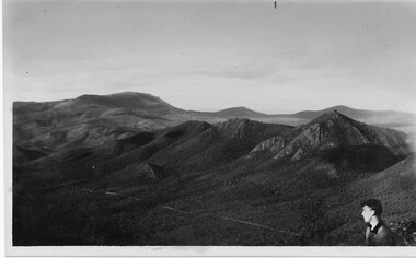
Postcard - Coloured, C 1950s
This photo is of an unknown location in the Grampians.Photo shows a range of hills. The head and shoulders of young man can be seen in the bottom right hand cornerPost Card Correspondence, Address only Kodak Autraliascenery, grampians ranges -
Coal Creek Community Park & Museum
drill core samples
purpose: unknown location: local7 different pieces of drill core samples of varying lengths and diameters -
Clunes Museum
Document - NEWSPAPER CUTTING AND HISTORICAL GUIDE, WHAT TO LOOK FOR IN AND WHERE TO FIND IT, 1971/1972
HISTORY LOCATIONS CLUNES SITES.1 NEWSPAPER CUTTING CLUED ONTO PAPER - HISTORY OF CLUNES .2 3 X PAGES AND MAP DETAILING PLACES OF INTEREST IN CLUNESlocal history, places of interest clunes -
 Kew Historical Society Inc
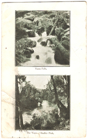
Postcard, Yarra Falls, The Yarra at Studley Park, 1920-1950
The Yarra River was a major subject for the producers of postcards in Melbourne. This dual image postcard shows images of the Yarra in two locations. Studley Park in Kew was a major location for recreation activities by the people of Melbourne.Image of the Yarra at Sudley Park shows remnant vegetation preserved on the banks of the Yarra in this part of Kew.Monochrome postcard with two images of the Yarra River, the lower image showing the Yarra at Studley Park. The reverse has a handwritten birthday greeting from Eileen to her mother Mrs Clark. Original postage stamp has been removed and slight tearing in top right corner. Two ink stamps KEW HISTORICAL SOCIETY have been added."Mrs Clark, Harp Road, East Kew / Wishing Mother a very happy Birthday and many returns / from Eileen"yarra falls, dual image postcards, yarra river -- studley park -- melbourne (vic.), monochrome postcards -
 Clunes Museum
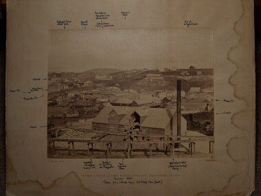
Photograph, C. NETTLETON, CIRCA 1865
SEPIA PHOTOGRAPH AND PHOTOCOPY OF CLUNES UNITED QUARTZ MINING COMPANY, TALL CHIMNEY ON RIGHT HAND SIDE.CLUNES UNITED QUARTZ MINING COMPANY REGISTERED CLUNES HANDWRITTEN NOTES: PERIOD 1865 TAKEN FROM HILLSIDE BELOW PORT PHILLIP MINE (SOUTH) LOCATIONS OF VARIOUS BUILDINGSlocal history, photography, photographs, mining -
 Ringwood and District Historical Society
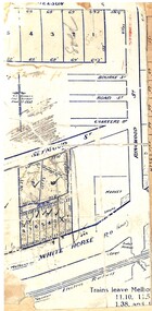
Map, Partially trimmed copy of a retail and residential auction advertisement, Ringwood, Vic. - 1926
One of 3 unrelated land subdivision maps on cardboard backing. Numbered allotments on Nelson Street, Seymour Street and Whitehorse Road, Ringwood.W.J. Bonwick, Licensed Surveyor, Phone WU4830. Location map also includes Bourke Street, Bond Street, Charter Street, Ringwood Street, and Shops and Market sites in Ringwood. -
 Kew Historical Society Inc
Plan - Subdivision Plan, Belford Heights Estate, Kew, ca. 1925
Pru Sanderson, in her groundbreaking ‘City of Kew Urban Conservation Study : Volume 2 - Development History’ (1988), summarised the periods of urban development and subdivisions of land in Kew. The periods that she identified included 1845-1880, 1880-1893, 1893-1921, 1921-1933, 1933-1943, and Post-War Development. These periods were selected as they represented periods of rapid growth or decline in urban development. An obvious starting point for Sanderson’s groupings involved population growth and the associated economic cycles. These cycles also highlighted urban expansion onto land that was predominantly rural, although in other cases it represented the decline and breakup of large estates. A number of the plans in the Kew Historical Society’s collection can also be found in other collections, such as those of the State Library of Victoria and the Boroondara Library Service. A number are however unique to the collection.The Kew Historical Society collection includes almost 100 subdivision plans pertaining to suburbs of the City of Melbourne. Most of these are of Kew, Kew East or Studley Park, although a smaller number are plans of Camberwell, Deepdene, Balwyn and Hawthorn. It is believed that the majority of the plans were gifted to the Society by persons connected with the real estate firm - J. R. Mathers and McMillan, 136 Cotham Road, Kew. The Plans in the collection are rarely in pristine form, being working plans on which the agent would write notes and record lots sold and the prices of these. The subdivision plans are historically significant examples of the growth of urban Melbourne from the beginning of the 20th Century up until the 1980s. A number of the plans are double-sided and often include a photograph on the reverse. A number of the latter are by noted photographers such as J.E. Barnes.The Belford Heights Estate was a subdivision in Kew East, even though the title of the plan indicates that it was located in Kew. The subdivision had been approved by 1915, and included 105 lots facing Strathalbyn, Kitchener, Hamilton and Beresford Streets, as well as Balfour and Belford Roads. Those lots hand coloured with red probably represent blocks that had been sold. The additional information provided on the plan is also of interest. The plan includes the original location of East Kew State (Primary) School in Strathalbyn Street, which opened in 1892. The inset Locality Plan also includes the route of the Outer Circle Railway and the location of the Wilsmere and East Kew Stations. The location of the landmark Harp of Erin Hotel is also marked on the Locality Plan.belford heights estate, subdivision plans - kew -
 Bendigo Historical Society Inc.
Document - Geological Survey of Victoria, Hustlers Line of Reef, Bendigo, April, 2014
Seven men were killed at the Great Extended Hustler's mine disaster on 2nd May 1914 by an explosion of dynamite occurring as the men were waiting at the plat to ascend the mine at the end of their shift. No blame was attached to anyone in the findings of the inquisition. It was unknown what caused the dynamite to explode. This document formed part of the research done at the time by Bendigo Historical Society, of the 100 years commemoration of the mine disaster, held at Hustler's Hill in 2014. Seven page photocopy of Department of Mines, Bulletin, Geological Survey of Victoria, Hustlers Line of Reef, Bendigo, No. 33 by H.S. Whitelaw. Includes plan of Hustlers Royal Reserve No. 2, (main shaft) showing location on Pall Mall, and location of Post Office and Law Courts; plan of location of Hustlers Royal Reserve No. 2 (Park Shaft) showing Jail (sic), Camp Hill State School, two 'lagoons' in between tennis court, croquet court and bowling green; a plan of the Great Extended Hustler's Shaft and two copied images of Hustler's Hill showing mining buildings, poppet heads and chimneys. Comet, K.K., Hustler's No. 1, Old Comet and United Hustler's and Redan Mines are shown in the images. great extended hustlers, goldmining, accident, quartz, mining, k.k. mine, comet mine, hustler's line of reef, old comet, united hustler's, redan -
 Melbourne Tram Museum
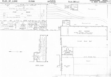
Drawing, Melbourne & Metropolitan Tramways Board (MMTB), "Footscray Depot and bus garage", c1937
Set of three photocopied plans or drawings on A3 sheet of "Footscray Depot and bus garage" c 1937 .1 - P7993 - Plan of land showing car shed, bus garage and offices dated 1-4-1937 - shows substation location. .2 - P? - Plan of land showing buildings and surrounding properties - dated 1-4-1937 .3 - P79821 - ditto but a wider area - dated 1-4-1937 - shows substation location.trams, tramways, drawings, depots, property, footscray depot, substation -
 Mission to Seafarers Victoria
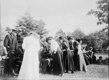
Photograph - Photograph, Sepia
Same location as item 1845 and 1848Small monochrome photograph (faded) depicting an outdoor gathering of seamen and LHLG memberslhlg, picnic, ladies