Showing 10623 items
matching maps
-
 Victorian Aboriginal Corporation for Languages
Book, George Mackaness, George Augustus Robinson's journey into South-Eastern Australia, 1844 with George Henry Haydon's narrative of part of the same journey, 1978
Looking at the journeys of George Augustus Robinson and George Henry Haydon into South-Eastern Australia.maps, b&w illustrations, b&w photographsgeorge augustus robinson -
Victorian Aboriginal Corporation for Languages
Book, Edgar Morrison et al, Frontier life in the Loddon Protectorate : episodes from early days, 1837-1842 /? by Edgar Morrison. The Aborigines of Australia : a lecture delivered ... before the John Knox Young Men's Association, on Wednesday May 10th, 1854 /? by Edward Stone Parker, 1967
The episodes related here occurred between the years 1837 and 1842 and describe what would now be called a period of confrontation between the Aboriginal inhabitants and the white settlers who flocked to the scene so glowlingly described by Sir Thomas Mitchell in 1836.maps, b&w illustrations, b&w photographsloddon, edward stone parker -
 Victorian Aboriginal Corporation for Languages
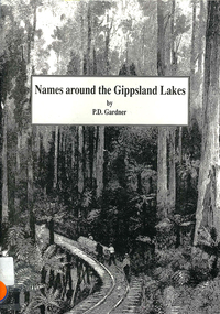
Book, P D Gardner, Names around the Gippsland Lakes : their origins, meanings and history, 1991
Gives descriptions of area, origin and meanings.Maps, b&w illustrations, b&w photographsgippsland, gunnai, kurnai, bairnsdale, wurruk, place names -
 Victorian Aboriginal Corporation for Languages
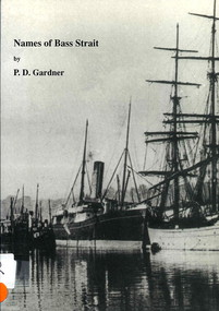
Book, P D Gardner, Names of Bass Strait : their origins, meanings and history, 1996
An examination of the origins of over 400 names in and around the Bass Strait, including Victorian areas from Cape Otway to Lakes Entrance and the north coast of Tasmania.Maps, b&w illustrations, b&w photographsbunerong, bass strait, tasmania, place names, bassian isthmus, king island, otway coast, port phillip bay, western port bay, wilsons promontory, cape barren island, flinders island, king island -
 Victorian Aboriginal Corporation for Languages
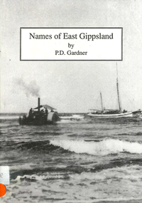
Book, P D Gardner, Names of East Gippsland : their origins, meanings and history, 1992
Detailed examination of the origins of local names from Mallacoota to Marlo and from Wingan Inlet to Willis. Includes explanations of the origins of major towns and their features.Maps, b&w illustrations, b&w photographskrauatungalung, gunnai, kurnai, bidawal, east gippsland, lake tyers, point hicks, -
 Victorian Aboriginal Corporation for Languages
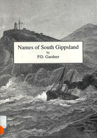
Book, P D Gardner, Names of South Gippsland : their origins, meanings and history, 1992
Provides an account of the origins and histories of local names in the South Gippsland region.Maps, b&w illustrations, b&w photographsbunerong, kulin, gunnai, kurnai, brataualung, seaspray, phillip island, mirboo, wilsons promontory, woodside, foster, inverloch, leongatha, wonthaggi -
 Victorian Aboriginal Corporation for Languages
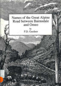
Book, P D Gardner, Names of the Great Alpine Road between Bairnsdale and Omeo : their origins, meanings and history, 1997
Lists the place names along the Victorian Alps, with descriptions and meanings.Maps, b&w illustrations, b&w photographsgunnai, kurnai, ngarigo, jaitmathang, brabiralung, tongiomunjie, tambo, tongio, bruthen, tambo, mount stringy, swifts creek -
 Victorian Aboriginal Corporation for Languages
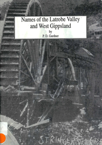
Book, P D Gardner, Names of the Latrobe Valley and West Gippsland : their origins, meanings and history, 1992
An account of the origins and histories of local names from Robin Hood to Kilmany, and from Mirboo North to Mt. Howitt.Maps, b&w illustrations, b&w photographsgunnai, kurnai, braiakaulung, bunerong, wurundjeri, kulin, coranderrk, warragul, morwell, rosedale, governor la trobe, drouin, noojee, darnum, walhalla, strzelecki, heyfield, gormandale -
 Victorian Aboriginal Corporation for Languages
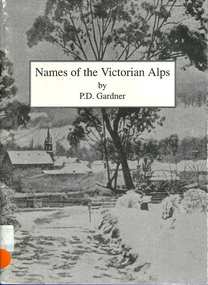
Book, P D Gardner, Names of the Victorian Alps : their origins, meanings and history, 1991
Gives a comprehensive account of the origins of local names in the area. Anecdotes of interesting pieces of history.Maps, b&w illustrations, b&w photographsjaitmathang, minjambuta, djilimatang, ngarigo, brabiralung, braiakaulung, yuin, gunnai, lake tyers, dargo river, omeo, bright, swifts creek, benambra, ovens valley, mount hotham, mount nugong, wonnangatta station -
 Victorian Aboriginal Corporation for Languages
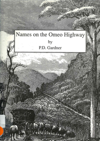
Book, P D Gardner, Names on the Omeo Highway between Bairnsdale and Omeo : their origins, meanings and history, 1992
An account of the origins and histories of local names between Bairnsdale and Omeo.Maps, b&w illustrations, b&w photographsgunnai, kurnai, brabiralung, jaitmathang, ngarigo, yuin, tongiomunjie, tongio gap, bruthen, tambo, hells gate, mount stringy, doctors flat -
 Victorian Aboriginal Corporation for Languages
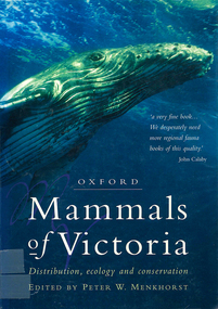
Book, Peter W Menkhorst, Mammals of Victoria : distribution, ecology and conservation, 1996
Arranged in family (type) groups with photos and detailed descriptions of each mammal.Maps, colour photographs, b&w photographs, graphsmammals, fauna, victoria -
 Victorian Aboriginal Corporation for Languages
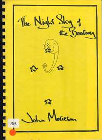
Book, John Morieson, The night sky of the Boorong
Based on historical notes of a variety of people, it explains the Night Skies of the Lake Tyrell area of Victoria and the mythology of the people regarding the legends of the skies.Maps, b&w illustrations, b&w photographsboorong, astronomy, ecological zodiac, william stanbridge, lake tyrell -
 Victorian Aboriginal Corporation for Languages
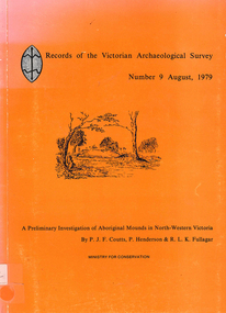
Book, PJF Coutts et al, Records of the Victorian Archaeological Survey : number 9, August 1979 : a preliminary investigation of Aboriginal mounds in North-Western Victoria, 1979
Maps, charts, graphs, b&w photographs, diagramsvictoria archaeological survey, murray valley, grampians -
 Victorian Aboriginal Corporation for Languages
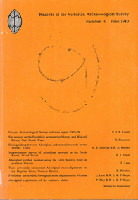
Book, Records of the Victorian Archaeological Survey : number 10, June 1980, 1980
Maps, charts, graphs, b&w photographs, diagrams -
 Victorian Aboriginal Corporation for Languages
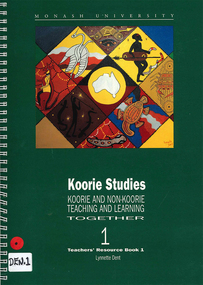
Book, Lynnette Dent, Koorie studies : Koorie and non-Koorie teaching and learning together : teachers resource book 1, 1993
Teachers? Resource Book produced for the Ganai language, with units of work, word lists, etc, includes Overview, The Dreaming, Social Organisation, Language and Food, Koories Today, Curriculum Areas, Excursions to Koorie sites, Resources.maps, b&w illustrations, b&w photographsgunai, ganai, kurnai gippsland, study and teaching, dreaming stories, koorie law, koorie culture, teaching resources -
 Victorian Aboriginal Corporation for Languages
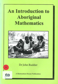
Book, John Rudder, An introduction to Aboriginal mathematics, 1999
Aboriginal mathematics tends to focus on the relationship of numbers rather than quantities. This book shows why numbers were irrelevant to Aborigines and outlines the kind of mathematics that was used.maps, b&w illustrations, b&w photographsnorth east arnhem land, turtle egg mathematics, aboriginal mathematics, aboriginal social life, measuring space, measuring time, flora, fauna -
 Flagstaff Hill Maritime Museum and Village
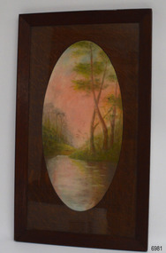
Drawing - Pastel Picture, W.R. Angus (Dr. William Roy Angus), 1925
This large pastel drawing was created by Dr W.R. Angus in 1925, the year after he graduated as a doctor in South Australia. In 1926 Dr Angus was appointed as Medical Assistant to Dr Thomas Francis Ryan, in Nhill, Victoria, where he extended his experiences in radiology and pharmacy. Eventually, in 1939, he and his wife Gladys moved to Warrnambool, Victoria, with their children. The drawing is part of the W.R. Angus Collection, which includes another of the doctor’s pastel drawings and a box of used pastels. The picture was framed by W.H. Rogers & Co. of North Terrace, Adelaide. The business also framed maps and plans. This pastel drawing is locally significant for being the work of Warrnambool doctor, W.R. Angus. It is part of the W.R. Angus Collection, which is significant for still being located at the site it is connected with, Doctor Angus being the last Port Medical Officer in Warrnambool. The collection of medical instruments and other equipment is culturally significant, being a historical example of medicine, administration, household equipment and clothing from late 19th to mid-20th century. Dr Angus assisted Dr Tom Ryan, a pioneer in the use of X-rays and in ocular surgery. The collection includes Army objects, which are examples of items issued to Doctors and Surgeons in the Medical Services of the Australian Army in World War 2. It also includes household items used by Dr Angus and his family from the 1920s in various locations including Warrnambool, together creating an understanding of the furnishing of an early to mid-20th century home.Pastel drawing behind glass in a rectangular wooden frame with an unusual oval wooden matt. The subject is a scene with a pink-tinted sky reflected in a river running between the foot of two hills with trees. The picture was created and signed by W R Angus in 1925. The back is covered in brown paper and has a mounting wire. Inscriptions are on the picture and the back. A remnant of the framer’s label is attached. The picture is part of the W.R. Angus Collection. Signature and date; “W.R.A. / 1925” Printed on label remnant; “—Rogers & Co. / - ORIA STREET / - way Station, North Terrace / “THE CORRECT FRAMERS” / -lise in Map and Plan Mounting / PHONE 5437”flagstaff hill, warrnambool, maritime village, maritime museum, shipwreck coast, great ocean road, drawing, pastel drawing, pastel drawing by w.r. angus 1925, rogers & co., w.h. rogers & co., correct framers, w.r. angus collection -
 Bendigo Military Museum
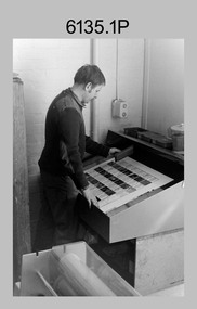
Photograph - Print Troop – Lithographic Squadron – Army Survey Regiment, Fortuna, Bendigo
This collection of 23 photos was most likely taken in Lithographic Squadron, Army Survey Regiment, Fortuna, Bendigo, in 1988. In photos .1P and .2P the technician is preparing a Chromalin map proof for supporting information that would be printed on the reverse side of a topographic map. This map was commonly referred to as a ‘snack’ map, with photos of edible indigenous plants and descriptions endemic to that region printed on the reverse side to assist soldiers living off the land in survival situations. The authoritative information was provided by Major Leslie James (Les) Hiddins aka ‘the Bush Tucker Man’ He is a retired Australian Army soldier and war veteran, who is best known for his love and knowledge of the Australian bush. See item 6190.6P for more information on the Chomalin proof production process. In the remaining photos, Print Troop’s technicians were most likely operating the Komoni, Planeta or Ultra-MAN-III offset printing presses, as well as working in the map despatch dock. Although these photos are not annotated most personnel are positively identified. This is a set of 23 photographs of Print Troop personnel and equipment from Lithographic Squadron at the Army Survey Regiment, Fortuna, Bendigo, 1988. The photographs were on 35mm negative film and were scanned at 96 dpi. They are part of the Army Survey Regiment’s Collection. .1) - Photo, black & white, 1988, Chromalin Proof laminating, Terry King. .2) - Photo, black & white, 1988, Chromalin Proof laminating, Terry King. .3) to .6) - Photo, black & white, 1988, Ultra-MAN-III Printing Press, Colin Yeats. .7) - Photo, black & white, 1988, Ultra-MAN-III Printing Press, L to R: Greg Rowe, SPR Mark ‘Dogs’ Doherty. .8) - Photo, black & white, 1988, Ultra-MAN-III Printing Press, SPR Mark ‘Dogs’ Doherty. .9) to .10) - Photo, black & white, 1988, Ultra-MAN-III Printing Press, John Bateman. .11) - Photo, black & white, 1988, Ultra-MAN-III Printing Press. .12) - Photo, black & white, 1988, Map laminator? L to R: SGT Dale Hudson, SGT Gary Kerr. .13) - Photo, black & white, 1988, Newkoni Komori Printing Press, Peter Hamilton. .14) to .17) - Photo, black & white, 1988, Original Heidelberg Printing Press, Peter Hamilton. .18) to .19) - Photo, black & white, 1988, Map Despatch area, SPR Steve Wright. .20) - Photo, black & white, 1988, Map Despatch area, L to R: unidentified, SGT Gary Kerr. .21) - Photo, black & white, 1988, Printing Presses - foreground: Ultra-MAN-III (x2), centre: Newkoni Komori and background: Planeta Polygraph. .22) - Photo, black & white, 1988, Ultra-MAN-III Printing Presses (x2). .23) - Photo, black & white, 1988, L to R: Daryl South, Mark McCulloch.No personnel are identifiedroyal australian survey corps, rasvy, army survey regiment, army svy regt, fortuna, asr, litho, printing -
 Melbourne Tram Museum
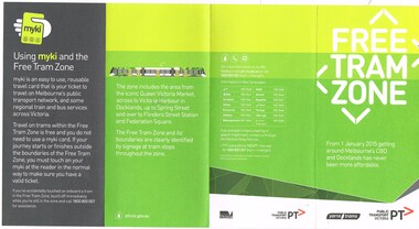
Pamphlet, Public Transport Victoria (PTV), 'Free Tram Zone", Dec. 2014
... Maps ...Pamphlet - DL size, 4 fold, printed on off white paper, titled "Free Tram Zone", providing information about the introduction of the free tram zone in the Melbourne CBD and a map. Applicable from 1/1/2015. Has contact details, Yarra Trams, PTV logos and Victorian Government logo on the rear. Notes the use of Myki cards. 2 copies held.trams, tramways, free tram, yarra trams, maps, melbourne, myki -
 Kew Historical Society Inc
Plan - Subdivision Plan, Argyle Road, Heather Grove, Victor Avenue, Kew, c.1937
The Kew Historical Society's map collection includes a substantial number of real estate subdivision plans, mainly of Kew but also of surrounding suburbs in Melbourne. Most of the subdivision plans date from the 1920s and 1930s when the districts old homes and local farmland were being split up to accommodate residential growth in the postwar period. These early plans were assembled by a local firm, Jas R Mather & McMillan, which had an office in Cotham Road. Many of the plans, and sometimes photos, were annotated by the agents.Subdivision plans are historically important documents used as evidence for the growth of suburbs in Australia. They frequently provide information about when the land was sold as well as evidence relating to surveyors and real estate and financial agents. The numerous subdivision plans in the Kew Historical Society's collection represent working documents, ranging from the initial sketches made in planning a subdivision to printed plans on which auctioneers or agents listed the prices for which individual lots were sold. In a number of cases, the reverse of a subdivision plan in the collection includes a photograph of a house that was also for sale by the agent. These photographs provide significant heritage information relating house design and decoration, fencing and household gardens.The photograph may also be aesthetically significant depending on the importance of the photographic atelier.Undated blue subdivision plan in Kew of 14 lots facing Argyle Road, Heather Grove and Victor Road. The Plan identifies Tuxen & Miller as the surveyors. [Formerly catalogued as MAP.0059]subdivision plans - kew, argyle road - kew, heather grove - kew, victor avenue - kew -
 Ringwood and District Historical Society
Map, Department of Mines, Plan of area applied for under the mining leases regulations in the township of Ringwood between Maroondah Highway and Mt. Dandenong Road. Mining District of Castlemaine, County of Mornington, Parish of Ringwood T Area 58(A) 2 (R)15(P) Acres, Roods, Perches. 1934, 20-Feb-34
Map of the township of Ringwood with subdivisions between Maroondah Highway and Mt. Dandenong Road. the area applied for on lease No.8210 by E.G.Browne.Mining District of Castlemaine, County of Mornington, Parish of Ringwood T Area 58(A) 2 (R)15(P) Acres, Roods, Perches.Buff coloured sheet foolscap with black printing showing map of the township of Ringwood between Maroondah Highway and Mt. Dandenong Road. Mining District of Castlemaine, County of Mornington, Parish of Ringwood T Area 58(A) 2 (R)15(P) Acres, Roods, Perches +Additional Keywords: Browne E.G. -
 City of Moorabbin Historical Society (Operating the Box Cottage Museum)
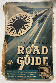
Book, Herald Touring Club (Victoria), The Herald road guide, 1950s
Map of southeastern Australia, Adelaide to Brisbane, showing roads and distances, with chief detail about Victoria. Includes strip maps, itinerary guides, and index. Issued by the Herald Touring Club, with new district and city maps surveyed by the Club.1 atlas (224 p.), 1 folded map : ill., maps ; non-fictionMap of southeastern Australia, Adelaide to Brisbane, showing roads and distances, with chief detail about Victoria. Includes strip maps, itinerary guides, and index. Issued by the Herald Touring Club, with new district and city maps surveyed by the Club.automobile travel, road maps, herald touring club -
 National Vietnam Veterans Museum (NVVM)
Map
A details map detailing Nui Dat. This map is a Special Edition 2map, nui dat -
 Stawell Historical Society Inc
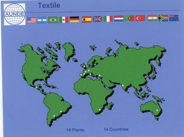
Photograph - Aunde Album 29, Textile Plants, 2002
Aunde / Norwellan Textiles North Western Woolen Mills became Norwellan Textiles then AUNDEColour landscape photo: Map of the world dots of locations and countries maps.Textile AUNDE logo 19 Plants, 14 Countries.industry, aunde -
 National Vietnam Veterans Museum (NVVM)
Map, Map of Area Surround Luscombe Airfield
Laminated map of military installations surrounding Luscombe Airfield. No identification of the map.luscombe field -
 Warrnambool RSL Sub Branch
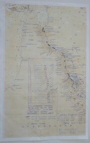
Map - 1947 Minesweeping map, North Queensland minesweeping map, unknown
1947 an after-effect od WW2Laminated A3 Map plus A4 map in pocket (copies of original)shows location of minefields to be cleared in 1947 and names of minesweeping ships!947 ran history -
Bendigo Historical Society Inc.
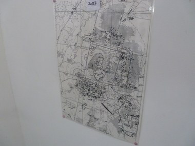
Map - CAMPBELL COLLECTION: BENDIGO AND DISTRICT MAPS
Map. Bendigo & District. The same as 10104.1. The map is in a very damaged condition.map, bendigo, allotments -
Bendigo Historical Society Inc.
Map - CAMPBELL COLLECTION: BENDIGO AND DISTRICT MAPS
Map. Sedgwick. Continuation of 10104.13. (number 360 in map cupboard 1)map, bendigo, agricultural lands -
 Bendigo Historical Society Inc.
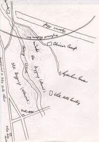
Document - CONSTABLE RYAN COLLECTION: HAND DRAWN MAP OF AREA OF CONSTABLE RYAN DISAPPEARANCE
An hand drawn map of the area of constable Ryan disappearance. The map is not to scale.document -
Bendigo Historical Society Inc.
Map - NERRING SHEET 2, 21/12/1894
Map[: Nerring sheet 2 ( number 187 in Map Cupboard 1)map, bendigo, parish plan, nerring