Showing 8334 items matching "bridging"
-
 Eltham District Historical Society Inc
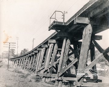
Photograph, George W. Bell, Trestle Bridge, Eltham, 1960c
Black and white photograph of Railway Bridge over Diamond Creek c.1960railways, bridges, eltham, diamond creek, george w bell collection -
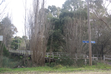
 Eltham District Historical Society Inc
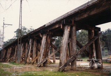
Photograph, Railway trestle bridge, Panther Parade, Eltham, July 1986, Jul-86
Two colour photographs of railway trestle bridge over Diamond Creek, Elthamrailways, diamond creek, panther place, bridges, eltham -
 Eltham District Historical Society Inc
Photograph, Mittons Bridge, 1972c
Black and white photograph of Mittons Bridge over Diamond Creek c.1972bridges, mittons bridges, diamond creek, st andrews -
 Eltham District Historical Society Inc
Photograph, Old Warrandyte Bridge
Postcard showing old timber trestle Warrandyte Bridge over Yarra Riverbridges, yarra river, warrandyte, kangaroo ground road -
 Eltham District Historical Society Inc
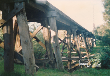
Photograph, Railway trestle bridge Eltham
Two colour photographs of railway trestle bridge over Diamond Creek, Elthambridges, railways, eltham, diamond creek, panther place -
 Ringwood and District Historical Society
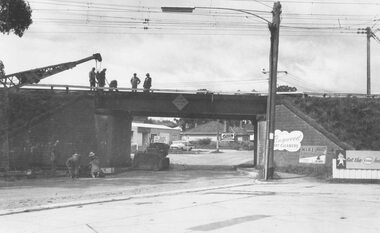
Photograph, Maroondah Highway West, Ringwood, 1965. Wantirna Road bridge
Written on rear of backing sheet: "Start of widening Wantirna Road bridge, 1965. -
 Ringwood and District Historical Society
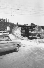
Photograph, Maroondah Highway West, Ringwood, 1965. Wantirna Road bridge
Typed below photograph, "Wantirna Road railway bridge. Widening underpass - 1965". -
 Glenelg Shire Council Cultural Collection
Photograph - Photograph - Bridge Construction, n.d
Port of Portland Authority Archivesport of portland archives -
Glenelg Shire Council Cultural Collection
Photograph - Photograph - Bridge Construction, 30/05/1957
Port of Portland Authority Archivesport of portland archives, garden st bridge -
 Bendigo Historical Society Inc.
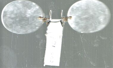
Accessory - PINZE NES GLASSES
Pair of pinces nez (glasses) with gold wire bridge with a label 'DI 462'.personal effects, seeing aids, pair of pinze nes glasses with gold wire bridge -
Port Melbourne Historical & Preservation Society
Photograph - Centenary Bridge, Port Melbourne, 1990
Part of Ron Laing's collection of photographs taken around Port Melbourne over a thirteen year period. Donated to the PMH&PS by the photographer.Set of five colour photographs of Centenary Bridge at Station Pier prior to demolition.centenary bridge, ron laing -
Port Melbourne Historical & Preservation Society
Photograph - Sewerage works, main drain, Bridge and Ross Streets, Port Melbourne, Jack Bolt, 2011
Colour photograph of sewerage works on main drain. Corner Bridge and Ross streetsutilities - sewerage, engineering - board of works, bridge street, ross street -
Port Melbourne Historical & Preservation Society
Newspaper - The Record, West Gate Bridge opening, 14 Nov 1978
Copy of "The Record" souvenir edition. Opening of the West Gate Bridge, November 1978built environment - civic, local government - city of port melbourne, west gate bridge, anna louise robieson, noel turnbull -
 Port Melbourne Historical & Preservation Society
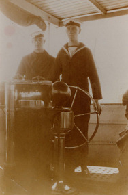
Photograph - Peter James and Bonnie on bridge of PS Weeroona, 1930s
Sepia photo of Peter James (on left) and Bonnie on the bridge of the P.S.Weeroona paddle steamer.transport - shipping, peter james, bonnie, ps weeroona -
Port Melbourne Historical & Preservation Society
Photograph - Station Street, looking south from Bridge Street, Port Melbourne, 1990s
Photograph of Station St looking south from Bridge St, late 1990sbuilt environment - domestic, parks and gardens, railway reserve -
Port Melbourne Historical & Preservation Society
Photograph - Former shop cnr Evans & Bridge Streets, David Thompson, Nov 2021
Two digital images of corner shop, Evans & Bridge Streets, Port Melbourne.built environment - commercial -
 Bendigo Historical Society Inc.
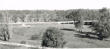
Photograph - 'MARYDALE' AXEDALE COLLECTION: PANORAMIC PHOTO
Panoramic photo of open land with road and bridge, taken from Ingham's Road.axedale, history, marydale property -
 Bendigo Historical Society Inc.
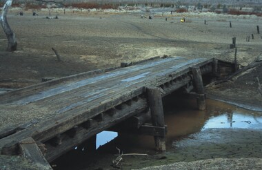
Slide - VAL DENSWORTH COLLECTION: DRY LAKE EPPALOCK, May 2004
Slide. Dry Lake Eppalock. A Small wooden bridge over the river in the Lake.slide, bendigo, dry lake eppalock., dry lake eppalock. -
 Bendigo Historical Society Inc.
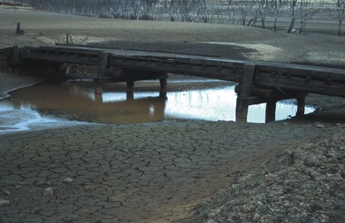
Slide - VAL DENSWORTH COLLECTION: DRY LAKE EPPALOCK, May 2004
Slide. Dry Lake Eppalock. A small bridge over the pool of water in the Lake.slide, bendigo, dry lake eppalock., dry lake eppalock. -
 Bendigo Historical Society Inc.
Slide - BENDIGO & DISTRICT P.O.I
Slide. Bendigo & District P.O.I. The Law Courts as seen from Bridge Street .slide, bendigo, bendigo & district p.o.i., bendigo & district p.o.i. -
 Clunes Museum
Photograph
PART OF CLUNES TOWNSHIP FROM CAMP PARADE.TOWNSHIP VIEW OF CLUNES, FROM LOWER FRASER STREET, TWO BRIDGES IN PICTURE.CLUNES FROM CAMP PARADE. CIRCA 1897local history, photography, photographs, clunes township -
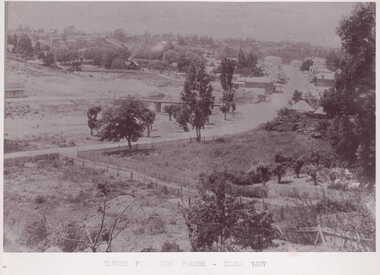
 Whitehorse Historical Society Inc.
Photograph, Deep Creek Road, 2001
Coloured Photo of Deep Creek Road, Mitcham, prior to clearing for erection of Bridge.deep creek road, mitcham. -
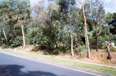
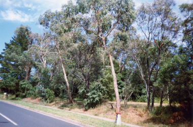 Whitehorse Historical Society Inc.
Photograph, Deep Creek Road, 2001
Coloured Photo of Deep Creek Road, Mitcham, prior to clearance for Bridge building.deep creek road, mitcham -
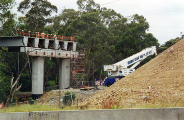 Whitehorse Historical Society Inc.
Photograph, Bridge Work - Deep Creek Road, 1/02/2002 12:00:00 AM
Coloured Photo of Work progressing on Bridge spanning Deep Creek Road, Mitcham.deep creek road, mitcham. -
 Whitehorse Historical Society Inc.
Photograph, Railway Bridge, 4/01/2001 12:00:00 AM
Black and white photograph of Railway Bridge, Cochrane Street and Brunswick Road, Mitcham.cochrane street, mitcham, brunswick road -
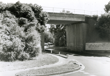
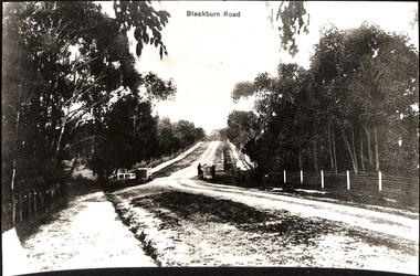 Whitehorse Historical Society Inc.
Photograph, Blackburn Road, Blackburn showing bridge
2 copies of black and white photo of Blackburn Road, Blackburn, showing bridge.road, blackburn road -
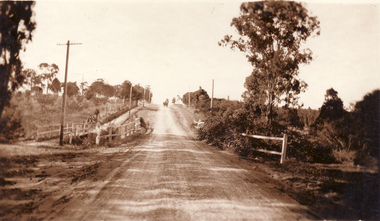 Whitehorse Historical Society Inc.
Photograph - Black and white photo, Bridge on Surrey Road, Blackburn
Black and white photo mounted on board showing Bridge on Surrey Road, Blackburn.surrey road, blackburn -
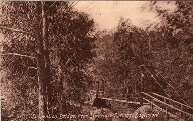 Ballarat Heritage Services
Photograph - Photograph - Black and White, Suspension Bridge, Near Tipperary Springs, Daylesford
Black and white postcard of the Suspensiopn Bridge near Tipperary Mineral Water Spring. mineral water, daylesford, central springs, tipperary spring, suspension bridge -
 Ballarat Heritage Services
Souvenir - Postcard Booklet Image, Suspension Bridge Over Doctors Gully from Photographic Booklet of Hepburn Springs, Vic, c1945
Hepburn Springs in a tourist town with natural mineral water springsA black and white photographic image of a suspension bridge over Doctors Gully, Hepburnhepburn springs, suspension bridge, doctors gully -
 Ballarat Heritage Services
Photograph - Colour, Bridge From Vaughan to Tarilta, 2017, 16/07/2017
Colour photograph of the bridge between Vaughan and Tarilta. It has been closed to traffic.vaughan, tarilta, bridge, river