Showing 11522 items matching "maps"
-
 Victorian Aboriginal Corporation for Languages
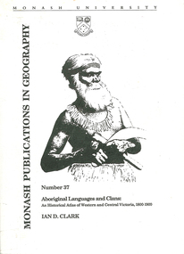
Book, Ian D Clark, Aboriginal languages and clans : an historical atlas of Western and Central Victoria, 1800-1900, 1990
Comprehensive coverage of language in the Western and Central Victorian areas, 1800-1900. Includes detailed language structures and historical details, Aboriginal Protectors and their work are included.maps, b&w illustrations, b&w photographsaboriginal clans, spatial and social organization, dhauwurd wurrung, gundijimara, djab wurrung, dja dja wurrung, djargurd wurrung, gadubanud, girai wurrung, gulidjan, jardwadjali, wada wurrung, wergaia -
 Victorian Aboriginal Corporation for Languages
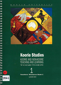
Book, Lynnette Dent, Koorie studies : Koorie and non-Koorie teaching and learning together : teachers resource book 1, 1993
Teachers? Resource Book produced for the Ganai language, with units of work, word lists, etc, includes Overview, The Dreaming, Social Organisation, Language and Food, Koories Today, Curriculum Areas, Excursions to Koorie sites, Resources.maps, b&w illustrations, b&w photographsgunai, ganai, kurnai gippsland, study and teaching, dreaming stories, koorie law, koorie culture, teaching resources -
 Victorian Aboriginal Corporation for Languages
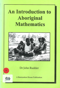
Book, John Rudder, An introduction to Aboriginal mathematics, 1999
Aboriginal mathematics tends to focus on the relationship of numbers rather than quantities. This book shows why numbers were irrelevant to Aborigines and outlines the kind of mathematics that was used.maps, b&w illustrations, b&w photographsnorth east arnhem land, turtle egg mathematics, aboriginal mathematics, aboriginal social life, measuring space, measuring time, flora, fauna -
 Victorian Aboriginal Corporation for Languages
Book, Richard Broome, Aboriginal people of Victoria, 1990
Booklet on Victorian Aboriginal culture and history.colour photographs, illustrations, b&w photographs, maps -
Victorian Aboriginal Corporation for Languages
Book, Richard Broome, Aboriginal people of Victoria, 2004
Booklet on Victorian Aboriginal culture and history.colour photographs, illustrations, b&w photographs, maps -
 Victorian Aboriginal Corporation for Languages
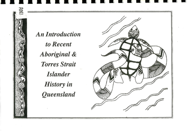
Book, Kerrie Kelly et al, An introduction to recent Aboriginal &? Torres Strait Islander history in Queensland, 1997
An introduction to Aboriginal and Torres Strait Islander history during the process of colonisation in Queensland.maps, b&w photographs, b&w illustrationsqueensland history, frontier conflict, racial segregation, assimilation policies, integration policies, racial legislation, self determination, phrenology, social darwinism, commonwealth policy -
 Victorian Aboriginal Corporation for Languages
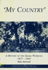
Book, Bain Attwood, 'My country' : a history of the Djadja Wurrung 1837-1864, 1999
A description of the invasion of Djadja Wurrung land in Central Victoria which began in the mid 1830s.maps, b&w illustrations, b&w photographsdjadja wurrung, dja dja wurrung, dja dja wrung aboriginal association, beembarmin, victorian pastoral leases, franklinford, fernihurst, edward parker, caroline morgan, thomas dunolly, cummeragunja, racial conflict, racism, victorian social history -
 Victorian Aboriginal Corporation for Languages
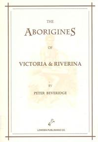
Book, Peter Beveridge et al, The Aborigines of Victoria and Riverina, 2008
The Beveridges pioneered the Swan Hill area on the Murray River and lived among the People of the Murray River. They learned the Aboriginal dialects, lore and customs. Peter Beveridge faithfully recorded these and his book was published posthumously by his family.maps, b&w illustrations, b&w photographsvictorian history, murray river -
 Victorian Aboriginal Corporation for Languages
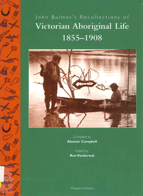
Book, Ron Vanderwal, John Bulmer's recollections of Victorian Aboriginal life, 1855-1908
John Bulmer spent forty years of his life as missionary to Aboriginal people in Victoria, in 1855 devoting his activities to communities on the Murray, but most of his life was spent at Lake Tyers where he established a Church of England mission in 1862, In his later years he wrote a series of thirteen papers in which he recorded his observations on the life and times of the people to whom he ministered. Over a period of several years Alistair Campbell transliterated the manuscripts, altering a little but retaining the flavour of the original text.maps, b&w photograph, word lists, tablesgunai kurnai, gippsland, lake tyers, lakes entrance, king charley, snowy river, ellen hood, sarah moffat, lance mcdougall, kassie mcdougall, tom foster, alec mccrae, nellie blair, john bulmer, victorian history, indigenous social life, kinship, religion and mythology, bush foods -
 Victorian Aboriginal Corporation for Languages
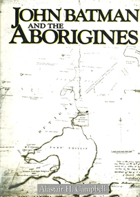
Book, Alastair H Campbell, John Batman and the Aborigines, 1987
A comprehensive account of John Batman's life. This is a broad social history of the life and contentions of the original Port Phillip settlement. It includes relations between the European colonists and the Aboriginal population. It shows how the initial Aboriginal policy lay the ground for the near genocide of Port Phillip's original inhabitants.maps, b&w illustrations, b&w photographsbunurong, boonwurrung, wathaurong, woiworung, woiwurrung, wurundjeri, wodewarrou, gerarlture, beingalite, you whamgete, you yangs, yarra river, kurung, john batman, port phillip bay, victorian history, victorian indigenous history, batman treaty -
 Victorian Aboriginal Corporation for Languages
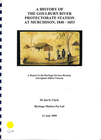
Book, Ian D Clark, A history of the Goulburn River Protectorate Station at Murchison, 1840-1853 : a report to the Heritage Services Branch, Aboriginal Affairs Victoria, 1999
Contains histories of the Aboriginal Protectors in the Goulburn River area and their work with the people in this region using journal entries and historical records.maps, b&w photograph, colour illustrations, tables -
Victorian Aboriginal Corporation for Languages
Book, C C Culvenor, The boundaries of the Mount Franklin Aboriginal Reserve, 1992
"This enquiry into the boundaries of the Mount Franklin Aboriginal Reserve had its origins in the preparation of a biography of geologist Thomas Smith of Sandon, which raised queries about Boundary Gully Road, Parkers Gully and the location in that vicinity of the Reserve boundary. At a subsequent meeting of the Daylesford Historical Society, commemorating the 150th anniversary of the founding of the Aboriginal Reserve at Franklinford in 1841, it became clear that the actual boundaries were only poorly known ... A search for information srouces in Melbourne and Sydney did not produce an overall Plan, but it is hoped that the material obtained will present a sufficiently accurate picture to be useful to other local historians and be of some interest also to the general reader" --Preface. Contents: The boundaries of the Mt. Franklin Aboriginal Reserve The five mile radius The Tarrengower challenge Provisional boundaries Survey of the Reserve Breakup of the Reserve References Appendices.maps, b&w illustrations, b&w photographsmount franklin -
Victorian Aboriginal Corporation for Languages
Book, George Mackaness, George Augustus Robinson's journey into South-Eastern Australia, 1844 with George Henry Haydon's narrative of part of the same journey, 1978
Looking at the journeys of George Augustus Robinson and George Henry Haydon into South-Eastern Australia.maps, b&w illustrations, b&w photographsgeorge augustus robinson -
 Victorian Aboriginal Corporation for Languages
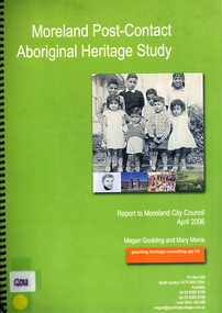
Book, Megan Goulding et al, Moreland post-contact Aboriginal heritage study, 2006
This study aims to identify Aboriginal heritage sites and landscape associations in the Moreland municipality that date from the pre-contact period through to the early contact period when Europeans settled in and around the area, to the present day.maps, colour photographs, b&w photographs, tableswoiworung, woi wurrung, wurundjeri, waa, bunjil, werribee river, port phillip, mount baw baw, great dividing range, yarra river, eastern kulin, gunung willam balluk, william barak, john batman, william thomas, moreland history, moieties, local history, colonisation -
 Victorian Aboriginal Corporation for Languages
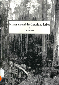
Book, P D Gardner, Names around the Gippsland Lakes : their origins, meanings and history, 1991
Gives descriptions of area, origin and meanings.Maps, b&w illustrations, b&w photographsgippsland, gunnai, kurnai, bairnsdale, wurruk, place names -
 Victorian Aboriginal Corporation for Languages
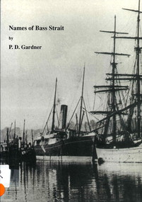
Book, P D Gardner, Names of Bass Strait : their origins, meanings and history, 1996
An examination of the origins of over 400 names in and around the Bass Strait, including Victorian areas from Cape Otway to Lakes Entrance and the north coast of Tasmania.Maps, b&w illustrations, b&w photographsbunerong, bass strait, tasmania, place names, bassian isthmus, king island, otway coast, port phillip bay, western port bay, wilsons promontory, cape barren island, flinders island, king island -
 Victorian Aboriginal Corporation for Languages
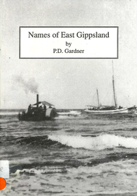
Book, P D Gardner, Names of East Gippsland : their origins, meanings and history, 1992
Detailed examination of the origins of local names from Mallacoota to Marlo and from Wingan Inlet to Willis. Includes explanations of the origins of major towns and their features.Maps, b&w illustrations, b&w photographskrauatungalung, gunnai, kurnai, bidawal, east gippsland, lake tyers, point hicks, -
 Victorian Aboriginal Corporation for Languages
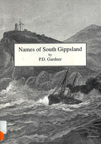
Book, P D Gardner, Names of South Gippsland : their origins, meanings and history, 1992
Provides an account of the origins and histories of local names in the South Gippsland region.Maps, b&w illustrations, b&w photographsbunerong, kulin, gunnai, kurnai, brataualung, seaspray, phillip island, mirboo, wilsons promontory, woodside, foster, inverloch, leongatha, wonthaggi -
 Victorian Aboriginal Corporation for Languages
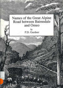
Book, P D Gardner, Names of the Great Alpine Road between Bairnsdale and Omeo : their origins, meanings and history, 1997
Lists the place names along the Victorian Alps, with descriptions and meanings.Maps, b&w illustrations, b&w photographsgunnai, kurnai, ngarigo, jaitmathang, brabiralung, tongiomunjie, tambo, tongio, bruthen, tambo, mount stringy, swifts creek -
 Victorian Aboriginal Corporation for Languages
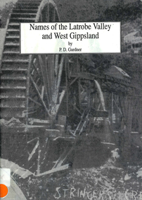
Book, P D Gardner, Names of the Latrobe Valley and West Gippsland : their origins, meanings and history, 1992
An account of the origins and histories of local names from Robin Hood to Kilmany, and from Mirboo North to Mt. Howitt.Maps, b&w illustrations, b&w photographsgunnai, kurnai, braiakaulung, bunerong, wurundjeri, kulin, coranderrk, warragul, morwell, rosedale, governor la trobe, drouin, noojee, darnum, walhalla, strzelecki, heyfield, gormandale -
 Victorian Aboriginal Corporation for Languages
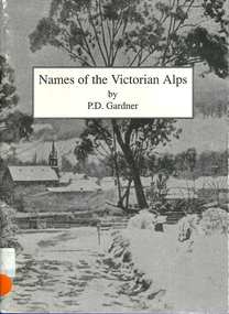
Book, P D Gardner, Names of the Victorian Alps : their origins, meanings and history, 1991
Gives a comprehensive account of the origins of local names in the area. Anecdotes of interesting pieces of history.Maps, b&w illustrations, b&w photographsjaitmathang, minjambuta, djilimatang, ngarigo, brabiralung, braiakaulung, yuin, gunnai, lake tyers, dargo river, omeo, bright, swifts creek, benambra, ovens valley, mount hotham, mount nugong, wonnangatta station -
 Victorian Aboriginal Corporation for Languages
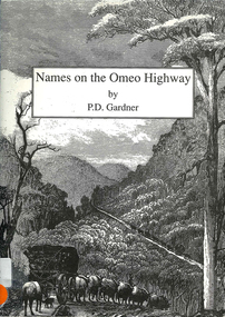
Book, P D Gardner, Names on the Omeo Highway between Bairnsdale and Omeo : their origins, meanings and history, 1992
An account of the origins and histories of local names between Bairnsdale and Omeo.Maps, b&w illustrations, b&w photographsgunnai, kurnai, brabiralung, jaitmathang, ngarigo, yuin, tongiomunjie, tongio gap, bruthen, tambo, hells gate, mount stringy, doctors flat -
 Victorian Aboriginal Corporation for Languages
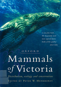
Book, Peter W Menkhorst, Mammals of Victoria : distribution, ecology and conservation, 1996
Arranged in family (type) groups with photos and detailed descriptions of each mammal.Maps, colour photographs, b&w photographs, graphsmammals, fauna, victoria -
 Victorian Aboriginal Corporation for Languages
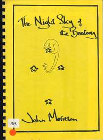
Book, John Morieson, The night sky of the Boorong
Based on historical notes of a variety of people, it explains the Night Skies of the Lake Tyrell area of Victoria and the mythology of the people regarding the legends of the skies.Maps, b&w illustrations, b&w photographsboorong, astronomy, ecological zodiac, william stanbridge, lake tyrell -
 Victorian Aboriginal Corporation for Languages
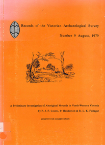
Book, PJF Coutts et al, Records of the Victorian Archaeological Survey : number 9, August 1979 : a preliminary investigation of Aboriginal mounds in North-Western Victoria, 1979
Maps, charts, graphs, b&w photographs, diagramsvictoria archaeological survey, murray valley, grampians -
 Victorian Aboriginal Corporation for Languages
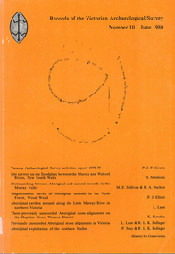
Book, Records of the Victorian Archaeological Survey : number 10, June 1980, 1980
Maps, charts, graphs, b&w photographs, diagrams -
 Ringwood and District Historical Society
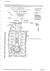
Document - Subdivision Plan, LP76792 Part of Crown Portions 19 & 20A, Parish of Ringwood, County of Bourke, Vol 8382 Fol 140 - 1967
LANDATA Land Victoria plan printout dated 2010Map includes Rupert Street and Prospect Court, Ringwood. -
 Eltham District Historical Society Inc
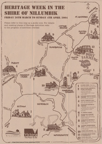
Booklet - Program, Shire of Nillumbik et al, Heritage Week in the Shire of Nillumbik, 2004
Map, with details of activitives presented by eight local history groups across the Shire of Nillumbik 26th March to Sunday 4th April 2004. Events included a dirt farming expo at Panton Hill. Program includes message by Mayor, Cr. Lex de Man and artwork by Syd Tunn. During the latter part of 2003 all of the historical societies and similar organisations in the Shire of Nillumbik attended a series of combined meetings arranged by Nillumbik Shire Council. The meetings were arranged by the Council's Arts and Cultural Services Co-ordinator and the Community Events Officer. ..The principal outcome of meetings ..to organise a Nillumbik Heritage Week to run from Friday 26th March to Sunday 4th April. The main event will be a combined heritage "expo" from 26th to 28th March, to be held in the Panton Hill Hall. The theme will be "Dirt Farming" which derives from the subsistence farming activities of the early settlers but could be widened to include gold mining, earth building and even modem day bushland regeneration. It fits well with the name "Nillumbik" which in the language of the Wurundjeri meant the not so good country covering most of our area and contrasted with the rich soil of the Kangaroo Grounds which they called Moor-rul. The following weekend each society will arrange their own separate activities. We intend to have open days at our Local History Centre on both days and this will include a display in the adjoining former Eltham Court House. We are also planning a heritage walk at 2.00pm on each day. Other groups will be having open days, displays, walks, guided car tours and other activities. - NL 154A3 sheet folded. Buff colour, with text and handrawn mapharry gilham collection, map, cultural heritage map, syd tunn, lex de man, eltham district historical society, nillumbik historical society, andrew ross museum, plenty historical society, st andrews queenstown historical society, warrandyte historical society, hurstbridge local history group -
 National Vietnam Veterans Museum (NVVM)
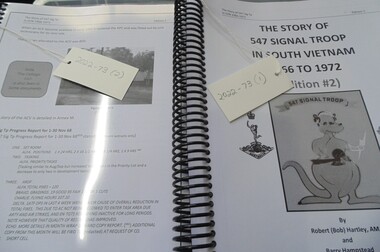
Booklet - Unit History, The Story of 547 Signal Troop/1966/1972/Edition #2
"The Story of 547 Signal Troop in South Vietnam 1966 to 1972", by Robert (Bob) Hartley, AM and Barry Hampstead. The manuscript tells the story of the unit, including its establishment, training, deployment, personnel, general life and operations while in Vietnam, the withdrawal, and return to Australia. It contains images, maps, operational information and first hand accounts of soldiers' experiences. This item contributes to an understanding of how Australia's involvement in the war in Vietnam (1962-1975) had a lasting impact on Australian servicemen.2 spiral- bound copies of booklet contains 691 pages of black and white writing, maps and photographs. Front page image is of a kangaroo holding lightning bolt with "Snoopy" in pouch. 547 signal, snoopy, robert hartley, signals, hartley -
 Warrnambool and District Historical Society Inc.
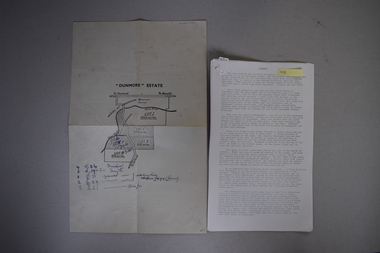
Map and Article, Dunmore, 1 1954 .2 1970
Both these items deal with the property of Dunmore, in the Macarthur/Hawkesdale/ Woolsthorpe area of Western Victoria. The first item is a sheet of paper with a map and details of the sale of portion of Dunmore in 1954. This is an original document. The second item is a history written by Stan Baulch of the property Dunmore from its establishment up to 1970. Dunmore was first established by Charles Hamilton MacKnight and two partners in 1842 and it was purchased by Samuel Baulch in 1893. After Samuel Baulch’s death the property was bequeathed to his three sons. One son, Stanley Baulch (1897-1980) took over the eastern portion which he named Rose Park. Stan Baulch was a member of the Warrnambool and District Historical Society and wrote several articles on aspects of his life and work, including this valuable article on the history of Dunmore. These items are of significance as they concern the estate of Dunmore in Western Victoria, an early and important property which is still farming land today under various owners. .1 This is a sheet of paper containing a map of the Dunmore property on one side and details of the sale of portion of Dunmore on the other side. The map has been annotated in handwritten black ink. The page has been folded twice. .2 This is an article typed on 12 foolscap pages. The typing is somewhat faint in places. ‘Dunmore’ Estate Dunmore baulch family, western district, victoria, dunmore estate, macarthur/hawkesdale, history of warrnambool