Showing 10954 items matching "land "
-
 Orbost & District Historical Society
book, Johnson, Brenda, The Orbost Story 1959 to 1966, after 2000
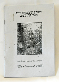
This story was written by Brenda Johnson and details her time in Orbost from 1959 -1966 settling on land at Lake Road in Newmerella.This book is a useful and interesting reference tool on life in Newmerella in the mid 20th century.A thin stapled paperback book of 31 pp. It is titled "The Orbost Story 1959 to 1966 Lake Road Newmerella Victoria". The cover is shiny silver with black print. In the centre is a black/white photograph of the block with numbers ( 2 3 ?) carved into a tree. There is a Land Rover in the background.Stapled inside back cover - "Bob Johnson" with telephone details and email address.newmerella-history johnson-brenda rural farming -
 Bendigo Historical Society Inc.
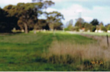
Photograph - CASTLEMAINE GAS COMPANY COLLECTION: PHOTO PADDOCK, 20/07/1999
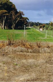
Photo of a paddock, a fence running on the right hand side. Date stamp at bottom left 20/07/1999. Location unknown.Kodakplace, land, paddock -
 Bendigo Historical Society Inc.
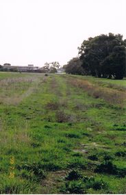
Photograph - CASTLEMAINE GAS COMPANY COLLECTION: PHOTO PADDOCK, 20/07/1999
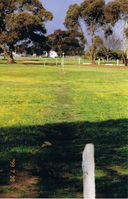
Photo of a paddock, trees in the background few amrking poles and a building. Date stamp at bottom left 20/07/1999Kodakplace, land, paddock -
 Bendigo Historical Society Inc.
Photograph - CASTLEMAINE GAS COMPANY COLLECTION: PHOTO PADDOCK, 20/07/1999
Photo of a paddock, sign ''Caution gas main'' at the centre, on the right hand side a road and on the left a fence and a power pole. Date stamp at bottom left 20/07/1999. location unknown.Kodakplace, land, paddock -
 Bendigo Historical Society Inc.
Photograph - CASTLEMAINE GAS COMPANY COLLECTION: PHOTO PADDOCK, 20/07/1999
Photo of a paddock. Date stamp at bottom right 20/07/1999. Location unknown.Kodakplace, land, paddock -
 Bendigo Historical Society Inc.
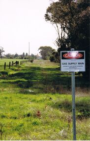
Photograph - CASTLEMAINE GAS COMPANY COLLECTION: PHOTO PADDOCK, 20/07/1999
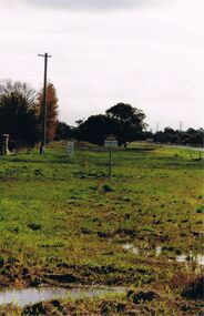
Photo of a paddock with a sign at right ''Caution Gas Supply Main'' date stamp at bottom left 20/07/1999. Location unknownKodakplace, land, paddock -
 Bendigo Historical Society Inc.
Photograph - CASTLEMAINE GAS COMPANY COLLECTION: PHOTO PADDOCK, 20/07/1999
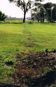
Photo of paddock with a trench line marked, a yellow and gray marker at the centre. Date stamp at bottom 20/07/1999. Location unknown.Kodakplace, land, paddock -
 Bendigo Historical Society Inc.
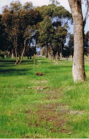
Photograph - CASTLEMAINE GAS COMPANY COLLECTION: PHOTO PADDOCK, 20/07/1999
Photo of a paddock, trees on the left, a building in the background left hand side. A date stamp in yellow at bottom left 20/07/1999Kodakplace, land, paddock -
 Bendigo Historical Society Inc.
Photograph - CASTLEMAINE GAS COMPANY COLLECTION: PHOTO PADDOCK, 20/07/1999
Photo of a paddock with what looks like the tracing of a trench. Trees in the background. At bottom left date stamp in yellow 20/07/1999. Location unknown.Kodakplace, land, paddock -
 Bendigo Historical Society Inc.
Photograph - BENDIGO: BIRDS EYE VIEW, late 1800's
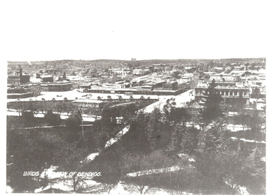
black and white copy: elevated view of Bendigo from Lower Pall Mall. Titled 'Birds eye view of Bendigo' on image. Treed area in foreground, townscape behind, ranges on skyline. In grey lead on back: view of Bendigo from Lower Pall Mallunknownplace, land, bendigo -
 Bendigo Historical Society Inc.
Painting - BARNADOWN WATERCOLOUR
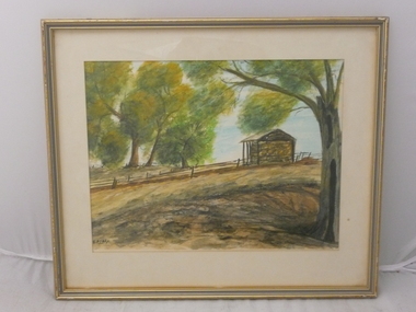
Watercolour - Along the River Bank by John.B.Perry showing open style hay shed, log rail fence & native australian trees. Markings: Along the River Bank. Campaspe river. Barnadown water colour by John. B.Perry.John.B.Perryplace, land, riverbank site -
 Bendigo Historical Society Inc.
Document - OLD TOM LEASE MAP
Hand Drawn map of Old Tom Lease - Parish of Huntly, County of Bendigo, Mining district of Sandhurst.place, land, mining -
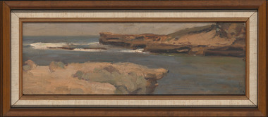 Latrobe Regional Gallery
MEYER, Mary. Born 1878. Died 1975, Seascape, Not dated
PaintingNot signed. Not dated.sea, land, seascape -
 Bendigo Historical Society Inc.
Administrative record - Order for surveys and reports 1926-1940
Green cover book with brown leather spine. Orders for surveys or reports, under the following headings: nature of instructions, correspondence number, when returned. amount of survey fee, by whom paid, date of account passed, remarks. The following surveyors are used: William Archdall, Castlemaine - Garnet G. Birch, Bendigo - J.H. Brown, St. Arnaud - A.A. Briggs. Echuca - A.D. Thomson, Mildura - Tom Lowndes, Kerang - R.A. Black, Nyah West.survey, land, government -
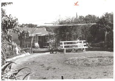 Bendigo Historical Society Inc.
Photograph - ARBOR: BACK YARD, 1960 's ?
BHS Collectionblack and white photograph. Back garden with arbor, seats, rock edging, houses at back, power pole with wires at back. Red crayon 'V' top centre.unknownplace, land, back yard -
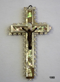 Bendigo Military Museum
Souvenir - CRUCIFIX, 1939-45
Souvenir from The Holy Land brought home by Eric L. BUGGE VX6316. Refer 181 for his service history.Wooden crucifix, brass figure of Christ glued on front. 4 pieces of laminated wood with decorative edging, decorative top layer of mother-of-pearl. Lower right-hand corner & edge missing. Hanger at top.Souvenir from the Holy Land. Brought home by Eric L. Bugge.Rear: "Jerusalem" 14 circles with strange hieroglyphics.religion-christian, souvenirs, handcrafts -
 Whitehorse Historical Society Inc.
Map, Nunawading. County of Bourke, 1878
Photocopy of map of Shire of Nunawading.Photocopy of map of Shire of Nunawading. Note: Fosters v President of the Shire of Nunawading. On Verso: Copied from the most up to date by the Dept of Lands, 1878. Laid before the Executive Council, 11 June 1878. Shows land holders.Photocopy of map of Shire of Nunawading.shire of nunawading, maps -
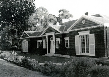 Whitehorse Historical Society Inc.
Photograph, Roger de Stoop
Roger de Stoop had the land cleared in 1952 and building started in 1953. He and his family moved in in 1954. The house has now been demolished but it was about 35 squares, was made of timber with blue slate roof, the slates having come from Belgium. Roger de Stoop had his outside timber walls painted in a dark colour.Black and white photocopy of house built by Roger de Stoop on land in Blackburn North (Henry Street - later 35 Middlefield Road). The house was called Middlefield House by local people.de stoop. roger. middlefield house -
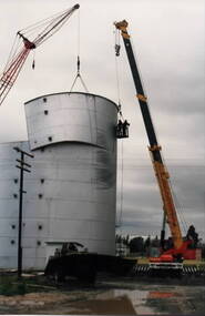 Sunbury Family History and Heritage Society Inc.
Photograph, Wheat silo, c1984
A wheat silo was erected on railway land adjacent to the Sunbury Station in 1967. Frank Millett handled the operations. As bulk handling was the preferred way to transport wheat, the silo gave local cereal growers to deliver their grain to the railhead. Over the years of the operation 200 grain wagons delivered wheat annually to the silo. In 1984 the silo was dismantled and removed.Cereal growing was one of the agricultural activities carried out in the Sunbury and surrounding areas for many years.A non-digital coloured photograph of a metal wheat silo being dismantled. A crane is beside the silo and two men are suspended from the crane in a basket to ensure that the sheets of iron land safely on the truck. wheat storage, silos, frank millett, cereal crops, sunbury railway station -
Linton and District Historical Society Inc
Certificate of Title, Certificate of Title: Allotment 36, Section 4, Township of Linton
Title of the land was transferred to James Adolphus Nelson and Theophilus William Nelson in 1955. James and Theo Nelson had already purchased adjacent allotments 27 - 30 in 1929.Copy of a Certificate of Title for an allotment of land situated between Grantley Street and Springdallah Creek in Linton. Copy comprised of three photostat sheets held together by tape. Most recent holders of the Title recorded as James Adolphus Nelson and Theophilus William Nelson.certificates of title, allotment 36 section 4 township of linton, james adolphus nelson, theophilus william nelson -
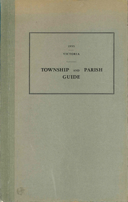 Victorian Aboriginal Corporation for Languages
Book, Department of Crown Lands and Survey Victoria, Township and parish guide : Victoria, 1955
A alphabetical list of townships proclaimed under the Land Acts of Victoria. Shows the parish, land district and the municipality in which each is situated, and the particulars of Gazettal of Proclamation.victorian geographical names, victorian administration -
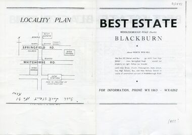 Whitehorse Historical Society Inc.
Document, Best Estate, n.d
sale of land at Best Estate, Blackburn North. Part of the original land holdings of R. de Stoop and R. Best of British Fur Co.Advertisement for sale of land at Best Estate, Blackburn North. Part of the original land holdings of R. de Stoop and R. Best of British Fur Co.sale of land at Best Estate, Blackburn North. Part of the original land holdings of R. de Stoop and R. Best of British Fur Co.land subdivision, best estate, blackburn north, chapman street, middleborough road, joseph street, nestor grove, vivian street, de stoop, roger, best, richard, british fur company -
 Whitehorse Historical Society Inc.
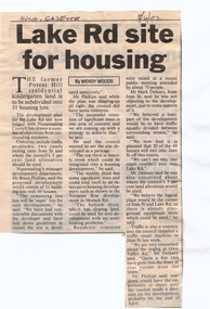
Article, Lake Rd Site for Housing, 8/04/1992 12:00:00 AM
Lake Rd Site for Housing.An article in the Nunawading Gazette on an objection by Mark Delaney on the traffic flow and hazards associated with the proposed development of land on the former Forest Hill Residential Kindergarten land.Lake Rd Site for Housing.land subdivision, forest hill residential kindergarten, lake road, forest hill, jean street, phillips, bruce, delaney, mark, glen valley road -
 Whitehorse Historical Society Inc.
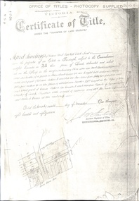
Document - Land Title, Certificate of Title, 29/11/1887
Photocopies of land titles involved in subdivision of land on the north-west corner of Whitehorse Road and Mitcham Road including Britannia Street. A list of purchasers is included.mitcham road, mitcham, whitehorse road, britannia street, rawlings, alfred, frost, john, richards, thomas, leech, george arthur, smith, reed, richard louis, young, frederick, hughes, doery, george henry, mitcham primary school, no. 2904, land subdivision -
Lakes Entrance Historical Society
Book, Morrissey, D.W and Morrissey E.W, Lakes Entrance a Short History revised Edition, 1980
History of Koorie inhabitants through to fishing industry, timber industry, early settlers and survey and sale of land. The opening of the entrance to allow shipping industry to operate bringing much trade and movement of primary produce etc. Local schoolHistory of Koorie inhabitants through to fishing industry, timber industry, early settlers and survey and sale of land. The opening of the entrance to allow shipping industry to operate bringing much trade and movement of primary produce etc. Local schoolMargaret Campbell''land settlement, religion, aboriginals -
 Bendigo Historical Society Inc.
Document - PETER ELLIS COLLECTION: INFORMATION ON THE BARFOLD GORGE
Foolscap page of information on the Barfold Gorge, by Frank Robbins. Barfold Gorge is compared with the Sydenham Organ Pipes National Park. There is a description of the Gorge. Native vegetation growing there is also mentioned. Turning it into a National Park is mentioned but it is in private ownership and this would require buy back of the land and create access problems as it is a farming area.place, land, barfold gorge, peter ellis collection, barfold gorge, sydenham organ pipes national park, campaspe river, mitchell's falls, queen's falls, piper's creek, turpin's falls, land conservation council, victoria conservation trust, frank robbins -
 Bendigo Military Museum
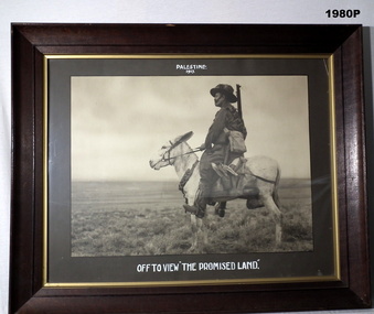
Photograph - PHOTOGRAPH WW1, FRAMED, c.1917
Heavy wooden frame, glass front, khaki coloured border, black & white photo of an Australian Light Horse Soldier on a donkey with a bandolier of extra ammunition around its neck.Top "Palestine 1917". Bottom, "Off to view the Promised land"photography-photographs, military history - army, palestine -
Coal Creek Community Park & Museum
Tin container, Stephen F. WHitman & Son Inc
Round tin with picture depicting city landscape.Whitman's Chocolates Land Sea and Air One Pound net....... -
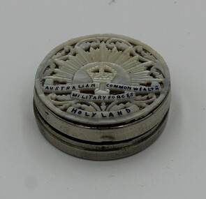 Charlton RSL Sub Branch
Souvenir - Souvenir ladies compact, Silver souvenir ladies compact/ utility box
Small silver souvenir ladies compact or utility boxAustralian Comm. Military Forces. "Made in Aden". Holy Land -
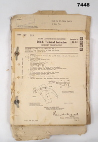 Bendigo Military Museum
Manual - ARMOURERS COURSE NOTES, Jun 1943
Items related to the A.A.O.C. Armoured Courses for "Sgt P.L.JAMES". Refer Cat No 7446 for his service details.Loose collection of various documents and instruction that are loosely termed D.M.E. Technical instructions are of various sizes but all are bound together with two metal studs,Headed "Allied Land Forces Headquarters" - "D.M.E. Technical Instructions"armoury course, a.a.o.c.