Showing 2318 items matching " infrastructure"
-
 Eltham District Historical Society Inc
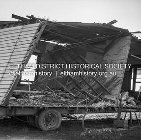
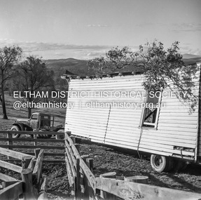
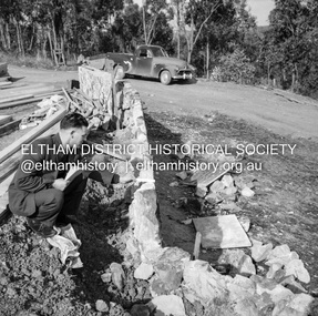
Negative - Photograph, J.A. McDonald, Removal of the remains of the Abraham house at Kangaroo Ground, c. May 1962
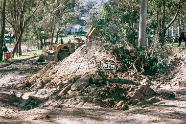
Martin Bros House Removing of Seaford was contracted to remove the remains of the storm damaged Abraham house from the property circa May 1962. The Abraham family owned land near the Aqueduct and east of Nicholas Lane at Kangaroo Ground (based on photos, at or near 40 Nicholas Lane).Record of various Shire of Eltham infrastructure works undertaken during the period of 1952-1962 involving bridge and road reconstruction projects, sometimes with Eltham Shire Council Project Reference numbers quoted. It was during this period that a number of significant improvements were made to roads and new bridges constructed within the shire that remain in place as of present day (2022). In many situations, the photos provide a tangible visible record of infrastructure that existed throughout the early days of the Shire. The album was put together by or under the direction of the Shire Engineer, J.A. McDonald.1962-05, abraham house, kangaroo ground, martin bros house removing seaford, nicholas lane, property damage -
 Eltham District Historical Society Inc
Negative - Photograph, J.A. McDonald, Removal of the remains of the Abraham house at Kangaroo Ground, c. May 1962
Martin Bros House Removing of Seaford was contracted to remove the remains of the storm damaged Abraham house from the property circa May 1962. The Abraham family owned land near the Aqueduct and east of Nicholas Lane at Kangaroo Ground (based on photos, at or near 40 Nicholas Lane).Record of various Shire of Eltham infrastructure works undertaken during the period of 1952-1962 involving bridge and road reconstruction projects, sometimes with Eltham Shire Council Project Reference numbers quoted. It was during this period that a number of significant improvements were made to roads and new bridges constructed within the shire that remain in place as of present day (2022). In many situations, the photos provide a tangible visible record of infrastructure that existed throughout the early days of the Shire. The album was put together by or under the direction of the Shire Engineer, J.A. McDonald.1962-05, abraham house, kangaroo ground, martin bros house removing seaford, nicholas lane, property damage -
 Eltham District Historical Society Inc
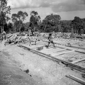
Negative - Photograph, J.A. McDonald, Building site inspection by Eltham Shire Council Building Surveyor, George Newton, c. July 1962
Record of various Shire of Eltham infrastructure works undertaken during the period of 1952-1962 involving bridge and road reconstruction projects, sometimes with Eltham Shire Council Project Reference numbers quoted. It was during this period that a number of significant improvements were made to roads and new bridges constructed within the shire that remain in place as of present day (2022). In many situations, the photos provide a tangible visible record of infrastructure that existed throughout the early days of the Shire. The album was put together by or under the direction of the Shire Engineer, J.A. McDonald.1962-07, building site, building surveyor, george e. newton, houses, eltham shire council -
 Eltham District Historical Society Inc
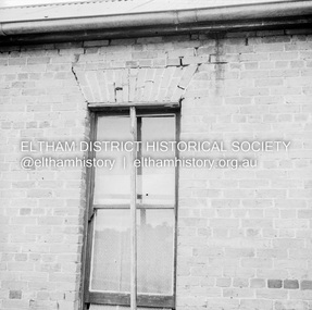
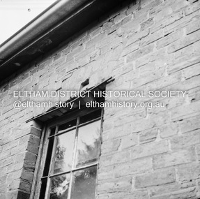
Negative - Photograph, J.A. McDonald, Old house, Susan Street, Eltham, c. 1962
Williams house, Susan StreetRecord of various Shire of Eltham infrastructure works undertaken during the period of 1952-1962 involving bridge and road reconstruction projects, sometimes with Eltham Shire Council Project Reference numbers quoted. It was during this period that a number of significant improvements were made to roads and new bridges constructed within the shire that remain in place as of present day (2022). In many situations, the photos provide a tangible visible record of infrastructure that existed throughout the early days of the Shire. The album was put together by or under the direction of the Shire Engineer, J.A. McDonald.eltham, houses, susan street, williams house -
 Eltham District Historical Society Inc
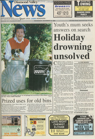
Newspaper - Newspaper article, Diamond Valley News, Prized uses for old bins, Diamond Valley News, December 14, p1, 1994
council amalgamation, shire of eltham, shire of montsalvat, shire of nillumbik, 1994, city of banyule, city of heidelberg, local government board, montsalvat, shire of diamond valley, garbage collection, shire of eltham infrastructure -
 Eltham District Historical Society Inc
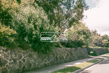
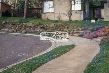
Photograph, Retaining wall with heavy planting, 25 Alma Street, Montmorency, 1 July 1972, 1972
Looking northeast across no. 25 to no. 2735mm colour positive transparency blue Agfacolour Service plastic mountalma street, houses, infrastructure, lower plenty, streets -
 Eltham District Historical Society Inc
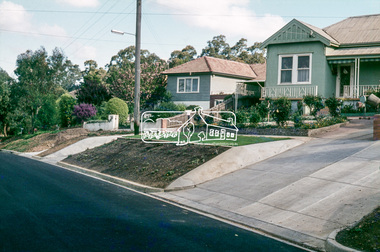
Photograph, Batter treatment, McFarlane Street, Montmorency, 1 July 1972, 1972
View looking at numbers 6 and 8 McFarlane Street35mm colour positive transparency blue Agfacolour Service plastic mounthouses, infrastructure, mcfarlane street, montmorency, streets -
 Eltham District Historical Society Inc
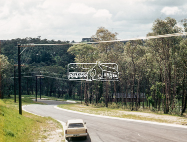
Photograph, Ancona Court, Eltham, 1 July 1972, 1972
Housing estate development prior to houses being constructed. New narrow road with roll over kerb treatment35mm colour positive transparency blue Agfacolour Service plastic mountancona court, eltham, infrastructure, streets -
 Eltham District Historical Society Inc
Photograph, Rockery and dry stone wall, 73 Fernside Avenue, Briar Hill, 1 July 1972, 1972
35mm colour positive transparency blue Agfacolour Service plastic mountbriar hill, fernside avenue, infrastructure, streets -
 Eltham District Historical Society Inc
Photograph, Stonewalls by owners of 63 and 65 Fernside Avenue, Briar Hill, 1 July 1972, 1972
35mm colour positive transparency blue Agfacolour Service plastic mountbriar hill, fernside avenue, infrastructure, streets -
 Eltham District Historical Society Inc
Photograph, Stone wall, Elsa Court, Eltham, 1 July 1972, 1972
35mm colour positive transparency blue Agfacolour Service plastic mounteltham, elas court, infrastructure, streets -
 Eltham District Historical Society Inc
Photograph, Trees on nature strip, Mayona Road, Montmorency, 1 July 1972, 1972
Montmorency Railway station behind the trees35mm colour positive transparency blue Agfacolour Service plastic mountinfrastructure, mayona road, montmorency, montmorency railway station, streets -
 Eltham District Historical Society Inc
Photograph, Batter treatment outside 2 Kent Court, Eltham, 1 July 1972, 1972
35mm colour positive transparency blue Agfacolour Service plastic mounteltham, infrastructure, kent court, streets -
 Eltham District Historical Society Inc
Photograph, Pinnarro Close, Hurstbridge, c. November 1980, 1980
35mm colour positive transparency Kodak Kodachrome cardboard mounthouses, hurstbridge, infrastructure, pinnarro close, properties, streets -
 Eltham District Historical Society Inc
Photograph, Coolaroo Avenue at intersection with Pinnarro Close, Hurstbridge, c.November 1980, 1980
35mm colour positive transparency Kodak Kodachrome cardboard mounthouses, hurstbridge, infrastructure, coolaroo avenue, properties, streets -
 Eltham District Historical Society Inc
Photograph, Coolaroo Avenue at intersection with Pinnarro Close, Hurstbridge, c.November 1980, 1980
No. 43 on right35mm colour positive transparency Kodak Kodachrome cardboard mounthouses, hurstbridge, infrastructure, coolaroo avenue, properties, streets -
 Eltham District Historical Society Inc
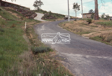
Photograph, Baldwin Avenue at Lilicur Road, Montmorency, c.1972, 1972c
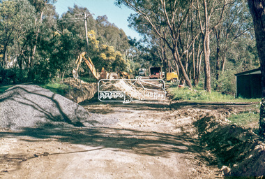
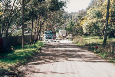
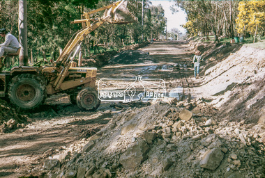
Shire of Eltham road construction and realignment works on Baldwin Avenue, Lilicur Road and Price Avenue, Montmorency, c.197235mm colour positive transparency blue Agfacolour Service plastic mountbaldwin avenue, infrastructure, lilicur road, montmorency, road construction -
 Eltham District Historical Society Inc
Photograph, Baldwin Avenue, Montmorency, c.1972, 1972c
Shire of Eltham road construction and realignment works on Baldwin Avenue, Lilicur Road and Price Avenue, Montmorency, c.197235mm colour positive transparency blue Agfacolour Service plastic mountbaldwin avenue, infrastructure, montmorency, road construction -
 Eltham District Historical Society Inc
Photograph, Baldwin Avenue, Montmorency, c.1972, 1972c
Shire of Eltham road construction and realignment works on Baldwin Avenue, Lilicur Road and Price Avenue, Montmorency, c.1972 Sherbourne Road in distance35mm colour positive transparency blue Agfacolour Service plastic mountbaldwin avenue, infrastructure, montmorency, road construction, sherbourne road -
 Eltham District Historical Society Inc
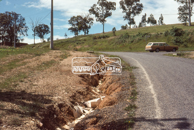
Photograph, Lilicur Road near Baldwin Avenue, Montmorency, c.1972, 1972c
Shire of Eltham road construction and realignment works on Baldwin Avenue, Lilicur Road and Price Avenue, Montmorency, c.197235mm colour positive transparency blue Agfacolour Service plastic mountbaldwin avenue, infrastructure, lilicur avenue, montmorency, road construction -
 Eltham District Historical Society Inc
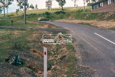
Photograph, Baldwin Avenue at Lilicur Road, Montmorency, c.1972, 1972c
Shire of Eltham road construction and realignment works on Baldwin Avenue, Lilicur Road and Price Avenue, Montmorency, c.1972 Cross Ref: EDHS_03867 (1972) EDHS_04005-10 (1980) EDHS_04774-1 (2019)35mm colour positive transparency blue Agfacolour Service plastic mountbaldwin avenue, infrastructure, lilicur road, montmorency, road construction -
 Eltham District Historical Society Inc
Photograph, Baldwin Avenue from Lilicur Road, Montmorency, c.1972, 1972c
Shire of Eltham road construction and realignment works on Baldwin Avenue, Lilicur Road and Price Avenue, Montmorency, c.1972 Sherbourne Road in distance Ref: EDHS_03875 (1972) and EDHS_04774-4 (2019) from opposite ends showing realignment of road at intersection of Sherbourne and the same Cypress tree35mm colour positive transparency blue Agfacolour Service plastic mountbaldwin avenue, infrastructure, lilicur road, montmorency, road construction, sherbourne road -
 Eltham District Historical Society Inc
Photograph, Baldwin Avenue at Sherbourne Road, Montmorency, c.1972, 1972c
Shire of Eltham road construction and realignment works on Baldwin Avenue, Lilicur Road and Price Avenue, Montmorency, c.1972 Cross Ref: EDHS_03878 (1972) EDHS_04005-9 (1980) EDHS_04774-2 and EDHS_04774-3 (2019)35mm colour positive transparency blue Agfacolour Service plastic mountbaldwin avenue, infrastructure, road construction, sherbourne road -
 Eltham District Historical Society Inc
Photograph, Baldwin Avenue from Mountain View Road, Montmorency, c.1972, 1972c
Shire of Eltham road construction and realignment works on Baldwin Avenue, Lilicur Road and Price Avenue, Montmorency, c.197235mm colour positive transparency blue Agfacolour Service plastic mountbaldwin avenue, infrastructure, mountain view road, road construction -
 Eltham District Historical Society Inc
Photograph - Colour Print, Scarlet Ash Court, Eltham, 15 October 1990, 15/10/1990
Colour photo print eltham, infrastructure, roadworks - gutters, scarlet ash court, shire of eltham, stokes orchard estate, streets -
 Eltham District Historical Society Inc
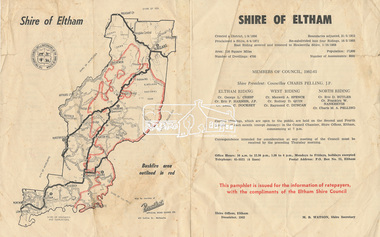
Pamphlet, Shire of Eltham, December 1962, 1962
Ratepayer information pamphlet issued by Eltham Shire Council. Gives details on shire boundaries and bushfire area, basic history, Councillors by Riding, meetings,office hours. Also information on the 1962 bushfires that raged throughout half the shire, 14-16 January 1962; local laws regarding dogs; Rates, Works Programme, Shire Offices and Town Planning The 1962 bushfire took two lives and caused damage to property approaching £1 million. Approximately 180 habitable dwellings were destroyed, hundreds of miles of fencing were burnt and thousands of acres of pasture lost.Colour bifold printed double sided (4 pages) councillors, dogs, eltham shire council, eltham shire office, infrastructure, rates, ridings, shire boundaries, shire of eltham, town planning, victorian bushfires - 1962, works programme