Showing 11527 items matching "maps"
-
 Federation University Historical Collection
Map, Map of Vitilevu showing vehicular roads, native tracks, villages, provinces, 1935
Printed map on paper backed onto linen with small inset maps of Nandi and Singatoka map, vitilevu, singatoka, nandi -
 City of Moorabbin Historical Society (Operating the Box Cottage Museum)
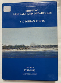
Book, Syme, Marten A, Shipping arrivals and departures, Victorian ports : Volume 1, 1798-1845, 1984
"This book is dedicated to the seamen who supplied the physical link for trade and immigration in the development of the Colony".3 v. : ill., charts, map Maps on lining papers. Includes bibliography and index.non-fiction"This book is dedicated to the seamen who supplied the physical link for trade and immigration in the development of the Colony".ship register, seamen, immigration -
Bendigo Historical Society Inc.
Map - JANIEMBER WEST, 18/02/1913
Map: Parish of Janiember West, County of Bendigo ( number 140 in Map Cupboard 1)map, bendigo, rural, janiember west , county of bendigo -
Bendigo Historical Society Inc.
Map - NERRING, August 1952
Map: Nerring, County of Bendigo. Parish plan ( number 180 in Map Cupboard 1)map, bendigo, parish plan, nerring, county of bendigo -
Bendigo Historical Society Inc.
Map - HAWKESTONE, 17/11/1915
Map: Hawkestone, County of Talbot. Parish plan ( number 178 in Map Cupboard 1)map, talbot, parish plan, hawkestone, county of talbot -
Bendigo Historical Society Inc.
Map - HARCOURT, September 1951
Map: Harcourt, County of Talbot. Parish plan ( number 177 in Map Cupboard 1)map, talbot, parish plan, harcourt, county of talbot -
Bendigo Historical Society Inc.
Map - KIMBOLTON, No date Visible
Map: Kimbolton, County of Bendigo. Parish plan ( number 172 in Map Cupboard 1)map, bendigo, parish plan, kimbolton -
Bendigo Historical Society Inc.
Map - WHIRRAKEE, 1971
Map: Whirrakee, County of Bendigo. Parish plan ( number 171 in Map Cupboard 1)map, bendigo, parish plan, whirrakee -
Bendigo Historical Society Inc.
Map - EPPALOCK, 15/11/1928
Map: Eppalock, County of Bendigo. Parish plan ( number 170 in Map Cupboard 1)map, bendigo, parish plan, eppalock -
Bendigo Historical Society Inc.
Map - EGERTON, 1/03/1890
Map: Egerton, County of Bendigo. Parish plan ( number 169 in Map Cupboard 1)map, bendigo, parish plan, egerton -
Bendigo Historical Society Inc.
Map - HUNTLY, August 1945
Map: Huntly, County of Bendigo, Parish plan ( number 168 in Map Cupboard 1)map, bendigo, parish plan, huntly, county of bendigo -
Bendigo Historical Society Inc.
Map - BAGSHOT, November 1948
Map: Bagshot, County of Bendigo. Parish plan ( number 167 in Map Cupboard 1)map, bendigo, parish plan, bagshot, county of bendigo -
Bendigo Historical Society Inc.
Map - LYELL, 16/04/1935
Map: Lyell, County of Bendigo. Parish plan ( number 166 in Map Cupboard 1)map, bendigo, parish plan, lyell, county of bendigo -
Bendigo Historical Society Inc.
Map - MARONG, June 1953
Map: Marong, County of Bendigo. Parish plan ( number 164 in Map Cupboard 1)map, bendigo, parish plan, marong, county of bendigo -
Bendigo Historical Society Inc.
Map - DARGILE, November 1953
Map: Dargile, County of Rodney. Parish plan ( number 162 in Map Cupboard 1)map, rodney, parish plan, dargile , county of rodney -
Bendigo Historical Society Inc.
Map - BENDIGO SHEET 5, May 1949
Map: Bendigo sheet 5 . Parish plan ( number 209 in Map Cupboard 1)map, bendigo, parish plan, bendigo -
Bendigo Historical Society Inc.
Map - BENDIGO SHEET 7, May 1949
Map: Bendigo sheet 7. Parish plan. ( number 208 in Map Cupboard 1)map, bendigo, parish plan, bendigo -
Bendigo Historical Society Inc.
Map - BENDIGO SHEET 7, 1949 ?
Map: Bendigo sheet 7. Parish plan ( number 207 in Map Cupboard 1)map, bendigo, parish plan, bendigo sheet 7 -
Bendigo Historical Society Inc.
Map - SANDHURST SHEET 3, 27/05/1925
Map: sandhurst sheet 3. Parish plan ( number 202 in Map Cupboard 1)map, bendigo, parish plan, sandhurst -
Bendigo Historical Society Inc.
Map - SANDHURST SHEET 3, No date visible
Map: Sandhurst sheet 3. Parish plan ( number 199 in Map Cupboard 1)map, bendigo, city streets, sandhurst -
Bendigo Historical Society Inc.
Map - SANDHURST SHEET 4, January 1947
Map: Sandhurst sheet 4. Parish plan ( number 198 in Map Cupboard 1)map, bendigo, city streets, sandhurst -
Bendigo Historical Society Inc.
Map - SANDHURST SHEET 5, Circa 1940's
Map: Sandhurst sheet 5. Parish plan ( number 197 in Map Cupboard 1)map, bendigo, city streets, sandhurst -
Bendigo Historical Society Inc.
Map - SANDHURST SHEET 6, 1947
Map: Sandhurst sheet 6. Parish plan ( number 196 in Map Cupboard 1)map, bendigo, city streets, sandhurst -
Bendigo Historical Society Inc.
Map - NERRING SHEET 4, Circa 1890's
Map: Nerring (part 4) . Parish plan ( number 189 in Map Cupboard 1)map, bendigo, parish plan, nerring -
Bendigo Historical Society Inc.
Map - CROSBIE, 26/09/1878
Map: Crosbie, County of Rodney. Parish plan (number 260 in map cupboard 1)map, rodney, parish plan, crosbie, county of rodney -
Bendigo Historical Society Inc.
Map - WHIRRAKEE, No date visible
Map: Whirrakee, County of Bendigo. Parish plan (number 258 in map cupboard 1)map, bendigo, parish plan, whirrakee -
Bendigo Historical Society Inc.
Map - ELLESMERE, Circa 1878
Map: Ellesmere, County of Bendigo. Parish plan (number 255 in map cupboard 1)map, bendigo, parish plan, ellesmere -
Bendigo Historical Society Inc.
Map - MUSKERRY, 23/01/1888
Map: Muskerry , County of Rodney. Parish plan. ( number 251 in Map Cupboard 1)map, rodney, parish plan, muskerry -
Bendigo Historical Society Inc.
Map - MUSKERRY, 23/01/1888
Map: Muskerry, County of Bendigo. Parish plan ( number 250 in Map Cupboard 1)map, bendigo, parish plan, muskerry -
Bendigo Historical Society Inc.
Map - NOLAN, 5/03/1888
Map: Nolan, County of Bendigo. Parish plan ( number 249 in Map Cupboard 1)map, bendigo, parish plan, nolan