Showing 24970 items matching " north"
-
 Ringwood and District Historical Society
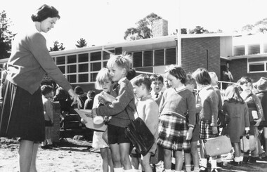
Photograph, Opening day at Ringwood Heights Primary School, Summit Cres, Ringwood North - 1966
Written on back of photograph, "Opening day, Loughnan Hill State School". (no date). -
 Ringwood and District Historical Society
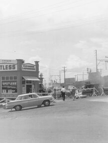
Photograph, Maroondah Highway East, Ringwood- 1964. Water main repair work on the north-east corner of Maroondah Hwy and Warrandyte Road
Black and white photographWritten on back of photograph: "New water main, corner Warrandyte Rd. and Maroondah Highway. 1964." Building on corner occupied by 'Spotless Cleaners & Launderers'. -
 Ringwood and District Historical Society
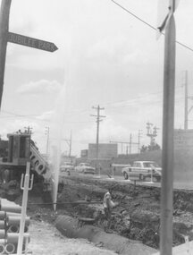
Photograph, Maroondah Highway East, Ringwood- 1964. Water main repair work on the north-east corner of Maroondah Hwy and Warrandyte Road
Black and white photographWritten on back of photograph: "Corner Maroondah Highway and Warrandyte Rd. Water main repair work,1964". -
 Ringwood and District Historical Society
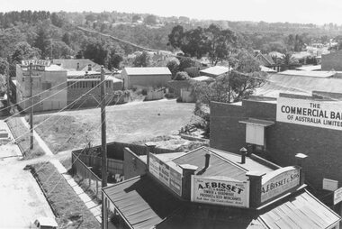
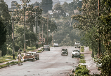
Photograph, Maroondah Highway East, Ringwood- 1960. North-easterly view from Ringwood Clocktower, cnr Maroondah Hwy and Warrandyte Road
Black and white photographWritten on back of photograph: "View from clocktower, 1960". -
 Ringwood and District Historical Society
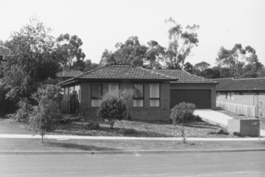
Photograph, No. 92 Kubis Drive, North Ringwood
Written on back of photograph, "No. 92 Kubis Drive." -
 Ringwood and District Historical Society
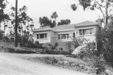
Photograph, No 12 Glenvale Road, North Ringwood. 1964, 1964
House in Glenvale Road (2 views). See also #2936-2939 for views of Glenvale Road taken at the same time.Written on back of photographs, "1964 - 12 Glenvale Road. Original supplied by Garrett Gundry." (2 views) -
 Ringwood and District Historical Society
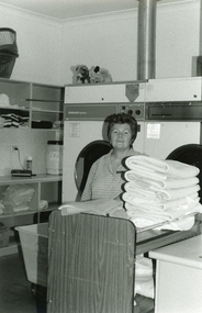
Photograph, Staff at Gracedale Nursing Home in Warrandyte Road, North Ringwood
Hella Hebblethwaite on the staff (59_1.jpg) Edith Elliott, resident at Gracedale (59_2.jpg) Lucy Young and Holly Arnold-Lester on the staff (59_3.jpg) -
 Ringwood and District Historical Society
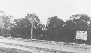
Photograph, Trees lining north side of Maroondah Highway between New Street and Ringwood Street, Ringwood - 1926. Auction Sale sign is shown on the eventual Holeproof factory site, later street numbered around 103 Maroondah Highway, Ringwood
Catalogue card reads, "Public Auction 1926. Saturday 29th May 1926. Holeproof factory once stood on this site. Billy Guyatt's discount store now occupies the site. (3 copies)". -
 Ringwood and District Historical Society
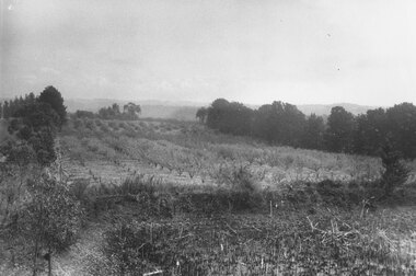
Photograph, Godbehear's orchard in Warrandyte Road North Ringwood, prior to subdivision. (undated)
Typed below photograph, "Godbehear's orchard prior to subdivision". -
 Ringwood and District Historical Society
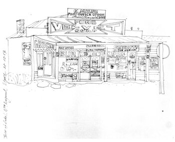
Photograph, Hand drawn picture by Eric Thake dated 1954 depicting Milne's Post Office and Store on the south-east corner of Oban Road and Warrandyte Road, North Ringwood
Typed below picture, "Mr. K. Milnes store. Corner Oban Rd. and Warrandyte Rd. 1954. Now demolished". -
 Ringwood and District Historical Society
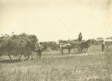
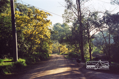
Photograph, Hay carts - "Quamby" North Ringwood 1910
Black and white photographWritten on back of photograph, "Quamby" Nth. Rwd. 1910. "R.F.M. Photo" handwritten on frontagriculture -
 Eltham District Historical Society Inc
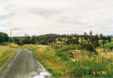
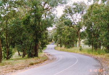
Photograph, Looking north along Ness Lane, Kangaroo Ground, 6 December 1992, 06/12/1992
The Eltham Horse Trail: Research and Warrandyte to Kinglake: Survey of proposed route, December 1992: (1) Research to Kangaroo GroundColour photographeltham horse trail (1992 survey), kangaroo ground, ness lane -
 Eltham District Historical Society Inc
Photograph, Looking north along Menzies Road, Kangaroo Ground, 6 December 1992, 06/12/1992
The Eltham Horse Trail: Research and Warrandyte to Kinglake: Survey of proposed route, December 1992: (2) Warrandyte to Kangaroo GroundColour photographeltham horse trail (1992 survey), kangaroo ground, menzies road -
 Eltham District Historical Society Inc
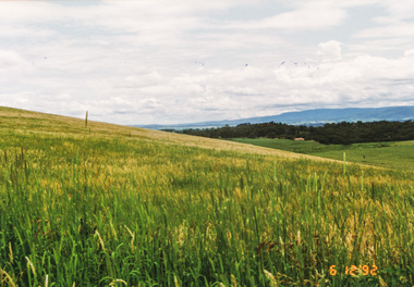
Photograph, Looking north from Eltham-Yarra Glen Road, Kangaroo Ground, 6 December 1992, 06/12/1992
The Eltham Horse Trail: Research and Warrandyte to Kinglake: Survey of proposed route, December 1992: (2) Warrandyte to Kangaroo Ground, trail route to be determined (1992)Four colour photographseltham horse trail (1992 survey), kangaroo ground, eltham-yarra glen road -
 Eltham District Historical Society Inc
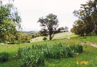
Photograph, Route north to Dawson Road near Kangaroo Ground Cemetery, 6 December 1992, 06/12/1992
The Eltham Horse Trail: Research and Warrandyte to Kinglake: Survey of proposed route, December 1992: (2) Warrandyte to Kangaroo GroundColour photographeltham horse trail (1992 survey), kangaroo ground cemetery, dawson road -
 Eltham District Historical Society Inc
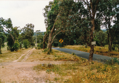
Photograph, Ingrams Road looking north to Allendale Road, Research, 19 December 1992, 19/12/1992
The Eltham Horse Trail: Research and Warrandyte to Kinglake: Survey of proposed route, December 1992: (4) Connecting trail to ElthamColour photographeltham horse trail (1992 survey), allendale road, ingrams road, research (vic.) -
 Eltham District Historical Society Inc
Photograph, Main Road looking north at Antoinette Boulevard Eltham, c.May 2001
Roll of 35mm colour negative film, 7 stripsAgfa HDC 200 plus-2eltham, streets, main road, antoinette boulevard -
 Eltham District Historical Society Inc
Photograph, Looking north up Para Road at intersection of Alma Street and Lees Road, Lower Plenty, c.July 1967, 1967
Packaged in "Filmpro King Size prints Definitely Better EST. 1918" envelope. Pencil notes: 36 shots $2.87 Eltham Shire J. McD and 19/7/67. Alma Street and Kett Street Lower Plenty c.July 1967.Black and white photographalma street, lower plenty, para road, houses, streets, lees road -
 Eltham District Historical Society Inc
Photograph, Looking north along Kett Street from near the intersection with Main Road, Lower Plenty, c.July 1967, 1967
Packaged in "Filmpro King Size prints Definitely Better EST. 1918" envelope. Pencil notes: 36 shots $2.87 Eltham Shire J. McD and 19/7/67. Alma Street and Kett Street Lower Plenty c.July 1967.Black and white photographlower plenty, houses, streets, kett street, main road -
 Eltham District Historical Society Inc
Negative - Photograph, Looking south along Ryans Road towards intersection with Kerrie Crescent, Eltham North, c.1998
Taken from opposite intersection with Elm CrescentRoll of 35mm colour negative film, 8 strips and associated 10 x 15 cm colour printKodak Gold 100-5elm crescent, eltham north, kerrie crescent, ryans road, streets -
 Eltham District Historical Society Inc
Negative - Photograph, Probably Jessica's Lane taken from Progress Road, Eltham North, 1998c
Roll of 35mm colour negative film, 8 strips and associated 10 x 15 cm colour printKodak Gold 100-5eltham north, jessica's lane, progress road -
 Eltham District Historical Society Inc
Negative - Photograph, Probably Jessica's Lane, Eltham North, 1998c
Roll of 35mm colour negative film, 8 strips and associated 10 x 15 cm colour printKodak Gold 100-5eltham north, jessica's lane -
 Eltham District Historical Society Inc
Negative - Photograph, Probably Jessica's Lane, Eltham North, 1998c
Roll of 35mm colour negative film, 8 strips and associated 10 x 15 cm colour printKodak Gold 100-5eltham north, jessica's lane -
 Eltham District Historical Society Inc
Negative - Photograph, Rear of Eltham North Hall, 1998c
Roll of 35mm colour negative film, 8 strips and associated 10 x 15 cm colour printKodak Gold 100-5eltham north, eltham north hall -
 Eltham District Historical Society Inc
Photograph, Looking north along Peter Street, Eltham, c.July 1998, 1998
Roll of 35mm colour negative film, 7 stripsKodak Gold 200-6peter street, eltham -
 Eltham District Historical Society Inc
Photograph, Looking north along Peter Street, Eltham, c.July 1998, 1998
Roll of 35mm colour negative film, 7 stripsKodak Gold 200-6peter street, eltham -
 Eltham District Historical Society Inc
Photograph, Fred Mitchell, Looking north along Bible Street approaching the intersection with Arthur Street, Eltham, 1967, 1967
Digital copy of colour photographfred mitchell collection, 1967, arthur street, bible street, streets -
 Eltham District Historical Society Inc
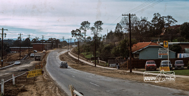
Photograph, Fred Mitchell, Main Road duplication just north of Bridge Street, Eltham, 1968, 1968
Shows the Eltham Shire Office, A.R. Warren's Fuel merchant business, and the new section of Main Road which was to become the northbound lanes.Digital copy of colour photographfred mitchell collection, 1968, eltham, eltham shire office, main road, road construction, duplication, fuel merchant, a.r. warren -
 Eltham District Historical Society Inc
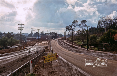
Photograph, Fred Mitchell, Main Road duplication just north of Bridge Street, Eltham, 1968, 1968
Shows the Eltham Shire Office, the construction of Panther Place and the new section of Main Road which was to become the northbound lanes.Digital copy of colour photographfred mitchell collection, 1968, eltham, eltham shire office, main road, road construction, duplication -
 Eltham District Historical Society Inc
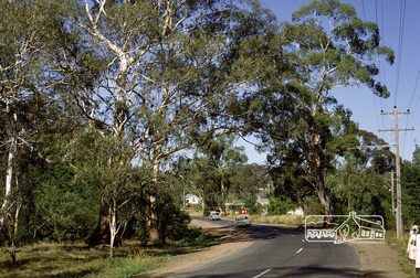
Photograph, Fred Mitchell, Heading north along Main Road approaching intersection with Mount Pleasant Road, Eltham, 1968, 1968
Wingrove Cottage visible in distance.Digital copy of colour photographfred mitchell collection, 1968, main road, wingrove cottage