Showing 8790 items matching "lower plenty road lower plenty"
-
 Greensborough Historical Society
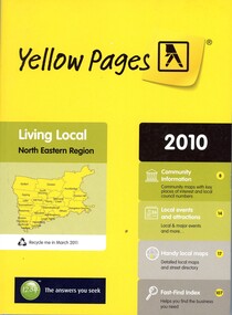
Book - Directory, Telstra Corporation Limited, Yellow Pages: Living local North Eastern Region 2010, 2010
... Greensborough Historical Society 34A Glenauburn Road Lower ...Yellow Pages is a listing of businesses and organisations and their telephone numbers and addresses within the north eastern region of Melbourne432 p black print on white and yellow paper, paperback, includes UBD Street maps and street indextelephone directories, north east melbourne -
 Greensborough Historical Society
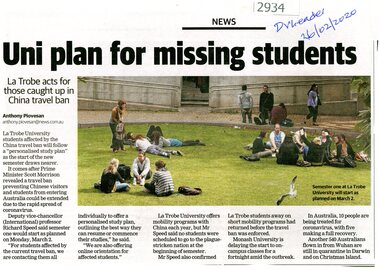
Article - Newspaper Clipping, Anthony Piovesan, Uni plan for missing students, 26/02/2020
... Greensborough Historical Society 34A Glenauburn Road Lower ...Means of providing study plans for Chinese students unable to enter Australia owing to coronavirus restrictions are being provided by La Trobe UniversityNewspaper clipping, text with colour photograph, by Anthony Piovesanla trobe university, international students, covid pandemic -
 Greensborough Historical Society
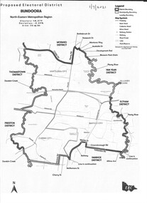
Map - Map (Copy), Electoral Boundaries Commission, Proposed electoral district: Bundoora, 01/07/2021
... Greensborough Historical Society 34A Glenauburn Road Lower ...Proposed revised electoral boundaries for the electoral district of Bundoora (North-Eastern Metropolitan Region) as at 01/07/20211p. black and white copy of mapelectoral boundaries, bundoora - maps, victoria - parliament -
 Greensborough Historical Society
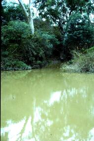
Slide - Photograph, John Ramsdale, Plenty River with European trees: Slide 27, 1990s
... Greensborough Historical Society 34A Glenauburn Road Lower ...Photograph shows the Plenty River at Greensborough with European trees on the bank.Part of the John Ramsdale collection of slides and audio visual material.Colour photograph scanned from slide.No caption. Printed maker's mark on slide "Kodak Kodachrome Slide"plenty river, vegetation -
 Greensborough Historical Society
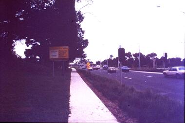
Slide - Photograph, John Ramsdale, Plenty Road near Parade College: Slide 29, 1990s
... Plenty Lower Plenty melbourne Photograph shows a 3-lane road ...Photograph shows a 3-lane road with "Federally funded" sign This is Plenty Road Bundoora, near Parade college.Part of the John Ramsdale collection of slides and audio visual material.Colour photograph scanned from slide.No caption. Printed maker's mark on slide "Kodak Kodachrome Slide"plenty road bundoora, parade college -
 Greensborough Historical Society
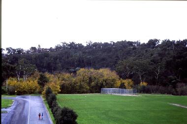
Slide - Photograph, John Ramsdale, Looking from Kalparrin to Partington's Flat: Slide 34, 1990s
... Greensborough Historical Society 34A Glenauburn Road Lower ...Photograph shows a sports ground with cricket nets. Looking toward Partington Flat from Kalparrin.Part of the John Ramsdale collection of slides and audio visual material.Colour photograph scanned from slide.No caption. Printed maker's mark on slide "Kodak Kodachrome Slide"partingtons flat, cricket, public reserves -
 Greensborough Historical Society
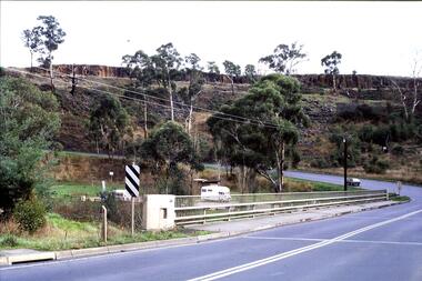
Slide - Photograph, John Ramsdale, Middle Gorge Park on Gorge Road: Slide 41, 1990s
... Greensborough Historical Society 34A Glenauburn Road Lower ...Photograph shows a bridge with van, road is on steep hill. This is the carpark at Middle Gorge Park on Kurrak Road Yarrambat.Part of the John Ramsdale collection of slides and audio visual material.Colour photograph scanned from slide.No caption. Printed maker's mark on slide "Kodak Kodachrome Slide"middle gorge park, kurrak road yarrambat, plenty gorge metropolitan park -
 Greensborough Historical Society
Slide - Photograph, John Ramsdale, Plenty River, upstream from Gorge: Slide 42, 1990s
... Greensborough Historical Society 34A Glenauburn Road Lower ...Photograph shows creek bed with vegetation, upstream from Plenty Gorge.Part of the John Ramsdale collection of slides and audio visual material.Colour photograph scanned from slide.No caption. Printed maker's mark on slide "Kodak Kodachrome Slide"plenty gorge, plenty river, mernda -
 Greensborough Historical Society
Slide - Photograph, John Ramsdale, Near scar tree Yallambie: Slide 48, 1990s
... Greensborough Historical Society 34A Glenauburn Road Lower ...Photograph shows rural view with cattle and trees. This is the scar or canoe tree in Yallambie. Part of the John Ramsdale collection of slides and audio visual material.Colour photograph scanned from slide.No caption. Printed maker's mark on slide "Kodak Kodachrome Slide"scar tree, canoe tree, yallambie -
 Greensborough Historical Society
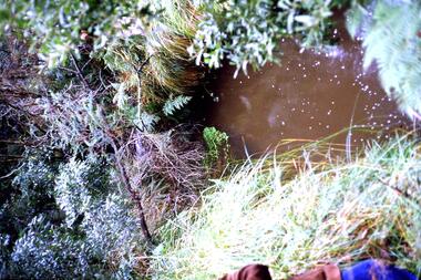
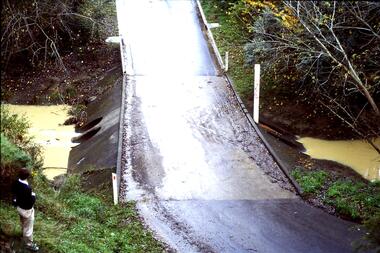
Slide - Photograph, John Ramsdale, Run off into Plenty River: Slide 64, 1990s
... Greensborough Historical Society 34A Glenauburn Road Lower ...Photograph shows water over ground. This is run off into the Plenty RiverPart of the John Ramsdale collection of slides and audio visual material.Colour photograph scanned from slide.No caption. Printed maker's mark on slide "Kodak Kodachrome Slide"plenty river -
 Greensborough Historical Society
Slide - Photograph, John Ramsdale, Ford over Plenty River to Partington's Flat: Slide 72, 1990s
... Plenty Lower Plenty melbourne Photograph shows road or path over ...Photograph shows road or path over culvert. This is the ford over Plenty River to Partington's FlatPart of the John Ramsdale collection of slides and audio visual material.Colour photograph scanned from slide.No caption. Printed maker's mark on slide "Kodak Kodachrome Slide"ford over plenty river, plenty river, partington's flat -
 Greensborough Historical Society
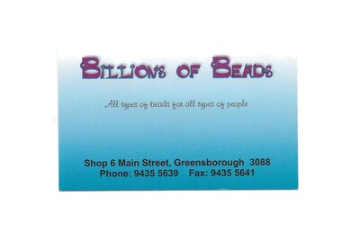
Business Card, Billions of beads, 2007c
... Greensborough Historical Society 34A Glenauburn Road Lower ...Former names: Bella's Beauty & Massage, Billions of Beads; In 2019, Imperial Tattoos. Sold history: Aug. 2005 $365,000; Jun 2007 $450,000; Oct. 2009 $455,000Cardboard business card, printed in colour both sidesbillions of beads, main street greensborough -
 Greensborough Historical Society
Slide - Photograph, John Ramsdale, Lower Plenty houses: Slide 79, 1990s
... Greensborough Historical Society 34A Glenauburn Road Lower ...Photograph shows a residential street in Lower Plenty - the Plenty River is behind.Part of the John Ramsdale collection of slides and audio visual material.Colour photograph scanned from slide.No caption. Printed maker's mark on slide "Kodak Kodachrome Slide"lower plenty, plenty river, residential development -
 Greensborough Historical Society
Slide - Photograph, John Ramsdale, Greensborough Bypass near Apollo Parkways: Slide 91, 1990s
... Greensborough Historical Society 34A Glenauburn Road Lower ...Photograph shows houses in foreground and further development in background, including Greensborough Bypass near Apollo Parkways.Part of the John Ramsdale collection of slides and audio visual material.Colour photograph scanned from slide.No caption. Printed maker's mark on slide "Kodak Kodachrome Slide"greensborough bypass, apollo parkways -
 Greensborough Historical Society
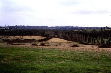
Slide - Photograph, John Ramsdale, Looking towards Bulleen from Lower Plenty; Slide 115, 1990s
... Greensborough Historical Society 34A Glenauburn Road Lower ...Photograph shows a rural scene with gum tree and pylon, looking towards Bulleen from Lower Plenty.Part of the John Ramsdale collection of slides and audio visual material.Colour photograph scanned from slide.No caption. Printed maker's mark on slide "Kodak Kodachrome Slide"bulleen, lower plenty -
 Greensborough Historical Society
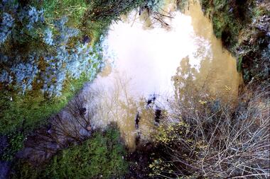
Slide - Photograph, John Ramsdale, Muddy water, Plenty River: Slide 119, 1990s
... Greensborough Historical Society 34A Glenauburn Road Lower ...Photograph is looking down on muddy water in the Plenty River.Part of the John Ramsdale collection of slides and audio visual material.Colour photograph scanned from slide.No caption. Printed maker's mark on slide "Kodak Kodachrome Slide"plenty river -
 Greensborough Historical Society
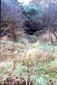
Slide - Photograph, John Ramsdale, Poorly managed farmland: Slide 121, 1990s
... Greensborough Historical Society 34A Glenauburn Road Lower ...Photograph shows a post and wire fence with bushland beyond, and example of poorly managed farmland, thistles in foreground.Part of the John Ramsdale collection of slides and audio visual material.Colour photograph scanned from slide.No caption. Printed maker's mark on slide "Kodak Kodachrome Slide"weeds, farming -
 Greensborough Historical Society
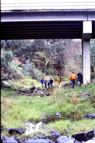
Slide - Photograph, John Ramsdale, Under Greensborough Bypass: Slide 122, 1990s
... Greensborough Historical Society 34A Glenauburn Road Lower ...Photograph shows a group of 7 people walking under an overpass - under Greensborough BypassPart of the John Ramsdale collection of slides and audio visual material.Colour photograph scanned from slide.No caption. Printed maker's mark on slide "Kodak Kodachrome Slide"greensborough bypass -
 Greensborough Historical Society
Slide - Photograph, John Ramsdale, Looking towards Bulleen brickworks; Slide 126, 1990s
... Greensborough Historical Society 34A Glenauburn Road Lower ...Photograph shows a rural view with paddocks and trees, looking towards Bulleen brickworks.Part of the John Ramsdale collection of slides and audio visual material.Colour photograph scanned from slide.No caption. Printed maker's mark on slide "Kodak Kodachrome Slide"bulleen -
 Greensborough Historical Society
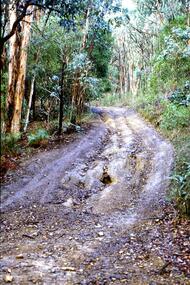
Slide - Photograph, John Ramsdale, Barbers Creek, Mernda: Slide 6, 1990s
... Greensborough Historical Society 34A Glenauburn Road Lower ...Photograph shows washed out bush track with gully erosion at Barbers Creek, Mernda.Part of the John Ramsdale collection of slides and audio visual material.Colour photograph scanned from slide.No maker's marks. No caption on slide.erosion, barbers creek mernda -
 Greensborough Historical Society
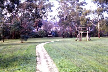
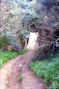
Slide - Photograph, John Ramsdale, Along the Plenty River Trail: Slide 7, 1990s
... Greensborough Historical Society 34A Glenauburn Road Lower ...Photograph shows park with narrow path, trees and timber play equipment taken along the Plenty River Trail.Part of the John Ramsdale collection of slides and audio visual material.Colour photograph scanned from slide.No maker's marks. No caption on slide.plenty river trail, greensborough, banyule parks -
 Greensborough Historical Society
Slide - Photograph, John Ramsdale, Drain into Plenty River: Slide 8, 1990s
... Greensborough Historical Society 34A Glenauburn Road Lower ...Photograph shows a drain or culvert near the Plenty River.Part of the John Ramsdale collection of slides and audio visual material.Colour photograph scanned from slide.No maker's marks. No caption on slide.plenty river, drains, pollution -
 Greensborough Historical Society
Slide - Photograph, John Ramsdale, Rural landscape Mill Park: Slide 9
... Greensborough Historical Society 34A Glenauburn Road Lower ...Photograph shows a rural landscape with a few buildings, possibly east of Plenty Road near Mill Park.Part of the John Ramsdale collection of slides and audio visual material.Colour photograph scanned from slide.No maker's marks. No caption on slide.mill park -
 Greensborough Historical Society
Slide - Photograph, John Ramsdale, Encroaching suburbia: Slide 10, 1990s
... Greensborough Historical Society 34A Glenauburn Road Lower ...Photograph shows encroaching residential looking from undeveloped to developed side of Plenty River.Part of the John Ramsdale collection of slides and audio visual material.Colour photograph scanned from slide.No maker's marks. No caption on slide.plenty river, residential development, urbanisation -
 Greensborough Historical Society
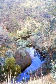
Slide - Photograph, John Ramsdale, Plenty Gorge: Slide 11, 1990s
... Greensborough Historical Society 34A Glenauburn Road Lower ...Photograph shows a river through bushland; this is the Plenty Gorge.Part of the John Ramsdale collection of slides and audio visual material.Colour photograph scanned from slide.No maker's marks. No caption on slide.plenty river, plenty gorge metropolitan park -
 Greensborough Historical Society
Slide - Photograph, John Ramsdale, Crossing Plenty River: Slide 12, 1990s
... Greensborough Historical Society 34A Glenauburn Road Lower ...Photograph shows erosion on a path to a footbridge over the Plenty River down from George Court Montmorency.Part of the John Ramsdale collection of slides and audio visual material.Colour photograph scanned from slide.No maker's marks. No caption on slide.plenty river, erosion, montmorency -
 Greensborough Historical Society
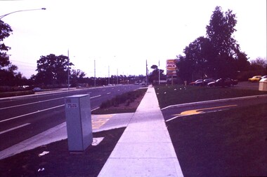
Slide - Photograph, John Ramsdale, Plenty Road: Slide 13, 1990s
... Plenty Lower Plenty melbourne Photograph shows a 3 lane road ...Photograph shows a 3 lane road with Hungry Jacks sign - Plenty Road Bundoora.Part of the John Ramsdale collection of slides and audio visual material.Colour photograph scanned from slide.No maker's marks. No caption on slide.plenty road bundoora -
 Greensborough Historical Society
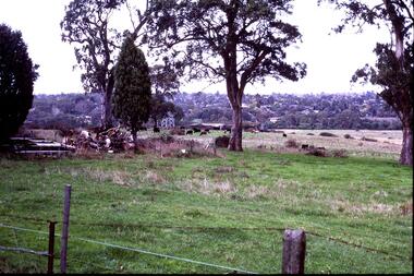
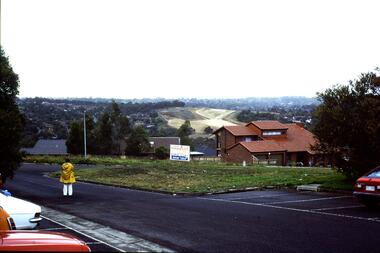
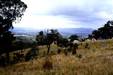
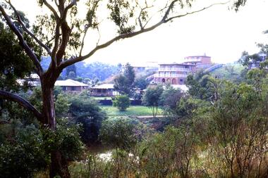
Slide - Photograph, John Ramsdale, Rural panorama: Slide 14
... Plenty Lower Plenty melbourne Photograph shows view across a road ...Photograph shows view across a road and open land to large house in a rural setting. At the time of the photograph was named 'Odyssey House' at Lower Plenty, Pre 1976 it was known as the Blessed Sacrament Fathers Seminary.Part of the John Ramsdale collection of slides and audio visual material.Colour photograph scanned from slide.No maker's marks. No caption on slide.rural landscape -
 Greensborough Historical Society
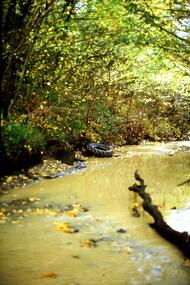
Slide - Photograph, John Ramsdale, Plenty River: Slide 15, 1990s
... Greensborough Historical Society 34A Glenauburn Road Lower ...Photograph shows the Plenty River with rubbish, including tyre and fallen branch. This part of the River is on the Montmorency - Greensborough border.Part of the John Ramsdale collection of slides and audio visual material.Colour photograph scanned from slide.No maker's marks. No caption on slide.plenty river, pollution -
 Greensborough Historical Society
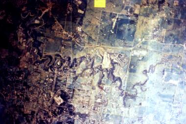
Slide - Photograph, John Ramsdale, Aerial view of Plenty River: Slide 16, 1990s
... Greensborough Historical Society 34A Glenauburn Road Lower ...Photograph shows aerial view of the Plenty River.Part of the John Ramsdale collection of slides and audio visual material.Colour photograph scanned from slide.No maker's marks. No caption on slide.plenty river, aerial photograph