Showing 1066 items matching "boundary"
-
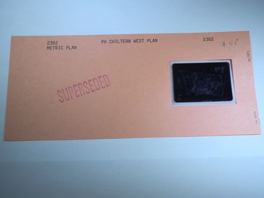
 Rutherglen Historical Society
Aperture Card microfilm, Victorian Land Tiltes Office, Parish Plan Chiltern West (Superseded)
Parish Schedule of Chiltern Westcard with a single microfilm insertplan, lots, roads, boundary -
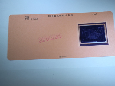
 Rutherglen Historical Society
Aperture Card microfilm, Victorian Land Tiltes Office, Parish Plan Chiltern West (Superseded)
Parish Schedule of Chiltern Westcard with a single microfilm insertplan, lots, roads, boundary -
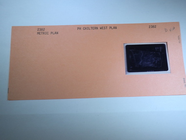 Rutherglen Historical Society
Aperture Card microfilm, Victorian Land Tiltes Office, Parish Plan Chiltern West
Parish Schedule of Chiltern Westcard with a single microfilm insertplan, lots, roads, boundary -
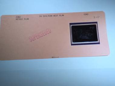
 Rutherglen Historical Society
Aperture Card microfilm, Victorian Land Tiltes Office, Parish Plan Chiltern West (Superseded)
Parish Schedule of Chiltern Westcard with a single microfilm insertplan, lots, roads, boundary -
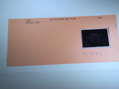 Rutherglen Historical Society
Aperture Card microfilm, Victorian Land Tiltes Office, Parish Plan Chiltern West, 15/03/2001
Parish Schedule of Chiltern Westcard with a single microfilm insertplan, lots, roads, boundary -
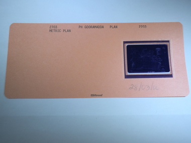 Rutherglen Historical Society
Aperture Card microfilm, Victorian Land Tiltes Office, Parish Plan Gooramadda, 28/03/2000
Parish Plan of Gooramaddacard with a single microfilm insertplan, lots, roads, boundary -
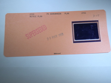 Rutherglen Historical Society
Aperture Card microfilm, Victorian Land Tiltes Office, Parish Plan Gooramadda (Superseded), 28/03/2000
Parish Plan of Gooramaddacard with a single microfilm insertplan, lots, roads, boundary -
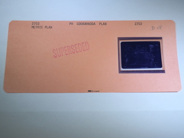 Rutherglen Historical Society
Aperture Card microfilm, Victorian Land Tiltes Office, Parish Plan Gooramadda (Superseded)
Parish Plan of Gooramaddacard with a single microfilm insertplan, lots, roads, boundary -
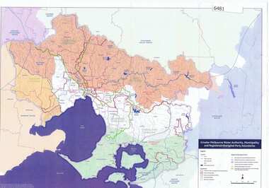 Greensborough Historical Society
Maps, Greater Melbourne Water Authority, Municipality and Registered Aboriginal party Boundaries, 18/07/2018
Shows Melbourne Water and Municipal area boundaries, with boundaries of registered aboriginal parties, in central Victoria.Printed in colour one sideMap reference 20180746aborigines victoria, water supply, melbourne water -
 Greensborough Historical Society
Aerial Photograph, AAM Photographics, Heidelberg AAM1969c 088, 24/11/1991
One of a series of overlapping aerial photographs of the Heidelberg/Greensborough area, covering Eaglemont, Heidelberg, Ivanhoe East & Viewbank. North boundary Hurstbridge railway, South boundary Ivanhoe East, East boundary Bulleen RoadLaminated colour aerial photographeaglemont, heidelberg, ivanhoe east, viewbank -
 Greensborough Historical Society
Map, Municipality of Heidelberg Plan No. 480, 17/10/1948
Map shows streets, buildings, river and major drainage easements in area covered by West boundary Sellars Street, North boundary Yando Street & South boundary Grimshaw Street. Adjoins Map No. 481 to East. Black & white map, features marked in green, gradients in red. Scale: 160 feet to 1 inchgreensborough -
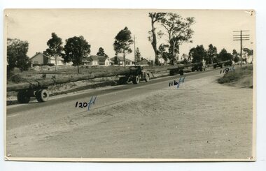 Orbost & District Historical Society
black and white photograph, mid 20th century
The photograph shows three trucks hauling logs of 120 feet, 116 feet and 118 feet long. Said to be the longest logs ever taken from East Gippsland forests, three special vehicles were needed to transport three giants, the longest measuring 120 feet, from the McKenzie River to Traralgon. Mr. J. De Piazza, of Orbost, was in charge of the transport of the logs. This photograph shows the logs passing through Bairnsdale.Orbost has historically been based on the timber industry, but that industry has declined considerably over the last 20 years. The number of locals involved in the timber industry has declined and many of the mills have closed. This item reflects a time when that industry was a significant contributor to the economy of the district.A black / white photograph of three trucks hauling logs of various lengths.on front - "120 ft; 118 ft; 116 ft" on back -" J. De Piazza, 23 Boundary Rd, Orbost, 1942"timber-industry-orbost -
 Greensborough Historical Society
Aerial Photograph, AAM Photographics, Heidelberg AAM1969c 106, 24/11/1991
One of an overlapping series of aerial photographs of the Heidelberg/Greensborough areas in 1991, covering the Simpson Barracks, Greensborough & Viewbank. North boundary Nell Street, East boundary Plenty River, South boundary Lower Plenty Road.Laminated colour aerial photographsimpson barracks, greensborough, viewbank -
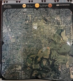
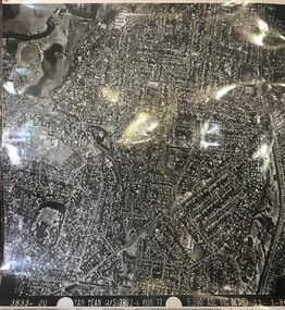 Greensborough Historical Society
Aerial Photograph, Yan Yean M/S 7922 Run 17 No. 3833-20, 01/11/1984
Covers Rosanna and parts of Viewbank and Heidelberg. East boundary Price Park; West boundary Hurstbridge railway lineLaminated black and white aerial photograph; adjoins 6226 on east siderosanna, viewbank, heidelberg -
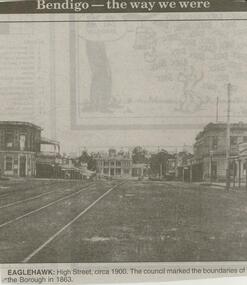 Bendigo Historical Society Inc.
Newspaper - JENNY FOLEY COLLECTION: EAGLEHAWK
Bendigo Advertiser ''The way we were'' from 2000. Eaglehawk: High Street, circa 1900. The council marked the boundaries of the Borough in 1863. The clip is in a folder.newspaper, bendigo advertiser, the way we were -
 Bendigo Historical Society Inc.
Document - LET'S TRAVEL EAST IN 1858 - 60'S
Nine pages of handwritten account of businesses from Mitchell Street, along Lyttleton Terrace and McIvor Road to the City boundary on the Bendigo side of Murphy Street.document, let's travel east in 1858 - 60's, moorabbee sheep run, curr's sheep run, glasgow bakery, lachlan frazer, mr hardiman, steen and holm coach painters, mr h haisman coach builder, scholton and march, march and s brown, haisman factory, city hall, police court, city lockup, market square, senior citizens club, weighbridge, dunlop tyre service station, tommy burns, matt lynch, tom & mick kennedy, darling hotel, the innes, mr bullens fruit shop, bricklayers arms hotel, cheshire arms hotel, mr i boffey, newcombe's timber yard, quinns monumental establishment, alexandra fountain, cumberland hotel, sannaman's coach factory, town hall hotel, her majesties open air picture show, mr r anderson, john ohagan, sandhurst hotel, the melbourne café, haymarket hotel, the old haymarket hotel, the market ale house, the prince of wales theatre, manchester hotel, mr john doran, dr backhaus, manchester hall, the bendigo star, james griffen coach factory, mr george lansell, whitting's marine store, cartrights marine store, sandhurst flour mills, mr john buckley, moorhead hay and corn mills, brian boru hotel, mr m r?dea, mr worth, mr condon, mr c cahill, nolan family, mr sides, the nailons, mrs boyan, jacky bryant, john oconnell general store, mr pierce, mr matthews, mr neil ward, mr hagan, william clapton, mr joseph dowd, mr morris, ancient briton hotel, the woolpak, the railway bridge, ampol service station, farrells dairy, farringtons brickworks, jacksons hide & tallow yard, fergusons, royal oak hotel, mr jackson, mr knight, st marys common school no812, mrs rersol, w d quinn, mr march, mr fred randall, mr steeple, the limerick hotel, back creek police shooting range, police station, stone lockup, holts service station, steepe's butcher shop, joch, john hattam -
 Port Melbourne Historical & Preservation Society
Plan - Metalling and channelling Evans Street from Ingles Street to Boundary Street, 14 Mar 1893
Specifications (94.1) and Plan (94.2) for metalling and channelling Evans Street from Ingles Street to Boundary Street . Loan Works 1893. Plan number 8.Both signed by J.J. Bartlett. (Mayor).engineering - roads streets lanes and footpaths, town planning, town clerks, mayors, arthur victor heath, james john bartlett -
Port Melbourne Historical & Preservation Society
Plan - Metalling and channelling Evans Street from Ingles Street to Boundary Street, 14 Mar 1893
Specifications (94.1) and Plan (94.2) for metalling and channelling Evans Street from Ingles Street to Boundary Street . Loan Works 1893. Plan number 8.Both signed by J.J. Bartlett. (Mayor).engineering - roads streets lanes and footpaths, town planning, town clerks, mayors, arthur victor heath, james john bartlett -
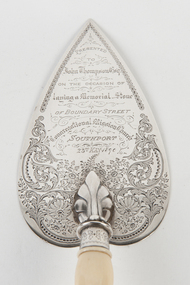 Uniting Church Archives - Synod of Victoria
Ceremonial object - Commemorative Trowel
Decorated silver trowel with bone handle.Presented to John Thompson Esq on the occasion of laying a Memorial Stone of Boundary Street Congregational Mission Church Southport. 23rd May 1890.congregational mission church southport -
Glenelg Shire Council Cultural Collection
Negative - Negative - Fawthrop Lagoon Portland, Victoria, Zilah Maschmedt, c. 1934
Negative for a black and white photograph. Image shows Bird sanctuary (Fawthrop Lagoon) View across water to Portland. Wooden fence - ? boundary of walkway, trees in foreground -
Port Melbourne Historical & Preservation Society
Map, Port Melbourne Sheet 1, 1962
Framed line drawing map of Port Melbourne (sheet 1) 1962, covering the area from Coode Canal to Plummer St and Todd rd to Boundary Stlocal government - city of port melbourne -
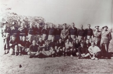 Tatura Irrigation & Wartime Camps Museum
Photograph, Garrison football Team 1944, 1945
Group photograph of the garrison football team in 1944.Black and white photograph of 14 standing, 5 in uniform, 10 kneeling, including the umpire holding ball, 4 seated cross legged including the boundary umpire.camp 13, internment camp football fields -
Whitehorse Historical Society Inc.
Article, Joint swimming pool proposed, 1967
Nunawading Council is to ask Doncaster and Templestowe Council to consider the construction of a swimming pool near the boundary of the two cities.Nunawading Council is to ask Doncaster and Templestowe Council to consider the construction of a swimming pool near the boundary of the two cities. The proposal came from Cr Keith Rooney.Nunawading Council is to ask Doncaster and Templestowe Council to consider the construction of a swimming pool near the boundary of the two cities. city of nunawading, city of doncaster and templestowe., swimming pools. -
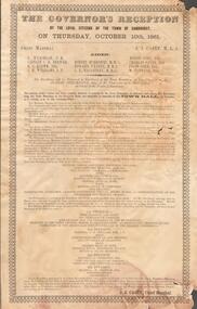 Bendigo Historical Society Inc.
Document - GOVERNOR'S RECEPTION 1861
Victorian Governor, Sir Henry Barkly visited Bendigo in Oct. 1861 as part of his regional tour that included, Castlemaine, Chewton, Back Creek and Inglewood.Buff coloured document. Written on top 'The Governor's Reception by the Loyal Citizens of the Town of Sandhurst on Thursday October 10th 1861. The program for the day is detailed, with instructions as to the order that participants should muster before the greeting of the Governor at the City Boundary at Kangaroo Flat. 'His Excellency will be welcomed to Sandhurst at the Town Boundary at Two o'clock p.m by Robert Strickland Esq. J.P. Chairman of the Municipality on behalf of the People of Sandhurst'bendigo, council, governor's reception 1861 -
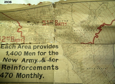 Bendigo Military Museum
Map - MAP, RECRUITING AREAS, Sands & McDougall Pty Ltd, Possible WW1 era
Each Battalion area provided 1400 men for the New Army & for 470 Reinforcements monthly.Map, paper on canvas backing, depicts recruiting areas for the raising & maintenance of Territorial Battalions in Melbourne (Vic) & suburbs. Printing is black & white with battalion boundaries & names in red.maps, battalions, recruiting -
Port Melbourne Historical & Preservation Society
Document - Specification, Metalling and chanelling, Danks Street from Esplanade East to Boundary Street South, Engineering Department, Town of Port Melbourne, 14 Mar 1893
Specification for metalling and channelling Danks Street from Esplanade East to Boundary Street South (Pickles Street) Loan Works 1893 plan 19; relates to plan 98.2Signed by JJ Bartlett (Mayor) 14.3.1893engineering - roads streets lanes and footpaths, town planning, town clerks, mayors, arthur victor heath, james john bartlett -
Port Melbourne Historical & Preservation Society
Plan - Metalling and channelling Danks Street from Esplanade East to Boundary Street South, Engineering Department, Town of Port Melbourne, 14 Mar 1893
Plan for metalling and channelling Danks Street from Esplanade East to Boundary Street South (Pickles Street) Loan Works 1893 plan 19; relates to specification 98.1Signed by JJ Bartlett (Mayor) 14.3.1893engineering - roads streets lanes and footpaths, town planning, town clerks, mayors, arthur victor heath, james john bartlett -
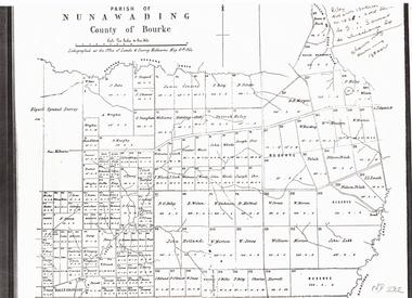 Whitehorse Historical Society Inc.
Document, Plan of Parish of Nunawading, 01/05/1864
Copy of plan of Parish of NunawadingCopy of plan of Parish of Nunawading, County of Bourke, lithographed at the Office of Lands and Survey, Melbourne, 13th May, 1864 showing boundaries of Koonung, Mullum Mullum and Dandenong Creeks.Copy of plan of Parish of Nunawadingland subdivision, parish of nunawading, county of bourke, elgars special survey, koonung creek, mullum mullum creek, dandenong creek -
 Whitehorse Historical Society Inc.
Photograph, Bill Cook
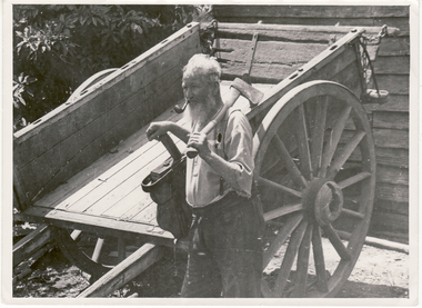
Black and white photo of Bill Cook. Cook Road in Mitcham named after him. Cook Street (Cook Road) formed the Western Boundary of his orchard in Mitcham.cook, bill, cook road, mitcham -
University of Melbourne, Burnley Campus Archives
Map, Hawthorn, 1981
Map of Hawthorn with legend of principal buildings. Shows council ward boundaries. Amended several times between 17/9/1958 (P. Linford) and 14/7/81hawthorn, buildings, p. linford, hawthorn council wards