Showing 273 items
matching campus map
-
 Federation University Historical Collection
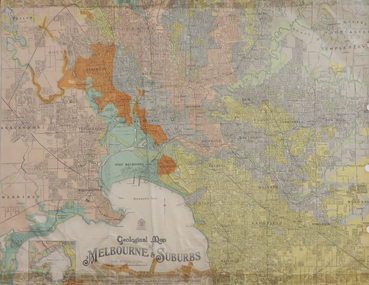
Map, Geological Map of Ascot, 1937, 1937
Coloured plan of Melbourne and suburbs.melbourne, geological, geology, caulfield, brighton, box hill, camberwell, richmond, prahran, st kilda, brunswick, coburg, keilor, braybrook, kew, hawthorn, northcote, williamstown, south melbourne -
 Federation University Historical Collection
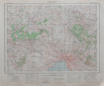
Map, Melbourne, 1943, 1943
2 copies of printed colour map on papermelbourne -
 Federation University Historical Collection
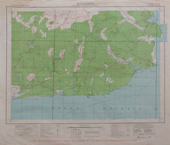
Map, Mallacoota, 1942, 1942
Printed colour map on paperThis map is an official document, if found, it must be handed in to the nearest military headquarters or police stationmallacoota, bass straight, cape evarard, cann river, genoa river, disaster bay -
 Federation University Historical Collection
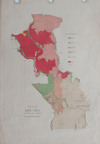
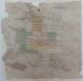
Plan, Parish of Lal-Lal County of Grant
Printed colour map on paperlal lal, mt doran, lal lal racecourse, geology, geological, moorabool river, mount duran -
 Federation University Historical Collection
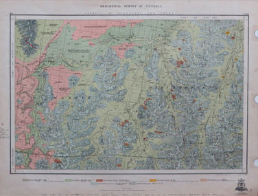
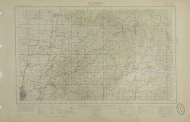
Map, Geological Survey of Victoria, 1913
Printed colour map on papervictoria, geological survey of victoria, gladstone, talbot -
 Federation University Historical Collection
Map, Lancefield, 1947
Printed coloured map on paperlancefield -
 Federation University Historical Collection
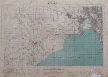
Map, Melbourne, Victoria, 1933
Printed colour map.melbourne, port phillip bay, werribee river, werribee, port melbourne, hobson's bay -
 Federation University Historical Collection
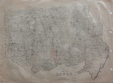
Maps, County of Lowan, 1930
Printed maps on paper backed onto linen: .1) County of Lowan .2) Weeahlowan -
 Federation University Historical Collection
Report, Report of Period with Central Electricity Generating Board (Including C.I.G.R.E. Conference), May-August 1958, 1958
Graham Beanland is a former Principal of the Ballarat SChool of Mines. Typed report by Graham H. Beanland. Includes maps showing generating stations and transmission lines, diagramatic layout of grid, 275 KV Developmentgraham beanland, electricity, electricity generating, central electricity generating board -
 Federation University Historical Collection
Map, Geological Sketch Map of the Mount Lyell District, 1935, 25-09-1935
Copy of a plan showing mining leases around Mount Lyell, Tasmania.mount lyell, queenstown, mining, king river -
 Federation University Historical Collection
Report, SMB: Budgetary Planning 1970/72; Buildings and other Capital Equipment Requirements, 1967/1968
Report typed on A4 paper stapled together Includes two large map - folded to firballarat school of mines, plans, buildings -
Federation University Historical Collection
Report, Report of the Place Names Committee, 1969, 30/06/1969
Seven Page stapled report. Includes map of the City of Keilor. place names, keilor -
 Federation University Historical Collection
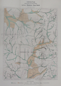
Map - Report, H.S. Whitelaw, Report on the Little Bendigo or Nerrina Gold-Field, Ballarat, 1901, 1901
Blue soft covered book. Includes Contour plan of the Little Bendigo Goldfieldlittle bendigo, nerrena, nerrina, h.s. whitelaw -
 Federation University Historical Collection
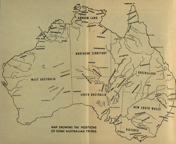
Map, Australia Showing Position of Some Australian Tribes, c1945, c1945
Digitised directly from "The Australian Aborigines: How to understand them" by A.P. ElkinMap of Australia showing states, river system and some Aboriginal Tribes.aboriginal, aborigines, kurnai, worworung, wongaibon, wiradjuri, dieri, wakelbura, pittapitta, waramunga, binbinga, anula, mara, waral, mulluk, larakia, worora, djaru, karadjerri, kogara, wongaii, pankala, tabalde, buandie -
 Federation University Historical Collection
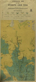
Map, Geological Map of The Stieglitz Gold Field, 1940
At the bottom of the 2nd page, there is text that reads "Geologically and topographically surveyed in 1909 by W.H. Ferguson, Assistant Field Geologist. Published 1940."Rectangular geological map edged in masking tape showing Steiglitz, Victoria. Scale 48 chains to 4 inches.steiglitz, geology, geological map, north albion, moreep, mining, mine, caribald reef, durdidwarrah, gilbraltar hill, mount pleasant gully, township of steiglitz, w.h. ferguson, garibaldi reef, yankee gully, kinglock mine engine shaft, herbert werner frederick de nully, albion gully, virago reef, mulrooney's reef -
 Federation University Historical Collection
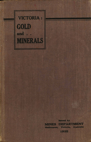
Book, Victoria: Gold and Minerals, 1935, 1935
Hard cover book. Fold out map showing auriferous areas and mineral localities in Victoria, 1935victoria, gold, minerals, 1935, geological map, hydrolic sluicing, panning, pneumatic drill, puddling machine, bendigo, coal mine, wonthaggi, yallourn, jamieson valley, geological school, melbourne university, mount buffalo, electric power station, briquette factory, mines department, george brown, secretary of mines, e.j. hogan, minister of mines, mining -
 Federation University Historical Collection
Photograph - coloured, Department of Lands and Survey, Portion of Victoria showing auriferous areas and mineral localities, 1935, 1935
Map included with book "Victoria: Gold and Minerals" issued by Mines Department Victoria, 1935Fold out coloured mapYellow mark indicating depositsvictoria, auriferous areas, mineral localities, department of mines, tin, antimony, copper, silver lead, tungsten, manganese, platinum, iron -
 Federation University Historical Collection
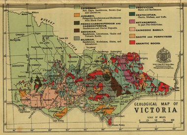
Photograph - colour, William Baragwanath, Department of Mines: Geological map of Victoria, c1935
Photograph included in book "Victoria: Gold and Minerals" issued by Mines Department Victoria, 1935Photographmap, department of mines, victoria, key to land formations, time periods, jurassic, geological map -
 Federation University Historical Collection
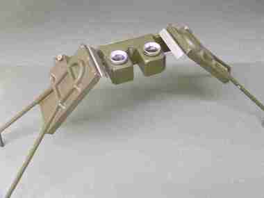
Instrument - Scientific Instruments, Universal Stereoscope
Initially made for and used by the military forces. Subsequently acquired (as army surplus equipment?) by the Ballarat School of Mines. Used in Surveying classes.A stereoscope arranged for positioning over a horizontal surface stored in a sturdy grey wood carry case. Spare set of mirrors attached to inside of box lid.scientific instruments, surveying, ballarat school of mines, stereoscope, map reading -
 Federation University Historical Collection
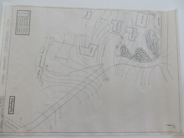
Plan - Contour tracings, Ballarat University College residence carparks and detail survey of Mt Helen campus, 1991/1992
3 ink on tracing paper survey maps .1) Detail survey Mt Helen campus 1992 .2) Top residence car park 1991 .3) BUC residences' car park 1991ink on tracing paper, b.u.c surveys, transpotr, ballarat college of advanced education, mount helen campus, carpark, student residences -
 Federation University Historical Collection
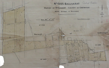
Map, No 6185 Ballaarat Parish of Ballaarat County of Grenville, not dated
Printed map with pencil inscriptionsmap, parish of ballaarat, grenville county, sebastopol, central company engine house, wesleyan reserve, victoria street, yarrowee street, charlotte st, kyle street -
 Federation University Historical Collection
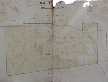
Map, No 6817 Ballaarat, Parish of Ballaarat, Mining District of Ballaarat, c1908
Printed map with pencil inscriptions on recto and versomap, mining districts, mining district of ballaarat -
 Federation University Historical Collection
Map, Lintons Pre-emptive Section, 1872, 1872
Printed map with coloured shading by F. W Niven Lydiard Street, Ballaratmap, mining districts, lintons claim, lintons diggings, f w niven, nivens steam lithographic machine, f.w. niven -
 Federation University Historical Collection
Map, Plan showing Locality of Reported Gold Find District of Tavula, 1935
Map with coloured shading on paper backed onto linen showing Crown Indian Settlement, Tovatova, Koro, Devotamap, devota, koro, crown indian settlemt, tovatova, tavua -
Federation University Historical Collection
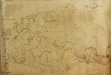
Map, Map of Vitilevu showing vehicular roads, native tracks, villages, provinces, 1935
Printed map on paper backed onto linen with small inset maps of Nandi and Singatoka map, vitilevu, singatoka, nandi -
 Federation University Historical Collection
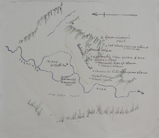
Plan, Dunn's Map of Early Gold Diggers at Golden Point, Ballarat, not dated
Hand drawn map in colour showing Yarrowee River and claims including James Oddie and Highett.dunn, dunn's map, comissioner's tent, oddie's claim, highett's claim, macdonald, suter & co claim, james oddie, golden point, gold discovery -
 Federation University Historical Collection
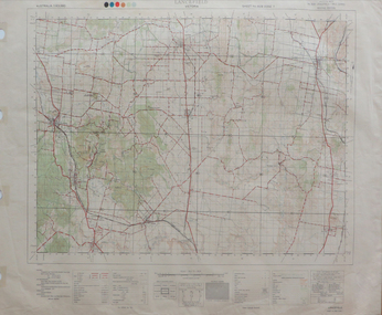
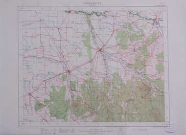
Map, Wangaratta, not dated
Printed colour map on paperwangaratta, broken river, ovens river, benalla, euroa -
 Federation University Historical Collection
Map, Warragul, 1942, not dated
printed colour mapwarragul -
 Federation University Historical Collection
Map, Yan Yean, 1935, 05/1935
Printed colour map on paperyan yean -
 Federation University Historical Collection
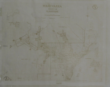
Map, Waanyarra, not dated
Photocopy of mapwaanyarra