Showing 460 items
matching freeways
-
 Lakes Entrance Historical Society
Book, Road Design Manual, 1985
Road design manual for rural and urban roads other than freeways giving all aspects of road construction.road construction and maintenance -
 University of Melbourne, Burnley Campus Archives
Album - Black and white and colour prints, Brian Ward, Freeway Construction, 1963-1972
(1) 14 black and white photographs showing views of where the Freeway would be going through near Burnley Gardens. (2) 2 photographs of views of the Yarra River near Burnley Gardens. (3) Aerial photograph of construction of the Freeway near Burnley Gardens and Yarra Boulevard. (4) 8 colour photographs of construction work in and over the River Yarra near the railway bridge. "Brian Ward Freeway Construction" handwritten on cover of folder. Student Dux 1973.freeway, burnley gardens, yarra river, yarra boulevard, river yarra, brian ward, aerial photographs -
Port Melbourne Historical & Preservation Society
Photograph - Construction of Bolte Bridge, Ron Laing, 1986 - 1999
Part of Ron Laing's collection of photographs recording Port Melbourne over a thirteen year period. Donated to the PMH&PS by the photographer.A set of 36 colour photographs covering the construction of the Bolte Bridge and approaches from the West Gate Freeway in Port Melbourneengineering - bridges, ron laing -
Whitehorse Historical Society Inc.
Article, Crossing work starts, 2003
Article on grade separation at Middleborough Road railway crossing; with items on maintaining tunnel design in proposed Mitcham Frankston Freeway.Article on grade separation at Middleborough Road railway crossing; with items on maintaining tunnel design in proposed Mitcham Frankston Freeway.Article on grade separation at Middleborough Road railway crossing; with items on maintaining tunnel design in proposed Mitcham Frankston Freeway.eastern freeway extension, railway crossings, middleborough road, blackburn, laburnum railway station -
Whitehorse Historical Society Inc.
Article, Housing plan for reserve, 2014
Housing on the Healesville Freeway Reserve .Housing on the Healesville Freeway Reserve could help meet increasing demand for properties according to Noel Jones Real Estate.Housing on the Healesville Freeway Reserve .healesville freeway reserve, noel jones -
Whitehorse Historical Society Inc.
Article, Freeway Land Fight, 1984
The State Labor Government wants to sell the Healesville Freeway Reservation land which action is being opposed by the Opposition Party.The State Labor Government wants to sell the Healesville Freeway Reservation land which action is being opposed by the Opposition Party.The State Labor Government wants to sell the Healesville Freeway Reservation land which action is being opposed by the Opposition Party.healesville freeway reservation, opposed -
Whitehorse Historical Society Inc.
Film - Videotape, Eastern Freeway Extension, 1/10/2000 12:00:00 AM
Video tape of proposed Eastern Freeway extension produced by Department of Infrastructure.|Duration - 3 minutes - made October 2000eastern freeway extension, victoria. department of infrastructure -
University of Melbourne, Burnley Campus Archives
Plan, The Heyington Diversion
yarra, river, freeway -
Whitehorse Historical Society Inc.
Document, Schwerkolt Cottage condition assessment, Jun-Jul 2000
Prepared for VicRoads Eastern Freeway project by Beauchamp Hogg Spano Consultants. Includes surrounding buildings on the site. Appendices A and B not supplied.schwerkolt cottage & museum complex, vicroads, eastern freeway -
 Whitehorse Historical Society Inc.
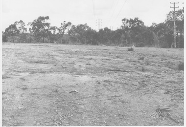
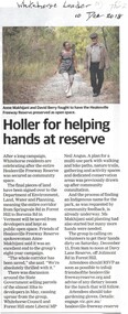
Article, Holler For Helping Hands At Reserve, 2018
After an 8 year campaign, Whitehorse residents are celebrating the approval of the entire Healesvile Freeway Reserve being secured as community space.After an 8 year campaign, Whitehorse residents are celebrating the approval of the entire Healesvile Freeway Reserve being secured as community space.After an 8 year campaign, Whitehorse residents are celebrating the approval of the entire Healesvile Freeway Reserve being secured as community space.healesvile freeway reservation, city of whitehorse, makhijani, ann, berry, david -
 Whitehorse Historical Society Inc.
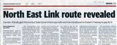
Article, North East Link Route Revealed, 2017
Corridor A of the North East Link Route has been approved by the State Government but tolls won't be introduced on the Eastern Freeway to pay for it.eastern freeway, north east link authority -
 Whitehorse Historical Society Inc.
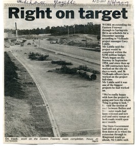
Newspaper, Right on Target, 1/06/1997 12:00:00 AM
Work on extending the Eastern Freeway to Springvale road, Nunawading is on schedule for a December opening. Cutting from Whitehorse Gazette, 11/6/1997.eastern freeway -
Whitehorse Historical Society Inc.
Document, Eastern Corridor Road Development, 1/11/1986 12:00:00 AM
... Freeways ...Collection of maps showing Eastern Corridor Road Development and traffic volume for public display.Collection of maps showing Eastern Corridor Road Development and traffic volume for public display.Collection of maps showing Eastern Corridor Road Development and traffic volume for public display.freeways, ecord study team -
 Whitehorse Historical Society Inc.
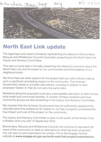
Article, North East Link Update, 2019
... Freeways ...The alliance of Boroondara, Banyule and Whitehorse councils have been presenting concerns about option A to the North East Link Inquiry and Advisory Committee regarding the impact on the community.The alliance of Boroondara, Banyule and Whitehorse councils have been presenting concerns about option A to the North East Link Inquiry and Advisory Committee regarding the impact on the community.The alliance of Boroondara, Banyule and Whitehorse councils have been presenting concerns about option A to the North East Link Inquiry and Advisory Committee regarding the impact on the community.north east link, freeways -
Whitehorse Historical Society Inc.
Article, Whitehorse vision for Healesville, 2014
City of Whitehorse Vision for Healesville Freeway Reservation.City of Whitehorse Vision for Healesville Freeway Reservation to include open space, sustained natural environment and some residential development covering 19% of the land.City of Whitehorse Vision for Healesville Freeway Reservation.healesville freeway reservation, city of whitehorse -
Whitehorse Historical Society Inc.
Article, Council moves on reserve, 2014
Plans for Healesville Freeway Reserve were changed by the Whitehorse Council.Plans for healesville Freeway Reserve were changed by the Whitehorse Council. The concept differs from the VicRoads draft , as a low-rise apartment building was removed.Plans for Healesville Freeway Reserve were changed by the Whitehorse Council. healesville freeway reserve, vicroads, nunawading community gardens, munroe, andrew, bennett, bill, carr, raylene, angus, neil, nadrasca farm, leane, shaun, barber, greg -
 Whitehorse Historical Society Inc.
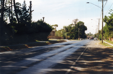
Photograph, Mitcham Road Prior to Widening, 1/02/2000 12:00:00 AM
Coloured photograph of Mitcham Road looking towards Park Road, Donvale. Taken from Freeway Reservation prior to construction to widen Mitcham Road.mitcham road, donvale, park road -
 Ringwood and District Historical Society
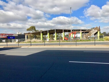
Photograph - Multiple, Demolition of Iceland Building, 28 Maroondah Highway, Ringwood 19 July 2019, 19/7/2019
Built in 1970 by Pat Burley, Iceland was a popular attraction, with bands as well as ice skating. It was sold in 1981, and subsequently was converted into various business units. 4 photos taken during the demolition if the old Ringwood Ice-skating Rink building, Iceland, 28 Maroondah Highway between New Street and the freeway. -
Port Melbourne Historical & Preservation Society
Photograph - Aerial view showing route of Lower Yarra Crossing Project (West Gate Bridge), Apr 1966
Black and white aerial photomap showing the proposed route of the Lower Yarra Crossing Project, later to become the West Gate Bridge and Freeway. April 1966'Lower Yarra Crossing Project' '296769'west gate bridge, transport - roads, engineering - bridges -
 Whitehorse Historical Society Inc.
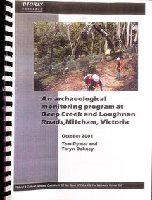
Document - Heritage Report, Rymer, Tom and Debney, Taryn, An Archaelogical Monitoring Program at Deep Creek and Loughnan Roads, Mitcham, Victoria, October 2001
The report on an archaeological monitoring program at Deep Creek and Loughnan Roads, Mitcham for the Eastern Freeway Extension to ensure that any Aboriginal and historical sites were suitably managed.An archaeological monitoring program at Deep Creek and Loughnan Roads, Mitcham for the Eastern Freeway Extension is reported to ensure that any Aboriginal and historical sites were suitably managed.non-fictionThe report on an archaeological monitoring program at Deep Creek and Loughnan Roads, Mitcham for the Eastern Freeway Extension to ensure that any Aboriginal and historical sites were suitably managed.deep creek road mitcham, archaeological sites, loughnan road ringwood -
 Whitehorse Historical Society Inc.
Newspaper - Article, Referendum, 12/07/1989
... freeways ...City of Nunawading; Referendum No 91 re Eastern arterial road and Big Bin garbage collection. Copy of notice placed in Nunawading Gazette, 12 July 1989.freeways, rubbish bins, city of nunawading -
 Eltham District Historical Society Inc
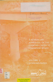
Book, A Review and Appraisal of the Diamond Creek to Ringwood Study, volume 2, working paper, by Loder and Bayly, 1979
... freeways ...Volume 2: Working papers. This report is a review and appraisal of the Outer Ring Road Study Diamond Creek to Ringwood prepared for The Road Planning Liaison Committee by the Joint Road Planning Group for the The City of Doncaster & Templestowe and The Shire of Eltham by Loder & Bayly Planning & Engineering Consultants. "This paper attempts to set a framework for an evaluation of the recommended road link between Diamond Creek and Ringwood." Various perspectives are examined. Includes fold out maps.91 p, maps, 27 cm.melbourne ring road, roads, freeways -
 Eltham District Historical Society Inc
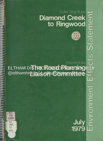
Book, The Road Planning Liaison Committee, Outer Ring Study, Diamond Creek to Ringwood: Environmental Effects Statement, July 1979
... freeways ...Prepared by The Road Planning Liaison Committee. The Outer Ring Study, Diamond Creek to Ringwood was a long term planning study carried out under the direction of the Road Planning Liaison Committee for the Government of Victoria. .. The basic aim of the .. Study was to determine the most appropriate future road system in the area between Diamond Creek and Ringwood, consistent with local and regional concerns and the environment of the area, with a view to seeking an emendment to the Metropolitan Planning Scheme to preserve the option to implement an appropriate road system some time in the future if this was considered necessary.non-fictionPrepared by The Road Planning Liaison Committee. The Outer Ring Study, Diamond Creek to Ringwood was a long term planning study carried out under the direction of the Road Planning Liaison Committee for the Government of Victoria. .. The basic aim of the .. Study was to determine the most appropriate future road system in the area between Diamond Creek and Ringwood, consistent with local and regional concerns and the environment of the area, with a view to seeking an emendment to the Metropolitan Planning Scheme to preserve the option to implement an appropriate road system some time in the future if this was considered necessary.roads, freeways, melbourne ring road -
 Eltham District Historical Society Inc
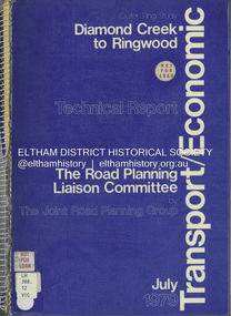
Book, The Joint Road Planning Group, Outer Ring Study, Diamond Creek to Ringwood: Technical Report Transport and Economic Evaluation, July 1979
... freeways ...Prepared for The Road Planning Liaison Committee by The Joint Road Planning Group. The Outer Ring Study, Diamond Creek to Ringwood was a long term planning study carried out under the direction of the Road Planning Liaison Committee for the Government of Victoria. .. The basic aim of the .. Study was to determine the most appropriate future road system in the area between Diamond Creek and Ringwood, consistent with local and regional concerns and the environment of the area, with a view to seeking an emendment to the Metropolitan Planning Scheme to preserve the option to implement an appropriate road system some time in the future if this was considered necessary. This technical report discusses, in detail, the transport and economic aspects of the investigation.. the techniques used take into account the long term implications of a range of possible travel cost policies and options and land use strategies.non-fictionPrepared for The Road Planning Liaison Committee by The Joint Road Planning Group. The Outer Ring Study, Diamond Creek to Ringwood was a long term planning study carried out under the direction of the Road Planning Liaison Committee for the Government of Victoria. .. The basic aim of the .. Study was to determine the most appropriate future road system in the area between Diamond Creek and Ringwood, consistent with local and regional concerns and the environment of the area, with a view to seeking an emendment to the Metropolitan Planning Scheme to preserve the option to implement an appropriate road system some time in the future if this was considered necessary. This technical report discusses, in detail, the transport and economic aspects of the investigation.. the techniques used take into account the long term implications of a range of possible travel cost policies and options and land use strategies.melbourne ring road, roads, freeways -
Whitehorse Historical Society Inc.
Pamphlet, Blackburn South Recreation Trail, 1989
Pamphlet outlining the history of the linear park along the alignment of the discontinued Healesville freeway.Pamphlet outlining the history of the linear park along the alignment of the discontinued Healesville freeway. It includes plans for the immediate future, the development of Fulton Reserve and lists the Committee of Management. A plan of the area is on the verso.Pamphlet outlining the history of the linear park along the alignment of the discontinued Healesville freeway.wurundjeri walk, fulton reserve, blackburn south recreation trail, city of nunawading -
Whitehorse Historical Society Inc.
Article, Disability farm in limbo, 2013
Doubts have bee raised about the suitability of an alternative site for the NADRASCA farm which is part of the Healesville Freeway Reservation at Morack Road.Doubts have bee raised about the suitability of an alternative site for the NADRASCA farm which is part of the Healesville Freeway Reservation at Morack Road. The site suggested is near Morack Golf Course.Doubts have bee raised about the suitability of an alternative site for the NADRASCA farm which is part of the Healesville Freeway Reservation at Morack Road. nadrasca, healesville freeway reservation, morack road vermont, koedyk, gus, leane, shaun, morack golf course -
 Whitehorse Historical Society Inc.
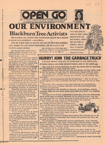
Newspaper, Open Go, 1/12/1976 12:00:00 AM
Periodical published under the Australian Assistance Plan and edited by Morna Sturrock, includes material on use of land next to Blackburn Lake, Koonung Mullum Forestway and along the route of the Eastern Freewayenviroment, blackburn & district tree preservation society, mullum mullem creek, koonung mullum forestry association, eastern freeway -
Whitehorse Historical Society Inc.
Article, Housing plan for reserve, 2012
VicRoads has earmarked large parts of the Healesville Freeway Reservation for housing under concept plans for the land's future.VicRoads has earmarked large parts of the Healesville Freeway Reservation for housing under concept plans for the land's future. Some community groups and Whitehorse Council are calling for the entirety of the reserve to be preserved as open space.VicRoads has earmarked large parts of the Healesville Freeway Reservation for housing under concept plans for the land's future. healesville freeway reservation, whitehorse -
Whitehorse Historical Society Inc.
Article, Many Questions on Land, 1/09/2014 12:00:00 AM
The Victorian State Governme.nt will protect 2 parcels of land totalling 15.4 ha. of the Healesville Freeway Reservation as Crown Land.The Victorian State Government will protect 2 parcels of land totalling 15.4 ha. of the Healesville Freeway Reservation as Crown Land and the planned walking and cycling path, running it's entire length, will go ahead.The Victorian State Governme.nt will protect 2 parcels of land totalling 15.4 ha. of the Healesville Freeway Reservation as Crown Land.healesville freeway reservation, cycling path, walkinig path -
Whitehorse Historical Society Inc.
Pamphlet, Eastern freeway extension, 1/02/2000 12:00:00 AM
Eastern Freeway extension Between Springvale Road and Ringwood: flora and fauna assessment.Eastern Freeway extension Between Springvale Road and Ringwood: flora and fauna assessment. Supplement no 13 : mapping of trees and native vegetation within the Deep Creek Road realignment [by] Botanicus Australia Pty Ltd for VicRoads.Eastern Freeway extension Between Springvale Road and Ringwood: flora and fauna assessment. eastern freeway extension, native plants, wild life, vicroads, deep creek road, mitcham