Showing 1045 items matching "general view"
-
 Eltham District Historical Society Inc
Photograph, Beard Street, Eltham, 3 Sep 1981
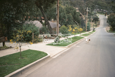
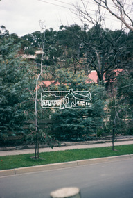
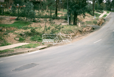
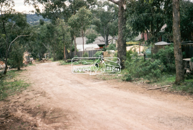
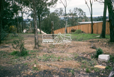
... to footpaths and gutters and general views of Beard Street... to footpaths and gutters and general views of Beard Street ...Roll of film taken by Eltham Shire Council officers of roads and houses in the Eltham East area, 3 September 1981 prior to construction of new water main; including views of existing damage to footpaths and gutters and general views of Beard Street. These images provide a perspective of housing estate developments and changes in housing styles and road development which began sweeping in from the mid 1970s with increasing urbanisation of what was once more outlying suburbs and regions.35mm colour positive transparency (1 of 28) Mount - Kodak Kodachrome Cardeltham, infrastructure, roads, beard street, grove street, valonia drive, wycliffe crescent, livingstone road -
 Eltham District Historical Society Inc
Photograph, Beard Street, Eltham, 3 Sep 1981
... to footpaths and gutters and general views of Beard Street... to footpaths and gutters and general views of Beard Street ...Roll of film taken by Eltham Shire Council officers of roads and houses in the Eltham East area, 3 September 1981 prior to construction of new water main; including views of existing damage to footpaths and gutters and general views of Beard Street. These images provide a perspective of housing estate developments and changes in housing styles and road development which began sweeping in from the mid 1970s with increasing urbanisation of what was once more outlying suburbs and regions.35mm colour positive transparency (1 of 28) Mount - Kodak Kodachrome Cardeltham, infrastructure, roads, beard street -
 Eltham District Historical Society Inc
Photograph, Water Main Pipe Track (Madine Way-Bainbridge Drive), Eltham, 3 Sep 1981
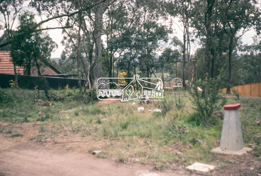
... to footpaths and gutters and general views of Beard Street... to footpaths and gutters and general views of Beard Street ...Roll of film taken by Eltham Shire Council officers of roads and houses in the Eltham East area, 3 September 1981 prior to construction of new water main; including views of existing damage to footpaths and gutters and general views of Beard Street. These images provide a perspective of housing estate developments and changes in housing styles and road development which began sweeping in from the mid 1970s with increasing urbanisation of what was once more outlying suburbs and regions.35mm colour positive transparency (1 of 28) Mount - Kodak Kodachrome Cardeltham, infrastructure, roads, bainbridge drive linear reserve, madine way, water main pipe track -
 Eltham District Historical Society Inc
Photograph, Water Main Pipe Track (Madine Way-Bainbridge Drive), Eltham, 3 Sep 1981
... to footpaths and gutters and general views of Beard Street... to footpaths and gutters and general views of Beard Street ...Roll of film taken by Eltham Shire Council officers of roads and houses in the Eltham East area, 3 September 1981 prior to construction of new water main; including views of existing damage to footpaths and gutters and general views of Beard Street. These images provide a perspective of housing estate developments and changes in housing styles and road development which began sweeping in from the mid 1970s with increasing urbanisation of what was once more outlying suburbs and regions.35mm colour positive transparency (1 of 28) Mount - Kodak Kodachrome Cardeltham, infrastructure, roads, bainbridge drive linear reserve, madine way, water main pipe track -
 Eltham District Historical Society Inc
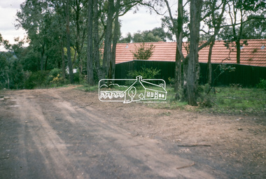
Photograph, Water Main Pipe Track (Madine Way-Eucalyptus Road), Eltham, 3 Sep 1981
... to footpaths and gutters and general views of Beard Street... to footpaths and gutters and general views of Beard Street ...Roll of film taken by Eltham Shire Council officers of roads and houses in the Eltham East area, 3 September 1981 prior to construction of new water main; including views of existing damage to footpaths and gutters and general views of Beard Street. These images provide a perspective of housing estate developments and changes in housing styles and road development which began sweeping in from the mid 1970s with increasing urbanisation of what was once more outlying suburbs and regions.35mm colour positive transparency (1 of 28) Mount - Kodak Kodachrome Cardeltham, infrastructure, roads, water main pipe track, madine way, eucalyptus road, tadema park -
 Eltham District Historical Society Inc
Photograph, Water Main Pipe Track (Madine Way-Eucalyptus Road), Eltham, 3 Sep 1981
... to footpaths and gutters and general views of Beard Street... to footpaths and gutters and general views of Beard Street ...Roll of film taken by Eltham Shire Council officers of roads and houses in the Eltham East area, 3 September 1981 prior to construction of new water main; including views of existing damage to footpaths and gutters and general views of Beard Street. These images provide a perspective of housing estate developments and changes in housing styles and road development which began sweeping in from the mid 1970s with increasing urbanisation of what was once more outlying suburbs and regions.35mm colour positive transparency (1 of 28) Mount - Kodak Kodachrome Cardeltham, infrastructure, roads, water main pipe track, madine way, eucalyptus road, tadema park -
 Bendigo Historical Society Inc.
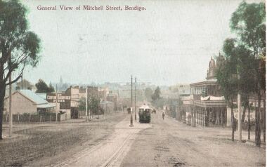
Postcard - ELAINE ROBB COLLECTION: MITCHELL STREET, BENDIGO
... towards Pall Mall. "General View of Mitchell Street, Bendigo... towards Pall Mall. "General View of Mitchell Street, Bendigo ...Hand coloured postcard: view of Mitchell Street, looking towards Pall Mall. "General View of Mitchell Street, Bendigo printed across top. Image shows tram in foreground, poles and line down centre of road. 'Sandhurst Coffee Palace' on banner outside two storey building with verandas and ornate pediments, on right hand side, 'The Living Centre' printed on the side of a shop on left side. Possibly late 1890's ? On rear of card: Post Card (W.T.P in ornate diamond shape) .W.T. Pater -
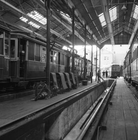 Ballarat Tramway Museum
Negative - Set of 2, Geoff Grant, 2/04/1955 12:00:00 AM
... printer (stored in folder ) of the general view of the car barn... (stored in folder ) of the general view of the car barn from ...Yields information about the interior appearance of the Geelong depot.Negative No. 263 and colour print made by colour laser printer (stored in folder ) of the general view of the car barn from the inside by Geoff Grant on 2/4/1955 while on an Australian Electric Traction Association tour. AETA special tram in background. 1545.1 - black and white image, made by Bill Scott on AGFA Prestige Digital paper, correct way around. Image on 1545 is reversed. Added 17/7/2009 Original negative scanned at hi res 18/5/2020 and image updated. 1545.1 - in ink "38)" in top left hand corner. Along bottom "Geelong depot Car 39 in background 2.4.1955 on a AETA tour Geoffrey Grant pic" and "William Scott" address label.trams, tramways, geelong, aeta, depot -
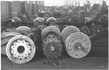 Melbourne Tram Museum
Photograph - Set of 7 Black & White Photograph/s, Melbourne & Metropolitan Tramways Board (MMTB), c1979 - 1970
... wheels at the Preston Workshops. .1 - General view... wheels at the Preston Workshops. .1 - General view ...Series of seven black and white photographs of Resilient wheels at the Preston Workshops. .1 - General view of the truck shop showing wheels completed and partially dismantled. .2 - showing a complete wheel axle with gear. (not imaged) .3 - showing a complete wheel and journal .4 - showing the various components set out. .5 - "Manufacture of one of jigs for new resilient wheels - MMTB design No. 2" .6 - detail of the one of the outer components. .7 - detail of another component that appears to have been damaged.trams, tramways, preston workshops, wheels, resilient wheels, testing, trucks -
 Melbourne Tram Museum
Photograph - Set of 3 Black & White Photograph/s, John Dare, 1975
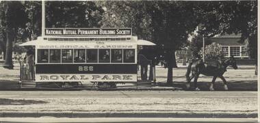
... " passing on the inbound track. .3 - general view of the tram..." passing on the inbound track. .3 - general view of the tram ...Set of three photograph by John Dare, 9/3/1975 of the operation of the TMSV horse Royal Park Zoo tram, No. 256, in the South Melbourne Football ground loop. .1 - Side of view of the tram with horse. .2 - With "Seven Colour Television Tram" passing on the inbound track. .3 - general view of the tram. The adtrams article (http://www.vicsig.net/index.php?page=trams&article=adtrams) accessed 22/8/2013 gives the advertising tram as SW6 900. image i4 - scan of three back of the photographs.On .1 and .3 - On rear ink "Recently restored horse tram was one of the highlights of the Labour Day weekend when it operated on a loop of track opposite the South Melbourne Football Ground. 9/3/75". Along with the ARHS Photo collection and John Dare name and address stamp. On .2 - as for .1, but with the additional words "Here it is seen paralleling the seven colour television tram"trams, tramways, horse trams, tmsv, south melbourne loop, advertising trams, tram 256, tram 900 -
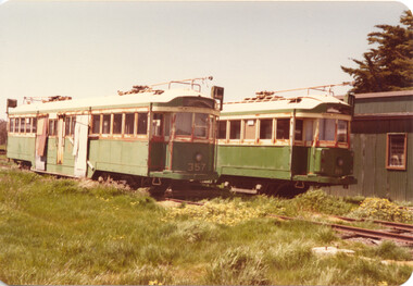 Melbourne Tram Museum
Photograph - MTPA tramcars - Haddon - Set of 4, Norm Cross, c1978
... - General view of the Haddon site showing five tramcars 4 - View... - General view of the Haddon site showing five tramcars 4 - View ...Set of four colour photographs of the Melbourne Tramcar Preservation Association's Haddon site, late 1970s. 1- Trams VR 41, W3 class 663, and W4 class 670 in the first stage of the main depot building. This was later extended forward. 2 - W2 class trams 357 and 499. Tram 499 was subsequently dismantled for spare parts. 3 - General view of the Haddon site showing five tramcars 4 - View of W3 class tram 656 being converted into accommodation.Yields information about tram as the MTPA site at Haddon, mid to late 1970s.Colour print with plain back, rounded corners - set of four.trams, tramways, mtpa, haddon, w2 class, w3 class, w4 class, tram 357, tram 499, tram 656, tram 41, tram 663, tram 670 -
 The Ed Muirhead Physics Museum
Chart, Image/Photo Grayson ruling engine, details of manufacture
... showing result of corrections. - general view of Apparatus... showing result of corrections. - general view of Apparatus ...Cardboard image chart covered in clear plastic showing a variety of black and white photomicrographs, measurements and images: - curve indicating condition of screw prior to regrinding - curves showing progressive improvement during regrinding - curve showing result of corrections. - general view of Apparatus for cutting ratchet teeth. - apparatus for refining crudely separated abrasive - photomicrographs of Abrasives used in lapping the lead screw - photomicrographs of Grayson’s test rulings (Approx. 1875) - Diamond Carriage Front View - Plan of Apparatus for testing the screw - Measurements of Grayson’s Test Rulings -
 Rutherglen Historical Society
Image, c1990
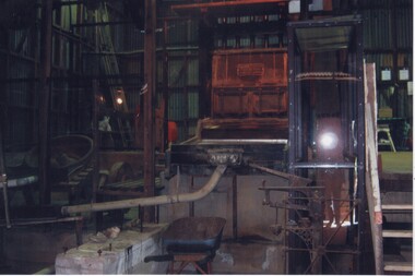
... This photograph is a general view of the machinery...-country This photograph is a general view of the machinery ...This photograph is a general view of the machinery of the Gold Battery. The Bergin Pan is on the left, Stamper Box and in foreground concrete bed for Wilfrey table which has been removed. This is one of a series of photographs of the Rutherglen Gold Battery. The battery's purpose was to crush quartz from nearby quartz reefs and extract gold from within. The battery was erected in 1908 and consists of a five-head battery, Wilfrey table, Bergin pan, portable steam engine and shed. The battery was restored in 2011/12 and can be viewed daily between 9.00am and 5.00pm. See website for details.Colour photograph of a number of large pieces of machinery inside a buildinggold battery, gold processing -
 Lorne Historical Society
Pamphlet - Tourist Brochure, Lovely Lorne
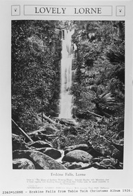
... general views of Lorne, Lover’s Walk, Erskine Falls . ... photographs, four general views of Lorne, Lover’s Walk, Erskine Falls ...The Victorian Railways promoted tourist destinations around Victoria. A folded paper tourist brochure about Lorne The front cover is a coloured painting of Lorne from above the Erskine River towards the main beach. , on the back is a black and white sketch tourist map of the roads, tracks and beauty spots. Inside the first fold are 6 black and white photographs, Cumberland River, Mt St George, Phantom Falls, Cumberland Cliffs, Teddy’s Lookout, leafy walk towards the pier. Inside contains written descriptions of the highlights of Lorne and six black and white photographs, four general views of Lorne, Lover’s Walk, Erskine Falls . souvenirs, victorian railways, publicity -
Bendigo Historical Society Inc.
Photograph - Great Extended Hustlers Gold Mine Sandhurst, April, 2014
... ' General View of the Principal Shafts'. Image shows mine buildings... bottom of image ' General View of the Principal Shafts'. Image ...Seven men were killed at the Great Extended Hustler's mine disaster on 2nd May 1914 by an explosion of dynamite occurring as the men were waiting at the plat to ascend the mine at the end of their shift. No blame was attached to anyone in the findings of the inquisition. It was unknown what caused the dynamite to explode. This document formed part of the research done at the time by Bendigo Historical Society, of the 100 years commemoration of the mine disaster, held at Hustler's Hill in 2014. Two pages of photocopies of images from the 'Australasian Sketcher' May 17th. 1873, of the Great Extended Hustlers Gold Mine Sandhurst. First page: across top of image 'Quartz Mining - The Great Extended Hustlers Mine, Sandhurst'. Across bottom of image ' General View of the Principal Shafts'. Image shows mine buildings, trestle way, mine dam in foreground, poppet head in background. Mining chimneys in background. Second page: same view as above with five small images of mine operations below; men underground, men in mine cate, man pushing ore truck. great extended hustlers, goldmining, accident, 1873 -
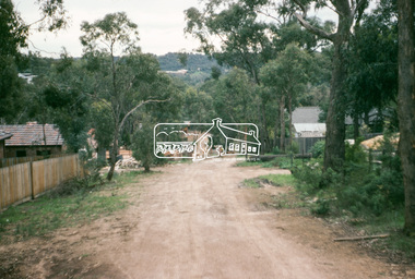
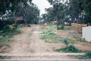
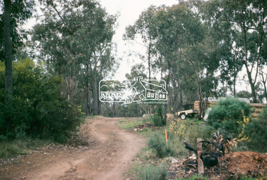
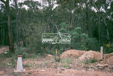
 Eltham District Historical Society Inc
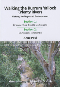
Book, Anne Paul, Walking the Kurrum Yallock (Plenty River), 25 July 2023
... general view, emerging at bridges and along its extensive trail... general view, emerging at bridges and along its extensive trail ...Kurrum Yallock - the Plenty River is Melbourne's third river. It is a defining feature of the region weaving its way through local suburbs and parklands. It is often hidden from general view, emerging at bridges and along its extensive trail network. While diminished since European settlement, the River provides an important environmental, wildlife corridor and recreational resource, along with many links to its settlement heritage. The Kurrum Yallock walks aim to guide people along the River Trail, while providing insight into key aspects of our recent history, an opportunity for reflection and an enhanced enjoyment of the River's special environment and landscape.birrarung, greensborough historical society, kurrum yallock, martins lane, plenty river, yallambie, yarra river -
 Ringwood and District Historical Society
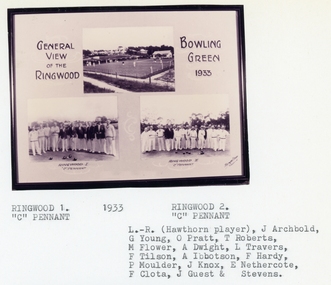
Photograph, Ringwood Bowling Club- 3 images of green and "C" Pennant Teams, 1933
... Image 1: General view of the Ringwood Bowling Green, 1933... Road Ringwood North melbourne Image 1: General view ...Sepia photograph (3 images)Image 1: General view of the Ringwood Bowling Green, 1933. Image 2: Ringwood 1, "C" Pennant Team, 1933. Image 3: Ringwood 2, "C" Pennant, 1933. L to R: (Hawthorn player), J Archbold, G Young, O Pratt, T Roberts, M Flower, A Dwight, L Travers, F Tilson, A Ibbotson, F Hardy, P Moulder, J Knox, E Nethercote, F Clota, J Guest, ? Srevens. -
![View of a Victorian Sheep Station / [by] Nicholas Caire, circa 1876](/media/collectors/550653872162f11fb04854aa/items/577b58dad0cdd10948cfdc7b/item-media/577b5942d0cdd10948d01fbf/item-fit-380x285.jpg) Kew Historical Society Inc
Kew Historical Society IncPhotograph, View of a Victorian Sheep Station, c.1876
... Views of Victoria (General Series) No.29 / ‘View... 'Views of Victoria: General Series' by the photographer, Nicholas ...Nicholas Caire was born on Guernsey in the Channel Islands in 1837. He arrived in Adelaide with his parents in about 1860. In 1867, following photographic journeys in Gippsland, he opened a studio in Adelaide. From 1870 to 1876 he lived and worked in Talbot in Central Victoria. In 1876 he purchased T. F. Chuck's studios in the Royal Arcade Melbourne. In 1885, following the introduction of dry plate photography, he began a series of landscape series, which were commercially successful. As a photographer, he travelled extensively through Victoria, photographing places few of his contemporaries had previously seen. He died in 1918. Reference: Jack Cato, 'Caire, Nicholas John (1837–1918)', Australian Dictionary of Biography.An original, rare photograph from the series 'Views of Victoria: General Series' by the photographer, Nicholas Caire (1837-1918). The series of 60 photographs that comprise the series was issued c. 1876 and reinforced a neo-Romantic view of the Australian landscape to which a growing nationalist movement would respond. Nicholas Caire was active as a photographer in Australia from 1858 until his death in 1918. His vision of the Australian bush and pioneer life had a counterpart in the works of Henry Lawson and other nationalist poets, authors and painters.Views of Victoria (General Series) No.29 / ‘View of a Victorian Sheep Station’ / Albumen silver photograph mounted on boardOn Reverse: ‘The present illustration is characteristic of a Squatter’s Station in Victoria, and is situated near Elphinstone. In the centre of the picture may be seen the Squatter’s residence or head-quarters surrounded by sheds and out-houses, and in the foreground is a flock of sheep in charge of a lad. Of late years it has become the practice to erect fences around the Australian Sheep Stations, which necessitates only the services of a boundary rider, and dispenses with those of a number of shepherds.’nicholas caire (1837-1918), landscape photography -
![View of Sailor’s Creek Bridge / [by] Nicholas Caire, circa 1876](/media/collectors/550653872162f11fb04854aa/items/577b5b7ed0cdd10948d14ae1/item-media/577b5be9d0cdd10948d196a2/item-fit-380x285.jpg) Kew Historical Society Inc
Kew Historical Society IncPhotograph, Anglo-Australasian Photographic Company, View of Sailor’s Creek Bridge, c.1876
... Views of Victoria (General Series) No.31 / ‘View... 'Views of Victoria: General Series' by the photographer, Nicholas ...Nicholas Caire was born on Guernsey in the Channel Islands in 1837. He arrived in Adelaide with his parents in about 1860. In 1867, following photographic journeys in Gippsland, he opened a studio in Adelaide. From 1870 to 1876 he lived and worked in Talbot in Central Victoria. In 1876 he purchased T. F. Chuck's studios in the Royal Arcade Melbourne. In 1885, following the introduction of dry plate photography, he began a series of landscape series, which were commercially successful. As a photographer, he travelled extensively through Victoria, photographing places few of his contemporaries had previously seen. He died in 1918. Reference: Jack Cato, 'Caire, Nicholas John (1837–1918)', Australian Dictionary of Biography.An original, rare photograph from the series 'Views of Victoria: General Series' by the photographer, Nicholas Caire (1837-1918). The series of 60 photographs that comprise the series was issued c. 1876 and reinforced a neo-Romantic view of the Australian landscape to which a growing nationalist movement would respond. Nicholas Caire was active as a photographer in Australia from 1858 until his death in 1918. His vision of the Australian bush and pioneer life had a counterpart in the works of Henry Lawson and other nationalist poets, authors and painters.Views of Victoria (General Series) No.31 / ‘View of Sailor’s Creek Bridge’ / Albumen silver photograph mounted on boardOn Reverse" ‘Sailor’s Creek as situated in the Jim Crow Ranges, which Range forms a portion of the Great Dividing Range of Mountains in Victoria. These hills contain many romantic spots. The one which forms the subject of the present illustration is a view of the Bridge which spans the Creek. Gold has been found throughout the course of the bed of this Creek in payable quantities. The diggers, as may be seen in the photograph, have constructed sluices in the side of the embankment for the purpose of washing the fine gold contained in the wash-dirt.’nicholas caire (1837-1918), sailor's creek (vic), gold mining (vic) -
![View of Sailor’s Creek Falls / [by] Nicholas Caire, circa 1876](/media/collectors/550653872162f11fb04854aa/items/577b5d13d0cdd10948d24e07/item-media/577b5d7dd0cdd10948d282ff/item-fit-380x285.jpg) Kew Historical Society Inc
Kew Historical Society IncPhotograph, Anglo-Australasian Photographic Company, View of Sailor’s Creek Falls, c. 1876
... Views of Victoria (General Series) No.32 / 'View... 'Views of Victoria: General Series' by the photographer, Nicholas ...Nicholas Caire was born on Guernsey in the Channel Islands in 1837. He arrived in Adelaide with his parents in about 1860. In 1867, following photographic journeys in Gippsland, he opened a studio in Adelaide. From 1870 to 1876 he lived and worked in Talbot in Central Victoria. In 1876 he purchased T. F. Chuck's studios in the Royal Arcade Melbourne. In 1885, following the introduction of dry plate photography, he began a series of landscape series, which were commercially successful. As a photographer, he travelled extensively through Victoria, photographing places few of his contemporaries had previously seen. He died in 1918. Reference: Jack Cato, 'Caire, Nicholas John (1837–1918)', Australian Dictionary of Biography.An original, rare photograph from the series 'Views of Victoria: General Series' by the photographer, Nicholas Caire (1837-1918). The series of 60 photographs that comprise the series was issued c. 1876 and reinforced a neo-Romantic view of the Australian landscape to which a growing nationalist movement would respond. Nicholas Caire was active as a photographer in Australia from 1858 until his death in 1918. His vision of the Australian bush and pioneer life had a counterpart in the works of Henry Lawson and other nationalist poets, authors and painters.Views of Victoria (General Series) No.32 / 'View of Sailor’s Creek Falls’ / Albumen silver photograph mounted on boardOn Reverse: ‘The Sailor’s Creek Falls are situated near Daylesford, in one of the valleys of the Jim Crow Ranges. The Creek at this particular juncture is naturally adapted for the formation of a large reservoir. The stream of water is small during summer months, but a great body of water may sometimes be seen during the winter or wet seasons.’nicholas caire (1837-1918), sailor's creek (vic), jim crow ranges, daylesford, sailor's falls, photography - landscapes - victoria -
 Lakes Entrance Historical Society
Photograph - Nithsdale, 1920 c
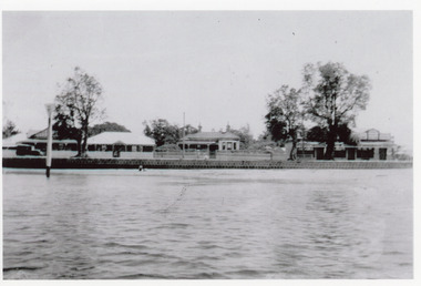
... guest house and general store. View of lake and bluestone wall... and general store. View of lake and bluestone wall in foreground ...Nithsdale' built 1890c by Barke Brothers, early storekeepers of Lakes Entrance, occupied by William, John and Mrs Jane Barke (mother). After 1920c lived in by members of the Coate/Symmons families. Later sold to Zagami and Crea, then lived in by Richard and Marlene Rijs - late 1970's, early 1980's. Later again sold to Tromp and relocated to Lake Tyers Beach in the late 1980's or early 1990's.Black and white photograph of a late Victorian style dwelling on Esplanade. Iron hipped roof veranda on twosides, bay window in front room. Two chimneys, picket fence. Set between guest house and general store. View of lake and bluestone wall in foreground. Lakes Entrance Victoriahouses, local history, people -
 Rutherglen Historical Society
Image, c1939
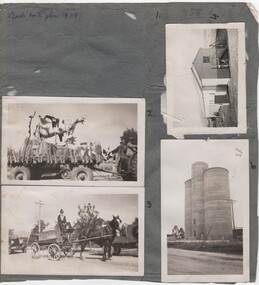
... photographs: 6. General View - Main St looking east 7. General Parade.... Silos built 1948. Other side has 5 photographs: 6. General View ...Small photographs pasted on both sides of a piece of grey cardboard. Written at top of the side with 4 photographs is "Back to Rutherglen 1939". It appears that there were once 5 photos on this side, but number 1 is missing (2017). Documentation identifies them as 1. Jaspers Corner Group 2. Float for parade 3. Fire Brigade cart 4. Unknown shed 5. Silos built 1948. Other side has 5 photographs: 6. General View - Main St looking east 7. General Parade 8. General Parade 9. Fire brigade cart ("Jim Sheridan" written on cardboard next to no. 9) 10. Main St looking east 1949 to 1950back to rutherglen, main street -
 Ballarat Tramway Museum
Photograph - B&W print of donated negative - set of 5, State Electricity Commission of Victoria (SECV), late 1930's
... - see note re repair. 1365.1 - general view of collision... St. mid 1939 - see note re repair. 1365.1 - general view ...Yields information about an accident or collision between a tramcar and a truck late 1930's. Gives information about the tramcar livery, and the damage to both vehiclesSet of five Black and white photo prints from collected negative of Ballarat (SEC) No. 14 photographed in collision with a truck in Drummond St. North, at corner of Webster St. mid 1939 - see note re repair. 1365.1 - general view of collision, with truck in the foreground, with tram 14 behind. 1365.2 - side view showing side of tram and rear end of the truck. 1365.3 - view from the front, showing the truck (Reg. No. 277.745) and the front of the tram. Tram showing destination of Gardens via Drummond St. Nth. 1365.4 - General view of collision, from about 20m away, showing point of collision and how far the tram travelled prior to stopping. Large amount of earth (mud) on the road. 1365.5 - view of the front end of the tram, showing collision damage after the truck has been removed. Good detail of the lining and "Pay as you Enter" sign. Note this photo was used in the lining of No. 27. The tramcar body card shows it was repaired following an accident June 1939. (Note added 2-2-19). Copy 2 - of all above photos - large format prints (253H x 203W) - added 30/7/2007, ex Alan Bradley holding of prints, received 5/2007. See also Reg Item 3904 for a mounted set of these photographs along with that of Reg Item. 580, 1019 and 1366. .Negatives rescanned 17/5/2020 and image updated. tramways, trams, accidents, collision, damage, drummond st. nth. , tram 14 -
 Melbourne Tram Museum
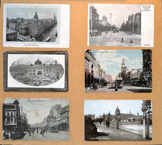
Postcard - Set of 6 mounted cable tram postcards, 1910s
... - General view of Collins Street Melbourne - from Spring St looking... to bottom: 1 - Town Hall Melbourne - damaged paper 2 - General view ...Postcards, all featuring the cable tram era, left to right, top to bottom: 1 - Town Hall Melbourne - damaged paper 2 - General view of Collins Street Melbourne - from Spring St looking west 3 - Central Railway Station, Melbourne - the principal building is complete though the roof along Swanston St over the other platforms is yet to be completed. 4 - Bourke St Melbourne - looking west from Swanston St - has the Wertheim and Roberts Stores in the view along with the post office. 5 - Bourke St Melbourne - looking east from Swanston St with Morells Orient Hotel and the Royal Mail Hotel on the two corners 6 - Melbourne from St Kilda Road.Demonstrates a set of 6 postcards featuring Melbourne cable trams.Set of 6 cable tram postcards mounted on to light weight boardtramways, flinders st station, swanston st, bourke st, collins st, st kilda road