Showing 287 items
matching greensborough - maps
-
 Greensborough Historical Society
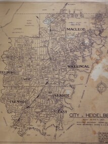
Map, City of Heidelberg: Municipal and Ward boundaries, 1967c
This map of the City of Heidelberg was issued subsequent to the separation of Heidelberg's North Ward to become the Shire of Diamond ValleyBlack on waxed paper. Scale: 20 chs to 1 inchG M Hutchins. 50c.city of heidelberg, heidelberg -
 Greensborough Historical Society
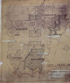
Map, City of Heidelberg: Residential Policy, 1976c
Shows residential zones 3, 4 & 5 established by Residential Policy adopted 13/12/1976Black print on waxed paper. Scale: 20 chs to 1 inchG M Hutchins. $1city of heidelberg, heidelberg -
 Greensborough Historical Society
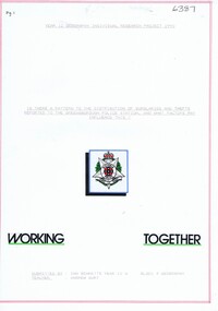
Folder, Ian Bennetts, Is there a pattern to the distribution of burglaries and thefts reported to the Greensborough police station, and what factors may influence this? by Ian Bennetts, 1990_
Year 12 Geography individual research project, Montmorency Secondary College, 1990. Investigates whether there a pattern to the distribution of burglaries and thefts reported to the Greensborough police station, and what factors may influence this? by Ian Bennetts72 p. spiral bound loose leaf folder. Typescript, coloured maps and diagramsVictorian Police logo on title page.thefts, greensborough, police - greensborough -
 Greensborough Historical Society
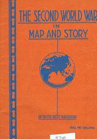
Book, Neville Smith, The Second World War in map and story, ed. by Neville Smith, 1941_
Series of articles first published in the "Argus" from 1941 to 1945, dealing with events and campaigns in World War 2.63 p., black & white photographs, col. maps.world war 2 -
 Greensborough Historical Society
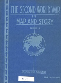
Book, Neville Smith, The Second World War in Map and Story, volume 3, ed. by Neville Smith, 1943_
Series of articles published by the "Argus" 1941-1943, dealing with events and campaigns in World War 2.48 p., col. maps.world war 2 -
 Greensborough Historical Society
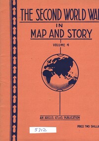
Book, Neville Smith, The Second World War in Map and Story, volume 4, ed. by Neville Smith, 1944_07
Series of articles published by the "Argus" 1941-1945, dealing with events and campaigns in World War 2.48 p., col. maps.world war 2 -
 Greensborough Historical Society
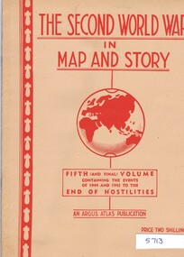
Book, Neville Smith, The Second World War in map and story, Vol. 5, ed. by Neville Smith, 1945_
Series of articles first published in the "Argus" from 1941 to 1945, dealing with events and campaigns in World War 2.50 p., black & white photographs, col. maps.world war 2 -
 Greensborough Historical Society
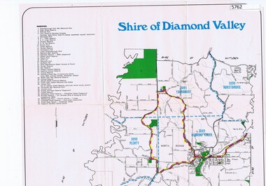
Map, Map - Shire of Diamond Valley, 1990c
Map issued by the Shire of Diamond Valley showing location of key organisations and features Map printed in colour, one sideshire of diamond valley -
 Greensborough Historical Society
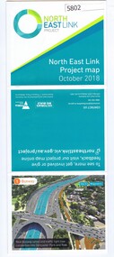
Leaflet, North East Link Authority, North East Link: project map October 2018, 2018_10
North East Link Authority was set up to lead development of this project. This map shows the proposed route with major intersections/interchanges. Map, colour text and images.north east link -
 Greensborough Historical Society
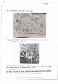
Article and Photograph, All Saints Anglican Church Greensborough, 2018_
Information and photographs of All Saints' Anglican Church Greensborough from the 1940s and 1950s. Includes a hand drawn map of the original site on the corner of Main Street and Grimshaw Street.This photograph and text was copied from a Facebook site. Members are people who lived in the Greensborough area and share their reminiscences of the area with others. The site is administered by a GHS member but is not officially affiliated with the Society. Any information is the opinion of the contributor. Article and photograph sourced from social media.all saints anglican church greensborough -
 Greensborough Historical Society
Booklet, TAA Air Atlas, 1972_
Souvenir publication, detailing airline routes, services and aircraft. TAA air atlas: your flight souvenir, compliments of Trans-Australia Airlines.16 p., printed in colour, maps, photographs and text.airlines, trans-australia airlines -
 Greensborough Historical Society
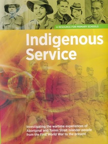
Book, Indigenous Service: a resource book for primary schools, 1914o
This volume is a resource for primary schools to investigate the wartime experiences of Aboriginal and Torres Strait Islander people from the First World War to the present.66 pages, colour illustrations, fold out map. Spiral binding with fold around outer cover.world war i, indigenous australians, aborigines, torres strait islanders -
 Greensborough Historical Society
Book, Indigenous Service: a resource book for secondary schools, 1914o
This volume is a resource for secondary schools to investigate the wartime experiences of Aboriginal and Torres Strait Islander people from the First World War to the present.66 pages, colour illustrations, fold out map. Spiral binding with fold around outer cover.world war i, indigenous australians, aborigines, torres strait islanders -
 Greensborough Historical Society
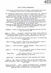
Article, Let's visit Bundoora, 1841o
This collection of notes aims 'for a deeper appreciation and understanding of the impact of our lives; culture and actions;.in Bundoora; a developing community'. Includes copies of uncited articles; photos and maps.Background information on Bundoora in the 20th century.Collection of articles, possibly notes from an oral presentation. Complete document available at GHS."Contents largely sourced from "In the beginning there was only the land", Len Kenna, 1988." - note on page 1.bundoora -
 Greensborough Historical Society
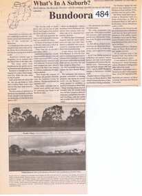
Newspaper Clipping, Bundoora: What's in a Suburb?, 16/09/2000
A short history of Bundoora from its earliest subdivision in 1838 to the end of the 20th century. Includes information on hospitals in the area - Larundel, Mont Park, 1 page, text, photos and map.bundoora, mont park -
![Plan, Surveyor's Street Plan of Melbourne 1837 [copy], 1837_](/media/collectors/4f729f5697f83e03086015b8/items/534ccbc12162ef06c8d2cbf7/item-media/58afbfe2d0ce1616fcdf244b/item-fit-380x285.jpg) Greensborough Historical Society
Greensborough Historical SocietyPlan, Surveyor's Street Plan of Melbourne 1837 [copy], 1837_
... available for sale from Greensborough Historical Society. Map ...Copy of Surveyor's Street Plan of Melbourne 1837. Donated by Patsy Coverdale and accompanied by brief details of her family connection to the map. Copies of plan available for sale from Greensborough Historical Society.Map of early Melbourne with connections to a current resident.Copy of plan, mounted on timber and framed.melbourne street plan, coverdaye, umpleby -
 Greensborough Historical Society
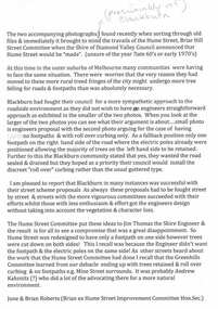
Folder, Hume Street Improvement Committee, 1958_
The Hume Street Improvement Committee was one of several 'progress associations' in the Greensborough area at the time the area was being urbanised. A typed page explains the concerns of residents when the street was being paved. Includes photographs and maps of area.These documents are concerned with the urbanisation of Greensborough in the mid 20th century while residents tried to maintain the rural feel of the area.Foolscap manilla folder containing various lists, maps and photographs.On cover "Hume Street Improvement Committee/ spare circulars/maps"greensborough, road making, brian roberts, hume street improvement committee, briar hill -
 Greensborough Historical Society
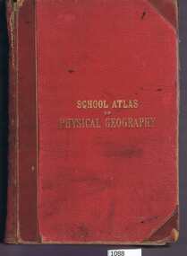
Book, W. & A.K. Johnston, School atlas of physical geography: the elementary facts of geology; hydrography; meteorology and natural history by Alex Keith Johnston, 1871_
This atlas of physical geography has 20 plates illustrating maps and various rock formations.This volume illustrates a 19th century view of physical geography.51 pages, 20 plates, maps. Red hard cover with title in gold lettering.Inscribed on fly leaf with original owner's name (1890)physical geography, school books, atlases -
 Greensborough Historical Society
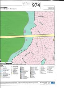
Map, Pioneer children's graves precinct, 1848-1860
Map showing the location and surrounds of Pioneer Children's Cemetery on the Plenty River in Greensborough. Children from pioneer families are buried here.Official government planning map for the Pioneer Children's Graves Precinct.Printed coloured copy of map of Plenty River areapioneer childrens cemetery, greensborough, partington, whatmough -
 Greensborough Historical Society
Article, The 1909 "Battle of Greensborough" / by John Gibson, 1909_
In 1909 military exercises were held in the Greensborough area. In this researched article the site is identified and activities related.This is the text of a presentation by John Gibson at the April 2013 meeting of GHS.2 pages, text, map and photograph.sugarloaf hill, bundoora, john gibson, greswell hill, latrobe house -
Greensborough Historical Society
Book, Melbourne Water, Plenty River Waterway Management Activity Plan 2000, 2000_
This report covers the catchment of the Plenty River from its upper reaches in the Great Dividing Range to the confluence with the Yarra River at Viewbank. It discusses ecological diversity and methods of improving water quality and significant areas of the catchment. Includes a brief history of settlement along the Plenty River.This is a significant plan for the improvement of the Plenty River.207 p., maps, folding maps. Printed on white paper with black spiral binding and clear plastic front cover.plenty river, melbourne water -
 Greensborough Historical Society
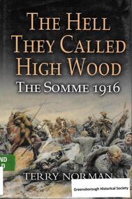
Book, Leo Cooper - Pen & Sword Books, The Hell they called High Wood: The Somme 1916 / Terry Norman, 2003_
Tells the story of the Battle of the Somme 1916.256 pages, illus., maps. Hard cover.world war i, the somme -
 Greensborough Historical Society
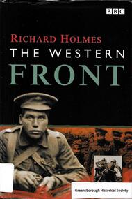
Book, BBC Worldwide, The Western Front / Richard Holmes, 1999_
Tells the story of the Western Front during World War I. 224 p., illus. (some col.), maps. Hard cover.world war i, western front -
 Greensborough Historical Society
Book, Angus & Robertson Ltd, The Australian Encyclopaedia, 1958_
Standard history of Australia to 195810 vols. illus. maps with index vol. 10australian encyclopaedia -
 Greensborough Historical Society
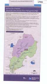
Newspaper Clipping, Diamond Creek stream flow management plan, 30/09/2015
In this Public Notice, Melbourne Water seeks feedback on the Diamond Creek Stream Flow Management Plan.News clipping, black text, colour map.diamond creek stream flow management plan, melbourne water. -
 Greensborough Historical Society
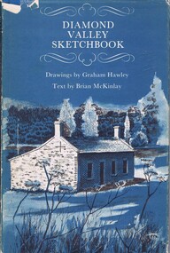
Book, Diamond Valley Sketchbook, 1973_
Contains drawings by Graham Hawley and text by Brian McKinley. Shows landmarks around the Diamond Valley.63p., illus., map as endpapers, dustcover."Happy birthday Kathryn May 1976"diamond valley, eltham, greensborough -
 Greensborough Historical Society
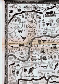
Map, George W. Bell, Eltham Warrandyte and environs: a visitor's guide map: centenary souvenir. 2nd ed, 1994c
Tourist guide to historic and other features in the Eltham Warrandyte area and environs, A2, black & white, folded 3 times to A5, printed on one sidewarrandyte, eltham, st helena, montmorency -
 Greensborough Historical Society
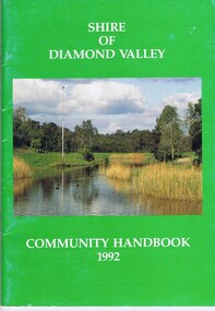
Book, Shire of Diamond Valley, Shire of Diamond Valley Community Handbook 1992, 1992_
Guide to services provided by Shire of Diamond Valley. The Shire of Diamond Valley was a Local Government Area located about 20 kilometres northeast of Melbourne. The shire covered an area of 74.38 square kilometres and existed from 1964 until 1994.Annual guide to services in Shire of Diamond Valley52 pages, col illus., maps. Cover illustration of Kalparrin Gardens Greensboroughshire of diamond valley -
 Greensborough Historical Society
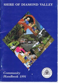
Book, Shire of Diamond Valley, Shire of Diamond Valley Community Handbook 1991, 1991_
Guide to services provided by Shire of Diamond Valley. The Shire of Diamond Valley was a Local Government Area located about 20 kilometres northeast of Melbourne. The shire covered an area of 74.38 square kilometres and existed from 1964 until 1994.Annual guide to services in Shire of Diamond Valley36 pages, col. illus., maps. Front cover is a collage of scenes from Diamond Valley, back cover illustration of a copy of "Summer Panorama, Tabletop, NSW" by Max Dimmack, from the Shire of Diamond Valley Art Collection.shire of diamond valley -
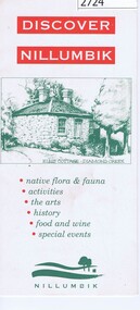 Greensborough Historical Society
Leaflet, Nillumbik Shire Council, Discover Nillumbik, 2000c
Map and lists of attractions within the Shire of NillumbikDouble sided, folded seven times printed in red and greennillumbik