Showing 509 items
matching mining - maps
-
 Bendigo Historical Society Inc.
Map - MAP WHITE HILL TO HUNTLY
... BENDIGO Mining Map of Bendigo creek and adjacent leads - White ...Map of Bendigo creek and adjacent leads - White Hills to Huntly replotted from old 4 chain to 1 inch survey of 1860 by G. W. Hart - Surveyor. Base of roads and streets taken from D.L.S. 1 . 10000 base maps. Legend: battery site, puddling mill site, dam bank site, cutting altering course of creek, lead boundaries.bendigo, mining -
 Bendigo Historical Society Inc.
Map - BENDIGO GOLDFIELDS MAP
... BENDIGO Mining bendigo goldfields Map of the Bendigo Goldfield ...Map of the Bendigo Goldfield, showing reef lines, mines and significant geographical features such as Monument Hill, Quartz Hill and Diamond Hill. On the back of map 'Department of Mines, Victoria. Plan of Bendigo Goldfield.bendigo, mining, bendigo goldfields -
 Bendigo Historical Society Inc.
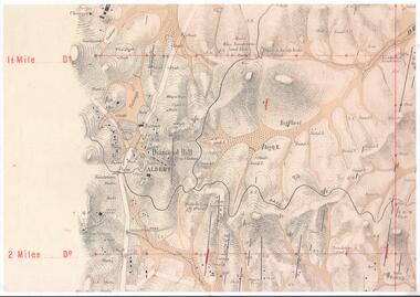
Map - DIAMOND HILL AREA
Copy of map of Diamond Hill area, with the Trig Station mid centre on map. Shafts, mines and geological features are marked.bendigo, mining, diamond hill -
 Bendigo Historical Society Inc.
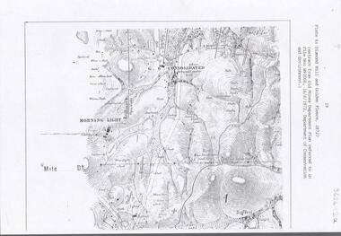
Document - DIAMOND HILL AREA MAP
... BENDIGO Mining diamond hill Map copy, 2 pages, from 'Old Mines ...Map copy, 2 pages, from 'Old Mines Department Plan, Dept of Conservation and Environment File No W91006, 16.6.1972' Map shows Golden Gully area with 'Town and Country Hotel' on north side and further south, with shafts and mine names marked.bendigo, mining, diamond hill -
 Bendigo Historical Society Inc.
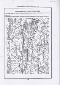
Document - DIAMOND HILL, GOLDEN GULLY COSERVATION AREA
... BENDIGO Mining golden gully Map of Golden Gully conservation area ...Map of Golden Gully conservation area comprising Glasgow and Golconda Consolidated, Glasgow Reef Company (Golden Gully) and New Napoleon. The area is significant because it contains the 'best evidence for hydraulic sluicing on the field as well as several early reef mining sites' On top of page 'Eaglehawk & Bendigo Heritage Study, Significant areas' Mines marked on page: Goldfields Extended shaft South Concord shaft Concord shaft Morning Light shaft Hansel and Mundy shaftbendigo, mining, golden gully -
 Bendigo Historical Society Inc.
Document - STAFFORD REEF MINE SITE, DIAMOND HILL
One page document describing the Stafford Reef Mine Site, Diamond Hill, Site 4.11, prepared by David Bannear. Information includes the map/grid references of the site and an overview of the history of the Stafford Reef Mine. The physical remains of the mine are described..bendigo, mining, stafford reef mine -
Bendigo Historical Society Inc.
Document - DIAMOND HILL HISTORIC AREA PARKS VICTORIA
Document, two pages, prepared by Parks Victoria in relation to the Diamond Hill Historic Area. Contains information regarding the history of the area; German Miners; Plants and animals. On second page is a map of the area showing historic features: Deborah Consolidated Gold workings Red, White and Blue Extended gold workings Goldfields Extended gold workings Dead Dog Gully, alluvial gold workings Glasgow & Golconda Gold workings and tramway Surface gold mining site Hansel Mundy gold workings Bendigo Goldfields Pty gold workings Stafford gold workings Langdon gold workings Great Opossum Gully alluvial gold workingsbendigo, mining, diamond hill -
Bendigo Historical Society Inc.
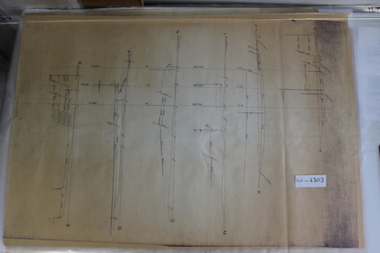
Map - HUSTLER'S & CHRISTMAS LINES OF REEFS - PLAN OF LINES OF SECTION OF REEFS
... MINING Parish Map Hustler's & Christmas Lines of Reefs Plan ...Underground Survey of Mines Bendigo. Plan of Cross Section Lines Shewing Connections with Trigonometrical Stations and Base Lines. 13/3/99 Signed ? Stirling. Places and mines mentioned Speciman Hill, Tambour Major, Lansell's 180, Victory and Pandora, Great Extended Hustler's, Windmill Hill on Victoria Reef. Next part of map is a Plan of Lines of Section between the Hustler's and Christmas Lines of Reefs. 8/3/99. Signed ?. Transverse Section. Shows Tambour Major Co., near the Christmas Line of Reef, Crosscuts and their depth, geological features and stone encountered. Then shows Thistle Line, Charshalton Line, Napoleon Line, Nell Gwynne Line, New Chum Line, Lansell's No 180 with levels, depths and geological features. Drawing is continued in three parts to fit on paper. Lansell's East Shaft with levels and depths, geological features and stone encountered. Sheepshead Line, Old Shaft, Garden Gully Line, Victory and Pabndora Co with crosscuts, depths, geological features and stone encountered. Paddy's Gully Line, Derby Line, Millers Line, Hustler's Line, Great Extended Hustler's Co with levels, depths, geological features and stone encountered. A note beside a Saddle Reef: 360,000 pounds paid in dividends from this reef. Average ounces per ton gold noted where found. Reference Table for stone and geological features. Datum Line 700 feet above Sea Level Unscannedmining, parish map, hustler's & christmas lines of reefs, plan of lines of section of reefs, ? stirling, specimen hill, tambour major, lansell's 180, victory & pandora, great extended hustler's, windmill hill, victoria reef, tambour major co, christmas line, hustler's line, thistle line, carshalton line, napoleon line, nell gwynne line, new chum line, lansell's no 180, lansell's east shaft, sheepshead line, old shaft, garden gully line, paddy's gully line, derby line, miller's line, hustler's line, great extended hustler's co -
 Bendigo Historical Society Inc.
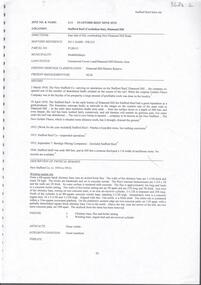
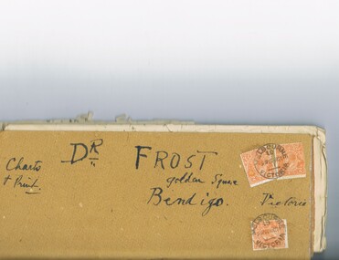
Document - MCCOLL, RANKIN AND STANISTREET COLLECTION: DR FROST, 1920
Correspondence to Dr. Frost re Badak Tin Mine. Binti Binti, Sweet Nell, Bettina, Mascotte & Maconi. Report on inspection of mine reports by Mr. M. Sheard (Mine Manager) & Dr. C. W. Laver of Kalgoorlie, map of Binti lease. Des Frost Golden Square Bendigo Victoria, charts and print.MCCOLL RANKIN & STANISTREETorganization, business, gold mining, mccoll rankin & stanistreet -
 Bendigo Historical Society Inc.
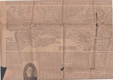
Newspaper - 1911 BENDIGO ADVERTISER, 14th July, 1914
( x ref 5673 , 8235 , Box 83 , 9077 ) Page 5 and 6 from the Bendigo Advertiser Friday July 14 1911. 1851 discovery of gold significant portion. Part of G Mackay 'Annals of Bendgo'Page 5 has an article titled Annals of Bendigo ''-the first article under this heading was published in the Bendigo Advertiser on 7th July .Included are Cameo photos of Messrs Johnson , Fenton , Sandbach , Frencham and Mrs Kennedy together with an early sketched map of the Bendigo Goldfields . Within the article is a mention of the sketched map as follows - '' The accompanying map was drawn from memory by W. Sandbach who lived a month in the Mia mia (22nd November to 19th December 1851 ) …The map was laid before the Frencham committee at the inquiry. The map shows geographical features such as 'Gentle Rise , Wooded pointbendigo, gold mining, bendigo discovery -
 Bendigo Historical Society Inc.
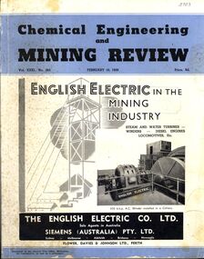
Book - CHEMICAL ENGINEERING AND MINING REVIEW, February 10th, 1939
Chemical Engineering and Mining Review February, 10th 1939 with photographs, maps and illustrations.books, technical, mining -
 Bendigo Historical Society Inc.
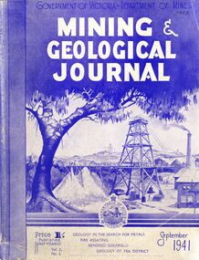
Book - MINING & GEOLOGICAL JOURNAL, September, 1941
... Mining journal Mining & Geological Journal September 1941 ...Mining & Geological Journal September 1941, Geology in the search for metals, fire assaying, Bendigo goldfields, Geology of Yea district published half yearly by the Department of Mines Victoria contains photographs, maps and illustrations.gold, mining, journal -
 Bendigo Historical Society Inc.
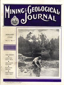
Book - MINING & GEOLOGICAL JOURNAL, 1940
... Mining journal Mining & Geological Journal January 1940 Vol.2 ...Mining & Geological Journal January 1940 Vol.2 No.2 Mine reports Chewton Gold Field, Geological Glossary, Flotation Process, Wonthaggi Coal Field published hald yearly by he Department of Mines Victoria contains photographs, maps and illustrations.gold, mining, journal -
 Bendigo Historical Society Inc.
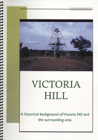
Book - VICTORIA HILL, A HISTORICAL BACKGROUND OF VICTORIA HILL AND THE SURROUNDING AREA, 2011
Victoria Hill a historical background of Victoria Hill and the surrounding area. Original article by Albert Richardson 1971 and revised and edited in 2012 by Philip Wilkin. Contains 26 pages with colour and black & white photographs and a map. Inside front cover is a 'Bendigo Miner' History Lives article by Jim Evans, dated 10 May 2012.Albert Richardson & Phillip Wilkinbendigo, mining, victoria hill -
 Coal Creek Community Park & Museum
Mine Map, 1942
6291.1 - Plan of "Austral Coal Mining Co" Lease in Korumburra detailing the mine tunnel plan, coal seam areas and some surface features such as railway sidings & Leura Creek. -
 Coal Creek Community Park & Museum
Mine Map
6303.1 - Cross sections of Korumburra coal mining area detailing local faulting and seam location/depth, boreholes, as well as elevation & surface topography along lines of sections. -
 Coal Creek Community Park & Museum
Mine Map
... 6306.1 - Map of Outtrim mining area, with modification... Korumburra gippsland 6306.1 - Map of Outtrim mining area ...6306.1 - Map of Outtrim mining area, with modification where damage/erasure has occurred. Shows tunnels, faults, tramways, boreholes, surface roads and (apparently) paddock boundaries and a creek. -
 Monbulk RSL Sub Branch
Book, Cleworth, Bob (Joseph Robert), The night shift : the story of RAAF minelaying Catalinas in coalition with US 7th Fleet, 22 April 1943 - 1 July 1945, 2015
An account of the minelaying by 4 Squadrons of the RAAF that between April 1943 and July 1945 in coalition with the USN 7th Fleet mined virtually every important Japanese port in the Southwest Pacific and as far North as Wenzhou (Wenchow) this was a substantial contribution to the Allied victory in the Pacific in WW2.Index, notes, bib, ill, maps, p.272.non-fiction An account of the minelaying by 4 Squadrons of the RAAF that between April 1943 and July 1945 in coalition with the USN 7th Fleet mined virtually every important Japanese port in the Southwest Pacific and as far North as Wenzhou (Wenchow) this was a substantial contribution to the Allied victory in the Pacific in WW2.world war 1939-1945 - aerial operations - australia, world war 1939-1945 - mining operations -
 Bendigo Historical Society Inc.
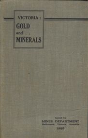
Book - BOOK - VICTORIA: GOLD AND . . MINERALS
A copy of the 1935 guide book Victoria: GOLD and MINERALS . This book gives in great detail about promising mining areas in Victoria along with detailed maps of them.book, bendigo, mining -
 Bendigo Historical Society Inc.
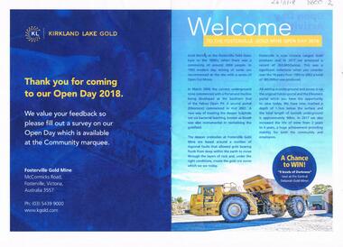
Document - FOSTERVILLE GOLD MINE COLLECTION: OPEN DAY 2018
2 page document, coloured, titled 'Kirkland Lake Gold' and 'Welcome to the Fosterville Gold Mine Open Day 2018'. Document describes activities available to visitors on the 2018 Open Day, and a map of the mine site showing location of various displays.bendigo, mining, fosterville gold mine -
 Bendigo Historical Society Inc.
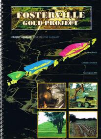
Document - FOSTERVILLE GOLD MINE COLLECTION: FOSTERVILLE GOLD PROJECT UPGRADE EXECUTIVE SUMMARUY
Black cover book, wire binding, 13 pages of text and maps. On front: Fosterville Gold Project' Map of ore body on cover - Central North, Central Ellesmere, Harringtons Hill. Contents include: open pits, heap leaching, waste dumps, estimated project life, changes from previously approved project, estimated project life, main project components, expanded open pits and underground mines, processing sulphide ore, tailings storages, waste rock dumps. Principles of rehabilitation, site preparation, rehabilitation activities during operation and decommissioning activities. Environmental issues, and summary of proposed new operating conditions.bendigo, mining, fosterville gold mine -
 Bendigo Historical Society Inc.
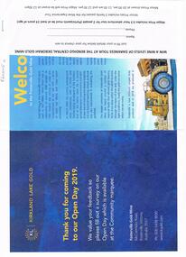
Document - FOSTERVILLE GOLD MINE COLLECTION: OPEN DAY 2019
Two page document for Kirkland Lake Gold Open day 2019. Open Day activities include: bus tours, technical services display, geology, exploration, processing, community and environment display, minerals council of Australia, Swick drilling, Central Deborah Gold Mine, Face painting, Goldfields Re-vegetation, Delecca's hire equipment, MacMahon underground mining services, Sandvik, and ISH24 safety specialists. Map of 'Fosterville Gold Mine Site Map' with activities highlighted. Fosterville is Victoria's larges gold producer and in 2918 a records 356,230 ounces at an average grade of 24.9 g per tonne. The mine has over 600 full time employees in 2019. Entry for '9 levels of darkness' tour at Central Deborah Mine attached.bendigo, mining, fosterville gold mine -
 Bendigo Historical Society Inc.
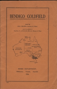
Book - BENDIGO GOLDFIELD
booklet, 51 pages. 'Bendigo Goldfield' issued by Geo Brown, Secretary for Mines. Mines Department 1936. Contains information on the geology of the Bendigo goldfield and major lines of reef and mines. Map of goldfield showing reef lines and mines attached to back cover.bendigo, mining, bendigo goldfield -
 Bendigo Historical Society Inc.
Document - CONSTABLE RYAN COLLECTION: MAP OF NORTH BENDIGO SHOWING CHINA CO. MINING LEASE
Map scale 1:5000 showing where the China Co. gold mining lease was.document -
 Bendigo Historical Society Inc.
Document - CONSTABLE RYAN COLLECTION: MAP OF NORTH BENDIGO CHINESE CAMP
... Photocopy of a map showing various mining leases around... Bendigo North Bendigo Photocopy of a map showing various mining ...Photocopy of a map showing various mining leases around North Bendigo. The photocopy is not of a very good quality.map, bendigo, north bendigo -
Bendigo Historical Society Inc.
Map - GEOLOGICAL MAP OF BENDIGO GOLD FIELD
... BENDIGO Mining Geological Map. H. Herman, Director of Geological ...Two framed laminated maps (a,b) of Bendigo goldfield reef lines, map (b) is a continuation of the reef lines in map (a). On map(a) written in black on top: 'Geological Map, Bendigo Gold Field', Scale of chains, anticlines, synclines, shafts, alluvial and contours marked. Map (b) is continuation of (a). Written on the bottom RH corner of map: 'Prepared in 1923 in the Bendigo Office Mines Department under the direction of H. Herman, Director of Geological Surveys, from surveys by H.S. Whitelaw, Fiield Geologist, assisted by E.S. Usher & J. J. Moore. Re-issued in 1936.'H. Herman, Director of Geological Surveys, from surveys by H.S. Whitelaw, Fiield Geologist, assisted by E.S. Usher & J. J. Moore. Re-issued in 1936.'bendigo, mining, geological map. -
 Bendigo Historical Society Inc.
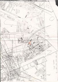
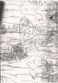
Document - MCCOLL, RANKIN AND STANISTREET COLLECTION: CHRISTMAS LEASE DOCUMENTS, 1941
Documents: folder contains - 'Consent to the Inclusion of Certain Lands in a Mining Lease', forms for Lease No. 11106, Map of No. 11106, List of land owners re: Lease 11106, Blank consent forms, Lease 11106 was below the 400foot level.MCCOLL RANKIN AND STANSISTREETorganization, business, gold mining, mccoll rankin and stansistreet, christmas gold mine. -
 Bendigo Historical Society Inc.
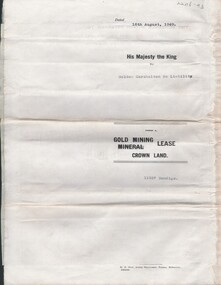
Document - MCCOLL, RANKIN AND STANISTREET COLLECTION: GOLDEN CARSHALTON NO LIABILITY, 1949
Documents: Gold Mining Lease No. 11257 FOL.36397 Bendigo 16/8/1949. Golden Carshalton N\L Map of Bendigo Sandhurst Lease No 11257 showing the Carshalton Mines Ltd New Main Shaft, Hansel Mundy Shaft.MCCOLL RANKIN AND STANSISTREETorganization, business, gold mining - legal, mccoll rankin and stansistreet. golden carshalton n\l. mundy shaft. -
 Bendigo Historical Society Inc.
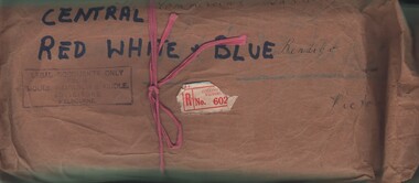
Document - MCCOLL, RANKIN AND STANISTREET COLLECTION: CENTRAL RED WHITE AND BLUE - BUNDLE OF PAPERS, 1912
Documents: Whitelaw Central Red White and Blue Mine Bendigo. 28 pages summary of gold mining correspondence - mortgage mining leases 943689340, contract of sale to Central Blue Gum GM 1933, leases with mining rights, treatment of pyrites agreement 1917 - J. Edwards & Co, Helen Streader - release of liability after being paid (pounds)125 by mine due to accidental death of husband 1912. Another for Ellen Lane 1916, list of titles held by Co , lease agreements Filcock and Manning, Andrew Harkness 'winding plant at mine' 1923, notice to perform agreement to Manning's 1916, Edwards Metallurgical Works 1917, map for 9777 Bendigo, contract for explosives with Dalgety & Co 1917, new scrip for lost shares 1917, Miner's Right 1911, sale of land Ra. A. Rankin 1910.MCCOLL RANKIN AND STANISTREETorganization, mining, central red white and blue, mccoll rankin and stanistreet. -
 Bendigo Historical Society Inc.
Document - CONNELLY, TATCHELL, DUNLOP COLLECTION: LEGAL PAPERS, 1878 1889
Document. Various legal papers. 1 - 1856? - Petition for Vesting Order in the matter of Diviney Michael, late of Sandhurst. Mentions Hughes Joshua and Freame H S? for Flegg Wm Sandhurst. 2 - Hughes J. Application for Vesting Order. Mentions Doran Joseph Christopher & Diviney. 3 - 1878 - In the matter of the Hope Tribute Mining Company Reg and in the matter of the Mining Companies Act 1891 between the Commercial Bank of Australia Ltd. (Appellant) and the Hope Tribute Mining Company Reg (Respondent). Appeal case. 4 - 1889 - Transfer of Land in Kerang from Ellis Asher (Postmaster) to Victorian Railways Commissioners. Contains map of said land.cottage, miners, connelly, tatchell & dunlop, diviney michael, hughes joshua, freame h s?, flegg wm, doran joseph christopher, hope tribute mining company, commercial bank of australia, ellis asher, victorian railways commissioners