Showing 429 items
matching mining gullies
-
 Bendigo Historical Society Inc.
Newspaper - JACK PERRY COLLECTION: NEWSPAPER HOUSEHOLD CHORES FOR YOUNG FAMILY MEMBERS
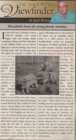
Newspaper article Bendigo Weekly by Jack Perry re chores undertaken by young family members. During early days of mining through to 1935-40. Photo of Mr. Lougsons hydraulic sluice of Myers Flat in the 1930's.. Recovering gold from Peg Leg Gully. Bendigo Advertiser 24.9.99person, individual, jack perry -
 Bendigo Historical Society Inc.
Document - LUDERMAN COLLECTION: SPRING GULLY, MANDURANG DOCUMENTS
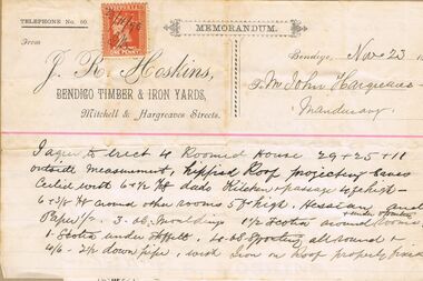
Document. Pastel Drawing Book, 'Bulldog' Series No. 589, containing series of invoices and documents relating to the Hargreaves family. Items stuck in book in order includes: invoices from J.R. Hoskin, Bendigo Timber and Iron Yards relating to construction of residence in Spring Gully (1896); Certificate of Registration of Residence Area for Thomas Snowdon, adjoining Hargreaves residence 200 yards from Reservoir; Elector's Right for John Billman Hargreaves of Mandurang, Tanner; handwritten note (Bairnsdale 24.1.34) on John Billman Hargreaves born 1861 on 14 June on Sheepwash Creek in Mandurang riding Shire of Strathfieldsaye near Bendigo possibly registered at Strathfieldsaye, Kangaroo Flat or Bendigo. Father's name John Hargreaves (English) mother's name Hosannah Hargreaves nee Billman'; 2 scrip certificates issued by 'Tanners Gold Mining Compagnie Pipers Hill, Sheepwash' overwritten on top of document ( underneath North Lord Warden Tribute Co., ) scrip certificate issued to John B. Hargreaves on 25 September 1882; invoice Jas. Knowlton, late J. Moody, watchmaker and jeweller, No. 1 Bath Corner, Bendigo 3.8.1895 for Diamond brooch; invoice H. Credginton watchmaker and jeweller and optician for 1 gem ring. Loose document inside contains written advice re taking wool off sheep skins and curing hides.person, individual, hargreaves, hoskins, hargreaves, snowdon, elector's right, tanner's gold mining compagnie, north lord warden tribute co., knowlton, credgington -
 Bendigo Historical Society Inc.
Document - SEBASTIAN (1863 - 1891)
Sebastian (1863 - 1891) - page of historical details under the title of RHSV, Bendigo and District Branch (no author; no date). Reference to : Sebastian Schmidt; Frederick the Great; Hugh Glass; Splitters Gully; Frederick the Great Tribute Company; Robert Charlton; Bruhn's Tribute.bendigo, mining, early history. miners, splitters creek, sabastian schmidt, great tribute company, mr hugh glass. whipstick scrub. charlton's paddock. -
 Bendigo Historical Society Inc.
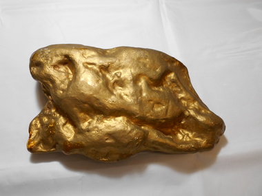
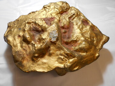
Memorabilia - GOLD NUGGET COLLECTION: 'THE BEAUTY'
Plaster model of The 'Beauty' Nugget found at Kangaroo Gully Bendigo in 1858 nine feet below the surface. Weight 242 ozs. (See additional Research)mining, models, plaster model of victorian gold nugget -
 Bendigo Historical Society Inc.
Memorabilia - GOLD NUGGET COLLECTION: 'THE SCHLEMM'
A plaster model of the Sclemm nugget found on 11.7.1872 at the Shoots Gully between Dunolly and James Creek, three feet below the surface. Associated with quartz and ironstone. Weight 538 ozs. Estimated yield 478 ozs. Finder Henry Davey. Value 2016 $849,760. (See additional research)mining, models, plaster model of victorian gold nugget -
 Bendigo Historical Society Inc.
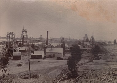
Photograph - DUCHESS TRIBUTE MINE
Black and white photograph: Gold mines, looking towards Snobs Hill. In the centre: Duchess Tribute Company of the Devonshire Mining Group. At least 8 poppet heads and 6 chimneys can be seen. The original is glued to cardboard. A copy of this photograph is in a black paper photo holder. On the back in pencil a sketch of where duchees tribute was located: between Alexander Street, Upper Road and Vinton Street, California Gully.business, mining, duchess tribute -
 Bendigo Historical Society Inc.
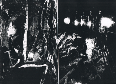
Photograph - LONG GULLY HISTORY GROUP COLLECTION: TWO UNDERGROUND PHOTOS
Copies of two dark black and white photos of underground mining at the Hercules mine. The left side one shows two miners facing the sides of the shaft prior to the boxing in with red gum slabs. one man is using a sledge hammer and the other is using a hand pick. The right-hand side photo This photo was either the Shenandoah or the New Chum Railway. Five men standing on a higher part are holding lamps and one man is standing on a ladder.bendigo, history, long gully history group, the long gully history group - two underground photos, hercules, shenandoah, new chum railway, victoria quartz -
 Bendigo Historical Society Inc.
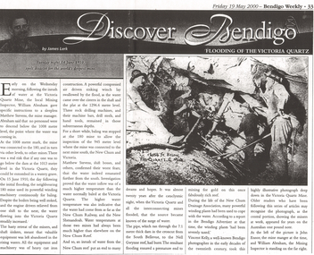
Newspaper - LONG GULLY HISTORY GROUP COLLECTION: FLOODING OF THE VICTORIA QUARTZ
Copy of an article from the Bendigo Weekly 19/5/2000 Discover Bendigo - Flooding of the Victoria Quartz by James Lerk. Article mentions the flooding of the mine, the equipment left in there and where the water had come from. An accompanying photo, taken by Vincent Kelly, shows miners at work underground. John Ennor, the mine manager at the time and William Abraham, the Mining Inspector are in the photo. Written on the photo is: 4156 ft below Vic Quartz G Mine.bendigo, history, long gully history group, the long gully history group - flooding of the victoria quartz, bendigo weekly 19/5/2000, james lerk, william abraham, matthew stevens, 180 mine, new chum and victoria, new chum railway, new shenandoah, new chum reef, south bellevue, nell gwynne reef, new chum drainage association, bendigo advertiser, vincent kelly, john ennor -
 Bendigo Historical Society Inc.
Document - LONG GULLY HISTORY GROUP COLLECTION: 1852 - 1950'S
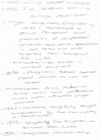
Two hand written pages with year dates and what took place at that time. Dates range from 1852 to 1950's. 1950's - mining stopped in Long /G. 1926 - First Teachers training College established. Taylor Horsefields Engineering works - Horsefield a genius. Pioneered local production of compressed air driven roak-drills, specialized in rock bores and drills exported them throughout the world. Harvester - for f/ter in Harvest equipment. 1856 - Anglican School opened held church as well as school. Manchester Arms, Admiral Arms both has pretentious music halls attracted large crowds. 1862 - Ironbark, Long Gully sought annexation by the Municipality of Sandhurst. 1872 - Long Gully Fire Brigade was formed. Keen rivals. 1850 - recognised Chinese camp. ? Long Gully - due to the sinking deeper and the rewards generally richer, became the heart of 'Little Cornwall' - Cornish people. * Tent Church services held in 1862. Long Gully Mine opened April 1852. On the back of the first page is written - Mines - Reefs. mines mentioned are New Chum Hill, the New Chum and Victoria, The Victoria HIll Ironbark, The North Old Chum, Lansell's Big 180, Ballerstadt's Open-Cut, and the Victoria Quartz Mine.bendigo, history, long gully history group, the long gully history group - 1852 to 1950's, first teachers training college, taylor horsefields engineering works, anglican school, manchester arms, admiral arms, municipality of sandhurst, long gully fire brigade, chinese camp, little cornwell, long gully mine -
 Bendigo Historical Society Inc.
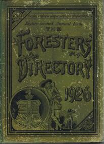
Book - DIRECTORY OF THE ANCIENT ORDER OF FORESTERS FRIENDLY SOCIETY FOR 1926
Green cover, on front ' Eighty second annual issue The Foresters' Directory 1926', 564 pages. Contains location and names of all Foresters Societies in that year. Bendigo United District (1862) had 5 Courts in 1926 - 136 adult benefit, 4 honorary members, £6984. District secretary Mr. M.H. P Webb; 7 Beehive Chambes, Bendigo. 3549 Bendigo 1861 (year of commencement) Bee Hive Mining Exchange, Pall Mall. Bendigo; fortnightly, Sec, T.A. Considine, Hope S. Bendigo. Treasurer E.B. Newell. 3768 Banner of Hope 1862. Foresters' hall, Kangaroo Flat, fortnighty Sec. C. Yeates, Kangaroo Flat, Treas C.A.F. Taylor. 3770 King of the Forest 1862, Mechanics' institute, Mount Korong Road, Long Gully; every four week. Sec. M.H. P. Webb, Long Guly Bendigo. 5500 Pride of Marong, 1871, Marong; Sec FM. palmer Post office Marong. Court for females only: Star of Bendigo 1894, BUFS Dispensary Hall Bendigo. alternate Tuesdays, Sec Miss Petersen, California Gully, Bendigo Treas Miss M. Baker.bendigo, clubs, foresters -
 Bendigo Historical Society Inc.
Newspaper - LONG GULLY HISTORY GROUP COLLECTION: JOHN EMERY AND HIS ASSOCIATES
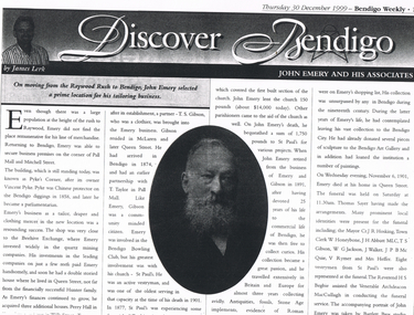
Copy of an article from the Bendigo Weekly 30/12/1999 Discover Bendigo by James Lerk titled John Emery and His Associates. John Emery was a tailor who had a business in Raywood. He moved to Bendigo where he set up his business as a tailor, draper and clothing mercer at the corner of Pall Mall and Mitchell Street. The shop was close to the Beehive Exchange, where he invested in the quartz mining companies. He took on a partner, T S Gibson, who was a clothier. Emery was involved in the Bendigo Bowling Club and St Paul's Church. Later he travelled and became a collector of curios. He donated sculptures to the Bendigo Art Gallery and loaned a number of paintings. Article is accompanied by a portrait of John Emery taken by Bartlett Bros studio.bendigo, history, long gully history group, the long gully history group - john emery and his associates, bendigo weekly 30/12/1999, james lerk, pyke's corner, vincent pyke, beehive exchange, hunter family, perry hall, t s gibson, t taylor, bendigo bowling club, st paul's church, emery and gibson, bendigo art gallery, thomas sayer, cr j r hosking, w honeybone, j h abbott, t s gibson, w g jackson, j walker, j p b mcquie, v rymer, mrs heffer, the reverend h s begbie, the venerable archdeacon maccullagh, bartlett bros -
 Bendigo Historical Society Inc.
Newspaper - LONG GULLY HISTORY GROUP COLLECTION: THE MINE FLOODING CRISIS - NEW PUMPING TECHNOLOGY SUGGESTED
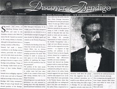
Copy of an article from the Bendigo Weekly 9/6/2000 titled The Mine Flooding Crisis - New Pumping Technology Suggested by James Lerk. Louis August Samuels was born in Germany. Samuels was involved in the mining industry in Australia and he had mining experience in West Africa. He had knowledge of the mines at the southern end of the field. He was president of the Mine Managers' Association. He believed the flooding was caused by the lack of baling and pumping operations. Earlier he had visited a coal mine in Bohemia to see a Riedler pump at work. It was a new design, very effective, simple in design and reliable. He watched it work. It was 500 metres underground and pushed the water to the surface in a single column. He suggested this type of pump could be adapted to use on the New Chum Reef. Even this suggestion was not the latest technical innovation, but it would be more efficient and less costly than baling. No one took him seriously and continued to remove water by the traditional means. Article is accompanied by a photo of Samuels.bendigo, history, long gully history group, the long gully history group - the mine flooding crisis - new pumping technology suggested, bendigo weekly 9/6/2000, james lerk, louis august samuels, origin of the bendigo saddle reefs and the cause of their golden wealth 1893, bendigo mine managers' association, victoria proprietary company, victoria quartz mine, new chum drainage association, riedler pump, riedler zwangschluss valve, technical school at aix-la-chapelle (achen) -
 Bendigo Historical Society Inc.
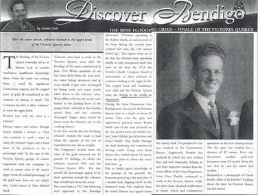
Newspaper - LONG GULLY HISTORY GROUP COLLECTION: THE MINE FLOODING CRISIS - FINALE OF THE VICTORIA QUARTZ
Copy of an article from the Bendigo Weekly titled Discover Bendigo The Mine Flooding Crisis - Finale of the Victoria Quartz by James Lerk. The lack of suitable machinery, insufficient knowledge of where the water was coming from, need for Government support, and the pegged price of gold, all contributed to the cessation of deep mining. The Victoria Quartz decided to allow tributers for work the upper levels. By 1913, the Company found it uneconomic to allow the tributers to continue working the upper levels and the poppet head and machinery were sold. During the Great Depression Ernest Smith, Davic Holden, Jack Harrison and David Patullo worked above the water line and did well enough to help their families from the worst effects of the Great Depression. Later Dave Patullo continued to work at the Victoria Quartz while the other three obtained employment in other mines. The article has a photo of David Patullo.bendigo, history, long gully history group, the long gully history group - the mine flooding crisis - finale of the victoria quartz, bendigo weekly, james lerk, victoria quartz mine, brough smyth, bendigo advertiser, victoria quartz company, great depression, ernest smith, david holden, jack harrison, david patullo, government battery eaglehawk -
 Bendigo Historical Society Inc.
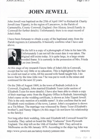
Document - LONG GULLY HISTORY GROUP COLLECTION: JOHN JEWELL
... Long Gully Imperial Football Club Mining Managers Association ...Five typed pages outlining the life of John Jewell from his birth in Cornwall to his marriages, immigration to Australia and his living in Ballarat, North Queensland and then to Bendigo where he worked at the Kentish Mine and was later the Manager. He also managed the Carlisle and Unity Batteries, was involved in a number of organisations and lent large sums of money to the Methodist Church in McIntyre Street Bendigo. There is a photo of John in his later life, one of his houses, John surrounded by 7 of his Grandchildren. and his headstone.bendigo, history, long gully history group, the long gully history group - john jewell, richard jewell, charity jewell (nee tippett), history of jewell family in cornwall, mrs frieda lee (nee jewell), sarah jewell, elizabeth tozer, john tippett jewell, henry tozer, nanny odgers, 'cadeueus', william john jewell, elizabeth jewell, john jewell, richard james jewell, kentish mine, george henry jewell, sarah ann clark, frederick albert victor jewell, william leslie norman jewell, mr j b watson, carlisle company, john jewell junior, carlisle battery, unity battery, the bendigonian 6/7/1909, long gully imperial football club, mining managers association, star of eaglehawk i.o.o.f., hopetoun band, carlisle mine cricket club , bell's reef co maldon, long gully fire brigade, dr simmonds, lanner, white hills cemetery, r bennetts, j cox, w arkinstall, w steen, g cox, t delchuray, mr a hicks mlc, mr w verece, messrs norris and son, passby mine, ah poo & co (workers of the sand), mr w farmer -
 Bendigo Historical Society Inc.
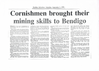
Newspaper - LONG GULLY HISTORY GROUP COLLECTION: CORNISHMEN FROUGHT THEIR MINING SKILLS TO BENDIGO
Copy of an article from the Bendigo Advertiser 1/9/1990 mentioning the Cornish influence on Victorian gold mining during the 1880's and 1890's. Also mentioned is population growth, rock drills and miner's phthisis.bendigo, history, long gully history group, the long gully history group - cornishmen brought their mining skills to bendigo, bendigo advertiser 1/9/1990, dr charles fahey, cornish association of bendigo and district, bendigo college of advanced education, george lansell, the mining exchange, beehive building, eaglehawk fire station, george ellis -
 Bendigo Historical Society Inc.
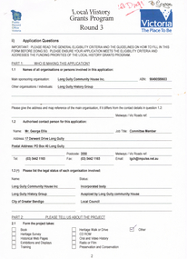
Document - LONG GULLY HISTORY GROUP COLLECTION: LOCAL HISTORY GRANTS PROGRAM ROUND 3
Application form to Local History Grants Program Round 3. Four pages with Public Record Office Victoria and logo in the top left corner and Victoria the Place To Be and logo in the top right corner. Written at the top of the page is ? Draft. Application is for a Poppet Head to acknowledge the Men and their families who worked in the underground mining industry and the achievement that Underground Mining made to make the City of Greater Bendigo what it is today. Also mentioned is estimated cost of of the project.bendigo, history, long gully history group, the long gully history group - local history grants program round 3, public record office victoria, long gully community house inc, long gully history group, mr george ellis, city of greater bendigo, long gully linear park, city of greater bendigo recreation department, city of greater bendigo community environmental education department, long gully community newsletter, eaglehawk times, bendigo advertiser, bendigo tourist bureau, shared action project (st lukes) -
 Bendigo Historical Society Inc.
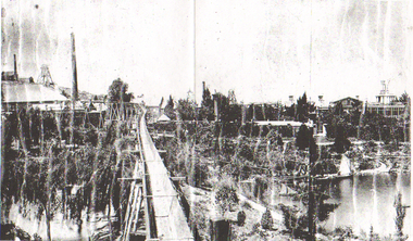
Photograph - LONG GULLY HISTORY GROUP COLLECTION: GEORGE LANSELLS FORTUNA, MINES & BATTERY
Copy of a black and white photo of George Lansells Fortuna, Mines & Battery. this photo is a continuation of the part a photo further to the right. In the photo is Fortuna and next to it is two chimneys, a raised trolleyway going to the poppet legs and some buildings. In front of the poppet legs and Fortuna is the lake. There are also more trees and shrubs. Written on the back left is: George Lansells Fortuna Mines & Battery Bendigo and on the right is: Fortuna. Mining Days. Taken from West Side. Booth St.bendigo, history, long gully history group, the long gully history group - george lansells fortuna, mines & battery -
 Bendigo Historical Society Inc.
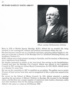
Document - LONG GULLY HISTORY GROUP COLLECTION: RICHARD HARTLEY SMITH ABBOTT
Copy of a piece about Richard Hartley Smith Abbott. Abbott was born in Bendigo. He was a hardware merchant, it operated as Abbot Supply Co. He was a director of the Bendigo gas Co, Sandhurst Building Society and Sandhurst Trustees Co. He also helped pioneer tanning in Australia and he had his tannery in Mandurang. He served on the Strathfieldsaye Council and later the Bendigo City Council. He was elected to the Legislative Council in 1907 and in 1932 served as a Senator. In 1887 he was on the committee to establish an art gallery. He served on the School of Mines Council. In 1910, he attended a meeting about Miners' Phthisis in Bendigo. He invested in the Bendigo mines and his firm was a major supplier of various hardware for the mining companies. There is also a photo.bendigo, history, long gully history group, the long gully history group - richard hartley smith abbott, parliamentary library, abbott supply co, bendigo gas co, sandhurst building society, sandhurst trustees co, strathfieldsaye council, bendigo city council, art gallery, school of mines council, miners' phthisis -
 Bendigo Historical Society Inc.
Document - LONG GULLY HISTORY GROUP COLLECTION: HISTORY OF THE FIELD (GOLD)
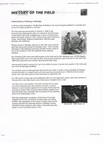
Three pages of History of the Field, A Brief History of Mining in Bendigo. The history starts in 1851 when gold was discovered along the Bendigo Creek to 1992 when Bendigo Mining NL purchased the licences and infrastructure from WMC. There are four small photos: Two men working a puddling machine; Victoria Hill - 1850's Open Cut; Victoria Hill Quartz Mine, and the Central Deborah Mine. There is also a web address in the top right corner.bendigo, history, long gully history group, the long gully history group - history of the field (gold), mrs margaret kennedy, mrs farrell, edward nucella emmett, cave and amos, victoria quartz, new chum railway, bendigo amalgamated gold mies, bendigo mines ltd, deborah mines, william burrell, wmc, williams united, charshalton, bendigo mining nl, new bendigo project, trevor clark, shelley saunders, peter wiseman, new bendigo - 10 million ounces of gold -
 Bendigo Historical Society Inc.
Document - LONG GULLY HISTORY GROUP COLLECTION: THE BENDIGO POST OFFICE
Article titled The Bendigo Post Office, compiled by L C Bennetts. Mentioned is the history of the Bendigo Post Office and postmarks, some information on mining, Bendigo foundries, Underground connections of mines, expenses and shaft sinking costs. Also mentioned is Bendigo and Eaglehawk - 60 years ago and the role the pubs played in daily living. They were where theatres, concerts and dances were held, and the meeting rooms for clubs and lodges, even church benefits. Listed is a number of Bendigo hotels. Some even had a few names. Names of the pubs are: The Freemasons, The Courthouse, The Commercial Law Courts, The Hamburg, The European, The Prince Bismark, The Lord Kitchener, The Bendigo, The Rosalind Park, The Showgrounds, Atheneum Club, Olivers, Bridge Hotel, Bourkes, The Globe, The Hibernia, Albert, Albion, Abbotts, Australian, Belvidere, Beehive, British Queen, Black Eagle, British and American, Brian Boru, Bakers Arms, Butchers Arms, Brick Layers Arms, Bull and Mouth, Cresent, Clarence, Back Creek Bridge, Cape Clear, Crooked Billet, Cambridgeshire Arms, Camp, Coach and Horses, Cricketers Arms, Diggers Rest, Ellesmere, Five Lions, Franklyn, Golden Square, Golden Gate, Golden Gully, Golden Age, Golden Vine, Gumtree, Glasgow Reef, Great Britain, Haymarket, Daniel O'Connell, Half Way House, Fleece Inn, Ironbark, Johnsons Reef, Lancashire, Live and Let Live, Manchester Arms, Gold Mines, Metropolitan, Crown, National, New Chum, Honeysuckle Street, Pavilion, Napier Arms, Quartz Miners Arms, Retreat Inn, Rainbow, Rose of Australia, Lake View, Robin Hood, Fountain, Southern Cross, Bath, Berlin, Spring Gully, Star, Sir Charles Hotham, Silvermines, Royal Oak, Suburban, Town Hall, Temperance, Ship Inn, View Point, View Bend, Victoria, Exchange, American, Arcade, Belfast, All Nations, Union, United Kingdom, Union Jack, Westend, Washington, Waterloo, Wellington, Whitehorse, Wheat Sheaf, Yorkshire, Niagra and Noahs Ark.bendigo, history, long gully history group, the long gully history group - the bendigo post office, l c bennetts, mt alexander post office, porcupine inn, cenotaph, pike or pyke, baby health centre, sandhurst post office, government survey office, queen elizabeth oval, sandhurst trustees company, mr h b briston, savings bank, telegraph office, the sub-treasury, sir henry brougham lock kcb, sir john nimmo mla, prince of wales group of mines, the new prince of wales, eaglehawk golf links, new prince of wales no 2, the whip and jersey, mines department, lansell's big 180, new chum and victoria mine and battery, new chum railway, koch's pioneer, south new moon, catherine reef united, new moon, the virginia, south bell vue, central nell gwynne, north nell gwynne, miner's phthisis, hercules engine house, ironbark, new chum syncline, hercules energetic, roberts & sons, harkness & co, horwoods, great southern, ulster, carlisle, lansells big 180, victoria quartz, new st mungo, duchess tribute, south devonshire, hopewell mine, saxby mine, mcnair & co, shamrock, mr king, burke and wills expedition, sandhurst hotel, courthouse, hiberian, the freemasons, the courthouse, the commercial law courts, the hamburg, the european, the prince bismark, the lord kitchener, the bendigo, the rosalind park, the showgrounds, atheneum club, olivers, bridge hotel, bourkes, the globe, the hibernia, albert, albion, abbotts, australian, belvidere, beehive, british queen, black eagle, british and american, brian boru, bakers arms, butchers arms, brick layers arms, bull and mouth, cresent, clarence, back creek bridge, cape clear, crooked billet, cambridgeshire arms, camp, coach and horses, cricketers arms, diggers rest, ellesmere, five lions, franklyn, golden square, golden gate, golden gully, golden age, golden vine, gumtree, glasgow reef, great britain, haymarket, daniel o'connell, half way house, fleece inn, ironbark, johnsons reef, lancashire, live and let live, manchester arms, gold mines, metropolitan, crown, national, new chum, honeysuckle street, pavilion, napier arms, quartz miners arms, retreat inn, rainbow, rose of australia, lake view, robin hood, fountain, southern cross, bath, berlin, spring gully, star, sir charles hotham, silvermines, royal oak, suburban, town hall, temperance, ship inn, view point, view bend, victoria, exchange, american, arcade, belfast, all nations, union, united kingdom, union jack, westend, washington, waterloo, wellington, whitehorse, wheat sheaf, yorkshire, niagra, noahs ark -
 Bendigo Historical Society Inc.
Document - LONG GULLY HISTORY GROUP COLLECTION: EAGLEHAWK & NOTED EVENTS
Notes on Eaglehawk compiled by H Biggs mentions early settlement, discovery of gold, separation of Eaglehawk from the Marong District Roads Board, Nominations for Council and Newspapers. Noted Events compiled by June Parry mention events from 1839 to 1876 and some in 1928. These included early settlement, gold discovery at The Rocks, Churches, hospital, Bendigo Advertiser, Theatre Royal, Police Office, Post Office, Census, First Council Works, Telegraph, Mining Company, Mining Board, Public Market, various buildings built, Rates, Schools, and very early trams.bendigo, history, long gully history group, the long gully history group - eaglehawk & noted events, h biggs, june parry, james mouat, joseph crook, marong district roads board, camp hotel, charles sherratt, mt alexander north run, grice and heape, ravenswood, gibson and fenton, mrs john kennedy, mrs patrick farrel, mr j a paton, mr lachlan mclachlan (bendigo mac), bendigo hospital, bendigo advertiser, theatre royal, lieutenant governor sir charles and lady hotham, harney's bridge, e j ennor, sandhurst fire brigade, mr townsend, bendigo water works, cornish & co, post office, bendigo pottery, bendiog agricultural society, benevolent asylum, bendigo gas company, cattle yards, coliban water supply scheme, cr w v simons, j mouat, sir henry barkly, sandhurst borough, eaglehawk borough, cr john mcintyre, duke of edinburgh, latham and watson's mine, galatea (model ship), st paul's church of england, rev g p despard, bendog rifle association, strathfieldsaye shire hall, corporate high school, bendigonian society, richard andrews, easter fair, g aspinall, j burnsides, viscount canterbury (sir h manners sutton), beehive stores, mining exchanges, annual waverley prize, bendigo water works, city fire brigade, city family hotel, bendigo united friendly society medical institute and dispensary, jewish synagogue, masonic hall, school of mines, j h abbott, australian natives association, temperance hall, royal princess theatre, albion hall, central state school, high school, gravel hill state school, early trams, electricity commission -
 Bendigo Historical Society Inc.
Document - LONG GULLY HISTORY GROUP COLLECTION: NEW HISTORY GROUP IN LONG GULLY - OPEN INVITATION TO ATTEND
A newly formed History Group in Long Gully had been formed to promote the history of Long Gully. It contributed to the City of Bendigo with it's thriving mining centre. Mentioned is the School and origin of street names. The aims of the group are to document the history of Long Gully and to make people aware of Long Gully's interesting past.bendigo, history, long gully history group, the long gully history group - new history group in long gully - open invitation to attend, city of bendigo, first teachers college, long gully primary school, energetic mine, sir john quick, humboldt mine, pearl mine, hercules mine, edward dyason, manchester arms hotel, george ellis, alan crossley -
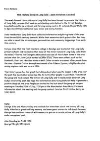
 Bendigo Historical Society Inc.
Document - LONG GULLY HISTORY GROUP COLLECTION: MARKING OUR MINING HISTORY
... Group - Marking our mining history Long Gully History Group ...Copy of a newspaper article titled Marking our mining history printed in the Bendigo Adveretiser 27/5/2002. the Long Gully History Group plans to create an information marker in its neighbourhood acknowledging the role underground mining made to Bendigo.bendigo, history, long gully history group, the long gully history group - marking our mining history, long gully history group, the bendigo cornish association, george ellis, bendigo advertiser -
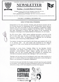 Bendigo Historical Society Inc.
Document - LONG GULLY HISTORY GROUP COLLECTION: CORNISH ASSOCIATION NEWSLETTER DECEMBER 2001
Cornish Association of Bendigo & District Inc. Newsletter Volume 7: Number 4: December 2001. Titled Early Ethnic Gold Pioneers. Members met at the Chinese Museum before taking a walk down the street to view the Centenary of Federation display which is housed in the Museum, situated in the Old Post Office. Sir John Quick is also mentioned. According to Lorna Erwin, Publicity Officer for the Bendigo Cornish Association, the display covers some of the major aspects of mining, education, communications, health, religion, sporting and social life in Bendigo over the last 100 years and provides an interesting and informative comparison between life in Bendigo in 1901 and life today. Also mentioned is Bendigo can be proud of the Museum which was made possible by a grant from the Federal Government to allow Bendigo to share in the Centenary of Federation Celebrations.bendigo, history, long gully history group, the long gully history group - cornish association newsletter december 2001, cornish association of bendigo & district inc, george a ellis, eaglehawk fire statin, chinese museum, centenary of federation, old post office, sir john quick, bendigo advertiser, bathurst convention of 1896, commonwealth constitution 1897 - 1898, lorna erwin -
 Bendigo Historical Society Inc.
Document - LONG GULLY HISTORY GROUP COLLECTION: REASONS FOR PLACEMENT OF PLAQUES IN THE NEW CHUM PARK
Two reasons for placement of Plaques in The New Chum Park. One is to acknowledge the contribution that both the Cornish and German people who lived and worked in Long Gully made to the establishment of City of Greater Bendigo. The second, Famous Journalist Anthony Trollop visited Bendigo just as Underground Mining was starting to blossom. His remarks of Bendigo were uncomplimentary as that of Ballarat, which he complimented as a beautiful city. Twenty years later thanks to U/ground mining Bendigo rivalled Ballarat as a beautiful city to which the residents of Long Gully played a major role. Heading at top of page - Long Gully History Group.bendigo, history, long gully history group, the long gully history group - reasons for placement of plaques in the new chum park, long gully history group, city of greater bendigo, anthony trollop -
 Bendigo Historical Society Inc.
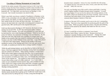
Document - LONG GULLY HISTORY GROUP COLLECTION: UNVEILING OF MINING MONUMENT AT LONG GULLY
... LONG GULLY HISTORY GROUP COLLECTION: UNVEILING OF MINING...The Long Gully History Group - Unveiling of Mining Monument... Group - Unveiling of Mining Monument at Long Gully Long Gully ...Paper mentions that credit for the project must go to the Long Gully History Group who have been working to install a sense of pride in the locals by highlighting the contribution the former residents made to the city. Long Gully was once known as Bendigo's Little Cornwall - the Cornish Association was asked to help. Also mentioned Long Gully in the 1870's, Gold discovery, Anthony Trollop's visit to Bendigo and his praise for Ballarat and his comments on Bendigo which were not flattering. Also mentioned was the men and their work, the miners complaint, the unrest in the mining industry and a lot of the miners leaving for West Australia.bendigo, history, long gully history group, the long gully history group - unveiling of mining monument at long gully, long gully history group, bendigo's little cornwall, cornish association, anthony trollop -
 Bendigo Historical Society Inc.
Photograph - LONG GULLY HISTORY GROUP COLLECTION: PHOTO OF MINING AREA
Copy of two black and white photos of a mining area. the top photo shows a hilly area with vegetation and a track and the lower photo shows a bush area with a fence? behind some shrubs in the foreground.bendigo, history, long gully history group, the long gully history group - photo of mining area -
 Bendigo Historical Society Inc.
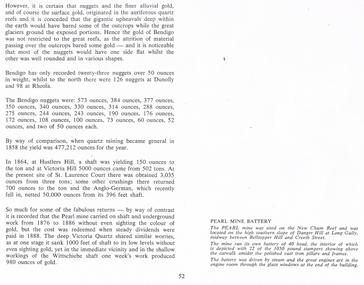
Document - LONG GULLY HISTORY GROUP COLLECTION: GOLD MINING
... The Long Gully History Group - Gold Mining... BENDIGO History long gully history group The Long Gully History ...Copy of page 52 from a book. Mentioned are nuggets of gold. Some large Bendigo nuggets and their weight in ounces are mentioned, but no names of the nuggets. Some yields from shaft mining are also mentioned. The Pearl Mine and the Victoria Quartz did a lot of work without sighting any gold, while nearby at the Wittschiebe shaft there was a good find. There is also a short piece about the Pearl Mine Battery. It belongs to photo that was on the next page.bendigo, history, long gully history group, the long gully history group - gold mining, hustlers hill, victoria hill, st laurence court, anglo-german, pearl mine, victoria quartz, wittschiebe shaft, new chum reef, danger hill, belltopper hill -
 Bendigo Historical Society Inc.
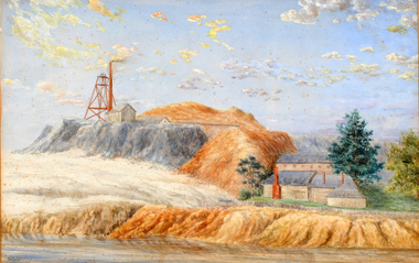
Artwork, other - Hustlers Reef Paintings, 1901
The century-old paintings of Bendigo gold mines made the long journey home from Western Australia in 2012. The paintings of the Great extended Hustler’s Mine, Bendigo, and Koch’s Pioneer Gold Mine, Long Gully, were painted by C.G Robertson in 1901.For years the paintings sat in the Perth house of Charles and Grace Strue; however Ian and Katinka Napier, the grand-daughter of Mr and Mrs Strue, donated the paintings to the Bendigo Historical Society.DVD. Hustler's Gold. Hustlers Reef paintings. artist C G Robertson 1901, for one painting. Second Hustler Extended Bendigo.bendigo, mining, c. g. robertson artist -
 Bendigo Historical Society Inc.
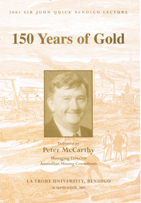
Book - LONG GULLY HISTORY GROUP COLLECTION: 150 YEARS OF GOLD
Book titled 150 Years of Gold delivered by Peter McCarthy, Managing Director Australian Mining Consultants at La Trobe University, Bendigo on 26 September, 2001, the 2001 Sir John Quick Bendigo Lecture. Book cover, inside and out has a beige copy of a wood engraving of Hustlers Reef, Sandhurst with a tan tone photo of Peter McCarthy on the centre front. Mining is mentioned from the late 1840s to the present day. In the back is a career history of Peter McCarthy and a short life story of Sir John Quick. Also in the back is a list of past lectures from 1994 to 2000.bendigo, history, long gully history group, the long gully history group - 150 years of gold, peter mccarthy, australian mining consultants, la trobe university bendigo, robertson hyetts, sir john quick, quick hyett and rymer, quick and hyett, national library of australia, charles joseph la trobe, james gumm, hargreaves, melbourne argus, henry frenchham, the times, gibbons, james esmond, dr barker, thomas hiscock, alfred clarke, geelong advertiser, wat tyler, dunlop and regan, commissioner doveton, sub commissioner armstrong, captain dana, argus, armstrong, stewart gibson, margaret kennedy, convict's prevention act, micky o'halloran, throckmorton, anti-gold-license association, g e thomson, dr jones, 'captain' edward brown, eureka rebellion, sir john quick, mark twain, australian federation, mining exchanges, alfred deakin, the amalgamated miner's association, robert clark, britian's national miners' association, silicosis, tuberculosis, walter summons, bendigo amalgamated mines, great war, gold mines of australia, bendigo mines limited, nell gwynne, carshalton shaft, napoleon shaft, george lansell, fortuna villa, the four deborah mines, world war two, central deborah, north deborah, william kelly, the edwards works, newstead dredge, jim crow dredge, adelong dredge, calder freeway, bendigo mining nl, randolph bedford, cra ltd, sovereign hill, ballarat historical park association, rmit, melbourne university, macquarie university, australasian institute of mining and metallurgy, institution of engineers australia, mineral industry consultants association, joint ore reserves committee, ceo institute, anthea mccarthy, michele matthews, sir john quick committee, city of greater bendigo, the hon justice michael kirby, mr don blackmore, murray darling basin commission, dr janet mccalman, australian research council, dr john white, visy industries, dr al luloff, mrs delys sargeant, the rt hon ninian stephen