Showing 1404 items matching "montmorency"
-
 Eltham District Historical Society Inc
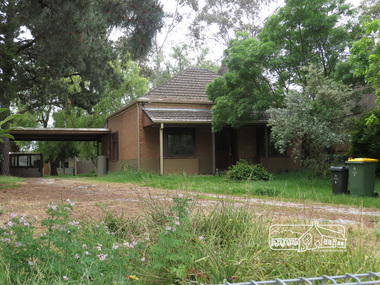
Photograph, Liz Pidgeon, 5 Apex Way, Montmorency, 7 November 2017, 7 Nov 2017
... 5 Apex Way, Montmorency, 7 November 2017...Apex Way, Montmorency, Victoria, Australia ...2 born digital imagesapex way, houses, montmorency -
 Eltham District Historical Society Inc
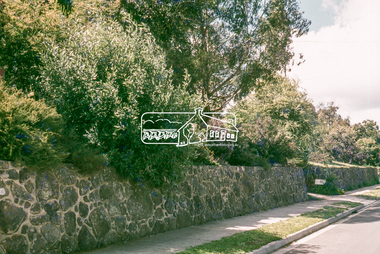
Photograph, Retaining wall with heavy planting, 25 Alma Street, Montmorency, 1 July 1972, 1972
... , Montmorency, 1 July 1972...Montmorency, Victoria, Australia ...Looking northeast across no. 25 to no. 2735mm colour positive transparency blue Agfacolour Service plastic mountalma street, houses, infrastructure, lower plenty, streets -
 Eltham District Historical Society Inc
Photograph, Batter treatment, McFarlane Street, Montmorency, 1 July 1972, 1972
... Batter treatment, McFarlane Street, Montmorency, 1 July...Montmorency, Victoria, Australia ...View looking at numbers 6 and 8 McFarlane Street35mm colour positive transparency blue Agfacolour Service plastic mounthouses, infrastructure, mcfarlane street, montmorency, streets -
 Eltham District Historical Society Inc
Photograph, Baldwin Avenue at Lilicur Road, Montmorency, 13 November 2019, 13/11/2019
... Baldwin Avenue at Lilicur Road, Montmorency, 13 November...Montmorency, Victoria, Australia ...Interesection of streets with footpath and no entry sign on "one way" street in Lilicur Street. Trees line Baldwin Avenue Cross Ref: EDHS_03867 (1972), EDHS_04005-10 (1980), EDHS_04774-1 (2019)Born digitalbaldwin avenue, lilicur road, montmorency, intersection -
 Eltham District Historical Society Inc
Photograph, Baldwin Avenue at Lilicur Road, Montmorency, 13 November 2019, 13/11/2019
... Baldwin Avenue at Lilicur Road, Montmorency, 13 November...Montmorency, Victoria, Australia ...Cross Ref: EDHS_04005-9 (1980) EDHS_04774-2 (2019)Born digitalbaldwin avenue, lilicur road, montmorency, landscaping, nature strip -
 Eltham District Historical Society Inc
Photograph, Sherbourne Road, Montmorency, 13 November 2019, 13/11/2019
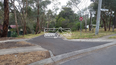
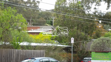
... Sherbourne Road, Montmorency, 13 November 2019...Montmorency, Victoria, Australia ...Cross Ref: EDHS_03878 (1972) EDHS_04005-9 (1980) EDHS_04774-2 and EDHS_04774-3 (2019) The house (across Sherbourne Rd) above the present Oesteotherapy place. This same view from older photo (1980) looked directly and clearly, across to this red brick house. This view is now blocked off as they 'built up' the end of Baldwin at Sherbourne (see older 1972 photo showing earth works at same spot).Born digitalbaldwin avenue, montmorency, sherbourne road, landscaping, streetscape -
 Eltham District Historical Society Inc
Photograph, Baldwin Avenue, Montmorency viewed from Sherbourne Road, 13 November 2019, 13/11/2019
... Baldwin Avenue, Montmorency viewed from Sherbourne Road, 13...Montmorency, Victoria, Australia ...Ref: EDHS_03875 (1972) and EDHS_04774-4 (2019) from opposite ends showing realignment of road at intersection of Sherbourne and the same Cypress treeBorn digitalbaldwin avenue, montmorency, sherbourne road, gardens, landscaping -
 Eltham District Historical Society Inc
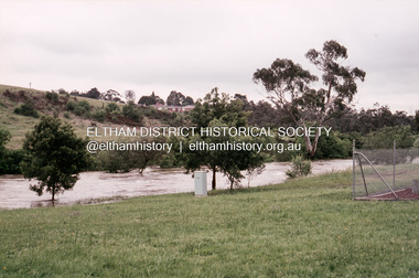
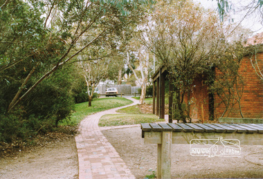
Slide, Floodwater, near Palara Court, Montmorency, November 1971, 1971
... Floodwater, near Palara Court, Montmorency, November 1971...Montmorency, Victoria ...35 mm colour positive transparency Mount - Agfacolor Service (Blue)floods, montmorency, palara court -
 Eltham District Historical Society Inc
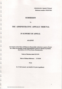
Document - Folder, Ron F. McCormack, Appeal against Eltham Shire Permit granted for a propsed Youth Enterntainment Centre, 41-43 Were Street, Montmorency, 1993-1994
... Youth Enterntainment Centre, 41-43 Were Street, Montmorency ...In 1993 Eltham Shire Council issued a permit to Michael Muzur, Terry Lant and Andrew McMillan to redevelop the former Montmorency Theatre/Bingo Hall at 41-43 Were Street as an alcohol-free youth entertainment centre. Ron McCormack, retired former JP on behalf of 41 Joint Appellants consisting of local residents and traders successfully lobbied the community and won an Appeal to have the permit cancelled as unsuitable development. The Administrative Appeal Tribunal found that the proposed development came withing the Eltham Planning Scheme definition of an 'amusement parlour' and that the playing of pool an amusement machines would be the focus of the centre and unlikely to attract older age groups. The tribunal was not satisfied the applicants had sufficient knowledge or where with all required for the successful running of this type of operation. With respect to the objectors, the Tribunal did not accept that a responsibly managed and attractive amusement parlour could not coexist near the adjoining residential area and without detriment to the commercial centre. At a Council meeting on June 7, 1994 councillors requested a report outlining criteria to be used to assess planning applications for youth entertainment venues given the Tribunal's view that a poorly managed facility in a small neighbourhood shopping centre, particularly in such close proximity to a residential area would not only have the potential to increase perceived youth problems, but could jeopardise the prospects of future proposals. Ron McCormack moved to Montmorency from Coburg in the early 1980s and from then sat on the bench at Eltham Courthouse when Police requested assistance out of hours, until the eventuial closure of the Courthouse. montmorency theatre, montmorency bingo hall, 41-43 were street, youth entertainment centre, eltham shire council, planning permit, administrative appeals tribunal, ron f mccormack -
 Eltham District Historical Society Inc
Slide, Sackville Street, Montmorency; split road near no. 36, c.Oct. 1980
... Sackville Street, Montmorency; split road near no. 36...Montmorency ...One of a series of images of roads and infrastructure focussed on the Quinn Estate in Montmorency taken by Eltham Shire Council Planning and Engineering officers. They provide perspective of the changes in housing styles and road development that began sweeping in from the mid 1970s with increasing urbanisation of what was once more outlying suburbs and regions.35 mm colour positive transparency Mount - Kodak Kodachrome CardProcessed Oct 1980sackville street, infrastructure, montmorency, roads -
 Eltham District Historical Society Inc
Photograph, Public toilets, Were Street, Montmorency, c.1990
... Public toilets, Were Street, Montmorency...montmorency ...Photographs of public land in Were Street, Montmorency with public toilets. Before the the erection of the wind mill. Brick paved footpath, angle parking and two public phone boxes.6 colour photographs (2 sets)montmorency, public tiolets, were street, parks, public toilets, shopping centres -
 Eltham District Historical Society Inc
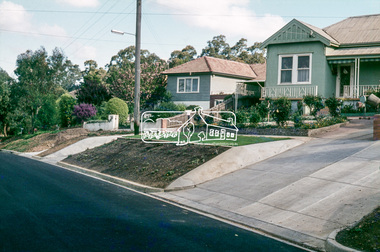
Slide, Belmont Crescent, Montmorency, c. Mar. 1981
... Belmont Crescent, Montmorency...montmorency ...One of a series of images of road infrastructure focussed on Belmont Crescent in Montmorency taken by Eltham Shire Council Planning and Engineering officers. They provide perspective of the changes in housing styles and road development that began sweeping in from the mid 1970s with increasing urbanisation of what was once more outlying suburbs and regions. All images have been identified with GPS35 mm colour positive transparency (1 of 8) Mount - Kodak Kodachrome CardProcessed Mar 1981infrastructure, montmorency, roads, belmont crescent -
 Eltham District Historical Society Inc
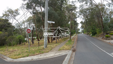
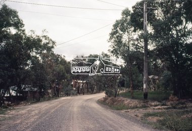
Slide - Photograph, Aerial Photo (c.1987): Montmorency, north of railway, c.Aug. 1990
... Aerial Photo (c.1987): Montmorency, north of railway...montmorency ...Part of a presentation, "Roads and Byways of the Shire of Eltham", by Russell Yeoman to the 12 September 1990 Society meeting. Slides shown included copies of old photos and recent images ranging from the suburban streets of Eltham and Montmorency to the mountain roads of Kinglake. In the byways category are views of some iof the Shire's bicycle paths including then recently completed sections of the Main Yarra Trail at Lower Plenty.35mm colour positive transparency (1 of 37) Mount - Agfachrome Agfa CS System black 8 dotsinfrastructure, roads, aerial photographs, montmorency -
 Eltham District Historical Society Inc
Slide, Adam Crescent, Montmorency, c. Feb. 1981
... Adam Crescent, Montmorency...Montmorency ...One of a series of images of road infrastructure focussed on Adam Crescent in Montmorency taken by Eltham Shire Council Planning and Engineering officers. They provide perspective of the changes in housing styles and road development that began sweeping in from the mid 1970s with increasing urbanisation of what was once more outlying suburbs and regions. All images have been identified with GPS though house numbers have changed35 mm colour positive transparency (1 of 21) Mount - Kodak Kodachrome CardProcessed Feb 1981adam crescent, infrastructure, montmorency, roads -
 Eltham District Historical Society Inc
Slide, Adam Crescent, Montmorency, c. Feb. 1981
... Adam Crescent, Montmorency...montmorency ...One of a series of images of road infrastructure focussed on Adam Crescent in Montmorency taken by Eltham Shire Council Planning and Engineering officers. They provide perspective of the changes in housing styles and road development that began sweeping in from the mid 1970s with increasing urbanisation of what was once more outlying suburbs and regions. All images have been identified with GPS though house numbers have changed35 mm colour positive transparency (1 of 21) Mount - Kodak Kodachrome CardProcessed Feb 1981adam crescent, infrastructure, montmorency, roads -
 Eltham District Historical Society Inc
Slide - Photograph, Grand Boulevard, Montmorency, c.Aug. 1990
... Grand Boulevard, Montmorency...Montmorency ...Part of a presentation, "Roads and Byways of the Shire of Eltham", by Russell Yeoman to the 12 September 1990 Society meeting. Slides shown included copies of old photos and recent images ranging from the suburban streets of Eltham and Montmorency to the mountain roads of Kinglake. In the byways category are views of some iof the Shire's bicycle paths including then recently completed sections of the Main Yarra Trail at Lower Plenty.35mm colour positive transparency (1 of 37) Mount - Agfachrome Agfa CS System black 8 dotsinfrastructure, roads, grand boulevard, montmorency -
 Eltham District Historical Society Inc
Slide, Mitchell Avenue near Panorama Heights Preschool, Montmorency, c.Oct. 1980
... , Montmorency...Montmorency ...One of a series of images of roads and infrastructure focussed on the Quinn Estate in Montmorency taken by Eltham Shire Council Planning and Engineering officers. They provide perspective of the changes in housing styles and road development that began sweeping in from the mid 1970s with increasing urbanisation of what was once more outlying suburbs and regions.35 mm colour positive transparency Mount - Kodak Kodachrome CardProcessed Oct 1980infrastructure, mitchell avenue, montmorency, panorama heights preschool, roads -
 Eltham District Historical Society Inc
Slide, Mitchell Avenue looking towrads Montmorency South Primary School, c.Oct. 1980
... Mitchell Avenue looking towrads Montmorency South Primary...Montmorency ...One of a series of images of roads and infrastructure focussed on the Quinn Estate in Montmorency taken by Eltham Shire Council Planning and Engineering officers. They provide perspective of the changes in housing styles and road development that began sweeping in from the mid 1970s with increasing urbanisation of what was once more outlying suburbs and regions.35 mm colour positive transparency Mount - Kodak Kodachrome CardProcessed Oct 1980infrastructure, mitchell avenue, montmorency, montmorency south primary school, roads