Showing 203 items
matching para rd
-
 Eltham District Historical Society Inc
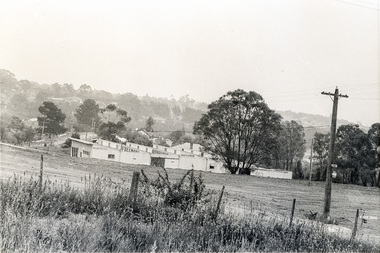
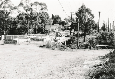
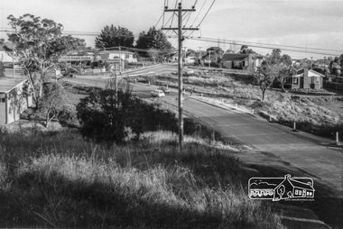
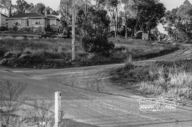
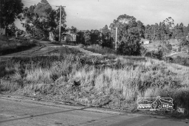
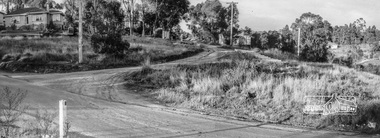
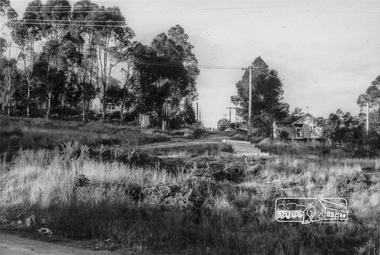
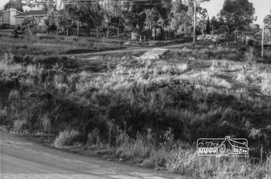
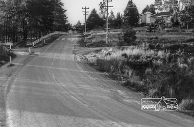
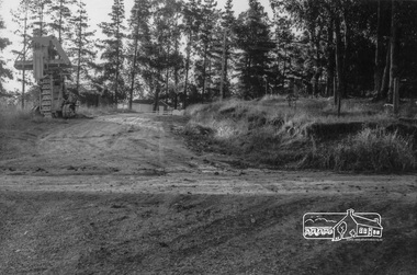
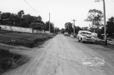
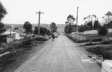
Photograph, Sherbourne Road, Para Road and Simms Road at Briar Hill/Montmorency prior to the upgrade of Sherbourne Road Railway bridge, c.1970
Collection of photographs probably taken around the same time depicting Sherbourne Road, Para Road and Simms Road at Briar Hill/Montmorency prior to the upgrade of Sherbourne Road Railway bridge, c.1970. Photo 01648_ 19 This home owned by Mrs Cameron. Her daughter married a Mr Davey, for whom Davey Road was named - email from M. Jones 20/07/2015 Photographer unknownThese photos are very significant in the documentation of the development of the Briar Hill and Montmorency areas and the changes in the physical landscape along the railway line area.20 black and white prints 9 cm x 13 cm.1970, briar hill, davey road, montmorency, para road, cameron, davey, sherbourne road, simms road, railway line, roadworks -
 Eltham District Historical Society Inc
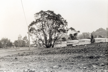
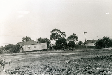
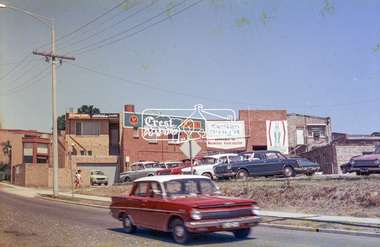
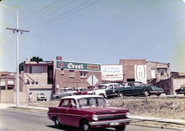
Photograph, Rear view of Lower Plenty shops from Para Road, c.1976, 1976c
Streetscape development over timeRoll of 35mm colour negative film, 2 stripsAgfa CNSpara road, lower plenty, shops, shoe inn, maunder's food store -
 Eltham District Historical Society Inc
Photograph, Para Road and Main Road, Lower Plenty, c.1976, 1976c
Streetscape development over timeRoll of 35mm colour negative film, 2 stripsAgfa CNSpara road, lower plenty, shops, main road, shoe inn, maunder's food store -
 Eltham District Historical Society Inc
Photograph, Para Road and Main Road, Lower Plenty, c.1976, 1976c
Streetscape development over timeColour photographpara road, lower plenty, shops, main road -
 Eltham District Historical Society Inc
Photograph, Rear view of Lower Plenty shops from Para Road, c.1976, 1976c
Streetscape development over timeColour photopgraphpara road, lower plenty, shops -
 Eltham District Historical Society Inc
Photograph, Para Road, Montmorency, industrial area looking south from Plenty River Bridge on boundary of Shire of Eltham
Colour photograph02076, montmorency (france) photo album, montmorency, para road, plenty river, industry -
 Eltham District Historical Society Inc
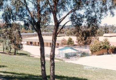
Photograph, Montmorency High School, Para Road, located north of tennis courts, 1985, 1985
Colour photograph02076, montmorency (france) photo album -
 Eltham District Historical Society Inc
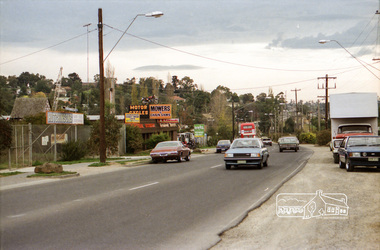
Photograph, Industrial development, Para Road, Briar Hill, c.1984, 1996
Views of industrial sites and shop fronts on Para Road, Briar Hill including the business 'Greensborough Motorcycles'. Para Road, Briar Hill is parallel to the Hurstbridge Railway Line. The building 'Greensborough Motorcycles' was destroyed by fire in the early 2000s.Roll of 35mm colour negative film, 4 stripsKodak CP 100 5094briar hill, greensborough, greensborough motorcycles, hutchinson's, industry, international discounters, para road -
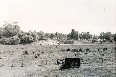
 Eltham District Historical Society Inc
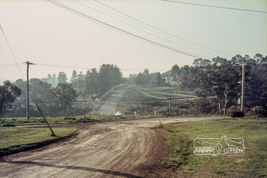
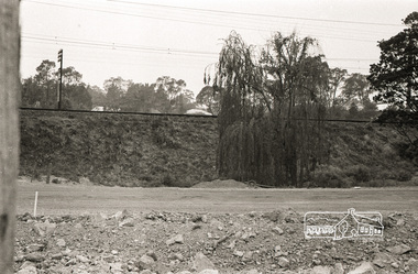
Photograph, Para Road Bridge construction, Briar Hill, near Greensborough, c.1971, 1971c
Three black and white photographs; two showing construction works of the bridge over the Plenty River at Briar Hill and one of Greensborough Park, Grimshaw Street, summer 1971-1972greensborough, briar hill, para road, bridges, construction, plenty river -
 Eltham District Historical Society Inc
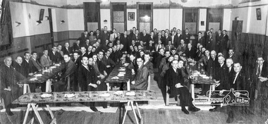
Photograph, Anglers Hall opening Night, Para Road, Briar Hill, 1937, 1937
Black and white photograph of the opening of Anglers Hall showing the table settings and 87 men seated and standing around posing for the shotanglers hall, para road, briar hill, ceremonies -
 Eltham District Historical Society Inc
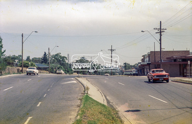
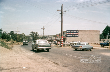
Photograph, Intersection of Para Road with Main Road, Lower Plenty, c.1965, 1965c
Digital file only; created from original colour positive slide transparencystreets, lower plenty, main road, para road, shops, maunder's food store, russell yeoman collection, shoe inn, maunder's food store -
 Eltham District Historical Society Inc
Photograph, Russell Yeoman, Para Road, c.1969, 1969c
Looking north from behind the Lower Plenty shops at Main Road and Para Road.Digital file only; created from original colour positive slide transparencystreets, lower plenty, para road, russell yeoman collection -
 Eltham District Historical Society Inc
Negative - Photograph, Russell Yeoman, Para Road / Carter Street Bridge over the Plenty River, Briar Hill, c.Jul. 1969
Bridge over the Plenty River at Briar Hill before widening and alterations. The Plenty River at Briar Hill represented the boundary between the Shire of Eltham and the Shire of Diamond Valley. The bridge was known as the Carter Street Bridge as prior to 1969 Para Road, Briar Hill became Carter Street, Greensborough across the river. It was at this time that the name Para Road was continued and replaced Carter Street.This photo forms part of a collection of photographs gathered by the Shire of Eltham for their centenary project book,"Pioneers and Painters: 100 years of the Shire of Eltham" by Alan Marshall (1971). The collection of over 500 images is held in partnership between Eltham District Historical Society and Yarra Plenty Regional Library (Eltham Library) and is now formally known as the 'The Shire of Eltham Pioneers Photograph Collection.' It is significant in being the first community sourced collection representing the places and people of the Shire's first one hundred years.Digital image 35 mm B&W negativeshire of eltham pioneers photograph collection, briar hill, 1969-07, bridge, carter street bridge, para road, para road bridge, plenty river, shire of diamond valley, shire of eltham -
 Eltham District Historical Society Inc
Photograph, Looking south along Para Road at intersection of Alma Street and Lees Road, Lower Plenty, c.July 1967, 1967
Old community hall (long wall with row of windows) and Lower Plenty Kindergarten visible at corner of Glenauburn and Para Roads. Packaged in "Filmpro King Size prints Definitely Better EST. 1918" envelope. Pencil notes: 36 shots $2.87 Eltham Shire J. McD and 19/7/67. Alma Street and Kett Street Lower Plenty c.July 1967.Black and white photographalma street, glenauburn road, carisbrook crescent, lees road, lower plenty, lower plenty kindergarten, para road, houses, streets -
 Eltham District Historical Society Inc
Photograph, Looking northeast up Alma Street from Para Road at intersection of Alma Street and Lees Road, Lower Plenty, c.July 1967, 1967
Packaged in "Filmpro King Size prints Definitely Better EST. 1918" envelope. Pencil notes: 36 shots $2.87 Eltham Shire J. McD and 19/7/67. Alma Street and Kett Street Lower Plenty c.July 1967.Black and white photographalma street, lees road, lower plenty, para road, houses, streets -
 Eltham District Historical Society Inc
Photograph, Looking northeast up Alma Street from Para Road at intersection of Alma Street and Lees Road, Lower Plenty, c.July 1967, 1967
Packaged in "Filmpro King Size prints Definitely Better EST. 1918" envelope. Pencil notes: 36 shots $2.87 Eltham Shire J. McD and 19/7/67. Alma Street and Kett Street Lower Plenty c.July 1967.Digital composite of two black and white photographsalma street, lees road, lower plenty, para road, houses, streets -
 Eltham District Historical Society Inc
Photograph, Looking northeast up Alma Street from Para Road at intersection of Alma Street and Lees Road, Lower Plenty, c.July 1967, 1967
Packaged in "Filmpro King Size prints Definitely Better EST. 1918" envelope. Pencil notes: 36 shots $2.87 Eltham Shire J. McD and 19/7/67. Alma Street and Kett Street Lower Plenty c.July 1967.Black and white photographalma street, lower plenty, para road, houses, streets -
 Eltham District Historical Society Inc
Photograph, Looking north up Para Road at intersection of Alma Street and Lees Road, Lower Plenty, c.July 1967, 1967
Packaged in "Filmpro King Size prints Definitely Better EST. 1918" envelope. Pencil notes: 36 shots $2.87 Eltham Shire J. McD and 19/7/67. Alma Street and Kett Street Lower Plenty c.July 1967.Black and white photographalma street, lower plenty, para road, houses, streets, lees road -
 Eltham District Historical Society Inc
Photograph, 20 Para Road viewed from near 2 Alma Street, Lower Plenty, c.July 1967, 1967
Packaged in "Filmpro King Size prints Definitely Better EST. 1918" envelope. Pencil notes: 36 shots $2.87 Eltham Shire J. McD and 19/7/67. Alma Street and Kett Street Lower Plenty c.July 1967.Black and white photographalma street, lower plenty, houses, streets -
 Eltham District Historical Society Inc
Photograph, Looking southwest along Alma Street to Para Road, Lower Plenty, c.July 1967, 1967
Packaged in "Filmpro King Size prints Definitely Better EST. 1918" envelope. Pencil notes: 36 shots $2.87 Eltham Shire J. McD and 19/7/67. Alma Street and Kett Street Lower Plenty c.July 1967.Black and white photographalma street, lower plenty, houses, streets -
 Eltham District Historical Society Inc
Photograph, Looking northeast along Alma Street to Para Road, Lower Plenty, c.July 1967, 1967
Packaged in "Filmpro King Size prints Definitely Better EST. 1918" envelope. Pencil notes: 36 shots $2.87 Eltham Shire J. McD and 19/7/67. Alma Street and Kett Street Lower Plenty c.July 1967.Black and white photographalma street, lower plenty, houses, streets -
 Eltham District Historical Society Inc
Photograph, Looking southwest along Alma Street to Para Road, Lower Plenty, c.July 1967, 1967
Packaged in "Filmpro King Size prints Definitely Better EST. 1918" envelope. Pencil notes: 36 shots $2.87 Eltham Shire J. McD and 19/7/67. Alma Street and Kett Street Lower Plenty c.July 1967.Black and white photographalma street, lower plenty, houses, streets -
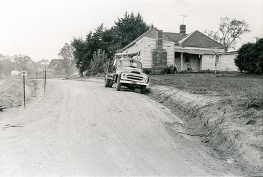
 Eltham District Historical Society Inc
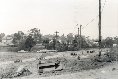
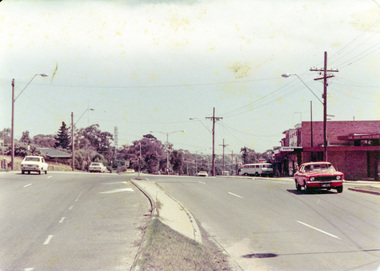
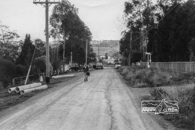
Photograph, Sherbourne Road, Para Road and Simms Road at Briar Hill, 3 November 1967, 3 Nov 1967
Viewed from western side of Para Road near Graham Body Works. Simms Road is running to the right in front of the old house. The house belongs to Mrs Cameron whose daughter married a DAVEY after which Davey Street is named. Excavation work is being undertaken for the realignment of the Para Road and Sherbourne Road intersection where the current roundabout is located, approximately where the two cars are parked. Mrs Cameron's house and the other are where Montmorency Secondary College is situated. The school opened in 1969.Roll of 35mm black and white negative film, 6 strips Ilford HP3briar hill, cameron, davey, davey road, graham body works, greensborough, montmorency secondary college, sherbourne road, simms road