Showing 11698 items matching "maps "
-
 Phillip Island and District Historical Society Inc.
Book, WELLS, John, Colourful tales of old Gippsland, 1990
Maps on endpapers. First published Rigby, 1977. Includes bibliographical references.gippsland, history -
4th/19th Prince of Wales's Light Horse Regiment Unit History Room
Brass tankard
Trench art, brass tankard, brass bottom, Handle attached with solder Faintly engraved map of Middle East on one side and mosque on othertankard, mess property -
 Ringwood and District Historical Society
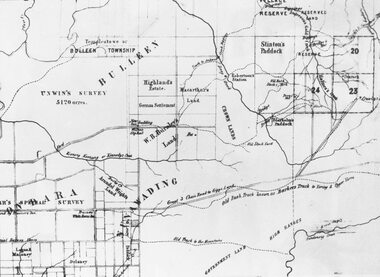
Photograph, Circa 1855 Parish Map including Bulleen, Nunawading, and eventual site of Ringwood below blocks 23 & 24
Catalogue card reads, "C1858 Parish Map - Nunawading, Ringwood & Scoresby". -
 Victorian Aboriginal Corporation for Languages
Periodical, Australian Institute of Aboriginal and Torres Strait Islander Studies, Australian Aboriginal studies : journal of the Australian Institute of Aboriginal and Torres Strait Islander Studies, 2007
1. The moral lexicon of the Warlpiri people of central Australia LR Hiatt This paper discusses words that match ?Good? and ?Bad?; examples of ?Good? and ?Bad? behaviour; morality and law; and egalitarianism and dominance. It also presents a comparison with Gidjingarli (Burarra). 2. Mobs and bosses: Structures of Aboriginal sociality Patrick Mullins (Mount Druitt, NSW) A commonality of Aboriginal social organisation exists across the continent in communities as different as those from the Western Desert across to Cape York, from the towns of New South Wales and Western Australia to cities like Adelaide. This is found in the colloquial expressions ?mob? and ?boss?, which are used in widely differing contexts. Mobbing is the activity where relatedness, in the sense of social alliances, is established and affirmed by virtue of a common affiliation with place, common experience and common descent, as well as by the exchange of cash and commodities. Bossing is the activity of commanding respect by virtue of one?s capacity to bestow items of value such as ritual knowledge, nurturance, care, cash and commodities. Mobbing and bossing are best understood as structures in Giddens? sense of sets of rules and resources involved in the production of social systems, in this case social alliances. Mobbing and bossing imply a concept of a person as a being in a relationship. Attention needs to be given to the way these structures interact with institutions in the wider Australian society. 3. Recognising victims without blaming them: A moral contest? About Peter Sutton?s ?The Politics of Suffering: Indigenous Policy in Australia since the 1970s? and Gillian Cowlishaw?s replies Ma�a Ponsonnet (Universit� Paris- 8-Saint-Denis) Peter Sutton?s texts on Aboriginal violence, health and their politicisation are replied to using his methodology, and acknowledging his convincing points. Sutton rightly denounces a lack of lucidity and scientific objectivity in anthropological debates. These inadequacies impede identification of what Aboriginal groups can do to improve their situations for fear that this identification would lead to blame the victims. At the other end of the ethical spectrum, those who advocate a broader use of what I will call a ?resistance interpretation? of violence fail to recognise victims as such, on the implicit grounds that seeing victims as victims would deprive them of any agency, on the one hand, and entail blame, on the other hand. I aim to define a middle road between those views: the idea that victims should be acknowledged as such without being denied their agency and without being blamed for their own condition. This middle road allows identification of the colonisers? responsibilities in the contemporary situation of Indigenous communities in Australia, and to determine who can do what. Secondly, I show that Sutton?s texts convey, through subtle but recurrent remarks, an ideology of blame rather than a mere will to identify practical solutions. As a consequence, some of his proposals do not stand on a solid and objective causal analysis. 4. 'You would have loved her for her lore?: The letters of Daisy Bates Bob Reece (Murdoch University) Daisy Bates was once an iconic figure in Australia but her popular and academic reputation became tarnished by her retrograde views. Her credibility was also put in doubt through the exposure of her fictionalised Irish background. In more recent times, however, her ethnographic data on the Aborigines of Western Australia has been an invaluable source for Native Title claims, while her views on Aboriginal extinction, cannibalism and ?castes? are being seen as typical of her time. This article briefly reviews what has been the orthodox academic opinion of her scientific achievement before summarising what is reliably known of her early history and indicating what kind of person is revealed in the 3000 or more letters that she left behind. 5. What potential might Narrative Therapy have to assist Indigenous Australians reduce substance misuse? Violet Bacon (Curtin University of Technology) Substance misuse is associated with adverse consequences for many Australians including Aboriginal and Torres Strait Islander peoples. Extensive research has been conducted into various intervention, treatment and prevention programs to ascertain their potential in reducing substance misuse within Aboriginal and non-Aboriginal communities. I explore the potential of Narrative Therapy as a counselling intervention for assisting Indigenous Australians reduce the harm associated with substance misuse. 6. Bone points from the Adelaide River, Northern Territory Sally Brockwell (University of Canberra) and Kim Akerman (Moonah) Large earth mounds located next to the vast floodplains of the lower Adelaide River, one of the major tropical rivers draining the flat coastal plains of northern Australia, contain cultural material, including bone points. The floodplains of the north underwent dynamic environmental change from extensive mangrove swamps in the mid-Holocene, through a transition phase of variable estuarine and freshwater mosaic environments, to the freshwater environment that exists today. This geomorphological framework provides a background for the interpretation of the archaeology, which spans some 4000 years. 7. A different look: Comparative rock-art recording from the Torres Strait using computer enhancement techniques Liam M Brady (Monash University) In 1888 and 1898, Cambridge University?s Alfred C Haddon made the first recording of rock-art from the Torres Strait islands using photography and sketches. Systematic recording of these same paintings and sites was carried out from 2000 to 2004 by archaeologists and Indigenous Torres Strait Islander and Aboriginal communities as part of community-based rock-art recording projects. Computer enhancement techniques were used to identify differences between both sets of recordings, to reveal design elements that Haddon missed in his recordings, and to recover images recorded by Haddon that are today no longer visible to the naked eye. Using this data, preliminary observations into the antiquity of Torres Strait rock-art are noted along with recommendations for future Torres Strait region rock-art research and baseline monitoring projects. 8. Sources of bias in the Murray Black Collection: Implications for palaeopathological analysis Sarah Robertson (National Museum of Australia) The Murray Black collection of Aboriginal skeletal remains has been a mainstay of bio-anthropological research in Australia, but relatively little thought has been given to how and why this collection may differ from archaeologically obtained collections. The context in which remains were located and recovered has created bias within the sample, which was further skewed within the component of the collection sent to the Australian Institute of Anatomy, resulting in limitations for the research potential of the collection. This does not render all research on the collection unviable, but it demonstrates the importance of understanding the context of a skeletal collection when assessing its suitability for addressing specific research questions.maps, b&w photographs, colour photographs, illustrations, graphs, chartswarlpiri, sociology, daisy bates, substance abuse, narrative therapy, rock art, technology and art, murray black collection, pleistocene sites, watarrka plateau -
 Victorian Aboriginal Corporation for Languages
Periodical, Australian National University Department of Pacific and Southeast Asian History, Aboriginal history, 1984
maps, b&w illustrations, b&w photographs, graphs, charts -
 Victorian Aboriginal Corporation for Languages
Periodical, Australian National University Department of Pacific and Southeast Asian History, Aboriginal history, 1987
maps, b&w illustrations, b&w photographs, document reproductions -
 Victorian Aboriginal Corporation for Languages
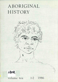
Periodical, Australian National University Department of Pacific and Southeast Asian History, Aboriginal history, 1986
maps, b&w photograph, graphs, charts, reproductions of historic items -
 Victorian Aboriginal Corporation for Languages
Periodical, Royal Historical Society of Victoria, Victorian historical journal : Victoria : 150 years of gold, 2001
maps, b&w illustrations, b&w photographs, document reproductions -
Victorian Aboriginal Corporation for Languages
Book, Ian D. Clark, 'We are all of one blood' : a history of the Djabwurrung Aboriginal people of western Victoria, 1836-1901. Vol. 2, 2016
Vol 2 Biographies, genealogies, pastoral station profiles, collectors of Djabwurrung heritage, and place names. maps, b&w illustrations, b&w photographs, colour illustrationsdjabwurrung, djab wurrung, western victoria, victoria, port phillip aboriginal protectorate, biographies, genealogies, pastoral stations, social histories, place names, siewright, lake condah, balllarat, thomas jerusalem, king billy, mount emu -
Victorian Aboriginal Corporation for Languages
Book, Ian D Clark, 'We are all of one blood' : a history of the Djabwurrung Aboriginal people of western Victoria, 1836-1901. Vol. 1, 2016
Vol 1 A History of the Djabwurrung, 1836-1901maps, b&w illustrations, b&w photographs, colour illustrationsdjabwurrung, djab wurrung, western victoria, victoria, port phillip aboriginal protectorate, biographies, genealogies, pastoral stations, social histories, place names, siewright, lake condah, balllarat, thomas jerusalem, king billy, mount emu, histories -
 Victorian Aboriginal Corporation for Languages
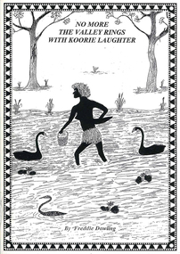
Book, Wendy Mitchell et al, Corroboree or war party: the last dance of the Wangaratta Pangerang : No more the valley rings with Koorie laughter, 2009
Details the coming of the white man, including explorers and squatters to the Wangaratta area, from a white perspective, written by Wendy Mitchell, and an Aboriginal perspective, written by Freddie Dowling.maps, b&w illustrations, b&w photographs, word listswangaratta, pangarang, genocide -
Victorian Aboriginal Corporation for Languages
Book, Edgar Morrison, Early days in the Loddon Valley : memoirs of Edward Stone Parker 1802-1865, 1966
maps, b&w illustrations, b&w photographs, document reproductionsloddon -
 Victorian Aboriginal Corporation for Languages
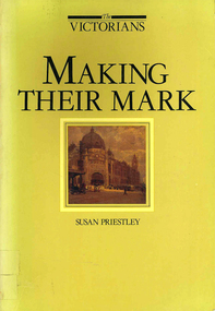
Book, Susan Priestley, Making their mark, 1984
maps, b&w illustrations, b&w photographs, colour illustrations -
 Victorian Aboriginal Corporation for Languages
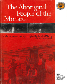
Book, The Aboriginal people of the Monaro, 2000
A comprehensive history of the Aboriginal people of the Monaro district. Written by a collection of contributors.maps, b&w photographs, b&w illustrations, document reproductions -
Victorian Aboriginal Corporation for Languages
Book with CD-ROM, Iain Luck et al, Meet the eastern Kulin : the Aboriginal people of Central Victoria, 2001
Teacher resource kit.b&w photographs, b&w illustrations, maps, CD-ROMeastern kulin, central victoria -
 Victorian Aboriginal Corporation for Languages
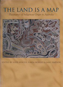
Book, Luise Hercus, The land is a map : placenames of Indigenous origin in Australia, 2002
Place names often evoke important information about features of the environment and their place in Indigenous knowledge. On the other hand, place names given by European settlers are largely arbitrary.Maps, b&w photographs, b&w illustrations, word listsplace names, wik, cape york peninsula, ngalakgan, alawa, marra, yukgul, kaurna, yuwaalaraay, yuwaaliyaay, gamilaraay, ngiyampaa -
 Victorian Aboriginal Corporation for Languages
Book, Patrick McConvell, Archaeology and linguistics : Aboriginal Australia in global perspective, 1997
Various authors: studies of wider patterns in Aboriginal language and culture, including migration, tool exchange, and particularly the role of linguistic evidence in establishing historical connections between Australian tribes as well as further afield in the Australasian region.B&w illustrations, b&w photographs, maps, word listsanthropological linguistics -
 Victorian Aboriginal Corporation for Languages
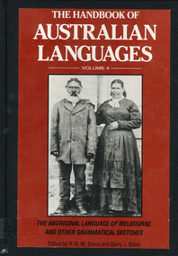
Book, R M W Dixon, The handbook of Australian languages : volume 4, the Aboriginal language of Melbourne and other grammatical sketches, 1991
maps, word lists, b&w illustrations, b&w photographs -
 Victorian Aboriginal Corporation for Languages
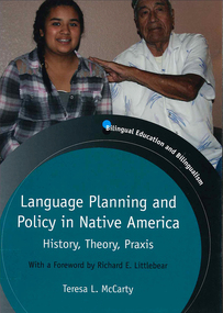
Book, Teresa L McCarty, Language planning and policy in Native America : history, theory and praxis, 2013
Contextualizing Native American LPP: legal-political, demographic and sociolinguistic foundations; conceptualizing Native American LPP: critical sociocultural foundations; Native American languages 1492-2012; Indigenous literacies, bilingual education and community empowerment: Navajo case study; language regenesis in practice; language in the lives of Indigenous youth; planning language for the Seventh GenerationMaps, b&w illustrations, b&w photographs, colour photographslanguage planning, language policy, native american languages, language standardisation, language restriction -
 Victorian Aboriginal Corporation for Languages
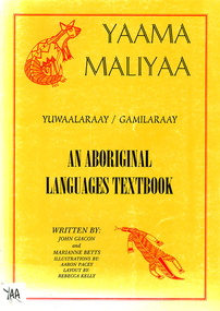
Book, John Giacon et al, Yaama maliyaa, Yuwaalaraay - Gamilaraay : an aboriginal languages textbook, 1999
Includes index. Bibliography. For secondary school students.B&w illustrations, b&w photographs, maps, word listsgamilaraay, yuwaalaraay -
 Victorian Aboriginal Corporation for Languages
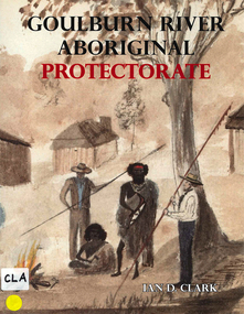
Book, Ian D Clark, Goulburn River Aboriginal Protectorate : a history of the Goulburn River Aboriginal Protectorate Station at Murchison, Victoria, 1840 - 1853, 2013
This study explains why the locality of what is now known as Murchison is one of the most important historic Aboriginal places in regional Victoria.maps, b&w illustrations, b&w photographs, document reproductionsngurai-illam balug, ngurai-illam wurrung, daungwurrung, yaithmathang, yortayorta, yorta yorta, bangerang, murchison, murnang, george augustus robinson, goulburn river aboriginal protectorate, goulburn river region, victorian history -
 Victorian Aboriginal Corporation for Languages
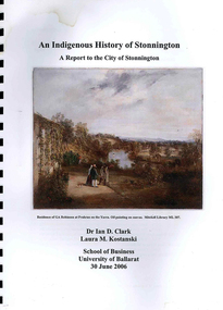
Book, Ian D Clark et al, An Indigenous history of Stonnington : a report to the City of Stonnington, 2006
This report presents the results of historical research into the Aboriginal history of the City of Stonnington.maps, colour illustrations, b&w illustrations, colour photographs, tableswoiwurrung, woi wurrung, boonwurrung, boon wurrung, derrimut, william thomas, stonnington, local history, victorian history -
 Victorian Aboriginal Corporation for Languages
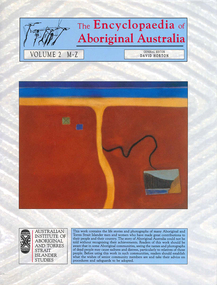
Book, David Horton, The Encyclopaedia of Aboriginal Australia : Aboriginal and Torres Strait Islander history, society and culture ; volume 2 M-Z, 1994
Comprehensive edition including all aspects of Aboriginal history, culture, heritage and environment.maps, colour illustrations, b&w illustrations, colour photographs, tables -
Victorian Aboriginal Corporation for Languages
Book, David Horton, The Encyclopaedia of Aboriginal Australia : Aboriginal and Torres Strait Islander history, society and culture ; volume 1 A-L, 1994
Comprehensive 2 volume set of encyclopaedia covering all aspects of Australian Aborigines, flora, fauna and environment.maps, colour illustrations, b&w illustrations, colour photographs, tables -
 Victorian Aboriginal Corporation for Languages
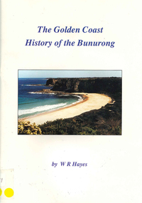
Book, W R Hayes, The golden coast : history of the Bunurong, 1998
A history of the section of Victorian coastline from Andersons Inlet to Cape Woolamai. Includes descriptions of the impacts and consequences of European occupation on the Aboriginal people of this region.maps, colour photographs, b&w photographs, b&w illustrationsbunurong, boon wurrung, andersons inlet, cape woolamai, colonisation -
 Victorian Aboriginal Corporation for Languages
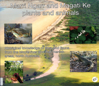
Book, Ngarul Jimmy Nambatu et al, Marri Ngarr and Magati Ke plants and animals : Aboriginal knowledge of flora and fauna from the Moyle River and Neninh areas, North Australia, 2009
Aboriginal knowledge of flora and fauna from the Moyle River and Neninh areas.Maps, b&w illustrations, b&w photographs, colour photographs,marri ngarr, magati ke, wadeye, moyle river, northern territory, flora, fauna, ethnobiology -
 Victorian Aboriginal Corporation for Languages
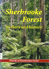
Book, Friends of Sherbrooke Forest, Sherbrooke Forest : its flora and history, 2000
Notes on plants in the area, including swamp/water plants.Maps, b&w illustrations, b&w photographs, colour photographsdandenong ranges national park, indigenous vascular plants, weed management -
 Victorian Aboriginal Corporation for Languages
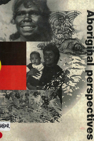
Book, Museum of Victoria Education Service, Aboriginal perspectives, 1996
The kit is designed for the general public, teachers and students, to give an understanding of Australian Indigenous people and culture and to break down stereotypes that are common in the school system and the wider community. The information presented is about the cultural, spiritual, economic and religious aspects of pre-contact societies. The impact of invasion on traditional societies and the post-colonial history of Australian Indigenous people is explored.Maps, b&w illustrations, b&w photographs, colour photographsculture, history, john batman, batman treaty, coranderrk mission, koorie culture, lake condah mission, kinship systems, aboriginal art, dreaming stories, kulin, gunai/kurnai, mara, wotjobaluk, wudjubaluk, koori -
 Ballarat RSL Sub-Branch Inc.
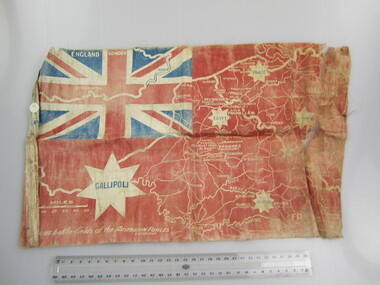
Flag - Australian Red Ensign (sm)
With map showing "Famous battle-fields of the Australian Forces" printed overfirst world war (ww1), 1914 - 1918, flags, ballarat rsl, ballarat -
 Bendigo Military Museum
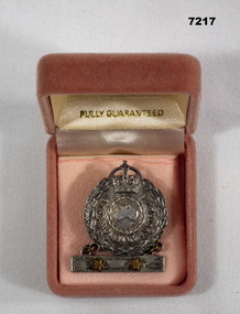
Badge - FEMALE RELATIVE BADGE, WW2, Amor, Sydney, 1939-45
MOTHER'S BADGE OF ISABELLA BROOK WHO HAD TWO SONS SERVING DURING WW2.1. Badge - silver metal, bar with two yellow metal stars contained in a box."TO THE WOMEN OF AUSTRALIA" Moulded small map of Australia inside a Laurel wreath.mothers badge, ww2