Showing 7988 items
matching w b
-
 Victorian Aboriginal Corporation for Languages
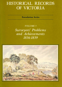
Book, Michael Cannon, Historical records of Victoria : foundation series : volume 5 : surveyors? problems and achievements 1836-1839, 1988
... maps, b&w illustrations, b&w photographs, tables..., b&w illustrations, b&w photographs, tables Reproductions ...Reproductions of various transactions and reports dealing with the surveying history of Port Phillip, including letters, maps, illustrations, tables, and a detailed history of the surveying of Victoria.maps, b&w illustrations, b&w photographs, tablesvictorian history, port phillip, robert hoddle, monee monee creek, geelong, barwon river, werribee river -
 Lara RSL Sub Branch
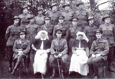
Photograph - B and W photograph, Kit McNaughton and fellow staff of the plastic Surgery division of the Queen Mary Hospital, Sidcup, Kent, England 1918
... B and W photograph... Hospital, Sidcup, Kent, England 1918 Photograph B and W photograph ...Kit McNaughton and fellow staff of the plastic Surgery division of the Queen Mary Hospital, Sidcup, Kent, England 1918 Also the cover picture of the paperback book, "Kitty's War" by Janet Butler 2013On Back of Photo - WWW.Kit .Mcnaughton Reminiscences from a bloody Imperial War NSW Nurses and Midwives Association Janet Butler - 'Kitty's War' Latrobe University Queen Mary Hospital Sidcup in Kent England Plastic Surgery Hospital 1918unknown -
 Stawell Historical Society Inc
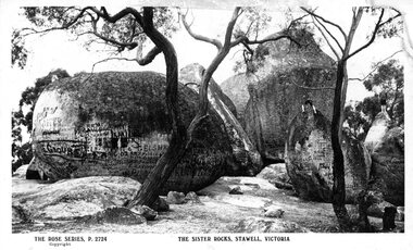
Photograph, Sister Rocks Stawell, 1920's
... B/W Postcard, Rose Series of Sister Rocks Stawell...B/W Postcard Rose Series of Sister Rocks. Trees...B/W Postcard, Rose Series of Sister Rocks Stawell Tourism ...B/W Postcard, Rose Series of Sister Rocks StawellB/W Postcard Rose Series of Sister Rocks. Trees in foreground, boy sitting on rockThe Rose Series P.2724 Copyright The Sister Rocks, Stawell, Victoria Looking Easttourism -
 Eltham District Historical Society Inc
Negative - Photograph, Tom Prior, Langlands Bridge, Eltham, c.1900
... Digital image 4 x 5 inch B&W Neg B&W print... Digital image 4 x 5 inch B&W Neg B&W print Langlands Bridge ...It is noted in the Reynolds Prior collection (Ivy Reynolds) as the first bridge in Eltham however given the current state of knowledge, this is considered unlikely and there is no other supporting source. John Hunter Langlands, owner of the farm known as ‘Ihurst’ on the west side of Diamond Creek to the south of John Wright Murray’s land, died in 1907. In 1909 his land was subdivided into 100 lots to become the ‘Glen Park Estate’. It is possible that the bidge may have crossed the Diamond Creek to Langland's land along the original alignment of Glen Park Road which used to run between present day Progress Road and Coleman Crescent. SEPP Source (c.1970): Mrs. E.R. Reynolds, Thompson Crescent, Research The Reynolds family were early settlers in Research. The Reynolds/ Prior collection of photographs were taken by Tom Prior, the maternal uncle of Ivy Reynolds, around 1900 and the 60 photos in the album give a fine overview of many of the landmarks of Research and Eltham over 100 years ago. lvy lived in the family home for many years at 106 Thompson Cres Research. Ivy's father, Ernst Richard Reynolds and grandfather, Richard Reynolds, lived at the same address. Ivy's father Richard worked for Mr. Trail on his property in Research. Reynolds Road is named after the family. Mr Tom Prior (wife Eva) worked at the Melbourne zoo. He was very innovative and made his own camera, using the black cloth hood to exclude the light. The photographs are a reminder of the rural nature of Research and Eltham and its rich heritage. This photo forms part of a collection of photographs gathered by the Shire of Eltham for their centenary project book,"Pioneers and Painters: 100 years of the Shire of Eltham" by Alan Marshall (1971). The collection of over 500 images is held in partnership between Eltham District Historical Society and Yarra Plenty Regional Library (Eltham Library) and is now formally known as the 'The Shire of Eltham Pioneers Photograph Collection.' It is significant in being the first community sourced collection representing the places and people of the Shire's first one hundred years.Digital image 4 x 5 inch B&W Neg B&W printsepp, shire of eltham pioneers photograph collection, eltham, langlands bridge, reynolds prior collection, bridge, john hunter langlands -
 Eltham District Historical Society Inc
Photograph, George W. Bell, Our Lady Help of Christians Catholic Church, Henry Street, Eltham, c.1962
... Digital image 4 x 5 inch B&W Neg B&W print... Church Digital image 4 x 5 inch B&W Neg B&W print Our Lady Help ...The second St Mary's Catholic Church Eltham was located at the corner of Main Road and Henry Street, Eltham and was opened/blessed October 13, 1912. The wooden church was built to replace an earlier brick church also known as St Mary's (1865-1912), which had been situated on the main road near present day Wingrove Park. The church and land cost £1,400 (Evelyn Observer). The wooden church was destroyed by fire in 1961. This modern (1960s) style church was built to replace the destoyed St Mary's and was called Our Lady of Help Christians. By this time Henry street had been closed off from Main Road.This photo forms part of a collection of photographs gathered by the Shire of Eltham for their centenary project book,"Pioneers and Painters: 100 years of the Shire of Eltham" by Alan Marshall (1971). The collection of over 500 images is held in partnership between Eltham District Historical Society and Yarra Plenty Regional Library (Eltham Library) and is now formally known as the 'The Shire of Eltham Pioneers Photograph Collection.' It is significant in being the first community sourced collection representing the places and people of the Shire's first one hundred years.Digital image 4 x 5 inch B&W Neg B&W printsepp, shire of eltham pioneers photograph collection, eltham, roman catholic church, churches catholic, main road, george w bell collection, our lady of help christians church -
 Port Melbourne Historical & Preservation Society
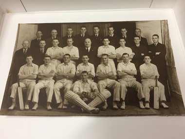
Photograph - Port Melbourne Cricket Club, Victorian Sub-District Cricket Association Premiers, 1938
... : F. STEVENSON (Hon. Treasurer), A. DOWNER, W. PAYNE, B... A DOWNER W PAYNE B CULLEN Henry Carr SOUTHWARD E LEE W J PRICE ...Black and white photo of 1937-38 Victorian Sub-District Cricket Association Premiers. Port Melbourne Cricket Club. 26 men shown, 12 in cricket clothing, named as follows: Back Row : B. ROWAN, J. TATE, J. HARVEY (Assistant Secretary), T. BOWMAN, H. CROMPTON, G. GLOVER, S. FINDLAY, W. WILSON Centre Row : F. STEVENSON (Hon. Treasurer), A. DOWNER, W. PAYNE, B. CULLEN, Cr. H. C. SOUTHWARD (President), J. WOODRUFF, E. LEE, W. J. PRICE (Hon. Secretary), A. NUGENT Front Row ; G. MOORE, B. DUNN, T. MARSHALL, T. LAHIFF (Captain), G. V. BEARD (Vice-Captain), W. JONES, A. YOUNG Seated : H. GAYsport - cricket, port melbourne cricket club, b rowan, j tate, j harvey, t bowman, h crompton, g glover, s findlay, w wilson, f stevenson, a downer, w payne, b cullen, henry carr southward, e lee, w j price, a nugent, g moore, b dunn, t marshall, tommy lahiff, g v beard, w jones, a young, h gay, jack woodruff -
 Orbost & District Historical Society
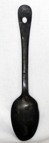
spoon
... Some indecipherable marks W B... gippsland utensil spoon food Some indecipherable marks W B V1 or W1 ...A large metal spoon which has a hanging hole in the top of the handle.Some indecipherable marks W B V1 or W1utensil spoon food -
 Stawell Historical Society Inc
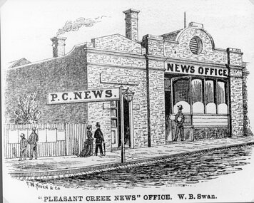
Drawing, Pleasant Creek News Office in Upper Main Street Stawell from the P.C. News Supplement 1888 -- Sketch
... "Pleasant Creek News" Office. W. B. Swan.... Supplement 1888 Stawell Businesses "Pleasant Creek News" Office. W. B ...Pleasant Creek News Office upper Main Street from P.C. News Supplement 1888 Line drawing of news office"Pleasant Creek News" Office. W. B. Swan.stawell businesses -
 Victorian Aboriginal Corporation for Languages
Periodical, Australian National University Department of Pacific and Southeast Asian History, Aboriginal history, 1984
... maps, b&w illustrations, b&w photographs, graphs, charts... Street Brunswick melbourne maps, b&w illustrations, b&w ...maps, b&w illustrations, b&w photographs, graphs, charts -
 Victorian Aboriginal Corporation for Languages
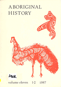
Periodical, Australian National University Department of Pacific and Southeast Asian History, Aboriginal history, 1987
... maps, b&w illustrations, b&w photographs, document... Street Brunswick melbourne maps, b&w illustrations, b&w ...maps, b&w illustrations, b&w photographs, document reproductions -
 Victorian Aboriginal Corporation for Languages
Periodical, Royal Historical Society of Victoria, Victorian historical journal : Victoria : 150 years of gold, 2001
... maps, b&w illustrations, b&w photographs, document... Street Brunswick melbourne maps, b&w illustrations, b&w ...maps, b&w illustrations, b&w photographs, document reproductions -
 Victorian Aboriginal Corporation for Languages
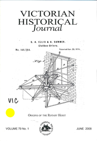
Periodical, Royal Historical Society of Victoria, Victorian historical journal : origins of the rotary hoist, 2008
... b&w photographs, b&w illustrations, document reproductions... Street Brunswick melbourne b&w photographs, b&w illustrations ...b&w photographs, b&w illustrations, document reproductions, tables -
 Victorian Aboriginal Corporation for Languages
Book, Ian D. Clark, 'We are all of one blood' : a history of the Djabwurrung Aboriginal people of western Victoria, 1836-1901. Vol. 2, 2016
... maps, b&w illustrations, b&w photographs, colour... billy, mount emu maps, b&w illustrations, b&w photographs ...Vol 2 Biographies, genealogies, pastoral station profiles, collectors of Djabwurrung heritage, and place names. maps, b&w illustrations, b&w photographs, colour illustrationsdjabwurrung, djab wurrung, western victoria, victoria, port phillip aboriginal protectorate, biographies, genealogies, pastoral stations, social histories, place names, siewright, lake condah, balllarat, thomas jerusalem, king billy, mount emu -
Victorian Aboriginal Corporation for Languages
Book, Ian D Clark, 'We are all of one blood' : a history of the Djabwurrung Aboriginal people of western Victoria, 1836-1901. Vol. 1, 2016
... maps, b&w illustrations, b&w photographs, colour... billy, mount emu histories maps, b&w illustrations, b&w ...Vol 1 A History of the Djabwurrung, 1836-1901maps, b&w illustrations, b&w photographs, colour illustrationsdjabwurrung, djab wurrung, western victoria, victoria, port phillip aboriginal protectorate, biographies, genealogies, pastoral stations, social histories, place names, siewright, lake condah, balllarat, thomas jerusalem, king billy, mount emu, histories -
Victorian Aboriginal Corporation for Languages
Book, Helen Gardner et al, Southern Anthropology : a History of Fison and Howitt's Kamilaroi and Kurnai, 2015
... b&w illustrations, b&w photographs, tables, document..., fisson, kamilaroi, kurnai, evolution, archives, australia b&w ...From far-flung sites in Australia and the Pacific Islands, Lorimer Fison and A. W. Howitt produced the landmark study, 'Kamilaroi and Kurnai' (1880). Their book revealed the complexity of Aboriginal and Pacific Island societies and changed the course of anthropology in the early years of the discipline. Using archival sources and an innovative approach, Southern Anthropology explores the research, writing and reception of 'Kamilaroi and Kurnai'. Historical chapters track Fison and Howitt's collection and analysis of anthropological material in the context of raging debates about the evolution of humans. This narrative is interspersed with an introduction to the kinship and social organisation of Aboriginal and Pacific Island people that highlight the enduring value of Fison and Howitt's methods and the resurgence of their questions in contemporary anthropology. Southern Anthropology is designed to be read across disciplinary boundaries. b&w illustrations, b&w photographs, tables, document reproductionshistories, anthropology, howitt, fisson, kamilaroi, kurnai, evolution, archives, australia -
 Victorian Aboriginal Corporation for Languages
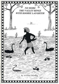
Book, Wendy Mitchell et al, Corroboree or war party: the last dance of the Wangaratta Pangerang : No more the valley rings with Koorie laughter, 2009
... maps, b&w illustrations, b&w photographs, word lists...&w illustrations, b&w photographs, word lists Details ...Details the coming of the white man, including explorers and squatters to the Wangaratta area, from a white perspective, written by Wendy Mitchell, and an Aboriginal perspective, written by Freddie Dowling.maps, b&w illustrations, b&w photographs, word listswangaratta, pangarang, genocide -
Victorian Aboriginal Corporation for Languages
Book, Edgar Morrison, Early days in the Loddon Valley : memoirs of Edward Stone Parker 1802-1865, 1966
... maps, b&w illustrations, b&w photographs, document... Street Brunswick melbourne Loddon maps, b&w illustrations, b&w ...maps, b&w illustrations, b&w photographs, document reproductionsloddon -
 Victorian Aboriginal Corporation for Languages
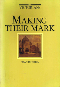
Book, Susan Priestley, Making their mark, 1984
... maps, b&w illustrations, b&w photographs, colour... Street Brunswick melbourne maps, b&w illustrations, b&w ...maps, b&w illustrations, b&w photographs, colour illustrations -
 Victorian Aboriginal Corporation for Languages
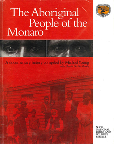
Book, The Aboriginal people of the Monaro, 2000
... maps, b&w photographs, b&w illustrations, document... Street Brunswick melbourne maps, b&w photographs, b&w ...A comprehensive history of the Aboriginal people of the Monaro district. Written by a collection of contributors.maps, b&w photographs, b&w illustrations, document reproductions -
Victorian Aboriginal Corporation for Languages
Book with CD-ROM, Iain Luck et al, Meet the eastern Kulin : the Aboriginal people of Central Victoria, 2001
... b&w photographs, b&w illustrations, maps, CD-ROM... Street Brunswick melbourne Eastern Kulin Central Victoria b&w ...Teacher resource kit.b&w photographs, b&w illustrations, maps, CD-ROMeastern kulin, central victoria -
 Victorian Aboriginal Corporation for Languages
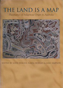
Book, Luise Hercus, The land is a map : placenames of Indigenous origin in Australia, 2002
... Maps, b&w photographs, b&w illustrations, word lists... Gamilaraay Ngiyampaa Maps, b&w photographs, b&w illustrations, word ...Place names often evoke important information about features of the environment and their place in Indigenous knowledge. On the other hand, place names given by European settlers are largely arbitrary.Maps, b&w photographs, b&w illustrations, word listsplace names, wik, cape york peninsula, ngalakgan, alawa, marra, yukgul, kaurna, yuwaalaraay, yuwaaliyaay, gamilaraay, ngiyampaa -
 Victorian Aboriginal Corporation for Languages
Book, Patrick McConvell, Archaeology and linguistics : Aboriginal Australia in global perspective, 1997
... B&w illustrations, b&w photographs, maps, word lists... Street Brunswick melbourne anthropological linguistics B&w ...Various authors: studies of wider patterns in Aboriginal language and culture, including migration, tool exchange, and particularly the role of linguistic evidence in establishing historical connections between Australian tribes as well as further afield in the Australasian region.B&w illustrations, b&w photographs, maps, word listsanthropological linguistics -
 Victorian Aboriginal Corporation for Languages
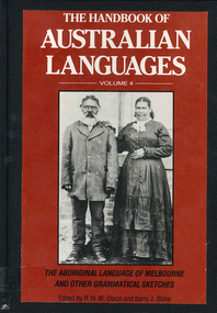
Book, R M W Dixon, The handbook of Australian languages : volume 4, the Aboriginal language of Melbourne and other grammatical sketches, 1991
... maps, word lists, b&w illustrations, b&w photographs... Street Brunswick melbourne maps, word lists, b&w illustrations, b ...maps, word lists, b&w illustrations, b&w photographs -
 Victorian Aboriginal Corporation for Languages
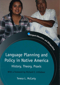
Book, Teresa L McCarty, Language planning and policy in Native America : history, theory and praxis, 2013
... Maps, b&w illustrations, b&w photographs, colour... restriction Maps, b&w illustrations, b&w photographs, colour ...Contextualizing Native American LPP: legal-political, demographic and sociolinguistic foundations; conceptualizing Native American LPP: critical sociocultural foundations; Native American languages 1492-2012; Indigenous literacies, bilingual education and community empowerment: Navajo case study; language regenesis in practice; language in the lives of Indigenous youth; planning language for the Seventh GenerationMaps, b&w illustrations, b&w photographs, colour photographslanguage planning, language policy, native american languages, language standardisation, language restriction -
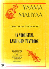 Victorian Aboriginal Corporation for Languages
Book, John Giacon et al, Yaama maliyaa, Yuwaalaraay - Gamilaraay : an aboriginal languages textbook, 1999
... B&w illustrations, b&w photographs, maps, word lists... Street Brunswick melbourne Gamilaraay Yuwaalaraay B&w ...Includes index. Bibliography. For secondary school students.B&w illustrations, b&w photographs, maps, word listsgamilaraay, yuwaalaraay -
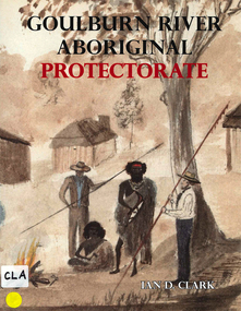 Victorian Aboriginal Corporation for Languages
Book, Ian D Clark, Goulburn River Aboriginal Protectorate : a history of the Goulburn River Aboriginal Protectorate Station at Murchison, Victoria, 1840 - 1853, 2013
... maps, b&w illustrations, b&w photographs, document... Protectorate Goulburn River region Victorian history maps, b&w ...This study explains why the locality of what is now known as Murchison is one of the most important historic Aboriginal places in regional Victoria.maps, b&w illustrations, b&w photographs, document reproductionsngurai-illam balug, ngurai-illam wurrung, daungwurrung, yaithmathang, yortayorta, yorta yorta, bangerang, murchison, murnang, george augustus robinson, goulburn river aboriginal protectorate, goulburn river region, victorian history -
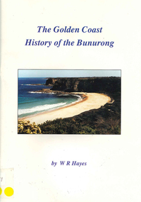 Victorian Aboriginal Corporation for Languages
Book, W R Hayes, The golden coast : history of the Bunurong, 1998
... maps, colour photographs, b&w photographs, b&w... Cape Woolamai colonisation maps, colour photographs, b&w ...A history of the section of Victorian coastline from Andersons Inlet to Cape Woolamai. Includes descriptions of the impacts and consequences of European occupation on the Aboriginal people of this region.maps, colour photographs, b&w photographs, b&w illustrationsbunurong, boon wurrung, andersons inlet, cape woolamai, colonisation -
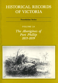 Victorian Aboriginal Corporation for Languages
Book, Ian Macfarlane, Historical records of Victoria : foundation series : volume 2A : the Aborigines of Port Phillip 1835-1839, 1982
... b&w illustrations, b&w photographs, tables, document... system b&w illustrations, b&w photographs, tables, document ...Reproductions of various transactions and reports dealing with Aboriginal people in Port Phillip in the period 1835-39, beginning with some of the earliest reports and tracing the evolution of government interaction and policy towards Aborigines in the 19th century. Covers mission work, government reports, the native police, conflicts with squatters, with numerous illustrations and original reports. Contents: Part I, Evolution of British policy Ch. 1. Proposals to appoint protectors of aborigines Ch. 2. Racial conflict in the year of official settlement at Port Phillip Ch. 3. House of Commons Select Committee on Aborigines Part II, The Wesleyan Mission at Buntingdale Ch. 4. Establishment and early operations of the Wesleyan mission Part III, The Government acts Ch. 5. Establishing the first government mission 1835-7 Ch. 6. Food and clothing for the Aborigines Ch. 7. Punishment of Aborigines found drunk, 1836-8 Ch. 8. Operations of the government mission, November 1837 to March 1839 Ch. 9. First attempt to form a native police corps Part IV, Growing conflict with squatters, 1837-8 Ch. 10. The disappearance of Gellibrand and Hesse Ch. 11. Attacks in the Western District Ch. 12. Attacks on the overland routes to Port Phillip Ch. 13. Evolution of policy in Sydney, 1838.b&w illustrations, b&w photographs, tables, document reproductionsvictorian history, colonisation, justice system -
 Victorian Aboriginal Corporation for Languages
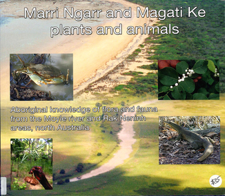
Book, Ngarul Jimmy Nambatu et al, Marri Ngarr and Magati Ke plants and animals : Aboriginal knowledge of flora and fauna from the Moyle River and Neninh areas, North Australia, 2009
... Maps, b&w illustrations, b&w photographs, colour... River Northern Territory flora fauna ethnobiology Maps, b&w ...Aboriginal knowledge of flora and fauna from the Moyle River and Neninh areas.Maps, b&w illustrations, b&w photographs, colour photographs,marri ngarr, magati ke, wadeye, moyle river, northern territory, flora, fauna, ethnobiology -
 Victorian Aboriginal Corporation for Languages
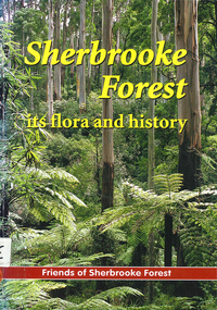
Book, Friends of Sherbrooke Forest, Sherbrooke Forest : its flora and history, 2000
... Maps, b&w illustrations, b&w photographs, colour... indigenous vascular plants weed management Maps, b&w illustrations, b ...Notes on plants in the area, including swamp/water plants.Maps, b&w illustrations, b&w photographs, colour photographsdandenong ranges national park, indigenous vascular plants, weed management