Showing 2127 items
matching map of bendigo
-
 Bendigo Historical Society Inc.
Map - SERPENTINE, No date Visible
... , County of Bendigo ( number 156 in Map Cupboard 1)... Inc. History House 11 Mackenzie Street Bendigo goldfields MAP ...Map: Township of Janiember (name crossed out and 'Serpentine' hand written in its place, Parish of Janiember east, County of Bendigo ( number 156 in Map Cupboard 1)map, bendigo, township, serpentine, janiember, parish of janiember east, county of bendigo -
Bendigo Historical Society Inc.
Map - MANDURANG, November 6th 1854
... Inc. History House 11 Mackenzie Street Bendigo goldfields MAP ...Map: The village of Mandurang situated about 6 miles from Sandhurst, Parish of Mandurang ( number 155 in Map Cupboard 1)map, bendigo, village, mandurang -
Bendigo Historical Society Inc.
Map - GOORNONG, 1/10/1906
... of Bendigo ( number 154 in Map Cupboard 1)... Inc. History House 11 Mackenzie Street Bendigo goldfields MAP ...Map: Township of Goornong, Parish of Goornong, County of Bendigo ( number 154 in Map Cupboard 1)map, bendigo, township, goornong, county of bendigo -
Bendigo Historical Society Inc.
Map - GOORNONG, Revised 5/06/1926
... of Bendigo ( number 153 in Map Cupboard 1)... Inc. History House 11 Mackenzie Street Bendigo goldfields MAP ...Map: Town of Goornong, Parish of Goornong, County of Bendigo ( number 153 in Map Cupboard 1)map, bendigo, township, goornong, county of bendigo -
Bendigo Historical Society Inc.
Map - TARNAGULLA SHEET 3, No date Visible
... Inc. History House 11 Mackenzie Street Bendigo goldfields MAP ...Map: Tarnagulla Sheet 3, hand written on the side of the map. ( number 152 in Map Cupboard 1)map, parish plan, tarnagulla -
Bendigo Historical Society Inc.
Map - BEAR'S LAGOON, 2/10/1931
... Map: Town of Munica ( name crossed out and Bear's Lagoon... Inc. History House 11 Mackenzie Street Bendigo goldfields MAP ...Map: Town of Munica ( name crossed out and Bear's Lagoon hand written in), Parish of Janiember east, County of Bendigo ( number 151 in Map Cupboard 1)map, bendigo, township, bear's lagoon, munica, janiember east, county of bendigo -
 Bendigo Historical Society Inc.
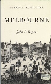
Book - NATIONAL TRUST GUIDES MELBOURNE, 1970
National Trust Guides Melbourne, 92 pages of descriptions, history and photographs of Melbourne heritage buildings with map.John P Roganhistory, melbourne, melbourne history, heritage buildings, national trust. -
Bendigo Historical Society Inc.
Map - HUNTLY, 7/01/1904
... of Bendigo ( number 150 in Map Cupboard 1)... Inc. History House 11 Mackenzie Street Bendigo goldfields MAP ...Map: Township of Huntly, Parish of Huntly, County of Bendigo ( number 150 in Map Cupboard 1)map, bendigo, township, huntly, parish of huntly, county of bendigo -
 Bendigo Historical Society Inc.
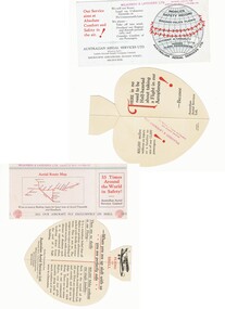
Document - BASIL WATSON COLLECTION: PUBLICITY CARDS FOR AUSTRALIAN AERIAL SERVICES LTD, c. 1930
Two publicity cards for Australian Aerial Services Ltd a. heart-shaped fold-out card highlighting the safety record of Australian Aerial Services Ltd. 'Flying with Shell' pop-out on card with image of bi-plane 'There is no need to be Half-hearted about taking a Flight in our Aeroplanes!When you are up aloft with us you are perfectly safe'; b. rectangular card highlighting safety record of AAS Ltd with aerial route map on reverse. Inside card: We will not stunt; Land on Unknown Grounds; or Fly unnecessarily Low. We always - Take off into wind; Overhaul our engines and aircraft periodically; and Consider comfort of our Passengers' Red stamp of 'Wilkinson & Lavender Ltd on back of card - Booking agents for Australian Aerial Services Ltd'business, transport, aviation -
Bendigo Historical Society Inc.
Map - TARNAGULLA SHEET 2, No date Visible
... Inc. History House 11 Mackenzie Street Bendigo goldfields MAP ...Map: Tarnagulla Sheet 2, Parish planmap, parish plan, tarnagulla -
Bendigo Historical Society Inc.
Map - SANDHURST (PART), No date Visible
... Inc. History House 11 Mackenzie Street Bendigo goldfields MAP ...Map: Hand Draughted parish plan showing the area North and East of Spring Gully Reservoir ( number 206 in Map Cupboard 1)map, bendigo, parish plan, parish of sandhurst, spring gully -
Bendigo Historical Society Inc.
Map - DINGEE SUBDIVISION, 25/11/1913
... Inc. History House 11 Mackenzie Street Bendigo goldfields MAP ...Map: Dingee Subdivision, Parishes of Talambe and Yallook, County of Bendigo, Parish Plan, Canvas Backed ( number 128 in Map Cupboard 1)map, bendigo, rural, dingee subdivision, talambe, yallook, county of bendigo -
Bendigo Historical Society Inc.
Map - BURNEWANG PARK ESTATE, circa 1920
... Inc. History House 11 Mackenzie Street Bendigo goldfields MAP ...Map: Burnewang Park Estate, Parishes of Diggorra and Minto, County of Bendigo, Parish Plan ,Canvas backed ( number 127 in Map Cupboard 1)map, bendigo, rural, burnewang, diggorra, minto, county of bendigo -
 Bendigo Historical Society Inc.
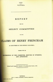
Book - 1890 ROYAL COMMISSION GOLD DISCOVERY BENDIGO, 1890
( x ref 5673 , 8235 , Box 83 , 9077 ) Photocopy of original documents from the 1890 Royal Commission into who discovered the first gold in Bendigo with a report from the Select Committee upon the claims of Henry Frencham and evidence from other claimants plus a map.bendigo, history, early digging days, bendigo- history- gold- pioneers -
 Bendigo Historical Society Inc.
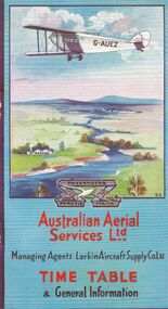
Document - BASIL WATSON COLLECTION: AUSTRALIAN FLIGHT TIMETABLES, a. & b. 1927/29; c. 1927?
Australian Flight Timetables,3 booklets: 1. Australian Aerial Services Ltd. booklet contains timetables, educational notes on aerial transport, first flight impressions, coach connections with airports, rules of the air, 1920's although no date on booklet. Aerial route map shows route from Melbourne to Hay, then to Adelaide, and east to Cootamundra. 2. AHS Timetable and general information booklet. Issued 1st March 1929, contains timetables, general information re flights, image of passengers 'emplaning' at Essendon Airport. 3. 'Fly There' booklet of timetable information and passenger fares and parcel rates. West Australian Airways.person, individual, basil watson -
Bendigo Historical Society Inc.
Map - EAGLEHAWK (PART), 22/01/1882
... Inc. History House 11 Mackenzie Street Bendigo goldfields MAP ...Map: Parish plan showing area Eastward from Lightning Hill ( number 205 in Map Cupboard 1)map, bendigo, parish plan, eaglehawk, lightning hill -
Bendigo Historical Society Inc.
Map - RESURVEY PARISH OF SANDHURST, 23/07/1891
... Inc. History House 11 Mackenzie Street Bendigo goldfields MAP ...Map: Resurvey, Parish of Sandhhurst sheet No. IV, Enlargement of part of sheet No. III. Parish plan ( number 204 in Map Cupboard 1)map, bendigo, parish plan, parish of sandhurst, resurvey -
Bendigo Historical Society Inc.
Map - RESURVEY, PARISH OF SANDHURST, 1/08/1891
... Inc. History House 11 Mackenzie Street Bendigo goldfields MAP ...Map: Resurvey , Parish of Sandhurst sheet 3. Parish plan ( number 203 in Map Cupboard 1)map, bendigo, parish plan, parish of sandhurst resurvey -
Bendigo Historical Society Inc.
Map - SANDHURST SHEET 3, 27/05/1925
... Inc. History House 11 Mackenzie Street Bendigo goldfields MAP ...Map: sandhurst sheet 3. Parish plan ( number 202 in Map Cupboard 1)map, bendigo, parish plan, sandhurst -
Bendigo Historical Society Inc.
Map - SANDHURST SHEET 2, No date visible
... Inc. History House 11 Mackenzie Street Bendigo goldfields MAP ...Map:Sandhurst, County of Bendigo Sheet 2. Parish plan, Eaglehawk. ( number 200 in Map Cupboard 1)map, bendigo, city streets, sandhurst -
Bendigo Historical Society Inc.
Map - SANDHURST SHEET 3, No date visible
... Inc. History House 11 Mackenzie Street Bendigo goldfields MAP ...Map: Sandhurst sheet 3. Parish plan ( number 199 in Map Cupboard 1)map, bendigo, city streets, sandhurst -
Bendigo Historical Society Inc.
Map - SANDHURST SHEET 4, January 1947
... Inc. History House 11 Mackenzie Street Bendigo goldfields MAP ...Map: Sandhurst sheet 4. Parish plan ( number 198 in Map Cupboard 1)map, bendigo, city streets, sandhurst -
Bendigo Historical Society Inc.
Map - SANDHURST SHEET 5, Circa 1940's
... Inc. History House 11 Mackenzie Street Bendigo goldfields MAP ...Map: Sandhurst sheet 5. Parish plan ( number 197 in Map Cupboard 1)map, bendigo, city streets, sandhurst -
Bendigo Historical Society Inc.
Map - SANDHURST SHEET 6, 1947
... Inc. History House 11 Mackenzie Street Bendigo goldfields MAP ...Map: Sandhurst sheet 6. Parish plan ( number 196 in Map Cupboard 1)map, bendigo, city streets, sandhurst -
Bendigo Historical Society Inc.
Map - SANDHURST : COUNTY OF BENDIGO (PART), Circa 1940's
... Inc. History House 11 Mackenzie Street Bendigo goldfields MAP ...Map: Large scale (2 chains=1') of part of the city of Bendigo. Showing the area from Sommerville St. to Edwards Rd. Flora Hill ( number 195 in Map Cupboard 1)map, bendigo, city streets, bendigo, flora hill, sommerville st. -
Bendigo Historical Society Inc.
Map - TOWNSHIP OF KANGAROO FLAT, 27/01/1932
... Inc. History House 11 Mackenzie Street Bendigo goldfields MAP ...Map: Township of Kangaroo flat, Parish of Sandhurst , County of Bendigo. Parish plan ( number 194 in Map Cupboard 1)map, bendigo, township, kangaroo flat -
Bendigo Historical Society Inc.
Map - LANDS AVAILABLE FOR SELECTION, 6/05/1912
... Inc. History House 11 Mackenzie Street Bendigo goldfields MAP ...Map: Lands available for selection, County of Bendigo. Parish plan ( number 192 in Map Cupboard 1)map, bendigo, lands available for selection, lands available for selection, bendigo -
Bendigo Historical Society Inc.
Map - NERRING. SHEET ?, Circa 1894
... Inc. History House 11 Mackenzie Street Bendigo goldfields MAP ...Map: Nerring, Part ( number unreadable), County of Bendigo. Parish plan ( number 190 in Map Cupboard 1)map, bendigo, parish plan, nerring -
 Bendigo Historical Society Inc.
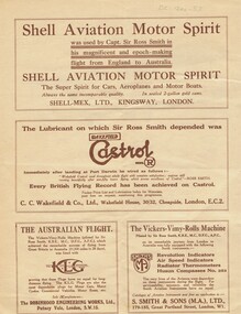
Document - BASIL WATSON COLLECTION: 'THE ROSS SMITH FLIGHT FROM ENGLAND TO AUSTRALIA' - TRAVELOGUE PROMOTION, c. 1920
Booklet: 'The Ross Smith Flight from England to Australia' - 4 page Travelogue booklet promotion for the Lowell Thomas Travelogues series, Re flight from England to Australia. On cover ' Under the patronage of HRH The Prince of Wales, The Ross Smith Flight from England to Australia' Includes short story of the flight by Capt. Sir Ross Smith, KB, MC, DFC, AFC. , map of flight and photos of Ross and Keith Smith. List of pictures shown in the travelogue. Original signatures of Ross and Keith Smith on the front cover.person, individual, ross smith -
 Bendigo Historical Society Inc.
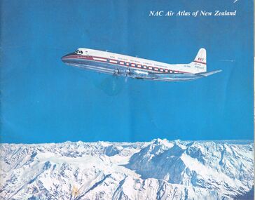
Document - MCCOLL, RANKIN AND STANISTREET COLLECTION: NAC AIR ATLAS OF NEW ZEALAND, 1955
McColl Rankin & Stanistreet, NAC Air Atlas of New Zealand. Photographs, arial photographs & maps. Shows air routes. Information on commercial air flights in New Zealand. Published by New Zealand National Airways Corp.organization, business, bendigo businesses, mccoll rankin & stanistreet, nac air atlas of new zealand