Showing 3336 items matching "engineering"
-
 Moorabbin Air Museum
Functional Object - Fraser Nash FN4 Tail Turret (Short Sunderland IIi / V Ml814 / Nz4108 / VH-Brf)
Historical Details: . Description: Frazer Nash was a British automobile manufacturer and engineering company founded in 1922 that had produced around 400 cars by the mid 1930’s. A separate company Nash & Thompson was established in 1929 by business partners Archibald Frazer Nash and Henry. Level of Importance: -
Unions Ballarat
Photograph: Frank and Rosalie Sheehan, 3/10/2010
Photograph: Frank and Rosalie Sheehan The photograph was taken at a memorial luncheon for the late Norm Borchers. The event was held at Sebastopol Bowling Club and Frank Sheehan was a guest speaker. Norm Borchers passed away in 2008. Borchers was a Club President of the Sebastopol Lions Club (1975-76). He worked for the railways as an engineering employee and was long-term trade unionist (Amalgamated Engineering Union and the Australian Railways Union) and ALP member; he lived and worked in the Ballarat area. Norm was active in workplace disputes during the ALP split in 1955. He was a long time supporter of Ballarat Trades Hall. Frank Sheehan was the state member for Ballarat South, serving from 1982-1992. Rosalie Sheehan is his wife.Photographbtlc, ballarat trades and labour council, ballarat trades hall, borchers, norm, sheehan, frank, sheehan, rosalie, alp, australian labor party, politicians - state -
 Bendigo Historical Society Inc.
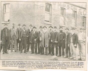
Photograph - CORNISH COLLECTION: VISIT OF BENDIGO MINE MANAGERS TO THOMPSON'S ENGINEERING WORKS, CASTLEMAINE
Photograph. Cornish Collection - visit of Bendigo mine managers to Thompson's Engineering Works, Castlemaine. Article (undated) from Bendigo Advertiser (?) re visit one hundred years ago - with photos of 14 men with part of Thompson & Co brick building in background: : Mr Hicks (Red, White and Blue); Mr Glanville (Hustlers Royal Reserve); Mr Kidd (Shamrock Co.0; Mr Hollow (South Bellevue); Mr Rowe (new Chum Rail); Mr Jas Northcote (Lansell's general manager); Mr Edward (Fortuna-Hustlers); Mr Prior (Garden Gully); Mr J Lonsdale (Shenandoah); Mr Whitford (Lazarus Co,); Mr Harvey (New Chum United); Mr Bradshaw (electrical engineering); Mr Lonsdale (Lazarus Co.); Mr L B McGrath (Thompson's representative).bendigo, gold mining, miners -
 B-24 Liberator Memorial Restoration Australia Inc
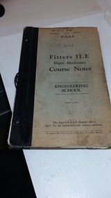
Work on paper - Flight Mechanics Course Notes, Fitters II.E Flight Mechanics Course Notes
R.H. Percy was a flight mechanic fitter on B-24 aircraft c1942-1945These course notes were used by all flight mechanics for B-24 aircraft.Foolscap size cardboard covered papers51067 Percy R.H. course 176 TFM, R.A.A.F. 4847 Fitters II.E, Flight Mechanics Course Notes, ENGINEERING SCHOOL, ISSUE 3-1941, This Book is R.A.A.F. Property and is NOT TO BE REPRODUCED without authority. By authority: Wilke & Co Pty. Ltd. Printers 19-47 Jeffcott Street, Melbourne. -
 Ringwood and District Historical Society
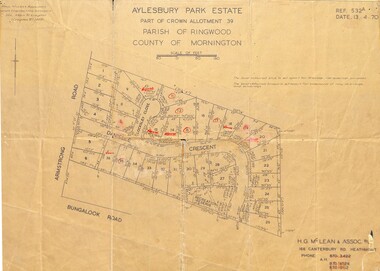
Map - Plan of Subdivision, Aylesbury Park Estate, Part of Crown Allotment 39, Parish of Ringwood, County of Mornington - 1970
Map showing residential allotments for sale in Armstrong Road, Danielle Crescent and Locksley Close, Heathmont, Victoria.Ref.532A Date 13.4.70. Paul Millar & Associates, Land & Engineering Surveyors, 14A Main Street Croydon (Phone) 723 4493. Ref.532A Date 13.4.70. (Agent) H.G. McLean & Assoc P/L, 166 Canterbury Road Heathmont, Phone 8703422 A.H. 8706726 8700112. -
 Eltham District Historical Society Inc
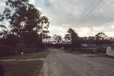
Slide, Roundabout at Reichelt Avenue and McCarthy Grove, Montmorency, c.Oct. 1980
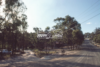
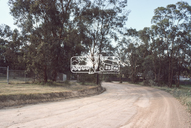
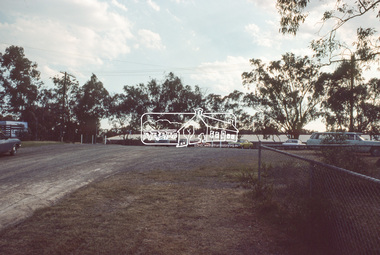
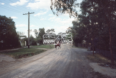
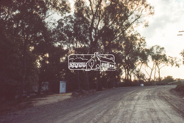
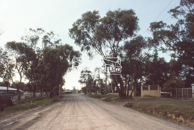
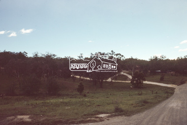
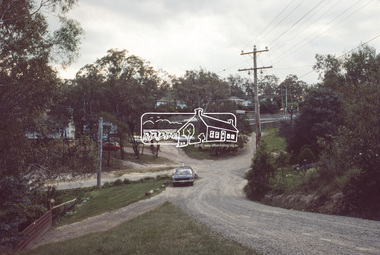
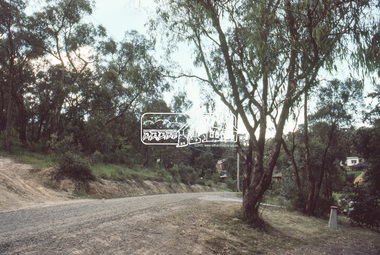
One of a series of images of roads and infrastructure focussed on the Quinn Estate in Montmorency taken by Eltham Shire Council Planning and Engineering officers. They provide perspective of the changes in housing styles and road development that began sweeping in from the mid 1970s with increasing urbanisation of what was once more outlying suburbs and regions.35 mm colour positive transparency Mount - Kodak Kodachrome CardProcessed Oct 1980infrastructure, mccarthy grove, montmorency, reichelt avenue, roads, roundabout -
 Eltham District Historical Society Inc
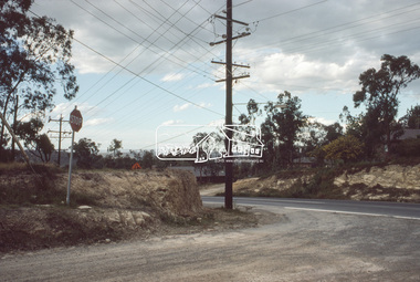
Slide, Mitchell Avenue near Panorama Heights Preschool, Montmorency, c.Oct. 1980
One of a series of images of roads and infrastructure focussed on the Quinn Estate in Montmorency taken by Eltham Shire Council Planning and Engineering officers. They provide perspective of the changes in housing styles and road development that began sweeping in from the mid 1970s with increasing urbanisation of what was once more outlying suburbs and regions.35 mm colour positive transparency Mount - Kodak Kodachrome CardProcessed Oct 1980infrastructure, mitchell avenue, montmorency, panorama heights preschool, roads -
 Eltham District Historical Society Inc
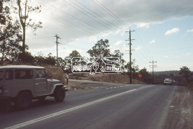
Slide, Mitchell Avenue looking towrads Montmorency South Primary School, c.Oct. 1980
One of a series of images of roads and infrastructure focussed on the Quinn Estate in Montmorency taken by Eltham Shire Council Planning and Engineering officers. They provide perspective of the changes in housing styles and road development that began sweeping in from the mid 1970s with increasing urbanisation of what was once more outlying suburbs and regions.35 mm colour positive transparency Mount - Kodak Kodachrome CardProcessed Oct 1980infrastructure, mitchell avenue, montmorency, montmorency south primary school, roads -
 Eltham District Historical Society Inc
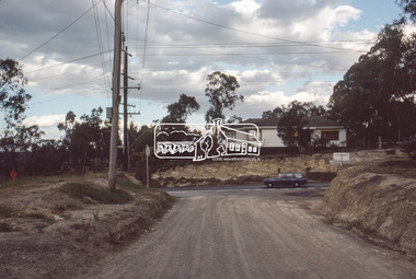
Slide, Looking east along Buena Vista Drive, Montmorency near no. 69, c.Oct. 1980
One of a series of images of roads and infrastructure focussed on the Quinn Estate in Montmorency taken by Eltham Shire Council Planning and Engineering officers. They provide perspective of the changes in housing styles and road development that began sweeping in from the mid 1970s with increasing urbanisation of what was once more outlying suburbs and regions.35 mm colour positive transparency Mount - Kodak Kodachrome CardProcessed Oct 1980buena vista drive, horse, infrastructure, montmorency, roads -
 Eltham District Historical Society Inc
Slide, Quinn Estate, Buena Vista Drive, Montmorency near school looking northwest, c.Oct. 1980
One of a series of images of roads and infrastructure focussed on the Quinn Estate in Montmorency taken by Eltham Shire Council Planning and Engineering officers. They provide perspective of the changes in housing styles and road development that began sweeping in from the mid 1970s with increasing urbanisation of what was once more outlying suburbs and regions.35 mm colour positive transparency Mount - Kodak Kodachrome CardProcessed Oct 1980housing estate, infrastructure, montmorency, quinn estate, roads -
 Eltham District Historical Society Inc
Slide, Looking north along Buena Vista Drive near Montmorency South Primary School, c.Oct. 1980
One of a series of images of roads and infrastructure focussed on the Quinn Estate in Montmorency taken by Eltham Shire Council Planning and Engineering officers. They provide perspective of the changes in housing styles and road development that began sweeping in from the mid 1970s with increasing urbanisation of what was once more outlying suburbs and regions.35 mm colour positive transparency Mount - Kodak Kodachrome CardProcessed Oct 1980buena vista drive, infrastructure, montmorency, montmorency south primary school, roads -
 Eltham District Historical Society Inc
Slide, Quinn Estate looking east along Cressy Streett, Montmorency before Quinn Way, c.Oct. 1980
One of a series of images of roads and infrastructure focussed on the Quinn Estate in Montmorency taken by Eltham Shire Council Planning and Engineering officers. They provide perspective of the changes in housing styles and road development that began sweeping in from the mid 1970s with increasing urbanisation of what was once more outlying suburbs and regions.35 mm colour positive transparency Mount - Kodak Kodachrome CardProcessed Oct 1980infrastructure, montmorency, cressy street, housing estate, quinn estate, quinn way, roads -
 Eltham District Historical Society Inc
Slide, Quinn Estate from Sackville Street looking west to 'T-bowl' near Main Road, Montmorency, c.Oct. 1980
One of a series of images of roads and infrastructure focussed on the Quinn Estate in Montmorency taken by Eltham Shire Council Planning and Engineering officers. They provide perspective of the changes in housing styles and road development that began sweeping in from the mid 1970s with increasing urbanisation of what was once more outlying suburbs and regions.35 mm colour positive transparency Mount - Kodak Kodachrome CardProcessed Oct 1980roads, housing estate, infrastructure, main road, montmorency, quinn estate, sackville street, t-bowl -
 Eltham District Historical Society Inc
Slide, Quinn Estate, looking northeast along Sackville Street, Montmorency near no. 12, c.Oct. 1980
One of a series of images of roads and infrastructure focussed on the Quinn Estate in Montmorency taken by Eltham Shire Council Planning and Engineering officers. They provide perspective of the changes in housing styles and road development that began sweeping in from the mid 1970s with increasing urbanisation of what was once more outlying suburbs and regions.35 mm colour positive transparency Mount - Kodak Kodachrome CardProcessed Oct 1980infrastructure, housing estate, montmorency, quinn estate, roads, sackville street -
 Eltham District Historical Society Inc
Slide, Sackville Street, Montmorency; split road near no. 36, c.Oct. 1980
One of a series of images of roads and infrastructure focussed on the Quinn Estate in Montmorency taken by Eltham Shire Council Planning and Engineering officers. They provide perspective of the changes in housing styles and road development that began sweeping in from the mid 1970s with increasing urbanisation of what was once more outlying suburbs and regions.35 mm colour positive transparency Mount - Kodak Kodachrome CardProcessed Oct 1980sackville street, infrastructure, montmorency, roads -
 Eltham District Historical Society Inc
Slide, Quinn Estate looking east along Sackville Street just prior to Quinn Way, Montmorency, c.Oct. 1980
One of a series of images of roads and infrastructure focussed on the Quinn Estate in Montmorency taken by Eltham Shire Council Planning and Engineering officers. They provide perspective of the changes in housing styles and road development that began sweeping in from the mid 1970s with increasing urbanisation of what was once more outlying suburbs and regions.35 mm colour positive transparency Mount - Kodak Kodachrome CardProcessed Oct 1980roads, housing estate, infrastructure, montmorency, quinn estate, quinn way, sackville street -
 Eltham District Historical Society Inc
Slide, Quinn Estate near Sackville Reserve, Montmorency, c.Oct. 1980
One of a series of images of roads and infrastructure focussed on the Quinn Estate in Montmorency taken by Eltham Shire Council Planning and Engineering officers. They provide perspective of the changes in housing styles and road development that began sweeping in from the mid 1970s with increasing urbanisation of what was once more outlying suburbs and regions.35 mm colour positive transparency Mount - Kodak Kodachrome CardProcessed Oct 1980quinn estate, housing estate, infrastructure, montmorency, roads, sackville reserve, sackville street -
 Eltham District Historical Society Inc
Slide, Reichelt Avenue, Montmorency at intersection with Bolton Street (now closed), c.Oct. 1980
One of a series of images of roads and infrastructure focussed on the Quinn Estate in Montmorency taken by Eltham Shire Council Planning and Engineering officers. They provide perspective of the changes in housing styles and road development that began sweeping in from the mid 1970s with increasing urbanisation of what was once more outlying suburbs and regions.35 mm colour positive transparency Mount - Kodak Kodachrome CardProcessed Oct 1980bolton steet, eltham, infrastructure, montmorency, reichelt avenue, roads -
 Eltham District Historical Society Inc
Slide, Quinn Estate, Reichelt Avenue near Riverina Road, Montmorency, c.Oct. 1980
One of a series of images of roads and infrastructure focussed on the Quinn Estate in Montmorency taken by Eltham Shire Council Planning and Engineering officers. They provide perspective of the changes in housing styles and road development that began sweeping in from the mid 1970s with increasing urbanisation of what was once more outlying suburbs and regions.35 mm colour positive transparency Mount - Kodak Kodachrome CardProcessed Oct 1980housing estate, infrastructure, montmorency, quinn estate, reichelt avenue, roads -
 Eltham District Historical Society Inc
Slide, Quinn Estate, Buena Vista Drive, Montmorency near school looking northwest, c.Oct. 1980
One of a series of images of roads and infrastructure focussed on the Quinn Estate in Montmorency taken by Eltham Shire Council Planning and Engineering officers. They provide perspective of the changes in housing styles and road development that began sweeping in from the mid 1970s with increasing urbanisation of what was once more outlying suburbs and regions.35 mm colour positive transparency Mount - Kodak Kodachrome CardProcessed Oct 1980housing estate, infrastructure, montmorency, quinn estate, roads -
 Eltham District Historical Society Inc
Slide, Quinn Estate looking west along Cressy Street, Montmorency, c.Oct. 1980
One of a series of images of roads and infrastructure focussed on the Quinn Estate in Montmorency taken by Eltham Shire Council Planning and Engineering officers. They provide perspective of the changes in housing styles and road development that began sweeping in from the mid 1970s with increasing urbanisation of what was once more outlying suburbs and regions.35 mm colour positive transparency Mount - Kodak Kodachrome CardProcessed Oct 1980cressy street, housing estate, infrastructure, montmorency, quinn estate, roads -
 Eltham District Historical Society Inc
Slide, Quinn Estate looking west along Cressy Street, Montmorency near no. 29, c.Oct. 1980
One of a series of images of roads and infrastructure focussed on the Quinn Estate in Montmorency taken by Eltham Shire Council Planning and Engineering officers. They provide perspective of the changes in housing styles and road development that began sweeping in from the mid 1970s with increasing urbanisation of what was once more outlying suburbs and regions.35 mm colour positive transparency Mount - Kodak Kodachrome CardProcessed Oct 1980cressy street, housing estate, infrastructure, montmorency, quinn estate, roads -
 Eltham District Historical Society Inc
Slide, Quinn Estate, looking along Cressy Street towards Quinn Way, Montmorency, c.Oct. 1980
One of a series of images of roads and infrastructure focussed on the Quinn Estate in Montmorency taken by Eltham Shire Council Planning and Engineering officers. They provide perspective of the changes in housing styles and road development that began sweeping in from the mid 1970s with increasing urbanisation of what was once more outlying suburbs and regions.35 mm colour positive transparency Mount - Kodak Kodachrome CardProcessed Oct 1980quinn estate, cressy street, housing estate, infrastructure, montmorency, roads -
 Eltham District Historical Society Inc
Slide, Reichelt Avenue, Montmorency at T-bowl near no. 27, c.Oct. 1980
One of a series of images of roads and infrastructure focussed on the Quinn Estate in Montmorency taken by Eltham Shire Council Planning and Engineering officers. They provide perspective of the changes in housing styles and road development that began sweeping in from the mid 1970s with increasing urbanisation of what was once more outlying suburbs and regions.35 mm colour positive transparency Mount - Kodak Kodachrome CardProcessed Oct 1980infrastructure, montmorency, reichelt avenue, roads, t-bowl -
 Eltham District Historical Society Inc
Slide, Intersection of Reichelt Avenue, Montmorency at Bolton Street, c.Oct. 1980
One of a series of images of roads and infrastructure focussed on the Quinn Estate in Montmorency taken by Eltham Shire Council Planning and Engineering officers. They provide perspective of the changes in housing styles and road development that began sweeping in from the mid 1970s with increasing urbanisation of what was once more outlying suburbs and regions.35 mm colour positive transparency Mount - Kodak Kodachrome CardProcessed Oct 1980infrastructure, bolton steet, eltham, montmorency, reichelt avenue, roads -
 Eltham District Historical Society Inc
Slide, Reichelt Avenue/Buena Vista Drive closure towards Bolton Street, c.Oct. 1980
One of a series of images of roads and infrastructure focussed on the Quinn Estate in Montmorency taken by Eltham Shire Council Planning and Engineering officers. They provide perspective of the changes in housing styles and road development that began sweeping in from the mid 1970s with increasing urbanisation of what was once more outlying suburbs and regions.35 mm colour positive transparency Mount - Kodak Kodachrome CardProcessed Oct 1980buena vista drive, infrastructure, montmorency, reichelt avenue, roads -
Federation University Historical Collection
Document - Document - Letter, Ballarat Junior Technical School: School correspondence with Messer & Opie Ptd Ltd, re scholarships, 1956
Letters relate to the awarding of the scholarship provided by Messer and Opie Pty Ltd. School informed them of the winner of the 1955 scholarship was Barry Paterson. He has gone to the School of Mines and started a four year course in Electrical Engineering. School also thanks them for the money for the following year's scholarship. .1 and .3: Yellow pages, typed .2: Light orange, typedLetterhead for Messer & Opie Signature of secretary, B McCoyballarat junior technical school, head master, l garner, barry paterson, messer & opie, scholarship, intermediate technical certificate, diploma entrance level, school of mines, electrical engineering -
 Federation University Historical Collection
Photograph - Photograph - Colour, Ballarat School of Mines M.B. John Building
On 11 June 1987 The M.B. John Trade–Art building (Albert Street front) of SMB was officially opened by the Hon. John Cain, Premier of Victoria, in the presence of Morgan B. John. Programs include 3 Dimensional Art, Painting & Decorating, and Engineering Trades. (SMB Institutional Plan 1989)Colour photographs of the Ballarat School of Mines M.B. John Building on Albert Street, Ballarat. Some images show the Ballarat School of Mines Botanical Garden.ballarat school of mines botanical garden, m.b. john building, ballarat school of mines, morgan b. john, m.b. john, morgan bevan john, trades