Showing 11534 items matching "maps"
-
 Victorian Aboriginal Corporation for Languages
Periodical, Australian National University Department of Pacific and Southeast Asian History, Aboriginal history, 1984
maps, b&w illustrations, b&w photographs, graphs, charts -
 Victorian Aboriginal Corporation for Languages
Periodical, Australian National University Department of Pacific and Southeast Asian History, Aboriginal history, 1987
maps, b&w illustrations, b&w photographs, document reproductions -
 Victorian Aboriginal Corporation for Languages
Periodical, Australian National University Department of Pacific and Southeast Asian History, Aboriginal history, 1986
maps, b&w photograph, graphs, charts, reproductions of historic items -
 Victorian Aboriginal Corporation for Languages
Periodical, Royal Historical Society of Victoria, Victorian historical journal : Victoria : 150 years of gold, 2001
maps, b&w illustrations, b&w photographs, document reproductions -
 Victorian Aboriginal Corporation for Languages
Book, Ian D. Clark, 'We are all of one blood' : a history of the Djabwurrung Aboriginal people of western Victoria, 1836-1901. Vol. 2, 2016
Vol 2 Biographies, genealogies, pastoral station profiles, collectors of Djabwurrung heritage, and place names. maps, b&w illustrations, b&w photographs, colour illustrationsdjabwurrung, djab wurrung, western victoria, victoria, port phillip aboriginal protectorate, biographies, genealogies, pastoral stations, social histories, place names, siewright, lake condah, balllarat, thomas jerusalem, king billy, mount emu -
Victorian Aboriginal Corporation for Languages
Book, Ian D Clark, 'We are all of one blood' : a history of the Djabwurrung Aboriginal people of western Victoria, 1836-1901. Vol. 1, 2016
Vol 1 A History of the Djabwurrung, 1836-1901maps, b&w illustrations, b&w photographs, colour illustrationsdjabwurrung, djab wurrung, western victoria, victoria, port phillip aboriginal protectorate, biographies, genealogies, pastoral stations, social histories, place names, siewright, lake condah, balllarat, thomas jerusalem, king billy, mount emu, histories -
 Victorian Aboriginal Corporation for Languages
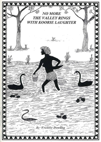
Book, Wendy Mitchell et al, Corroboree or war party: the last dance of the Wangaratta Pangerang : No more the valley rings with Koorie laughter, 2009
Details the coming of the white man, including explorers and squatters to the Wangaratta area, from a white perspective, written by Wendy Mitchell, and an Aboriginal perspective, written by Freddie Dowling.maps, b&w illustrations, b&w photographs, word listswangaratta, pangarang, genocide -
Victorian Aboriginal Corporation for Languages
Book, Edgar Morrison, Early days in the Loddon Valley : memoirs of Edward Stone Parker 1802-1865, 1966
maps, b&w illustrations, b&w photographs, document reproductionsloddon -
 Victorian Aboriginal Corporation for Languages
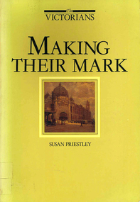
Book, Susan Priestley, Making their mark, 1984
maps, b&w illustrations, b&w photographs, colour illustrations -
 Victorian Aboriginal Corporation for Languages
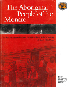
Book, The Aboriginal people of the Monaro, 2000
A comprehensive history of the Aboriginal people of the Monaro district. Written by a collection of contributors.maps, b&w photographs, b&w illustrations, document reproductions -
Victorian Aboriginal Corporation for Languages
Book with CD-ROM, Iain Luck et al, Meet the eastern Kulin : the Aboriginal people of Central Victoria, 2001
Teacher resource kit.b&w photographs, b&w illustrations, maps, CD-ROMeastern kulin, central victoria -
 Victorian Aboriginal Corporation for Languages
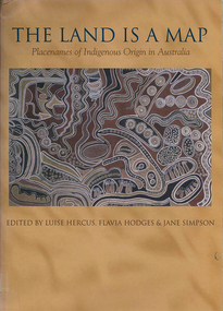
Book, Luise Hercus, The land is a map : placenames of Indigenous origin in Australia, 2002
Place names often evoke important information about features of the environment and their place in Indigenous knowledge. On the other hand, place names given by European settlers are largely arbitrary.Maps, b&w photographs, b&w illustrations, word listsplace names, wik, cape york peninsula, ngalakgan, alawa, marra, yukgul, kaurna, yuwaalaraay, yuwaaliyaay, gamilaraay, ngiyampaa -
 Victorian Aboriginal Corporation for Languages
Book, Patrick McConvell, Archaeology and linguistics : Aboriginal Australia in global perspective, 1997
Various authors: studies of wider patterns in Aboriginal language and culture, including migration, tool exchange, and particularly the role of linguistic evidence in establishing historical connections between Australian tribes as well as further afield in the Australasian region.B&w illustrations, b&w photographs, maps, word listsanthropological linguistics -
 Victorian Aboriginal Corporation for Languages
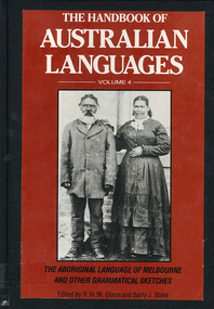
Book, R M W Dixon, The handbook of Australian languages : volume 4, the Aboriginal language of Melbourne and other grammatical sketches, 1991
maps, word lists, b&w illustrations, b&w photographs -
 Victorian Aboriginal Corporation for Languages
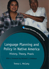
Book, Teresa L McCarty, Language planning and policy in Native America : history, theory and praxis, 2013
Contextualizing Native American LPP: legal-political, demographic and sociolinguistic foundations; conceptualizing Native American LPP: critical sociocultural foundations; Native American languages 1492-2012; Indigenous literacies, bilingual education and community empowerment: Navajo case study; language regenesis in practice; language in the lives of Indigenous youth; planning language for the Seventh GenerationMaps, b&w illustrations, b&w photographs, colour photographslanguage planning, language policy, native american languages, language standardisation, language restriction -
 Victorian Aboriginal Corporation for Languages
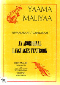
Book, John Giacon et al, Yaama maliyaa, Yuwaalaraay - Gamilaraay : an aboriginal languages textbook, 1999
Includes index. Bibliography. For secondary school students.B&w illustrations, b&w photographs, maps, word listsgamilaraay, yuwaalaraay -
 Victorian Aboriginal Corporation for Languages
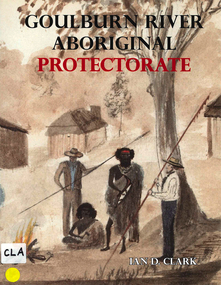
Book, Ian D Clark, Goulburn River Aboriginal Protectorate : a history of the Goulburn River Aboriginal Protectorate Station at Murchison, Victoria, 1840 - 1853, 2013
This study explains why the locality of what is now known as Murchison is one of the most important historic Aboriginal places in regional Victoria.maps, b&w illustrations, b&w photographs, document reproductionsngurai-illam balug, ngurai-illam wurrung, daungwurrung, yaithmathang, yortayorta, yorta yorta, bangerang, murchison, murnang, george augustus robinson, goulburn river aboriginal protectorate, goulburn river region, victorian history -
 Victorian Aboriginal Corporation for Languages
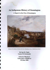
Book, Ian D Clark et al, An Indigenous history of Stonnington : a report to the City of Stonnington, 2006
This report presents the results of historical research into the Aboriginal history of the City of Stonnington.maps, colour illustrations, b&w illustrations, colour photographs, tableswoiwurrung, woi wurrung, boonwurrung, boon wurrung, derrimut, william thomas, stonnington, local history, victorian history -
 Victorian Aboriginal Corporation for Languages
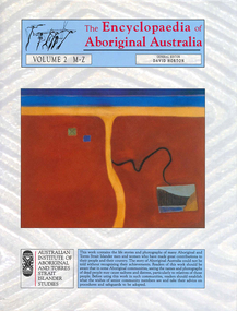
Book, David Horton, The Encyclopaedia of Aboriginal Australia : Aboriginal and Torres Strait Islander history, society and culture ; volume 2 M-Z, 1994
Comprehensive edition including all aspects of Aboriginal history, culture, heritage and environment.maps, colour illustrations, b&w illustrations, colour photographs, tables -
Victorian Aboriginal Corporation for Languages
Book, David Horton, The Encyclopaedia of Aboriginal Australia : Aboriginal and Torres Strait Islander history, society and culture ; volume 1 A-L, 1994
Comprehensive 2 volume set of encyclopaedia covering all aspects of Australian Aborigines, flora, fauna and environment.maps, colour illustrations, b&w illustrations, colour photographs, tables -
 Victorian Aboriginal Corporation for Languages
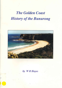
Book, W R Hayes, The golden coast : history of the Bunurong, 1998
A history of the section of Victorian coastline from Andersons Inlet to Cape Woolamai. Includes descriptions of the impacts and consequences of European occupation on the Aboriginal people of this region.maps, colour photographs, b&w photographs, b&w illustrationsbunurong, boon wurrung, andersons inlet, cape woolamai, colonisation -
 Victorian Aboriginal Corporation for Languages
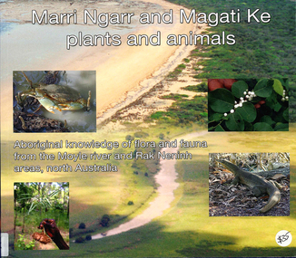
Book, Ngarul Jimmy Nambatu et al, Marri Ngarr and Magati Ke plants and animals : Aboriginal knowledge of flora and fauna from the Moyle River and Neninh areas, North Australia, 2009
Aboriginal knowledge of flora and fauna from the Moyle River and Neninh areas.Maps, b&w illustrations, b&w photographs, colour photographs,marri ngarr, magati ke, wadeye, moyle river, northern territory, flora, fauna, ethnobiology -
 Victorian Aboriginal Corporation for Languages
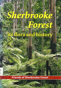
Book, Friends of Sherbrooke Forest, Sherbrooke Forest : its flora and history, 2000
Notes on plants in the area, including swamp/water plants.Maps, b&w illustrations, b&w photographs, colour photographsdandenong ranges national park, indigenous vascular plants, weed management -
 Victorian Aboriginal Corporation for Languages
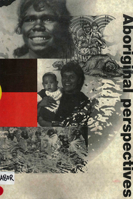
Book, Museum of Victoria Education Service, Aboriginal perspectives, 1996
The kit is designed for the general public, teachers and students, to give an understanding of Australian Indigenous people and culture and to break down stereotypes that are common in the school system and the wider community. The information presented is about the cultural, spiritual, economic and religious aspects of pre-contact societies. The impact of invasion on traditional societies and the post-colonial history of Australian Indigenous people is explored.Maps, b&w illustrations, b&w photographs, colour photographsculture, history, john batman, batman treaty, coranderrk mission, koorie culture, lake condah mission, kinship systems, aboriginal art, dreaming stories, kulin, gunai/kurnai, mara, wotjobaluk, wudjubaluk, koori -
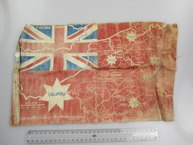 Ballarat RSL Sub-Branch Inc.
Flag - Australian Red Ensign (sm)
With map showing "Famous battle-fields of the Australian Forces" printed overfirst world war (ww1), 1914 - 1918, flags, ballarat rsl, ballarat -
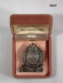 Bendigo Military Museum
Badge - FEMALE RELATIVE BADGE, WW2, Amor, Sydney, 1939-45
MOTHER'S BADGE OF ISABELLA BROOK WHO HAD TWO SONS SERVING DURING WW2.1. Badge - silver metal, bar with two yellow metal stars contained in a box."TO THE WOMEN OF AUSTRALIA" Moulded small map of Australia inside a Laurel wreath.mothers badge, ww2 -
University of Melbourne, Burnley Campus Archives
Map, Melbourne Metropolitan Planning Scheme, c. 1978
Maps showing Zones and Reservations in the Merri Creek area of Melbourne, prepared by the Drafting Department, Planning Branch, MMBW. (1) Map No 36, coloured. (2) Map No 37, coloured. (3) Map No 38, not coloured. (4) Map No 46. Scale 1:9600. May have been used in planning the Native Garden Woodland Area. merri creek, melbourne and metropolitan board of works, melbourne metropolitan area -
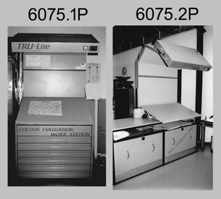 Bendigo Military Museum
Photograph - Equipment used in Map Production at the Army Survey Regiment, 1991
These nine photographs of technical equipment were provided to the Directorate of Survey as input to the 1990-1991 Annual Report. The equipment in Photos .1P and .2P were used to evaluate/validate colour values on printed maps. The equipment in Photo .3P is a daylight film processor. The Optronix 5040 Laser Scanner/Plotter was shown in Photos .4P to .6P. The Print Room’s Map Handling Station in photo .7P provided ergonomic benefits to the Printer Technician and improved despatching productivity. The Optical Disk Archive and Retrieval System (ODARS) equipment in .8P was optical "platter" disk technology for the secure and long term archive storage of large amounts of digital map data. Map data was transferred from large reels of magnetic tape. As most map type (letters and names) generation was done in Automap 2, The ITEK Typesetter shown in photo .9P was close to obsolete in 1991. At this time it was used to generate map type for other RASvy units, contractors and sections still performing manual map production at Army Svy Regt.This is a set of photographs of Army Survey Regiment technical equipment taken in 1991. The photographs were printed on photographic paper and are part of the Army Survey Regiment’s Collection. The photographs were scanned at 300 dpi. .1) - Photo, black & white, 1991, Colour Evaluation Workstation No 1, Lithographic Squadron .2) - Photo, black & white, 1991, Colour Evaluation Workstation No 2, Lithographic Squadron .3) - Photo, black & white, 1991, Daylight film processor, Lithographic Squadron, Daylight Working Contacting Frames in background. .4) - Photo, black & white, 1991, Optronix 5040 Laser Scanner/Plotter, Lithographic Squadron .5) - Photo, black & white, 1991, Optronix 5040 Laser Scanner/Plotter, Lithographic Squadron .6) - Photo, black & white, 1991, Optronix 5040 Laser Scanner/Plotter, Lithographic Squadron .7) - Photo, black & white, 1991, Map Handling Station, Lithographic Squadron .8) - Photo, black & white, 1991, Optical Disk Archive and Retrieval System (ODARS), Cartographic Squadron .10) - Photo, black & white, 1991, Optronix 5040 Laser Scanner/Plotter, Lithographic Squadron .9) - Photo, black & white, 1991, ITEK Typesetter, Cartographic Squadron.1P, .2P, .4P to .10P – equipment description annotated on back .3P - no annotation.royal australian survey corps, rasvy, army survey regiment, army svy regt, fortuna, asr, litho, automap -
 Lara RSL Sub Branch
Book, Australia in the War of 1939-1945 - MEDICAL Middle East and Far East. Author Allan.S.Walker MD, Ch.M. F.R.A.C.P, First Published 1953
The complete record of the Medical conditions setting up camp hospitals, medical transport, medical records,Photographs, Maps,IllustrationsAustralian War Memorialtobruk, crete, general health in the desert, surgical conditions in the desert, syria, nurses, tropical medicine, malaria, medical conditions, burma thai railway, labour forces, prison camps -
 Greensborough Historical Society
Map, Keelbundora. Counties of Bourke and Evelyn, 1950_11
Covers area bounded by Merri Creek, Yarra River, Plenty River and Crown Portions 24 to 28, with section including Maroondah Aqueduct and Darebin Creek.Photocopy of digitised mapkeelbundora (parish)