Showing 10632 items
matching maps
-
 Victorian Aboriginal Corporation for Languages
Periodical, Australian National University Department of Pacific and Southeast Asian History, Aboriginal history, 1984
maps, b&w illustrations, b&w photographs, graphs, charts -
 Victorian Aboriginal Corporation for Languages
Periodical, Australian National University Department of Pacific and Southeast Asian History, Aboriginal history, 1987
maps, b&w illustrations, b&w photographs, document reproductions -
 Victorian Aboriginal Corporation for Languages
Periodical, Australian National University Department of Pacific and Southeast Asian History, Aboriginal history, 1986
maps, b&w photograph, graphs, charts, reproductions of historic items -
 Victorian Aboriginal Corporation for Languages
Periodical, Royal Historical Society of Victoria, Victorian historical journal : Victoria : 150 years of gold, 2001
maps, b&w illustrations, b&w photographs, document reproductions -
 Victorian Aboriginal Corporation for Languages
Book, John Giacon et al, Yaama maliyaa, Yuwaalaraay - Gamilaraay : an aboriginal languages textbook, 1999
Includes index. Bibliography. For secondary school students.B&w illustrations, b&w photographs, maps, word listsgamilaraay, yuwaalaraay -
 Victorian Aboriginal Corporation for Languages
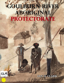
Book, Ian D Clark, Goulburn River Aboriginal Protectorate : a history of the Goulburn River Aboriginal Protectorate Station at Murchison, Victoria, 1840 - 1853, 2013
This study explains why the locality of what is now known as Murchison is one of the most important historic Aboriginal places in regional Victoria.maps, b&w illustrations, b&w photographs, document reproductionsngurai-illam balug, ngurai-illam wurrung, daungwurrung, yaithmathang, yortayorta, yorta yorta, bangerang, murchison, murnang, george augustus robinson, goulburn river aboriginal protectorate, goulburn river region, victorian history -
 Victorian Aboriginal Corporation for Languages
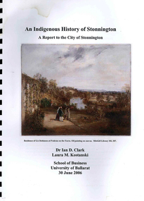
Book, Ian D Clark et al, An Indigenous history of Stonnington : a report to the City of Stonnington, 2006
This report presents the results of historical research into the Aboriginal history of the City of Stonnington.maps, colour illustrations, b&w illustrations, colour photographs, tableswoiwurrung, woi wurrung, boonwurrung, boon wurrung, derrimut, william thomas, stonnington, local history, victorian history -
 Victorian Aboriginal Corporation for Languages
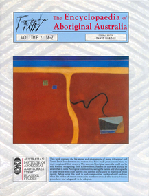
Book, David Horton, The Encyclopaedia of Aboriginal Australia : Aboriginal and Torres Strait Islander history, society and culture ; volume 2 M-Z, 1994
Comprehensive edition including all aspects of Aboriginal history, culture, heritage and environment.maps, colour illustrations, b&w illustrations, colour photographs, tables -
 Victorian Aboriginal Corporation for Languages
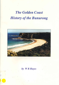
Book, W R Hayes, The golden coast : history of the Bunurong, 1998
A history of the section of Victorian coastline from Andersons Inlet to Cape Woolamai. Includes descriptions of the impacts and consequences of European occupation on the Aboriginal people of this region.maps, colour photographs, b&w photographs, b&w illustrationsbunurong, boon wurrung, andersons inlet, cape woolamai, colonisation -
 Victorian Aboriginal Corporation for Languages
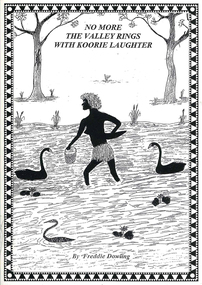
Book, Wendy Mitchell et al, Corroboree or war party: the last dance of the Wangaratta Pangerang : No more the valley rings with Koorie laughter, 2009
Details the coming of the white man, including explorers and squatters to the Wangaratta area, from a white perspective, written by Wendy Mitchell, and an Aboriginal perspective, written by Freddie Dowling.maps, b&w illustrations, b&w photographs, word listswangaratta, pangarang, genocide -
 Victorian Aboriginal Corporation for Languages
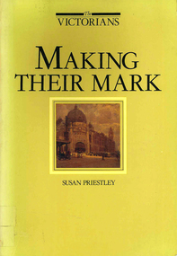
Book, Susan Priestley, Making their mark, 1984
maps, b&w illustrations, b&w photographs, colour illustrations -
 Victorian Aboriginal Corporation for Languages
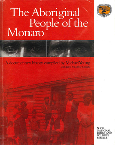
Book, The Aboriginal people of the Monaro, 2000
A comprehensive history of the Aboriginal people of the Monaro district. Written by a collection of contributors.maps, b&w photographs, b&w illustrations, document reproductions -
 Victorian Aboriginal Corporation for Languages
Book, David Horton, The Encyclopaedia of Aboriginal Australia : Aboriginal and Torres Strait Islander history, society and culture ; volume 1 A-L, 1994
Comprehensive 2 volume set of encyclopaedia covering all aspects of Australian Aborigines, flora, fauna and environment.maps, colour illustrations, b&w illustrations, colour photographs, tables -
Victorian Aboriginal Corporation for Languages
Book, Edgar Morrison, Early days in the Loddon Valley : memoirs of Edward Stone Parker 1802-1865, 1966
maps, b&w illustrations, b&w photographs, document reproductionsloddon -
Victorian Aboriginal Corporation for Languages
Book with CD-ROM, Iain Luck et al, Meet the eastern Kulin : the Aboriginal people of Central Victoria, 2001
Teacher resource kit.b&w photographs, b&w illustrations, maps, CD-ROMeastern kulin, central victoria -
 Victorian Aboriginal Corporation for Languages
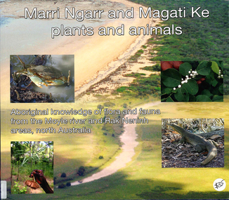
Book, Ngarul Jimmy Nambatu et al, Marri Ngarr and Magati Ke plants and animals : Aboriginal knowledge of flora and fauna from the Moyle River and Neninh areas, North Australia, 2009
Aboriginal knowledge of flora and fauna from the Moyle River and Neninh areas.Maps, b&w illustrations, b&w photographs, colour photographs,marri ngarr, magati ke, wadeye, moyle river, northern territory, flora, fauna, ethnobiology -
 Victorian Aboriginal Corporation for Languages
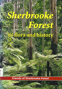
Book, Friends of Sherbrooke Forest, Sherbrooke Forest : its flora and history, 2000
Notes on plants in the area, including swamp/water plants.Maps, b&w illustrations, b&w photographs, colour photographsdandenong ranges national park, indigenous vascular plants, weed management -
 Victorian Aboriginal Corporation for Languages
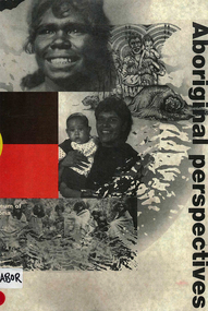
Book, Museum of Victoria Education Service, Aboriginal perspectives, 1996
The kit is designed for the general public, teachers and students, to give an understanding of Australian Indigenous people and culture and to break down stereotypes that are common in the school system and the wider community. The information presented is about the cultural, spiritual, economic and religious aspects of pre-contact societies. The impact of invasion on traditional societies and the post-colonial history of Australian Indigenous people is explored.Maps, b&w illustrations, b&w photographs, colour photographsculture, history, john batman, batman treaty, coranderrk mission, koorie culture, lake condah mission, kinship systems, aboriginal art, dreaming stories, kulin, gunai/kurnai, mara, wotjobaluk, wudjubaluk, koori -
 Victorian Aboriginal Corporation for Languages
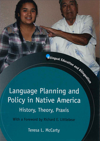
Book, Teresa L McCarty, Language planning and policy in Native America : history, theory and praxis, 2013
Contextualizing Native American LPP: legal-political, demographic and sociolinguistic foundations; conceptualizing Native American LPP: critical sociocultural foundations; Native American languages 1492-2012; Indigenous literacies, bilingual education and community empowerment: Navajo case study; language regenesis in practice; language in the lives of Indigenous youth; planning language for the Seventh GenerationMaps, b&w illustrations, b&w photographs, colour photographslanguage planning, language policy, native american languages, language standardisation, language restriction -
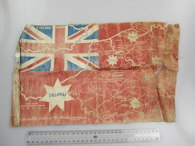 Ballarat RSL Sub-Branch Inc.
Flag - Australian Red Ensign (sm)
With map showing "Famous battle-fields of the Australian Forces" printed overfirst world war (ww1), 1914 - 1918, flags, ballarat rsl, ballarat -
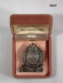 Bendigo Military Museum
Badge - BADGE, WOMEN OF AUSTRALIA, Amor, Sydney, 1939-45
MOTHER'S BADGE OF ISABELLA BROOK WHO HAD TWO SONS SERVING DURING WW2.1. Badge - silver metal, bar with two yellow metal stars contained in a box."TO THE WOMEN OF AUSTRALIA" Moulded small map of Australia inside a Laurel wreath.mothers badge, ww2 -
Bendigo Historical Society Inc.
Map - MARKS COLLECTION: GEOLOGICAL MAP OF IRELAND
Rolled map on wooden hanger, woodern rail on bottom. On top of map: 'geological survey of Ireland' On bottom LH side: the geology of this map published June 1855 by Sir R.I. Murchison, Director General, J. Beebe Jukes Local Director, surveyed by T. Oldham. Map part of Lansell material. On back of map at top written in black pen 'Treland'.person, bendigo, george lansell -
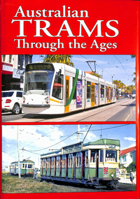 Melbourne Tram Museum
Book, Maurice Kelly, "Australian Trams Through the Ages", 2015
... Maps ...Book, hard bound with photo jacket, 320 pages, sewn binding with glued end papers, printed on gloss paper, titled "Australian Trams Through the Ages", compiled by Maurice Kelly of Topmill Pty Ltd. Limited Edition - number 340 of 1000. Published 2015, has a table of contents listing photos of 22 tramway systems, including Gold Coast light rail, Museums horse trams, include some light railways such as Aramac. The Melbourne section includes Doncaster, horse trams, cable trams, electric trams, a maps c1950 and 1956, 1981 and PTV map of July 2014. many electric trams, generally photos by Arthur Perry, including an E class tram. Features tram 5012 on front cover.trams, tramways, topmill, maps, melbourne, cable trams, horse trams, mmtb, melbourne, ptc -
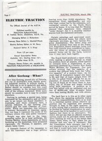 Ballarat Tramway Museum
Magazine - Electric Traction article, Keith Kings, After Geelong What?" and "Farewell to Geelong", March 1956
Editorial written at the time of the start of the closure of many Australian tramway systems, asking what is the next tramway system to close. The other two Victorian Provincial Tramway systems were considered safe at the time, however under constant threat of closure by the SEC due to the losses that were being incurred. Written by well-known Victorian tramway historian Keith Kings. The article with maps and photos details the history of the Geelong tramway system.Details the history of the Geelong Tramway system and gives details of the tramcars that were used on the system.Photocopy of an item from the Electric Traction Magazine March 1956 about the closure of the Geelong Tramway System, and trimmed to the magazine original size - 12 sheets stapled. Includes Maps and photographs. Text written by Keith Kings. Article interspersed with materials about the Adelaide Tramway system.geelong trams, closure, tramways, tramcars -
Glenelg Shire Council Cultural Collection
Map - Map - Glenelg River, 1975
Laminated map, Glenelg River - Casterton, proposed flood level and lines to be designated. Photograph of map taken in 1975. Produced by Rural Water Commission to Shire Engineer, Casterton, attached to reverse of map.flood, flood levels, casterton -
Stawell Historical Society Inc
Book - Family History, Reading Family History 1826 - 2001, March 11 2001
Updated family HistorySoft cover - Yellow - Red Script Title. UK Map in Red - Journeyline in red. Australa Map in Red.Oct 2004. Donated to Stawell Biarri Group for Genealogogy Inc. by Mrs Isobel Reading -
Whitehorse Historical Society Inc.
Map, Map of Nunawading, 1950?
Map of the entire City of Nunawading: complimentary map issued by Frank Fisher & Co real estate agents, Blackburn.Map of the entire City of Nunawading: complimentary map issued by Frank Fisher & Co real estate agents, Blackburn.Map of the entire City of Nunawading: complimentary map issued by Frank Fisher & Co real estate agents, Blackburn.nunawading, map -
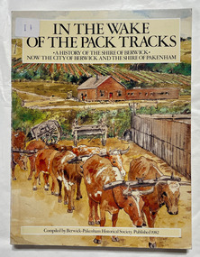 City of Moorabbin Historical Society (Operating the Box Cottage Museum)
Book, Berwick-Pakenham Historical Society, In the wake of the pack tracks : a history of the Shire of Berwick, now the City of Berwick and the Shire of Pakenham, 1982
A history of the Shire of Berwick, now the City of Berwick and the Shire of Pakenham.xvi, 175 p. : ill., maps (some col.), ports. ; Includes index. eCol. maps on lining papers.non-fictionA history of the Shire of Berwick, now the City of Berwick and the Shire of Pakenham.berwick, pakenham -
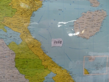 National Vietnam Veterans Museum (NVVM)
Map, Map of Vietnam, Lao, Campuchia
Laminated colour map of Vietnam, Laos and Campuchia. Map details rivers, hamlets, town and all geographical features.laos map, vietnam map, campuchia map -
Bendigo Historical Society Inc.
Map - PARISH OF SANDHURST SHEET 5A, 1970
Map: Parish of Sandhurst Sheet 5A, County of Bendigo. Parish plan ( number 161 in Map Cupboard 1)map, bendigo, parish plan, parish of sandhurst, county of bendigo