Showing 25615 items matching "plenty-township-estate"
-
 Stawell Historical Society Inc
Map, Department of Crown Lands and Survey Victoria, Allotments in the Township of Banyana. Parish of Burrum Burrum. 1946 / 1971, 1971
Richardson River. Avon River JunctionPaper Map of County of BorungReprint of the 1946 edition. Drawn and reproduced at the Department of Crown Lands and Survey Victoria 1971.survey -
Stawell Historical Society Inc
Map, Stawell Gold Mines, Stawell Township proposed Town zoning showing Special Uses ( Mining) 1998, 1998
Shows Mining activity Stockpiles Tracks, Plant, Dams, Waste heap, Tailing Dams, IronbarksMap Printed in Colour with Coloured LegendStawell Gold Mines Pty Ltd Date April 1998mining -
Stawell Historical Society Inc
Map, Stawell Gold Mine, Stawell Gold Mine Photo Map of Stawell Township showing Underground Declines in mining lease, 2007
SGM photo Map 2007 Produced for Public Consultation over Big Hill Open Pit Proposal. Aerial Views Stawellmining, gold, map -
Stawell Historical Society Inc
Map, MPI Mines, Plan View of Township Area 2003, 13/6/2003
goldShowing known gold workings & Houses Stawell Gold Mines. 13 June 2003 1 : 7500 MPI Minesmining -
Stawell Historical Society Inc
Map, MPI Mines, Plan View of Township Area 2003, 13/6/2003
goldShowing known old gold workings Stawell Gold Mines. 13 June 2003 1 : 7500 MPI Minesmining -
Stawell Historical Society Inc
Map, Stawell Gold Mine, Tenement Boundaries Stawell Township 2001, August 2001
Showing Underground Development Stawell Gold Mines Victoria Scale 1 : 20000mining, gold -
Malmsbury Historical Society
Photograph (Item), "Malmsbury Township, Daffodil Plantation", Malmsbury c1991
Associated with - "M.H.S., M.A.A." Buildings - Taken From Barker St -
![Photograph (Item), Township Of Malmsbury (1879) [Duplicate Entry], Malmsbury ca1990](/media/collectors/510b3f7f023fd725b4cd52a4/items/60062caeff312d11a81298e4/item-media/60062d78ff312d11a812b31d/item-fit-380x285.jpg) Malmsbury Historical Society
Malmsbury Historical SocietyPhotograph (Item), Township Of Malmsbury (1879) [Duplicate Entry], Malmsbury ca1990
People - "Williamson, Florence" -
 Malmsbury Historical Society
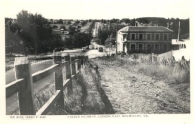
Postcard (Item), "Postcard Township Of Malmsbury, Rose Series P4845", Malmsbury c1938
Associated with - Rose Series P4845 Buildings - The Mansions -
 Whitehorse Historical Society Inc.
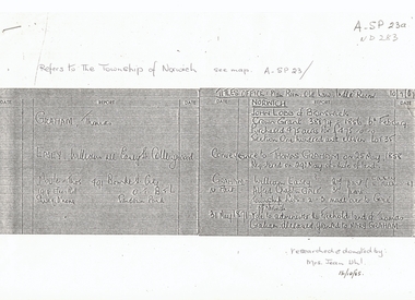
Document, Township of Norwich, C1860
List of names from Titles OfficeList of names from Titles Office concerning proposed Norwich Village Vermont 1850sList of names from Titles Officeland titles, norwich village, vermont, graham, thomas, easey, william, moule, lobb, john, gale, alfred chaplin -
 Rutherglen Historical Society
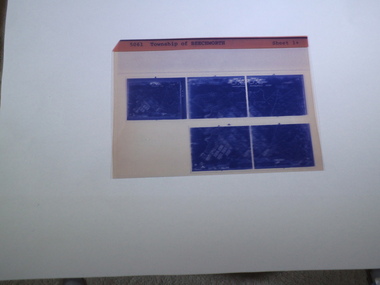
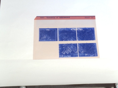
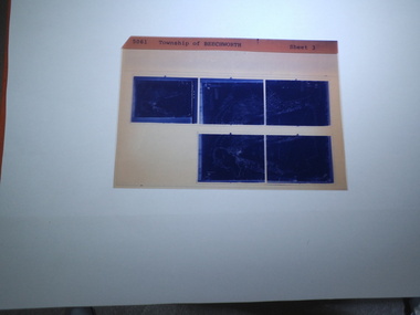
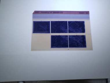
microfich sheet, Victorian Land Tiltes Office, Township of Beechworth
Town layout of Beechworth5 Aperture Sized microfilms on a single microfiche in a paper sleeve plan, town, boundries, lots, roads -
 Rutherglen Historical Society
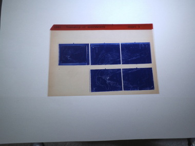
microfiche sheet, Victorian Land Tiltes Office, Township of Beechworth
Town layout of Beechworth5 Aperture Sized microfilms on a single microfiche in a paper sleeve plan, town, boundries, lots, roads -
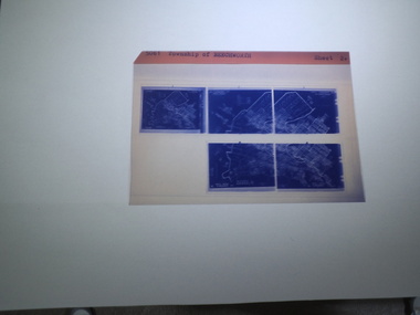
 Rutherglen Historical Society
microfiche sheet, Victorian Land Tiltes Office, Township of Beechworth
Town layout of Beechworth5 Aperture Sized microfilms on a single microfiche in a paper sleeve plan, town, boundries, lots, roads -
 Rutherglen Historical Society
microfiche sheet, Victorian Land Tiltes Office, Township of Rutherglen
Town layout of Beechworth5 Aperture Sized microfilms on a single microfiche in a paper sleeve plan, town, boundries, lots, roads -
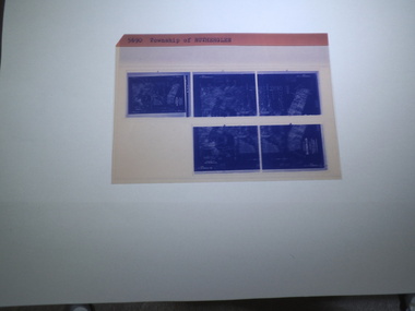
 Rutherglen Historical Society
microfiche sheet, Victorian Land Tiltes Office, Township of Rutherglen
Town layout of Beechworth5 Aperture Sized microfilms on a single microfiche in a paper sleeve plan, town, boundries, lots, roads -
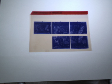
 Rutherglen Historical Society
microfiche sheet, Victorian Land Tiltes Office, Township of Beechworth
Town layout of Beechworth5 Aperture Sized microfilms on a single microfiche in a paper sleeve plan, town, boundries, lots, roads -
 Rutherglen Historical Society
microfiche sheet, Victorian Land Tiltes Office, Township of Beechworth
Town layout of Beechworth5 Aperture Sized microfilms on a single microfiche in a paper sleeve plan, town, boundries, lots, roads -
 Rutherglen Historical Society
microfiche sheet, Victorian Land Tiltes Office, Township of Beechworth
Town layout of Beechworth5 Aperture Sized microfilms on a single microfiche in a paper sleeve plan, town, boundries, lots, roads -
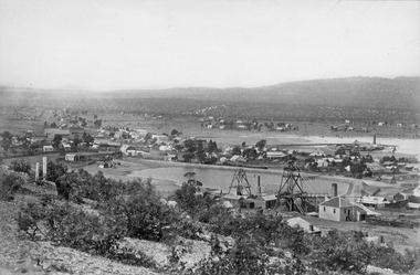
 Ballarat Heritage Services
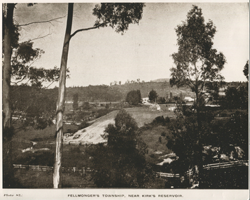
Photograph - Black and White, Fellmonger's Township
fellmongers -
 Ballarat Heritage Services
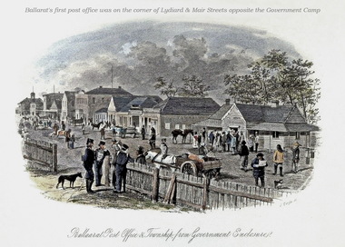
Image, Ballarat Post Office and Township from Government Enclosure
Coloured engraving by Samuel Thomas Gill showing the Ballaarat Post Office in the Government Camp. ballarat post office, government camp, camp st, ballarat, samuel thomas gill, s.t. gill -
 Inverloch Historical Society
0004425 Photograph - circa 1890 - Inverloch Township - WH Ferguson (Photographer) - State Library of Victoria
-
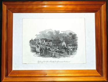 Ballarat Tramway Museum
Decorative object - Framed, Samuel Thomas Gill, "Ballarat Post Office & Township from Government Enclosure", 1857
Ballarat's first post office was located in Ballarat East. The print is by S. t. Gill and depicts a busy street scene.Framed drawing - wooden frame with card backing and framing clips and foldout stand.ballarat, post office, gold fields, ballarat east -
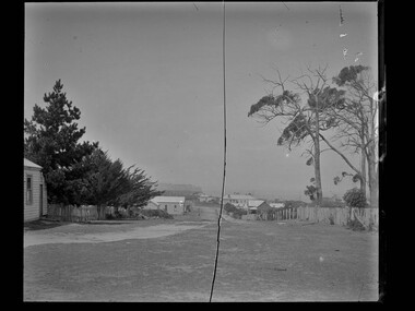
 Stawell Historical Society Inc
Photograph, Panorama of Stawell Township with Poppet heads & Government Dam, later No2 Reservoir at centre of photo1878
Poppet heads and Government Dam later No2 Reservoir at centre of photo with Black Ranges in background. Stawell East State School on left, Wimmera Battery (also known as Cobb's Battery) on right of photo. 1878. Mr Chaponnel was an Engine Driver on the Battery. No2 West Scotchmans mine on left started in 1873No2 Reservoir in centre of photograph behind two prominent poppet heads. Black Range in right rear of photo. Victorian Views. C. Herbert, Photo. Stawell. 1878stawell mining -
Federation University Art Collection
Watercolour, Neville Bunning, [Township]
This item is part of the Federation University Art Collection. The Art Collection features over 1000 works and was listed as a 'Ballarat Treasure' in 2007.art, artwork -
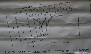 Melton City Libraries
Map, Block details section 21 Township of Melton, 1965
In 1861, Mary Dowling and John Luby obtained Crown Grant land on the corner of Smith and McKenzie Street Melton.Section 21 is covers the block of Smith, Henry and McKenzie Street Meltoncouncil -
 Wodonga & District Historical Society Inc
Photograph - Mitta Junction Township
Mitta Junction which was established about 1920 on the Victorian side of the Hume Dam construction site (originally called the Mitta Junction Reservoir). The town was built to house workers and their families. It included houses, private and government boarding houses, a shop, hall and school as well as tennis courts and a cricket pitch. Mitta Junction was a thriving community with many activities, including Balls and Euchre Nights, held at the Hall which opened in February 1922. The community also fielded a very successful football team in the local competition. After the completion of the Dam, the village and all its contents were sold at auction in June 1936 for £7,000. Individual houses sold at about £40 for removal to nearby towns. The Mitta Junction School which opened in 1922 continued to operate with very small numbers after the village was moved. Its numbers were boosted in the early 1980s by the children of Army staff at the nearby Latchford Barracks Army Apprenticeship School. It finally closed in December 1985.These images are significant because they capture the history of an important vanished town whose residents played a vital role in the construction of the Hume Dam.A collection of black and white images and a sketch map featuring the village of Mitta Junction, built to house workers on the construction of the Hume Dam. Some of the photographs have been mounted on heavy card.mitta junction township, hume dam construction, hume dam history -
Lakes Entrance Historical Society
Book, Stevens M I, Township of Cann River, Parish of Noorinbee, County of Croajingolong, 1977
An account of the development of the Cann River town and district in Gippsland, Victoria, compiled for the 50th. anniversary of the Cann River school. Includes list of pupils and head teachers, information on other schools, and recollections of residents.settlers, schools, township -
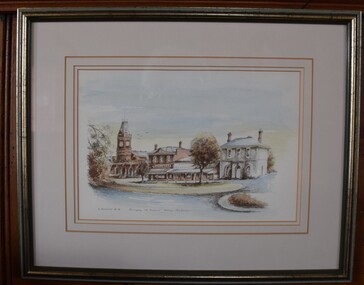 Buninyong Visitor Information Centre
Painting - Water colour painting, R. Anderson, Township of Buninyong near Ballarat, Victoria, Australia, 1988
Painted in 1988 during the Bicentennial year. Artist: R. AndersonWater colour showing south side of Learmonth Street, Buninyong, including Town Hall, Whykes' Butchers, a shop and the National Bank building.R. Anderson, '88 Copyright.buninyong, shops, streetscapes, learmonth street -
Lakes Entrance Historical Society
Book, Green Os, Marlo The Township the Plains The Cape, 1984
History of Marlo Victoria from its settlement until 1983 includes sketch maps and photographs.township -
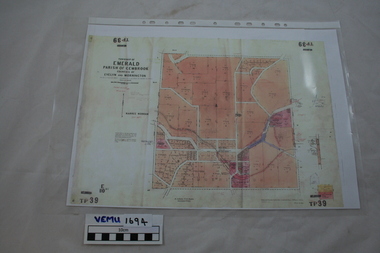 Emerald Museum & Nobelius Heritage Park
Map, Township of Emerald, Parish of Gembrook, counties of Evelyn and Mornington
Map showing property owners, posted 12 September 1956Includes Ferntree Gully to Gembrook Railway and Property Owners (coloured in pink).