Showing 1797 items matching " settlement"
-
 Monbulk Historical Society
Ben Simcox
Bennie Simcox first came to the Monbulk area about 1860, following the first important gold discovery at the end of 1858. As the gold rush was short lived Simcox returned to Collingwood but later came back to Monbulk, built himself a hut to live in and become its first known permanent resident. The hut was burnt in the 1913 fires. Monbulk was thrown open to selection in 1894, and that's when the first farmers including Bennie Simcox went into Monbulk. It was a big, timbered country in those days. Once Ben had cleared some of his land he started to grow raspberries on it. He would be up before daylight ready to start picking. Ben also picked for a local family, the Camms to help make ends meet. When Ben Simcox was virtually at the retired stage, he wanted to develop his bit of the gully as a tourist attraction, As his nephew Fred Gay who owned the 10 acres below Ben wanted to farm, he was happy to swap his treed block with Ben. At a time when most settlers were clearing their properties, Ben Simcox, by contrast, cultivated the native plants and planted most of the large trees seen on the property today. And so Nathania Springs was developed as a tourist resort, and a mini-botanical garden. He diverted the natural water supply to form ornamental garden pools stocked with trout and tame native black fish. There were many visitors came to the Dandenongs, Some arriving in motor cars others in converted furniture vans lined with seats or charabancs with the long extended chassis and the open canvas roofs. Identities such as Billy Hughes, Madame Melba would often come to look through Nathania Springs. Bennie sold Nathania Springs to Councillor Ferdinand Thomas Le Juge, a boarding house proprietor and later the town baker in 1909 then in about 1921 Ben’s nephew Fred and his wife and family continued to open Nathania Springs to the public. It was not unusual in around 1924-25 for up to a thousand people a day to arrive at Nathania Springs to go through the gardens. At sixpence a time, that was a lot of money in those days. This photo is part of a collection of historic and social significance of the early settlement of Monbulk. Copies of photographs can be purchased from the Monbulk Historical Society.simcox, nathania springs, monbulk, 1860, berries -
 Surrey Hills Historical Society Collection
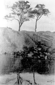
Photograph, Muriel Pornitz (deceased), Quarry on site of Grovedale Road - James Street Park
The photo is of a painting of the dam formed on land between Grovedale Road and James Street, Surrey Hills. It was painted in 1927 by Miss Muriel Pornitz, an art teacher, who lived in Grovedale Road. The land had been part of Mr James Maling Snr’s property and in the 1880s clay was removed to build houses, including his own located on the corner of Weybridge and James Streets. Maling grazed cattle on this area and used it as a dam. The land was subsequently made into parkland, the quarry / dam having been filled in after several drownings had occurred in the 1920s/1930s. See also SHP94, another copy of the same. Muriel Hedwig Lucy Pornitz lived at 22 Grovedale Road, Surrey Hills. She was born c1894 in Balwyn; died in Kew on 1 December 1982. She was the daughter of Konrad Pornitz (1864-1903) and his wife Charlotte Richardson Gooderidge (1863-1942), known as Tottie, who married in 1890. Konrad Pornitz is listed in the 1892 directory as living in Edgevale Road, Kew and the business Pornitz and Ross at 291 & 293 Little Collins Street, importers and commission merchants. The 1896 directory gives the Kew address as 176 Edgevale Road, Kew, however the business Pornitz and Ross was dissolved on 1st day of October 1892, by mutual agreement. Legal notice advised that: Mr Pornitz will hereafter carry on the business on his own behalf at the same address, under the style "Pornitz and Ross". Muriel is buried in Box Hill Cemetery (B-086-0042) along with Ulrich Horst Holm Pornitz known as Horst or Bon (d 1957) and Edith Olga Pornitz (d 1951), her brother and sister. A further sibling (Konrad b 1891) died in infancy. He is buried with his mother in Boroondara (Kew) Cemetery - C/E A 0366. Konrad died at his home 'Yarran' in Lane Cove Road, North Sydney on 31 October 1903; reported in the Sydney Morning Herald. Buried Gore Hill Cemetery, St Leonards, North Sydney. The headstone reveals he was born in Chemnitz, Saxony in 1863. Muriel was also known as Muriel Pornett. She studied at the South Australian School of Arts & Crafts in 1911 under James Ashton and Fred Britton, and at the Australian School of Etching in Sydney. She was also an illustrator and cartoonist. The photo, and the painting from which it is derived, documents the landscape prior to close settlement and is material to early building and farming in the Surrey Hills area.A black and white photograph of a painting of a landscape of parkland. Two trees are on top of a rise and are reflected at the bottom in water. The signature of the artist is in the bottom right corner: "AUST MP 192" (and the rest is cut off).(miss) muriel pornitz, grovedale road, james street, surrey hills, artists, parks and reserves, (mr) john butler maling, snr, quarry, dam, (miss) muriel hedwig lucy pornitz, box hill cemetery, muriel pornett -
 Surrey Hills Historical Society Collection
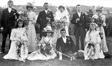
Photograph, Wedding of Annie Beckett and Henry Leigh at Guildford Villa, 21/9/1899, 21/9/1899
Taken at Guildford Villa, which has been demolished, at the wedding of Annie Beckett and Henry Leigh. Background view is to the north with Guildford Road across the photo and Monserrat' on Mont Albert Road on the horizon. Identification: Back row - L to R: Bert Leigh, Katie Beckett, Henry (Harry) Leigh, Annie Beckett, Percy Leigh, Clara Beckett. Front row - L to R: Mabel Beckett, Elsie Beckett, Arthur Leigh, Winnie Leigh. The bride was the daughter of Robert Beckett (senior) of Essex Road and the bridegroom was the son of Timothy Leigh, estate agent and architect of Essex Road. Married at the Wesleyan Church.Both the Beckett and Leigh families were significant in the early days of settlement of Surrey Hills.A B&W photo of bridal party comprised of bride, bridegroom, 3 bridesmaids, 3 male attendants and 2 flowergirls against a largely rural background.guildford villa, weddings, wedding dresses, annie beckett, henry leigh, harry leigh, bert leigh, percy leigh, clara beckett, mabel beckett, elsie beckett, arthur leigh, winnie leigh, topography -
 Surrey Hills Historical Society Collection
Photograph, Grovedale Road Quarry in the 1920s - looking south, c1920
The quarry was part of John Butler Maling's property. He was one of the original settlers of the area and farmed the area between Weybridge Street and Whitehorse Road. Clay was quarried from part of this area and used to make the bricks used in the construction of his home, known as 'Ancyra'. This is still extant at the corner of Weybridge and James Streets. Maling grazed cows and used the quarry as a water source. He was the uncle of John Butler Maling, Mayor of Camberwell. He was married to Kate Conlon in 1882. They had 3 children: Silas Young, Alick and Zillah. Maling was born in c1829 in Shepreth, Cambridgeshire; he died in Surrey Hills on 9 October 1912 and is buried in Box Hill Cemetery - CE-*-0586. Mrs Kate Maling (born c1859 in Co Meath, Ireland) died at the property on 8 March 1921. She is buried in Brighton General Cemetery. Probate was valued at over 10,000 pounds and included other properties in Sandringham, Hawthorn and Macedon. At the time of her death the Surrey Hills property was described as being 23 acres with 2 brick houses, 1 cow, 2 heifers and 40 fowls or chickens. The property was subdivided after her death. The property was subdivided into 110 house blocks in c1923 - see Maling's Estate subdivision flyer on the State Library of Victoria's website. This shows that the Grovedale Park site had been acquired by Camberwell Council by this time. An attached newspaper clipping documents prices realised for a cross-section of blocks. The MMBW map of 1925, also on the SLV website, shows the outline of the clayhole / quarry. The quarry was filled in after several drownings or near drownings and the land is now occupied by a park and playground, known as Grovedale Road Park, maintained by the City of Boroondara. Beckett Park is sited on horizon to the left beyond the trees. This documents the landscape prior to close settlement and is material to early building and farming in the Surrey Hills area.Black and white photo of the quarry between Grovedale Road and James Street taken in the 1920s and looking south. In the foreground is an area of water with reeds in the LH corner. Beyond on the high banks there are single storey houses in the background and (?) some light poles. An object that looks like a tank on posts is in a cutting on the far bank.quarries, grovedale road, james street, clay quarries, farming, kate conlon, kate maling, john butler maling, ancyra -
 Surrey Hills Historical Society Collection
Photograph, Grovedale Road Quarry in the 1920s - looking north, c1920
The quarry was part of John Butler Maling's property. He was one of the original settlers of the area and farmed the area between Weybridge Street and Whitehorse Road. Clay was quarried from part of this area and used to make the bricks used in the construction of his home, known as 'Ancyra'. This is still extant at the corner of Weybridge and James Streets. Maling grazed cows and used the quarry as a water source. He was the uncle of John Butler Maling, Mayor of Camberwell. He was married to Kate Conlon in 1882. They had 3 children: Silas Young, Alick and Zillah. Maling was born in c1829 in Shepreth, Cambridgeshire; he died in Surrey Hills on 9 October 1912 and is buried in Box Hill Cemetery - CE-*-0586. Mrs Kate Maling (born c1859 in Co Meath, Ireland) died at the property on 8 March 1921. She is buried in Brighton General Cemetery. Probate was valued at over 10,000 pounds and included other properties in Sandringham, Hawthorn and Macedon. At the time of her death the Surrey Hills property was described as being 23 cres with 2 brick houses, 1 cow, 2 heifers and 40 fowls or chickens. The property was subdivided after her death. The quarry was filled in after several drownings or near drownings and the land is now occupied by a park and playground maintained by the City of Boroondara. Beckett Park is sited on horizon to the left beyond the trees. This documents the landscape prior to close settlement and is material to early building and farming in the Surrey Hills area.Black and white photo of the quarry between Grovedale Road and James Street taken in the 1920s and looking north. In the foreground is an area of water with high banks dividing the horizontal centre. Beyond are paddocks and trees behind which is a row of at least 3 single-storey houses. Light poles can be seen along a distant street. There are many mature trees in the background. The houses and trees are positioned along Whitehorse Road in the vicinity of Westminster Street. Shadows indicate the photo was taken in early morning or evening.quarries, grovedale road, james street, surrey hills, balwyn, clay quarries, ancyra, kate conlon, kate maling, john butler maling, farming -
 Port Fairy Historical Society Museum and Archives
Book, Bennett, Bruce, Sea Baths of Victoria, 2013
This is the story of the sea baths in Victoria from earliest settlement in 1837. Their development and growth followed the prosperity of Victorian society for nearly a hundred years.152 pages : illustrations (some colour), maps ; 22 x 31 cm. Includes bibliographical references (pages 146-150) and index.This is the story of the sea baths in Victoria from earliest settlement in 1837. Their development and growth followed the prosperity of Victorian society for nearly a hundred years.baths, sea -- history., bathing beaches -- australia -- victoria -- history., public baths -- australia -- victoria -- history., public baths., sea., bathing beaches -- australia., public baths -- victoria -- 19th century., public baths -- victoria -- 20th century., sea -- australia -- victoria -- history., book -
 Port Fairy Historical Society Museum and Archives
Book, Macmillan Publishers Group Australia Pty Ltd, Triumph of the nomads : a History of Ancient Australia, 1982
Argues that Australia's Indigenous people discovered the land, adapted it and mastered its climates, seasons & reserves.23.0 x 14.0cms, 938 pp. b/w illust dust jacketnon-fictionArgues that Australia's Indigenous people discovered the land, adapted it and mastered its climates, seasons & reserves.habitation - nomadism., demography - palaeodemography - aboriginal settlement of australia., reproduction - infanticide., feuds and warfare., hunting, gathering and fishing., food - plants., trade and exchange - trade routes., australiens (aborign̈es), aborigines, australian -- social life and customs., aboriginal australians -- social life and customs -- northern territory., aboriginal australians -- history., aboriginal australians -- culture -- history., aboriginal australians -- civilization -- history., aboriginal australians -- economic conditions -- history., aboriginal australians -- social life and customs., human ecology -- australia., aboriginal australians., aborigines., australiens (aborigènes), australien., australia -- history., lake mungo / walls of china (willandra sw nsw si54-08), tasmania (tas), australia - aborigines, book -
 Port Fairy Historical Society Museum and Archives
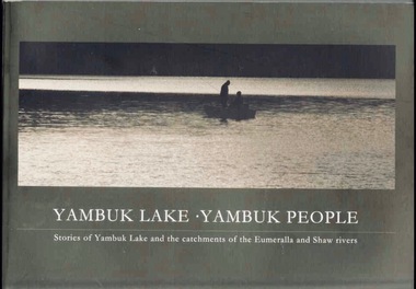
Book, Glenelg-Hopkins Catchment Management Authority, Yambuk Lake Yambuk people : stories of Yambuk Lake and the catchments of Eumeralla and Shaw Rivers, 2008
This title explores the complex relationships between the people and the place of Yambuk; the value of local knowledge and tells the stories of the Yambuk Lake, wetlands, rivers and catchment. Historic records and photographs are combined with the recollections of more than 20 people who know the lake.vi, 207 pages : colour illustrations, maps. ; 21 x 30 cm. Includes bibliographic references. non-fictionThis title explores the complex relationships between the people and the place of Yambuk; the value of local knowledge and tells the stories of the Yambuk Lake, wetlands, rivers and catchment. Historic records and photographs are combined with the recollections of more than 20 people who know the lake.baxter, annie maria, 1816-1905., water quality management -- victoria -- yambuk lake., settlement and contacts - settlers., animals - fish - eels., gunditjmara / gurndidy / dhaurwurd-wurrung people (s20) (vic sj54-11), yambuk (vic.) -- social conditions., yambuk (vic.) -- history., yambuk lake (vic.), yambuk (w vic sj54-11), deen maar / lady julia percy island (w vic sj54-11), eumeralla (w vic sj54-11), peek wurrung people, book -
 Port Fairy Historical Society Museum and Archives
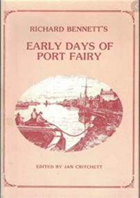
Book, Warrnambool Institute Press, Richard Bennett's Early days of Port Fairy, 1984
Articles written for the Warrnambool Standard in 1880s describing Port Fairy district in 1840s; mentions violence at Mount Rouse Aboriginal station; attitudes to publication of Brough Smyth and Currs works; photographs of local Aboriginesviii, 92p. : ill., ports. ; 25cm.non-fictionArticles written for the Warrnambool Standard in 1880s describing Port Fairy district in 1840s; mentions violence at Mount Rouse Aboriginal station; attitudes to publication of Brough Smyth and Currs works; photographs of local Aboriginesport fairy (vic.) -- history, settlement and contacts - colonisation - 1851-, race relations - violent - massacres, settlement and contacts - colonisation - 1788-1850., port fairy region (vic.) -- history., mount rouse (w vic sj54-07), warrnambool (w vic sj54-11), port fairy (w vic sj54-11), kooloor / mount rouse (w vic sj54-07), book -
 Port Fairy Historical Society Museum and Archives
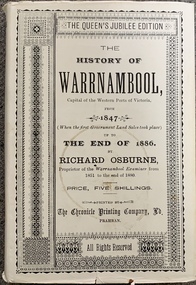
Book, Richard Osburne, The history of Warrnambool, capital of the western ports of Victoria, from 1847 (when the first government land sales took place) up to the end of 1886, 1980
The history of Warrnambool, capital of the western ports of Victoria, from 1847 (when the first government land sales took place) up to the end of 1886 / by Richard Osburne Other Authors, Fraser, Malcolm, 1930-2015, (author of introduction, etc.) Tylee Memorial Collection368 pages, unnumbered and folded leaves of plates : illustrations (some colour), maps, portraits, plans ; 19 cmnon-fictionThe history of Warrnambool, capital of the western ports of Victoria, from 1847 (when the first government land sales took place) up to the end of 1886 / by Richard Osburne Other Authors, Fraser, Malcolm, 1930-2015, (author of introduction, etc.) Tylee Memorial Collectionvictoria. warrnambool, 1847-1886. facsimiles, government policy - initial period and protectionism., settlement and contacts - 19th century., mining industry - gold., race relations - violent - massacres, religions - christianity - missions., warrnambool (vic.) -- history., framlingham / purnim (w vic sj54-11), demography - census data, book -
 Port Fairy Historical Society Museum and Archives
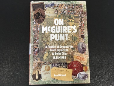
Book, Ron Michael, On McGuire's Punt. A profile of Shepparton from squatting to solar city, 1838-1988
History of Shepparton's first 150 years. Including closer settlement, irrigation, multiculturalism.174p. : ill., non-fictionHistory of Shepparton's first 150 years. Including closer settlement, irrigation, multiculturalism.shepparton (vic.), history, book -
 Mrs Aeneas Gunn Memorial Library
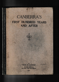
Book, Penfold, Canberra's first hundred years and after, 1927
Notes on Aborigines, land grants, places and families in the federal territory, brief notes on Aboriginal names and tribal districts, quotes previous authors; early camping grounds - place names.non-fiction Notes on Aborigines, land grants, places and families in the federal territory, brief notes on Aboriginal names and tribal districts, quotes previous authors; early camping grounds - place names.canberra (act) - history, canberra - settlement and contacts -
 Mrs Aeneas Gunn Memorial Library
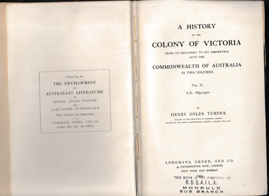
Book, Longmans, Green, and Co, A history of the Colony of Victoria : from its discovery to its absorption into the Commonwealth of Australia, 1904
A history of the Colony of Victoria : from its discovery to its absorption into the Commonwealth of Australia volume two 1854-1900Index, p.356.non-fictionA history of the Colony of Victoria : from its discovery to its absorption into the Commonwealth of Australia volume two 1854-1900victoria - history 1854-1900, victoria - settlement -
 Mrs Aeneas Gunn Memorial Library
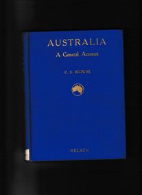
Book, T. Nelson and sons, Australia : a general account - history, resources, production, social conditions, 1929
Outline of geography, European exploration and settlement, economic development, social condition, flora and fauna; includes a brief general account of Aboriginal culture.Index, Ill, maps, p.272.non-fictionOutline of geography, European exploration and settlement, economic development, social condition, flora and fauna; includes a brief general account of Aboriginal culture.australia - social life and customs, australia - history -
 Mrs Aeneas Gunn Memorial Library
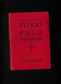
Book, G. Bell & Sons, By flood and field : adventures ashore and afloat in North Australia, 1912
Factual account of life in the Northern Territory in the late 19th century; - 1st section - Authors adventures as a shipwrecked mariner at Wark Aboriginal Settlement and Port Essington; 2nd section - Detailed narrative of the authors work & explorations as a customs official and as a patrol police officer, stationed at Port Darwin; Description of Malays and their trading ventures by proas; Relations between Malays and Aborigines employment of latter in collecting, trepangs, pearls, tortoise-shells - physical and cultural influences (e.g. intermixture, and language) feuds and murders; Notes on food gathering and hunting (use of wommera) - tracking - corroborrees settling of disputes by simulated fighting - group murder and guilt rites (Malays and Chinese), canoes decorated - Maria Is. sacred burial ground qualities of Aborigines; noted; Intertribal fighting - Woolna tribe against local Darwin Aborigines; Cannibalism at Limba Luchumbo - King River; Contact between Aborigines and settlers, ranging from extreme cruelty to great friendships; Aboriginal girls stolen for domestic work causing trouble; Further accounts of Chinese - opium & gold smuggling; Search for Dylompo - Groote Eylandt unsuccessful.Ill, p.327.non-fictionFactual account of life in the Northern Territory in the late 19th century; - 1st section - Authors adventures as a shipwrecked mariner at Wark Aboriginal Settlement and Port Essington; 2nd section - Detailed narrative of the authors work & explorations as a customs official and as a patrol police officer, stationed at Port Darwin; Description of Malays and their trading ventures by proas; Relations between Malays and Aborigines employment of latter in collecting, trepangs, pearls, tortoise-shells - physical and cultural influences (e.g. intermixture, and language) feuds and murders; Notes on food gathering and hunting (use of wommera) - tracking - corroborrees settling of disputes by simulated fighting - group murder and guilt rites (Malays and Chinese), canoes decorated - Maria Is. sacred burial ground qualities of Aborigines; noted; Intertribal fighting - Woolna tribe against local Darwin Aborigines; Cannibalism at Limba Luchumbo - King River; Contact between Aborigines and settlers, ranging from extreme cruelty to great friendships; Aboriginal girls stolen for domestic work causing trouble; Further accounts of Chinese - opium & gold smuggling; Search for Dylompo - Groote Eylandt unsuccessful. northern australia - description and travel, northern australia - economic relations -
 Mrs Aeneas Gunn Memorial Library
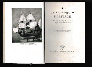
Book, George Harrap, Mayflower heritage, 1957
The story of the descendants of the Mayflower expeditionIndex, bib, p.190.non-fictionThe story of the descendants of the Mayflower expeditionmayflower, new england settlement -
 Mrs Aeneas Gunn Memorial Library
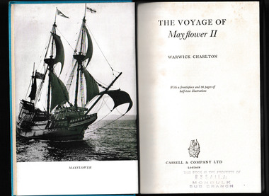
Book, Cassell, The voyage of Mayflower II, 1957
The story of the recreation of the original Mayflower journey.Ill, p.263.non-fictionThe story of the recreation of the original Mayflower journey.mayflower, new england settlement -
 Friends of Ballarat Botanical Gardens History Group
Work on paper - William Cross Yuille (28/3/1819 - 19/7/1894), Life, Work and Legacy, 20/11/2011
The Black Swamp in western Ballarat frequently ca to be called Yuille's Swamp and in time, Lake Wendouree.William Yuille had a station, south of the Swamp, which became part of the gold rush settlement of Ballarat in 1838.2 pages of printNonejohn garner, doctor john garner, lake wendouree, yuille's swamp, black swamp, ballarat botanic gardens, friends of ballarat botanical gardens, william cross yuille, grazier, explorer, pioneer, scot, horse trainer, victoria racing club, squatter, gardens, ballarat, john garner collection -
 Friends of Ballarat Botanical Gardens History Group
Photograph - Digital image TIFF, Floral Carpet Design 1985
floral carpet 1985, 150 years settlement anniversary -
 Bacchus Marsh & District Historical Society
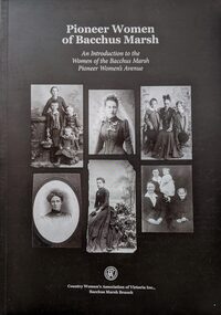
Book, Pioneer Women of Bacchus Marsh: An Introduction to the Women of Bacchus Marsh Pioneer Women's Avenue
This book explores the lives of 274 pioneer women of Bacchus Marsh and district. In this work the pioneer period is defined as women who were either born in the Bacchus Marsh area before 1869 or arrived there prior to 1869. The women's stories in the book are derived from the list of women pioneers of the district compiled in 1936 to commemorate the centenary of European settlement in Bacchus Marsh.Importantly this 2015 publication identifies a number of First Nations women known to have lived in the district prior to 1869 and acknowledges the fact that many thousands of women have lived in the district prior to the European colonial era. Citation: Pioneer Women of Bacchus Marsh: An Introduction to the Women of the Bacchus Marsh Pioneer Women's Avenue. [Written and compiled by the Country Women's Association Branch, Bacchus Marsh]. Published by Country Women's Association of Victoria Inc., Bacchus Marsh Branch, 2015.An A4 sized printed book published in paperback edition. 228 pages, with black white photographs and portraits and illustrations. Includes a\subject and name indexes. BMDHS Location: AR/SU4non-fictionThis book explores the lives of 274 pioneer women of Bacchus Marsh and district. In this work the pioneer period is defined as women who were either born in the Bacchus Marsh area before 1869 or arrived there prior to 1869. The women's stories in the book are derived from the list of women pioneers of the district compiled in 1936 to commemorate the centenary of European settlement in Bacchus Marsh.Importantly this 2015 publication identifies a number of First Nations women known to have lived in the district prior to 1869 and acknowledges the fact that many thousands of women have lived in the district prior to the European colonial era. Citation: Pioneer Women of Bacchus Marsh: An Introduction to the Women of the Bacchus Marsh Pioneer Women's Avenue. [Written and compiled by the Country Women's Association Branch, Bacchus Marsh]. Published by Country Women's Association of Victoria Inc., Bacchus Marsh Branch, 2015.bacchus marsh vic. history, pioneers biographies, women pioneers bacchus marsh -
 The Celtic Club
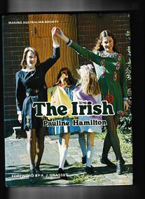
Book, Pauline Hamilton, The Irish, 1978
A story of Irish migration to Australia from the beginning of settlement to the recent present.Index, bib, plates, ill. p.108.non-fictionA story of Irish migration to Australia from the beginning of settlement to the recent present.irish - immigration, irish - australian culture -
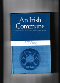 The Celtic Club
Book, E. T. Craig, An Irish commune, 1983
An account of the communal experiment at Rahahine, County Clare 1831 - 1833p.208.non-fictionAn account of the communal experiment at Rahahine, County Clare 1831 - 1833collective settlements - ireland, social conditions - ireland -
 The Celtic Club
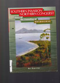
Book, Rex Harcourt, Southern invasion, northern conquest: Story of the founding of Melbourne, 2001
This book is an account of how exploration and settlement of Port Phillip paved the way for colonising present day Victoria.Index, bib, plates, maps, ill. p. 240.non-fictionThis book is an account of how exploration and settlement of Port Phillip paved the way for colonising present day Victoria.exploration and development - melbourne, john batman - melbourne - history -
 Wodonga & District Historical Society Inc
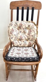
Furniture - Haeusler Family Rocking chair
The Wodonga Historical Society Haeusler Collection provides invaluable insight into life in late nineteenth and early twentieth century north east Victoria. The collection comprises manuscripts, personal artefacts used by the Haeusler family on their farm in Wodonga, and a set of glass negatives which offer a unique visual snapshot of the domestic and social lives of the Haeusler family and local Wodonga community. The Haeusler family migrated from Prussia (Germany) to South Australia in the 1840s and 1850s, before purchasing 100 acres of Crown Land made available under the Victorian Lands Act 1862 (also known as ‘Duffy’s Land Act’) in 1866 in what is now Wodonga West. The Haeusler family were one of several German families to migrate from South Australia to Wodonga in the 1860s. The Collection also depicts development of life in Wodonga through the eyes of one family, through a collection of artefacts, diaries, letters and photographs. This item is from the Hauseler Collection which documents social life of early settlers in the Wodonga community.An old wooden rocking chair, The chair was originally home manufactured from timber. The back slats have been repaired and replaced by metal slats attached at the top and base of the backrest section.early settlement wodonga, haeusler family of wodonga -
 Wodonga & District Historical Society Inc
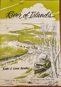
Book - River of Islands, Kath & Leon Bentley, 1985
A detailed guide to the Murray RIver, including descriptions of the terrain and settlements along the river as well as detailed charts of the river from Yarrawonga to the Hume WeirAn A4 sized publication including text, photos and maps describing the history and surrounds of the Murray River from Yarrawonga to the Hume Weir.A detailed guide to the Murray RIver, including descriptions of the terrain and settlements along the river as well as detailed charts of the river from Yarrawonga to the Hume Weirmurray river navigation, murray river settlement, leisure activities - boating -
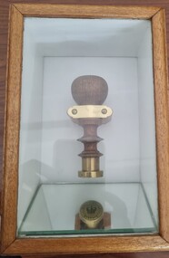 Wodonga & District Historical Society Inc
Functional object - Seal - Police Office, Belvoir
This seal was used for official police and court documents by the Belvoir Police Office.The initial land survey for the city now known as Wodonga was first undertaken in 1852 by Thomas Wedge - Assistant Surveyor. The new township was called "Belvoir" and was proclaimed by that name in 1852 and again in 1861. The first sale of land in Belvoir was held at Wangaratta on April 28, 1854, when all the allotments surveyed by Thomas Wedge (excepting those set apart for reserves, government and public areas) were offered at auction. Following representations by the Postmaster General on June 23, 1869, the Governor in Council, on July 12, 1869, approved of its Aboriginal name "Wodonga" being restored. The seal was found at the Yackandandah Courthouse by the Circuit Judge, the late Mr. Jim Humphrey. As the Wodonga Historical Society was in recess at that time, the seal was held in trust by the North-East Historical Society in Wangaratta. It was donated to the Wodonga Historical Society in 1987.This item was the official seal of the Belvoir Police office from the beginning of the European settlement of the modern day city of Wodonga, then know as Belvoir. It is one of the earliest relics of that period of history, until its name was changed in 1869.Wood and metal seal bearing the official emblem of the Police Office Belvoir. It would have been used to apply a wax seal to official documents. The seal is mounted in a timber and glass case so that the imprint of the seal can be seen reflected in a mirror mounted in the base of the box.Around the edges of the seal "POLICE OFFICE / BELVOIR"belvoir police, official seal, history wodonga -
 Wodonga & District Historical Society Inc
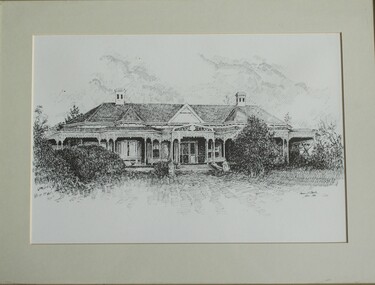
Drawing - Cambourne House, Kevin P. Clark, 1984
Cambourne homestead was built by 1903 for Rebecca S. Carkeek, who purchased the property in Wodonga in 1899. Cambourne is situated on the original Wodonga run which was established in 1836. The township of Belvoir, later renamed as Wodonga. In 1855 the pre-emptive right of 171 acres of the Wodonga run was granted and sold the following year. The allotments on which the five-acre Cambourne property developed, were purchased in 1873 and 1876, coinciding with the opening of the railway from Melbourne. The property was purchased by Rebecca Carkeek in June 1899, wife of William Carkeek, publican of Wodonga and shire councillor. Local architects Gordon and Gordon have been credited with the design of Cambourne. The house at Cambourne was built at some stage between 1900 and 1903 as a large single storey homestead. It was constructed in red brick with corrugated iron roof and encircling verandah. Cambourne is a probable work of architects Gordon and Gordon, it is amongst their best preserved and one of their few surviving buildings in Victoria. Today Cambourne remains on a reduced allotment due to the acquisition of land in 1972 by the Country Roads Board and in 2006 by Vic Roads for road works adjacent to the property.This drawing is significant as a representation of Cambourne in Wodonga. Cambourne is of historical significance due to its links with the early settlement of the district and as an example of closer settlement which occurred in regional centres of the State. Cambourne, Wodonga is also of architectural significance as a largely intact late Victorian style house with elaborate decorative cast iron work and distinctive transverse plan. As a probable work of architects Gordon and Gordon, it is amongst their best preserved and one of their few surviving buildings in Victoria. A framed drawing of historic home, Cambourne in Wodonga. The drawing has been mounted and framed.On bottom right corner" Kevin P. Clark 1984"cambourne wodonga, gordon and gordon architects, historic buildings wodonga, heritage buildings wodonga -
 Wodonga & District Historical Society Inc
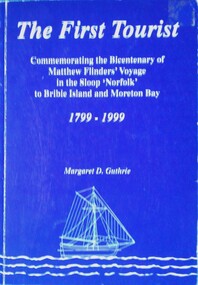
Book - The First Tourist, Margaret D. Guthrie, 1999
The full title of this publication is "The first tourist: commemorating the bicentenary of Matthew Flinders' voyage in the sloop Norfolk to Bribie Island and Moreton Bay, 1799-1999". It was sponsored by Pacific Harbour, Bribie Island with the assistance of the Regional Arts Development Fund. Although Flinders documented his voyage to Australia in his major work "Voyage to Terra Australia", little mention is made of his voyage to Bribie Island. However this publication claims Matthew Flinders as the first official tourist to Bribie Island. It was published to celebrate the bicentenary of his voyage.A book of 72 pages including plates, maps and illustrations. The cover is blue with white text and an illustration of a sailing sloop. It includes a bibliography.The full title of this publication is "The first tourist: commemorating the bicentenary of Matthew Flinders' voyage in the sloop Norfolk to Bribie Island and Moreton Bay, 1799-1999". It was sponsored by Pacific Harbour, Bribie Island with the assistance of the Regional Arts Development Fund. Although Flinders documented his voyage to Australia in his major work "Voyage to Terra Australia", little mention is made of his voyage to Bribie Island. However this publication claims Matthew Flinders as the first official tourist to Bribie Island. It was published to celebrate the bicentenary of his voyage.matthew flinders, flinders bicentenary, australia - exploration and settlement -
 Wodonga & District Historical Society Inc
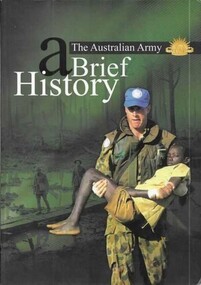
Book - The Australian Army - A Brief History, Austin, Brigadier M and Lever, Major Geoff, 2001
A revised short history of the Australian Army beginning with Aboriginal resistance to settlement; through an examination of the service of colonial forces in the Sudan and Boer Wars; both World Wars, Korea, Vietnam and Afghanistan. It contains a detailed section explaining the history and traditions of the Australian Army including patches, badges, the slouch hat and the Rising Sun badge.A bound volume of 96 pages featuring an image of an Australian soldier carrying an injured child on the cover. This publication includes 11 maps in colour as well as black and white and colour illustrations.A revised short history of the Australian Army beginning with Aboriginal resistance to settlement; through an examination of the service of colonial forces in the Sudan and Boer Wars; both World Wars, Korea, Vietnam and Afghanistan. It contains a detailed section explaining the history and traditions of the Australian Army including patches, badges, the slouch hat and the Rising Sun badge.australian military, military history -
 Wodonga & District Historical Society Inc
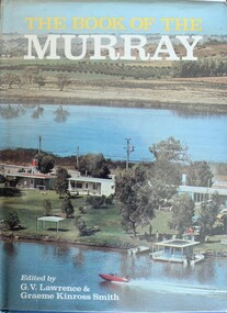
Book - The Book of the Murray, Lawrence, G. V.; and Smith, Graeme Kinross, 1975
This book contains contributions from 16 writers who have first-hand knowledge of the Murray River area. It provides a comprehensive picture of the river in all its aspects. It gives a fascinating look at one of Australia's most important geographical and historical features. Contributors and chapters in this book are: - 1. Past, Present and Future – G. V. Lawrence 2. The Structure of the Murray – Edmund D. Gill 3. Seeing the Murray – Graeme Kinross Smith 4. The Mountains at the Source – Elyne Mitchell 5. The Explorers – Leigh Betheras 6. The Irrigators – G. Arch Grosvenor 7. Murray Water Conservation – W. G. L. Harrison & K. E. Johnson 8. The Murray River Steamers – Ian Mudie 9. Pioneer Days: A Story of Seventy Years Ago – Dorothy Roysland 10. Birdlife of the Murray Valley – John Eckert 11 .Aborigines in the Murray Valley, How We Learned the Story – H. A. Lindsay, The Aboriginal Occupation – Norman B. Tindale 12. Fish of the Murray River – John S. Lake 13. Native Plants of the Murray Valley – J. H. Willis 14. Murray Wildlife – K. N. G. SimpsonThis publication has a hard cover with blue boards and a pictorial dust jacket. It consists of 264 pages.This book contains contributions from 16 writers who have first-hand knowledge of the Murray River area. It provides a comprehensive picture of the river in all its aspects. It gives a fascinating look at one of Australia's most important geographical and historical features. Contributors and chapters in this book are: - 1. Past, Present and Future – G. V. Lawrence 2. The Structure of the Murray – Edmund D. Gill 3. Seeing the Murray – Graeme Kinross Smith 4. The Mountains at the Source – Elyne Mitchell 5. The Explorers – Leigh Betheras 6. The Irrigators – G. Arch Grosvenor 7. Murray Water Conservation – W. G. L. Harrison & K. E. Johnson 8. The Murray River Steamers – Ian Mudie 9. Pioneer Days: A Story of Seventy Years Ago – Dorothy Roysland 10. Birdlife of the Murray Valley – John Eckert 11 .Aborigines in the Murray Valley, How We Learned the Story – H. A. Lindsay, The Aboriginal Occupation – Norman B. Tindale 12. Fish of the Murray River – John S. Lake 13. Native Plants of the Murray Valley – J. H. Willis 14. Murray Wildlife – K. N. G. Simpsonmurray river, australian geography, settlement on the murray river, native plants, aborigines in the murray valley, murray valley flora and fauna