Showing 2127 items
matching map of bendigo
-
 Bendigo Historical Society Inc.
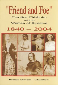
Book - FRIEND AND FOE, 2004
Friend and Foe Caroline Chisholm and the Women of Kyneton 1840 - 2004. Published by Springfield & Hart 206 pages with photographs, illustrations and a map. Signed by the author.Brenda Stevenshistory, kyneton, women of kyneton, kyneton - history, women on goldfields, kyneton women, womens rights. -
 Bendigo Historical Society Inc.
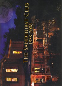
Book - THE SANDHURST CLUB 1858 - 2008, 2008
... of the Sandhurst Club 101 pages published by The Sandhurst Club Bendigo... Club Bendigo with photographs, illustrations & maps. Book ...The Sandhurst Club 1858 - 2008, the history of the Sandhurst Club 101 pages published by The Sandhurst Club Bendigo with photographs, illustrations & maps.Geoff Russellbendigo, clubs, sandhurst club, bendigo - history, sandhurst club, promininet people. -
 Bendigo Historical Society Inc.
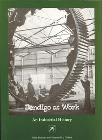
Book - BENDIGO AT WORK, AN INDUSTRIAL HISTORY, 2005
Bendigo at Work, an Industrial History an insight into Bendigo's industrial development. Published by Holland House for the National Trust of Australia, 266 pages with photographs, illustrations and maps and signed by the authors.Mike Butcher and Yolande M J Collinsbendigo, history, industrial, bendigo - history - industry, industrial development. -
 Bendigo Historical Society Inc.
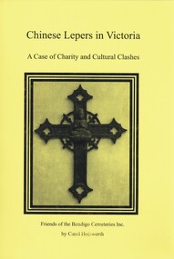
Book - CHINESE LEPERS IN VICTORIA, 2009
Chinese Lepers in Victoria, a case of charity and cultural clashes, published by Friends of the Bendigo Cemeteries Inc, 94 pages with photographs, illustrations and maps.Carol Holsworthvictoria, history, chinese lepers, victoria - chinese, chinese lepers, chinese burials, infectious diseases. -
 Bendigo Historical Society Inc.
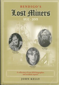
Book - BENDIGO'S LOST MINERS 1852 - 2001, 2008
... , illustrations and maps. Book BENDIGO'S LOST MINERS 1852 - 2001 ...Bendigo's Lost Miners 1852 - 2001, a collection of over 850 biographies and accident reports with copies of some inquest reports, mine managers reports, applications for graves and other documents with regard to the deaths of men, boys and one woman who were killed in Bendigo's mines from 1852 to 2006. Published by Australian Institute of Genealogical Studies Bendigo area, 381 pages with photographs, illustrations and maps.John Kellybendigo, mining, deaths, bendigo - history - gold mines - bendigo gold miners, mine accidents. -
 Bendigo Historical Society Inc.
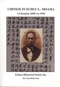
Book - CHINESE IN ECHUCA - MOAMA, 2008
Chinese In Echuca - Moama, A Chronicle 1850's to 1930, published by The Echuca Historical Society, 140 pages with photographs, illustrations and maps. Donated and signed by the author.Carol Holsworthchinese, echuca - moama, echuca - moama - history, chinese. -
 Bendigo Historical Society Inc.
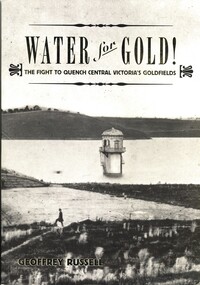
Book - WATER FOR GOLD, 2009
Water for Gold, The fight to quench central Victoria's goldfields. Published by Australian Scholarly Publishing with a grant from Coliban Water to celebrate the 15th anniversary of the first serious attempts by the Bendigo Water Works Company in 1859 to supply water to the goldfields of Central Victoria, 288 pages photographs, illustrations & maps. Signed by the author.Geoffrey Russellvictoria, history, water, bendigo - history, central victorian goldfields, coliban water. -
 Bendigo Historical Society Inc.
Book - ORIGINS OF BENDIGO STREET NAMES BOOK 2, 2007
... and map Book ORIGINS OF BENDIGO STREET NAMES BOOK 2 ...ORIGINS OF BENDIGO STREET NAMES BOOK 2. 34 pages with photos and mapRita Hullbendigo, hospital, street names, bendigo, street names -
 Bendigo Historical Society Inc.
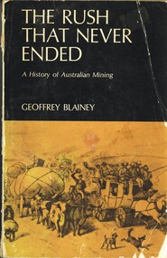
Book - THE RUSH THAT NEVER ENDED, 1969
The Rush That Never Ended, A history of Australian mining. Published by Geoffrey Norman Blainey, 389 pages with photographs & maps.Geoffrey Blaineyaustralia, history, mining, australia - history, gold mining, mining. -
 Bendigo Historical Society Inc.
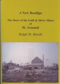
Book - A NEW BENDIGO, THE STORY OF THE GOLD & SILVER MINES OF ST ARNAUD, 2008
A New Bendigo, The Story of the Gold & Silver Mines of St Arnaud. Published by R.W.Birrell, 257 pages with photographs, illustrations & Map. Signed by the Author.Ralph.W.Birrell.book, st arnaud, st arnaud - history, mining - gold & silver. -
 Bendigo Historical Society Inc.
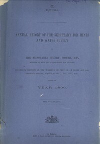
Book - ANNUAL REPORT OF THE SECRETARY FOR MINES AND WATER SUPPLY, c1897
Annual Report Of The Secretary For Mines And Water Supply, Victoria 1896. Publisher: Government Printer, Melbourne. 71 pages. Maps & drawings. Inscriptions: Little 180, see page 59 (cover), A Richardson, 29 Harrison St, Bendigo (1st page).victoria, victorian mining report, mining machinery mine safety mining statistics bendigo mines -
 Bendigo Historical Society Inc.
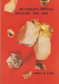
Book - BENDIGOS MINING HISTORY 1851 - 1954, 1991
Bendigos Mining History 1851 - 1954. An overview of some of the trends in mining growth, development and ultimate decline of gold mining in Bendigo. Published by the Bendigo Trust, first edition of 4000 copies, 79 pages with photographs, illustrations & maps plus a newspaper cutting dated 1997.James A Lerk.bendigo, history, gold mining, bendigo - history, gold mining, bendigo gold mines. -
 Bendigo Historical Society Inc.
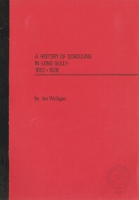
Book - LONG GULLY PRIMARY SCHOOL COLLECTION: A HISTORY OF SCHOOLING IN LONG GULLY, 1978
A History of Schooling in Long Gully 1852 - 1928. This essay first sets the Bendigo and Long Gully scenes and then outlines the history of previous schools in the Long Gully township before detailing the history and achievements of Long Gully primary school from its inception in 1879 to the end of its first fifty years. 37 pages with maps.Ian. Weibgen.bendigo, education, long gully, bendigo - long gully., schools, education. -
 Bendigo Historical Society Inc.
Book - THE YOUNG WOMEN'S CHRISTIAN ASSOC IN BENDIGO 1906 TO 1939, 1985
The Young Women's Christian Association in Bendigo 1906 to 1939, a research project submitted to the Bendigo College of Advanced Education in partial fuffilment of the requirement of the Bachelor of Arts degree ( Humanities ) contains 52 pages with photographs (poor) and a map.Lisa Haybook, bendigo, ywca, bendigo - young women's christian assoc. -
 Bendigo Historical Society Inc.
Book - THE EFFECTS OF RECREATION ON THE WHIPSTICK FOREST PARK, 1983
The Effects of Recreation on the Whipstick Forest Park a Social Science III B research paper Bachelor of Arts (Social Science) Bendigo College of Advanced Education. 51 pages with maps.Anne Butlerbook, bendigo, whipstick, whipstick forest, land conservation, flora & fauna. -
Bendigo Historical Society Inc.
Archive - MCCOLL, RANKIN AND STANISTREET COLLECTION: NELL GWYNNE REEF MINING BOX, 1930's - 1940's
... Bendigo Historical Society Inc. Bendigo Historical Society ...Mining Box. Painted green with yellow interior. Nell Gwynne Reef painted on the front of the box. Tag number 488, now box number 9. Box contains Minute Book (from 3/10/1939 to 21/8/1947) and financial books for Forbes Carshalton GMC N/L.mining, parish map, nell gwynne reef, mccoll, rankin & stanistreet, nell gwynne reef, forbes carshalton gmc n/l, mining box -
Bendigo Historical Society Inc.
Map - WELLSFORD, 4/07/1876
... Inc. History House 11 Mackenzie Street Bendigo goldfields MAP ...Map: Parish of Wellsford, County of Bendigo. Strathfieldsaye, Wellsford , Bagshot (number 311 in map cupboard 1)map, bendigo, parish plan, wellsford -
Bendigo Historical Society Inc.
Map - MUSKERRY, No date visible
... Inc. History House 11 Mackenzie Street Bendigo goldfields MAP ...Map: Parish of Muskerry. Parish plan (number 310 in map cupboard 1)map, parish plan, muskerry -
Bendigo Historical Society Inc.
Map - WESTON, 21/10/1876
... Inc. History House 11 Mackenzie Street Bendigo goldfields MAP ...Map: Re-Survey of part of the parish of Weston, County of Rodney. Parish plan (number 309 in map cupboard 1)Murray and Hargreave, Authorised surveyorsmap, rodney, parish plan, parish of weston, murray and hargreave -
Bendigo Historical Society Inc.
Archive - MCCOLL, RANKIN AND STANISTREET COLLECTION: SOUTH NELL GWYNNE MINE BOX, 1930's
... Bendigo Historical Society Inc. Bendigo Historical Society ...Metal trunk painted dark blue. Formerly box 478. Now South Nell Gwynne Box 8. Tag attached to front 'box 478'. Paper pasted on the front with Sth. Nell Gwynne printed on it. Box contains documents relating to the South Nell Gwynne and are individually catalogued within.Some paint scuffsmining, parish map, mccoll, rankin & stanistreet, south nell gwynne, gold mining, metal box -
Bendigo Historical Society Inc.
Map - TARNAGULLA SHEET 3, No date visible
... Inc. History House 11 Mackenzie Street Bendigo goldfields MAP ...Map: Tarnagulla Sheet 3. Parish plan (number 308 in map cupboard 1)map, parish plan, tarnagulla -
Bendigo Historical Society Inc.
Map - TARNAGULLA SHEET 2, No date visible
... Inc. History House 11 Mackenzie Street Bendigo goldfields MAP ...Map: Tarnagulla Sheet 2. Parish plan (number 307 in map cupboard 1)map, parish plan, tarnagulla -
 Bendigo Historical Society Inc.
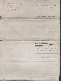
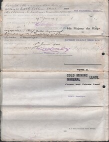
Document - MCCOLL, RANKIN AND STANISTREET COLLECTION: CENTRAL NELL GWYNNE - FORM D GOLD MINING LEASE 10981 BENDIGO, 5 Oct 1936
Document. Renewal New Lease no 11073 His Majesty the King to Central Nell Gwynne GMC N/L. 1 map no 10981 of Mining District of Bendigo Parish of Sandhurst City of Bendigo County of Bendigo. No 10981 Bendigo Vo 322 Fol 35594.McColl, Rankin & Stanistreetorganization, business, central nell gwynne, mccoll, rankin & stanistreet, cnetral nell gwynne, gold mining, lease -
Bendigo Historical Society Inc.
Map - TARNAGULLA SHEET 4, 25/11/1926
... Inc. History House 11 Mackenzie Street Bendigo goldfields MAP ...Map: Tarnagulla Sheet 4. Parish plan (number 306 in map cupboard 1)map, parish plan, tarnagulla -
 Bendigo Historical Society Inc.
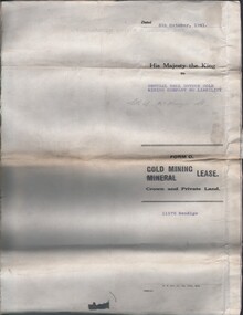
Document - MCCOLL, RANKIN AND STANISTREET COLLECTION: CENTRAL NELL GWYNNE, 5/10/1941
Document. Paper Document containing an indenture detailing lease between His Majesty the King to Central Nell Gwynne Gold Mining Company No Liability. Included is a map of the mining district of Bendigo Parish of Sandhurst. No 11172 Bendigo Vol 327 Fol 36016.McColl, Rankin & Stanistreetorganization, business, central nell gwynne, mccoll, rankin & stanistreet, central nell gwynne, gold mining, lease -
Bendigo Historical Society Inc.
Map - SALISBURY WEST, 29/01/1878
... Inc. History House 11 Mackenzie Street Bendigo goldfields MAP ...Map: Salisbury West, County of Gladstone. Parish plan (number 305 in map cupboard 1)map, gladstone, parish plan, salisbury west -
Bendigo Historical Society Inc.
Archive - MCCOLL, RANKIN AND STANISTREET COLLECTION: NORTH DEBORAH MINING BOX
... Bendigo Historical Society Inc. Bendigo Historical Society ...Mining Box: metal box, painted dark blue, formerly box number 482 - Now North Deborah Mining Box 7. Tag affixed to front ' box 482' Printed on door in white paint ' North Deborah'. Box contains various documents relating to North Deborah Mine. Documents are individually catalogued within box.mining, parish map, mccoll rankin & stanistreet, mining, gold mining, north deborah -
Bendigo Historical Society Inc.
Map - TARNAGULLA SHEET 1, Examined 25/08/1926
... Inc. History House 11 Mackenzie Street Bendigo goldfields MAP ...Map: Tarnagulla Sheet 1, Counties of Gladstone and Bendigo. Parish plan (number 304 in map cupboard 1)map, gladstone, parish plan, tarnagulla -
 Bendigo Historical Society Inc.
Document - MCCOLL, RANKIN AND STANISTREET COLLECTION: CENTRAL NELL GWYNNE, March - April 1943
Document. Manila folder & 4 letters, 1 map The 4 letters pertain to an application by the Commonwealth of Australia to the lands Depart. For sale of an area of 8 acres 0 roods 31 perches now comprising the garden of Fortuna to unlimited depth.McColl, Rankin & Stanistreetorganization, business, central nell gwynne, mccoll, rankin & stanistreet, central nell gwynne gmc, south nell gwynne, gold mining, dept of mines -
 Bendigo Historical Society Inc.
Document - MCCOLL, RANKIN AND STANISTREET COLLECTION: NAPOLEON REEF GOLD MINING CO. N.L, 1938
5 Page Legal Document with map of lease area, 6 land application forms (see attached pdf for details).organization, business, industrial - mining, mccoll rankin & stanistreet, mining, gold mining, napoleon reef