Showing 3760 items
matching surveyed
-
 Bendigo Military Museum
Manual - Defense Mapping Agency (US) - Digitizing the Future Third Edition, c1990
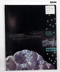
Digitizing the Future Third Edition, An information booklet describing the types of new digital geographic products produced by the US Defense Mapping Agency. The Australian Army Survey Regiment went on to also produce many of these digital productsSoft Cover Book, Paper Pages, 3 parts with Numerous Sections in each Part, Text, Diagrams and Photographs, Data Information Sheets, DMA Stock No: DDIPDIGITALPACFront Cover, "DO NOT REMOVE FROM CARTO SQN"royal australian survey corps, rasvy, fortuna, army survey regiment, army svy regt, asr -
 Federation University Historical Collection
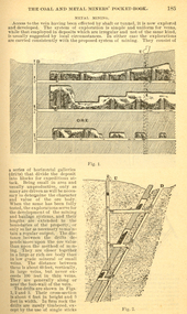
Book, The Colliery Engineer Company, Coal and Metal Miners' Pocket Book, 1893
This book was specially compiled and prepared for the convenient use of mine officials, mining engineers, and students preparing themselves for certificates of competency as mine inspectors or mine foremen.Dark, hard covered book. Contents include arithmetic, weights and measures, Cylinders, Geometry, Mensuration, Surveying, strength and Weight of Materials, wire ropes, chains, Colliery management, precious metals, ventilation, hydrostatics, hydraulics, mine railways, Friction of mine cars, colliery machinery, steam raising, rules for engine drivers, faults, electricity, glossary of Mining terms.mining, coal, metal, colliery, definitions, brook, advertisements -
 Anglesea and District Historical Society
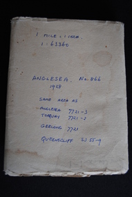
Map, Royal Australian Survey Corps, Anglesea, Victoria, 1954
Anglesea, Victoria [cartographic material] produced by Royal Australian Survey Corps. Colour; Scale [1:63,360] 1 mile to 1 inch; transverse Mercator projection; Sheet No. 866, Zone 7. Two stamps: 1. Rankine and Dobbie Pty Ltd. 2. Authorised for sale / Price 2/- / By Department of the Army Original date: November 1928.(See above)anglesea map, topographic map -
 University of Melbourne, Burnley Campus Archives
Plan, Burnley Gardens. City of Richmond. Parish of Jika Jika - County of Bourke, 1927
Plan showing Burnley Gardens - bounded by Swan St to N, Yarra River to E, Richmond Park on S and W side. Photo-lithographed at Dept of Lands & Survey by W.J. Butson. Plan shows old orchard, fowl sheds, coops and yards, milking shed, silo,nursery, glasshouse, fattening pens, gardens and orchards area in S.W. corner.burnley gardens, orchards, sheds, nursery -
 Villa Alba Museum
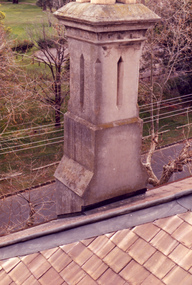
Photograph - Rendered chimney, c.1987
Built for William and Anna-Maria Greenlaw in the early 1880s, and with interiors decorated by the Paterson Bros, Villa Alba remained in private ownership until 1949. From 1950, the house was owned by a number of institutions. By 1984, the Villa Alba Preservation Society had been formed, and three years later, the Mount Royal Hospital granted a 25-year lease to Kew Council. In 2004, the title to Villa Alba was passed by the Victorian Government to The Villa Alba Museum Incorporated. The Museum, at 44 Walmer Street, Kew, is now a cultural institution committed to the collection, study and display of 19th century interior decorative finishes, and the components of 19th and 20th century interior decoration.This is one of a number of historically and aesthetically significant photos of the interiors and exterior of Villa Alba when it was still owned by the Mount Royal Hospital, showing twentieth century accretions and deterioration of the historic fabric of the building. This was a benchmark survey against which future conservation and restoration activities can be measured.In December 1987, Mockridge Stahle & Mitchell Pty Ltd Architects prepared ‘Villa Alba Survey: A Report on the fabric for Mount Royal Hospital’ of which this photograph is a part. Photo of one chimney on the south west corner of the house. The distinctive rendering of the chimney cornets with the welsh slates used on the roof. This chimney services the fireplaces in the dining room and the second and third bedrooms. villa alba museum, conservation photographs, victorian architecture, slate roofs, chimneys -
Ballarat Tramway Museum
Newspaper, Angela Carey, "Support for trams - Visitors like the idea but residents shy at the cost.", 9/01/1997 12:00:00 AM
Item written by Angela Carey in The Courier, Ballarat, page 1 on 9/1/1997 reporting on a survey by the Courier the previous day. Response to the question "Do you think Ballarat City Council should spend money to bring trams back to Ballarat?" Yes - 71%, No - 24% and unsure - 3%. Gives a breakdown between residents and visitors and general comments.feasibility study, ballarat city tramway, ballarat revival, surveys -
Whitehorse Historical Society Inc.
Map, Aerial photographs Nunawading, 1972
Department of Crown Lands and Survey, Melbourne, 1972.Department of Crown Lands and Survey, Melbourne, 1972. Project runs 34 - 39 - City of Nunawading. frames numbered from South to North boundaries, each strip numbered from West to east. The series extends further West to Box Hill and East to Ringwood than the 1970 project. No index map. Sheets 39/2 and 34/28 missing.non-fictionDepartment of Crown Lands and Survey, Melbourne, 1972.victoria. department of crown lands and survey, aerial photographs, nunawading, mitcham, blackburn, blackburn north, blackburn south, forest hill, vermont, burwood east, box hill, ringwood, vermont south -
Whitehorse Historical Society Inc.
Letter - Correspondence, Office of Lands and Survey, 1861
Copy of letter written by W. Fletcher, Office of Lands and Survey, Melbourne, 2 Nov 1861.Copy of letter written by W. Fletcher, Office of Lands and Survey, Melbourne, 2 Nov 1861. Reporting that charcoal burners in the Parish of Nunawading are using wood for that purpose without a license and suggesting the policeman at Whitehorse by informed. Attached note suggests author is possibly Walter Thomas Fletcher, early owner of land that included what is now Matheson's orchard (1988).Copy of letter written by W. Fletcher, Office of Lands and Survey, Melbourne, 2 Nov 1861.charcoal burning, fletcher, w, forest hill, parish of nunawading -
 Ballarat Tramway Museum
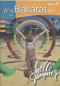
Magazine, City of Ballaarat, "my Ballarat - Summer 2016", Jan. 2017
Magazine - 40 pages, centre stapled, full colour printed on white paper, titled "my Ballarat - Summer 2016", providing news, events, activities for the City of Ballarat. Includes the results of the Lake Wendouree Master Plan Survey - includes the expansion of the Ballarat Tram depot for the joint BTM - RSL Ballarat Sub-branch - Tramway and Military Interpretative Centretrams, tramways, btm, rsl, masterplan, lake wendouree, botanical gardens -
 Ringwood and District Historical Society
Document, Packet: Ringwood Jaycees - Art Show Programmes 1975; Development Project 1962-1963; Junior Jaycees Art Show 1972; Survey 1967
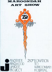
Packet includes the following: . Ringwood Junior Chamber of Commerce- Community Development Project, 1962-63. . 1967 Ringwood Community Survey- conducted by the Ringwood Jaycees. . Maroondah Art Show 1972. . Maroondah Art Show 1969. . Programme- Junior Chamber International Senate Award for Stan Morris, March 20th, 1969. . Maroondah Art Show 1975. -
 Ballarat Tramway Museum
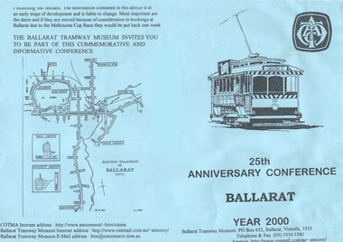
Pamphlet - flyer, Ballarat Tramway Museum (BTM), "25th Anniversary Conference Ballarat Year 2000", 1998
Produced to promote the COTMA 2000 conference.Pamphlet or form advertising the BTM's COTMA Conference for 2000 - "25th Anniversary Conference Ballarat Year 2000", consisting of a folded A4 blue photocopied sheet and a single sheet of paper as a survey form with 11 questions. Has tram 33 as the logo on the front cover and map of the Ballarat tramways in 1971. Distributed at the 1998 Christchurch Conference. Two copies held.trams, tramways, cotma, conferences, btm, 25th anniversary -
![Plan, University of Melbourne Burnley Campus Institute of Land and Food Resources Formerly known as the Royal Horticultural Gardens Burnley [sic], 2001](/media/collectors/52f2d90c9821f4163875a333/items/6145823c174069677c22f6e6/item-media/65ef8feeb2201fddf6999498/item-fit-380x285.jpg) University of Melbourne, Burnley Campus Archives
University of Melbourne, Burnley Campus ArchivesPlan, University of Melbourne Burnley Campus Institute of Land and Food Resources Formerly known as the Royal Horticultural Gardens Burnley [sic], 2001
site plan, buildings, planrs -
 Bendigo Historical Society Inc.
Document - MCCOLL, RANKIN AND STANISTREET COLLECTION: VICTORIAN GOLD ASSOCIATION, 1931
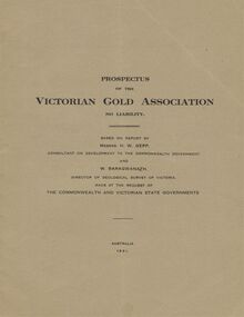
Prospectus of the Victorian Gold Association N.L. Based on a report by Messrs H. W. Gepp Consultant on Development to the Commonwealth Government and W. Baragwanath, Director of the Geological Survey of Victoria. Dated 1931 This company was formed to investigate the Deborah Mine, The Central Nell Gwynne Mine and the Monument Hill Mine. 12 pages including maps and Transverse Sections of the MinesThe Commonwealth and Victorian State Governments. E. Whitehead & Co., Pty., Ltd Printers 21 Equitale Place, Melbourne, C1.gold, mining, prospectus, bendigo, gold mines, victorian gold associatian, deborah mine, central nell gwynne mine, monument hill mine. -
Bendigo Historical Society Inc.
Map - POWLETT : COUNTY OF BENDIGO, 2-12-15
Map. Powlett, County of Bendigo, County of Gladstone, Janiember West, Janiember East, Yarrayne, Salisbury West, Kurting, Korong, River Loddon. By Authority Albert J. Mullett, Government Printer, Melbourne. Photographed at the Department of Lands and Survey, Melbourne by W. J. Butson.2-12-15. Price 1/-. (number 119 in map cupboard 1)Albert J. Mullett, Government Printermap, bendigo, powlett -
Bendigo Historical Society Inc.
Map - NERRING : COUNTY OF BENDIGO, August 1952
Map. Nerring, County of Bendigo, Yarraberb, Leichardt, Marong, Sandhurst, Huntly, Neilborough, Bendigo and Swan Hill Railway, Bendigo and Kulwin Railway, Loddon Valley Highway. By authority J.J. Gourley, Government Printer, Melbourne. Drawn and reproduced at the Department of Lands and Survey, Melbourne, Victoria. August 1952. Price $1.00. (number 76 in map cupboard 1)J.J. Gourley, Government Printer, Melbourne.map, bendigo, nerring -
Bendigo Historical Society Inc.
Map - MILLOO : COUNTY OF BENDIGO, 29-2-24
Map. Milloo, County of Bendigo. Wanurf, Dingee, Kamarooka, Pannoomilloo, Waranga Mallee Channel, Elmore to Kerang Road, Pannoo Estate. By authority A.J. Mullett, Govt. Printer. Photo-Lithographed at the Department of Lands and Survey, Melbourne, by W.J. Butson, 29-2-24. Price 1/-. Janiember to Rochester Road. (number 72 in map cupboard 1)A.J. Mullett, Government Printer.map, bendigo, milloo -
Bendigo Historical Society Inc.
Map - DIGGORRA : COUNTY OF BENDIGO, 26-6-36
Map. Parish of Diggorra, County of Bendigo, Parish of Ballendella, Parish of Pannoobamawm, Pannoomilloo, Rochester West, Warragamba, Minto, Egerton, Elmore, Northern Railway to Echuca, Elmore and Cohuna Railway, Township of Elmore. By authority H.J. Green, Govt. Printer. Photo-Lithographed at the Deptartment of Lands and Survey, Melbourne. 26-5-36. (number 58 in map cupboard 1)H.J. Green, Govt. Printer.map, bendigo, diggorra -
Bendigo Historical Society Inc.
Map - BENDIGO AND DISTRICT PARISH MAPS, 21-10-26
Map. Sandhurst, County of Bendigo, City of Bendigo, Strathfieldsaye, Mandurang, Marong, Nerring, Borough of Eaglehawk, Township of Kangaroo Flat, Lockwood, Huntly, Epsom, Wellsford. By Authority H.J. Green, Government Printer, Photo-Lithographed at the Department of Lands and Survey, Melbourne bj W.J Butson 21-10-26,Price 1/-. (number 13 in map cupboard 1)By Authority H.J. Green, Govt. Printermap, bendigo, sandhurst -
Bendigo Historical Society Inc.
Map - KNOWSLEY EAST : COUNTY OF BENDIGO, 18-112-77
Map. Knowsley East, County of Bendigo, County of Rodney, Weston, Knowsley, Crosbie, Dargile, Heathcote, Forest Creek, Shingle Hut Creek, Mt. Camel Estate, Sheep Station Creek, Mount Ida Creek. Photo-graphed at the Department of Lands and Survey, Melbourne by J. Noune 18-12-77, (number 104 in map cupboard 1)J. Nounemap, bendigo, knowsley east -
Bendigo Historical Society Inc.
Document - HUSTLERS REEF RESERVE CONSERVATION MANAGEMENT PLAN
Conservation management plan (112 pages) prepared by Lee Andrews & Associates, Heritage Consultants, in 2011, for the Hustlers Reef Reserve. The reserve cover the site of the former Great Extended Hustlers Mine site. Leigh McKinnons amendments to the plan are included with the document. History of the site, a physical survey and analysis, comparative analysis, cultural significance and conservation policy are addressed in the document.bendigo, mining, great extended hustlers mine site -
 Bendigo Historical Society Inc.
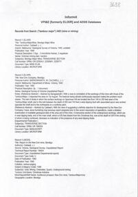
Document - TAMBOUR MAJOR MINE
Six page document describing resources found in a search for 'Tambour major' and 'Mine' with Informit databaxse, VPI&E (formerly ELIXIR) and AESIS Databases. For example, record 1: Author Caldwell, J.J. Melbourne Geological Survey of Victoria 1946 3 figs, 3 microfiche frames, 2 negatives. Subject: Bendigo Major Mine, transverse section.bendigo, mining, tambour major -
Bendigo Historical Society Inc.
Document - HARRY BIGGS COLLECTION: OLD POLICE BARRACKS, 5/6/70
Document. Harry Biggs Collection. A letter on Public Works Department Victoria letterhead from G. Serpell Director General to Mr H. Biggs, Treasurer Royal Historical of Victoria (Bendigo Branch) dated 5th June 1970. In the letter he is stating The Depart. Of Crown Lands & Survey is investigating the future use & control of the old Police Barracks building.G. Serpell Director Generalorganization, club/society, community, harry biggs collection, old police barracks -
 Bendigo Military Museum
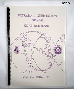
Administrative record - Australian - United Kingdom Exchange End of Tour Report by WO2 KA Fenton RE 1990, WO2 KA Fenton RE, 25.10.1990
A 2 x year personnel exchange program existed between RASvy and the Survey elements of the Royal Engineers UK. This is an end of Tour Report produced by WO2 KA Fenton RE of his experiences during his exchange tour. An A4 Booklet stylised map of the world with Corps Badges foe RASvy and Royal Engineers (UK), back cover overhead aerial Photo of Army Svy Regt, 14 Pages, 4 Annexes and an enclosureroyal australian survey corps, rasvy, fortuna, army survey regiment, army svy regt, asr -
 Whittlesea Historical Society Inc.
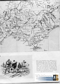
Document - Copy, Off to the Diggings
Research Notes: Yea Road construction. From Whittlesea surveyed 1860 & Gazetted. Construction through most of Mr. Thomas Wills & Henry Gibbs holdings. April - October, fencing contract David & William Johnson of Richlands estate. 1. Photocopy, 1 sheet, A4, article with sketch and one of the first map published of bush roads and rough tracks from Melbourne to the Diggings. 2. Handwritten research notes re the Yea Road construction, author and date unknown.yea road contruction, thomas wills, henry gibbs, david johnson, william johnson, johnson family, richlands estate whittlesea, johnston family -
Clunes Museum
Document, GARDEN LICENCE 5/
RECEIPT BOOK FOR DEPARTMENT OF LANDS AND SURVEY FOR THE YEARS 1889 - 1891 . LICENCE COSTING 5/- WAS ISSUED TO RESIDENTS TO PERMIT THEM TO ENTER UPON CROWN LANDS NOT EXCEEDING IN AREA. ONE ACRE AS SPECIFIED HEREUNDER, FOR PURPOSES OF GARDEN AND RESIDENCE.local history, book, licence, receipt, garden -
Clunes Museum
Document (Item), DEPARTMENT OF LANDS AND SURVEY, RENEWALS GARDEN LICENCE 5/
RECEIPT BOOK DEPARTMENT OF LANDS AND SURVEY. LICENCE TO ENTER UPON CROWN LANDS NOT EXCEEDING IN AREA ONE ACRE, AS SPECIFIED HEREUNDER, FOR PURPOSES OF GARDEN AND RESIDENCE. FEE PER ANNUM 5 / O (FIVE SHILLINGS) FIFTY CENTSlocal history, local government, council, licence, garden -
 Federation University Historical Collection
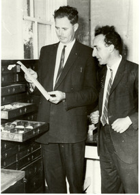
Photograph, Jack Barker and Phil Day with the Baragwanath Donation
William Baragwanath joined the Victorian Department of Mines in 1897, was director of the geological survey (1922-4), Chief Mining Surveyor (1924-43), Secretary for Mines (1932-34), consultant to the Department of Mines (1943-50) . He was born at Durham Lead on 1 August 1878 and was a former student of the Ballarat School of Mines. Baragwanath was president of the Royal society of Victoria (1943-44) and a councillor of the Ballarat School of Mines (1916-1950). After Baragwanath's death on 20 September 1966 the Department of Minerals and Energy (Geological Survey division) donated a number of Baragwanath's items to the Ballarat School of Mines, including this collection. Black and white photograph of E.J. Jack Barker (Ballarat School of Mines Principal) and Phil Day (Head of Geology) standing in front of a cabinet of geological specimens housed in a timber cabinet. ballarat school of mines, geology, ej barker, jack barker, phil day, baragwanath, william baragwanath, victorian mines department -
 Bendigo Military Museum
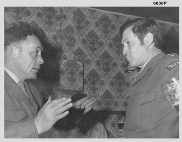
Photograph - LTCOL DR Ridge and SSGT G Haswell Circa 1972-1975, 1975
Photograph taken in the Sergeants Mess, Fortuna Villa circa 1972-1975 whilst LTCOL DR Ridge was the Commanding Officer of the Army Survey Regiment and SSGT G Haswell was a stores NCO. WO2 Szentirmay (in the background) was a Lithographic Technical Warrant Officer. 4233 LTCOL DR Ridge was commissioned from the ranks and served from 1946 - 1975, he was Commanding Officer of the Army Survey Regiment from 1972-1975. 310207 SSGT G Haswell served 1950- 1978 after a British Army career, 14613 WO2 T Szentirmay BEM served 1958-1980 after an Eastern European Army career.Black and White photograph of LTCOL DR Ridge and SSGT G Haswell Circa 1972-1975 taken at the Sergeants Mess at Fortuna Villa, Bendigoroyal australian survey corps, rasvy, fortuna, army survey regiment, army svy regt, asr -
 Bendigo Military Museum
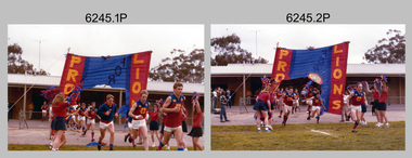
Photograph - Army Survey Regiment’s Fortuna Lions Football Club Grand Finals, Seymour, Victoria, 1983
This is a set of 25 colour photographs of Army Survey Regiment’s Australian Rules football team – the Fortuna Lions aka “Fortuna Fumblers”, taken at Seymour Victoria in 1983. The 26th item is a A4 paper document detailing the history of Fortuna Football Club from 1978 to 1993. The Fortuna Lions competed in the Puckapunyal Area Football Association for several years from 1978 to 1984 and in 1983, fielded a great team it managed to reach the Grand Final. Held at the neutral ground at Kings Park, Seymour, the match was an incredibly exciting and bruising contest played in damp conditions and ended in a draw. Dave Lawler’s spectacular mark was a highlight. Due to heavy rain during the following week, the Grand Final replay was held the following week in even heavier conditions. The Fortuna Lions prevailed in the replay with an emphatic victory. The team’s leaders were Eddie Jacobs (coach), Rhys De Laine (captain), Greg Else (vice-captain), and Ken Slater (manager). See item 6244.27P for black & white photographs taken at the two grand finals. Although not part of the photo collection, the team photo with names .24P and a photo of the premiership banner .25P are included. The team changed its name to the Fortuna Falcons and its guernsey to gold with a blue ‘V’ in 1988 and continued to compete in the competition up to 1995.This is a set of 25 photographs of Army Survey Regiment’s Australian Rules football team – the Fortuna Lions aka “Fortuna Fumblers”, taken at Seymour Victoria in 1983. The 26th item is a A4 paper document detailing the history of Fortuna Football Club from 1978 to 1993. The photographs were printed on photographic paper They are part of the Army Survey Regiment’s Collection. The photographs were scanned at 300 dpi and the document at 200 dpi. Fortuna’s footballers named below are in Fitzroy jumpers. .1) - Photo, colour. 1983. L to R: Nick Van Dalen, Jim Ash, Dennis Learmonth, Greg Higgins, Dave Lawler. .2) - Photo, colour. 1983. L to R: Terry McIntyre, Andy Godden, Rod Skidmore, Alan Staley, Carmel Butler, Gayle Humphrey. .3) - Photo, colour. 1983. L to R: Greg Else, Doug Home, Wendy Leitinger, Leah Hoffman, Carmel Butler, Ken Talbot-Smith. .4) - Photo, colour. 1983. L to R: Leah Hoffman, Carmel Butler, Kristin Skidmore, Neville Carr, Brian Fauth on right of banner. .5) - Photo, colour. 1983. L to R: Dave Lawler, Larry Thompson, Rod Skidmore, Greg Higgins, Gayle Humphrey. .6) and .7) - Photo, colour. 1983. Army Survey Regiment, 1st Armoured Regiment and officials line up before game. .8) - Photo, colour. 1983. L to R: unidentified (x2), Kristin Skidmore, Carmel Fauth, Leah Hoffman, Wendy Leitinger, Gayle Humphrey, Di Weston, unidentified, Rob Straube. .9) and .10) - Photo, colour. 1983. Competition’s individual award recipients. Eddie Jacobs in white shorts. .11) and .12) - Photo, colour. 1983. Fortuna’s supporters on boundary. .13) to .15) - Photo, colour. 1983. All players unidentified. .16) - Photo, colour. 1983. Dave Lawler launches to take a spectacular mark. .17) - Photo, colour. 1983. L to R: Stu Ridge (No.2) Eddie Jacobs (No.16), and (No.9). .18) - Photo, colour. 1983. L to R: unidentified (No.9), unidentified, Alan Staley (No.7). .19) - Photo, colour. 1983. L to R: Alan Staley (No.7), unidentified (No.17), unidentified, unidentified (No.9), Greg Higgins (No.20). .20) - Photo, colour. 1983. All players unidentified. .21) - Photo, colour. 1983. Peter Jones (No.5) .22) - Photo, colour. 1983. L to R: Greg Higgins (No.20), unidentified, Alan Staley (No.7). .23) - Photo, colour. 1983. L to R: Unidentified, Greg Byers (No.19). .24) - Photo, colour. 1983. Fortuna Football Club Team Photo. .25) - Banner, colour. 1983. Fortuna Football Club Premiership Banner. .26) - Document, black & white. 1993. History of Fortuna Football Club from 1978 to 1993..1P to .23P – no annotations .24P – Members of team named on bottom .26 - A4 size paper document of the team’s history.royal australian survey corps, rasvy, army survey regiment, army svy regt, fortuna, asr -
 Bendigo Military Museum
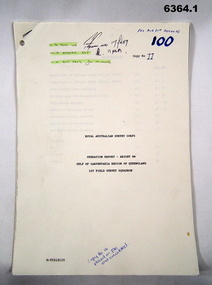
Administrative record - Royal Australian Survey Corps Report on Operation Aright 88 conducted by 1 Field Survey Squadron 1988, 1 Fd Svy Sqn, 9 Feb 1989
Comprehensive Operation Report containing all aspects of OP Aright 88 in the Gulf of Carpentaria region of Queensland. Chapters include: General Information, Operations, Operational Support, Admin and Logistics, Communications, Conclusion and Recommendations. There are four Annexes, Area of Operations, Technical Summary, Nominal Roll, Det 1 Fd Svy Sqn and Air Support Contact Details.Unbound A4 Paper Report held together by a staple top LH corner. Typed pages and diagrams. 6364.1 is copy number 11, 6364.2 is copy number 12 6364.1 is copy number 11, "FOR AIR SURVEY RECORDS" "Tech WO", "Aero Trig", "ADJ", "SGT REES for Records" 6364.2 is copy number 12 "Placed on File and circulated", "Circular Received 15 Feb 1989" on back page. royal australian survey corps, rasvy, fortuna, army survey regiment, army svy regt, asr