Showing 11161 items matching "planning "
-
 University of Melbourne, Burnley Campus Archives
Plan, Fooks Martin Sandow Pty. Ltd, V.C.A.H. Burnley Proposed Brick Paving Layout & Detail, c. 1970
Coloured plan by Fooks Martin Sandow Pty. Ltd.fooks martin sandow, burnley gardens, brick paving -
University of Melbourne, Burnley Campus Archives
Plan, Kirsten Strutt, Design for Mr & Mrs Swan 7 Gascoyne Street Canterbury 3126, c. 1990-2000
Coloured plan by Kirsten Strutt. Scale 1:100.canterbury, kirsten strutt -
University of Melbourne, Burnley Campus Archives
Plan, Student Meeting Room VCAH, 1995
Plans for Student Meeting Room - Options 1-4.amenities, students -
University of Melbourne, Burnley Campus Archives
Plan, Department of Agriculture - Victoria Burnley Gardens Hort. College Facilities, 1973-1983
Partly handdrawn plan of the horticultural facilities at Burnley Gardens.facilities, burnley gardens -
 St Patrick's Old Collegians Association (SPOCA)
Photograph - Buildings, SPJC, Exterior, 1969 Series, 8
-
University of Melbourne, Burnley Campus Archives
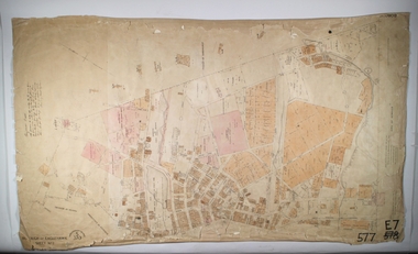
Map, Map of Showgrounds, c. 1970
Tracing paper plan with grid lines. Student project? -
 Bendigo Historical Society Inc.
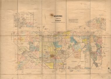
Map - JACK FLYNN COLLECTION: MARONG, June 1933
Map: Parish of Marong, County of Bendigo. Parish plan.By Authority W.M. Houston, Government Printer. Drawn and reporduced at the Dept., of Lands and Survey, Melbourne, Victoria.map, bendigo, parish plan, marong -
University of Melbourne, Burnley Campus Archives
Plan, Plan of Creswick Park - Hawthorn, c. 1970
2 Photocopies of plan showing irrigation lines. No 885.creswick park, hawthorn, webb-way irrigation system -
University of Melbourne, Burnley Campus Archives
Plan, Planting Plan, c. 1980
Planting plan with critical notes. Scale 1:250plants, gardens, planting plan, construction plan, concept plan, model drawing -
 Ballarat Heritage Services
Plan, Plan of Ballarat Police Camp
Plan of Ballarat Allotments, the Ballarat Police Camp, etc.ballarat police camp, white flat co, ballarat -
 Bendigo Historical Society Inc.
Map - BOROUGH OF EAGLEHAWK SHEET 2, 9/12/1902
Map: Borough of Eaglehawk, sheet No. 2. Parish planmap, bendigo, parish plan, borough of eaglehawk -
 Bendigo Historical Society Inc.
Map - BOROUGH OF EAGLEHAWK SHEET 2, 9/12/1902
Map: Borough of Eaglehawk, Sheet No, 2. Parish planmap, bendigo, parish plan, borough of eaglehawk -
 Bendigo Historical Society Inc.
Map - BOROUGH OF EAGLEHAWK SHEET 3, Circa 1880's
Map: Borough of Eaglehawk , sheet No. 3. Parish planmap, bendigo, parish plan, `borough of eaglhawk -
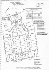 Ringwood and District Historical Society
Document - Subdivision Plan, LP17967 Part of Crown Allotment 33, Parish of Warrandyte, County of Evelyn, Vol 6141 Fol 054 - 1948
LANDATA Land Victoria plan printout dated 2008Map includes Wonga Road, Berea Avenue, Fyfe Avenue and Collett Avenue, Ringwood. Markings also include PS309215, LP143952, LP210020, LP24182, LP70960, SP29097, RP9235, SP19956 and LP113437. -
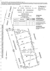 Ringwood and District Historical Society
Document - Subdivision Plan, LP40417 Part of Crown Portions 16 & 18, Parish of Ringwood, County of Mornington, Vol 6231 Fol 035 and Vol 8139 Fol 248 - 1957
LANDATA Land Victoria plan printout dated 2008Map includes Heathmont Road, Heathmont, with allotments adjoining Railway Reserve. Other markings include LP95632NS. -
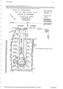
 Ringwood and District Historical Society
Document - Subdivision Plan, LP26914 Multiple Crown Allotments, Parish of Ringwood, County of Mornington, Vol 8021 Fol 053 - 1954
LANDATA Land Victoria plan printout dated 2010Part of Crown Allotments 1, 1A, 2, 3, 4, 5, 6, 7, 8, 9, 10, 55, 56, 57. Section C Crown Allotments 3, 12 & part of 2. Section B Map includes Bedford Road, Government Road (later Bedford Park Road then Hill Street), Marwarra Street and Tooronga Road, Ringwood. (Sheet 1 of 2 - Sheet 2 not included with collection). -
 Ringwood and District Historical Society
Document - Subdivision Plan, LP10477 Parish of Warrandyte, County of Evelyn, Vol 2453 Fol 574 - 1924
LANDATA Land Victoria plan printout circa 2010Part of Crown Allotment 30. Map includes Warrandyte Road, Kennedy Avenue and Wonga Road, Ringwood. Street name amended from Wonga Road to Loughnan Road 1940. Other markings include CP102182, CP171386, LP127934, PS349846, RP7582, PS309312,RP8679 and CP106336. -
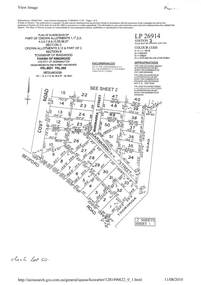
 Ringwood and District Historical Society
Document - Subdivision Plan, LP76792 Part of Crown Portions 19 & 20A, Parish of Ringwood, County of Bourke, Vol 8382 Fol 140 - 1967
LANDATA Land Victoria plan printout dated 2010Map includes Rupert Street and Prospect Court, Ringwood. -
University of Melbourne, Burnley Campus Archives
Plan, Phil Tulk, Proposed Planting Scheme Nursery Surrounds, 1997
Coloured plan by Phil Tulk 5/8/97.phil tulk, nurseries, kunzea, dianella -
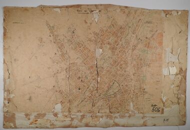 Bendigo Historical Society Inc.
Map - SANDHURST SHEETS 1 AND 2, No date visible
Map: Sandhurst sheets 1 and 2. Parish planmap, bendigo, parish plan, sandhurst -
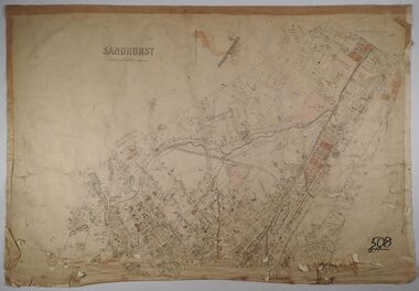 Bendigo Historical Society Inc.
Map - SANDHURST, No date Visible
Map: Parish plan showing the Northern section of the Municipalitymap, bendigo, parish plan, sandhurst -
 Bendigo Historical Society Inc.
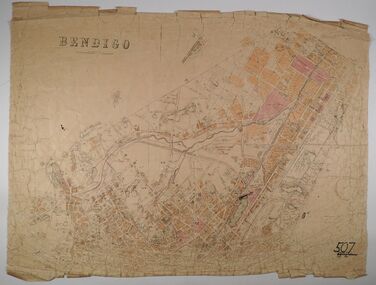
Map - BENDIGO, No date visible
Map: Parish plan showing the Northern section of the Municipalitymap, bendigo, parish plan, bendigo -
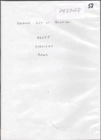 Bendigo Historical Society Inc.
Document - GREATER CITY OF BENDIGO DRAFT STRATEGY PLANS
DVD, Greater City of Bendigo Draft Strategy Plans, -
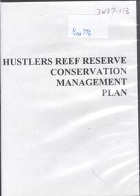 Bendigo Historical Society Inc.
Archive - HUSTLERS REEF RESERVE CONSERVATION MANAGEMENT PLAN
DVD. HUSTLERS REEF RESERVE CONSERVATION MANAGEMENT PLAN. -
Clunes Museum
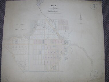
Plan - TITLE PLAN CAMPBELLTOWN, PARISH OF CAMPBELLTOWN, 1876
1 PAGE PHOTCOPY OF LAND TITLE PLANS 18752658 C 364 PARISH OF CAMPBELLTOWN COUNT OF TALBOT COMPILED BY CHARLES MCDONALS 1876campbelltown titles plan, photo-lithographic -
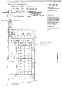 Ringwood and District Historical Society
Document - Subdivision Plan, LP23855 Part of Crown Allotment 14B, Parish of Ringwood, County of Mornington, Vol 6687 Fol 394 - 1952
LANDATA Land Victoria plan printout circa 2008Map includes Cuthbert Street, Orchard Grove, and Lowen Avenue (formerly part of Balfour Avenue), Heathmont. Other markings include SP25736, LP98835 and LP40209. Accompanying pencil sketch on light cardboard backing includes sales notations on lots 4 to 8 on Sunset Drive and Cuthbert Street and comment - Roads to be formed & E.L&W provided by vendor. -
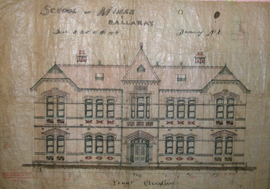 Federation University Historical Collection
Plan, Ballarat School of Mines New Classrooms (now Administration Building), 1899, 16/02/1899
In 1900 this building was described as 'handsome in design, well lit, well ventilated, commodious - containing Council room, office, chemical laboratory, mineralogical laboratory, students room and six lecture rooms. Original hand coloured plan on linen of the Ballarat School of Mines New Classrooms (in 2014 known as the Federation University Australia SMB campus Administration Building). The plan shows the front elevation, section on line, ground and 1st floor plan. Copy in black frame with cream mount.ballarat school of mines, new classrooms, administration building, architectural plans, a building -
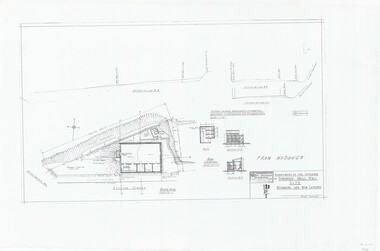 Ringwood and District Historical Society
Plan, Drill Hall Site - Design for Military Units and Miniature Rifle Range, Ringwood, Victoria - Circa 1935
Technical drawings (a) Block Plan - Ringwood Drill Hall Site, Station Street, Ringwood. (b) Plan View, End and Side Elevation, Drill Hall Wodonga - Removed to Ringwood. (c) Plan View, Front and Rear Elevations, Minature Rifle Range at Ringwood Drill Hall.Commonwealth of Australia. Department of The Interior, Works & Services Branch, Victoria. -
Port Melbourne Historical & Preservation Society
Audio - PMHPS Meeting, John THWAITES, Deputy Premier of Victoria, Glen Stuart, 28 Aug 2000
Recording of PMHPS Meeting on 25.09.2000. Recording done by Glen STUART at Port Town Hall. Speaker was John THWAITES, Planning Minister and Deputy Premier of Victoria, Minister for Planning and Health. Discussing heritage, Planning and development. Tape duration 0:35:01 including member's questionsbuilt environment, town planning, town planning, heritage, john thwaites -
University of Melbourne, Burnley Campus Archives
Plan, Circus Site, c. 1990
(1) Copy of Plan: City of Richmond City Engineers Department Circus Site: includes Descriptions of Site Preparation, Plant List and Plant Order List. (2) On tracing paper: Plant Plan. (3) On tracing paper: "Yarra Vegetation Survey - Site 3," Plant Plan(1) Handwritten on reverse, "Richmond Council - Yarra Blvd to Bridge Road."circus, survey, richmond, vegetation survey, colin mock, yarra river