Showing 11556 items matching "maps"
-
 Victorian Railway History Library
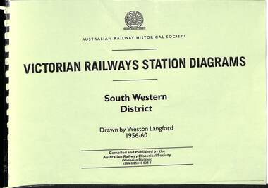
Book, Langford, Weston, Victorian Railway Station Diagrams 1956-1960 - South Western District, 1956-1960
Railway diagrams of all the stations in the South Western district of Victoria in 1956 to 1960.maps, p.76.non-fictionRailway diagrams of all the stations in the South Western district of Victoria in 1956 to 1960.railroad infrastructure - victoria, railroads - victoria -
 Victorian Railway History Library
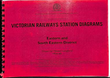
Book, Langford, Weston, Victorian Railway Station Diagrams 1956-1960 - Eastern and South Eastern District, 1956-1960
Railway diagrams of all the stations in the Eastern and South Eastern district of Victoria in 1956 to 1960.maps, p.67.non-fictionRailway diagrams of all the stations in the Eastern and South Eastern district of Victoria in 1956 to 1960.railroad infrastructure - victoria, railroads - victoria -
 Victorian Railway History Library
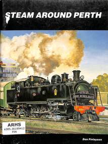
Book, Finlayson, Don, Steam Around Perth, 1986
A Pictorial history of steam locomotives working in Perth Western Australia up to the 1980s.ill, maps, p56.non-fictionA Pictorial history of steam locomotives working in Perth Western Australia up to the 1980s.steam locomotives - western australia - history, railroads - western australia - history -
 Victorian Railway History Library
Book, Joyce, John, Steam Up: A Pictorial Tribute to Steam Operation in Western Australia, 1971
A pictorial history of steam locomotives in Western Australia.ill, maps, p52.non-fictionA pictorial history of steam locomotives in Western Australia.railroads - western australia - history, steam locomotives - western australia - history -
 Victorian Railway History Library
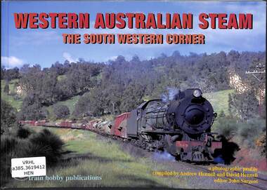
Book, Hennell, Andrew, Western Australian Steam: The South Western Corner, 2009
A pictorial history of steam locomotives in the South Western corner of Western Australia.ill, maps, p56.non-fictionA pictorial history of steam locomotives in the South Western corner of Western Australia.steam locomotives - australia - history, railroads - western australia - history -
 Victorian Railway History Library
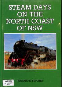
Book, Butcher, Richard. K, Steam Days on the North Coast of NSW, 1990
A history of the transition from steam to diesel on the North Coast railway to Casino in NSW.ill, maps, p80.non-fictionA history of the transition from steam to diesel on the North Coast railway to Casino in NSW.locomotives -- new south wales -- north coast -- history, railroads -- new south wales -- north coast -- history -
 Federation University Historical Collection
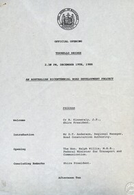
Document - Documents, Tourello: Opening of Tourello Bridge; Tourello Hunt Club, 1909; Tourello Tennis Club; Government Land Auction, 1855
Maps and typed documentstourello bridge, hunt club, tennis club, government land auctions, talbot, clunes, coghill, lenaghan, peter lalor, r. kinnersly, d.t. anderson, ralph willis, creswick -
 Stawell Historical Society Inc
Map, Lexington County of Borong 1910 & 1914, 1910
Parish to the North East of MoystonA2 Parish mapPhoto Lithographed at the Department of Lands and Survey. Melbourne by T.F. McGauran 5.12.10 & W.J. Butson 24.3.14survey -
 Monbulk RSL Sub Branch
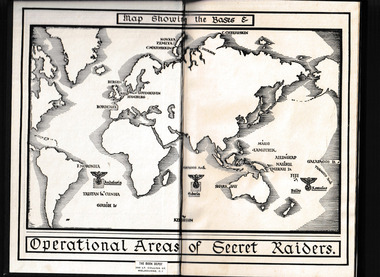
Book, William Kimber, The secret raiders : the story of the operations of the German armed merchant raiders in the Second World War, 1955
Tells the story of the operations of the German armed merchant raiders in the Second World Warmap, p.232.non-fictionTells the story of the operations of the German armed merchant raiders in the Second World Warworld war 1939 – 1945 –naval operations - germany, q-ships - germany -
Bendigo Historical Society Inc.
Map - CAMPBELL COLLECTION: BENDIGO & DISTRICT MAPS
Map. Bendigo Whipstick, Scale 40 chains to 1 inch, Forests Commission Victoria, map N0.3, legend for roads and land and forest. (number 371 in map cupboard 1)map, bendigo, country lands -
 Bendigo Historical Society Inc.
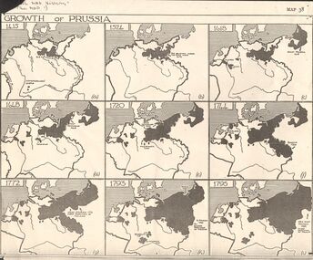
Map - GERMAN HERITAGE SOCIETY COLLECTION: GROWTH OF PRUSSIA
Photocopy of a map titled Growth of Prussia. Nine maps with the dates 1415, 1524, 1618, 1648, 1720, 1744, 1772, 1793 and 1795. Maps have letters (a) to (i) as well.map, german heritage society collection - growth of prussia-map 38 -
 Ithacan Historical Society
Photograph, Bill Florence arriving in Australia, 1922
This photograph was taken when Bill Florence (Vasilis Florias) arrived in Melbourne in 1922. Many migrants on their arrival in Australia were photographed within this backdrop. Copies of these photos were often sent to their families back in their homeland.A sepia photograph of a portrait view of a man framed within a map of Australia with the words 'Welcome To' across the top of the map. Around the map are sketches of Australian bush scenes, animals and the sea.immigration -
 Melbourne Tram Museum
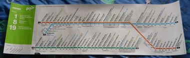
Poster, Yarra Trams, "Route poster - Yarra Trams - Routes 1, 8 and 19", 2012
... Maps ...Full colour poster printed on a vinyl plasticized based with adhesive backing sheet titled "Route poster - Yarra Trams - Routes 1, 8 and 19." Gives a map layout for the three routes, most stops, shows the Melbourne CBD, connecting services, Yarra trams logo, accessible stops. On right hand end, has the poster details and date of November 2012.trams, tramways, yarra trams, routes, maps, north coburg, moreland, toorak, south melbourne -
Whitehorse Historical Society Inc.
Map, Aerial photographs Nunawading, 1972
Department of Crown Lands and Survey, Melbourne, 1972.Department of Crown Lands and Survey, Melbourne, 1972. Project runs 34 - 39 - City of Nunawading. frames numbered from South to North boundaries, each strip numbered from West to east. The series extends further West to Box Hill and East to Ringwood than the 1970 project. No index map. Sheets 39/2 and 34/28 missing.non-fictionDepartment of Crown Lands and Survey, Melbourne, 1972.victoria. department of crown lands and survey, aerial photographs, nunawading, mitcham, blackburn, blackburn north, blackburn south, forest hill, vermont, burwood east, box hill, ringwood, vermont south -
Glenelg Shire Council Cultural Collection
Map, 1885
Significant collection relating to the social history across the shire.Map, Victoria. Skeleton map of Telegraph Circuits and Railways 1885. Scale 16 miles to 1 inch.map, skeleton map, telegraph, railways, 1885, 1880s -
Bendigo Historical Society Inc.
Map - KANGAROO FLAT, 27/.01/1932
Map: Township of Kangaroo Flat, Parish of Sandhurst, County of Bendigo ( number 148 in Map Cupboard 1)map, bendigo, township, kangaroo flat, parish of sandhurst, county of bendigo -
Bendigo Historical Society Inc.
Map - LANGWORNOR SHEET 2, 26/06/1889
Map: Langwornor sheet 2, County of Dalhousie. Parish plan ( number 173 in Map Cupboard 1)map, dalhousie, parish plan, langwornor, county of dalhousie -
Bendigo Historical Society Inc.
Map - LANGWORNOR SHEET 1, No date visible
Map: Langwornor sheet 1, County of Dalhousie. Parish plan ( number 174 in Map Cupboard 1)map, dalhousie, parish plan, langwornor, county of dalhousie -
Bendigo Historical Society Inc.
Map - RESURVEY, PARISH OF SANDHURST, 1/08/1891
Map: Resurvey , Parish of Sandhurst sheet 3. Parish plan ( number 203 in Map Cupboard 1)map, bendigo, parish plan, parish of sandhurst resurvey -
Bendigo Historical Society Inc.
Map - SANDHURST SHEET 1, No date visible
Map: Sandhurst ,County of Bendigo sheet 1. Parish plan ( number 201 in Map Cupboard 1)map, bendigo, city streets, sandhurst -
Bendigo Historical Society Inc.
Map - LANDS AVAILABLE FOR SELECTION, 6/05/1912
Map: Lands available for selection, County of Bendigo. Parish plan ( number 192 in Map Cupboard 1)map, bendigo, lands available for selection, lands available for selection, bendigo -
Bendigo Historical Society Inc.
Map - HARCOURT, No date visible
Map: Township of Harcourt, Parish pf Harcourt, County of Talbot, (number 265 in map cupboard 1)map, talbot, township, harcourt -
Bendigo Historical Society Inc.
Map - CITY OF SANDHURST RESURVEY SHEET 2, 23/05/1881
Map City of sandhurst Resurvey, sheet 2. Parish plan ( number 231 in Map Cupboard 1)map, bendigo, parish plan, sandhurst resurvey -
Bendigo Historical Society Inc.
Map - CITY OF BENDIGO RESURVEY SHEET 1, 5/06/1903
Map: City of Bendigo resurvet sheet 1. Parish plan ( number 219 in Map Cupboard 1)map, bendigo, parish plan, bendigo resurvey -
Bendigo Historical Society Inc.
Map - CITY OF BENDIGO RESURVEY SHEET NO. 3, Circa 1900
Map: City of Bendigo Resurvey sheet No. 3. Parish plan ( number 214 in Map Cupboard 1)map, bendigo, parish plan, bendigo, resurvey -
Bendigo Historical Society Inc.
Map - WELLSFORD, 4/07/1876
Map: Parish of Wellsford, County of Bendigo. Strathfieldsaye, Wellsford , Bagshot (number 311 in map cupboard 1)map, bendigo, parish plan, wellsford -
Bendigo Historical Society Inc.
Map - PARISHES OF WARRAGAMBA AND MINTO, No date visible
Map: Parishes of Warragamba and Minto,Hand draughted parish plan. (number 290 in map cupboard 1)map, parish plan, warragamba, minto -
Bendigo Historical Society Inc.
Map - KAMAROOKA ALLOTMENTS, 7/06/1894
Map: Parish of Kamarooka Allotments, County of Bendigo. Parish plan (number 288 in map cupboard 1)map, bendigo, allotments, kamarooka, allotments -
Bendigo Historical Society Inc.
Map - BRIDGEWATER, 10/09/1913
Map: Bridgewater, Parishes of Bridgewater and Inglewood, Counties of Bendigo and Gladstone (number 276 in map cupboard 1)map, bendigo, parish plan, bridgewater -
Bendigo Historical Society Inc.
Map - BAGSHOT, Circa 1878
Map: Parish of Bagshot, County of Bendigo. Parish plan (coloured) (number 329 in map cupboard 1)map, bendigo, parish plan, bagshot