Showing 31463 items
matching c.
-
 Ringwood and District Historical Society
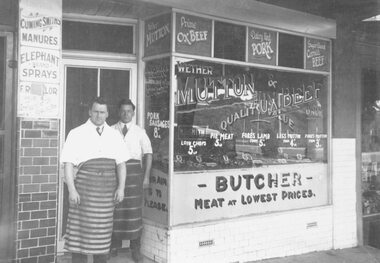
Photograph, Mr M.B. Smith, butcher, standing behind Mr. Geo Pratt, assistant, at their shop east of Adelaide Street in Whitehorse Road, Ringwood - c.1924
Written on backing sheet, "Shop Main Street. Mr. M.B. Smith - butcher. Standing in front of him is Mr.Geo Pratt, his assistant". -
 Ringwood and District Historical Society
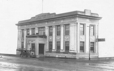
Photograph, Ringwood Town Hall - c. 1930
Written on back of photograph, "Old Town Hall". -
 Ringwood and District Historical Society
Photograph, Town Hall rooftop view of Railway station entrance, Ringwood, Vic. - c.1964
Station entrance from town hall looking east, 4 copiesPhotograph dated 1962. -
 Ringwood and District Historical Society
Photograph, Town Hall rooftop view of Railway station entrance, Ringwood, Vic. - c.1964
Ringwood railway station taken from town hall, Ringwood Cycles, CE Carter.Photograph dated "1962" -
 Ringwood and District Historical Society
Photograph, Ringwood Town Hall - c. 1930
Town hall, adjacent buildings blank outWritten on backing sheet, "1927". -
 Ringwood and District Historical Society
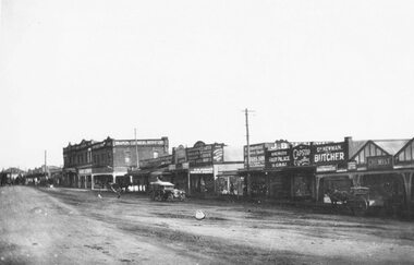
Photograph, Maroondah Highway Ringwood - c.1923
North side of Maroondah Highway, Ringwood, west of Warrandyte Road. Shops in foreground later redeveloped as the site of Safeway supermarket then Officeworks office supplies outlet, prior to Eastland Shopping Centre expansion to fill the corner site in 2015.Typed below photograph, "Maroondah Highway Ringwood 1923. Shops in foreground (later) Safeway and Eastland car park". Second copy contradicts this date, stating photograph taken in 1927. -
 Ringwood and District Historical Society
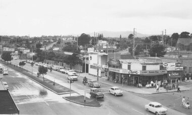
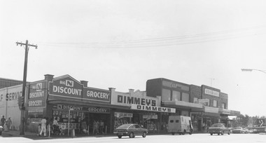
Photograph, Shops on the north-east corner of Melbourne Street and Maroondah Highway, Ringwood - c.1970
Black and white photograph of shops. Shops in photograph are "Big N Discount Grocery, Dimmey's, ANZ Bank, Sound and Camera" Safeway roof can be seen in the distance. -
 Ringwood and District Historical Society
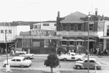
Photograph, State Savings Bank extension, photographed from coolstore roof, Maroondah Highway, Ringwood - c.1960
Written on backing sheet, "Extension of bank. Photo taken from roof of coolstore". -
 Ringwood and District Historical Society
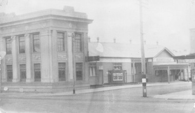
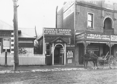
Photograph, Post Office and commercial buildings, Maroondah Highway, Ringwood - c.1920
Written on backing sheet, "Main Street, Ringwood, second post office, Frank Parker's - later Mayor and Ellis agent". -
 Ringwood and District Historical Society
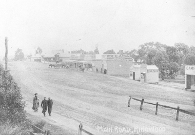
Photograph, Image of central Ringwood, including E.S. & A. Bank - Ringwood's first bank, Maroondah Highway, Ringwood - c.1910
Written on photograph, "Main Road, Ringwood". Date varies between photographs - most labelled 1910. Postcard indicates that the E.S. & A. Bank was the first bank in Ringwood. -
 Ringwood and District Historical Society
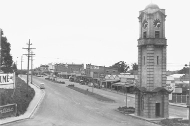
Photograph, Postcard view of the clocktower and main street from the railway bridge above Warrandyte Road and Maroondah Highway, Ringwood - c.1930
Typed below photograph, "Shops on right now Safeway site - c1930". Written on backing sheet of one photograph, "Original site of Ringwood Memorial Clocktower. Intersection Maroondah Highway and Warrandyte Rd." -
 Ringwood and District Historical Society
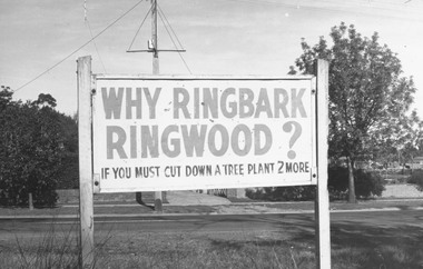
Photograph, "Why Ringbark Ringwood?" Council signs located at various sites around Ringwood in a drive to retain trees in the area - c.1960s
Typed below photograph, 'Council signs around Ringwood in a drive to retain trees of area.' -
 Ringwood and District Historical Society
Photograph, Aerial photo of Cherrydene Estate in foreground off Oban Rd, Ringwood - c.1967
Written on back of photograph, "Aerial photo of Cherry Dene Estate in foreground, c1967 off Oban Rd." -
 Ringwood and District Historical Society
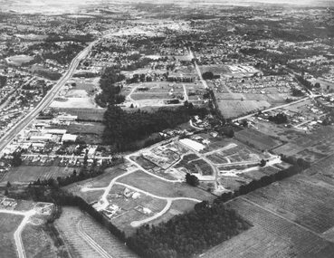
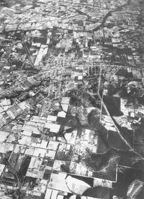
Photograph, Aerial view of Park Orchards and Ringwood - c.1960
Catalogue card reads, "Aerial view of Ringwood". -
 Ringwood and District Historical Society
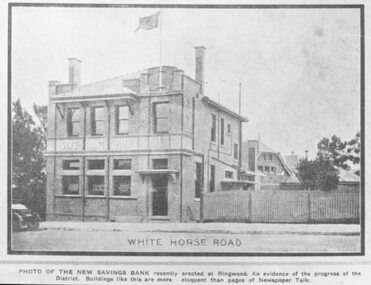
Photograph, Land sale brochure image of the State Savings Bank of Victoria branch and manager's residence, Maroondah Highway, Ringwood - c. 1920s
Typed below photograph, "White Horse Road" and statement underneath reads, "Photo of the new Savings Bank recently erected at Ringwood. An evidence of the progress of the District. Buildings like this are more eloquent than pages of Newspaper Talk." -
 Ringwood and District Historical Society
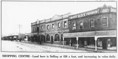
Photograph, Land sale brochure image of shopping centre frontages west of Adelaide Street, Maroondah Highway, Ringwood - c. 1920s
Typed below photograph, "Shopping Centre - Land here is selling at fifty pounds a foot, and increasing in value daily". -
 Ringwood and District Historical Society
Photograph, Land sale brochure image of shopping centre frontages along Maroondah Highway at Melbourne Street, Ringwood - c. 1920s
Written on back of photograph, "Land values - Main Street, Ringwood - land worth fifty pounds a foot". -
 Ringwood and District Historical Society
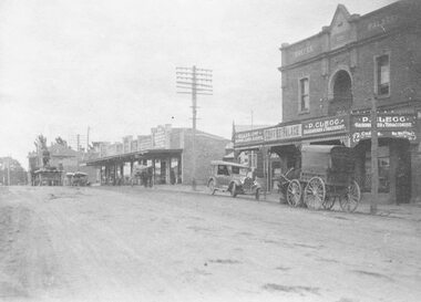
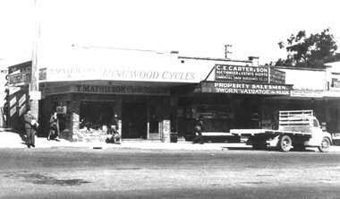
Photograph, Main Street Ringwood, probably early 1950s, T Mathieson Cycles, C Carter to right
Main St. Ringwood. Ringwood Cycles now site of Commercial Bank of Sydney -
 Ringwood and District Historical Society
Photograph, View towards library in Warrandyte Road being built, across creek. c.1969. Two photographs
Written on back of photograph, "View towards library being built, across creek." -
 Ringwood and District Historical Society
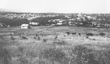
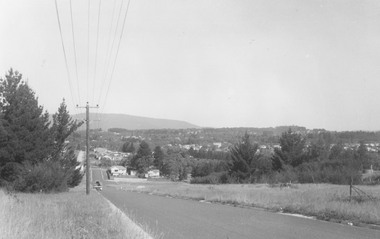
Photograph, View from Loughnan's Hill looking south east - c.1946
View from Loughnan's Hill looking south east - 1946. Written on back of photograph, "Smoke on left from Bamford's Timber Yard". -
 Ringwood and District Historical Society
Photograph, View from Loughnan Rd. looking south east over Harrison Street/Andrew Street corner, c.1949
Black and white photograph showing some vacant land and new houses under construction. Developed area in background. (3 copies)Typed below photograph, "View from Loughnan Rd. looking south east, 1949". Written on backing sheet, "View from Loughnan Rd. to corner Harrison and Andrew Street, c1949". -
 Ringwood and District Historical Society
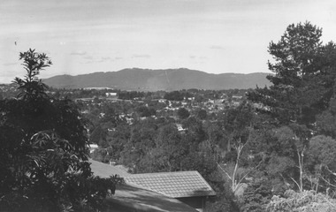
Photograph, Looking east from Loughnan Road across William & Andrew Streets c.1946
Looking east from Loughnan Road across William & Andrew Streets 1946 -
 Ringwood and District Historical Society
Photograph, Two photos of Panfield Estate, owned by Vic Hunter sold by Miles & Co. - view from Panfield Avenue looking to Mullum Road, c.1963-65
Two photos - various inscriptions. "This (first) photo is RHS partner of V15" "Panfield Estate 1960. Panfield Ave. to Mullum Rd." "1965. Panfield Estate owned by Vic Hunter sold by Miles & Co." and second photo has written below photograph,"This photo is LHS partner of V11". Written on backing sheet,"Panfield Estate looking to Mullum Rd, 1963". -
 Ringwood and District Historical Society
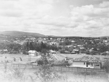
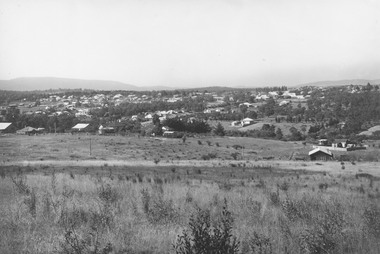
Photograph, View overlooking Ringwood from cnr Pine and Panorama, Loughnan Hill - c.1973-74
Inscriptions on backing sheets read, "1973 - from corner Pine and Panorama" and "Ringwood from Loughnan Hill, 1974". -
 Ringwood and District Historical Society
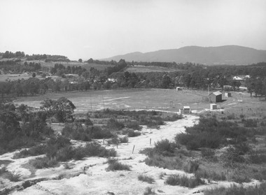
Photograph, East Ringwood oval c.1928
Typed below photograph, "View of East Ringwood oval from present site of Civic Centre. Mt. Dandenong Rd. on right - 1935". Catalogue card reads, "Suggest this photo is taken early 1920s.... E.R.F.C. was established approx. 1928. Prior to this the Ringwood F.C. played on the oval". -
 Ringwood and District Historical Society
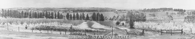
Photograph, Dublin Rd. Station Estate brochure. c.1923
Printed on picture, "Dublin Rd. Station Estate" . Written below picture, "c1923". -
 Ringwood and District Historical Society
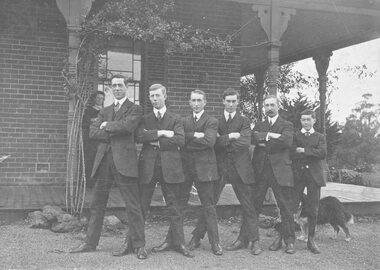
Photograph, Miles family members c.1909 - Arthur, Tom, Syd, Raoul, A.T., Keith. Mrs. E. T. Miles on veranda. (Remaining son E. Leslie Miles not in photo)
Written on backing sheet, "Arthur, Tom, Syd, Raoul, A.T., Keith. Mrs. E. T. Miles on veranda. (Remaining son E. Leslie Miles not in photo)". -
 Ringwood and District Historical Society
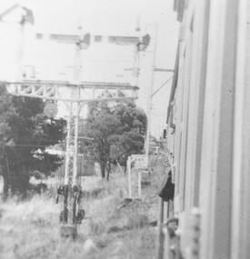
Photograph, Ringwood railway station precinct. Easterly view from train approaching north platform from Melbourne c.1948
Typed on accompanying sheet, "...shows the three arms of a disc of the arrival signals from Melbourne. I took this picture about 1948". -
 Ringwood and District Historical Society
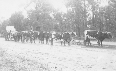
Photograph, Bullock team in Bedford Road opposite later site of Ringwood High School. c.1890
Typed below photograph, "Bedford Road, opposite present High School about 1890". Another copy dates the photograph as 1923 and another copy states on the backing sheet, "Hussey of South Warrandyte, 1924. Used in and around Ringwood". -
 Ringwood and District Historical Society
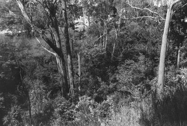
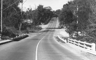
Photograph, Two photos taken at Deep Creek Road bridge c.1973
Typed below photograph, "Deep Creek Road bridge..."