Showing 8571 items matching "park road"
-
 Koroit & District Historical Society
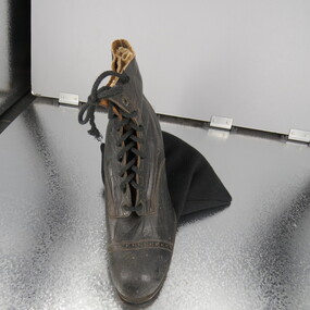
Button-up boot
-
 Koroit & District Historical Society
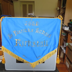
Kirkstall's St Patrick's School Banner
This was the banner used on sports days. -
 Koroit & District Historical Society
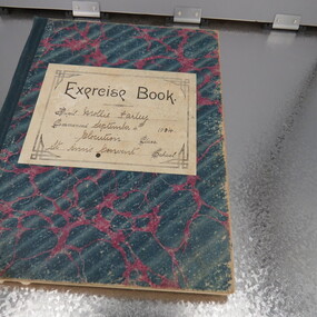
Class book
Class book of Mollie Farley from St Ann's Convent Warrnambool -
 Koroit & District Historical Society
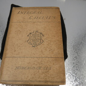
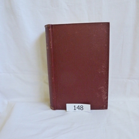
Integral Calculus by Homersham Cox
-
 Koroit & District Historical Society
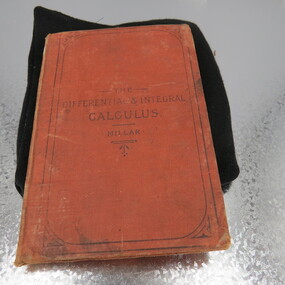
The Differential and Integral Calculus by Millar
-
 Koroit & District Historical Society
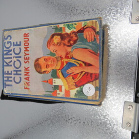
The Kings Choice (Class book)
Miss Fulton's Post Office Lending Library -This book was placed in our hygienic steriliser since last read... -
 Koroit & District Historical Society
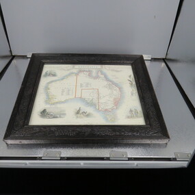
Framed Map of Australia
-
 Koroit & District Historical Society
Australia Day Achievement Medals
-
 Koroit & District Historical Society
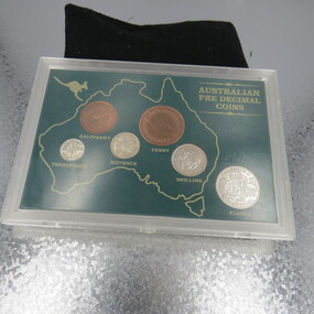
Pre decimal coins
-
 Koroit & District Historical Society
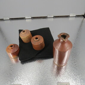
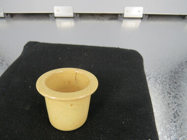
Ink Wells
-
 Koroit & District Historical Society
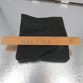
rulers
-
 Koroit & District Historical Society
Compass
-
 Koroit & District Historical Society
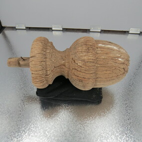
Acorn finial
-
 Koroit & District Historical Society
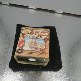
Bicentenary tea tin
-
 Koroit & District Historical Society
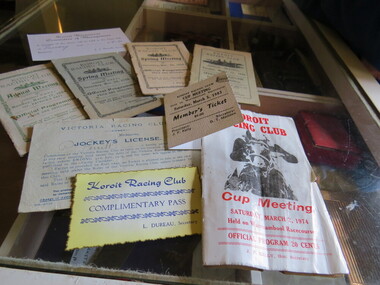
Racing Memorabilia
-
 Koroit & District Historical Society
Class books
-
 Koroit & District Historical Society
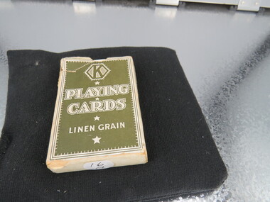
Playing cards
-
 Koroit & District Historical Society
Ink Wells
-
 Koroit & District Historical Society
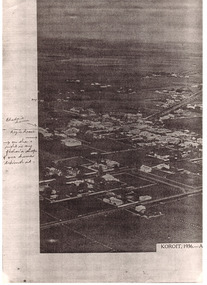
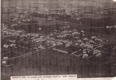
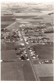
Koroit aerial shot
PAR0001 to PAR0003 Photocopy of a black and white photograph. Aerial photograph of Koroit 1936. Writing would probably be by Rhoda Hindhaugh formerly Stevenson nee Barr. Souvenir aerial photograph taken by The Argus newspaper 1936. The buildings have been named in pen entered at a later date. -
 Koroit & District Historical Society
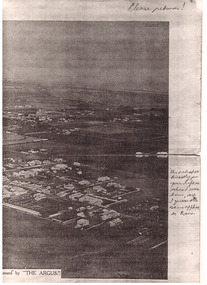
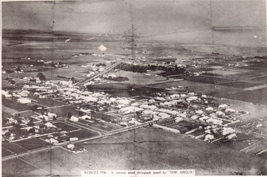
Koroit aerial shot
-
 Koroit & District Historical Society
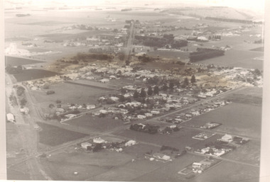
Koroit aerial shot
Photograph hanging in chambers at Koroit libraryBlack and white photograph copy of originalKoroit Vic. July 1985 Ian Oswald-Jacobs -
 Koroit & District Historical Society
Koroit aerial shot
-
 Phillip Island and District Historical Society Inc.
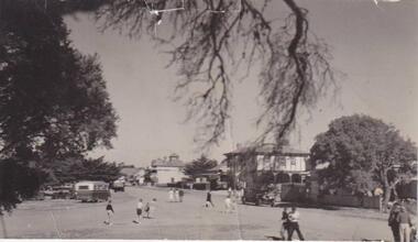
Photograph, San Remo
Broad view of The Esplanade beneath an overhanging branch of tree, looking at hotels and shops. On the right is a large bush to the left a large tree. A bus, car and truck are parked to left and unidentifiable figures of people walking to and fro across the road.Esplanade, San Remolocal history, photographs, san remo, black & white photograph, mona condrick -
 Mortlake and District Historical Society
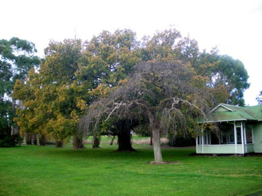
Queen Victoria's Oak Tree
This magnificent English oak tree is located at Tea Tree Lake park in Mortlake. This park was formerly the Botanic Gardens which were developed on what had been swamp land. An artificial lake was created there in 1988 as a Bi-Centenary project.The tree is located adjacent to the historic Montgomery Pavillion and was planted on the occasion of Her Majesty Queen Victoria's birthday on 24th May 1883. An outstanding tree, planted to commemorate a much-revered Queen in an historically-significant Botanic Gardens (now much altered). A very old oak tree planted 1883. queen victoria, mortlake, mortlake botanic gardens, tea tree lake, montgomery pavillion -
 Greensborough Historical Society
Book, Angus & Robertson Ltd, Official History of Australia in the War of 1914-18; by C. E. W. Bean. 8th edition, 1938_
The official history of Australia in WW1 written by C. E. W. Bean12 volumes. Hard cover, dark red binding. Maps and black and white illustrationsPresented to James Gordon Saunders Longfellow St Norman Park Q July 1950c e w bean, world war i, australia army, gallipoli -
 Greensborough Historical Society
Folder, Aerial Imaging - Plenty River: by Ian Bryant, 2011_11
Investigates early land use along the Plenty River from north of the main aqueduct crossing in Greensborough to south of the golf course in Lower PlentyHistorical features seen from aerial and satellite images of the modern landscape may indicate earlier agricultural land usage.9 x A4 pages of text and colour annotated maps downloaded from nearmap.com.plenty river, ian bryant, lower plenty, greensborough, yallambie park, aerial photography -
 Greensborough Historical Society
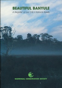
Book, Beautiful Banyule: by Carol Toomey, 1999_
A record of reserves and their features in the City of Banyule 1999. Full title: Beautiful Banyule: a register of out city's natural assets.A register of Banyule's natural assets104 pages, colour illustrations.Soft cover with treed skyline on front cover. 2 copies.Library labels.city of banyule, parks banyule, gardens banyule, historical sites banyule. -
 Greensborough Historical Society
Book, Nillumbik Shire Council, 1997 Community Guide Nillumbik, 1997_
Guide to services provided by Nillumbik Shire Council. Nillumbik Shire is located 25 kilometres north-east of Melbourne and the southern boundary is the Yarra River. The south of Nillumbik is predominantly urban, with commercial centres at Eltham and Diamond Creek. The north of the municipality includes significant natural features like Kinglake National Park and Sugarloaf ReservoirAnnual guide to services in Nillumbik. 64 pages. Cover is pale yellow with colour drawings. nillumbik shire council, handbooks