Showing 3221 items
matching road map
-
 Whitehorse Historical Society Inc.
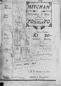
Document, Mitcham, ca 1920
Brochure for auction of 70 sites bounded by Mitcham, Doncaster East and Whitehorse Roads on 1 May ?1920.Brochure for auction of 70 sites bounded by Mitcham, Doncaster East and Whitehorse Roads on 1 May ?1920. Agents: T.R.B. Morton & Sons, Coghill & Haughton.|The home/hospital shown on brochure in Harrison Street near Mitcham Road owned by Dr Drake and later Dr Cochrane was called 'Coombe-Wood'Brochure for auction of 70 sites bounded by Mitcham, Doncaster East and Whitehorse Roads on 1 May ?1920.auctions, doncaster east road, mitcham, whitehorse road, mitcham road, mcdowall street, burnett street, t.r.b. morton & son, coghill & haughton, william street, harrison street, drake, francis, john, dr -
 Whitehorse Historical Society Inc.
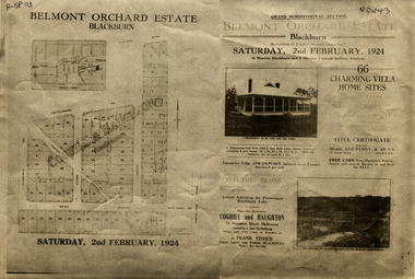
Document, Belmont Orchard Estate, 1924
Brochure for auction of Belmont Orchard Estate, BlackburnBrochure for auction of Belmont Orchard Estate, Blackburn, (now Nunawading) 66 sites, 2 February 1924. Agents: Coghill & Haughton, Frank Fisher.Brochure for auction of Belmont Orchard Estate, Blackburnauctions, belmont orchard estate, patterson street, nunawading, central road, joyce street, lilian street, west avenue -
![Brochure for auction of Eastdawn Estate, Mitcham, 70 lots [20 February 1915]](/media/collectors/56f368632162f118acbff12e/items/60d923316e5f99545134e472/item-media/60d9477c6e5f995451350fb8/item-fit-380x285.jpg) Whitehorse Historical Society Inc.
Whitehorse Historical Society Inc.Document, Eastdawn Estate, 1915
Brochure for auction of Eastdawn Estate, Mitcham, 70 lots [20 February 1915]Brochure for auction of Eastdawn Estate, Mitcham, 70 lots [20 February 1915]. Agents Coghill & Haughton.Brochure for auction of Eastdawn Estate, Mitcham, 70 lots [20 February 1915]auctions, eastdawn estate, mother foster's estate, mitcham road, mitcham, orient avenue, hull parade, vernal avenue -
 Whitehorse Historical Society Inc.
Document, Particulars of maintainance works, 1933
... Financial documents Maps Burwood Road Healesville Road Whitehorse ...Shire of Blackburn and Mitcham - particulars of maintenance works carried out under the maintenance grant for the year ending 30 Jun 1933 and map showing work on the Main Healesville Road and Main Burwood Road.Shire of Blackburn and Mitcham - particulars of maintenance works carried out under the maintenance grant for the year ending 30 Jun 1933 and map showing work on the Main Healesville Road and Main Burwood Road.Shire of Blackburn and Mitcham - particulars of maintenance works carried out under the maintenance grant for the year ending 30 Jun 1933 and map showing work on the Main Healesville Road and Main Burwood Road.local government, shire of blackburn and mitcham, financial documents, maps, burwood road, healesville road, whitehorse road -
Whitehorse Historical Society Inc.
Document, Eastern Freeway Extension, 2000 - 2002
Eastern Freeway ExtensionEastern Freeway Extension- Cost estimates for community consultation option Public consultation process : report on analysis submissions Deep Creek Road - Landscape concept Media Release from Premier of Victoria VicRoads - Works update newsletters Whitehorse City Council minutes VicRoads Correspondence Schwerkolt Cottage Precinct - Concept Plan VicRoads maps.Eastern Freeway Extensioneastern freeway extension, vicroads, victoria. department of infrastructure, city of whitehorse, schwerkolt cottage, landscape planning, maps -
Whitehorse Historical Society Inc.
Map, Map of Mitcham, Tunstall and Blackburn, c1937
... , Whitehorse Road, Mitcham Map of Mitcham, Tunststall and Blackburn ...Map of Mitcham, Tunststall and Blackburn showing the location of T.M. McDonnell, real estate agent, Whitehorse Road, MitchamMap of Mitcham, Tunststall and Blackburn showing the location of T.M. McDonnell, real estate agent, Whitehorse Road, MitchamMap of Mitcham, Tunststall and Blackburn showing the location of T.M. McDonnell, real estate agent, Whitehorse Road, Mitchammaps, mcdonnell, t.m. -
Whitehorse Historical Society Inc.
Map, Box Hill in 1883, c1933
... Whitehorse Historical Society Inc. 2-10 Deep Creek Road ...Map of Box Hill in 1883 showing churches, hotels, etc, linked to ND 4231 '1933 map'Map of Box Hill in 1883 showing churches, hotels, etc, linked to ND4231 '1933 map'Map of Box Hill in 1883 showing churches, hotels, etc, linked to ND 4231 '1933 map'maps, box hill -
Whitehorse Historical Society Inc.
Map, Map of Mont Albert, Box Hill, Surrey Hills and Blackburn, c 1933
... Whitehorse Historical Society Inc. 2-10 Deep Creek Road ...Map of Box Hill and Surrounds, showing location of Box Hill Grammar School.Map of Box Hill and Surrounds, showing location of Box Hill Grammar School.Map of Box Hill and Surrounds, showing location of Box Hill Grammar School.maps, box hill grammar school -
Whitehorse Historical Society Inc.
Map, Nunawading, 1966
... Whitehorse Historical Society Inc. 2-10 Deep Creek Road ...Nunawading's boundaries, schools, topography and railwaysNunawading's boundaries, schools, topography and railwaysNunawading's boundaries, schools, topography and railwaysmaps, city of nunawading, schools -
Whitehorse Historical Society Inc.
Map, Blackburn and Doncaster, 1950, 1950
... , Main Road, Doncaster. Blackburn and Doncaster, 1950 Map Map ...Map of part of Blackburn and Doncaster from Morgan's Street Directory, 1950. Advertisement for G.S. Grover, Real Estate Agent, Main Road, Doncaster.Map of part of Blackburn and Doncaster from Morgan's Street Directory, 1950. Advertisement for G.S. Grover, Real Estate Agent, Main Road, Doncaster.Map of part of Blackburn and Doncaster from Morgan's Street Directory, 1950. Advertisement for G.S. Grover, Real Estate Agent, Main Road, Doncaster.maps, blackburn, grover, g.s., doncaster -
Whitehorse Historical Society Inc.
Map, Nunawading - Bromide
... Whitehorse Historical Society Inc. 2-10 Deep Creek Road ...Map of the City of Nunawading indicating suburbs - marked 'Bromide'Map of the City of Nunawading indicating suburbs - marked 'Bromide'Map of the City of Nunawading indicating suburbs - marked 'Bromide'maps, city of nunawading -
Whitehorse Historical Society Inc.
Map, Nunawading - Deep Creek, 1868
... Whitehorse Historical Society Inc. 2-10 Deep Creek Road ...Map of Nunawading - Deep Creek area On verso: Copy of map with letter to Minister of Lands and Works. 1868 [ND 933]Map of Nunawading - Deep Creek area On verso: Copy of map with letter to Minister of Lands and Works. 1868 [ND933]Map of Nunawading - Deep Creek area On verso: Copy of map with letter to Minister of Lands and Works. 1868 [ND 933]maps, mitcham -
Whitehorse Historical Society Inc.
Map, Today's map of Mitcham, Nunawading, Blackburn, 1957
... Whitehorse Historical Society Inc. 2-10 Deep Creek Road ...Folded detailed map of Mitcham, Nunawading, BlackburnFolded detailed map of Mitcham, Nunawading, BlackburnFolded detailed map of Mitcham, Nunawading, Blackburnmaps, mitcham, nunawading, blackburn, burwood east, forest hill, vermont -
Whitehorse Historical Society Inc.
Map, State Savings Bank of Victoria, 1921
... Whitehorse Historical Society Inc. 2-10 Deep Creek Road ...Map of Box Hill, Blackburn and Tunstall, 1921 from Australian Guide and Business Directory showing site of Box Hill branch of State Savings Bank of Victoria.Map of Box Hill, Blackburn and Tunstall, 1921 from Australian Guide and Business Directory showing site of Box Hill branch of State Savings Bank of Victoria.Map of Box Hill, Blackburn and Tunstall, 1921 from Australian Guide and Business Directory showing site of Box Hill branch of State Savings Bank of Victoria.maps, box hill, blackburn, state savings bank of victoria -
Whitehorse Historical Society Inc.
Map, Street Index refer to D76 map, 1993
... Whitehorse Historical Society Inc. 2-10 Deep Creek Road ...List of street names in alphabetical orderList of street names in alphabetical orderList of street names in alphabetical ordermaps, city of nunawading -
Whitehorse Historical Society Inc.
Pamphlet, Neighbourhood activity in Nunawading, 1977
... Whitehorse Historical Society Inc. 2-10 Deep Creek Road ...An attempt by the E.R.E.C. / ACCESS Community Education Project to increase the awareness of community activity and involvement in the municipality.An attempt by the E.R.E.C. / ACCESS Community Education Project to increase the awareness of community activity and involvement in the municipality. Includes maps of region showing community centres etc.An attempt by the E.R.E.C. / ACCESS Community Education Project to increase the awareness of community activity and involvement in the municipality. city of nunawading, east burwood recreation association, north blackburn community action group, vermont south community association, libraries, social services, emergency services -
Whitehorse Historical Society Inc.
Document - Report, Frank Isaac White, 01/06/1997
Photocopy of a Luther Collage assignment on visits to war memorials and an investigation of Frank Isaac White, a name on the Mitcham War Memorial. White served in Egypt and France,. Maps show the route of his journeys including a period in hospital in England. Information is given about soldiers living conditions and his role as a artillery man. He was killed in Belgium on 20th September 1917 and buried in the Menin Road South Cematery at Ypres. Photographs of the cemetary are included and of his grave.white, frank isaac, menin road south military cemetry, ww1, war memorials -
Whitehorse Historical Society Inc.
Document, Historical maps and plans, 1855 1889
... Whitehorse Historical Society Inc. 2-10 Deep Creek Road ...Copy of catalogue of historical maps and plans - Crown Lands DepartmentCopy of catalogue of historical maps and plans - Crown Lands DepartmentCopy of catalogue of historical maps and plans - Crown Lands Departmentmaps, historical maps -
Whitehorse Historical Society Inc.
Map, Map of the City of Nunawading, c1960, c1960
Map of the City of Nunawading prepared by Drake & Co, Real Estate Agents in about 1960.city of nunawading, drake & co, maps -
Whitehorse Historical Society Inc.
Map, Broadbents map no 230, To and from Clifford Park, c1955
... Whitehorse Historical Society Inc. 2-10 Deep Creek Road ...Map - To and From Clifford Park by Broadbents 1955 - 56 prepared for a scout jamboree.maps, eastern suburbs (melbourne), scout groups -
Whitehorse Historical Society Inc.
Document, Letter from Glyn France with enclosures, 1993
Letter to Nunawading Historical Society from Glyn France with information on Schwerkolt Family with enclosures: 2 maps showing Frankfurt and Neudorgel; Domestic Personal service book and translation by Dr Ursula Halls; Marriage Certificate (August & Pauline Richter) 1850. Proceedings before coroner 9 Sep 1867; Letter from Alf Antonio to the Age re local schools.schwerkolt, paulina, marriage certificates, domestic personal service book, schwerkolt, johann august, richter, paulina, nunawading north primary school, antonio, alfred, halls, ursula, mitcham primary school, no. 2904, sweeney, john -
 Whitehorse Historical Society Inc.
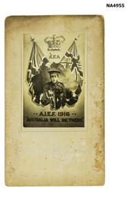
Photograph - A.I.E.F. 1916 Recruitment poster, 1916
Cardboard poster with recruiting photo of a crown with A F A flanked by two union flags. Flags with a map of Australia with soldiers in front.A.I.F.1916 Australia will be there underneath. R McGeehan-photographer The Central Studio Elm Grove Ripponlea MelbA.I.E.F. 1916 Australia will be therephotography, photographs / slides / film -
 Whitehorse Historical Society Inc.
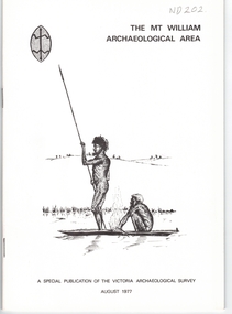
Document, Mt William Archaelogical Area, 1/08/1977 12:00:00 AM
Booklet issued by the Victorian Archaelogical Survey describing an abouiginal axe quarry at Mt William near Lancefield. The history of the site is described as is the archaelogical evidence.Booklet issued by the Victorian Archaelogical Survey describing an abouiginal axe quarry at Mt William near Lancefield. The history of the site is described as is the archaelogical evidence. A section describes the importance of axes in aboriginal culture. Map, illustrations.Booklet issued by the Victorian Archaelogical Survey describing an abouiginal axe quarry at Mt William near Lancefield. The history of the site is described as is the archaelogical evidence. aborigines, stone axes, mount william -
 Whitehorse Historical Society Inc.
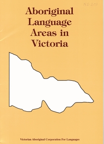
Document, Aboriginal language areas in Victoria, 1/07/1996 12:00:00 AM
Listing of all aboriginal languages spoken in Victoria.The distinction between language and dialect id discussed. Map, bibliagraphy.aborigines, aboriginal languages -
 Whitehorse Historical Society Inc.
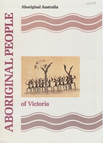
Book, Aboriginal People of Victoria, 1990
Illustrated booklet describing Aboriginal life from pre-contact times to the present day. Illustrations (some coloured).Illustrated booklet describing Aboriginal life from pre-contact times to the present day. Illustrations (some coloured). Map. Bibliography.Illustrated booklet describing Aboriginal life from pre-contact times to the present day. Illustrations (some coloured). aborigines, booklet -
Whitehorse Historical Society Inc.
Map, Bruce, 1989
Map of the Commonwealth Electoral Division of BruceMap of the Commonwealth Electoral Division of BruceMap of the Commonwealth Electoral Division of Bruceelectoral boundaries, bruce (commonwealth electoral division) -
Whitehorse Historical Society Inc.
Map, Chisholm, 1989
Map of the Commonwealth Electoral Division of Chisholm. Scale 1:25,000.Map of the Commonwealth Electoral Division of Chisholm. Scale 1:25,000.Map of the Commonwealth Electoral Division of Chisholm. Scale 1:25,000.electoral boundaries, chisholm (commonwealth electoral division) -
Whitehorse Historical Society Inc.
Map, Deakin, 1989
Map of the Commonwealth Electoral Division of Deakin. Scale 1:25000.Map of the Commonwealth Electoral Division of Deakin. Scale 1:25000.Map of the Commonwealth Electoral Division of Deakin. Scale 1:25000.electoral boundaries, deakin (commonwealth electoral division) -
Whitehorse Historical Society Inc.
Map, Deakin, 1977
Map of the Commonwealth Electoral Division of Deakin. Scale 1: 25,000.Map of the Commonwealth Electoral Division of Deakin. Scale 1: 25,000.Map of the Commonwealth Electoral Division of Deakin. Scale 1: 25,000.electoral boundaries, deakin (commonwealth electoral division), australia. parliament -
Whitehorse Historical Society Inc.
Map, Proposed suburb names, 1999
Whitehorse City Council: proposed suburb names and boundaries. Version 3.1Whitehorse City Council: proposed suburb names and boundaries. Version 3.1Whitehorse City Council: proposed suburb names and boundaries. Version 3.1city of whitehorse, suburb names