
Showing 2198 items matching "wests road"
-
 Whitehorse Historical Society Inc.
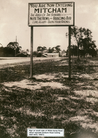
Photograph - Black and white photograph, Whitehorse Road Sign Mitcham, C1940s
... Road, Mitcham, looking east. Early 1940s. Note in 1870 the area was known as Air Hill. Center of shot shows shop on west side of what later became Alexander Street and further east house on the corner of Peel Street. ...Road, Mitcham, looking east. Early 1940s. Note in 1870 the area was known as Air Hill. Center of shot shows shop on west side of what later became Alexander Street and further east house on the corner of Peel Street. ...Sign on south side of Whitehorse Road opposite Dunlavin Road, Mitcham, looking east. Early 1940s. Note in 1870 the area was known as Air Hill. Center of shot shows shop on west side of what later became Alexander Street and further east house on the corner of Peel Street. These signs are very similar to those erected in nearby Vermont.advertising signs, whitehorse road, mitcham, dunlavin road -
 Whitehorse Historical Society Inc.
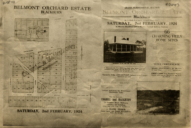
Document, Belmont Orchard Estate, 1924
... road...joyce street...lilian street...west...Original in 'Haughton Maps', La Trobe Library auctions belmont orchard estate patterson street nunawading central road joyce street lilian street west avenue Brochure for auction of Belmont Orchard Estate, Blackburn Brochure for auction of Belmont Orchard Estate, Blackburn, (now Nunawading) 66 sites, 2 February 1924. ...Brochure for auction of Belmont Orchard Estate, BlackburnBrochure for auction of Belmont Orchard Estate, Blackburn, (now Nunawading) 66 sites, 2 February 1924. Agents: Coghill & Haughton, Frank Fisher.Brochure for auction of Belmont Orchard Estate, Blackburnauctions, belmont orchard estate, patterson street, nunawading, central road, joyce street, lilian street, west avenue -
 Kew Historical Society Inc
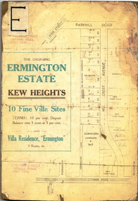
Plan - Subdivision Plan, 10 Fine Villa Sites: Ermington Estate, Kew Heights, ca. 1917
... west side of Hillcrest Avenue. In the plan, the latter is named as ‘Hill Crest Avenue’. The plan indicates that the subdivision was based on the surveying work of Johnson & Tait. Opposite Ermington, the existing house ‘Parkhill’ is identified. A faded stamp on two parts of the plan indicates that it was in the possession of Jas. [R.] Mathers, Financial Agent, [136] Cotham Road...west side of Hillcrest Avenue. In the plan, the latter is named as ‘Hill Crest Avenue’. The plan indicates that the subdivision was based on the surveying work of Johnson & Tait. Opposite Ermington, the existing house ‘Parkhill’ is identified. A faded stamp on two parts of the plan indicates that it was in the possession of Jas. [R.] Mathers, Financial Agent, [136] Cotham Road ...Pru Sanderson, in her groundbreaking ‘City of Kew Urban Conservation Study : Volume 2 - Development History’ (1988), summarised the periods of urban development and subdivisions of land in Kew. The periods that she identified included 1845-1880, 1880-1893, 1893-1921, 1921-1933, 1933-1943, and Post-War Development. These periods were selected as they represented periods of rapid growth or decline in urban development. An obvious starting point for Sanderson’s groupings involved population growth and the associated economic cycles. These cycles also highlighted urban expansion onto land that was predominantly rural, although in other cases it represented the decline and breakup of large estates. A number of the plans in the Kew Historical Society’s collection can also be found in other collections, such as those of the State Library of Victoria and the Boroondara Library Service. A number are however unique to the collection.The Kew Historical Society collection includes almost 100 subdivision plans pertaining to suburbs of the City of Melbourne. Most of these are of Kew, Kew East or Studley Park, although a smaller number are plans of Camberwell, Deepdene, Balwyn and Hawthorn. It is believed that the majority of the plans were gifted to the Society by persons connected with the real estate firm - J. R. Mathers and McMillan, 136 Cotham Road, Kew. The Plans in the collection are rarely in pristine form, being working plans on which the agent would write notes and record lots sold and the prices of these. The subdivision plans are historically significant examples of the growth of urban Melbourne from the beginning of the 20th Century up until the 1980s. A number of the plans are double-sided and often include a photograph on the reverse. A number of the latter are by noted photographers such as J.E. Barnes.In November 1917, the Ermington Estate was advertised as an ‘Executor’s Sale’. It included the 10-roomed villa residence, ‘Ermington’, home of the late Mrs. Lorimer, and 10 ‘magnificent allotments’. The plan in the Kew Historical Society Collection is a little more specific. Ermington is described as having 9 Rooms &c. and there are 11 lots shown on the west side of Hillcrest Avenue. In the plan, the latter is named as ‘Hill Crest Avenue’. The plan indicates that the subdivision was based on the surveying work of Johnson & Tait. Opposite Ermington, the existing house ‘Parkhill’ is identified. A faded stamp on two parts of the plan indicates that it was in the possession of Jas. [R.] Mathers, Financial Agent, [136] Cotham Road, Kew.subdivision plans - kew, ermington heights estate - kew heights -
 Kew Historical Society Inc
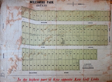
Plan - Subdivision Plan, J R Mathers & McMillan, Willsmere Park Estate, c.1940
... Annotations on the plan indicate that the more expensive lots faced Belford Road opposite the Kew Golf Links. Two of these sold for £310. Lots further to the west in Willow Grove were sold for £60 less. ...Annotations on the plan indicate that the more expensive lots faced Belford Road opposite the Kew Golf Links. Two of these sold for £310. Lots further to the west in Willow Grove were sold for £60 less. ...Pru Sanderson, in her groundbreaking ‘City of Kew Urban Conservation Study : Volume 2 - Development History’ (1988), summarised the periods of urban development and subdivisions of land in Kew. The periods that she identified included 1845-1880, 1880-1893, 1893-1921, 1921-1933, 1933-1943, and Post-War Development. These periods were selected as they represented periods of rapid growth or decline in urban development. An obvious starting point for Sanderson’s groupings involved population growth and the associated economic cycles. These cycles also highlighted urban expansion onto land that was predominantly rural, although in other cases it represented the decline and breakup of large estates. A number of the plans in the Kew Historical Society’s collection can also be found in other collections, such as those of the State Library of Victoria and the Boroondara Library Service. A number are however unique to the collection.The Kew Historical Society collection includes almost 100 subdivision plans pertaining to suburbs of the City of Melbourne. Most of these are of Kew, Kew East or Studley Park, although a smaller number are plans of Camberwell, Deepdene, Balwyn and Hawthorn. It is believed that the majority of the plans were gifted to the Society by persons connected with the real estate firm - J. R. Mathers and McMillan, 136 Cotham Road, Kew. The Plans in the collection are rarely in pristine form, being working plans on which the agent would write notes and record lots sold and the prices of these. The subdivision plans are historically significant examples of the growth of urban Melbourne from the beginning of the 20th Century up until the 1980s. A number of the plans are double-sided and often include a photograph on the reverse. A number of the latter are by noted photographers such as J.E. Barnes. In 1910, the Willsmere Park Estate Dairy was lauded in the Box Hill Reporter as ‘an object lesson in dairying’. Ten years later, in 1923, it was to be sold. The first subdivision of the Estate included 77 grand allotments with frontages to Belford and Kilby Roads, Elm and Willow Groves, and Acacia Avenue. Every lot was claimed to be ‘high and dry’, and with panoramic views of Kew and East Kew. The balance of the Estate, and the largest proportion of allotments was to be subdivided and sold from 1940. This second sale included 109 lots fronting Kilby Road and Elm and Willow Groves. Annotations on the plan indicate that the more expensive lots faced Belford Road opposite the Kew Golf Links. Two of these sold for £310. Lots further to the west in Willow Grove were sold for £60 less. Many of the houses to be built on these 109 allotments after the War faced Government restrictions on building materials and the dimensions of each house due to postwar shortages.subdivision plans - east kew, willsmere park estate -
![Scene on the Yarra, near Rourke's Bridge / [by] Nicholas Caire, circa 1876](/media/collectors/550653872162f11fb04854aa/items/5777571cd0cdd10a5c191a9c/item-media/57775788d0cdd10a5c193e0d/item-fit-380x285.jpg?cb=6) Kew Historical Society Inc
Kew Historical Society IncPhotograph, Anglo-Australasian Photographic Company, Scene on the Yarra, near Rourke's Bridge, c. 1876
... road from / St. Huberts to the Native Station at Corranderrk, and to the township at Healesville. The river at this place abounds / with fish of a large description, which are caught by the Natives, frequently in considerable quantitities. printed in ink on support reverse l.c.l.: J.W. FORBES, Agent, printed in ink on support reverse l.c.: ANGLO-AUSTRALASIAN PHOTOGRAPHIC COMPANY, MELBOURNE. printed in ink on support reverse l.c.r.: 10 Temple Court, Collins Street West...road from / St. Huberts to the Native Station at Corranderrk, and to the township at Healesville. The river at this place abounds / with fish of a large description, which are caught by the Natives, frequently in considerable quantitities. printed in ink on support reverse l.c.l.: J.W. FORBES, Agent, printed in ink on support reverse l.c.: ANGLO-AUSTRALASIAN PHOTOGRAPHIC COMPANY, MELBOURNE. printed in ink on support reverse l.c.r.: 10 Temple Court, Collins Street West ...Nicholas Caire was born on Guernsey in the Channel Islands in 1837. He arrived in Adelaide with his parents in about 1860. In 1867, following photographic journeys in Gippsland, he opened a studio in Adelaide. From 1870 to 1876 he lived and worked in Talbot in Central Victoria. In 1876 he purchased T. F. Chuck's studios in the Royal Arcade Melbourne. In 1885, following the introduction of dry plate photography, he began a series of landscape series, which were commercially successful. As a photographer, he travelled extensively through Victoria, photographing places few of his contemporaries had previously seen. He died in 1918. Reference: Jack Cato, 'Caire, Nicholas John (1837–1918)', Australian Dictionary of BiographyAn original, rare photograph from the series 'Views of Victoria: General Series' by the photographer, Nicholas Caire (1837-1918). The series of 60 photographs that comprise the series was issued c. 1876 and reinforced a neo-Romantic view of the Australian landscape to which a growing nationalist movement would respond. Nicholas Caire was active as a photographer in Australia from 1858 until his death in 1918. His vision of the Australian bush and pioneer life had a counterpart in the works of Henry Lawson and other nationalist poets, authors and painters.Albumen silver photograph mounted on boardprinted in ink on support l.c.: SCENE ON THE YARRA, NEAR ROURKE'S BRIDGE. / COPYRIGHT REGISTERED. printed in ink on support reverse c.: VIEWS OF VICTORIA. / (GENERAL SERIES.) / No. 16. / SCENE ON THE YARRA, NEAR ROURKE'S BRIDGE. / The subject of the present illustration represents the New Bridge crossing the River Yarra on the road from / St. Huberts to the Native Station at Corranderrk, and to the township at Healesville. The river at this place abounds / with fish of a large description, which are caught by the Natives, frequently in considerable quantitities. printed in ink on support reverse l.c.l.: J.W. FORBES, Agent, printed in ink on support reverse l.c.: ANGLO-AUSTRALASIAN PHOTOGRAPHIC COMPANY, MELBOURNE. printed in ink on support reverse l.c.r.: 10 Temple Court, Collins Street West.nicholas caire (1837-1918), landscape photography - victoria -
![Roadway Scene on the Black Spur / [by] Nicholas Caire, circa 1876](/media/collectors/550653872162f11fb04854aa/items/577759b7d0cdd10a5c1a5d0a/item-media/57775a11d0cdd10a5c1aab42/item-fit-380x285.jpg?cb=6) Kew Historical Society Inc
Kew Historical Society IncPhotograph, Anglo-Australasian Photographic Company, Roadway Scene on the Black Spur, c.1876
... road which is represented in this illustration has lately been constructed by the Government at considerable / expense. It is three miles in length from the base to the summit, some portions of which are very steep. Mails / are conveyed by Cobb & Co.'s Coaches to Marysville and Woodspoint via this route daily. The scenery on the Black / Spur, and beyond as far as Myrtle Creek, is exceedinly picturesque. printed in ink (vertically) on support reverse l.c.l.: 10 Temple Court, Collins Street West...road which is represented in this illustration has lately been constructed by the Government at considerable / expense. It is three miles in length from the base to the summit, some portions of which are very steep. Mails / are conveyed by Cobb & Co.'s Coaches to Marysville and Woodspoint via this route daily. The scenery on the Black / Spur, and beyond as far as Myrtle Creek, is exceedinly picturesque. printed in ink (vertically) on support reverse l.c.l.: 10 Temple Court, Collins Street West ...Nicholas Caire was born on Guernsey in the Channel Islands in 1837. He arrived in Adelaide with his parents in about 1860. In 1867, following photographic journeys in Gippsland, he opened a studio in Adelaide. From 1870 to 1876 he lived and worked in Talbot in Central Victoria. In 1876 he purchased T. F. Chuck's studios in the Royal Arcade Melbourne. In 1885, following the introduction of dry plate photography, he began a series of landscape series, which were commercially successful. As a photographer, he travelled extensively through Victoria, photographing places few of his contemporaries had previously seen. He died in 1918. Reference: Jack Cato, 'Caire, Nicholas John (1837–1918)', Australian Dictionary of BiographyAn original, rare photograph from the series 'Views of Victoria: General Series' by the photographer, Nicholas Caire (1837-1918). The series of 60 photographs that comprise the series was issued c. 1876 and reinforced a neo-Romantic view of the Australian landscape to which a growing nationalist movement would respond. Nicholas Caire was active as a photographer in Australia from 1858 until his death in 1918. His vision of the Australian bush and pioneer life had a counterpart in the works of Henry Lawson and other nationalist poets, authors and painters.Albumen silver photograph mounted on boardprinted in ink on support l.c.: ROADWAY SCENE ON THE BLACK SPUR. / COPYRIGHT REGISTERED printed in ink (vertically) on support reverse u.c.l.: J.W. FORBES, Agent, printed in ink (vertically) on support reverse c.l.: ANGLO-AUSTRALASIAN PHOTOGRAPHIC COMPANY, MELBOURNE. printed in ink (vertically) on support reverse c.: VIEWS OF VICTORIA. / (GENERAL SERIES.) / No. 18. / ROADWAY SCENE ON THE BLACK SPUR. / The road which is represented in this illustration has lately been constructed by the Government at considerable / expense. It is three miles in length from the base to the summit, some portions of which are very steep. Mails / are conveyed by Cobb & Co.'s Coaches to Marysville and Woodspoint via this route daily. The scenery on the Black / Spur, and beyond as far as Myrtle Creek, is exceedinly picturesque. printed in ink (vertically) on support reverse l.c.l.: 10 Temple Court, Collins Street West.nicholas caire (1837-1918), landscape photography, black spur - victoria -
 Vision Australia
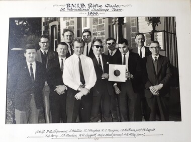
Photograph - Image, RVIB Rifle Club 1st International Challenge Team 1966, 1966
... Road with 30 members, and soon became involved in matches with sighted rifle clubs in the area. The club had many successful years, competing against teams from Canada and New Zealand in 1968. These were the members of the RVIB Rifle Club's first international challenge team (left to right): P Hull (referee), J Mallia, R.J. Hughes, R.C. Teague, J.O. Hoffman (Captain), I.V. Leggett, F.G. Berry, J.D. Machin, W.R. Leggett, W.G.C. West...Road with 30 members, and soon became involved in matches with sighted rifle clubs in the area. The club had many successful years, competing against teams from Canada and New Zealand in 1968. These were the members of the RVIB Rifle Club's first international challenge team (left to right): P Hull (referee), J Mallia, R.J. Hughes, R.C. Teague, J.O. Hoffman (Captain), I.V. Leggett, F.G. Berry, J.D. Machin, W.R. Leggett, W.G.C. West ...In the 1960's, the RVIB approached engineer George Glover to produce equipment to allow blind people to shoot, based upon that made available at St Dunstan's Hospital in the UK. The rifle range opened in February 1966 at the rear of St Kilda Road with 30 members, and soon became involved in matches with sighted rifle clubs in the area. The club had many successful years, competing against teams from Canada and New Zealand in 1968. These were the members of the RVIB Rifle Club's first international challenge team (left to right): P Hull (referee), J Mallia, R.J. Hughes, R.C. Teague, J.O. Hoffman (Captain), I.V. Leggett, F.G. Berry, J.D. Machin, W.R. Leggett, W.G.C. West (referee) and A.W. Alley (coach).Black and white photograph of 11 men standing outside a bluestone buildingRVIB Rifle Club 1st International Challenge Team 1966 (Lg. -R) P. Hull (referee), J. Mallia, R.J. Hughes, R.C. Teague, J.O. Hoffman (Capt.), I.V. Leggett F.G. Berry, J.D. Machin, W.R. Leggett, W.G.C. West (referee), A.W. Alley (coach)rvib rifle club, recreation, richard teague, ronald hughes, john hoffman, ian leggett, wayne leggett, fred berry, john machin, joseph mallia -
 Surrey Hills Historical Society Collection
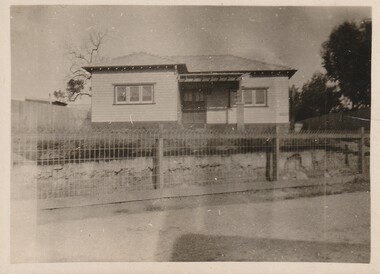
Work on paper - Photograph, 50 Broughton Road, Surrey Hills, c1924
... West and then in 1942 they were listed in Hamilton. When the war ended they came back to Melbourne and in the late 1940s built a home at Blackburn. Their daughter was at school in Grade 6 at Surrey Hills State School in 1935. See related photo. At the time of the donation, this simple home was still extant. Since then, c2021, it was demolished and replaced by a large single dwelling. This photo is representative of the simple interwar home that infilled earlier scattered residential development in this part of Surrey Hills. Broughton Road ...Information from the donor by email gives: My grandparents Norman & Hilda Pryde lived at 50 Broughton Rd, Surrey Hills. The home was named 'Strathaven' after the town in Scotland where Norman's father came from. They married in 1923. I know they lived there in 1924 when my mother Norma was born. Norman worked for Moran & Cato so I know they moved around a lot for his work and I think they rented out the house from time to time. During some time in the 1920s they were listed on electoral rolls in Nyah West and then in 1942 they were listed in Hamilton. When the war ended they came back to Melbourne and in the late 1940s built a home at Blackburn. Their daughter was at school in Grade 6 at Surrey Hills State School in 1935. See related photo. At the time of the donation, this simple home was still extant. Since then, c2021, it was demolished and replaced by a large single dwelling.This photo is representative of the simple interwar home that infilled earlier scattered residential development in this part of Surrey Hills.An original B&W photo of a simple timber home set behind a woven wire fence and taken from across the street. The garden looks relatively undeveloped.NILbroughton road, surrey hills, norman pryde, hilda pryde, hilda gwendoline scales, 'strathaven', house names, 1920-1929, moran & cato, norma pryde, norma cleak, jenny pomeray, interwar housing -
 Surrey Hills Historical Society Collection
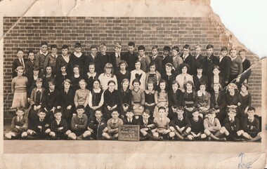
Work on paper - Photograph, Surrey Hills State School 2778, Grade 6, 1935, 1935
... Road, Surrey Hills. The home was named 'Strathaven' after the town in Scotland where Norman's father came from. Norman & Hilda were married in 1923. Norma was born in 1924. Norman worked for Moran & Cato so the family moved around a lot for his work and is thought to have rented out the house from time to time. During some time in the 1920s they were listed on electoral rolls in Nyah West...Road, Surrey Hills. The home was named 'Strathaven' after the town in Scotland where Norman's father came from. Norman & Hilda were married in 1923. Norma was born in 1924. Norman worked for Moran & Cato so the family moved around a lot for his work and is thought to have rented out the house from time to time. During some time in the 1920s they were listed on electoral rolls in Nyah West ...Information from the donor by email gives: Norma Pryde is identified as the girl in the second row on the far right. Her parents Norman & Hilda Pryde lived at 50 Broughton Road, Surrey Hills. The home was named 'Strathaven' after the town in Scotland where Norman's father came from. Norman & Hilda were married in 1923. Norma was born in 1924. Norman worked for Moran & Cato so the family moved around a lot for his work and is thought to have rented out the house from time to time. During some time in the 1920s they were listed on electoral rolls in Nyah West and then in 1942 they were listed in Hamilton. When the war ended they came back to Melbourne and in the late 1940s built a home at Blackburn. Norma married John Cleak in 1947 in Camberwell. This photo is representative of the large classes that were common in the interwar period.An original B&W postcard photo of a class taken outside against a brick wall. There are 34 boys in 2 rows. The back row of 20 boys would have been standing on a bench and in the front row the 14 boys are seated on the ground. The girls are standing in 2 rows - 14 girls in the second back row and 16 girls in the second front row. A total of 64 students. There does not appear to be a standard uniform.Front: In blue ballpoint: An arrow + ME Rear: In grey lead pencil on the LHS: "Miss N Pryde / Kitchener Rd / Croydon / Vic"; a stamp in purple ink on the RHS: "SUZANNE ET CIE PTY. LTD. / 357 COLLINS STREET / MELBOURNE." In addition a diagonal blue squiggle.surrey hills, norma pryde, norma cleak, jenny pomeray, surrey hills state school 2778, education, 1930-1939, 1935 -
 Surrey Hills Historical Society Collection
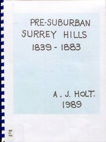
Book, Alan Judge Holt (deceased), Pre-Suburban Surrey Hills 1839-1883, 1989
... road...surrey hills...(mr) aldo massora...aborigines...damper creek...back creek...west...(mr) henry jamieson (mr) ken hall (ms) edna holt (mr) frank bamford (mr) harrison buchanan scouts grange hill wattle park round hill bona vista mount albert barton street (mr) john raeburn (mr) edmund holt (mr) james dunn butter merchant mont albert road elgar road view hill new street surry mont delany's hill reservoir hill riversdale road middlesex road surrey hills (mr) aldo massora aborigines damper creek back creek west creek kooyongkoot creek (mr) john gardiner (mr) chas mullins (mr) henry elgar (mr) robert campbell (mr) alexander dyce (mr) robert brooks t budds payne (mr) hugh glass (mr) patrick trainer w virtue (mr) t fulton (mr) john crimp (mr) w dempsey (mr) w e stanbridge (mr) james atkinson j porter j collings w edde (mr) orlando fenwick (dr)(mr) l l smith (mr) j h knipe (mr) george cockcroft (sr) (mr) john martin kleinert w morton d delaney a moeller (mr) william smith (mr) e.p.s.sturt (mr) thomas blood (mr) patrick mornane (mr) henry de carle w craig j hill w oliver j keogh a laing vineyards toll gates (mr) david staig (mr) phillip kleeper (mr) goyder usher (mr) james lawler (mr) w.e. stanbridge (mr) gideon rutherford c a f mater j gadsby w h wrixon e h lamont i ainger (mr) james henty (mr) henry henty w freemantle w palmer beckett park, maranoa gardens Unpublished manuscript / notes written by Alan Holt about settlers in and around Surrey Hills bound in-house. ...Author: Alan Judge Holt amassed a significant collection of historical material related to the Surrey Hills area. Born in Moonee Ponds in 1912 to Edmund Holt and Ellen Ruby Sutton, he married Edna Jean Pallot in 1937. They lived at 62 Broughton Road, Surrey hills, had 3 sons and were strongly associated with the Surrey Hills Methodist Church. Alan was Secretary of the Victorian Lands Department and in his spare time recorded the occupancy of every property in Surrey Hills and Mont Albert at the beginning of each decade from 1890 to 1980. His collection of files and individual cards covers people, places, churches, clubs, businesses and other organisations in the area. Alan used this information to give talks and tours of the area and gifted his material to the local history collection through Jocelyn Hall.Unpublished manuscript / notes written by Alan Holt about settlers in and around Surrey Hills bound in-house. It is supported by maps showing landowners over various years from about 1840-1885(mr) henry jamieson, (mr) ken hall, (ms) edna holt, (mr) frank bamford, (mr) harrison buchanan, scouts, grange hill, wattle park, round hill, bona vista, mount albert, barton street, (mr) john raeburn, (mr) edmund holt, (mr) james dunn, butter merchant, mont albert road, elgar road, view hill, new street, surry mont, delany's hill, reservoir hill, riversdale road, middlesex road, surrey hills, (mr) aldo massora, aborigines, damper creek, back creek, west creek, kooyongkoot creek, (mr) john gardiner, (mr) chas mullins, (mr) henry elgar, (mr) robert campbell, (mr) alexander dyce, (mr) robert brooks, t budds payne, (mr) hugh glass, (mr) patrick trainer, w virtue, (mr) t fulton, (mr) john crimp, (mr) w dempsey, (mr) w e stanbridge, (mr) james atkinson, j porter, j collings, w edde, (mr) orlando fenwick, (dr)(mr) l l smith, (mr) j h knipe, (mr) george cockcroft, (sr) (mr) john martin kleinert, w morton, d delaney, a moeller, (mr) william smith, (mr) e.p.s.sturt, (mr) thomas blood, (mr) patrick mornane, (mr) henry de carle, w craig, j hill, w oliver, j keogh, a laing, vineyards, toll gates, (mr) david staig, (mr) phillip kleeper, (mr) goyder usher, (mr) james lawler, (mr) w.e. stanbridge, (mr) gideon rutherford, c a f mater, j gadsby, w h wrixon, e h lamont, i ainger, (mr) james henty, (mr) henry henty, w freemantle, w palmer, beckett park, maranoa gardens -
 Surrey Hills Historical Society Collection
Book, Robin Da Costa-Adams, Enniskillen McAlpin Residence, Feb-09
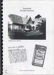
... (mr) arthur plaisted (mr) walter plaisted enniskillen shrublands house names (mr) francis henty (mrs) mary henty (mr) ernest carter heathfield (mr) john hindson (mrs) alice hindson (mr) william hindson (mrs) annie west mcalpin (mr) john mcalpin mcalpin bakery (mr) keith matthies dental surgeon (mr) william wolf architects (miss) mary beacon robin ca costa-adams A report prepared by Robin da Costa-Adams in 2009 to assess the cultural heritage significance of "Enniskillen" at 14 Balwyn Road, Canterbury. ...This report was prepared by historian Robin da Costa-Adams to assess the cultural heritage significance of "Enniskillen" at 14 Balwyn Road, Canterbury. It includes some family history on a number of prominent families - the McAlpin family, the Hindson family and the architect, Arthur William Plaisted who designed 'Enniskillen' for the McAlpin family. McAlpin's was a major Victorian flour company in the nineteenth and early twentieth centuries. Owned and operated by J. McAlpin and Sons, the company sold its flour products across Australia and overseas. McAlpin's developed a successful marketing campaign which was pitched directly at housewives. One innovation was the publishing of a free cookbook which had recipes in it that used McAlpin's products. These free cookbooks were published successively from the 1930s through to the 1960s in Australia. Arthur Plaisted also designed the Surrey Hills Medical Centre in Union Road c1911. Some of his work is featured on the State Library of Victoria Collection. Robin da Costa-Adams has researched and written many publications including 'Blackburn a picturesque history, 1978'; 'Land of Gold: Gwlad yr Aur: James Tipping and a Mining Heritage'; 'Address (with signatories) from the women of Ballarat & Ballarat East to the women of England 1864 : against transportation of convicts', compiled and indexed by Robin; and 'Connie's Story : commemorating the Life of Mrs Edward (Plorn) Dickens'. Robin has been a tireless campaigner for heritage protection in Canterbury. This document on 'Enniskillen' was included with Robin's submission for 2 VCAT hearings regarding possible development of the property. Both resulted in a judgement against the proposed developments. In the recent (2021) hearing the document was specifically mentioned in the judgement.A report prepared by Robin da Costa-Adams in 2009 to assess the cultural heritage significance of "Enniskillen" at 14 Balwyn Road, Canterbury. It includes some family history on the McAlpin family, the Hindson family and the architect Arthur WIlliam Plaisted family.(mr) arthur plaisted, (mr) walter plaisted, enniskillen, shrublands, house names, (mr) francis henty, (mrs) mary henty, (mr) ernest carter, heathfield, (mr) john hindson, (mrs) alice hindson, (mr) william hindson, (mrs) annie west mcalpin, (mr) john mcalpin, mcalpin bakery, (mr) keith matthies, dental surgeon, (mr) william wolf, architects, (miss) mary beacon, robin ca costa-adams -
 Surrey Hills Historical Society Collection
Photograph, 215 Union Road, c 1920
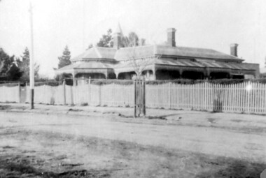
... road. Shows street surface, bluestone kerbing, a young tree within a guard and a Victorian style home with 3 chimneys, a slate roof and a veranda on at least the south and west side. ...road. Shows street surface, bluestone kerbing, a young tree within a guard and a Victorian style home with 3 chimneys, a slate roof and a veranda on at least the south and west side. ...The house was variously known as ‘Mintaro’, ‘Montiere’ and ‘Goonoo Goonoo’, the later after 1920 when it was purchased by Natale Cerini and his wife Ethel May (nee Swan), who were married in 1918. Built 1887-1888 by William Wigley. The original colour was deep cream with dark green trim. Property included a block of land on south side and also land to the north. The original coach house was on what became 213 Union Road and was used to build a yacht in by the then neighbours, the Flemings. The street plane trees were replaced in the 1970s with melaleucas and in 1987 new plane trees were planted between the melaleucas. Sepia copy of an older photo of 215 Union Road from diagonally across the road. Shows street surface, bluestone kerbing, a young tree within a guard and a Victorian style home with 3 chimneys, a slate roof and a veranda on at least the south and west side. Beyond the house are mature cypress and other trees and a spire. The spire belonged to Surrey College, a boys' boarding school (later Nethercourt Hospital and St Judes.)'mintaro', 'montiere', 'goonoo goonoo', william wigley, mrs ethel may cerini, miss ethel may swan, miss jocelyn cerini, mrs jocelyn hall, miss lynette cerini, victorian style, 215 union road -
 Wonga Park Community Cottage History Group
Photograph - View of Herb and Alma Beavis' house, facing south west from Yarra Road 1984
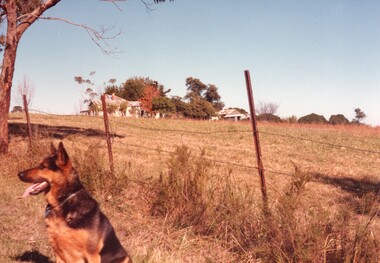
... facing south west from Yarra Road 1984...Digital copy of Photograph facing south west from Yarra Road 1984 Photograph View of Herb and Alma Beavis' house ...Digital copy of Photograph -
 Wonga Park Community Cottage History Group
Work on paper (Item) - Letter, Wonga Park 1984 Letter from Shire of Lillydale to Wonga Park & District Residents' Association with four alternative intersection treatments
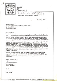
... The Wonga Park and District Residents' Association requested the Shire of Lillydale consider removing the crests on Jumping Creek Road Wonga Park east and west of the intersection with Yarra and Dudley Roads to improve visibility at the intersection. ...The Wonga Park and District Residents' Association requested the Shire of Lillydale consider removing the crests on Jumping Creek Road Wonga Park east and west of the intersection with Yarra and Dudley Roads to improve visibility at the intersection. ...The Wonga Park and District Residents' Association requested the Shire of Lillydale consider removing the crests on Jumping Creek Road Wonga Park east and west of the intersection with Yarra and Dudley Roads to improve visibility at the intersection. The Shire of Lillydale thought that this would simply increase the speed of traffic through the intersection and suggested a roundabout be built and came up with four alternative treatments. When they discovered that a roundabout would require water mains to be lowered and the M&MBW would not give a quote on the cost (which would be substantial) they opted for traffic islands instead. -
 Tarnagulla History Archive
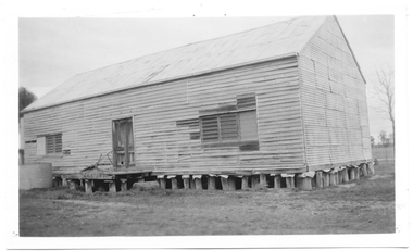
Photograph of shed on Metelman's farm (formerly Herd's Store), Shed on Metelman's farm (formerly Herd's Store), 25/071968
... road...main street...metelman...farming...arnold west...West to be used as barn (as was as late as May 1970). This photograph is an original print, made in 1968. tarnagulla commerce shops stores herd's commercial road main street metelman farming arnold west Monochrome photograph depicting a large weatherboard building on stumps, in a paddock. ...Murray Comrie Collection. Information collated by Murray Comrie: This building was formerly Herd's Store in Tarnagulla, moved to Metelman's farm in Arnold West to be used as barn (as was as late as May 1970). This photograph is an original print, made in 1968. Monochrome photograph depicting a large weatherboard building on stumps, in a paddock. Three louvre windows and central door.tarnagulla, commerce, shops, stores, herd's, commercial road, main street, metelman, farming, arnold west -
 Tarnagulla History Archive
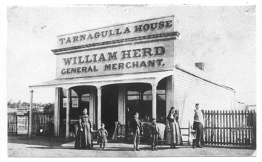
Photograph of Herd's Store, Tarnagulla, Herd's Store, Tarnagulla, Between 1852 and 1910
... Road where he built this large store. He was a member of the first Borough Council in 1864 and Mayor on several occasions. Herd died in 1899, aged 70 and his son carried on the business for several years. This building was later moved to Metelman's farm in Arnold West...Road where he built this large store. He was a member of the first Borough Council in 1864 and Mayor on several occasions. Herd died in 1899, aged 70 and his son carried on the business for several years. This building was later moved to Metelman's farm in Arnold West ...Murray Comrie Collection. Information collated by Murray Comrie: William Herd was born in Scotland in 1829, and came to Australia in 1852. He set up a business at Hard Hills and then and the lower end of the main lead at Sandy Creek (Tarnagulla). He then purchased a business from a Mr. Turnbull in Commercial Road where he built this large store. He was a member of the first Borough Council in 1864 and Mayor on several occasions. Herd died in 1899, aged 70 and his son carried on the business for several years. This building was later moved to Metelman's farm in Arnold West to be used as barn (and was as late as May 1970), as shown in THA-2019.0055. This photograph is a reasonable copy created from an older original. Copy probably made by Murray Comrie in the 1970s. Monochrome photograph depicting a high storefront with text 'Tarnagulla House William Herd General Merchant'. Group of people standing in front of store. Picket fencing either side.tarnagulla, commerce, shops, stores, herd's, william herd, commercial road, main street, council, councillors, mayor -
 Tarnagulla History Archive
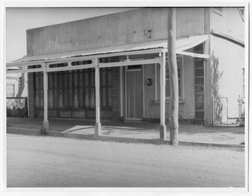
Photograph looking down Commercial Road, Tarnagulla, Looking down Commercial Road, Tarnagulla, c.1960s
... Shopfront located on west side of Commercial Rd between King and Poverty Streets. Original print. tarnagulla buildings businesses commercial road Monochrome photograph of a shopfront in Commercial Road, Tarnagulla. ...Murray Comrie Collection. Shopfront located on west side of Commercial Rd between King and Poverty Streets. Original print.Monochrome photograph of a shopfront in Commercial Road, Tarnagulla. tarnagulla, buildings, businesses, commercial road -
 Tarnagulla History Archive
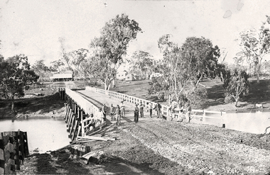
Photograph of the newly completed bridge at Newbridge, Victoria, c.1894, The newly completed bridge at Newbridge, Victoria, c.1894, 1894
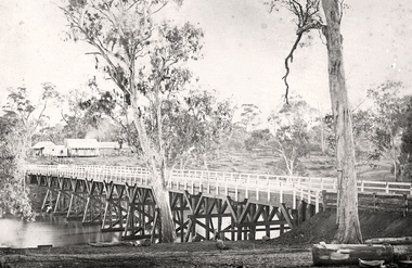
... roads workers farms people Monochrome photograph depicting the newly completed wooden bridge at Newbridge, Victoria. Thirteen men are in the image, standing at one end of the bridge. These are most likely men who worked on constructing the bridge. Position of photographer is on the west ...Murray Comrie Collection. This photograph is a well-preserved original. Monochrome photograph depicting the newly completed wooden bridge at Newbridge, Victoria. Thirteen men are in the image, standing at one end of the bridge. These are most likely men who worked on constructing the bridge. Position of photographer is on the west bank of the Loddon, looking east.newbridge, bridge, loddon river, infrastructure, construction, roads, workers, farms, people -
 Tarnagulla History Archive
Photograph of the newly completed bridge at Newbridge, Victoria, c.1894, The newly completed bridge at Newbridge, Victoria, c.1894, 1894
... This photograph is a well-preserved original. newbridge bridge loddon river infrastructure construction roads businesses buildings Monochrome photograph depicting the newly completed wooden bridge at Newbridge, Victoria. Position of photographer is on the east bank of the Loddon, looking west toward the present day Newbridge Pub. ...Murray Comrie Collection. This photograph is a well-preserved original. Monochrome photograph depicting the newly completed wooden bridge at Newbridge, Victoria. Position of photographer is on the east bank of the Loddon, looking west toward the present day Newbridge Pub.newbridge, bridge, loddon river, infrastructure, construction, roads, businesses, buildings -
 Port Fairy Historical Society Museum and Archives
Postcard - post card, A.C. Aberline, Moyne Bridge & River Port Fairy, c.1900
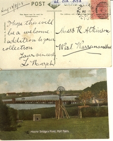
... Reverse:- aug.13/8/08- i hope this will be a welcome addition to your collection yours Sincerly, L Murphy - To Miss R Atkinson, West Warrnambool Hand coloured Photograph of the Moyne river road bridge, a domestic windmill in foreground and in the background large sheds made for use as a postcard with reverse side stamped Moyne Bridge & River Port Fairy Postcard post card A.C. ...A card sent to Miss R. Atkinson of West Warrnambool to add to her collection of postcardsHand coloured Photograph of the Moyne river road bridge, a domestic windmill in foreground and in the background large sheds made for use as a postcard with reverse side stamped Front:- Moyne bridge & river, port Fairy. Reverse:- aug.13/8/08- i hope this will be a welcome addition to your collection yours Sincerly, L Murphy - To Miss R Atkinson, West Warrnambool moyne bridge, moyne river, windmill -
 Port Fairy Historical Society Museum and Archives
Photograph
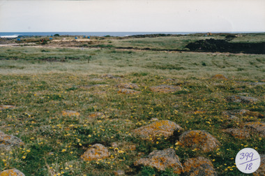
... west...bluestone...road...South Beach Development South beach development south west bluestone road street Coloured photograph of Looking from hill above South Beach Estate before earth works Photograph Photograph ...South Beach DevelopmentColoured photograph of Looking from hill above South Beach Estate before earth workssouth beach, development, south west, bluestone, road, street -
 University of Melbourne, Burnley Campus Archives
Newspaper - Newspaper Cutting, The Argus, The Horticultural Society of Victoria, 1869
... Description of entering the Gardens from Bridge Road and what could be seen of the new West Orchard, the Ornamental Gardens and the Proving Ground....the argus gardens west orchard ornamental gardens proving ground fruit trees Copy of article in "The Argus" 13 October, 1869. Description of entering the Gardens from Bridge Road and what could be seen of the new West Orchard, the Ornamental Gardens and the Proving Ground. ...Copy of article in "The Argus" 13 October, 1869. Description of entering the Gardens from Bridge Road and what could be seen of the new West Orchard, the Ornamental Gardens and the Proving Ground.the argus, gardens, west orchard, ornamental gardens, proving ground, fruit trees -
 Linton and District Historical Society Inc
Photograph, Linton Bushfire, 1998, December 1998
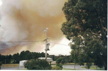
... Linton bushfire 1998, Snake Valley Road area, five Geelong West firefighters died in this fire....Linton bushfire 1998, Snake Valley Road area, five Geelong West firefighters died in this fire. ...Linton bushfire 1998, Snake Valley Road area, five Geelong West firefighters died in this fire.Colour photograph of bushfire smoke over Linton."Linton Fire December 2, 1998/Looking North on Skipton Road".bushfires -
 Linton and District Historical Society Inc
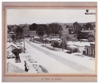
Postcard, A View at Linton, Sussex Street, Linton, view to south, circa 1940
... west. On the right of the photo are Ching's store, R. N. Sandow confectionery shop, a house next to it, and the first Bank of NSW building. Two houses are further down the road...west. On the right of the photo are Ching's store, R. N. Sandow confectionery shop, a house next to it, and the first Bank of NSW building. Two houses are further down the road ...The "Lorna, Bob and Elsie" in the inscription are probably Elsie McCorkell, her son Robert Hayward, and her daughter Lorna McCorkell.A very small photograph which has been made into a souvenir/postcard. The photograph is a view of Sussex Street, Linton, looking south-west. On the right of the photo are Ching's store, R. N. Sandow confectionery shop, a house next to it, and the first Bank of NSW building. Two houses are further down the road past Gillespie Street. On the left of the photo are the Edinburgh Bakery and a store with a verandah on the corner of Gillespie Street. The photograph is glued to a beige-coloured card which has a decorative edge cut into it. A printed border surrounds the photograph, and the words "A View at Linton" are printed underneath it. The card appears to have had the right-hand edge trimmed with scissors. Because of this, an inscription on the back of the card has been partially cut away. The inscription reads "-rs Whitehand & Doris / -with love from Lorna, Bob and Elsie".sussex street linton, buildings, shops, houses, sandow shop, ching's store, edinburgh bakery, postcards, souvenirs, lorna mccorkell, robert hayward, elsie mccorkell -
![Map, Ballarat and Gordons Lane Plan of Land required [for railway line work]](/media/collectors/5e461d8021ea67224c82f2a1/items/676ff3a62c3783fe00b96a8d/item-media/676ff4a42c3783fe00b96cb6/item-fit-380x285.jpg?cb=6) Bacchus Marsh & District Historical Society
Bacchus Marsh & District Historical SocietyMap, Ballarat and Gordons Lane Plan of Land required [for railway line work]
... west of the Bacchus Marsh railway station which would have been among the first stages of the line to Ballan to have been constructed. This suggests the date of this map to be in the late 1880s. Bacchus Marsh Victoria History Maddingley Victoria History Railway Lines Single page map showing land required for railway line work near Griffith Street, Bacchus Marsh. Scale 10 chains to 1 inch. Hand-written on the map are the exact distances between Bacchus Marsh and Gordons (Gordon) and between Bacchus Marsh and Melbourne as measured from the corner of Maddingley Road ...The railway line from Melbourne to Bacchus Marsh was completed in February 1887. After this date work continued to extend the line to Ballan. This map indicates a portion of land only a few hundred metres west of the Bacchus Marsh railway station which would have been among the first stages of the line to Ballan to have been constructed. This suggests the date of this map to be in the late 1880s.Single page map showing land required for railway line work near Griffith Street, Bacchus Marsh. Scale 10 chains to 1 inch. Hand-written on the map are the exact distances between Bacchus Marsh and Gordons (Gordon) and between Bacchus Marsh and Melbourne as measured from the corner of Maddingley Road and Station Street. Distances recorded are in miles, chains and links. The land required for the railway works is marked in red ink and runs through an area known as Kennedy's Gully. Part of a set of maps which are pasted into a bound volume containing 76 maps or plans in total. High resolution digital image stored on BMDHS computer network. bacchus marsh victoria history, maddingley victoria history, railway lines -
 Bacchus Marsh & District Historical Society
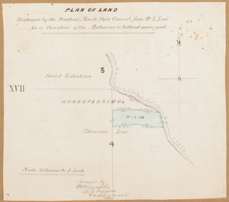
Map, Plan of land purchased by the Bacchus Marsh Shire Council from Mr. T. Low for a deviation of the Melbourne to Ballarat main road. 1877
... road deviation is shaded in blue. It adjoins the Korkuperrimul Creek on one side which indicates the land is located just a few kilometers to the west of Bacchus Marsh. ...road deviation is shaded in blue. It adjoins the Korkuperrimul Creek on one side which indicates the land is located just a few kilometers to the west of Bacchus Marsh. ...The date of this plan is 1877 and the land indicted on it required for a road deviation is shaded in blue. It adjoins the Korkuperrimul Creek on one side which indicates the land is located just a few kilometers to the west of Bacchus Marsh. Single page map showing a portion of land purchased by the Bacchus Marsh Shire from Mr Thomas Low for the purpose of a road deviation. Land held by David Robertson is also shown on the map. Scale: 2 chains to 1 inch. Part of a set of maps which are pasted into a bound volume containing 76 maps or plans in total. High resolution digital image stored on BMDHS computer network. Surveyed by W. E. Standfield, Shire Engineer, Bacchus Marsh, 12/4/77bacchus marsh roads and streets, melbourne to ballarat road -
 Rutherglen Historical Society
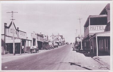
Image, c1940-1950
... Further along on the right of the road is the Rutherglen Hotel (now Poachers Paradise Hotel). main street star hotel rutherglen hotel poachers paradise hotel hotels shops cumberland hotel Printed at the bottom of the photo: "V5 Main Street, Rutherglen" Written on mount: "Main St. Looking east from western end. Circa late 40's early 50's" One of three black and white photographs mounted on orange paper. This one of Main Street looking west ...At the centre of the photo, on the left hand side of the road, is the Star Hotel. On the right hand side of the road, in the foreground is the Cumberland Hotel. Further along on the right of the road is the Rutherglen Hotel (now Poachers Paradise Hotel).One of three black and white photographs mounted on orange paper. This one of Main Street looking west.Printed at the bottom of the photo: "V5 Main Street, Rutherglen" Written on mount: "Main St. Looking east from western end. Circa late 40's early 50's"main street, star hotel, rutherglen hotel, poachers paradise hotel, hotels, shops, cumberland hotel -
 Wodonga & District Historical Society Inc
Memorabilia - CountryLink Collection
... road service brand that operated in regional areas of New South Wales, and to and from Canberra, Brisbane and Melbourne. CountryLink operated rail services a fleet of XPT and locomotive-hauled passenger trains. The Southern region of the Country Link network covered New South Wales districts of Illawarra, South Coast, Snowy Mountains, South West Slopes, Southern Tablelands, Riverina and Sunraysia regions plus the Australian Capital Territory and parts of Victoria. ...road service brand that operated in regional areas of New South Wales, and to and from Canberra, Brisbane and Melbourne. CountryLink operated rail services a fleet of XPT and locomotive-hauled passenger trains. The Southern region of the Country Link network covered New South Wales districts of Illawarra, South Coast, Snowy Mountains, South West Slopes, Southern Tablelands, Riverina and Sunraysia regions plus the Australian Capital Territory and parts of Victoria. ...For residents of Northeast Victoria, railway services have provided a critical link between the area and state capital cities. CountryLink was established in January 1989 under the Transport Administration Act 1988. It was a passenger rail and road service brand that operated in regional areas of New South Wales, and to and from Canberra, Brisbane and Melbourne. CountryLink operated rail services a fleet of XPT and locomotive-hauled passenger trains. The Southern region of the Country Link network covered New South Wales districts of Illawarra, South Coast, Snowy Mountains, South West Slopes, Southern Tablelands, Riverina and Sunraysia regions plus the Australian Capital Territory and parts of Victoria. The Government of Victoria contributed to the provision of these services. Services ran along the Main South line from Sydney Central station to Albury before continuing on the North East line to Southern Cross station in Melbourne. The Sydney/Melbourne Express ceased in November 1993 and was replaced by an XPT in November 1993 In December 1994, a daylight service to Melbourne resumed by extending the Riverina XPT from Albury. In July 2013, CountryLink was merged with the intercity services of CityRail to form NSW TrainLink.These items are connected to a major transportation system in eastern Australia.A collection of uniform items and memorabilia from the CountryLink rail service. They include a tie and tiepin, staff badge and lanyard, cups and a bag with CountryLink logo.Tag on tie: Stylecore Corporate Wear Australia/ Polyester/ Made in England On all items: CountryLinkcountrylink, australian railways, countrylink uniforms -
 Wodonga & District Historical Society Inc
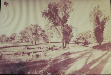
Photograph - Photo - Felltimber Creek Road, Wodonga, Neil Coles, July 1984
... Felltimber Creek Road is on the south-eastern edge of West Wodonga. It was originally covered in bushland...Felltimber Creek Road is on the south-eastern edge of West Wodonga. It was originally covered in bushland felltimber creek Wodonga 1980s Wodonga scenes A large black and white image of cows grazing in a paddock. ...Felltimber Creek Road is on the south-eastern edge of West Wodonga. It was originally covered in bushlandA large black and white image of cows grazing in a paddock. Image is in a metal and glass frame.felltimber creek, wodonga 1980s, wodonga scenes -
 Wodonga & District Historical Society Inc
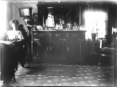
Negative - Haeusler Glass Negatives Collection - Mrs. McFarlane at Mac's Hotel, Wodonga West
... West. The Haeusler family were one of several German families to migrate from South Australia to Wodonga in the 1860s. This digital image was produced from one of the glass negatives that form part of the collection, probably taken by Louis Haeusler (b.1887) with the photographic equipment in the Wodonga Historical Society Haeusler Collection. Mac's Hotel, is believed to have begun in 1868. For most of its life run by William and Mary McFarlane, the son in law and daughter of Mary Ann King. In 1867 Mary Ann King had taken over the licence of the Wodonga Hotel in Sydney Road...West. The Haeusler family were one of several German families to migrate from South Australia to Wodonga in the 1860s. This digital image was produced from one of the glass negatives that form part of the collection, probably taken by Louis Haeusler (b.1887) with the photographic equipment in the Wodonga Historical Society Haeusler Collection. Mac's Hotel, is believed to have begun in 1868. For most of its life run by William and Mary McFarlane, the son in law and daughter of Mary Ann King. In 1867 Mary Ann King had taken over the licence of the Wodonga Hotel in Sydney Road ...The Wodonga Historical Society Haeusler Collection provides invaluable insight into life in late nineteenth and early twentieth century north east Victoria. The collection comprises manuscripts, personal artefacts used by the Haeusler family on their farm in Wodonga, and a set of glass negatives which offer a unique visual snapshot of the domestic and social lives of the Haeusler family and local Wodonga community. The Haeusler family migrated from Prussia (Germany) to South Australia in the 1840s and 1850s, before purchasing 100 acres of Crown Land made available under the Victorian Lands Act 1862 (also known as ‘Duffy’s Land Act’) in 1866 in what is now Wodonga West. The Haeusler family were one of several German families to migrate from South Australia to Wodonga in the 1860s. This digital image was produced from one of the glass negatives that form part of the collection, probably taken by Louis Haeusler (b.1887) with the photographic equipment in the Wodonga Historical Society Haeusler Collection. Mac's Hotel, is believed to have begun in 1868. For most of its life run by William and Mary McFarlane, the son in law and daughter of Mary Ann King. In 1867 Mary Ann King had taken over the licence of the Wodonga Hotel in Sydney Road. Mac’s Hotel closed in 1891 when William withdrew his application for renewal of licence.This item is unique and has well documented provenance and a known owner. It forms part of a significant and representative historical collection which reflects the local history of Wodonga. It contributes to our understanding of domestic and family life in early twentieth century Wodonga, as well as providing interpretative capacity for themes including local history and social history.Digital image created from the Haeusler Glass negative collection. Mrs. McFarlane at Mac's Hotel. Wodonga West. wodonga pioneers, haeusler family, glass negatives, dry plate photography, sunday school west wodonga
