Showing 427 items
matching topography
-
 Lakes Entrance Historical Society
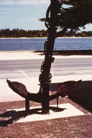
Photograph, Fraser, Ian, 1990c
Colour photograph of the anchor situated at the Central Shopping Plaza. It shows an anchor of unknown origin, highway, Cunninghame Arm, scrub covered sand hummocks of South shore. Lakes Entrance Victoria township, waterfront, topography -
 Lakes Entrance Historical Society
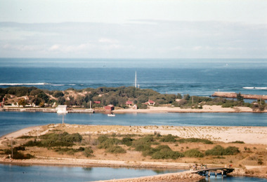
Photograph - Bullock Island, 1962
Image printed from 35mm slideColour photograph of Bullock Island showing cleared and grass planted south eastern area in preparation for relocation of Public Works and fishing industry facilities. Traffic access to island via humpy bridge. Lakes Entrance Victoriabridges, waterways, topography -
 Lakes Entrance Historical Society
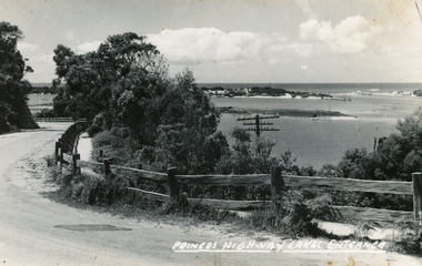
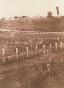
Postcard, Bulmer H D, 1920c
Black and white copy same sizeTinted postcard of a bend in the Princes Highway, Jemmys Point. It shows the road between the steep cutting and post and rail fence. Glimpse of footbridge to Bullock Island, entrance and hummocks. Lakes Entrance VictoriaPrinces Highway, Lakes Entrance topography, waterways, roads and streets -
 Lakes Entrance Historical Society
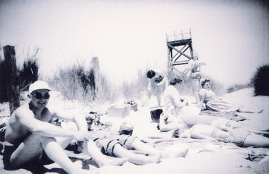
Photograph, Scarce, Heather, 1960c
Spotting tower for lifesaving club built 1937cBlack and white photograph of eight people, some in bathing costumes, sitting on the sand hummock. Showing the observation tower in background. Tower built for Royal Lifesaving Club. Lakes Entrance Victoria people, topography, beaches -
 Lakes Entrance Historical Society
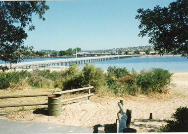
Photograph - Footbridge, 1999c
This photo taken from south side (looking towards township on northern side)Colored photograph of the footbridge over the Cunninghame Arm, taken from the path on the southern shore. It shows sand, scrub, treated pine fences and rubbish bin, town in the distance on northern shore. Lakes Entrance Victoriawaterfront, topography, bridges -
 Lakes Entrance Historical Society
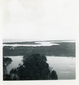
Photograph - Rigby Island, 1950c
Two other copies 6 x 9 (one - slightly different view)Small format photograph of view from Kalimna across Rigby Island to back lakes near Lakes Entrance, Victoriaislands, waterways, topography -
 Lakes Entrance Historical Society
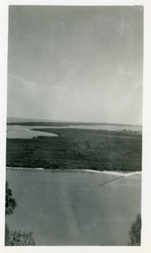
Photograph - Rigby Island, 1950c
Black and white photograph of view from Kalimna across Rigby Island to back lakes near Lakes Entrance, Victoriaislands, waterways, topography -
 Lakes Entrance Historical Society
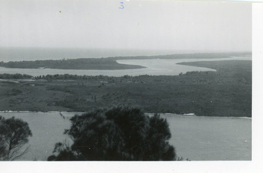
Photograph - Rigby Island, 1950c
Two other copies 6 x 9 (one - slightly different view)Small format photograph of view from Kalimna across Rigby Island to back lakes near Lakes Entrance, Victoriaislands, waterways, topography -
 Lakes Entrance Historical Society
Photograph - Rigby Island, 1950c
Two other copies 6 x 9 (one - slightly different view)Small format photograph of view from Kalimna across Rigby Island to back lakes near Lakes Entrance, Victoriaislands, waterways, topography -
 Lakes Entrance Historical Society
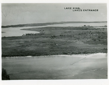
Postcard - Lake King, Bulmer H D, 1950c
Two other copies same sizeBlack and white small format postcard showing part of Rigby Island, Reeves Channel, Hopetoun Channel, The Barrier, on Gippsland Lakes, Victoria, showing foreground bushes, and Bass Strait in distance.Lake King Lakes Entranceislands, waterways, topography -
 Lakes Entrance Historical Society
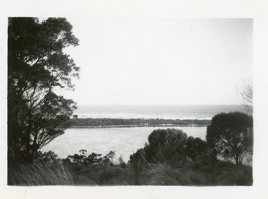
Photograph - Snake Island, 1950c
Also two other copies 7 x 11Black and white photograph showing eastern end of Rigby Island, Snake Island, and dunes at Lakes Entrance, Victoria. Reeves River below, foreground bushes, Hopetoun Channel in middle distance, Bass Strait in distance. waterways, topography, islands -
 Lakes Entrance Historical Society
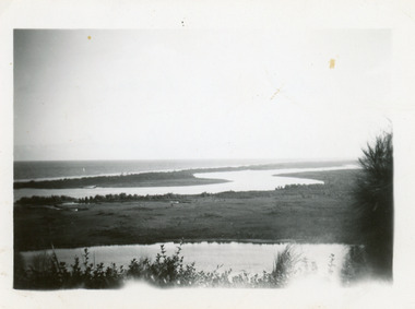
Photograph - Hopetoun Channel, 1950c
Black and white photograph showing sand dunes and Hopetoun Channel, Lakes Entrance, Victoria. Sand dunes near entrance Western Pier, hidden by trees. Schnapper Cottage just visible on shore. Bass Strait beyond dunes, trees and shrubbery in foreground Jemmys Point. Lakes Entrance Victoriaislands, topography, waterways -
 Lakes Entrance Historical Society
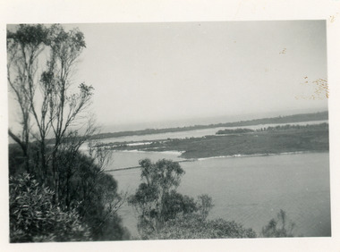
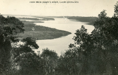
Postcard - Gippsland Lakes, Bulmer and Segerberg, 1915c
Black and white postcard of the Gippsland lakes, taken from Jemmys Point. It shows Rigby Island, Fraser Island and Flannagan Island, Reeves Channel. Natural vegetation in foreground. Lakes Entrance VictoriaView from Jimmy's Point Lakes Entranceislands, waterways, topography -
 Lakes Entrance Historical Society
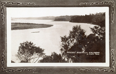
Photograph - Reeves River, 1910c
Also another copy print 8 x 13, both printed as though framedBlack and white photograph of Reeves Channel, Gippsland Lakes. It shows Rigby Island opposite the steep cliffs of mainland shore. Small island off Rigby was known as the Doughboy. Taken from Jemmys Point, natural vegetation in foreground. Lakes Entrance VictoriaReeves River from Kalimnaislands, waterways, topography -
 Lakes Entrance Historical Society
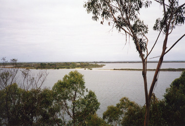
Photograph - Fraser Island, Holding M, 2000c
Colour photograph of Fraser Island, Gippsland Lakes, taken from Nyerimilang. It shows Flannagan Island mid centre, residence on Fraser Island, scrub covered dunes of southern shore of lake system. Lakes Entrance Victoria waterways, topography, islands -
 Lakes Entrance Historical Society
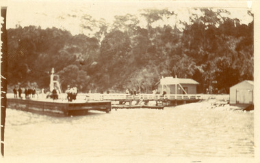
Photograph - Kalimna Jetty, 1930c
Black and white photograph of Kalimna Jetty. It shows a substantial jetty and landing, storage shed and boat shed, navigation light on end of jetty, many people on jetty, perhaps waiting for arrival of passenger steamer, in background steep cliffs bordering shoreline. Lakes Entrance Victoriawaterways, topography, jetties -
 Lakes Entrance Historical Society
Photograph - S.S. Gippsland, 1920c
Black and white photograph of the steamer Gippsland leaving the Kalimna Jetty Gippsland Lakes Victoria. It shows the steep cliffs of Jemmys Point Bullock Island and entrance in the background. Lakes Entrance VictoriaKalimna Cove and Jetty Gippsland Lakesjetties, topography, ships and shipping -
 Lakes Entrance Historical Society
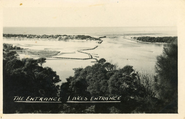
Postcard - The Entrance, 1940c
Also one similar images, 7 x 12.5, donated by Pam Cole, Lara VicBlack and white postcard of Bullock Island, and rock groynes, Reeves and Entrance Channels and Carpenter Town at the New Works, taken from Jemmys Point, dense vegetation in foreground. Lakes Entrance VictoriaThe Entrance Lakes Entrance waterways, topography, township -
 Lakes Entrance Historical Society
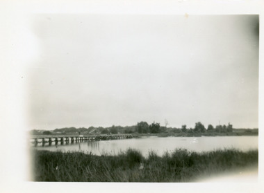
Photograph - Bullock Island, 1930c
Black and white photograph of Bullock Island, showing sparse vegetation on island, low foot bridge to island, reedy vegetation in foreground. Lakes Entrance Victoria topography, islands, bridges -
 Lakes Entrance Historical Society
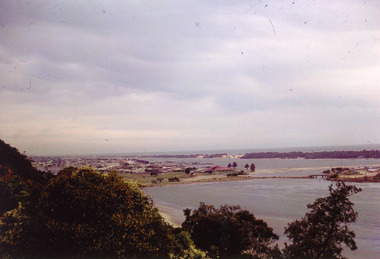
Photograph - Lakes Entrance, Nelson Joan, 1975c
Colour photograph of the township, taken from Jemmys Point. It shows the causeway and raised bridge to Bullock Island, scrub covered sand hummocks and Bass Strait in distance. Lakes Entrance Victoria waterways, topography, township -
 Lakes Entrance Historical Society
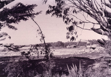
Photograph - Bullock Island, Fish Marie, 2005c
Black and white photograph showing heavy machinery clearing the site of Pecks fish processing factory on Bullock Island, photo also shows dumped sand on island and Kalimna Heights in background. Lakes Entrance Victoriaislands, topography, machinery -
 Lakes Entrance Historical Society
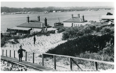
Photograph - Carpentertown, 1900c
Also black and white copy 9 x 13 cmBlack and white photograph showing buildings on dunes. From left is harbour masters house, harbour engineers house, and Carpenters house. Child on boardwalk and newly planted marram grass on dune. Township across Cunninghame Arm. Lakes Entrance Victoriawaterways, topography, township -
 Lakes Entrance Historical Society
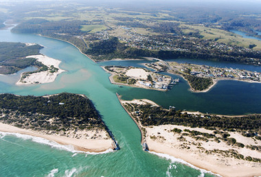
Photograph - Lakes Entrance, 2000
Colour photograph of aerial view of the entrance at Lakes Entrance, shows part of Rigby Island, Bullock Island, North Arm, Cunninghame Arm and buildup of sand on ocean shores of sand hummocks. Lakes Entrance Victoria waterways, township, topography -
 Lakes Entrance Historical Society
Photograph, Merrangbaur House Lakes Entrance Victoria, 1950c
formerly Merrangbaur House, showing the tree which for many years was a Lakes Entrance landmark and a navigation sign for boats entering the original entranceSepia toned photograph of Pine Hill, . Guest house is visible on brow of hill. Lakes Entrance Victoriaguesthouses, tourism, topography -
 Lakes Entrance Historical Society
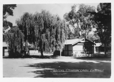
Postcard - Whiters Camp Park, Bulmer H D, 1945c
One of a set of eight small format postcardsSmall format black and white postcard of Whiters Camp Park, showing two cement sheet buildings, weeping willow tree and other trees. Lakes Entrance VictoriaWhiters Camp Park Lakes Entrancetourism, topography, resort -
 Lakes Entrance Historical Society
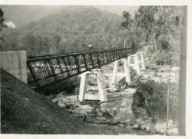
Photograph - Bridges, 1990
Also another photo taken laterColour photograph showing McKillops Bridge across the Snowy River in the High Country near Deddick, East Gippsland near the Victorian / NSW border, south side of bridge, road to Deddick just visible opposite end, taken from west end of bridge. River flowing to right, bridge of timber, steel and concrete, mountains around. East Gippsland Victoriabridges, waterways, topography -
 Lakes Entrance Historical Society
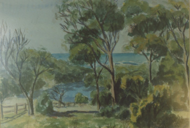
Photograph - Lake Bunga, 1980c
Colour photograph of a painting by Rodney Symmonds showing lake between overhanging trees with ocean beyond, Lake Bunga Victoriatopography, waterways, forest -
 Lakes Entrance Historical Society
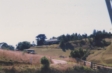
Photograph, 2000 c
Also a similar colour photograph number 03861.1 size 10 x 15 cmColour photograph of Frenchman's Gully showing Wyanga Winery vehicle on winery track with property Taradale of Leigh and Judy Davies on opposite hill Lakes Entrance Victoriaaerial photograph, topography, township -
 Lakes Entrance Historical Society
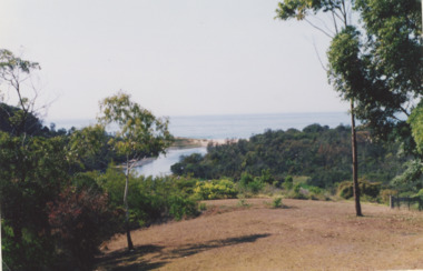
Photograph, Lake Bunga Victoria
taken from 'Bunga Haven' looking toward the closed entrance with ocean in the background Colour Photograph of Lake Bunga Victoria. Second photo of Lake Bunga waterways, topography, gippsland lakes -
 Lakes Entrance Historical Society
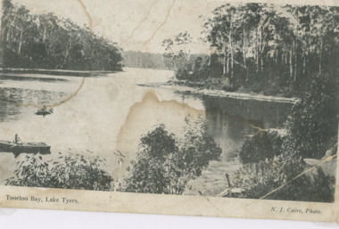
Photograph - Toorloo Bay Lake Tyers Victoria
Advertisement on back for Sale Steamboat Co LtdBlack and white photograph showing heavily forested shorelines, two small rowing boats left foreground Toorloo Bay Lake Tyers VictoriaToorloo Bay Lake Tyerswaterways, topography, gippsland lakes