Showing 14988 items
matching view
-
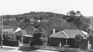
 Ringwood and District Historical Society
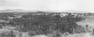
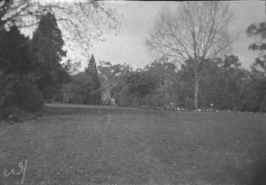
Photograph, View from Loughnan Road towards centre of Ringwood - undated
View from Loughnan Road towards centre of Ringwood - undated. -
 Buninyong & District Historical Society
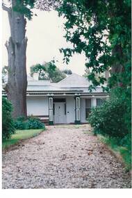
Photograph - Original Photograph, Front view Netherby, Warrenheip St. in 1991, 1991
historic, buildingColour photograph, Front view Netherby, Warrenheip St. in 1991buninyong, warrenheip st., netherby, sparling -
 Buninyong & District Historical Society
Photograph - Original Photograph, Larundel homestead, Elaine in 1993, side view, 21/11/1993
historic Colour photo, Larundel homestead, Elaine in 1993, side viewelaine, larundel, austin family -
 Stawell Historical Society Inc
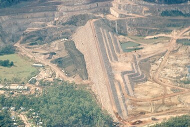
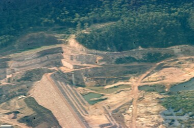
Slide, Ian McCann, Ariel view of the Dam Wall at Lake Bellfield, 1960's
Ariel View of the Dam wall at lake Bellfield Druning Constructiongrampians -
 Stawell Historical Society Inc
Slide, Ian McCann, Ariel View of Lake Bellfied showing the wall, 1960's
Ariel View of Lake Bellfield showing the wall during constructiongrampians, colour slide -
 Stawell Historical Society Inc
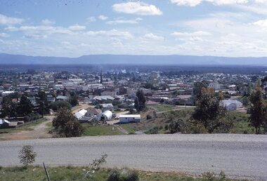
photograph - Slides, Ian McCann, View from Big Hill looing West?, 1976 - 1984
Clour Photograph of the view looking across Stawell towards the Grampians. -
 Whitehorse Historical Society Inc.
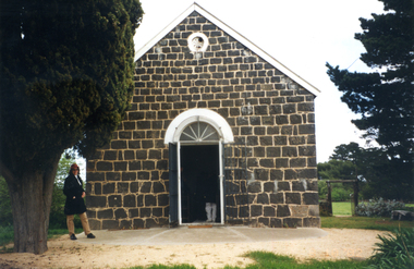
Photograph, Front view of St John's Church, 8/10/2002 12:00:00 AM
Coloured photograph of view of the front of the St Johns Church at Westgarthtown,westgarthtown, st johns church westgarthtown -
 Ballarat Heritage Services
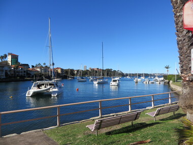
Photograph - Colour, View from the Flying Squadron Club, Kirribilli, 2019, 14/07/2019
Colour photograph of the view from the Flying Squadron Club, Kirribillisydney, flying squadron, kirribilli, sailing -
 University of Melbourne, Burnley Campus Archives
Negative - Black and white negative, Garden View, 1922-1923
Black and white photograph. Garden view across the Croquet Lawnj.l. provan, garden view, croquet lawn -
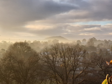 Ballarat Heritage Services
Photograph - Photpgraph - Colour, View Towards Mount Warrenheip, 2019, 20/06/2019
Colour photographs of a view towards Mount Warrenheip on a foggy morning.mt warrenheip, ballarat, fog -
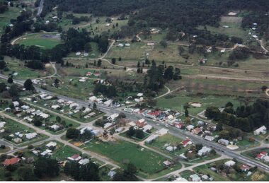 Linton and District Historical Society Inc
Photograph, Photographer: Alan Giles, Aerial View of Linton, 1991, 1.9.1991
Photograph taken by Alan Giles whilst on a joy flight over Linton. Shows oval, left top corner, Sussex St (Glenelg Highway) running from bottom RH corner.Colour photograph, aerial view of Linton township looking north."Linton township, Vic-1st September 1991".linton township -
 Eltham District Historical Society Inc
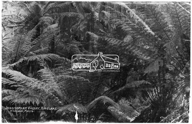
Photograph, Kinglake National Park; view from the Mountain Trail
Kinglake National Park was established in 1928 on 11,300 acres in the Shire of Eltham. Jehosophat Valley was named by the Hotelier Frank Thomson's father, who was so struck with the grandeur of the valley in all its pristine beauty that he 'ejaculated the word Jehosophat.'This photo forms part of a collection of photographs gathered by the Shire of Eltham for their centenary project book,"Pioneers and Painters: 100 years of the Shire of Eltham" by Alan Marshall (1971). The collection of over 500 images is held in partnership between Eltham District Historical Society and Yarra Plenty Regional Library (Eltham Library) and is now formally known as 'The Shire of Eltham Pioneers Photograph Collection.' It is significant in being the first community sourced collection representing the places and people of the Shire's first one hundred years.Digital imagesepp, shire of eltham pioneers photograph collection, kinglake, kinglake national park, view, bush, ferns, jehosophat -
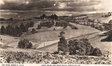 Emerald Museum & Nobelius Heritage Park
Photograph/postcard, Rose Series Postcards 'View from the Main Road, Emerald, Vic, circa 1930's - 40's
Early panorama of EmeraldPostcard from the Rose SeriesFront: The Rose Series P. 2774 'View from the Main Road, Emerald, Vicrose postcard series, emerald -
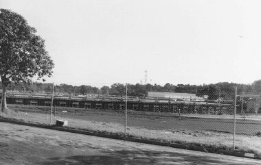 Ringwood and District Historical Society
Photograph, View of forming of ground floor of Target 1981
Written on back of photograph, "6/6/81. View of forming of ground floor of Target." -
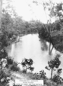 Ringwood and District Historical Society
Photograph, Pinemont Estate, Ringwood. View of lake
Label on photograph reads, "Pinemont Estate, Ringwood. View of lake, on the estate". (2 copies) -
 Ringwood and District Historical Society
Photographs, 1979-80 MMBW pipe line project at Hubbard Reserve, North Ringwood � View east from Debbie Place
Part of a 43-photo record of the MMBW�s engineering feat in drilling a 12 inch pipe line up to 40 feet deep through rock hardened by volcanic action associated with geological fault that occurs along the line. The work took place from October 1979 to May 1980 on the southern boundary of Hubbard Reserve, North Ringwood. The collection was presented to the Ringwood Historical Research Group by J Clarke on 9th June 1980.E558 N29 13 May 1980 A43 View east from Debbie Place -
 Ringwood and District Historical Society
Photograph, View from Maroondah Highway opposite Braeside Avenue towards Loughnan's Hill - 1973
View from Maroondah Highway opposite Braeside Avenue towards Loughnan's Hill - 1973. -
 Ringwood and District Historical Society
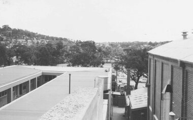
Photograph, View from town hall roof over reserve, 1962
Catalogue card reads, "View from town hall roof over reserve, 1962". -
 Federation University Historical Collection
Photograph - Photograph (Black & White), Mines Department, Back View School of Mines Ballarat, c 1900
The Albert Street end of the Ballarat School of Mines Campus included the Gauge Tower [designed by Henry R. Caselli] and the Mining Laboratory. The buildings shown along Albert Street have been demolished to make way for the M.B. John Building and the Flecknoe Building. Black and white photograph mounted onto green card. Shows the Ballarat School of Mines from Albert Street. The Henry Caselli designed Gauge tower is located on the left hand side of the photo, and Albert Street is an unmade dirt road.Written onto bottom of photo 'Back View School of Mines Ballarat. Mines Dept.ballarat school of mines, albert street, henry caselli, henry richards caselli, hr caselli -
 National Wool Museum
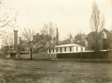
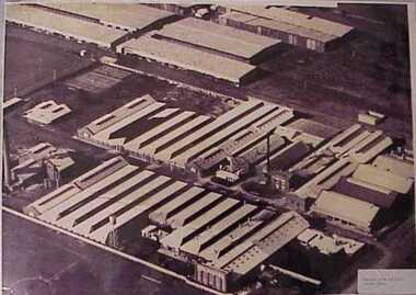
Photograph, Aerial view of mill circa 1920
Acquired when "Classweave Industries" closed down.Aerial view of mill circa 1920 H L S POTTER/ PHOTO STORES/...textile mills woollen mills, classweave industries pty ltd federal woollen mills ltd, textile mills, woollen mills -
 Friends of Westgarthtown
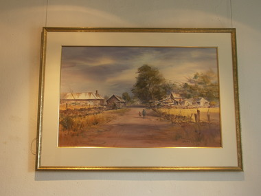
Painting, John Borrack, Ziebells, German Lane, South View
Painted from Gardenia Road. The extensive farm complex on the right. (Western side of Gardenia Road). was demolished in 1972 for housing development. Buildings shown are cowshed, hay barn, engine shed and stables. Painted in the late afternoon, the lengthening shadows and lowering sky, could presage the ominous fate awaiting the farm with development. The Ziebell Farm was known as “The Pines†and sadly none of the many that proliferated there remain. Today they would be equivalent to those at the cemetery, having been planted at the same time. Provenance: John Borrack CollectionWatercolour depicting Ziebell Farmhouse from the north, Thomastown and Mernda. In gold frame with cream border.Artist signature: John Borrack; 70's Ziebells German Lane South Viewillustrations, watercolours, john borrack, ziebell, watercolour, painting -
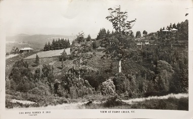 Kew Historical Society Inc
Postcard, Rose Stereograph Company, View at Ferny Creek, Vic, 1925-1939
The Kew Historical Society's postcard collection includes views of Kew, Melbourne and Greater Melbourne as well as those including overseas scenes sent or received from Europe or the Middle East. They date from the 1890s to the 2000s. These postcards may or may not include the name of the publisher or printer. A number of the cards were published as parts of popular series. A way of dating early postcards is to identify whether the reverse was divided by a central line which became the norm after 1902 in the United Kingdom. However, other postcards produced after this date do not always conform to this print layout.A Rose Series postcard of Ferny Creek in the Dandenongs to the north of Melbourne. The monochrome postcard is numbered P. 3811.Front: THE ROSE SERIES P. 3811 COPYRIGHT / VIEW AT FERNY CREEK, VIC. Reverse: POST CARD / THE ROSE SERIES DELUXE / A REAL PHOTOGRAPH PRODUCED IN AUSTRALIA / PUBLISHED BY THE ROSE STENOGRAPH CO., ARMADALE, VICTORIA / [Inscription] Many Happy Returns of the day, Mum.ferny creek - victoria, postcards -
 Port Melbourne Historical & Preservation Society
Postcard, View across Port Melbourne Lagoon, 1871
One from a set of six postcards related to the Gasworks and produced from early images by the City of Port Phillip: View across Sandridge Lagoon 1871 (same view as our #13.2)Cards have three logos: Gasworks Arts, City of Port Phillip, Gas and Fuel Corporationbuilt environment, sandridge lagoon, south melbourne gasworks -
 Ringwood and District Historical Society
Photograph, View from Milton Street, Heathmont . 1952-3
Black and white photograph showing view from Milton St, Heathmont"Written on back of photograph" Looking toward Bayswater and the Dandenongs from Milton St Heathmont 1952-3 -
 Ringwood and District Historical Society
Photograph, View looking from Milton St Heathmont. 1952-3
Black and white photograph showing view from Milton St, Heathmont"Written on back of photograph" Looking down Milton St from the drive of 7 Milton St, Heathmont 1952-3 -
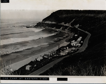 Lorne Historical Society
Photograph, C.R.B. Camp at Eastern View
Photograph showing and overview of Country Roads Board Camp at Eastern Viewg.o.r.: c, r.b. construction camp at eastern view -
 Eltham District Historical Society Inc
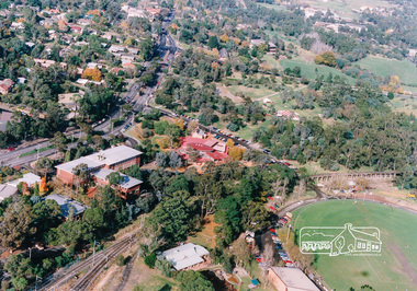
Photograph, Aerial view of Eltham Shire Office and Eltham Library precinct, 1994, 1994
Colour photograph of oblique aerial view centred on Eltham Library, 1994eltham, eltham library, eltham shire offices, eltham central park, alistair knox park, main road, aerial photographs -
 Eltham District Historical Society Inc
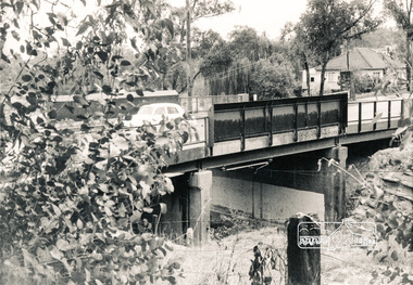
Photograph, Mountain View Road railway bridge, Montmorency
Black and white photograph of railway bridge, Mountain View Road, Montmorencybridges, railways, mountain view road, montmorency -
 Victorian Interpretive Projects Inc.
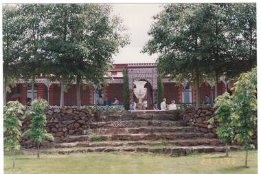
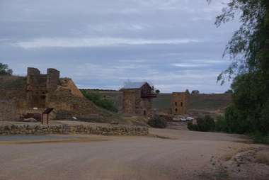
Photograph - Colour, Clare Gervasoni, View from Burra Lookout, South Australia, 29/05/2013
Burra is a town in South Australia's Copper triangle. View of mining remnants at Burra, South Australia from the Burra Lookout. -
 Stawell Historical Society Inc
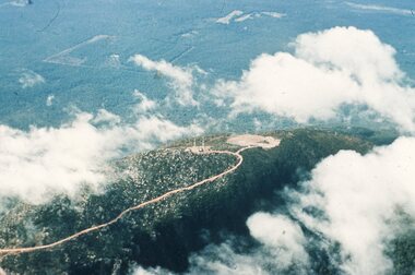
Slide, Ian McCann, Aerial View Grampians & Construction of Bellfield, 1960's
Colour Slide; aerial View of Mt William through scattered cloudsgrampians, mt william