Showing 240 items
matching atlases
-
 Williamstown High School
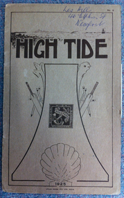
High Tide No.5, Atlas Press Pty Ltd, High Tide 1925
The school year book for the 1925 school year. It includes academic achievements for the year, sports results, prefects and student workA booklet comprising 16 p. Some black and white photographs and illustrations are included. The cover is of light brown card, printed in dark brown ink.On cover in pen: Les Hill, 46 Elphin St, Newport.williamstown high school, yearbooks, high tide -
 Williamstown High School
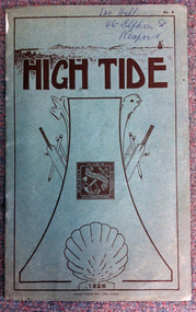
High Tide No.6, Atlas Press Pty Ltd, High Tide 1926
The school year book for the 1926 academic year. It contains 1926 prefects, sports results, scholarship winners, student workA booklet of 16 p. The cover is in forest green card printed in dark brown. Some black and white illustrations and photographs are included.On the front cover in pen: Les Hill, 46 Elphin St, Newport.williamstown high school, yearbooks, high tide -
 Robin Boyd Foundation
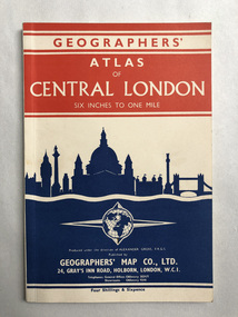
Booklet, Geographers Map Co, Atlas of London
walsh st library -
 Robin Boyd Foundation
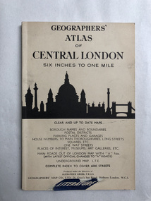
Booklet, Geographers, Atlas of Central London
walsh st library -
 Robin Boyd Foundation
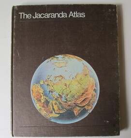
Book, Jacaranda Press, The Jacaranda Atlas, 1969
Hardcover"Suzy Boyd" Inside front cover, Newspaper clippings from The Age, 7th September 1993 re Casino development inserted insidegeography, walsh st library -
 Robin Boyd Foundation
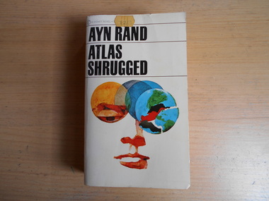
Book, Ayn Rand, Atlas Shrugged, 1957
Softcoverwalsh st library -
 Robin Boyd Foundation
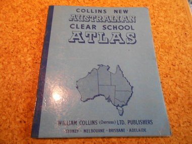
Book, Edgar Ford, Collins New Australian Clear School Atlas, 1965
Softcovergeography, walsh st library -
 Victorian Aboriginal Corporation for Languages
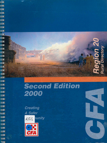
Map, Country Fire Authority, Region 20 rural directory, 2000
mapskerang, regional maps, atlas, fire protection -
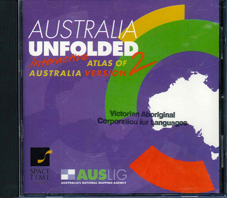 Victorian Aboriginal Corporation for Languages
CD-ROM, Australian Surveying and Land Information Group, Australia unfolded : interactive atlas of Australia, 1996
Systems requirements: Macintosh version: Mac Plus (68030 or higher recommended), 5 MB hard disk space, 2 MB RAM (4 MB RAM recommended), CD-ROM drive, mouse, System 7 or above. "9314231106006"--CD-ROM. System requirements: Windows version: IBM compatible 386 or higher, 5MB hard disk space, 4MB RAM (8MB RAM recommended), VGA monitor, CD-ROM drive, mouse, Windows 3.1 or above. In box (19 x 27 x 5 cm.).CD-ROMtopographic maps, australian maps, surveying -
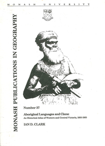 Victorian Aboriginal Corporation for Languages
Book, Ian D Clark, Aboriginal languages and clans : an historical atlas of Western and Central Victoria, 1800-1900, 1990
Comprehensive coverage of language in the Western and Central Victorian areas, 1800-1900. Includes detailed language structures and historical details, Aboriginal Protectors and their work are included.maps, b&w illustrations, b&w photographsaboriginal clans, spatial and social organization, dhauwurd wurrung, gundijimara, djab wurrung, dja dja wurrung, djargurd wurrung, gadubanud, girai wurrung, gulidjan, jardwadjali, wada wurrung, wergaia -
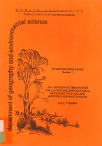 Victorian Aboriginal Corporation for Languages
Book, Sue C Wesson, An overview of the sources for a language and clan atlas of Eastern Victoria and Southern New South Wales, 1994
This monograph concerns Eastern Victoria and Southern New South Wales and reviews the ethnographic record available for the study area. A test case is made of one tribe within the study area which requires further research. Overall, the literature review and the case study demonstrate that the ability to undertake detailed reconstructions, as Clark and Barwick have done for the other regions, can be undertaken in Eastern Victoria and Southern New South Wales, and this model will form the basis of future research.maps, b&w illustrations, b&w photographs, document reproductions, tableswoiworung, bunurong, taungurong, ngurai-illam-wurung, bidawal, maap, norman tindale, diane barwick, aldo massola, eve fesl, ian david clark, george augustus robinson, reverend john bulmer, robert brough smyth, alfred william howitt, moieties, clan names -
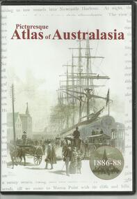 The Adam Lindsay Gordon Commemorative Committee Inc.
DVD, Picturesque Atlas of Australasia- 1886-1880
-
 Stawell Historical Society Inc
Archive - Maps, Victorian Government, Bailliere's Country Atlas of Victoria, 1866
Stawell is on Wimmera & Loddon MapLarge Boxed Volume of Maps in Book Burgandy Coloured BoxUnder the Supervision of the Mining and Survey Department -
Stawell Historical Society Inc
Book - Military Atlas, First World War Atlas, 1970
History of first war through Maps, Intro by Field Marshal Viscount Montgomery OG Alamein, KG Cartography by Arthur Banks Text by Martin Gilbertpaperback, covered in clear contact, white wig green square and red circle with gridDonated to Stawell Biarri group for genealogy inc 4/3/2009 by John Wynd Galen Champgnat Colege Library Wangarattafirst world war cartography history -
Stawell Historical Society Inc
Print, The Picturesque Atlas of Australia, Coloured Wood Engraving of Stawell c 1866 Published in "The Picturesque Atlas of Australasia", 1886
Prepared to celebrate the centenary of Australian settlement since the arrival of the First FleetColoured print of Stawell. View from Big Hill by Hy Fulwood Circa 1866panorama, mining -
Koorie Heritage Trust
Book, Beveridge, Peter, The Aborigines of Victoria and Riverina, 2008 [i.e. 1889]
The Beveridge family of Tyntynder were early settlers. The author was in daily contact with the Aboriginals of the Swan Hill and Murray River tribes, acquired their language and learned much of their customs. His writings were published after his death and this volume contains illustrations from Smyth's Aborigines of Victoria and Garran's Picturesque Atlas of Australasia. It also has biographical notes on Peter Beveridge and others.xxxiv, 221 p. : ill. ; 21 cm.The Beveridge family of Tyntynder were early settlers. The author was in daily contact with the Aboriginals of the Swan Hill and Murray River tribes, acquired their language and learned much of their customs. His writings were published after his death and this volume contains illustrations from Smyth's Aborigines of Victoria and Garran's Picturesque Atlas of Australasia. It also has biographical notes on Peter Beveridge and others.aboriginal australians -- victoria. | aboriginal australians -- murray river valley (n.s.w.-s.a.) | aboriginals - murray river vocabulary. -
Dandenong/Cranbourne RSL Sub Branch
Tribute Certificate
Details of PTE Griffiths' service can be found in the attached service record.Cardboard certificate with various flags and photographs of King George V, Sir Edward Grey and Lord Kitchener.A tribute from the citizens of the Shire of Dandenong to Herbert Wallace Griffiths. -
 Ringwood RSL Sub-Branch
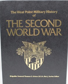
Book - US in WW2, 1031.1 Europe and Mediterranean War 1031.2 Asia and the Pacific 1031.3 Military Campaign Atlas, 1989
3 Volume set - hard cover covering Americas involvement in WW2. Part of The West Point Military series. Author -Brig Gen Thomas E. Griess (Series Editor)Publisher - Avery Publishing Group Inc NJ USA -
Moorabbin Air Museum
Book - ATLAS OF AIR WARFARE, ALEXANDER & MALCOLM SWANSTON, 2009
-
Moorabbin Air Museum
Book, Dana Bell, ATLAS OF WORLD AVIATION
-
Moorabbin Air Museum
Document (Item) - ARINC - Standard Atlas Language For Modular Test
ARINC Specification 626-3 -
Moorabbin Air Museum
Document (Item) - ARINC - Users Guide For ARINC 616 Avionics Subset Of Atlas
ARINC Report 605 -
Moorabbin Air Museum
Manual (Item) - ARINC - Avionics subset of Atlas Language
-
Moorabbin Air Museum
Document - Arinc Report 627 Progammers Guide for Smart Systems Using Arinc 626 Atlas, Airlines Electronic Engineering Committee Aeronautical Radio Inc
-
 Beechworth Honey Archive
Publication, James Halliday's wine atlas of Australia. (Halliday, James). Melbourne, 2008, 2008
311 pages, illustrated. -
 Lilydale RSL Sub Branch
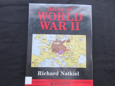
Book, Richard Natkiel, Atlas of World War 11, 1985
Book -
 Lilydale RSL Sub Branch
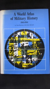
Book, Book Club Associates, A World Atlas of Military History 1945-1984, 1984
Book -
 Mrs Aeneas Gunn Memorial Library
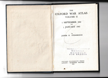
Book, Jasper H. Stembridge, The Oxford war atlas: v.2. 1 Sept. 1941 to 1 Jan 1943, 1943
An atlas illustrating the war up to January 1943Maps, p.47.non-fictionAn atlas illustrating the war up to January 1943world war 1939-1945 - atlases, world war 1939-1945 - history -
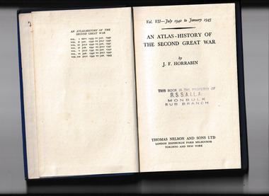 Mrs Aeneas Gunn Memorial Library
Book, T. Nelson, An atlas-history of the Second Great War : v. 7. July 1942 to January 1943, 1943
An atlas of the war from 1942 to 1943Ill, p.111.non-fictionAn atlas of the war from 1942 to 1943world war 1939-1945 - atlases, world war 1939-1945 - history -
Friends of St Brigids Association
Book - An Atlas of Irish History, Edwards, Ruth Dudley. 1989. An Atlas of Irish History. London ; New York : Methuen, 1981 1 atlas (286 p.) : maps ; 24 cm