Showing 610 items
matching boundary road
-
 Greensborough Historical Society
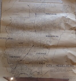
Map, City of Heidelberg. Engineers Dept, City of Heidelberg, 1960s
Map of the City of Heidelberg from the Yarra River in the South to North of Watsonia Military Camp. Shire of Diamond Valley is shown to the north.Map showing municipal and ward boundaries, black text on light brown paper."Scale: 20 CHS = to 1 IN"city of heidelberg -
 Greensborough Historical Society
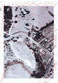
Aerial Photograph, Greensborough aerial with property overlay, 1945_
Enlargements of section of 1945 aerial survey photographs of central Greensborough, with property overlay boundaries and some street numbers by Noel WithersTwo photocopied enlargements with property overlay markingsStreet names and some property numbers. Overlays by Noel Withers.greensborough, plenty river -
 Glenelg Shire Council Cultural Collection
Negative - Negative - Fawthrop Lagoon Portland, Victoria, Zilah Maschmedt, c. 1934
Negative for a black and white photograph. Image shows Bird sanctuary (Fawthrop Lagoon) View across water to Portland. Wooden fence - ? boundary of walkway, trees in foreground -
 City of Moorabbin Historical Society (Operating the Box Cottage Museum)
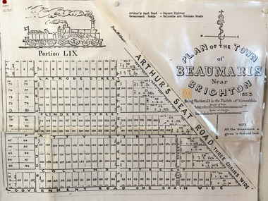
Document, photocopy of Plan of Beaumaris 1853, c1960
Beaumaris includes two early estates in the parish of Moorabbin developed by Josiah Holloway from 1852. Named Beaumaris Town and Beaumaris Estate (after the pastoral run in the area and ultimately after Beaumaris in Wales), the lots comprising them were marketed by Mr Holloway's suggesting that the railway was imminent and a canal would be built. The township developed slowly, a Post Office opened on 1 March 1868, but was replaced next month by Gipsy Village office (now Sandringham) In 1862 Beaumaris was one of the early settler communities within the boundaries of the Moorabbin District Roads Board , the region’s first local government authority. Beaumaris is a suburb in Melbourne, Victoria, Australia, 19 km south-east from Melbourne's central business district. .Since the Amalgamation of Councils 1994 the local government area is the City of Bayside which includes Brighton. A Photocopy of the Plan of Beaumaris 1853 A3moorabbin, county of bourke, brighton, beaumaris, pioneers, early settlers. market gardeners, cheltenham, king. john, holloway josiah, whorral charles, arthur’s seat road, nepean highway, morabbin district roads board, sandringham, mordialloc, mentone -
Glenelg Shire Council Cultural Collection
Photograph - Photograph - Meeting of Viscount de Lisle, Governor General of Australia and Cr. H. D. Mitchell, Shire President, 25/10/1963
Sourced from Casterton Town Hall (former Shire of Glenelg)Coloured photograph of Viscount de Lisle, Governor General of Australia, being greeted by Cr. H. D. Mitchell, Shire President, at Casterton Town Boundary, on 25th Oct. 1963. The photograph is in a cream folder, with green manufacturer's information -
Glenelg Shire Council Cultural Collection
Photograph - Photograph - Hanlon Park, Portland, n.d
Black and white photo of a football match at Hanlon Park, Portland, taken from north side of ground, looking south. Spectators can be seen behind white boundary fence, some footballers close to fence on that side.Back: Round purple stamp: 'PRINTED BY M.E. ANDREWS, PORTLAND' 'Scene of Football Match Portland V Casterton Federal' 'Attendance 400' - handwritten in black inkhanlon park, recreation, football, local sport -
 Eltham District Historical Society Inc
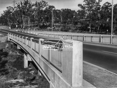
Photograph, Shire of Eltham, New bridge over the Plenty River, Lower Plenty, Nov. 1966
Newly constructed single span bridge on Main Road (now Lower Plenty Road) crossing the Plenty River at Lower Plenty. Site of Heidelberg Golf Club and Lower Plenty Hotel in the background. This was the boundary between the Shire of Eltham and the City of Heidelberg.This photo forms part of a collection of photographs gathered by the Shire of Eltham for their centenary project book ,"Pioneers and Painters: 100 years of the Shire of Eltham" by Alan Marshall (1971). The collection of over 500 images is held in partnership between Eltham District Historical Society and Yarra Plenty Regional Library (Eltham Library) and is now formally known as 'The Shire of Eltham Pioneers Photograph Collection.' It is significant in being the first community sourced collection representing the places and people of the Shire's first one hundred years.Digital imagesepp, shire of eltham pioneers photograph collection, lower plenty, bridge -
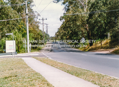
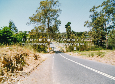
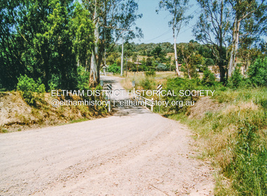
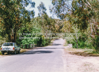
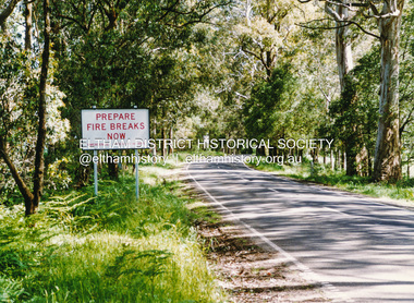
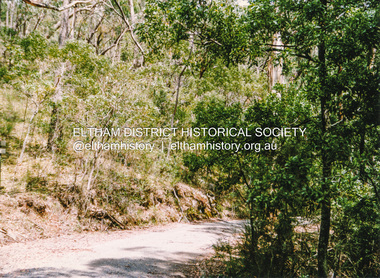
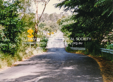 Eltham District Historical Society Inc
Photograph, Doug Orford, Bridge, Henty Road, Lower Plenty, 1991, 1991
From a collection of 35 photos taken by Doug Orford at 35 specific locations along the exact boundary of the then Shire of Eltham.Colour photographbridges, henty road, lower plenty -
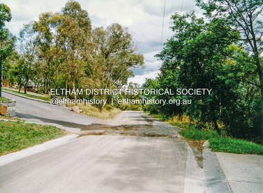
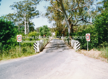
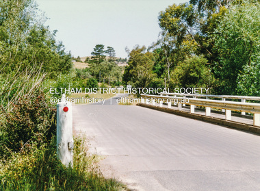
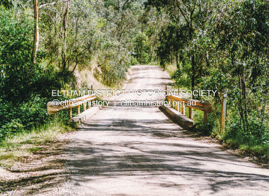
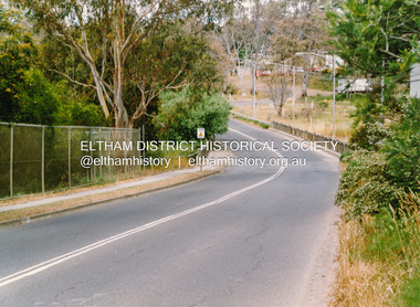 Eltham District Historical Society Inc
Photograph, Doug Orford, Bridge across Plenty River, Main Road, Lower Plenty, 1991, 1991
From a collection of 35 photos taken by Doug Orford at 35 specific locations along the exact boundary of the then Shire of Eltham.Colour photographbridges, lower plenty, main road, plenty river -
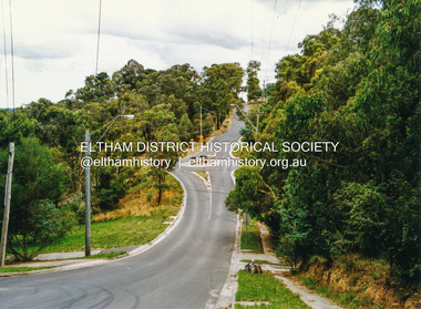
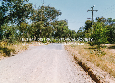
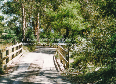
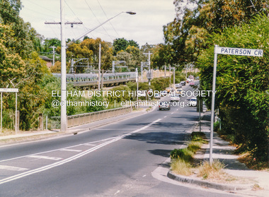 Eltham District Historical Society Inc
Photograph, Doug Orford, Bridge across Plenty River, Para Road, Briar Hill, 1991, 1991
From a collection of 35 photos taken by Doug Orford at 35 specific locations along the exact boundary of the then Shire of Eltham.Colour photographbridges, plenty river, para road, briar hill -
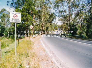
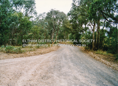
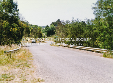
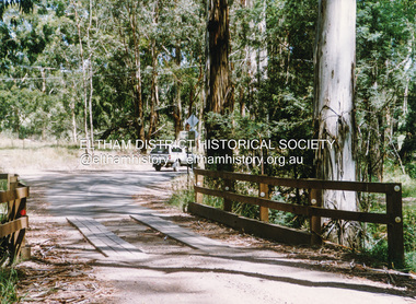
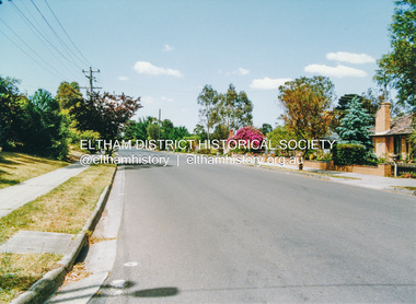 Eltham District Historical Society Inc
Photograph, Doug Orford, Mountain View Road, Briar Hill, near River Street, 1991, 1991
From a collection of 35 photos taken by Doug Orford at 35 specific locations along the exact boundary of the then Shire of Eltham.Colour photographbriar hill, mountain view road -
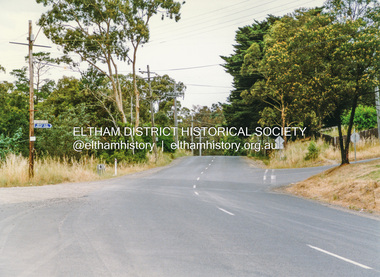
 Eltham District Historical Society Inc
Photograph, Doug Orford, Karingal Drive, Eltham, near Ramptons Road, 1991, 1991
From a collection of 35 photos taken by Doug Orford at 35 specific locations along the exact boundary of the then Shire of Eltham.Colour photographkaringal drive, eltham -
 Eltham District Historical Society Inc
Photograph, Doug Orford, Warringah Crescent, Eltham, near Ramptons Road, 1991, 1991
From a collection of 35 photos taken by Doug Orford at 35 specific locations along the exact boundary of the then Shire of Eltham.Colour photographeltham, warringah crescent -
 Eltham District Historical Society Inc
Photograph, Doug Orford, Ryans Road, Eltham, near Kerrie Crescent, 1991, 1991
From a collection of 35 photos taken by Doug Orford at 35 specific locations along the exact boundary of the then Shire of Eltham.Colour photographeltham, ryans road -
 Eltham District Historical Society Inc
Photograph, Doug Orford, Bridge across Diamond Creek, Wattletree Road, Eltham North, 1991, 1991
From a collection of 35 photos taken by Doug Orford at 35 specific locations along the exact boundary of the then Shire of Eltham.Colour photographbridges, diamond creek, wattletree road, eltham north -
 Eltham District Historical Society Inc
Photograph, Doug Orford, Bridge across Diamond Creek, Allendale Road, Eltham North, 1991, 1991
From a collection of 35 photos taken by Doug Orford at 35 specific locations along the exact boundary of the then Shire of Eltham.Colour photographbridges, diamond creek, eltham north, allendale road -
 Eltham District Historical Society Inc
Photograph, Doug Orford, Ingrams Road, Research, near Allendale Road, 1991, 1991
From a collection of 35 photos taken by Doug Orford at 35 specific locations along the exact boundary of the then Shire of Eltham.Colour photographingrams road, research (vic.) -
 Eltham District Historical Society Inc
Photograph, Doug Orford, Lorimer Road, Research, near Reynolds Road, 1991, 1991
From a collection of 35 photos taken by Doug Orford at 35 specific locations along the exact boundary of the then Shire of Eltham.Colour photographresearch (vic.), lorimer road -
 Eltham District Historical Society Inc
Photograph, Doug Orford, Kangaroo Ground - Wattle Glen Road, Wattle Glen, near Reynolds Road, 1991, 1991
From a collection of 35 photos taken by Doug Orford at 35 specific locations along the exact boundary of the then Shire of Eltham.Colour photographkangaroo ground - wattle glen road, wattle glen -
 Eltham District Historical Society Inc
Photograph, Doug Orford, Bridge across Diamond Creek, Wilson Road, Wattle Glen, 1991, 1991
From a collection of 35 photos taken by Doug Orford at 35 specific locations along the exact boundary of the then Shire of Eltham.Colour photographwattle glen, bridges, diamond creek, wilson road -
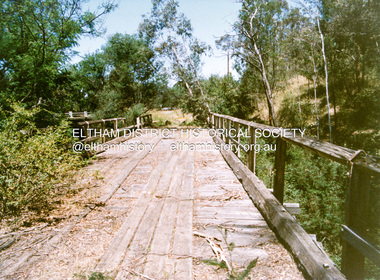
 Eltham District Historical Society Inc
Photograph, Doug Orford, Monash Bridge across Diamond Creek, Hurstbridge - Arthurs Creek Road, Hurstbridge, 1991, 1991
From a collection of 35 photos taken by Doug Orford at 35 specific locations along the exact boundary of the then Shire of Eltham.Colour photographbridges, diamond creek, hurstbridge - arthurs creek road, hurstbridge, monash bridge -
 Eltham District Historical Society Inc
Photograph, Doug Orford, Burkes Bridge across Arthurs Creek, Hurstbridge - Arthurs Creek Road, Hurstbridge, 1991, 1991
From a collection of 35 photos taken by Doug Orford at 35 specific locations along the exact boundary of the then Shire of Eltham.Colour photographbridges, hurstbridge - arthurs creek road, hurstbridge, burkes bridge, arthurs creek -
 Eltham District Historical Society Inc
Photograph, Doug Orford, The old Burkes Bridge across Arthurs Creek, Hurstbridge - Arthurs Creek Road, Hurstbridge, 1991, 1991
From a collection of 35 photos taken by Doug Orford at 35 specific locations along the exact boundary of the then Shire of Eltham.Colour photographbridges, hurstbridge - arthurs creek road, hurstbridge, burkes bridge, arthurs creek -
 Eltham District Historical Society Inc
Photograph, Doug Orford, Lintons Bridge across Arthurs Creek, Doctors Gully Road, Nutfield, 1991, 1991
From a collection of 35 photos taken by Doug Orford at 35 specific locations along the exact boundary of the then Shire of Eltham.Colour photographbridges, arthurs creek, lintons bridge, nutfield, doctors gully road -
 Eltham District Historical Society Inc
Photograph, Doug Orford, Bridge across Arthurs Creek, Arthurs Creek Road, Arthurs Creek, 1991, 1991
From a collection of 35 photos taken by Doug Orford at 35 specific locations along the exact boundary of the then Shire of Eltham.Colour photographbridges, arthurs creek, arthurs creek road -
 Eltham District Historical Society Inc
Photograph, Doug Orford, Bridge across Arthurs Creek, Eagles Nest Road, Arthurs Creek, 1991, 1991
From a collection of 35 photos taken by Doug Orford at 35 specific locations along the exact boundary of the then Shire of Eltham.Colour photographbridges, arthurs creek, eagles nest road -
 Eltham District Historical Society Inc
Photograph, Doug Orford, Bridge, Chads Creek Road, Strathewen, 1991, 1991
From a collection of 35 photos taken by Doug Orford at 35 specific locations along the exact boundary of the then Shire of Eltham.Colour photographbridges, chads creek road, strathewen -
 Eltham District Historical Society Inc
Photograph, Doug Orford, Heidelberg - Kinglake Road near Kinglake, 1991, 1991
From a collection of 35 photos taken by Doug Orford at 35 specific locations along the exact boundary of the then Shire of Eltham.Colour photographheidelberg-kinglake road, kinglake -
 Eltham District Historical Society Inc
Photograph, Doug Orford, Old Kinglake Road, Steels Creek, 1991, 1991
From a collection of 35 photos taken by Doug Orford at 35 specific locations along the exact boundary of the then Shire of Eltham.Colour photographold kinglake road, steels creek -
 Eltham District Historical Society Inc
Photograph, Doug Orford, Bridge across Watsons Creek, One Tree Hill Road, Christmas Hills, 1991, 1991
From a collection of 35 photos taken by Doug Orford at 35 specific locations along the exact boundary of the then Shire of Eltham.Colour photographwatsons creek, christmas hills, bridges, one tree hill road