Showing 798 items
matching rural road
-
 Greensborough Historical Society
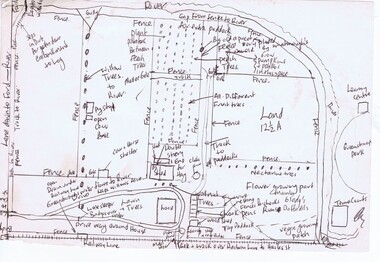
Map, Gary Partington, Alwyn at Whatmough Park, 1960s
The property "Alwyn" was owned by the Partington family and was compulsorily acquired by the Shire of Diamond Valley to become Whatmough Park. This plan was drawn from memory by Gary Partington and illustrates land use when his father, Alan Partington, owned the property.This plan illustrates the rural nature of land around Greensborough prior to the 1960s.Drawing of land use in 1960s at "Alwyn", a property currently occupied by Whatmough Park alwyn, partington family, whatmough park -
 Greensborough Historical Society
Booklet - Report, RBA Architects, Uglow House (Wyldefell), 2021
Constructed in 1955-56, the house was designed by Robin Boyd for Dr Arthur G R Uglow and his wife Enid, one of the buildings that formed a surge in residential occupation of the semi-rural Montmorency area in the 1950s. Citation 21 of the Banyule Heritage Study 2020.13 p. typescript and colour photographs, stapledbuena vista drive montmorency, uglow family, robin boyd, banyule heritage study 2020, montmorency - places -
 Greensborough Historical Society
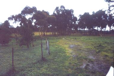
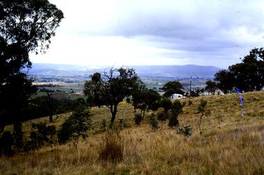
Slide - Photograph, John Ramsdale, Rural scene: Slide 17, 1990s
Photograph shows a rural scene with post and wire fence and trees. Location unknown.Part of the John Ramsdale collection of slides and audio visual material.Colour photograph scanned from slide.No caption. Printed maker's mark on slide "Kodak Kodachrome Slide"rural landscape -
 Greensborough Historical Society
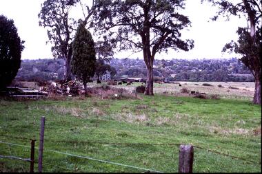
Slide - Photograph, John Ramsdale, Near scar tree Yallambie: Slide 48, 1990s
Photograph shows rural view with cattle and trees. This is the scar or canoe tree in Yallambie. Part of the John Ramsdale collection of slides and audio visual material.Colour photograph scanned from slide.No caption. Printed maker's mark on slide "Kodak Kodachrome Slide"scar tree, canoe tree, yallambie -
 Greensborough Historical Society
Slide - Photograph, John Ramsdale, Looking towards Bulleen from Lower Plenty; Slide 115, 1990s
Photograph shows a rural scene with gum tree and pylon, looking towards Bulleen from Lower Plenty.Part of the John Ramsdale collection of slides and audio visual material.Colour photograph scanned from slide.No caption. Printed maker's mark on slide "Kodak Kodachrome Slide"bulleen, lower plenty -
 Greensborough Historical Society
Slide - Photograph, John Ramsdale, Looking towards Bulleen brickworks; Slide 126, 1990s
Photograph shows a rural view with paddocks and trees, looking towards Bulleen brickworks.Part of the John Ramsdale collection of slides and audio visual material.Colour photograph scanned from slide.No caption. Printed maker's mark on slide "Kodak Kodachrome Slide"bulleen -
 Greensborough Historical Society
Slide - Photograph, John Ramsdale, Rural landscape Mill Park: Slide 9
Photograph shows a rural landscape with a few buildings, possibly east of Plenty Road near Mill Park.Part of the John Ramsdale collection of slides and audio visual material.Colour photograph scanned from slide.No maker's marks. No caption on slide.mill park -
 Greensborough Historical Society
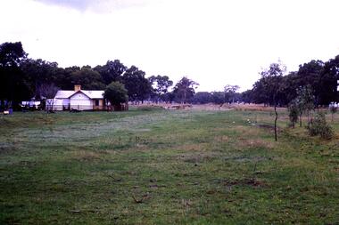
Slide - Photograph, John Ramsdale, Rural panorama: Slide 14
Photograph shows view across a road and open land to large house in a rural setting. At the time of the photograph was named 'Odyssey House' at Lower Plenty, Pre 1976 it was known as the Blessed Sacrament Fathers Seminary.Part of the John Ramsdale collection of slides and audio visual material.Colour photograph scanned from slide.No maker's marks. No caption on slide.rural landscape -
 Greensborough Historical Society
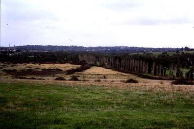
Slide - Photograph, John Ramsdale, Canoe tree, Bonds Road: Slide 20, 1990s
Photograph shows a rural scene with large gum tree (scar tree or canoe tree) in foreground and farmland in background. This is on Bonds Road Rosanna near the Rosanna Golf Club.Part of the John Ramsdale collection of slides and audio visual material.Colour photograph scanned from slide.No maker's marks. No caption on slide.canoe tree, first nations, bonds road rosanna -
 Greensborough Historical Society
Slide - Photograph, John Ramsdale, Old railway line Whittlesea: Slide 47, 1990s
Photograph shows what appears to be a rural farmhouse and paddock, this is part of the site of the old railway line to Whittlesea. In centre of photo is the old station platform.Part of the John Ramsdale collection of slides and audio visual material.Colour photograph scanned from slide.No maker's marks. No caption on slide.whittlesea, whittlesea rail line -
 Greensborough Historical Society
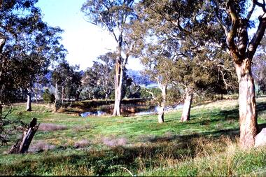
Slide - Photograph, John Ramsdale, Farmland Yallambie: Slide 49, 1990s
Photograph shows a rural landscape with gum trees and dam; this is near Yallambie on the Plenty River.Part of the John Ramsdale collection of slides and audio visual material.Colour photograph scanned from slide.No maker's marks. No caption on slide.plenty river, yallambie -
 Greensborough Historical Society
Slide - Photograph, John Ramsdale, Upper Plenty, possibly Yan Yean: Slide 56, 1990s
Photograph shows a rural scene after rain. The upper Plenty, possibly around Yan Yean.Part of the John Ramsdale collection of slides and audio visual material.Colour photograph scanned from slide.No maker's marks. No caption on slide.plenty river, yan yean -
 Greensborough Historical Society
Slide - Photograph, John Ramsdale, River flood plain looking west: Slide 67, 1990s
Photograph shows a rural scene with water over ground. This is the Plenty River flood plain looking west, Yan Yean or MerndaPart of the John Ramsdale collection of slides and audio visual material.Colour photograph scanned from slide.No maker's marks. No caption on slide.plenty river, yan yean, mernda -
 Phillip Island and District Historical Society Inc.
Transparencies, 1990's
Slides in good condition but of a size not currently in use.8 Transparencies containing a view of Erehwon Point, a Kiln on French Island & a Kiln on Back Beach Road, Phillip Island.local history, photography, photographs, slides, film, buildings, historic, rural industry, agriculture, early slides, chicory kilns, phillip island -
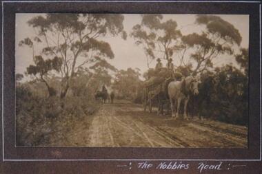 Phillip Island and District Historical Society Inc.
Photograph, Hay carting, The Nobbies Road, Phillip Island, c 1913
Unmade road through bush and trees. One white horse and one black horse pulling cart loaded with hay. Two hatted men seated on top of hay. A rider on horseback with stock in background. Very rural scene.Carting hay on Nobbies RoadThe Nobbies Roadlocal history, photographs, the nobbies road, sepia photograph, betty kus collection, rural scene, phillip island, bruce bennett -
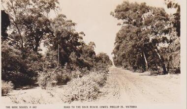 Phillip Island and District Historical Society Inc.
Photograph, Cowes, Phillip Island, C 1926
A dirt road - telegraph polesRoad to the Back Beach, Cowes, Phillip Island, Victoria. The Rose Series P662The Rose Series P662. Road to the Back Beach, Cowes, Phillip Is., Victorialocal history, postcards, cowes back beach, dirt road, sepia photograph, ian reiher, rural, cowes, phillip island -
 Phillip Island and District Historical Society Inc.
Photograph, 1978/79
Chicory Kiln alongside the house of Mr T Woods in Settlement Road, East Cowes, was built in approx. 1870. It had 18" thick mud brick walls at the core.Photograph of Chicory Kiln on Settlement Road, East Cowes, on land owned by Mr. T. Woods.local history, photographs, buildings - historical, housing, rural industry, coloured photograph, john cook, phillip island, t woods -
 Phillip Island and District Historical Society Inc.
Photograph, 1978/79
View of 18" thick mud brick walls in Chicory Kiln. This was built by Mr T Woods approx. 1870, Settlement Road, East Cowes. Two chicory sowers shown in photograph. Man in photograph is probably Mr T Woods.Photograph of the 18" thick mud brick walls at the core of the old Chicory Kiln on Mr T Woods house, Settlement Road, East Cowes.local history, photographs, buildings - historical, housing, rural industry, coloured photograph, john cook, phillip island, t woods -
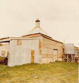
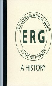 Greensborough Historical Society
Booklet, The Eltham Rural Group: a history, 05/12/1993
History of Eltham Rural Group, a fundraising and social society established in 1955.46 p., photographs; with invitation cardeltham rural group -
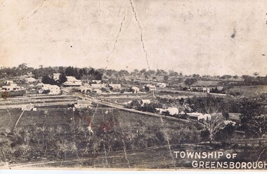 Greensborough Historical Society
Photograph - Digital Image, Greensborough township c1900, 1900s
This photograph shows a very rural Township of Greensborough around 1900.Digital copy of black and white photographmain street greensborough, greensborough -
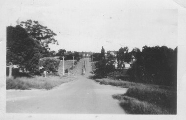 Greensborough Historical Society
Photograph - Digital image, Nance Reardon, Looking down Grimshaw Street 1950s, 1950s
Photograph of Grimshaw Street in the 1950s. A rural scene compared to today.Digital copy of black and white photograph.simons family, grimshaw street greensborough -
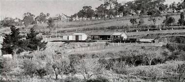 Greensborough Historical Society
Photograph - Digital Image, Greensborough Station, early 1900s, 1910_
Greensborough Station pre-World War I. The orchard on the land in the foreground is now Poulter Avenue and Pope Place.Shows the rural nature of the Greensborough area in the early 20th centuryDigital copy of black and white photograph. trains, greensborough railway station, poulter avenue greensborough, pope place greensborough -
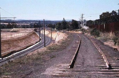 Greensborough Historical Society
Photograph - Digital Image, Watsonia Station, 1978c, 1978c
Watsonia Station during the duplication of the train line c1978. This photograph shows the existing rail line and the construction of the new tracks in the cutting. Looking toward Grimshaw Street.Shows the rural nature of the Greensborough area in the early 20th centuryDigital copy of colour photograph. trains, watsonia railway station -
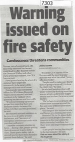 Greensborough Historical Society
Newspaper Clipping, Diamond Valley Leader, Warning issued on fire safety, 13/11/2019
Drones, out of control burn offs and badly executed barbecues could lead to a fire disaster across the Diamond Valley and other rural areas this summer, the CFA has warned.News article 1 page, black text.cfa, bushfire warnings, bushfires, country fire authority -
 Greensborough Historical Society
Folder, Hume Street Improvement Committee, 1958_
The Hume Street Improvement Committee was one of several 'progress associations' in the Greensborough area at the time the area was being urbanised. A typed page explains the concerns of residents when the street was being paved. Includes photographs and maps of area.These documents are concerned with the urbanisation of Greensborough in the mid 20th century while residents tried to maintain the rural feel of the area.Foolscap manilla folder containing various lists, maps and photographs.On cover "Hume Street Improvement Committee/ spare circulars/maps"greensborough, road making, brian roberts, hume street improvement committee, briar hill -
 Greensborough Historical Society
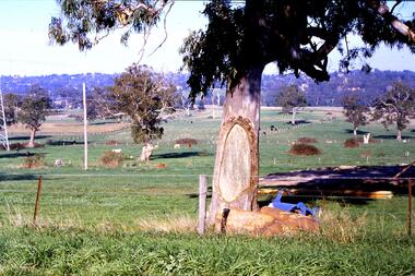
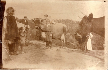
Photograph (copy), Unknown, Weaver and Partington families, 1914_
Rural scene with children identified as Lorna Weaver, William and Annie May Partington with baby Jack, Alan Partington and Nancy Weaver. The Weavers were friends of the Partington family. Alan's father, William Partington, can be seen in the left background, with Alan Partington centre foreground.The Partington family were Greensborough pioneers. Descendents still live in the area.Copy of sepia photograph of children and cows.alan partington, lorna weaver, nancy weaver, william partington -
 Glenelg Shire Council Cultural Collection
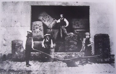
Photograph - Photograph - men and a wooden plough, Portland, n.d
... Cliff Street Portland great-ocean-road Unknown plough industry ...UnknownReproduction of original photograph depicting four men standing in doorway of a woolshed. Man in centre is standing on a pile of sacking, a man in front of him is leaning against a barrel and two men are standing to the left and the right of a wooden plough.Front: (no inscriptions) Back: First Plough in Portland, First Wool, First Cooper, First Blacksmith, First Bales of Wool (black type on label)plough, industry, rural, farming, wool bales -
Glenelg Shire Council Cultural Collection
Administrative record - Administrative record - Essay 'A Major Structural Rural Change To The Economy of Western Victoria', c. 1960
Handwritten 10 page essay, by an unknown author. Written in fountain pen on lined foolscap paper. Writing on one side of paper only. -
Glenelg Shire Council Cultural Collection
Booklet, A Homely Chat About Dairying, 09/1888
A booklet, containing a lecture on model dairies, 'A Homely Chat About Dairying'; delivered by Mr. D. Wilson, at the Centennial International Exhibition, 8th September 1888.centennial exhibition, melbourne exhibition building, 1888, dairy, rural industry -
 Glenelg Shire Council Cultural Collection
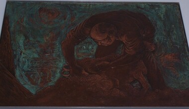
Sculpture - Bas-relief, Untitled (Early Pastoral Industries), n.d
Commissioned by State Bank to produce 5 copper bas-reliefs for 73 Percy Street, Portland. Spoke with Miss Betty Vivian (Member of the Portland Historical Society) re Portland's history. Commonwealth Bank stored objects in Melbourne (c.1991). Negotiations between Portland Historical Society and Commonwealth Bank of Australia led to gift of works to People of Portland. Stored at Council depot c.1998, retrieved for Maritime Discovery Centre display.Copper bas-relief depicting a man bent over to shear a sheep. His shirt sleeves are rolled up and he is bent toward the viewer.sculpture, industry, rural, copper, bas-relief, shearing, sheep, shearer