Showing 2090 items
matching bendigo maps
-
 Bendigo Historical Society Inc.
Map - BAMAWM ESTATE, 24/02/1931
... Inc. History House 11 Mackenzie Street Bendigo goldfields MAP ...Map: Bamawm Estate, Aquired under closer settlement Act 1904, County of Bendigo. Parish plan Canvas backed ( number 129 in Map Cupboard 1)map, bendigo, rural, bamawm estate, closer settlement acts 1904, county of bendigo -
 Bendigo Historical Society Inc.
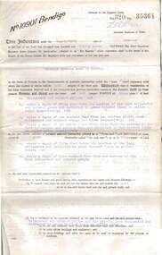
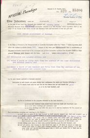
Document - MCCOLL, RANKIN AND STANISTREET COLLECTION: GOLD MINING LEASE, 1937
Document: McColl, Rankin and Stanistreet: document - gold mining lease document, 3 pages with map. Map adjoins Upper California Gully Road. Sheaf of 5 letters attached to inside of document with pin. Lease between Herbert Jackson Leed of Bendigo and State of Victoria. No. 10901, Vol 320 Fol 35364.organization, mining, gold mining lease, mccoll, rankin and stanistreet: herbert jackson leed, gold mining lease -
 Bendigo Historical Society Inc.
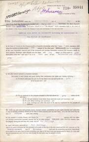
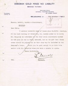
Document - MCCOLL, RANKIN AND STANISTREET COLLECTION: DEBORAH GOLD MINES NL GOLD MINING LEASE DOC, 1941
Document: McColl, Rankin and Stanistreet: Gold Mining Lease Private Land, 11089 Bendigo on front of document., Deborah Gold Mines NL - 3 pages, with map. Lease adjoins Railway Reserve, Breen Street. Transferred to North Deborah Mining Company NL on 9th. October, 1950. No. 11089, Vol 326 Fol 35941.organization, mining, gold mining lease, mccoll, rankin and stanistreet:, deborah gold mines nl, north deborah mining company nl, gold mining, lease -
 Bendigo Historical Society Inc.
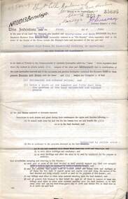
Document - MCCOLL, RANKIN AND STANISTREET COLLECTION: DEBORAH GOLD MINES NL GOLD MINING LEASE ON PRIVATE LAND, 1941
Document McColl, Rankin and Stanistreet: - 3 page lease document Deborah Gold Mines NL, with map., Lease adjoins Railway Reserve, Breen Street, Bendigo. Transferred to North Deborah Mining Company NL of Charing Cross, Bendigo on 9th. Oct. 1950. No. 11013, Vol 323, Fol 35696.organization, mining, gold mining lease documents, mccoll, rankin and stanistreet:, deborah gold mines nl, north deborah mining company nl, gold mining, lease document -
 Bendigo Historical Society Inc.
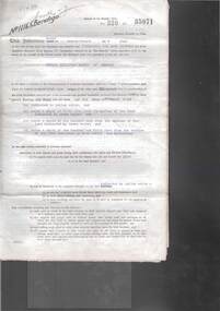
Document - MCCOLL, RANKIN AND STANISTREET COLLECTION: GOLD MINING LEASE RONALD ALEXANDER RANKIN, 1941
Document: McColl, Rankin and Stanistreet: lease document between Ronald Alexander Rankin of Bendigo and the State of Victoria. 3 pages with map - lease adjoins Bellevue Road. Lease transferred to Deborah Gold Mines NL in 1945.organization, mining, gold mining lease, mccoll, rankin and stanistreet:, ronald alexander rankin, lease document, gold mining -
 Bendigo Historical Society Inc.
Document - MCCOLL, RANKIN AND STANISTREET COLLECTION:SOUTH NELL GWYNNE GOLD MINING COMPANY NO LIABILITY, 1940
Document: South Nell Gwynne Gold Mining Company No Liability - gold mining lease document no. 11074 Bendigo. Document of 3 pages with map insert.organization, mining, south nell gwynne gold mining co., bendigo, mccoll, rankin & stanistreet -
 Bendigo Historical Society Inc.
Document - MCCOLL, RANKIN AND STANISTREET COLLECTION: DEBORAH GOLD MINE NL - LEASE DOCUMENTS, 1935, 1941
Document: McColl, Rankin and Stanistreet: lease documents. 12 pages of lease details, with attached map plan on no 9672 Bendigo. ( Abel and Eve Street marked )organization, mining, deborah gold mines nl, mccoll, rankin and stanistreet: deborah gold mines nl, gold mining, lease -
 Bendigo Historical Society Inc.
Document - MCCOLL, RANKIN AND STANISTREET COLLECTION: GOLD MINING LEASE CROWN LAND, 1937
... , includes map County of Bendigo, Parish of Mandurang. Dated 1937... 10916 Bendigo. Foolscap size document, includes map County ...Document : McColl, Rankin and Stanistreet: gold mining lease crown land 10916 Bendigo. Foolscap size document, includes map County of Bendigo, Parish of Mandurang. Dated 1937 between King George VI and John Jepson Stanistreet.person, mining, john jepson stanistreet, mccoll, rankin and stanistreet: bendigo, mining, goldmining, john stanistreet -
 Bendigo Historical Society Inc.
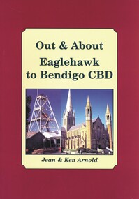
Book - OUT & ABOUT EAGLEHAWK TO BENDIGO CBD, 2007
... COTTAGE Miners Plaques monuments buildings maps buildings Bendigo ...Out & About Eaglehawk to Bendigo CBD .Plaques monuments, buildings, maps, buildings. 88 pages. Includes B&W photosJean & Ken Arnoldcottage, miners, plaques monuments, buildings, maps, buildings, bendigo and district -
 Bendigo Historical Society Inc.
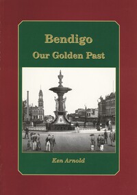
Book - BENDIGO OUR GOLDEN PAST, 2007
Bendigo Our Golden Past. Signed by Ken Arnold 2007. History of Bendigo. Photographs: black and white. Street maps, copy opf painting. 80 pages. Signed by: Ken Arnold, December 2007. 80 pages.Ken Arnoldbendigo, history, bendigo & district, history of bendigo -
 Bendigo Historical Society Inc.
Document - VARIOUS DOCUMENTS FROM 'BOX 511'
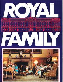
Various documents from 'Box 511': a. 'Royal Family' - re filmed portrait of Queen Elizabeth II (1959); b. 'Scientific American', issue of April 1934; c. 'Band of Hope Review, 1867 - published in England (Baptist); d. 'Beautiful Britain' - Art Series No 6 - Scenery of the United Kingdom, m1894; e. as for d. but Series 10; f. as for d. but Series 11; g. as for d. but Series unknown (no cover); h. 'Hobart and Suburbs' = Aerial Survey Maps (street directory), 1954 - ex libris A. Richardson, 1959; I. 'Weekly Times Annual, Dec 10, 1931 - cover and pages missing; j. 'Table Talk Christmas Annual, Dec 3, 1923 (cover and pages missing)document -
Bendigo Historical Society Inc.
Map - YARRABERB, 17/12/1937
... Inc. History House 11 Mackenzie Street Bendigo goldfields MAP ...Map: Township of Yarraberb, Parish of Yarraberb, County of Bendigo. Parish plan (number 274 in map cupboard 1)map, bendigo, township, yarraberb -
Bendigo Historical Society Inc.
Map - LOCKWOOD, November 25th 1855
... Inc. History House 11 Mackenzie Street Bendigo goldfields MAP ...Map: Garden Allotments within the Town Reserve of Lockwood on the Bullock Creek. Parish plan (number 273 in map cupboard 1)map, bendigo, parish plan, lockwood, garden allotments, bullock creek -
Bendigo Historical Society Inc.
Map - NEWBRIDGE, August 17th 1875
... Inc. History House 11 Mackenzie Street Bendigo goldfields MAP ...Map: Township of Newbridge, Parish of Tarnagulla, County of Bendigo. Parish plan (number 272 in map cupboard 1)map, bendigo, township, newbridge -
Bendigo Historical Society Inc.
Map - AXEDALE, 12/07/1909
... Inc. History House 11 Mackenzie Street Bendigo goldfields MAP ...Map: Township of Axedale, Parish of Axedale, County of Bendigo. Parish plan (number 271 in map cupboard 1)map, bendigo, township, axedale -
Bendigo Historical Society Inc.
Map - RAYWOOD, 18/09/1930
... Inc. History House 11 Mackenzie Street Bendigo goldfields MAP ...Map: Township of Raywood, Parish of Neilborough,County of Bendigo. Parish plan (number 270 in map cupboard 1)map, bendigo, township, raywood -
Bendigo Historical Society Inc.
Map - WALMER, Circa 1900
... Inc. History House 11 Mackenzie Street Bendigo goldfields MAP ...Map: Township of Walmer, 2 hand Draughted Parish plansmap, township, walmer -
Bendigo Historical Society Inc.
Map - NEWSTEAD, 28/07/1874
... Inc. History House 11 Mackenzie Street Bendigo goldfields MAP ...Map: Newstead Town and Suburban Lots, Parish of Strangways. Parish planmap, township, newstead -
Bendigo Historical Society Inc.
Map - PROPOSED TOWNSHIP PARISH OF CAMPASPE, 24th May 1875
... Inc. History House 11 Mackenzie Street Bendigo goldfields MAP ...Map: Proposed Township, Parish of Campaspe(This has been crossed out and 'Creek View' written above). Hand Draughted Parish plan Stapled to the backingmap, township, proposed township, campaspe, creek view -
Bendigo Historical Society Inc.
Map - GOORNONG, 1/10/1906
... Inc. History House 11 Mackenzie Street Bendigo goldfields MAP ...Map: Town of Goornong, Parish of Goornong, County of Bendigo. Parish plan (number 269 in map cupboard 1)map, bendigo, township, goornong -
Bendigo Historical Society Inc.
Map - STRATHFIELDSAYE, See above
... Inc. History House 11 Mackenzie Street Bendigo goldfields MAP ...Map: Township of Strathfieldsaye, Group of 4 plans, 2 hand drafted and 2 printed. Applied to canvas and stapled to the backing. The printed plans are dated January 1859 and 6th January 1871 (number 267 in map cupboard 1)map, bendigo, township, strathfieldsaye -
Bendigo Historical Society Inc.
Map - RAVENSWOOD, April 6th 1872
... Inc. History House 11 Mackenzie Street Bendigo goldfields MAP ...Map: Township of Ravenswood. Parish plan, has a 1913 calendar as a backing (number 266 in map cupboard 1)map, bendigo, township, ravenswood -
Bendigo Historical Society Inc.
Map - HARCOURT, No date visible
... Inc. History House 11 Mackenzie Street Bendigo goldfields MAP ...Map: Township of Harcourt, Parish pf Harcourt, County of Talbot, (number 265 in map cupboard 1)map, talbot, township, harcourt -
Bendigo Historical Society Inc.
Map - HARCOURT, 2/04/1917
... Inc. History House 11 Mackenzie Street Bendigo goldfields MAP ...Map: Town of Harcourt, County of Talbot. Parish plan (number 264 in map cupboard 1)map, talbot, township, harcourt -
Bendigo Historical Society Inc.
Map - NEWSTEAD, 15/10/1912
... Inc. History House 11 Mackenzie Street Bendigo goldfields MAP ...Map: Town of Newstead, Parish of Strangways, County of Talbotmap, talbot, township, newstead, county of talbot -
Bendigo Historical Society Inc.
Map - SURVEY OF MINES, SANDHURST, NEW CHUM, Circa 1881
... Inc. History House 11 Mackenzie Street Bendigo goldfields MAP ...Map: Survey of Mines, Sandhurst, New Chum, Longtitudinal Section of the New Chum, reef. 2 sheets. Sheet 5 and Sheet 8map, mining plan, survey of mines , sandhurst, new chum, gold mines bendigo -
Bendigo Historical Society Inc.
Map - NEW CHUM LINE, 1875
... Inc. History House 11 Mackenzie Street Bendigo goldfields MAP ...Plan: Longtitudinal section of the Southern Section of the New Chum Line of Reef. Compilation consisting of small sections stapled togetherCALEB THOMAS 1875map, mining plan, gold mines, new chum line -
Bendigo Historical Society Inc.
Map - NEW CHUM LINE, 1875
... Inc. History House 11 Mackenzie Street Bendigo goldfields MAP ...Plan: Longtitudinal Section of the Northern Section of the New Chum Line of Reef. Compilation consisting of smaller sections stapled togethermap, new chum line, gold mines, new chum line of reef -
Bendigo Historical Society Inc.
Map - PLAN OF BENDIGO CREEK, 12th March 1873
... Inc. History House 11 Mackenzie Street Bendigo goldfields MAP ...Map:Hand drafted plan of the Bendigo Creek, covering from Scott St. White Hills to Alder St. Kangaroo Flat. Scale 2 chains to 1 inchGeorge R------- ? City Surveyormap, bendigo, bendigo creek -
Bendigo Historical Society Inc.
Map - BENDIGO (COUNTY), Circa 1870's
... Inc. History House 11 Mackenzie Street Bendigo goldfields MAP ...Map:Plan showing the whole of the County of Bendigo-- attached handwritten sheet in the top left hand corner-'Proclaimed Commons Sandhurst District'. Also attached is a separate plan of the parish of Kimbolton (number 262 in map cupboard 1)map, bendigo, parish plan, bendigo, proclaimed commons