Showing 11326 items matching "land-clearing"
-
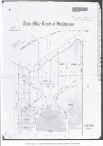
![Monnington [Estate], 1935](/media/collectors/550653872162f11fb04854aa/items/5907eb86d0ce0c14e82385c8/item-media/5907ecafd0ce0c14e823e87f/item-fit-380x285.jpg) Kew Historical Society Inc
Kew Historical Society IncPlan - Subdivision Plan, Monnington [Estate], 1935, 1935
Pru Sanderson, in her groundbreaking ‘City of Kew Urban Conservation Study : Volume 2 - Development History’ (1988), summarised the periods of urban development and subdivisions of land in Kew. The periods that she identified included 1845-1880, 1880-1893, 1893-1921, 1921-1933, 1933-1943, and Post-War Development. These periods were selected as they represented periods of rapid growth or decline in urban development. An obvious starting point for Sanderson’s groupings involved population growth and the associated economic cycles. These cycles also highlighted urban expansion onto land that was predominantly rural, although in other cases it represented the decline and breakup of large estates. A number of the plans in the Kew Historical Society’s collection can also be found in other collections, such as those of the State Library of Victoria and the Boroondara Library Service. A number are however unique to the collection.Subdivision plans are historically important documents used as evidence of the growth of suburbs in Australia. They frequently provide information about when the land was sold on which a built structure was subsequently constructed as well as evidence relating to surveyors and real estate and financial agents. The numerous subdivision plans in the Kew Historical Society's collection represent working documents, ranging from the initial sketches made in planning a subdivision to printed plans on which auctioneers or agents listed the prices for which individual lots were sold. In a number of cases, the reverse of a subdivision plan in the collection includes a photograph of a house that was also for sale by the agent. These photographs provide significant heritage information relating house design and decoration, fencing and household gardens.The first subdivision of Monnington took place in 1935. At that time, Monnington and 10 new allotments were offered for sale bordering Adeney and Marshall Avenues. In this subdivision plan, Monnington is one of 13 lots for sale. The subdivision created the irregular land holding of Monnington today. The excision of southwest corner of Monninton was caused by the need to have regular allotments facing the curve in Marshall Avenue.monnington - adeney avenue -- kew (vic.), subdivision plans -- kew (vic.) -
 Lakes Entrance Historical Society
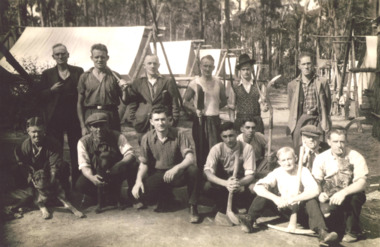
Photograph - The 4 Mile Camp Old Buchan Road, Buchan, East Gippsland Victoria, 1935-36
Relief gang burning charcoal for gas producers written on back of photograph but may be unemployed on Sustenance clearing roads and tracks. Tools shown axes, picks, fern hooks, slashers, sledghammers.Black and white photograph of fourteen men with two dogs and one cat at the single mens camp at The 4 Mile Old Buchan Road East Gippsland Victoria. Second photo shows some names from previous photo. Plus two other photos and names of same camp.( No names for last photo 05088.2)workmen, camp, topograpy, government services -
 Phillip Island and District Historical Society Inc.
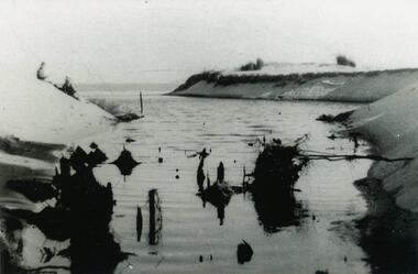
Photograph, 1954
One of a collection of photos donated by Daryl JohnsBlack & White Photograph of Woolamai Bight. Water and land masses. Swamp water broke through the channel to the beach.phillip island, woolamai bight, daryl johns -
 Glenelg Shire Council Cultural Collection
Slide - Slide - Construction Portland/Cashmore airport, c. 1980
Coloured slide. Trench with two workmen in it. Two men standing on right land edge of trench. Excavator at rear. -
4th/19th Prince of Wales's Light Horse Regiment Unit History Room
Photograph Set, The Rover Co Ltd (Technical Films Dept ), Landrover Publicity, 1960's
Blue plastic loose leaf folder containing 22 photographs of Land Rover vehicles in various configurations and situationsland rover, publicity -
 Eltham District Historical Society Inc
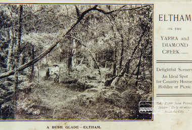
Photograph, A bush glade Eltham, c.1909, 1909c
Colour photograph from land sales brochure showing a bush glade Eltham c1909 sent to Mrs Andrewbush glade, eltham, bushland -
 Federation University Historical Collection
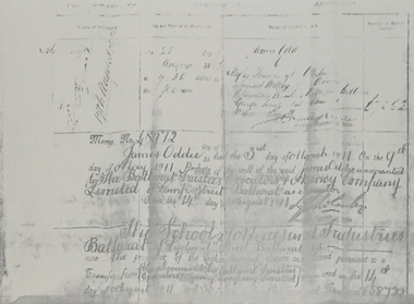
Document, James Oddie Probate Document
James Oddie died on 03 March 1911.Difficult to read thermo copy of a probate document relating to James Oddie's transfer of land to the Ballarat School of Mines.james oddie, ballarat school of mines, probate, land transfer, ballarat trustees, samuel willey -
 Flagstaff Hill Maritime Museum and Village
Postcard
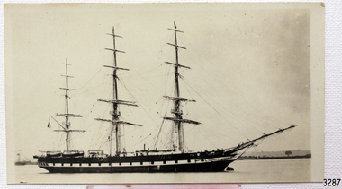
Black And White postcard of the sailing ship "Lady Jocelyn" with land in the background. (Sh 168 Ships I - L)flagstaff hill, warrnambool, shipwrecked-coast, flagstaff-hill, flagstaff-hill-maritime-museum, maritime-museum, shipwreck-coast, flagstaff-hill-maritime-village, lady jocelyn, post card, postcard, sailing ship -
Glenelg Shire Council Cultural Collection
Photograph - Photograph - Main Breakwater construction, Portland, n.d
Port Of Portland Authority Archivesport of portland archives, main breakwater, land reclamation, pivot, construction, harbour development -
Glenelg Shire Council Cultural Collection
Photograph - Photograph - Main Breakwater Construction, n.d
Port of Portland Authority Archivesport of portland archives, portland harbour, land reclamation, wharf construction, breakwater, battery point, aerial closeup -
Glenelg Shire Council Cultural Collection
Photograph - Photograph - Main Breakwater construction, Portland, n.d
Port of Portland Authority Archivesport of portland archives, main breakwater, construction, portland harbour, harbour development -
Glenelg Shire Council Cultural Collection
Photograph - Photograph - Main Breakwater construction, Portland, n.d
Port of Portland Authority Archivesport of portland archives, construction, portland harbour, harbour development, wharf, reclamation -
 Bendigo Historical Society Inc.
Document - CERTIFICATE OF TITLE
Certificate of titles and its subdivision plans for land bought by George Lansell in Toorak. Dated 27th August 1874.melbourne -
Port Melbourne Historical & Preservation Society
Document - Port Melbourne Council re Vacant Land, 1974 - 1978
Retained by donor from his service on Port Melbourne Council 1973-78Miscellaneous Port Melbourne Council documents 1974-78 Documents re vacant land, 1 October 1974local government - city of port melbourne, town planning, glen cosham -
Port Melbourne Historical & Preservation Society
Document - Port Melbourne Council re non-residential land use in residential zones, 1974 - 1978
Retained by donor from his service on Port Melbourne Council 1973-78Miscellaneous Port Melbourne Council documents 1974-78 Schedule of non-residential land uses in residential zoneslocal government - city of port melbourne, town planning, glen cosham -
 Bendigo Historical Society Inc.
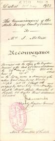
Document - JOHANSON COLLECTION: MORTGAGE MRS CATHERINE STUART RICHARDS
Reconveyance of land from The Commissioners of the State Banke of Victoria to Mrs I. Melrose, Dated 23 May 1922.bendigo, land sales, state bank vic, melrose, thecommissioners of the state bank of victoria, isabella melrose.solicitor moule hamilton & kiddle, 55 market street melbourne. -
 Bendigo Historical Society Inc.
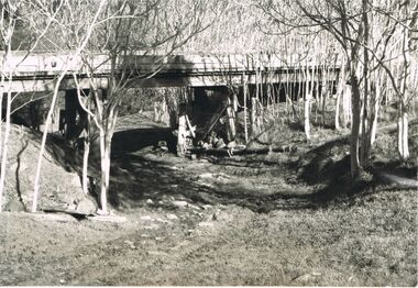
Photograph - 'MARYDALE' AXEDALE COLLECTION: PHOTOGRAPH DRY CREEK BED
Photograph.View of dry river bed, probably Campaspe River, Axedale, with open land with bridge crossing, at ''Marydale'', Axedale.axedale, history, marydale property -
 Bendigo Historical Society Inc.
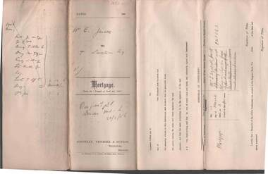
Document - CONNELLY, TATCHELL, DUNLOP COLLECTION: MORTGAGE E. JEWELL TO T. LUXTON
Mortgage document between Elizabeth Jewell and Thomas Luxton for land at Terrick Terrick, dated 13 March, 1906.cottage, miners, e. jewell, t. luxton, terrick terrick, kerang -
 Victorian Interpretive Projects Inc.
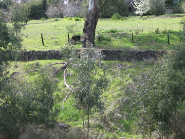
Photograph - Colour, Clare Gervasoni, Drystone Wall, Hepburn Springs, 2006, 247/08/2006
Colour photograph showing a drystone wall along Doctor's Gully in Hepburn Springs. This land was associated with Vincenzo Perini.drystone, perini, doctor's gully, hepburn, hepburn springs -
Tatura Irrigation & Wartime Camps Museum
Frame, Maher Family History framed, 2011
Made by Bernard Maher, descendant of Charles Maher.Large frame containing: photos - history of Charles Maher, who settled land in Tatura in 1873. Under glass.maher family, bernard maher, charles maher -
 Stawell Historical Society Inc
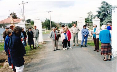
Photograph, Cemetery Crowd
7083. A Groupd of People standing inside the Cemetery Gates Stawell. 7083-1 A Group of people looking at a fenced headstone 7083-2 A Group of people looking at a Monument. With houses in the background. 7083-3 A Group of People lookning at graves. 7083-4 A Group of People on a dirt road over a small bridge, with a white ute in right foreground.5 Colour Photographs: showing a group of people at various locations looking at Graves, Monuments and a bush land site. -
 Whitehorse Historical Society Inc.
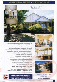
Document, 'Scobranic', 1/05/1998 12:00:00 AM
Land brochure giving details of the auction of 'Scobranic'Land brochure giving details of the auction of 'Scobranic' at 9 Wilkinson Street, East Burwood on 9/5/1998Land brochure giving details of the auction of 'Scobranic'land sales, 'scobranic', wilkinson street, burwood east no 9, whitehorse partners, shackleton, ted -
 Whitehorse Historical Society Inc.
Document, Estate of James Keogh, 1897
Copy of the will of James KeoghCopy of the will of James Keogh, January 1897 involving land in Box Hill, Surrey Hills, Tunstall, Mitcham and Nunawading.Copy of the will of James Keoghkeogh, james, wills, thomas, ann, o'shannassey st, mitcham, mitcham road, albert street, haines street, springfield road, nunawading, springvale road, metropolitan avenue, watts street, box hill, victoria crescent, mont albert, whitehorse road, surrey hills, lightfoot street -
Whitehorse Historical Society Inc.
Article, Man who turned down $1/2 million, 1982
Article about Roy Anderson who refused offers to buy his land on several occasions in Vermont South.Article about Roy Anderson who refused offers to buy his land on several occasions in Vermont South.Article about Roy Anderson who refused offers to buy his land on several occasions in Vermont South.anderson, roy, burwood highway, vermont south -
 Whitehorse Historical Society Inc.
Document, Auction -29 McDowall Street, Mitcham, 14/03/1998 12:00:00 AM
Land brochure advertising auctionLand brochure advertising auction of 29 McDowall Street, Mitcham on Saturday, 14th March, 1998 at 1.30 p.m.Land brochure advertising auctionmcdowall street, mitcham no 29, webb, philip, burnham, brett -
 Whitehorse Historical Society Inc.
Pamphlet - Document, Auction, 1/02/1998 12:00:00 AM
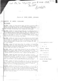
Land brochure advertising auction of 37 Fellows Street, Mitcham, Saturday 7th March, 1998Land brochure advertising auction of 37 Fellows Street, Mitcham, Saturday 7th March, 1998 at 12.15 p.m.Land brochure advertising auction of 37 Fellows Street, Mitcham, Saturday 7th March, 1998 fellows street, mitcham no 37, noel jones, lasky-davison, robert, munn, maria -
Whitehorse Historical Society Inc.
Newspaper - Article, Williams Road, Blackburn, 21/07/1976
Article re purchase by Nunawading Council of land for public open space in Nunawading Gazette 21 July 1976.williams road, blackburn, glen valley park, cootamundra walk, parks and reserves, city of nunawading -
 Whitehorse Historical Society Inc.
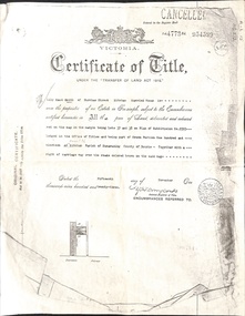
Document - Land Title, Certificate of Title, 15/11/1923
Photocopy of certificate of title for land in Deakin Street, Mitcham issued on 15 November 1923. Transfers to 1962 are included.deakin street, mitcham, smith, lily maud, doyle, elizabeth maud mary, king, wallace henry, ivy nora gladys, barnetson, chamberlin, gladys irene, oscar, frank ronald, land sales -
 Whitehorse Historical Society Inc.
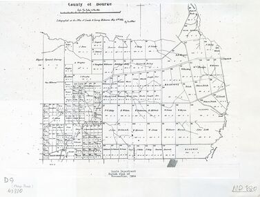
Map - Nunawading scaled Map, Nunawading, 1864
Parish plan of Nunawading, Lands Department, 1864, showing names of first purchasers of land. Copy also at NP215.parish of nunawading, land settlement, maps -
 Rutherglen Historical Society
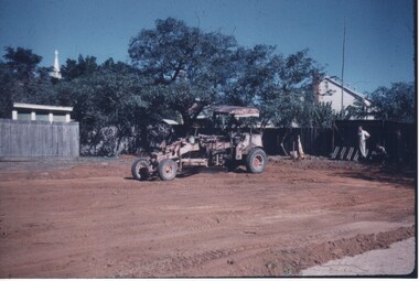
Image, Redmond Weller, 1950s
One of a collection of photos taken from slides by Mr Redmond Wheler, during his time as Head Master a Rutherglen State Higher Elementary SchoolColour photograph of a block of land being levelled by earth-moving machine, possibly for an extension to a school or school yard.rutherglen schools