Showing 179546 items
matching melbourne-map
-
 4th/19th Prince of Wales's Light Horse Regiment Unit History Room
Booklet, Manual of Map Reading, Air Photo Reading and Field Sketching Part 3 Field Sketching 1957, 1957
Hard covered booklet. 3 copiesWO Code No 9085field sketching -
 Eltham District Historical Society Inc
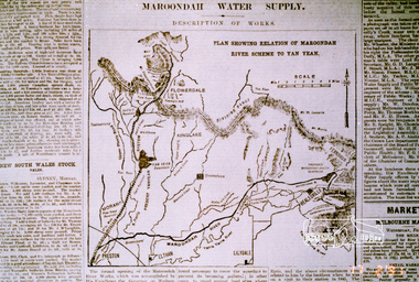
Photograph, Map showing the Maroondah system
Photograph of newspaper article (extract)maroondah dam, maroondah aqueduct -
4th/19th Prince of Wales's Light Horse Regiment Unit History Room
Booklet, Manual of Map Reading Air Photo Reading & Field Sketching Part II Air Photo Reading 1958, 1958
A hard covered booklet covering the aspects of air photo reading. 2 copiesWO Code No 9484air photo reading -
 Eltham District Historical Society Inc
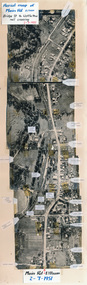
Photograph, Aerial map of Main Road, Eltham from Bridge Street to Wattletree Road, 2 July 1951, 1951
Constructed from five aerial images stitched together and adhered to a coreflute board (approx 100 x 30 cm) with inscriptions of street names and places written and/or stuck onto surface.eltham, main road, aerial photographs, streets, buildings, houses -
 Ringwood and District Historical Society
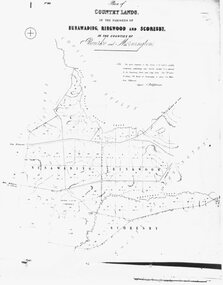
Photograph, Map-Country Lands, in the parishes of Nunawading, Ringwood and Scoresby (undated)
Early (undated) photograph of plan of "Country Lands, in the parishes of Nunawading, Ringwood and Scoresby, in the counties of Bourke and Mornington". -
 Federation University Historical Collection
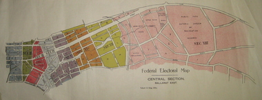
Plan - Plans, Tulloch & King, Federal Electoral Map Subdivision of Ballarat, c1901
It is thought that these are the first federal electorial plans for the Subdivision of Ballarat. The first member of Ballarat was Alfred Deakin.May of the Federal subdivision of Ballarat, with each section depicted in a different colour. The plans include Lake Wendouree, Central Ballarat subdivision; Soldiers Hill subdivision; Ballarat East subdivision, and Central Section Ballarat East, including the Ballarat East Botanic Garden .ballarat, federation, alfred deakin, elections, plan, electoral division, electoral map, polling -
 Federation University Historical Collection
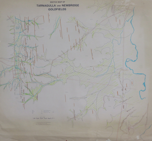
Plan, Sketch Map of Tarnagulla and Newbridge Goldfields, 1979, 1979
Pmap on paper with hand colouringtarnagulla, newbridge, map -
 Federation University Historical Collection
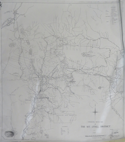
Map, Geological Sketch Map of the Mount Lyell District, 1935, 25-09-1935
Copy of a plan showing mining leases around Mount Lyell, Tasmania.mount lyell, queenstown, mining, king river -
 Federation University Historical Collection
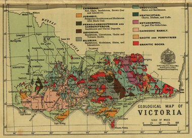
Photograph - colour, William Baragwanath, Department of Mines: Geological map of Victoria, c1935
Photograph included in book "Victoria: Gold and Minerals" issued by Mines Department Victoria, 1935Photographmap, department of mines, victoria, key to land formations, time periods, jurassic, geological map -
National Vietnam Veterans Museum (NVVM)
Booklet, The War Office: Manual of map reading, air photo reading and field sketching, part 2: Air photo reading, 1958, 1958
british armed forces - service manuals -
National Vietnam Veterans Museum (NVVM)
Booklet, The War Office: Manual of map reading, air photo reading and field sketching, part 3: Field sketching, 1956 (2 copies), 1956
british armed forces - service manuals -
National Vietnam Veterans Museum (NVVM)
Booklet, Practical map reading: reconnaissance mapmaking and field sketching, 1941
Australian Military Bookletaustralia - armed forces - service manuals -
National Vietnam Veterans Museum (NVVM)
Manual, Manual of map reading, air photo reading and field sketching: part 2: air photo reading, 1958
map reading, air photo reading -
National Vietnam Veterans Museum (NVVM)
Booklet, Australian Army: Training information bulletin no.20: map folding
australia - armed forces - service manuals -
National Vietnam Veterans Museum (NVVM)
Booklet, Manual of map reading, air photo reading and field sketching. Part 3, field sketching, 1957, 1957
british armed forces - service manuals -
National Vietnam Veterans Museum (NVVM)
Manual, Sheldon's map reading and field sketching: self instructor, 1945
Sgt. Brandon, K.W.australia - armed forces - service manuals, map reading -
 Moorabbin Air Museum
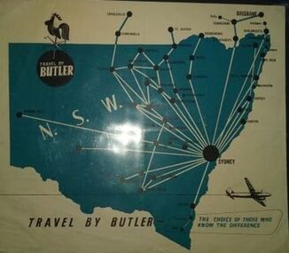
Flyer (item), Butler Air Transport: Timetable Information Fares/ Map
-
Moorabbin Air Museum
Map (item) - TAA map of Australia & Papua New Guinea 10th edition
-
Moorabbin Air Museum
Map (item) - Map - Puckapunyal Range Area Victoria
Military Survey 1:25,000 Zone 7 First Edition -
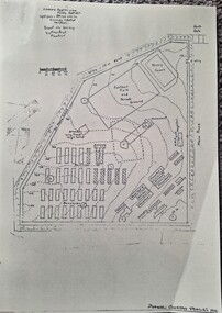 Tatura Irrigation & Wartime Camps Museum
Photograph, Camp 3 Compound B Survey Map, 1942
Gives an interesting and definitive idea of circumstances and life in the POW camps of Australia. Detailed sketch of Compound B Camp 3 based on survey by Manfred MuellerDetailed sketch of Compound B Camp 13 based on survey by Manfred Mueller September 1942. On cream paper, laminated.camp 13, camp sketches, manfred mueller, survey map, compound b camp 3 -
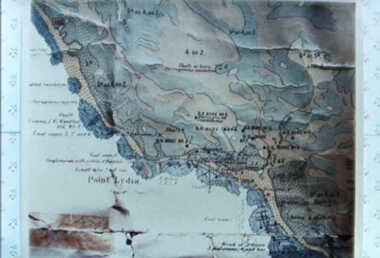 Inverloch Historical Society
000587 - Map - Point Lydia - Harmers Haven - Location of coal test bore holes - from Iris Earnshaw
-
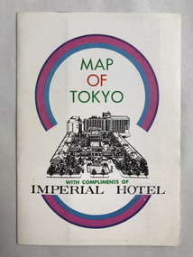 Robin Boyd Foundation
Map, Imperial Hotel, Map of Tokyo
Provided by Imperial Hotel, Tokyo Robin Boyd stayed here in the 1960swalsh st library -
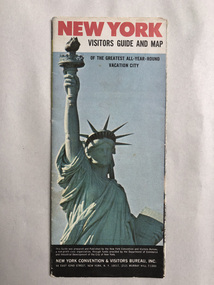 Robin Boyd Foundation
Map, New York Convention and Visitors Centre, New York Visitor Guide and Map: Of the Greatest All-Year-Round Vacation City, 1966
new york city, map, walsh st library -
 Robin Boyd Foundation
Map, Geographia, Map of London
walsh st library -
 Robin Boyd Foundation
Map, Universal Business Directories, Canberra Tourist Map, 1970
walsh st library -
 Robin Boyd Foundation
Map, ANZ in London; A map for visitors to London
walsh st library -
 Robin Boyd Foundation
Map, RACV, Portland District Map
walsh st library -
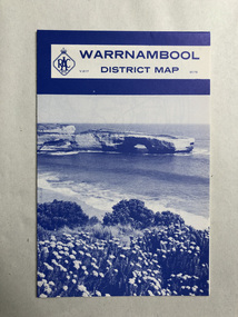 Robin Boyd Foundation
Map, RACV, Warrnambool District Map
walsh st library -
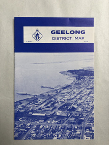 Robin Boyd Foundation
Map, RACV, Geelong District Map
walsh st library -
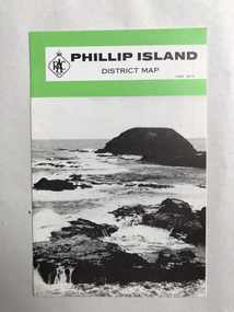 Robin Boyd Foundation
Map, RACV, Phillip Island District Map
walsh st library