Showing 179546 items
matching melbourne-map
-
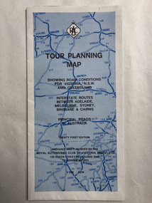 Robin Boyd Foundation
Map, RACV, Tour Planning Map
Showing road conditions for Victoria, NSW and Queenslandwalsh st library -
 Clunes Museum
Document - BOOKLET & POSTCARDS, "THE DAY THE KELLY GANG PUT EUROA ON THE MAP"
BOOKLET ISSUED BY THE EUROA HISTORICAL SOCIETY INC..1 BOOKLET ON THE KELLY GANG HOLDING UP THE NATIONAL BANK AT EUROA - DECEMBER 10TH 1878. .2.3 TWO SEPIA POSTCARDS OF THE EUROA BANK WITH SEVERAL POLICE AND LOCALS STANDING ABOUT THE FRONT OF THE BUILDING .4 POSTCARD DEPICTING SOUVENIRS THE SERVICE CARD OF ROBERT DAVID BOOTH DATED MAY 1877 WITH INSET IMAGES OF A LEAD BALL AND A DISFIGURED SIXPENCElocal history, books, history, local history., euroa museum -
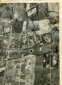
Stawell Historical Society Inc
Map, Township of Stawell Photo Map, 1947
Photograph of Stawell from Air Circa 1947. Shows mining sites and townshipmining, gold, map -
Stawell Historical Society Inc
Map, Stawell Joint Venture, Map of Stawell showing Mining Lease Boundary and Freehold Land, September 1988
Stawell Joint Venturemining, gold, map -
Whitehorse Historical Society Inc.
Map, Street Index refer to D76 map, 1993
List of street names in alphabetical orderList of street names in alphabetical orderList of street names in alphabetical ordermaps, city of nunawading -
 Whitehorse Historical Society Inc.
Map, Photo-map Ringwood A4A, 1945
Aerial photo covering approximately from Box Hill to Mitcham (West to East) and Springfield Road to Hawthorn Road (North to south).Aerial photo covering approximately from Box Hill to Mitcham (West to East) and Springfield Road to Hawthorn Road (North to south). Names of main roads inscribed.Aerial photo covering approximately from Box Hill to Mitcham (West to East) and Springfield Road to Hawthorn Road (North to south).aerial photographs, box hill, blackburn, nunawading, forest hill, mitcham -
Whitehorse Historical Society Inc.
Map, Map Of The Entire City Of Nunawading, 1920s?
City of Nunawading published by Frank Fisher & Co. Estate Agents.City of Nunawading published by Frank Fisher & Co. Estate Agents.City of Nunawading published by Frank Fisher & Co. Estate Agents.city of nunawading, maps -
 Whitehorse Historical Society Inc.
Photograph, Map Visit, 1/11/1999
Coloured photo of Society Volunteers working on cataloguing Artefacts on the occasion of Museum Accreditation Programme Reps visit for Inspection.museums australia (victoria). museum accreditation programme, schwerkolt cottage and museum complex -
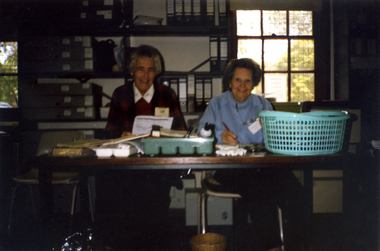 Whitehorse Historical Society Inc.
Photograph, Map Visit, 1/11/1999 12:00:00 AM
Coloured photo of Society Volunteers, Frances Warren and Margaret Skey working cataloguing Artefacts on the occasion of Museum Accreditation Inspection Visit.warren, frances, skey, margaret, museums australia (vic). museum accreditation program, schwerkolt cottage and museum complex -
 Whitehorse Historical Society Inc.
Photograph, Map Visit, 1/11/1999 12:00:00 AM
Coloured photo of Society Volunteers cataloguing Paper Collection on the occasion of Museum Accreditation Programme Inspection Visit.simmenauer, peter, crick, joan, museums australia (vic). museum accreditation program schwerkolt cottage and museum complex -
 Inverloch Historical Society
000715 - Photograph - 1997 - Old Outtrim - Map - Nancye Durham
-
 Ballarat and District Irish Association
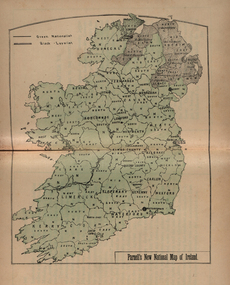
Map, Panell's New National Map
-
 Brimbank City Council
Map Book
Blue hardcover, tap spine -
 Brimbank City Council
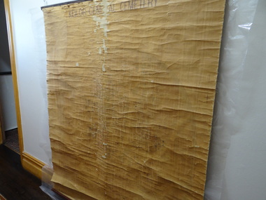
Map, Keilor General Cemetary Map
-
Tramways/East Melbourne RSL Sub Branch - RSL Victoria Listing id: 27511
Book, THE WAR OFFICE et al, MANUAL OF MAP READING (AIR PHOTO READING AND FIELD SKETCHING PART 11 1958), 1957
-
Tramways/East Melbourne RSL Sub Branch - RSL Victoria Listing id: 27511
Book, THE WAR OFFICE et al, MANUAL OF MAP READING part 111(AIR PHOTO READING AND FIELD SKETCHING PART111 FIELD SKETCHING 1957), 1958
-
Moorabbin Air Museum
Map (Item) - BOAC Britannia Fleet London to Colombo Route Map BA774
-
Moorabbin Air Museum
Work on paper (Item) - CAC Map, CAC Map- untitiled
Commonwealth Aircraft Corporation -
Moorabbin Air Museum
Map (Item) - Ansett Route Map - Broken Hill <> Alice Springs
-
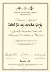 Ballarat Tramway Museum
Certificate - Framed certificate, Museums Australia, BTPS Museum Registration MAP 1993, Dec. 1993
Framed certificate for the Registration of the Ballarat Tramway Preservation Society under the Museum Accreditation Programme, dated Dec. 1993. The certificate signed by Weston Bate (Chairman Museums Advisory Board), Paul Clarkson (Director Arts Victoria), Annette Shiell (President Museums Association). Framed with a metal glazed frame, with two sheets of heavy cardboard and heavy black card with cut outs for hanging or standing. Certificate printed on heavy cartridge paper.trams, tramways, museum accreditation, museum, btps, map -
Moorabbin Air Museum
Newspaper (Item) - List of P40 Kittyhawks & Spitfire crashes, news clippings of Bombing of Darwin & Krait. PLUS Japanese invasion Map of Australia
-
Moorabbin Air Museum
Map (Item) - Middle East Egypt WW1 AFC Map
-
Moorabbin Air Museum
Map (Item) - Environs of the Top End Map
-
Moorabbin Air Museum
Drawing (Item) - Environs of the Top End Map
-
Moorabbin Air Museum
Document (Item) - The TAA Trans Australia Airlines Map of Australia
-
Moorabbin Air Museum
Manual (Item) - RAAF - With Map And Compass TG-74
-
Moorabbin Air Museum
Map (item) - Map Gippsland
-
 Queenscliffe Maritime Museum
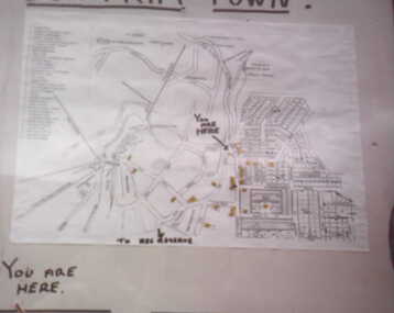
Drawing - Drawing showing the Queenscliffe Maritime Centre's [QMC} location in 1987, Map showing QMC location in 1987, 1987
Queenscliffe Maritime Centre historyLocation map of the original Queenscliffe Drawing showing the Queenscliffe Maritime Centre's [QMC} location in 1987.Reverse " NIL " -
 Queenscliffe Maritime Museum
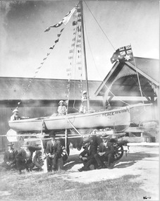
Photograph - Photographss of 1918 Peace Procession fishing boats, 3 x Photographs of 1918 Peace Procession fishing boats & 1 x map, 1918
1918 Peace Procession at Queenscliffeblack and white photographs of people & fishing boats involved in the 1918 Peace Procession at QueenscliffeRefer Notes section for detailslifeboats, 1918 peace procession -
 Ballarat Tramway Museum
Map, Ken McCarthy, Map of Proposed National Park Line - SPER, mid 1950's
Hand drawn plan on plain foolscap paper of proposed tram line from Loftus to View Point within National Park for South Pacific Electric Railways - with notes, proposed destination roll.trams, tramways, sper, national park line, loftus, destination roll