Showing 14119 items
matching properties
-
 Bendigo Historical Society Inc.
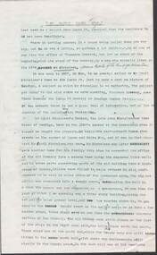
Document - ''IT SLOWLY FADES AWAY'': INFORMATION OF MICHELSEN FAMILY /THUNDERS BREWERY/LUCAN STREET BREWERY
Two page document: ''It slowly fades away - information re Michelsen family /Thunders Brewery/Lucan Street Brewery (two copies - one with pencilled-in additions/corrections. Information re the property at 46 Lucan Street and description of structure and gardens etc. Author? Date mentioned is 1973.person, individual, michelsen family, thunders brewery, lucan street brewery, bendigo cognac distillery -
 Bendigo Historical Society Inc.
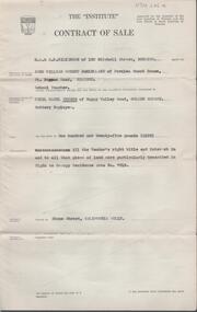
Document - H. A. & S. R. WILKINSON COLLECTION: CONTRACT OF SALE
Contract of sale dated 17th March, 1958 between Mr. J. W. R. McClelland (vendor) and Mr. C. B. Peters (purchaser). Property: Stone Street, California Gully being that piece of land described in Right to Occupy Residence Area no. 7613. Price: 125 pounds.organization, business, h.a. & s.r wilkinson real estate -
 Port Melbourne Historical & Preservation Society
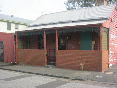
Photograph - Properties in Alfred Street, Port Melbourne
Photographic images of properties in Port Melbourne. Image may have been taken by a PMHPS member or scanned from a past resident or taken for real estate sale purposes. .01 - 21 Alfred St (Folly Cottage) May 2012 .02 - 73 Alfred st (April 2012)built environment - domestic, albert street -
 Whitehorse Historical Society Inc.
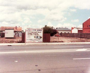
Photograph, Property at 347-349 Mitcham Road, Mitcham, owned By Methodist Church, C.1988
Coloured photo of Property, 347-349 Mitcham Road, Mitcham, owned by Methodist Church (now Uniting Church) and leased to Garage till September, 1982.Office building later built on site. In the background of the photo, the timber and steel roof building is the Mitcham Memorial Hall (now demolished).uniting church mitcham, mitcham road mitcham -
 Kew Historical Society Inc
Archive (series) - Subject File, LUSH, Joseph
Kew Historical SocietySince its foundation in 1958, members of the Kew Historical Society have been compiling and storing information about subjects relating to the history of Kew and its environs, of which this file is an example. Arranged by Secondary Values (value of records to users)Subject file containing information about Joseph Lush of Moubray, Lush and Co, an earlier European landowner in Kew, initially in Studley Park Road. The file contains a copy of his last will and testament, which include information about his property - Walmer House - in Walmer Street, Kew.joseph lush, walmer house -- walmer street -- kew (vic.)joseph lush, walmer house -- walmer street -- kew (vic.) -
 Kew Historical Society Inc
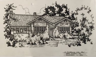
Drawing - Property Illustration, Margaret Picken, 10 Florence Avenue, Kew, 1989
This architectural drawing is one of a series created by Margaret Picken for a number of real estate agents in Melbourne between 1983 and 2005. Each work is signed and dated by the artist.Gift of Margaret Picken, 2020Extant (as of 2020) red brick house in the Federation Bungalow style. Built in 1920, with additions and alterations to the interiors and rear of the property in 1970 and 1989. In 2003 a gazebo was added at the rear. This pen and ink architectural drawing on drafting film of 10 Florence Avenue, Kew was made by Margaret Picken in 1987.10 FLORENCE AVE., KEW / MARG. PICKEN '87 / WOODARDS ~ KEWartist -- margaret picken 1950-, architectural drawings -- houses -- kew (vic.), 10 florence avenue - kew (vic). -
 Sunbury Family History and Heritage Society Inc.
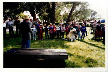
Photograph, c1989
The children from Bulla Primary School were taken on an excursion to Gellibrand hill Park which is a short distance from the School. The emphasis on the day's excursion was to identify the native fauna in the park as well as the vegetation.The property was originally settled by the Greene family in 1843. In 1980 the State Government purchased the property and it is now one of the state's parks where the natural vegetation has gradually been restored on the property. A non-digital coloured photograph of a group of adults and children listening to a man who is standing in front of a low seat and talking to them. There are buildings visible in the background. gellibrand hill, bulla primary school, school excursions -
 City of Kingston
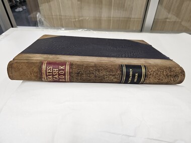
Book - Rates Cash Book, Rates Cash Book Moorabbin Shire, c.1918
Councils use property values to calculate how much each property owner pays in rates. This can give us some insight to property values within the municipalities. Receipts have been recorded by Receipt No, Date, Name and Riding. The subdivisions at that time which which were proclaimed by Order-in-Council on 22nd May 1917, were North Riding, Moorabbin Riding, Cheltenham Riding, and South Riding.Brown suede and Black linen bound book with Rates Cash Book Moorabbin Shire in gold text along the spinePrinted on white rectangular sticker in black ink: ARNALL & JACKSON/ Engravers and Lithographers/ PRINTERS/ and/ MANUFACTURING STATIONERS/ 478 Collins Street/ MELBOURNE/ No.B 33325 / 2/10/18 rates, ridings, moorabbin, municipality -
 City of Kingston
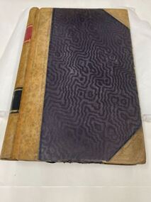
Book - Rates Cash Book, Rates Cash Book Moorabbin Shire, 1916
Councils use property values to calculate how much each property owner pays in rates. This can give us some insight to property values within the municipalities. Receipts have been recorded by Receipt No, Date, Name and Riding. The subdivisions at that time which which were proclaimed by Order-in-Council on 22nd May 1917, were North Riding, Moorabbin Riding, Cheltenham Riding, and South Riding.Brown suede and Black linen bound book with Rates Cash Book Moorabbin Shire in gold text along the spinePrinted on white rectangular sticker in black ink: ARNALL & JACKSON/ Engravers and Lithographers/ PRINTERS/ and/ MANUFACTURING STATIONERS/ 478 Collins Street/ MELBOURNE/ No.B 27676 / 1/8/19rates, ridings, moorabbin, municipality -
 Warrnambool and District Historical Society Inc.
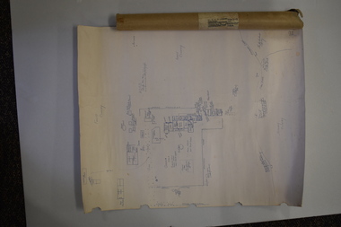
Document (Sketch Plan of Dunmore), Stan Baulch, 1972
This card has a sketch map showing the properties surrounding Dunmore on one side and a detailed sketch plan of Dunmore homestead in the early 1970s on the other side. The plan of Dunmore homestead shows interesting features such as the brick oven for bread making, the croquet lawn, the site of the aboriginal mia mias, the Turkish baths and the fowl house used later as a poison house. Francis and Ann Baulch were pioneer settlers in the Kirkstall area and their son Samuel worked at Dunmore in the Macarthur area before purchasing in the early 1870s the property he named Rose Park. In the 1890s he acquired property in the Dunmore estate and his son Stan Baulch gained a section of the Dunmore property after his father’s death. Stan Baulch named this Dunmore section, Rose Park, a property to the west of his father’s original Rose Park property. Stan Baulch was a long time member of the Warrnambool & District Historical Society and he contributed many local history articles and donated many local artefacts to the Society.This sketch plan is of interest as it tells us what the historic homestead of Dunmore in Western Victoria was like in the early 1970s. It will be useful for research. This is a sheet of white lightweight cardboard with a pencilled sketch on one side and a blue ink sketch plan of a house on the other side. The edges of the card have some torn sections. The card is enclosed in an oval cardboard cylinder (recycled and torn at the ends). Both the card and the cover have handwritten titles in ink. Dunmore Homestead & History by S. Baulch Dunmore Homestead drawn by Stan Baulch c.1972 dunmore property, western victoria, baulch family -
![Photograph - Digital Image, 16 Poulter Avenue [exterior], 21/05/2014](/media/collectors/4f729f5697f83e03086015b8/items/550905b52162f1199c254a62/item-media/550905f82162f1199c254dd0/item-fit-380x285.jpg) Greensborough Historical Society
Greensborough Historical SocietyPhotograph - Digital Image, 16 Poulter Avenue [exterior], 21/05/2014
Built in the 1930s, this property has been restored.Digital copy of colour photograph.poulter avenue -
![Photograph - Digital Image, 16 Poulter Avenue [exterior, side view], 21/05/2014](/media/collectors/4f729f5697f83e03086015b8/items/550906f72162f1199c25606f/item-media/550907382162f1199c256504/item-fit-380x285.jpg) Greensborough Historical Society
Greensborough Historical SocietyPhotograph - Digital Image, 16 Poulter Avenue [exterior, side view], 21/05/2014
Built in the 1930s, this property has been restored.Digital copy of colour photograph.poulter avenue -
![Photograph - Digital Image, 16 Poulter Avenue[interior, timber-lined walls and shutters], 21/05/2014](/media/collectors/4f729f5697f83e03086015b8/items/5509078e2162f1199c256a25/item-media/550907ea2162f1199c256f7e/item-fit-380x285.jpg) Greensborough Historical Society
Greensborough Historical SocietyPhotograph - Digital Image, 16 Poulter Avenue[interior, timber-lined walls and shutters], 21/05/2014
Built in the 1930s, this property has been restored.Digital copy of colour photograph.poulter avenue -
Ararat & District Historical Society (operating the Langi Morgala Museum)
Photograph
Old winery at Henry Duver's property at RhymneyBlack and white photo of a stone building with a pitched roof. There is a smaller entrance attached to the front of the building with an open door.Written on back: Entrance to old winery at Mr H. Duver's Rhymney -
Tatura Irrigation & Wartime Camps Museum
Book - Childrens, Die Fuinf und IHR Waldhaus, 1953
Property of former internee at Camp 3, TaturaHard cover childrens' book, Illustrated, Black and white with coloured picture on front cover. Picture shows five active young people in foreground, house under construction behind them and forest trees in backgrounddie funf und ihr waldhaus, bissinger g, wied g, camp 3, tatura, books, childrens -
 Kilmore Historical Society
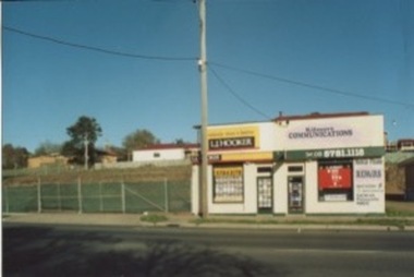
Photograph, 5 Sydney Street, 2006?
This photograph is the same property as seen in PHO-00010.15cm x 10cm colour photograph of the building on 5 Sydney Street, which at the time of the photograph is occupied by an L.J. Hooker and Kilmore Communications. The vacant lot adjacent to the building can been seen. Printed on matte standard photographic stock. Kodak and Fuji film brand. 2 photographs with different views from the street.real estate agents, construction sites -
Glen Eira Historical Society
Article - Prentice Street, 32A, Elsternwick
Two items about sales of this property: 1/Newspaper article dated 23/07/2004 featuring this property. It gives details of this Victorian home prior to upcoming sale. Describes interior style and notes the addition of the outside plunge pool and established garden. Includes a coloured photograph. 2/2 copies of same advertisement in 'Melbourne Weekly Bayside - Your Community Voice' dated 08/02/2012 for sale of property.victorian style, prentice street, elsternwick, peden gole, estate agents, timber houses, edwardian style, biggin scott -
 National Wool Museum
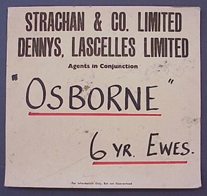
Notice
Advertising notice for a sheep sale at the Woolbroker's Stock Department. Involves Strachan and Co. Ltd and Dennys Lascelles Ltd who were the agents in conjunction. (NB: According to the original record, this object acquired with the purchase of property from Myer Properties Ltd and was acquired 6/8/86. It is not known what this property was or if anything else was acquired at the same time. Until further details are know, no accession record has been created.)STRACHAN & CO. LIMITED / DENNYS, LASCELLES LIMITED / Agents in Conjunction / "OSBORNE" / 6 YR. EWES. / For Information Only. But not Guaranteedsheep sales, dennys, lascelles limited strachan and co. limited, sign -
 Coal Creek Community Park & Museum
Bottle glass, c. 1935 -1955
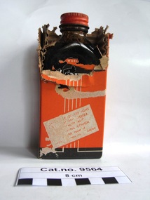
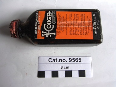
TROVE: The Advertiser (Adelaide S.A. 1931-1954) Sat 22 June 1935, page 24, Advertising 'PUBLIC NOTICE TO BOTTLERS, BOTTLE DEALERS, ETC., RE PROPERTY BRANDED BOTTLES WHICH ARE NOT SOLD. The undermentioned. Firms and Companies, carrying on business at Sydney and elsewhere. HEREBY GIVE NOTICE that all Bottles delivered by them, to their customers, having a notification moulded thereon that they are, or remain, the property of the Firms and Companies mentioned below. ARE NOT SOLD WITH THE CONTENTS THEREOF, BUT REMAIN THE PROPERTY OF SUCH FIRMS and COMPANIES. Such Bottles are loaned solely for me purpose of enabling the contents to be delivered to the purchasers from the said Firms and Companies, and to all subsequent purchasers of the contents. As soon as the Bottles are emptied of their contents they must not be refilled, destroyed, damaged, or used again for any purpose, but must, on demand, be delivered up to the Companies or Firms whose names are moulded thereon, or to their Accredited Agents:— BUTLER AND NORMAN. LTD., MANDIBLE ST., ALEXANDRIA, NJS.W. The remuneration received by Collectors, Dealers, etc. Is simply an allowance for the safe custody, and collection of the Bottles. LEGAL ACTION WILL BE TAKEN AGAINST ANY PERSON OR COMPANY VIOLATING THE PROPERTY RIGHTS OF THESE FIRMS' OR COMPANIES' BRANDED BOTTLES........................Taylor Chemical Co..............'. TROVE : Courier-Mail (Brisbane, Qld. : 1933 - 1954), Thursday 5 July 1945, page 7, Advertising. DON'T COUGH ALL NIGHT ! take a dose of YCOUGH at bedtime! Y- Cough will relieve your cough or cold while you sleep peacefully! 1'9 AT ALL CHEMISTS AND STORES. On box labels : Taylor Chemical Co. Sydney, Reg. Vic. 3146. Clear, rectangular in section, screw top bottle with orange metal lid and orange, brown & white printed paper label, containing dark brown liquid, in a corrugated cardboard lined orange, dark brown and white printed cardboard box. Embossed on side of bottle in cartouche 'THIS BOTTLE LWAYS REMAINS THE PROPERTY OF TAYLOR CHEMICAL CO. SYDNEY'. Embossed on base of bottle AGM logo with the numerals '16510' along side and the numeral '3' below. On orange metal top printed in white 'Y-COUGH' and 'PLEASANT TO TAKE'. On paper bottle label '....world.......Y-COUGH REGISTERED FOR RELIEF OF COUGHS, OF COLDS, INFLUENXA, BRONCHITUS AND WHOOPING COUGH and for the relief of throat soreness and irritation. DOSE : Adults : one or two teaspoonsful every 2 hours or when cough is troublesome. Children over 6, one teaspoonful every 3 or 4 hours. Under 6, half quantity. FOR Colds and Influenza : one teaspoonful in cup of hot water after getting into bed will give added relief. This package contains 3.77% Potassii Bromidum. Net Contents : 2 1/2 Fl. Oz. Sole Manufacturers TAYLOR CHEMICAL CO. SYDNEY. Reg. Vic. 3146'. Front of box & repeated rear ' Y-COUGH REGISTERED FOR RELIEF OF COUGHS, OF COLDS, INFLUENXA, BRONCHITUS AND WHOOPING COUGH and for relief of throat soreness and irritation. Side 1. of box 'PLEASANT TO TAKE Sole Manufacturers TAYLOR CHEMICAL CO. SYDNEY. Reg. Vic. 3146'. Side 2. of box 'NO HARMFUL DRUGS Sole Manufacturers TAYLOR CHEMICAL CO. SYDNEY. Reg. Vic. 3146'. chemist, medicine, influenza -
 Coal Creek Community Park & Museum
Bottle, glass, c. 1935 -1955
TROVE: The Advertiser (Adelaide S.A. 1931-1954) Sat 22 June 1935, page 24, Advertising 'PUBLIC NOTICE TO BOTTLERS, BOTTLE DEALERS, ETC., RE PROPERTY BRANDED BOTTLES WHICH ARE NOT SOLD. The undermentioned. Firms and Companies, carrying on business at Sydney and elsewhere. HEREBY GIVE NOTICE that all Bottles delivered by them, to their customers, having a notification moulded thereon that they are, or remain, the property of the Firms and Companies mentioned below. ARE NOT SOLD WITH THE CONTENTS THEREOF, BUT REMAIN THE PROPERTY OF SUCH FIRMS and COMPANIES. Such Bottles are loaned solely for me purpose of enabling the contents to be delivered to the purchasers from the said Firms and Companies, and to all subsequent purchasers of the contents. As soon as the Bottles are emptied of their contents they must not be refilled, destroyed, damaged, or used again for any purpose, but must, on demand, be delivered up to the Companies or Firms whose names are moulded thereon, or to their Accredited Agents:— BUTLER AND NORMAN. LTD., MANDIBLE ST., ALEXANDRIA, NJS.W. The remuneration received by Collectors, Dealers, etc. Is simply an allowance for the safe custody, and collection of the Bottles. LEGAL ACTION WILL BE TAKEN AGAINST ANY PERSON OR COMPANY VIOLATING THE PROPERTY RIGHTS OF THESE FIRMS' OR COMPANIES' BRANDED BOTTLES........................Taylor Chemical Co..............'. TROVE : Courier-Mail (Brisbane, Qld. : 1933 - 1954), Thursday 5 July 1945, page 7, Advertising. DON'T COUGH ALL NIGHT ! take a dose of YCOUGH at bedtime! Y- Cough will relieve your cough or cold while you sleep peacefully! 1'9 AT ALL CHEMISTS AND STORES. On box labels : Taylor Chemical Co. Sydney, Reg. Vic. 3146. Clear, rectangular in section, screw top bottle with orange metal lid and orange, brown & white printed paper label, containing dark brown liquid, in a corrugated cardboard lined orange, dark brown and white printed cardboard box. Embossed on side of bottle in cartouche 'THIS BOTTLE LWAYS REMAINS THE PROPERTY OF TAYLOR CHEMICAL CO. SYDNEY'. Embossed on base of bottle AGM logo with the numerals '16510' along side and the numeral '3' below. On orange metal top printed in white 'Y-COUGH' and 'PLEASANT TO TAKE'. On paper bottle label '....world.......Y-COUGH REGISTERED FOR RELIEF OF COUGHS, OF COLDS, INFLUENXA, BRONCHITUS AND WHOOPING COUGH and for the relief of throat soreness and irritation. DOSE : Adults : one or two teaspoonsful every 2 hours or when cough is troublesome. Children over 6, one teaspoonful every 3 or 4 hours. Under 6, half quantity. FOR Colds and Influenza : one teaspoonful in cup of hot water after getting into bed will give added relief. This package contains 3.77% Potassii Bromidum. Net Contents : 2 1/2 Fl. Oz. Sole Manufacturers TAYLOR CHEMICAL CO. SYDNEY. Reg. Vic. 3146'. Front of box & repeated rear ' Y-COUGH REGISTERED FOR RELIEF OF COUGHS, OF COLDS, INFLUENXA, BRONCHITUS AND WHOOPING COUGH and for relief of throat soreness and irritation. Side 1. of box 'PLEASANT TO TAKE Sole Manufacturers TAYLOR CHEMICAL CO. SYDNEY. Reg. Vic. 3146'. Side 2. of box 'NO HARMFUL DRUGS Sole Manufacturers TAYLOR CHEMICAL CO. SYDNEY. Reg. Vic. 3146'. chemist, medicine, infuenza -
 Kew Historical Society Inc
Photograph - Clarence Kindergarten and Sub-Primary, 180 Cotham Road, 1930-1935
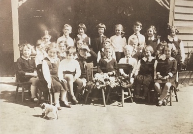
180 Cotham Road, formerly 178 and later 210 Cotham Road, described as a brick residence of six rooms, was constructed in c.1890, for Alexander Hall, a dentist. From 1903, Miss Florrie Wymond operated a girls school at the property, and a timber schoolroom building was constructed at the rear of the property. During the 1930s, the school was known as the Clarence Primary School, and operated by Misses F L and M Wymond. While the listing of the property as a primary school had ceased by 1947, the Wymond family owned the property until the mid 1960s. (Source: Lovell Chen 2007, Review of B-graded buildings in Kew, Camberwell and Hawthorn).One of three photographs taken between 1930 and 1935 of students of 'Clarence' Kindergarten and Sub-Primary, located at 180 Cotham Road. The photos were accompanied by detailed notes identifying the names of students (where remembered).schools -- kew (vic.), clarence school, clarence house, 180 cotham road -- kew (vic.) -
 Kew Historical Society Inc
Photograph - Clarence Kindergarten and Sub-Primary, 180 Cotham Road, 1930-1935
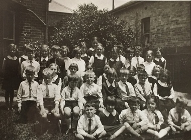
180 Cotham Road, formerly 178 and later 210 Cotham Road, described as a brick residence of six rooms, was constructed in c.1890, for Alexander Hall, a dentist. From 1903, Miss Florrie Wymond operated a girls school at the property, and a timber schoolroom building was constructed at the rear of the property. During the 1930s, the school was known as the Clarence Primary School, and operated by Misses F L and M Wymond. While the listing of the property as a primary school had ceased by 1947, the Wymond family owned the property until the mid 1960s. (Source: Lovell Chen 2007, Review of B-graded buildings in Kew, Camberwell and Hawthorn).One of three photographs taken between 1930 and 1935 of students of 'Clarence' Kindergarten and Sub-Primary, located at 180 Cotham Road. The photos were accompanied by detailed notes identifying the names of students (where remembered).schools -- kew (vic.), clarence school, clarence house, 180 cotham road -- kew (vic.) -
 Kew Historical Society Inc
Photograph - Clarence Kindergarten and Sub-Primary, 180 Cotham Road, 1930-1935
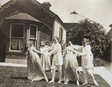
180 Cotham Road, formerly 178 and later 210 Cotham Road, described as a brick residence of six rooms, was constructed in c.1890, for Alexander Hall, a dentist. From 1903, Miss Florrie Wymond operated a girls school at the property, and a timber schoolroom building was constructed at the rear of the property. During the 1930s, the school was known as the Clarence Primary School, and operated by Misses F L and M Wymond. While the listing of the property as a primary school had ceased by 1947, the Wymond family owned the property until the mid 1960s. (Source: Lovell Chen 2007, Review of B-graded buildings in Kew, Camberwell and Hawthorn).One of three photographs taken between 1930 and 1935 of students of 'Clarence' Kindergarten and Sub-Primary, located at 180 Cotham Road. The photos were accompanied by detailed notes identifying the names of students (where remembered).schools -- kew (vic.), clarence school, clarence house, 180 cotham road -- kew (vic.) -
 Kiewa Valley Historical Society
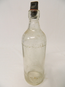
Bottle - Soft Drink
Soft drink came in bottles owned by the manufacturer for re use and bought at the local grocery store or at a large city store on a shopping expedition. The shape of the bottles changed as did the stopper used to seal it.Historical: Change of bottles - shape, glass, stopper, embossing, use Aesthetic: Display showing embossing and shape.Clear glass lemonade bottle with straight sides four fifths of the way up then tapering sharply in to form a neck and then the opening. At top of sides there is large embossed writing around the circumference. There are 3 rows of embossed writing towards the base on one side and some on the base. A bakelite stopper is screwed in. This has a rectangular shape to assist a grip for turning.W. Woodroofe Ltd. Norwood S.A. at the top. This bottle is not sold / It remains the Property / Of W. Woodroofe Ltd. and opposite this an embossed pattern that looks like an ice-cream followed by the word Mark On the base: '2418'soft drink bottle -
Cobram Historical Society Inc
Cream bottle, Buzza's Model Dairy Cobram phone 100
GlassThe bottle contains milk bottled for sale by Buzza's Model Dairy Cobram, phone 100. Bottle is the property of the above. It is loaned and cannot be legally used by others. Imperial half pint. 589. 2. 0 -
 Uniting Church Archives - Synod of Victoria
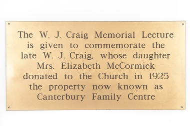
Plaque
Metal oblong gold coloured plastic plaque with black text."The W. J. Carig Memorial Lecture is given to commemorate the late W. J. Craig, whose daughter Mrs. Elizabeth McCormick donated to the Church in 1925 the property now known as Canterbury Family Centre"canterbury family centre -
 Melbourne Legacy
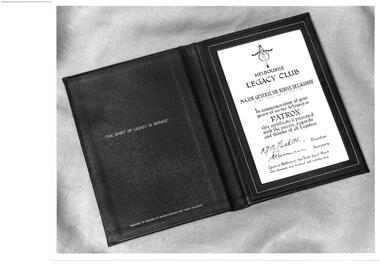
Photograph - Photo, 1973
Two photos of the Patron's Certificate in a leather wallet to be presented to Sir Rohan Delacombe on 10 March 1973, in commemoration of his service to Legacy as Patron. The incumbent Governor of Victoria is the patron of Legacy. 1973 was the Golden Jubilee year of Legacy It came from a Legacy envelope marked "P1" in red pen, with assorted photos of major events such as 1973 Federal Conference, 1983 Morwell, 1973 Legacy march Anzac Day, 50 year celebration inclusion in Anzac Day March, with authority of RSL (some are items 00440 to 0442).A record of relationship with the Governor of Victoria.Black and white photo x 2 of Patron's Certificate."Patron's Certificate in Green Morocco leather wallet 1973", written in blue pen. Stamped "Property of Legacy Melbourne" in purple ink. Stamped "John Squire Photography" in purple ink. B1226-2 in pencil.governor of victoria, golden jubilee, patron -
 Melbourne Tram Museum
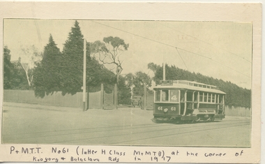
Document - Illustration/s, 1970's
Black and white illustration of PMTT No. 61 at the corner of Orrong and Balaclava Rds, c1917. Tram has route No. 4 in the window. Has a very large house entry gates in the background. Illustration has been pasted onto a piece of light cardboard with a caption written on the lower edge.Along the bottom edge in ink "P&MTT No. 61 (latter H class M&MTB) at the corner of Kooyong and Balaclava Rds in 1917. Property in 2011 shown as Melbourne Grammar School in Google Earth.trams, tramways, balaclava rd, pmtt, orrong rd, tram 61 -
Glenelg Shire Council Cultural Collection
Photograph - Photographs - Tarragal, c. 1989
Four black and white images of properties photocopied on to white Ar paper. Top left, 'Tarragal South' homestead, top right, 'Lal Lal homestead; bottom left, 'Tarragal Downs' homestead; bottom right 'Tarragal Downs' shearing shed. Images are photocopied from object number 8414.Front: Tom left image '1989' black pen (before photocopying) Bottom left and right 'Tarragal Downs, white print, (before photocopying)tarragal -
 Bendigo Historical Society Inc.
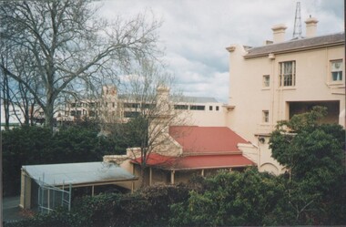
Photograph - EDITH LUNN COLLECTION: BENDIGO BANK FROM SANDHURST CLUB
Two views looking across the rear of properties on View Street Taken 28/08/1997 B8A looking across to the Bendigo Bank from the veranda of the Sandhurst Club Bendigo Bank building at Charing Cross 8Brear of the National Australia Bank building and into the entrance of the Samdhurst Club, on View StreetEdith Lunn