Showing 2842 items matching "wests road"
-
 Whitehorse Historical Society Inc.
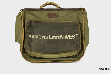
Functional object - Officers Dress Bag
World War 2 Noel Edmund Charles WestLarge khaki Army Dress bag with handle and many compartments VX102715 Lieut. N. West.VX102715 Lieut. N. Westarmy, bag, w.w.2, noel edmund charles west -
 Whitehorse Historical Society Inc.
Map, Melbourne and Metropolitan Board of Works, Feb 1982
... Canterbury Road West - Middleborough Road Melbourne and Metropolitan ...Map area: North - Laburnum and Blackburn Stations East - Blackburn Lake South - bordering Canterbury Road West - Middleborough Roadnon-fictionMap area: North - Laburnum and Blackburn Stations East - Blackburn Lake South - bordering Canterbury Road West - Middleborough Roadmaps, melbourne and metropolitan board of works, parish of nunawading -
 Whitehorse Historical Society Inc.
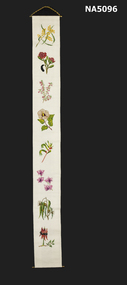
Decorative object - Wall hanging
Domestic object demonstrating Australian State Floral symbolsA cross stitched wall hanging on a brass hanger. The white cotton background has the Australian native flower emblems in a line down the centre. Firstly the Australian emblem - golden Wattle, then New South Wales - Waratah, Victoria - Common Heath, Northern Territory -Sturt's Desert Rose, West Australia - Kangaroo paw, Queensland - Cooktown Orchid, Tasmania - Blue Gum, West Australia - Sturt Desert pea.embroidery, australian floral emblems -
 Rutherglen Historical Society
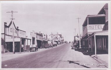
Image, c1940-1950
At the centre of the photo, on the left hand side of the road, is the Star Hotel. On the right hand side of the road, in the foreground is the Cumberland Hotel. Further along on the right of the road is the Rutherglen Hotel (now Poachers Paradise Hotel).One of three black and white photographs mounted on orange paper. This one of Main Street looking west.Printed at the bottom of the photo: "V5 Main Street, Rutherglen" Written on mount: "Main St. Looking east from western end. Circa late 40's early 50's"main street, star hotel, rutherglen hotel, poachers paradise hotel, hotels, shops, cumberland hotel -
 Rutherglen Historical Society
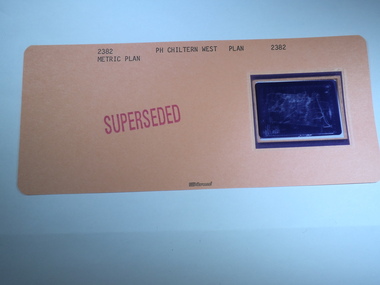
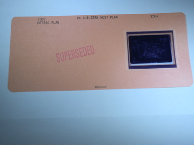
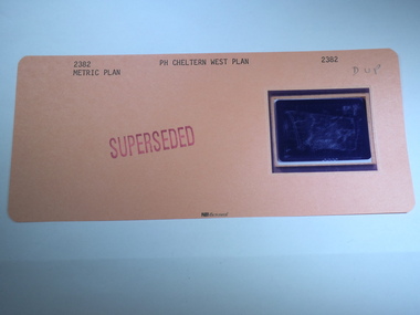
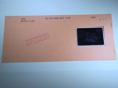
Aperture Card microfilm, Victorian Land Tiltes Office, Parish Plan Chiltern West (Superseded)
... -country Parish Schedule of Chiltern West plan lots roads boundary ...Parish Schedule of Chiltern Westcard with a single microfilm insertplan, lots, roads, boundary -
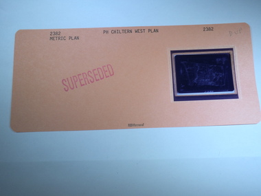
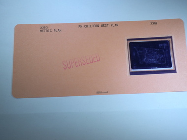
 Rutherglen Historical Society
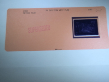
Aperture Card microfilm, Victorian Land Tiltes Office, Parish Plan Chiltern West (Superseded)
... -country Parish Schedule of Chiltern West plan lots roads boundary ...Parish Schedule of Chiltern Westcard with a single microfilm insertplan, lots, roads, boundary -
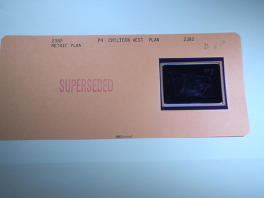
 Rutherglen Historical Society
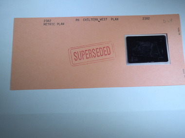
Aperture Card microfilm, Victorian Land Tiltes Office, Parish Plan Chiltern West (Superseded)
... -country Parish Schedule of Chiltern West plan lots roads boundary ...Parish Schedule of Chiltern Westcard with a single microfilm insertplan, lots, roads, boundary -
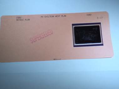
 Rutherglen Historical Society
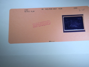
Aperture Card microfilm, Victorian Land Tiltes Office, Parish Plan Chiltern West (Superseded)
... -country Parish Schedule of Chiltern West plan lots roads boundary ...Parish Schedule of Chiltern Westcard with a single microfilm insertplan, lots, roads, boundary -
 Rutherglen Historical Society
Aperture Card microfilm, Victorian Land Tiltes Office, Parish Plan Chiltern West (Superseded)
... -country Parish Schedule of Chiltern West plan lots roads boundary ...Parish Schedule of Chiltern Westcard with a single microfilm insertplan, lots, roads, boundary -
 Rutherglen Historical Society
Aperture Card microfilm, Victorian Land Tiltes Office, Parish Plan Chiltern West (Superseded)
... -country Parish Schedule of Chiltern West plan lots roads boundary ...Parish Schedule of Chiltern Westcard with a single microfilm insertplan, lots, roads, boundary -
 Rutherglen Historical Society
Aperture Card microfilm, Victorian Land Tiltes Office, Parish Plan Chiltern West (Superseded)
... -country Parish Schedule of Chiltern West plan lots roads boundary ...Parish Schedule of Chiltern Westcard with a single microfilm insertplan, lots, roads, boundary -
 Rutherglen Historical Society
Aperture Card microfilm, Victorian Land Tiltes Office, Parish Plan Chiltern West (Superseded)
... -country Parish Schedule of Chiltern West plan lots roads boundary ...Parish Schedule of Chiltern Westcard with a single microfilm insertplan, lots, roads, boundary -
 Rutherglen Historical Society
Aperture Card microfilm, Victorian Land Tiltes Office, Parish Plan Chiltern West (Superseded)
... -country Parish Schedule of Chiltern West plan lots roads boundary ...Parish Schedule of Chiltern Westcard with a single microfilm insertplan, lots, roads, boundary -
 Rutherglen Historical Society
Aperture Card microfilm, Victorian Land Tiltes Office, Parish Plan Chiltern West (Superseded)
... -country Parish Schedule of Chiltern West plan lots roads boundary ...Parish Schedule of Chiltern Westcard with a single microfilm insertplan, lots, roads, boundary -
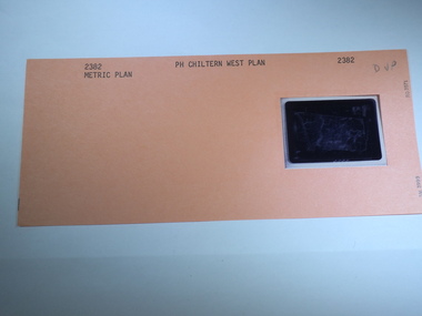 Rutherglen Historical Society
Aperture Card microfilm, Victorian Land Tiltes Office, Parish Plan Chiltern West
... -country Parish Schedule of Chiltern West plan lots roads boundary ...Parish Schedule of Chiltern Westcard with a single microfilm insertplan, lots, roads, boundary -
 Rutherglen Historical Society
Aperture Card microfilm, Victorian Land Tiltes Office, Parish Plan Chiltern West (Superseded)
... -country Parish Schedule of Chiltern West plan lots roads boundary ...Parish Schedule of Chiltern Westcard with a single microfilm insertplan, lots, roads, boundary -
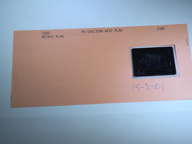 Rutherglen Historical Society
Aperture Card microfilm, Victorian Land Tiltes Office, Parish Plan Chiltern West, 15/03/2001
... -country Parish Schedule of Chiltern West plan lots roads boundary ...Parish Schedule of Chiltern Westcard with a single microfilm insertplan, lots, roads, boundary -
 Ballarat Heritage Services
Photograph, Views of the Westgate Bridge, 29/11/2022
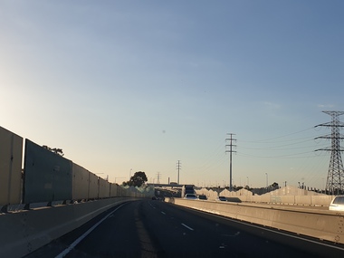
... giving access to Melbourne from the West. Westgate Bridge ...The Westgate Bridge spans the Yarra River giving access to Melbourne from the West. westgate bridge, melbourne, road, bridge -
 Ballarat Heritage Services
Photograph - Colour, Clare Gervasoni, Fawcett Hall and Public Library, 2015, 11/01//2015
Fawcett Hall is 14 kilometres North West of Alexandra, North East Victoria, in Spring Creek Road and is set amongst a small picturesque rural farming and business community with hills as a backdrop and Stony Creek running alongside the public reserves property boundary. Part of our hall building dates back to its establishment in 1882. Originally the hall served as a Mechanics Institute and Public Library and later as a primary school.Colour photograph of a weatherboard Hall.fawcett hall and public library, fawcett, fawcett mechanics' institute -
 Whitehorse Historical Society Inc.
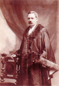
Photograph, Charles Frederick/Francis Rooks
Son of Abraham Rooks, (17/8/1824-1/9/1889) who emigrated from England, 1857 on board the 'Grand Trianon' with wife Sarah, and three children (John, Edward and Edmund). Charles, son of Abraham was elected to Council, 1940. Representing West Central Ward when he died, 1959. Mayor, City of Nunawading 1946-47 and 1955-56.Sepia photograph taken in mayoral robes with hand resting on ornamental chair. Birth registration as Charles Frederick Rooks afterwards known as Charles Francis Rooks.rooks, charles francis -
 Whitehorse Historical Society Inc.
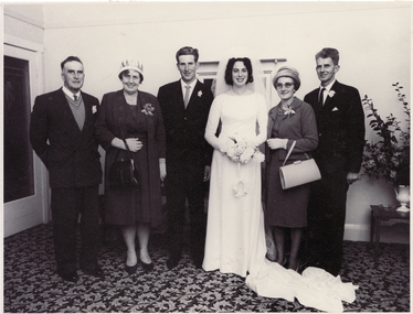
Photograph, Mullens/Blanksby Wedding
The Mullens family were one of the first to settle in the East Burwood area. They were orchardists with property on the north-west corner of Burwood and Springvale Roads.Black and white photograph of the marriage of Ivan Mullens of East Burwood, to Joy Blanksby. From right to left - Bruce Roy Mullens, Thelma Mary Mullens, Groom and Bride, Glen Blanksby, Harold Blanksby. The group is in a reception room with a leaf-patterned carpet.blanksby, joy, mullens, ivan, bruce roy, thelma mary, glen, harold -
 Whitehorse Historical Society Inc.
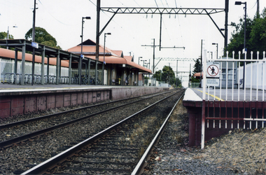
Photograph, Mitcham Railway Station
2013 - Station dismantled - going undergroundColoured photograph of Mitcham Railway Station looking west towards the city - 2012mitcham railway station, railways -
 Whitehorse Historical Society Inc.
Photograph, Mitcham Railway Station
Coloured photograph of Mitcham Railway Station southern platform looking west towards the city -2012mitcham railway station, railways -
 Whitehorse Historical Society Inc.
Photograph, Mitcham Primary School No 2904
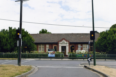
On 24th September 1888 a wooden state school opened on land purchased on the north west corner of Whitehorse and Mitcham Roads. In 1890 a contract was let for the construction of a one-room brick school house on that site. By 1907 student numbers had risen to 120 so the Church of Christ Hall was leased for 10/- a week. By 1922 cracks had appeared, plaster had fallen in the school and both the Brittania Street Scout Hall and the Methodist Church has been leased for classrooms. On 10/4/1930, a new school, to be occupied by the upper grades was opened in its present location.Coloured picture of Mitcham Primary School No 2904 The traffic lights are at the intersection of Mitcham and Doncaster East Roads - 2012mitcham primary school no. 2904, schools -
 Whitehorse Historical Society Inc.
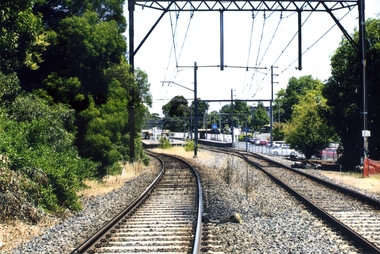
Photograph, Blackburn Railway Line, 2012
See NP3406Coloured photograph of the railway line near the Blackburn station, heading west towards the 'city' - 2012. Car park to right.blackburn railway station, transport -
 Whitehorse Historical Society Inc.
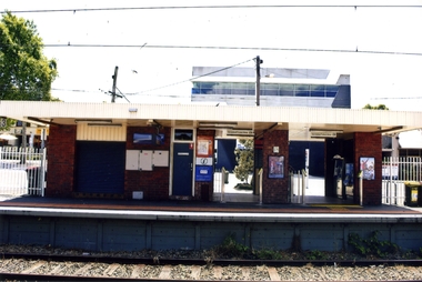
Photograph, Blackburn Railway Station, 2012
See NP3406Coloured photograph of the railway line near the Blackburn station, heading west towards the 'city Entry is from Railway Road and South Parade via a tunnel - 2012blackburn railway station, railways -
 Whitehorse Historical Society Inc.
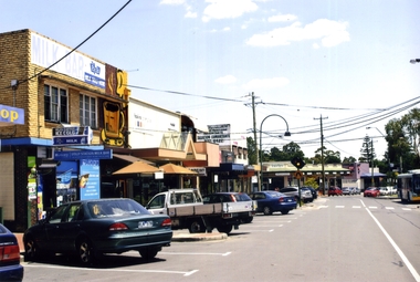
Photograph, Blackburn, South Parade, 2012
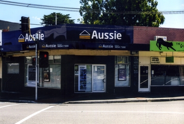
See NP4006Coloured photograph of South Parade Blackburn looking west. Bus on right is dropping people off at south side of the Blackburn station - 2012south parade, blackburn, shops, shopping -
 Whitehorse Historical Society Inc.
Photograph, Chapel Street, Blackburn, 2012
Coloured photographs of shops on the north-west corner of the junction of Railway Parade and Chapel Street, Blackburn, Post Office on the opposite corner.chapel street, blackburn, shops, shopping -
 Whitehorse Historical Society Inc.
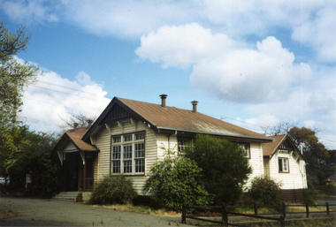
Photograph, Vermont Primary School No 3133, 1980's
The first of the Vermont Primary School buildings was erected on 1872. In 1907 a room was built onto the west side of the building and a new classroom and cloakroom were erected in 1922. Due to rising numbers and traffic volume, Vermont Progress Association urged the government to relocate the school buildings to a less prominent site, and new school buildings were erected in Nurlendi Street in the 1950's. The original timber building remained on the site until its removal to the Nurlendi Street site in the 1990's, and is on the city of Whitehorse Heritage Review.Coloured photograph of the Vermont Primary School while it was standing vacant from the 1950's until 1989 when it was moved to the main school in Nurlendi Road, Vermont. The school was on the North West corner of Canterbury and Mitcham roads facing Mitcham Road. Canterbury Road can be seen through the trees at the left of the photograph.vermont primary school no 3133, primary schools -
 Whitehorse Historical Society Inc.
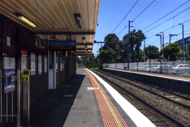
Photograph, Blackburn Railway Station
Coloured photograph taken of the southern side of the Blackburn Railway station looking west towards the city. Car park to the right is accessed from the Railway Road, Blackburnblackburn railway station