Showing 10704 items matching "east melbourne"
-
 Ringwood and District Historical Society
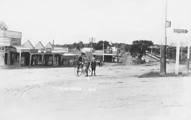
Photograph, Maroondah Highway Central, Ringwood. Whitehorse Rd, looking east towards Warrandyte Rd- 1918
Black and white photograph (3 copies- 2 large, 1 small) Typed below one photograph: "Whitehorse Rd. Looking east towards Warrandyte Rd. 1918". Image shows 2 men and a boy with bicycle in middle of the road. -
 Ringwood and District Historical Society
Photograph, Maroondah Highway Central, Ringwood. Rear of shops in Maroondah Hwy east of Adelaide Street- 1963
Black and white photograph (3 copies- 2 large, 1 small)Typed below large photograph: "Rear of shops in Maroondah Highway. Taken from Adelaide St. near Warrandyte Rd. 1963". Written on back of another copy: "Rear of shops in Maroondah Highway east of Adelaide Street. Shed on right is in Adelaide St opposite 'Mail' office." -
 Ringwood and District Historical Society
Photograph, Maroondah Highway Central, Ringwood. Looking east towards Adelaide Street and Warrandyte Road, 1918
Black and white photograph (3 copies- 2 large, 1 small).Typed below one large photograph: "Maroondah Hwy. 1918. Taken from outside railway station looking towards Warrandyte Rd." Image shows Coffee Palace and general store in middle, and Ringwood Post Office to the left. -
 Ringwood and District Historical Society
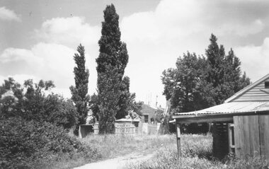
Photograph, 1979-80 MMBW pipe line project at Hubbard Reserve, North Ringwood. Debbie Place from the east end
Part of a 43-photo record of the MMBW's engineering feat in drilling a 12 inch pipe line up to 40 feet deep through rock hardened by volcanic action associated with geological fault that occurs along the line. The work took place from October 1979 to May 1980 on the southern boundary of Hubbard Reserve, North Ringwood. The collection was presented to the Ringwood Historical Research Group by J Clarke on 9th June 1980.E550 N12 Dec 1979 A43 Debbie Place from the east end -
 Ringwood and District Historical Society
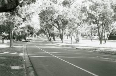
Photograph, Maroondah Highway Central, Ringwood. Easterly view towards Warrandyte Road intersection- 1974
Black and white photographWritten on backing sheet, "Main St. looking east to Warrandyte Rd. 1974". -
 Ringwood and District Historical Society
Photograph, The Ringwood East Presbyterian Church in Lois St
Written on back of photograph, "Rwd. E. Pres. Ch. Became coaching school, Lois St." -
 Ringwood and District Historical Society
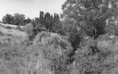
Photograph, Mullum Mullum Creek from footbridge on Munro St., Ringwood, looking east - 1969, 1970
Typed below photograph, "Mullum Creek from footbridge on Munro St. Looking east, 1969". Written on backing sheet, "Mullum Creek looking east at footbridge at Munro St. 1970. Pampas grass was planted years ago by Mrs. Blood".(To be verified in regards to planter). +Additional Keywords: Brown, Mrs / Blood, MrsTyped below photograph, "Mullum Creek from footbridge on Munro St. Looking east, 1969". Written on backing sheet, "Mullum Creek looking east at footbridge at Munro St. 1970. Pampas grass was planted years ago by Mrs. Brown or Mrs Blood". -
 Ringwood and District Historical Society
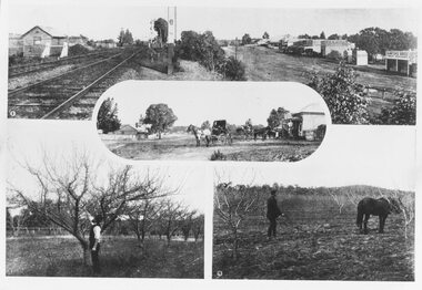
Photograph, Photos from a Weekly Times newspaper article featuring images of early Ringwood and East Ringwood circa 1910 (6 photos), Circa 1910
Shops, houses and hotel(s) were originally regarded as being in central Ringwood and later as Ringwood East after the commercial and residential developments gradually centered further west around the Railway Station precinct after train services commencedFive photographs; Ringwood Railway Crossing; Ringwood Shopping Strip; Pruning Demonstration; Shops, houses and hotel(s) in Mount Dandenong Road; Ploughing.Written on backing sheet, "Photos from Weekly Times. Check with H.A." -
 Ringwood and District Historical Society
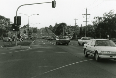
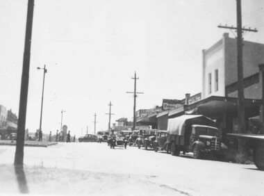
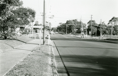
Photograph, Maroondah Highway, Ringwood, looking east from Oban Road - 1999
... Road Ringwood North melbourne Looking East along Maroondah ...Looking East along Maroondah Highway, near the corner of Oban Road in December 1999 -
 Ringwood and District Historical Society
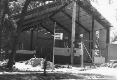
Photograph, Construction of East Ringwood Baptist Church in Dublin Road, Ringwood East prior to re-opening in 1966
East Ringwood Baptist Church in Dublin Road being re-built prior to official opening on Saturday May 14, 1966.Written on back of photograph, "East Ringwood" -
 Ringwood and District Historical Society
Photograph, Church of England, Patterson Street, Ringwood East - 1960, 1960
Photos of East Ringwood Church of England Church in Patterson Street in 1960Written on back of photographs, "Christ Church, Church of England, East Ringwood - 1960", "C of E, Rwd. E." and "C of E, Rwd. E." -
 Ringwood and District Historical Society
Photograph, Church of England, Patterson Street, East Ringwood, Vic. - circa 1960
Church of England Church at East Ringwood with people leavingWritten on back of photograph, "E. Rwd." Church of England Church at East Ringwood -
 Ringwood and District Historical Society
Photograph, Committee Sacred Heart Fete, Ringwood East - c.1950, circa 1950
Committee Sacred Heart FeteWritten on photograph, "Committee Sacred Heart Fete" No people identified. Photo not dated. -
 Ringwood and District Historical Society
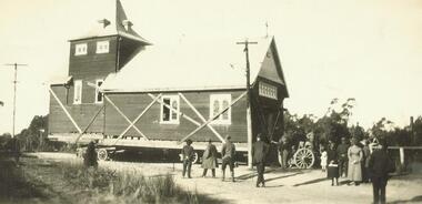
Photograph, Relocation of Ringwood Church of England building from Maroondah Hwy & Pratt Street corner to Ringwood Street - c.1924
Removing Church of England Church building from Ringwood East to near Post OfficeWritten on front of photograph, "Removing C. of E. from Ringwood East to near P. Office" -
 Ringwood and District Historical Society
Photograph, Main Street shops looking east - Maroondah Hwy, Ringwood - 1935
Written on back of photograph, "Main Street, Ringwood". -
 Ringwood and District Historical Society
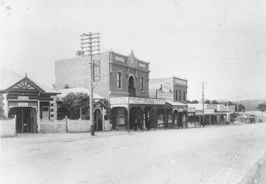
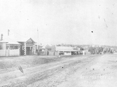
Photograph, Maroondah Highway Central, Ringwood. Looking east from opposite station entrance, c.1910
Black and white photograph (2 copies) Typed below photograph: "Maroondah Hwy. looking east from opposite the station entrance towards Warrandyte Rd, showing the new post office (our second) on the left. No telephones then and no poles and wires in the street. c1900 - 1910". -
 Ringwood and District Historical Society
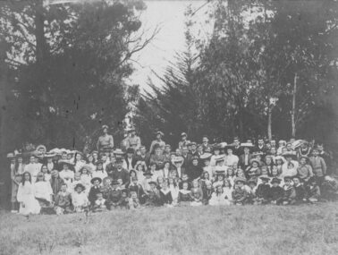
Photograph, Ringwood Methodist Sunday School picnic at Bayswater, 1908/9
Typed on backing sheet two labels, "Ringwood Methodist Sunday School picnic - At Bayswater, 1908. Photo by Lewis F. East". The other label reads, "Ringwood Methodist Sunday School picnic at Bayswater - 1909. Photographs Lewis F. East". Small label in lower left corner "Sir Ronald East, 57 Waimarie Drive, Mt. Waverley Victoria 3149. Telephone 277 4315".Written on back of photograph, "C of E. St. Paul's, Warrandyte Rd." -
 Ringwood and District Historical Society
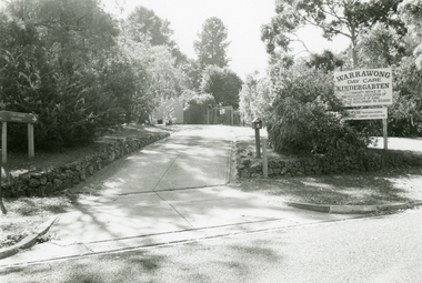
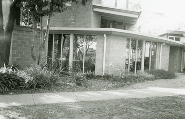
Photographs, Warrawong Kindergarten, East Ringwood in 1999
... Road Ringwood North melbourne Warrawong Kindergarten, East ... -
 Ringwood and District Historical Society
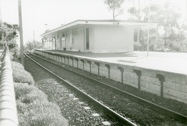
Photographs, Ringwood East Railway Station in 1999
... Road Ringwood North melbourne Ringwood East Railway Station ... -
 Ringwood and District Historical Society
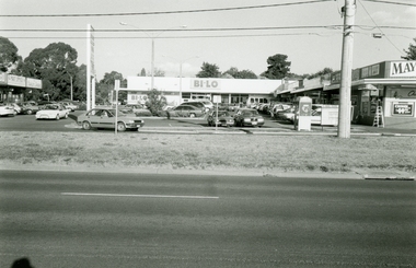
Photographs, Burnt Bridge Shopping Centre, East Ringwood in 1999
-
 Ringwood and District Historical Society
Photographs, Ringwood East Railway Crossing on Dublin Road in 1999
... Road Ringwood North melbourne Ringwood East Railway Crossing ... -
 Ringwood and District Historical Society
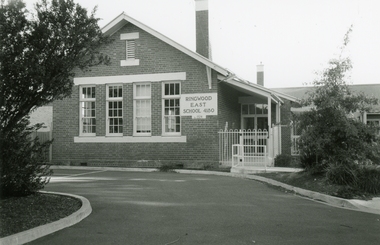
Photograph - Photographs, Ringwood East State School 4180 in Everard Road in 1999
... Road Ringwood North melbourne Ringwood East State School 4180 ... -
 Ringwood and District Historical Society
Photographs, Holy Trinity Church, Paterson Street, East Ringwood in 1999
-
 Ringwood and District Historical Society
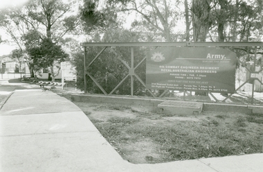
Photographs, Army Depot, Dublin Road, East Ringwood in 1999
4th Combat Engineer Regiment, Royal Australian Engineers -
 Ringwood and District Historical Society
Photographs, Old Lilydale road, East Ringwood in 1999
... Road Ringwood North melbourne Old Lilydale road, East Ringwood ... -
 Ringwood and District Historical Society
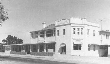
Photograph, Club Hotel, Mount Dandenong Road, Ringwood East - 1960
Written on back of photographs, "Club Hotel Ringwood East. 1960." "Club Hotel, Mt. Dande Rd. 1960" and "1960 Club Hotel" -
 Ringwood and District Historical Society
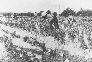
Photograph, Gathering Lancifolium Lilies and Queen Victoria Roses at Mr. John Hill's Nursery, Ringwood. 1905
Black and white photograph (2 copies)Typed under photograph: Gathering Lancifolium lillies and Queen Victoria roses at Mr John Hill's nursery, Ringwood. Typed below heading of one copy- "Mr. J. Hill's Nursery, Mt Dandenong Rd, Ringwood East. 1905. Written on back of photograph: "Hill Bros. Nursery 1905. (Mr. John Hill and daughters). Mt Dandenong Rd Ringwood East." Additional words- "Note Chimney stack (125' ?) from one of Ringwood brickworks on Dublin Rd. -
 Ringwood and District Historical Society
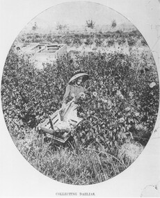
Photograph, Collecting Dahlias - Mr. Hill's Flower Farm - Mt. Dandenong Rd, Ringwood 1905
Black and white photograph (4 copies)Typed note at bottom of one photograph- "Mr. Hill's Flower Farm - Mt. Dandenong Rd. Miss Hill collecting dahlias. 1905." Typed note on back of separate photograph- "John Hill's flower farm 29/3/05, Mt Dandenong Rd, Ringwood East. Later Howship's flower farm, subdivided, name retained in street name. Miss Elvie Hill. -
 Ringwood and District Historical Society
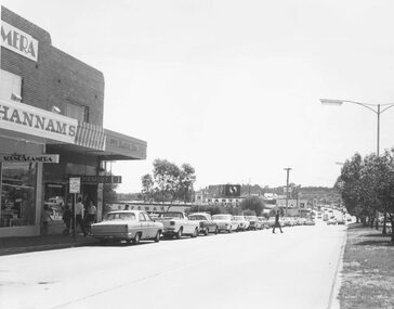
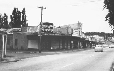
Photograph, Maroondah Highway Central, Ringwood. Corner Main Street & Adelaide St. looking east towards Warrandyte Road- 1966
History of the Norman Cash Grocery Stores. Normans started grocery store in Drummond Street Oakleigh in 1903 and expanded to 13 stores in adjacent suburbs, Ringwood being one of these. Photo is Norman & Sons P/L corner of Maroondah Highway and Adelaide Street.Black and white photograph (2 copies) Typed below one copy: "Corner Main Street & Adelaide St. looking east towards Warrandyte Road - 1966". Image shows Norman & Sons Grocer store on corner of Adelaide Street and Main Street. -
 Ringwood and District Historical Society
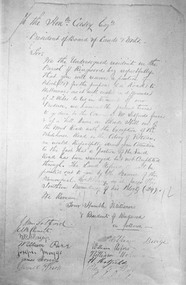
Photograph, Petition 4/9/1872 for road to Melbourne from "Blood's Hill" (eventual corner of Bedford Road and Dublin Road, Ringwood East). Canterbury Road was later extended as a result of the petition
Catalogue card reads, 'Petition 4/9/1872 "for road to Melbourne".