Showing 1773 items
matching maps and plans
-
 Bendigo Historical Society Inc.
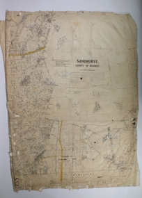
Map - SANDHURST SHEET 1, No date visible
Map: Sandhurst ,County of Bendigo sheet 1. Parish plan ( number 201 in Map Cupboard 1)map, bendigo, city streets, sandhurst -
Bendigo Historical Society Inc.
Map - LANDS AVAILABLE FOR SELECTION, 6/05/1912
Map: Lands available for selection, County of Bendigo. Parish plan ( number 192 in Map Cupboard 1)map, bendigo, lands available for selection, lands available for selection, bendigo -
Bendigo Historical Society Inc.
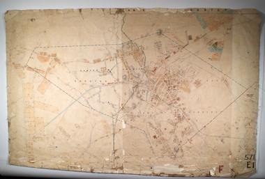
Map - CITY OF SANDHURST RESURVEY SHEET 2, 23/05/1881
Map City of sandhurst Resurvey, sheet 2. Parish plan ( number 231 in Map Cupboard 1)map, bendigo, parish plan, sandhurst resurvey -
Bendigo Historical Society Inc.
Map - CITY OF BENDIGO RESURVEY SHEET 1, 5/06/1903
Map: City of Bendigo resurvet sheet 1. Parish plan ( number 219 in Map Cupboard 1)map, bendigo, parish plan, bendigo resurvey -
Bendigo Historical Society Inc.
Map - CITY OF BENDIGO RESURVEY SHEET NO. 3, Circa 1900
Map: City of Bendigo Resurvey sheet No. 3. Parish plan ( number 214 in Map Cupboard 1)map, bendigo, parish plan, bendigo, resurvey -
Bendigo Historical Society Inc.
Map - PARISHES OF WARRAGAMBA AND MINTO, No date visible
Map: Parishes of Warragamba and Minto,Hand draughted parish plan. (number 290 in map cupboard 1)map, parish plan, warragamba, minto -
Bendigo Historical Society Inc.
Map - KAMAROOKA ALLOTMENTS, 7/06/1894
Map: Parish of Kamarooka Allotments, County of Bendigo. Parish plan (number 288 in map cupboard 1)map, bendigo, allotments, kamarooka, allotments -
Bendigo Historical Society Inc.
Map - NEILBOROUGH, 6/12/1882
Map: Parish of Neilborough, County of Bendigo. Parish plan. Earliest date on map 21/8/1877.map, bendigo, parish plan, neilborough -
Bendigo Historical Society Inc.
Map - BAGSHOT, Circa 1878
Map: Parish of Bagshot, County of Bendigo. Parish plan (coloured) (number 329 in map cupboard 1)map, bendigo, parish plan, bagshot -
Bendigo Historical Society Inc.
Map - GOORNONG, 29/04/1879
Map: Parish of Goornong, County of Bendigo. Parish plan (coloured) (number 326 in map cupboard 1)map, bendigo, parish plan, goornong -
 Bendigo Historical Society Inc.
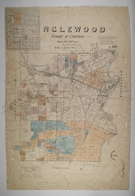
Map - INGLEWOOD, 17/12/1877
Map: Parish of Inglewood, County of Gladstone. Parish plan. Earliest date on map 31/12/75.map, gladstone, parish plan, inglewood -
Bendigo Historical Society Inc.
Map - LEICHARDT, 23/05/1875
Map: Parish of Leichardt, County of Bendigo. Parish plan (coloured). Attached plan in the top left hand corner marked 'Building Lots' (number 323 in map cupboard 1)map, bendigo, building lots, leichardt -
 Warrnambool and District Historical Society Inc.
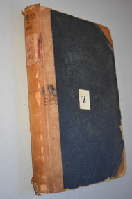
Ledger, Letter book 1892-1904, 1892
This letter book has letters, sketch maps and plans and dates from 1892 to 1904. It came from the office of John William Crawley, Junior, an engineer, architect and surveyor in private practice in Warrnambool and also the engineer of the Shire of Warrnambool from 1895 to 1935. His father, brother and son were also engineers and worked in that capacity or as the Shire Secretary for the Shire of Warrnambool, with the Crawley family recording a total of 132 years of service to the Shire. This letter book was passed on to John Crawley’s son, Rolf Crawley, Engineer for the Shire of Warrnambool from 1935 to 1968. The letter book then came into the possession of Michael Hand who took over the private surveying business of Rolf Crawley in Warrnambool. The Warrnambool and District Historical Society has acquired the letter book, one of several Crawley ledgers, from the Michael Hand estate. This letter book is of considerable significance as it contains maps, plans, sketches and written information which is the work of John William Crawley Junior, the engineer for the Shire of Warrnambool for 40 years. It will be very useful to researchers. This is a hard cover letter book of 500 pages. The cover is black with leather binding on the edges of the cover and on the spine. The pages contain an alphabetical listing of the letters, handwritten letters and many sketch maps and plans. There are several loose pages of plans and diagrams at the back of the book. The inside of the covers has a blue mottled pattern. The edges of the cover are torn. There is a mauve stamp on the first page. ‘Letter Book 1892 to 1901’ ‘Rolf L. Crawley, Civil Engineer, Drainage and Water Supply Engineer, Licensed Surveyor, Registered Architect, Warrnambool’ john william crawley, junior, warrnambool, rolf crawley, warrnambool, shire of warrnambool -
 Greensborough Historical Society
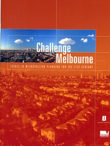
Book, Victoria. Department of Infrastructure, Challenge Melbourne: issues in metropolitan planning for the 21st century, 2000
A report on Melbourne's future growth and a strategic plan to manage this growth, 2000.36 p., text, col. illus., maps and col. plansmelbourne (victoria), town planning, infrastructure victoria -
 Bendigo Historical Society Inc.
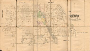
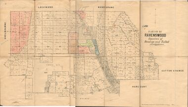
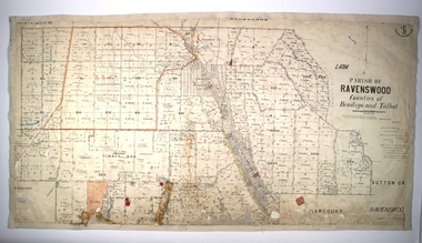
Map - JACK FLYNN COLLECTION: RAVENSWOOD, 12/12/1922
Map: Parish of Ravenswood, Counties of Bendigo and Talbot. Parish plan.map, bendigo, parish plan, ravenswood -
 Bendigo Historical Society Inc.
Map - JACK FLYNN COLLECTION: RAVENSWOOD, 12/12/1922
Map: Parish of Ravenswood, Counties of Bendigo and Talbot. Parish plan.By Authority A.J. Mullet Government Printer Melbourne. Photo Lithographed at the Department of lands and Survey, Melbourne by W.J. Butsonmap, bendigo, parish plan, ravenswood -
 Bendigo Historical Society Inc.
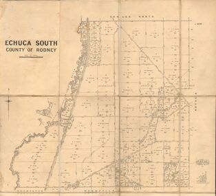
Map - JACK FLYNN COLLECTION: ECHUCA SOUTH, 13/08/1931
Map: Parish of Echuca South, County of Rodney. Parish plan.By Authority H. J. Green, Govt. Printer. Department of Lands and Survey, Melbourne. 13.8.31map, rodney, parish plan, echuca south , county of rodney -
 Bendigo Historical Society Inc.
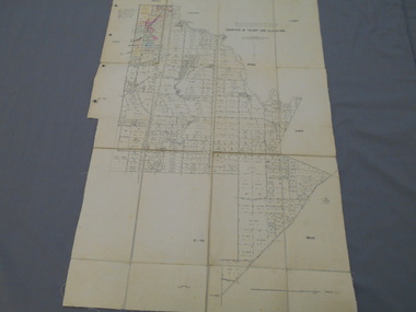
Map - JACK FLYNN COLLECTION: EDDINGTON, 1.12.1925
Map: Parish of Eddington, Counties of Gladstone and Talbot. Parish plan.Dept of Lands and Survey Melbourne by W.J. Butson 1.12.25map, talbot, parish plan, eddington, counties of talbot, gladstone -
 Bendigo Historical Society Inc.
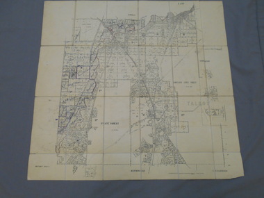
Map - JACK FLYNN COLLECTION: BET BET SHEET 2, 17/09/1931
Map: Parish of Bet Bet Sheet 2. Parish plan.Photo Lithographed at the Lands and Survey Melbourne. 17.9.31map, gladstone, parish plan, bet bet -
Bendigo Historical Society Inc.
Map - CITY OF SANDHURST RESURVEY SHEET NO. 3, 13/05/1881
Map: City of Sandhurst Resurvey sheet No. 3. Parish plan.map, bendigo, parish plan, sandhurst, resurvey -
 Whitehorse Historical Society Inc.
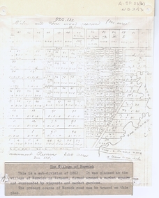
Document, The Village of Norwich, C1862
Map showing the planned village of NorwichMap showing the planned village of Norwich in Vermont about 1862Map showing the planned village of Norwichland settlement, morack road, vermont south, barkly street, vermont, george street, william street -
Stawell Historical Society Inc
Map, Plan Shewing Auriferous Deposits and Reefs (Map of Water Races), c1878
Plan Shewing Auriferous Deposits and Reefs (Map of Water Races)stawell, water -
 Bendigo Historical Society Inc.
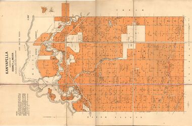
Map - JACK FLYNN COLLECTION: KANYAPELLA, 22/05/1939
Map: Parish of Kanyapella, Counties of Rodney and Moira. Parish plan.By Authority, T. Rider Acting Govt, Printer Melbourne. Drawn and Reproduced at the Dept. of Lands and Survey, Melbourne, Victoria.map, moira, parish plan, kanyapella, counties of rodney and moira -
 Bendigo Historical Society Inc.
Map - EAGLEHAWK, Circa 1870's
Map: Eaglehawk, Compilation of 2 parish plans covering Eaglehawkmap, bendigo, parish plan, eaglehawk -
 Bendigo Historical Society Inc.
Map - SANDHURST SHEET 1, 27/05/1925
Map: Sandhurst ,County of Bendigo, sheet 1. Parish planmap, bendigo, parish plan, sandhurst -
 Bendigo Historical Society Inc.
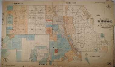
Map - PARISH OF RAVENSWOOD, Circa 1908
Map: Parish of Ravenswood, Counties of Bendigo and Talbot. Parish planmap, bendigo, parish plan, ravenswood, county of talbot -
 Bendigo Historical Society Inc.
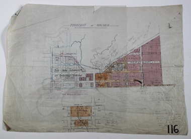
Map - WALMER, Circa 1900
Map: Township of Walmer, 2 hand Draughted Parish plansmap, township, walmer -
 Bendigo Historical Society Inc.
Map - PARISH OF RAVENSWOOD, 3/04/1875
Map: Parish of Ravenswood, Counties of Bendigo and Talbot. Parish planmap, bendigo, parish plan, ravenswood, county of talbot, county of bendigo -
 Warrnambool and District Historical Society Inc.
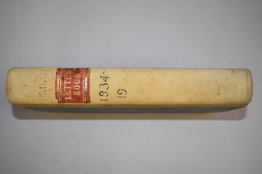
Letter book, J & R Crawley, 1934
This letter book contains letters, sketch maps and plans and dates from1934 to 1936. It originally came from the office of John William Crawley Junior, an engineer, surveyor and architect in private practice in Warrnambool and also the Shire Engineer for the Shire of Warrnambool from 1895 to 1935. His father, brother and son were also engineers and worked in that capacity or as the Shire Secretary for the Shire of Warrnambool, with the Crawley family recording a total of 132 years of service to the Shire. The Shire of Warrnambool existed from 1863 to 1994. The letter book was also used in the private practice of John Crawley’s son, Rolf who was the engineer for the Shire of Warrnambool from 1935 to 1968. The letter book then came into the possession of Michael Hand who took over the private surveying business of Rolf Crawley in Warrnambool. The Warrnambool and District Historical Society acquired the letter book, along with several other Crawley ledgers, from the estate of Michael Hand.This letter book is of considerable significance as it contains letters written by John Crawley and Rolf Crawley who were in an engineering, surveying and architects private practice in Warrnambool over the time covered in the book. It will be very useful to researchers. This is a hard cover book of 1000 pages but only 354 pages have been used. The cover is bound at the corners and on the spine with buff-coloured leather. The book contains an alphabetical index, handwritten letters, sketch maps and plans. ‘Private Letter Book 1934- 19.’ ‘R.L./J. W. Crawley Private’ john william crawley junior, warrnambool, rolf crawley, warrnambool, shire of warrnambool -
 Bacchus Marsh & District Historical Society
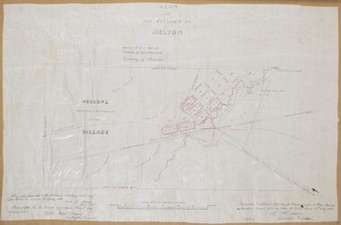
Map, Plan of the Village of Melton
A single page paper map showing a plan for the village of Melton, Parish of Djerriwarrh, County of Bourke. The map is pasted into a bound volume containing 76 maps or plans in total. High resolution digital image stored on BMDHS computer network. melton victoria maps