Showing 733 items matching "aerial photo"
-
 Glenelg Shire Council Cultural Collection
Photograph - Photograph - Airport, n.d
... Black and white aerial photo of airport under construction... quote this number' '3074-A' in red biro Black and white aerial ...Port of Portland Authority ArchivesBack: Top right 'Airport' in pencil Top left - purple stamp 'When ordering pleas quote this number' '3074-A' in red biroport of portland archives, airport -
Glenelg Shire Council Cultural Collection
Photograph - Photograph - Reclamation, n.d
... Black and white aerial photo of early stages of reclamation... and white aerial photo of early stages of reclamation Photograph ...Port of Portland Authority Archivesport of portland archives, reclamation -
Glenelg Shire Council Cultural Collection
Photograph - Photograph - Portland Harbour Development, n.d
... Black and white aerial photo of the quarry at Cape Grant.... Authority Archives Port of Portland Black and white aerial photo ...Port of Portland Authority Archivesport of portland -
Glenelg Shire Council Cultural Collection
Photograph - Photograph - Cape Grant Quarry, Portland, n.d
... Black and white aerial photo of Cape Grant Quarry....'- pencil Black and white aerial photo of Cape Grant Quarry ...Port of Portland Authority ArchivesFront: Back- '40 cms wide'- pencilport of portland archives, cape grant quarry, portland harbour, harbour development -
Glenelg Shire Council Cultural Collection
Photograph - Photograph - Cape Grant Quarry, Portland, n.d
... Black and white aerial photo of Cape Grant Quarry.... Portland Harbour Cape Grant Quarry Black and white aerial photo ...Port of Portland Authority Archivesport of portland archives, aerial photography, portland harbour, cape grant quarry -
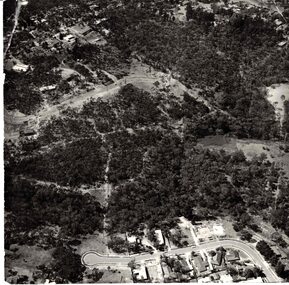 Whitehorse Historical Society Inc.
Photograph - Aerial Photograph, Bushland Yarran Dheran
... Aerial photos of Yarra Dheran including Mitcham and Donvale....Mitcham Donvale Yarra Dheran Aerial photos of Yarra Dheran ...Aerial photos of Yarra Dheran including Mitcham and Donvale.mitcham, donvale, yarra dheran -
Stawell Historical Society Inc
Photograph, B/W Aerial Photograph of Pleasant Creek Training Centre & Stawell Woolen Mills C 1960's, 1960's
... A3 Sized Aerial Photo on blue backing board....Education Manufacturing A3 Sized Aerial Photo on blue ...A3 Sized Aerial Photo on blue backing board.education, manufacturing -
Whitehorse Historical Society Inc.
Document, 520 Mitcham Road, 2005
... company organisational details; aerial photos of the area... of development company organisational details; aerial photos of the area... of development company organisational details; aerial photos of the area ...Papers relating to objections to development of 520-528 Mitcham Road Mitcham.Papers relating to objections to development of 520-528 Mitcham Road Mitcham. Includes: statement by Neil Edwin Kerby & Margaret Anne Kerby; Title searches for 449 Mitcham Road Mitcham and adjacent properties; plan of 1906 subdivision; ASIC extract of development company organisational details; aerial photos of the area; photographs of nearby properties and of Mitcham Road streetscapes and list of Mitcham objectors. CD copy at NP3771Papers relating to objections to development of 520-528 Mitcham Road Mitcham. mitcham road mitcham, nos. 520-528, kerby, neil edwin, kerby, margaret anne, mitcham road mitcham no. 449, 520 mitcham road pty ltd, listermay nominees pty ltd, land subdivision -
Glenelg Shire Council Cultural Collection
Photograph - Photograph - aerial view of Portland Harbour, n.d
... Black & white aerial photo of Portland Harbour looking... Portland Harbour Black & white aerial photo of Portland Harbour ...Port of Portland Authority Archivesport of portland archives, aerial photography, portland harbour -
Glenelg Shire Council Cultural Collection
Photograph - Photograph - Main Breakwater construction, Portland, n.d
... Black and white aerial photo of wharf area under... Portland Harbour Black and white aerial photo of wharf area under ...Port of Portland Authority Archivesport of portland archives, aerial photography, portland harbour -
Glenelg Shire Council Cultural Collection
Photograph - Photograph - Main Breakwater construction, Portland, n.d
... Black and white aerial photo of wharf area under... construction harbour development Black and white aerial photo of wharf ...Port of Portland Authority Archivesport of portland archives, main breakwater, construction, harbour development -
Glenelg Shire Council Cultural Collection
Photograph - Photograph - Cape Grant Quarry, n.d
... Black and white photo. Aerial photo of Cape Grant quarry.... and white photo. Aerial photo of Cape Grant quarry. Photograph ...Port of Portland Authority Archivesport of portland archives, cape grant quarry -
Glenelg Shire Council Cultural Collection
Photograph - Photograph - Cape Grant Quarry, Portland, n.d
... Black and white aerial photo of Cape Grant Quarry... Portland Harbour Cape Grant Quarry Black and white aerial photo ...Port of Portland Authority Archivesport of portland archives, aerial photography, portland harbour, cape grant quarry -
Glenelg Shire Council Cultural Collection
Photograph - Photograph - Stone Crusher, Cape Grant Quarry, n.d
... Black and white aerial photo of the stone crusher... Authority Archives Port of Portland Black and white aerial photo ...Port of Portland Authority Archivesport of portland -
Glenelg Shire Council Cultural Collection
Photograph - Photograph - Cape Grant Quarry, Portland, n.d
... Black and white aerial photo of Cape Grant Quarry...'- pencil, bottom left Black and white aerial photo of Cape Grant ...Port of Portland Authority ArchivesFront: Back- 'Cape Grant Quarry and crusher'- pencil, bottom leftport of portland archives, cape grant quarry, construction, crusher -
Whitehorse Historical Society Inc.
Map, Springvale Road, c1970
... Enlarged aerial photo of intersection of Springvale... aerial photo of intersection of Springvale and Whitehorse Roads ...Enlarged aerial photo of intersection of Springvale and Whitehorse Roads, Nunawading.Enlarged aerial photo of intersection of Springvale and Whitehorse Roads, Nunawading.Enlarged aerial photo of intersection of Springvale and Whitehorse Roads, Nunawading.springvale road, nunawading, whitehorse road, nunawading, maroondah highway, nunawading, aerial photographs -
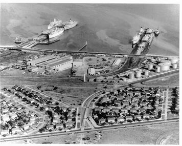 Port Melbourne Historical & Preservation Society
Photograph - Aerial view 1960s of Piers and surrounds
... Port Melbourne piers and surrounds. Aerial photo from... Beacon Port Melbourne piers and surrounds. Aerial photo from ...Gives a good overview of this area of Port Melbourne at a point in time. Identifiable objects are Station and Princes piers; Centenary Bridge; Commonwealth Government Marine Engine works; Beacons; Bank Houses; Commonwealth Oil fuel storage tanks; Missions to Seamen; Trugo club; Railway yards; Beacon Rad, Williamstown RoadPort Melbourne piers and surrounds. Aerial photo from the 1960spiers and wharves, built environment, mission to seamen, beacon -
Glenelg Shire Council Cultural Collection
Photograph - Photograph - Dutton Way, n.d
... Coloured aerial photo of Dutton Way, Showing the rock wall... Authority Archieves Coloured aerial photo of Dutton Way, Showing ...Port of Portland Authority ArchievesColoured aerial photo of Dutton Way, Showing the rock wall and groynes -
Glenelg Shire Council Cultural Collection
Photograph - Photograph - Point Danger and rifle range, n.d
... Black and white photo aerial photo of Point Danger... and white photo aerial photo of Point Danger and rifle range ...Port of Portland Authority Archivesport of portland archives, point danger -
Port Melbourne Historical & Preservation Society
Photograph - Aerial view of land reclamation at Webb Dock, Port Melbourne, 1997
... Colour aerial photo showing land reclamatioon at Webb Dock... authority Colour aerial photo showing land reclamatioon at Webb Dock ...Colour aerial photo showing land reclamatioon at Webb Dock, 1997piers and wharves - webb dock, melbourne harbor trust - port of melbourne authority -
Tatura Irrigation & Wartime Camps Museum
Book, Ernestine Hill, Water Into Gold, 1965
... Blue soft cover. Depicting aerial photo of farmland. White... cover. Depicting aerial photo of farmland. White lettering Water ...Depicts pioneers of irrigation - Chaffey bros and story of irrigation on the MurrayBlue soft cover. Depicting aerial photo of farmland. White letteringirrigation, chaffey -
Tatura Irrigation & Wartime Camps Museum
Book, Water into Gold, 1965
... Blue soft cover, depicting aerial photo of farmland, white... cover, depicting aerial photo of farmland, white lettering ...Depicts pioneers of irrigation, Chaffey Bros., and story of irrigation on the Murray RiverBlue soft cover, depicting aerial photo of farmland, white lettering.water into gold, irrigation, hill e, tatura, books, history, local, rural, industry -
Stawell Historical Society Inc
Photograph, Stawell Gold Mine, Aerial Photomap of Stawell & Mining 1997, 1997
... Large Laminated Aerial Photo Map showing Stawell... 1997 Large Laminated Aerial Photo Map showing Stawell ...Evaporation Dams Mining SiteLarge Laminated Aerial Photo Map showing Stawell and Mining activityMining Geology Office 1997mining -
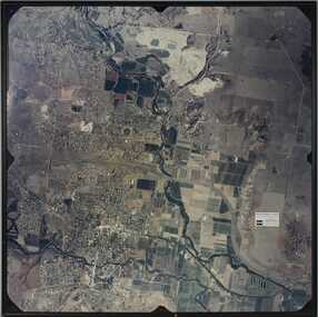 Bacchus Marsh & District Historical Society
Photograph, Aerial image of Bacchus Marsh and Darley in 1994
... "Bacchus Marsh - Darley. Aerial Photo 27 November, 1994... Marsh Vic. "Bacchus Marsh - Darley. Aerial Photo 27 November ...A whole of town and nearby area aerial image of Bacchus Marsh produced for display in the Arbee Real Estate Agency premises in Main Street, Bacchus Marsh.A large framed colour aerial photograph showing the township of Bacchus Marsh, the neighbouring smaller community of Darley, and the nearby areas of both places. "Bacchus Marsh - Darley. Aerial Photo 27 November, 1994. Presented by Arbee Real Estate "Professionals"'arbee real estate agency bacchus marsh, aerial views bacchus marsh vic. -
Glenelg Shire Council Cultural Collection
Photograph - Photograph - Cape Grant Quarry, n.d
... Black and white photo. Aerial photo of Cape Grant quarry.... Aerial photo of Cape Grant quarry, from sea Photograph Photograph ...Port of Portland Authority ArchivesBack: 'JAN 24, 1968' - pencil, top rightport of portland archives, cape grant quarry -
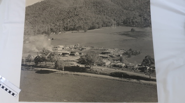 Kiewa Valley Historical Society
Photo - Tawonga Sawmill
... Black/grey and white aerial photo of the Tawonga Mill site... and white aerial photo of the Tawonga Mill site circa 1960s. Photo ...Photo of the Tawonga Sawmill at Tawonga. It was operated by Mt Beauty Timbers P/L circa 1960s. Prior to transfer to Mt Beauty site.The Mt Beauty Timber mill closed in the 1990s due to changes to government legislation regarding logging in the National Park.Black/grey and white aerial photo of the Tawonga Mill site circa 1960s.tawonga sawmill, mt beauty timbers pty ltd, logging -
Glenelg Shire Council Cultural Collection
Photograph - Photograph - Portland harbour, n.d
... Black and white aerial photo of Harbour and surrounds... Authority Black and white aerial photo of Harbour and surrounds ...Port of Portland Authority -
Glenelg Shire Council Cultural Collection
Photograph - Photograph - Portland Harbour, port area and Pivot fertilizer, n.d
... Black and white aerial photo of harbour and port area... Authority Black and white aerial photo of harbour and port area ...Port of Portland Authority -
Port Melbourne Historical & Preservation Society
Photograph - Aerial view of J Kitchen & Sons site, Ingles Street, Port Melbourne, 1930
... Overhead -aerial - photo of J Kitchen & Sons factories... Pty Ltd Overhead -aerial - photo of J Kitchen & Sons factories ...Overhead -aerial - photo of J Kitchen & Sons factories with Football ground at rearsport - australian rules football, sport - cricket, industry, j kitchen & sons pty ltd -
Port Melbourne Historical & Preservation Society
Photograph - Double-sided aerial photograph, Hobson's Bay and the Yarra River/Port Phillip and Western Port Bay, Surveyor General and Director of Mapping, Apr 1990
... Aerial photos of Port Phillip and Western Port (double... authority Aerial photos of Port Phillip and Western Port (double ...Landsat imagery - an extract from the atlas of VictoriaAerial photos of Port Phillip and Western Port (double sided aerial photographs). 1995 side A: Hobson's Bay and Yarra River - aerial photo mosaic; side B. Port Phillip and Western Port Bays - satellite photo.port of melbourne authority